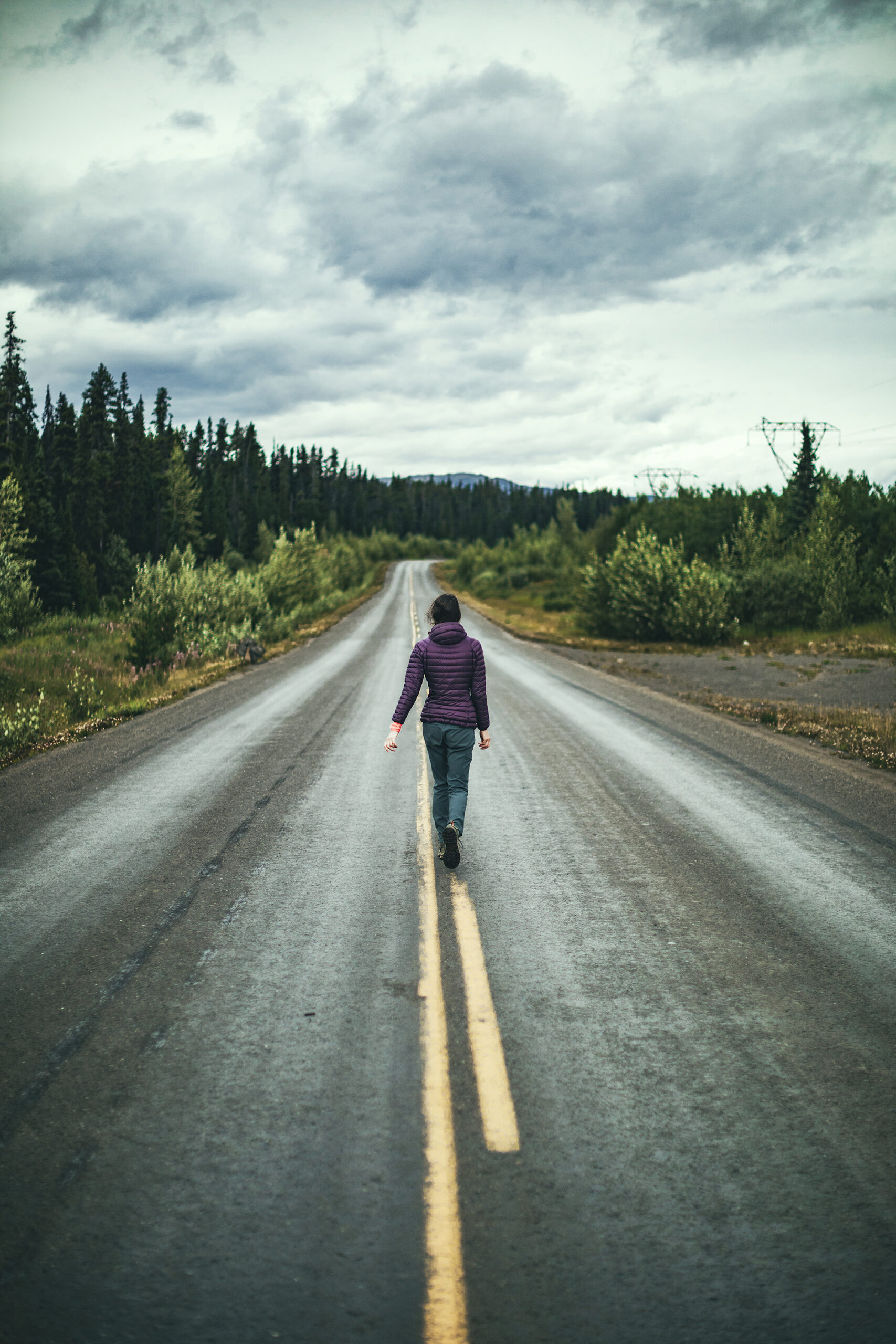
Video Recap: Klondike Highway, Keno Hill and Mount Hinton
Our adventures around the world…
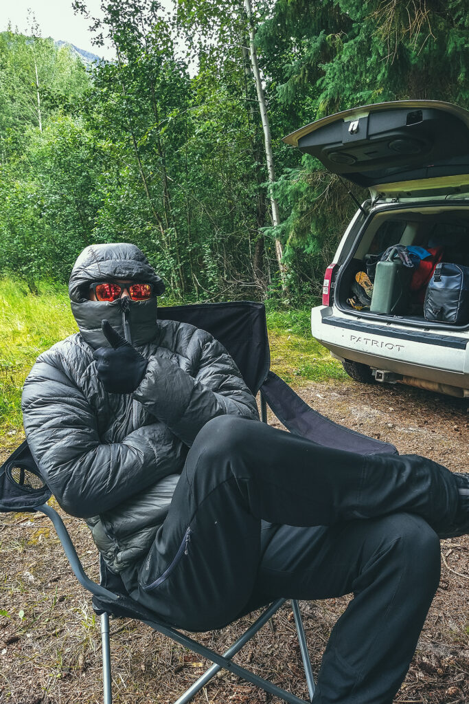
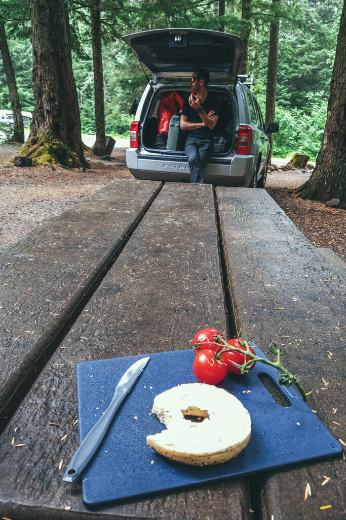
It rained pretty heavily in the early morning so we took some time getting up.
Brice made pancakes – more successfully than the last time. We had put the tarp on the bug shelter this time, instead of the sleeping tent, so the table was nice and dry for breakfast. Then we started packing things up, which was a bit of a process with everything being wet and untie-ing all the ropes we set up for the tarp. Eventually we took off and drove to Pelly Crossing, where we stopped for a bit to do some internet-ing (emails, instagram…) as there was phone service there.
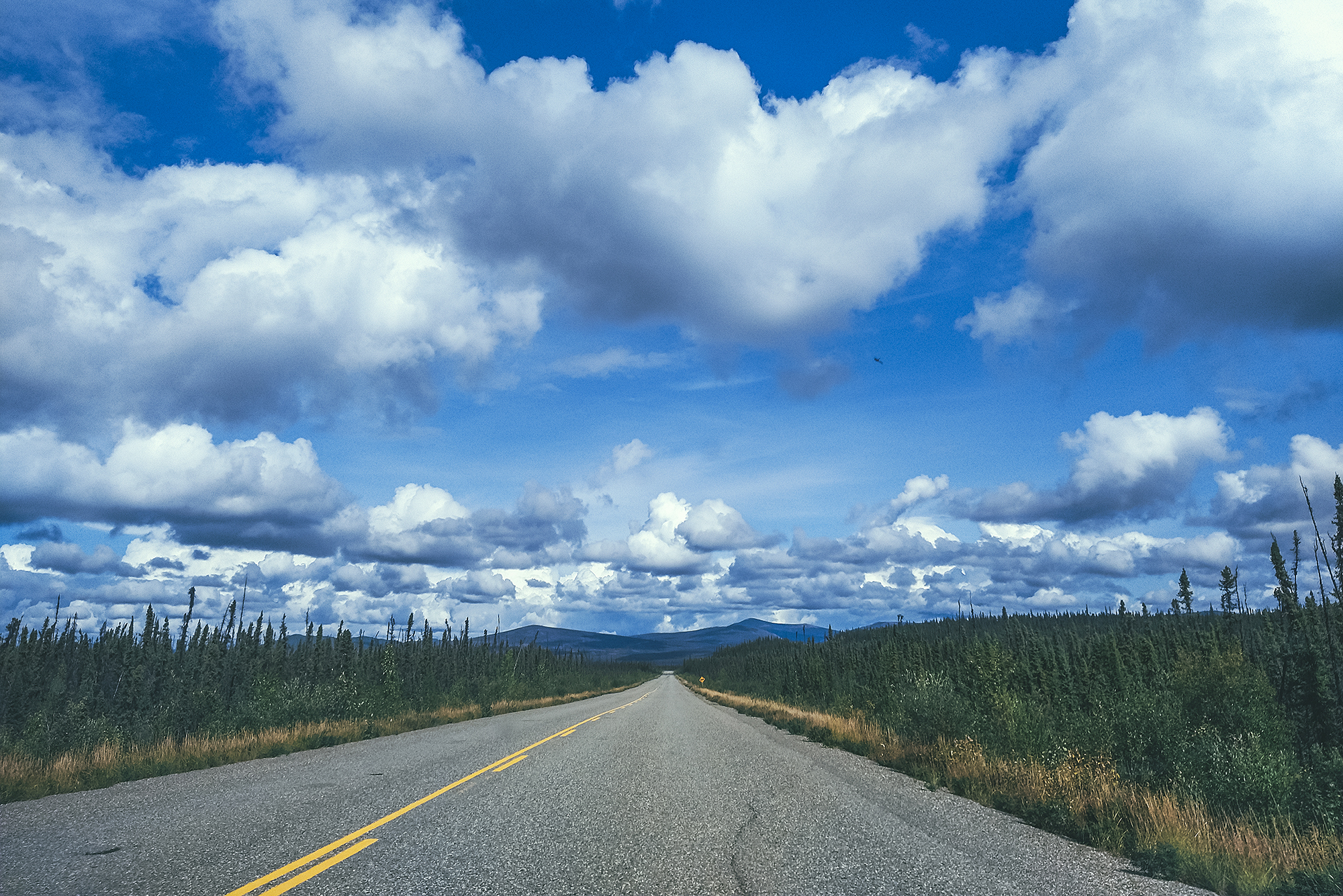
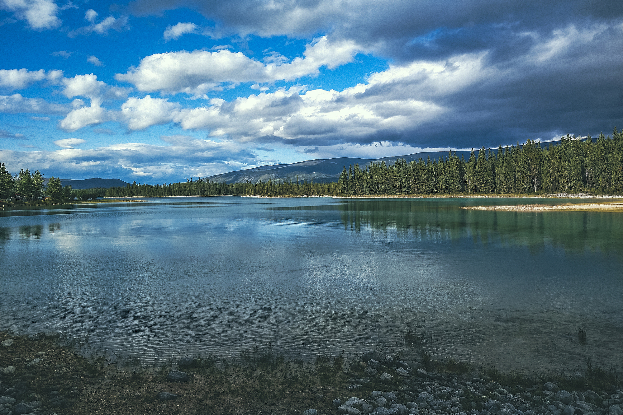
Then we were on our way. In Stewart crossing further down the road, we turned right to head East on the Silver trail, (Highway 11) for our second side trip – to Mayo then Keno City.
We stopped at a rest area for a quick lunch, and managed to get the tents and tarp 90% dry in the time we ate, thanks to a bit of sun and wind (with all the rain, we frequently took advantage on any dry spell during a stop to hang the tents out to dry).
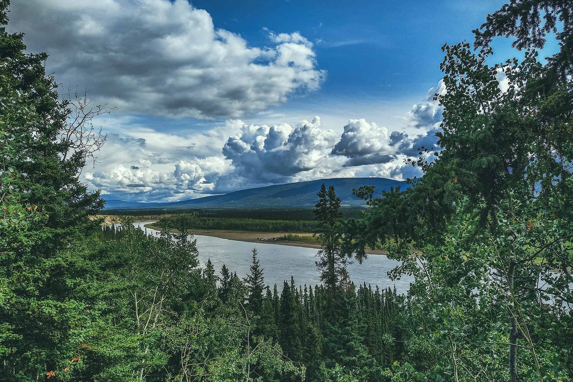
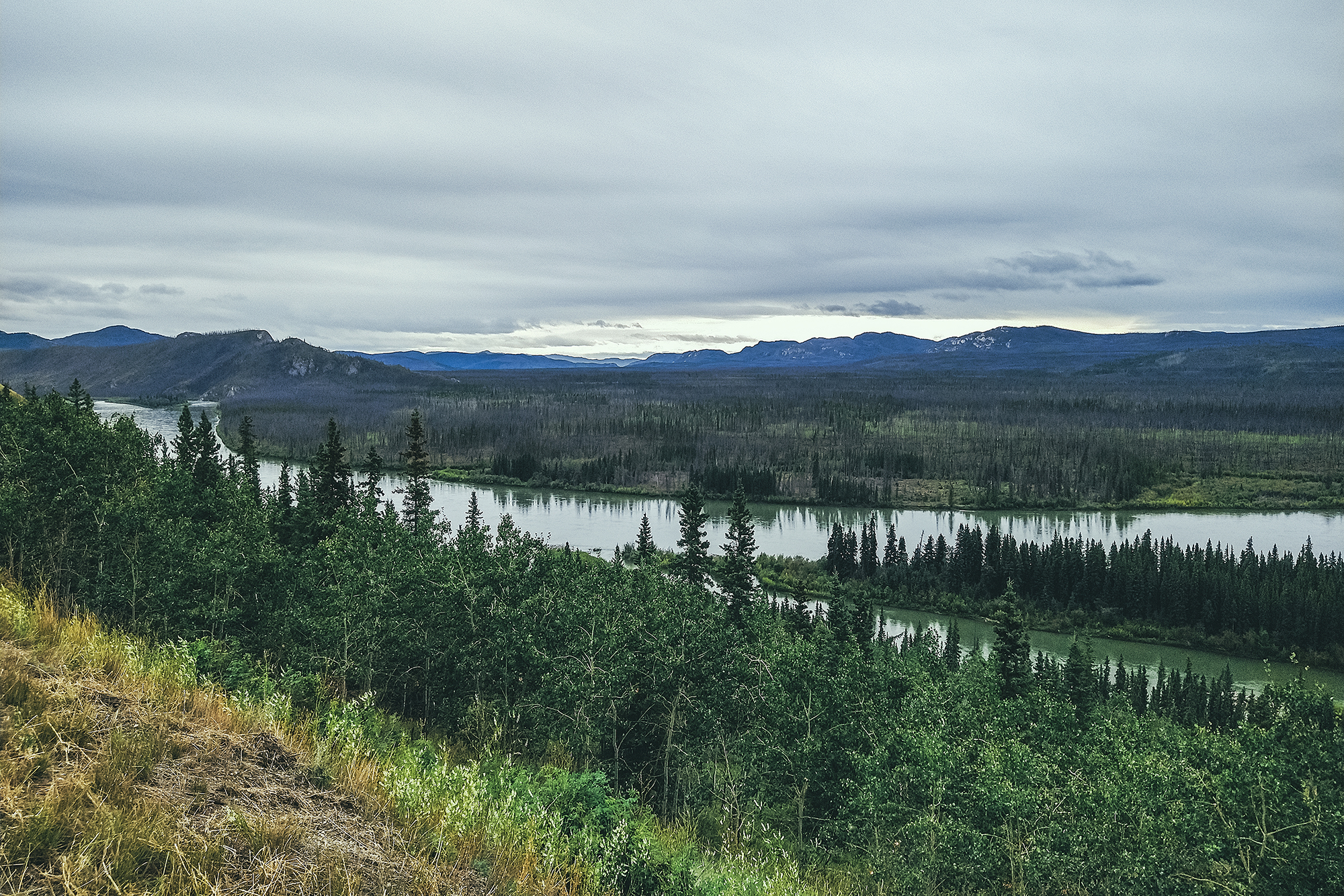
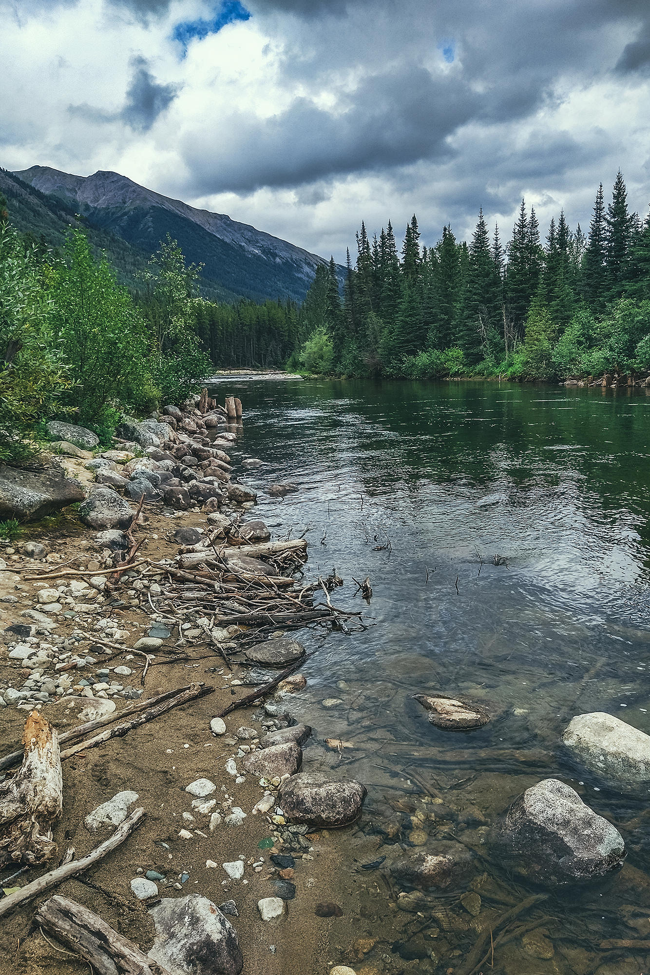
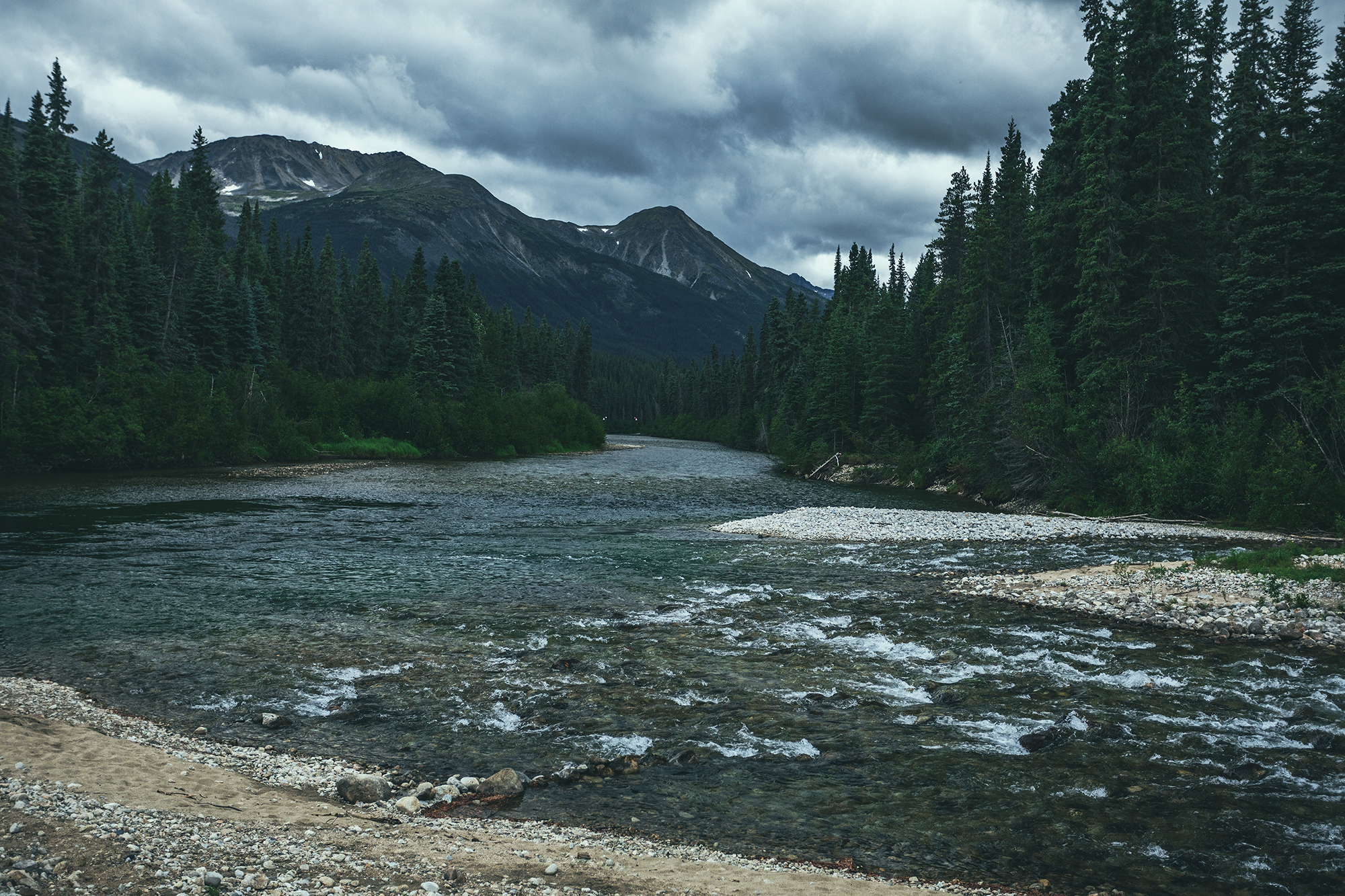
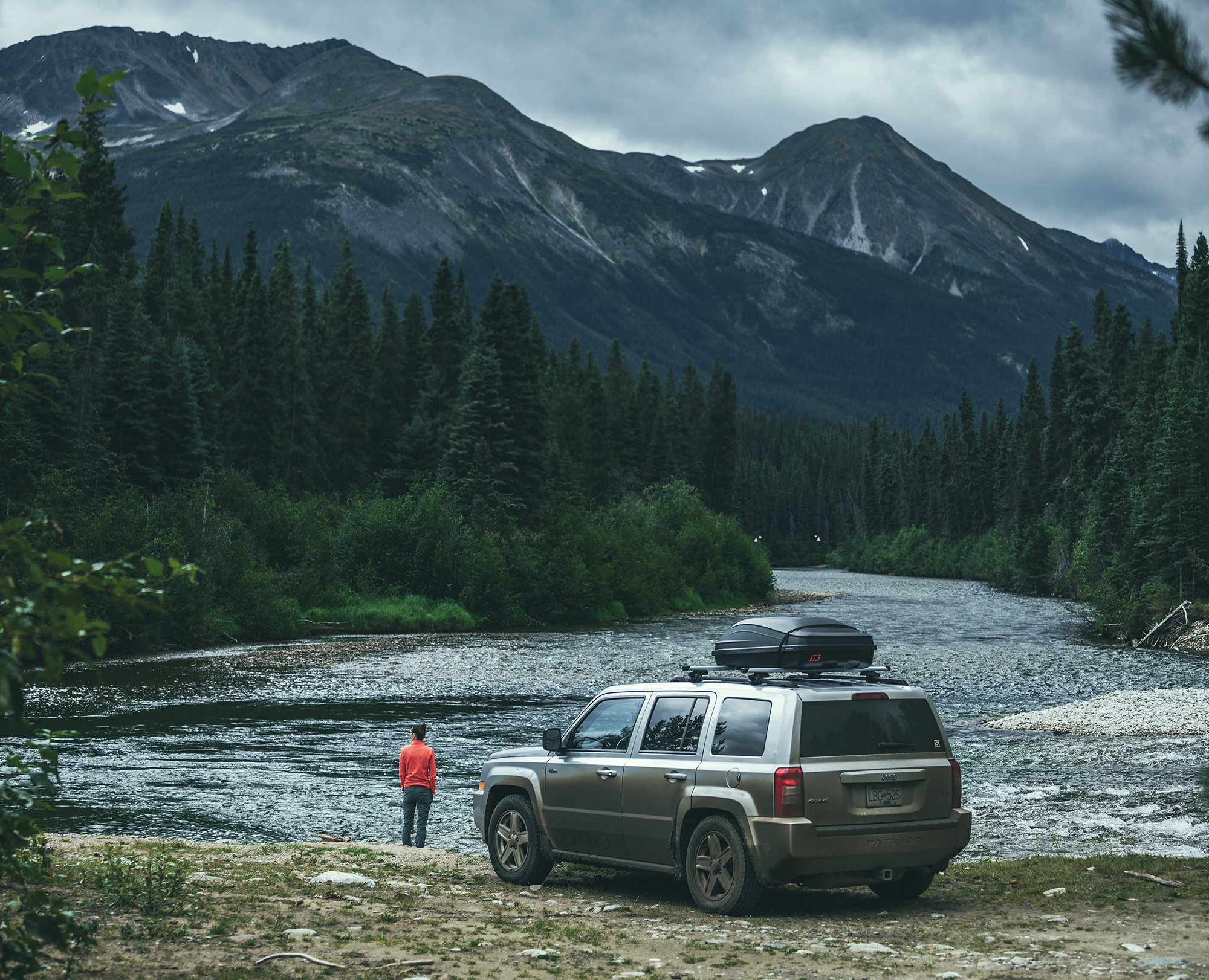
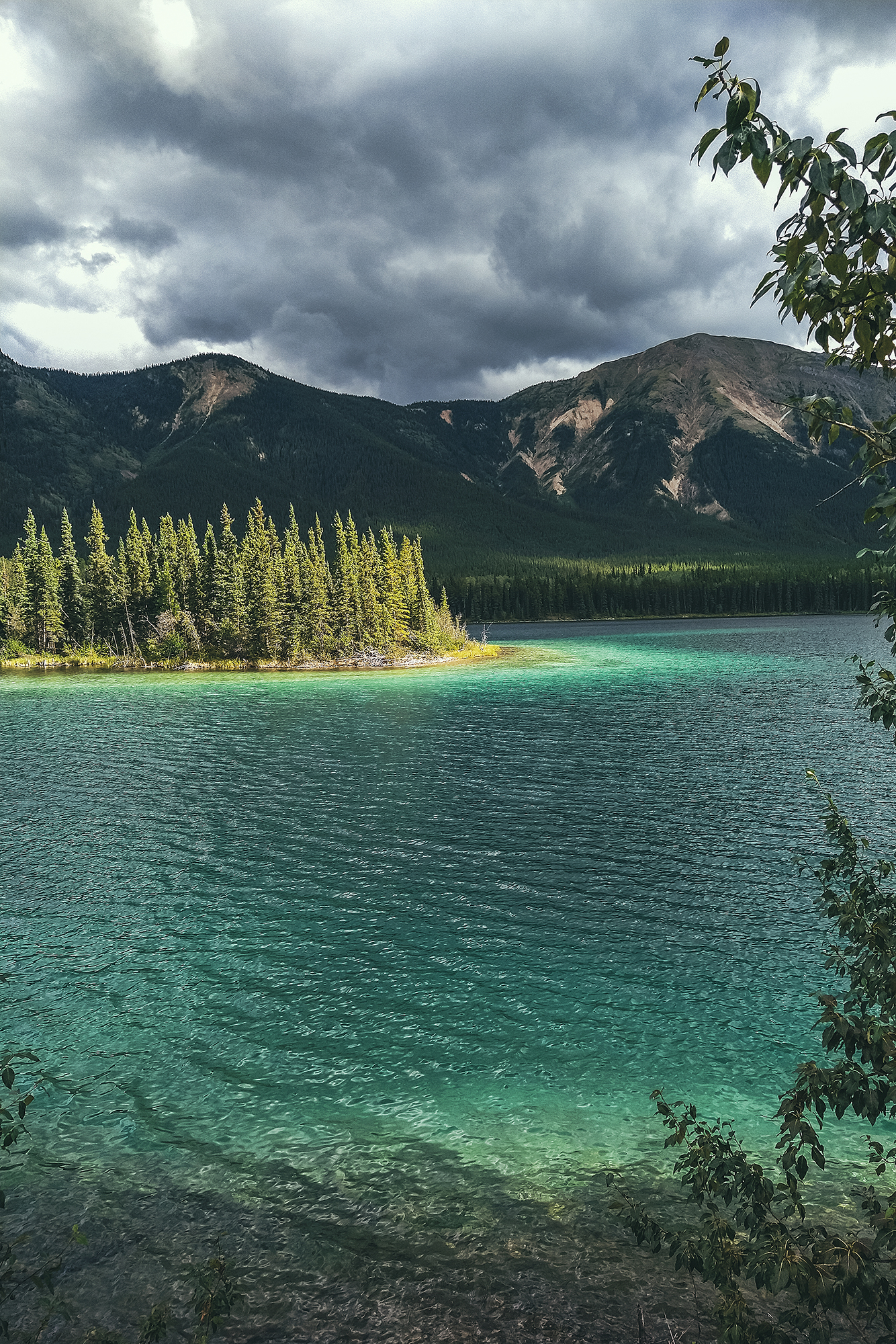
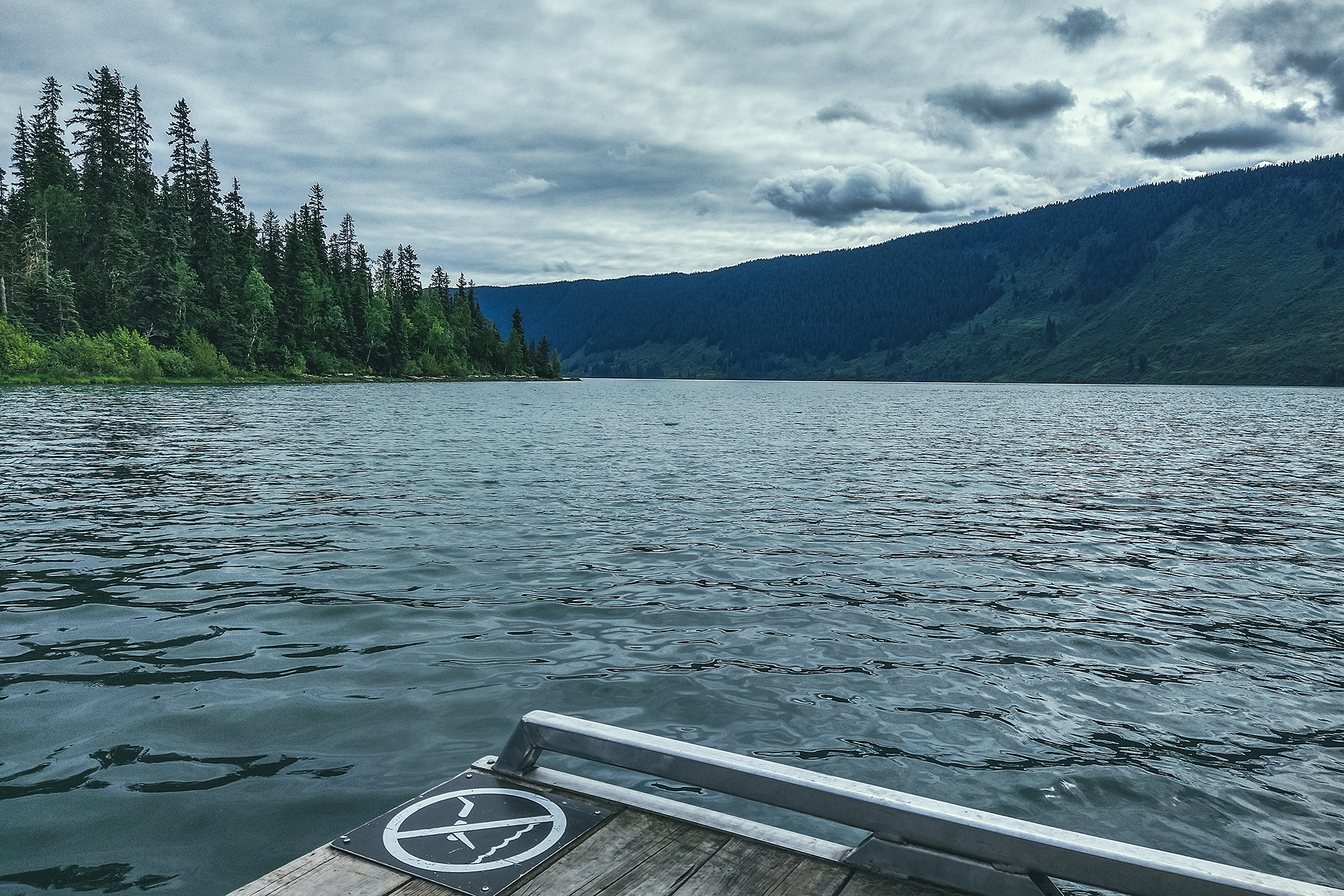
The stop had a nice view of the Stewart River, which was heavily mined for gold during the Klondike gold rush era, but it also turned out to be extremely rich in Silver (hence the name Silver trail), making it one of the top silver mining areas in North America until it closed in the late 80’s.
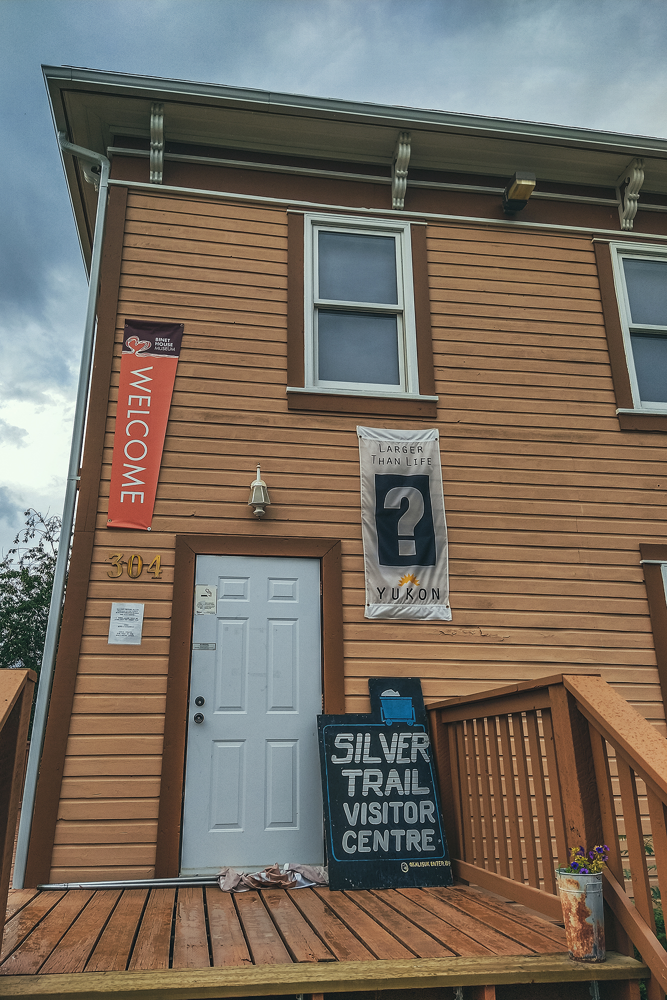
We followed the river all the way to Mayo, which is located on the traditional territory of the Na-Cho Nyak Dun First Nation, who have lived there for thousands of years.
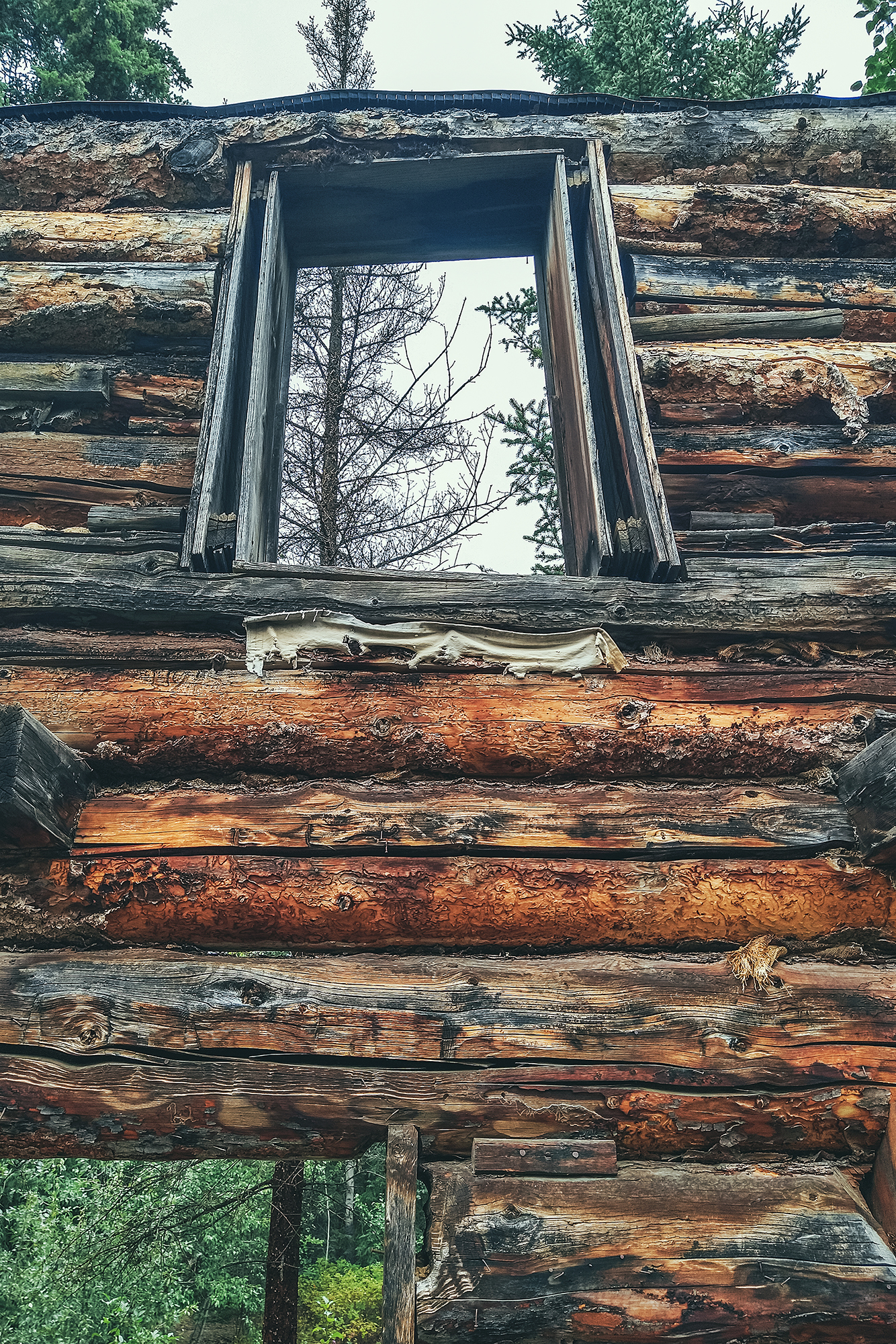
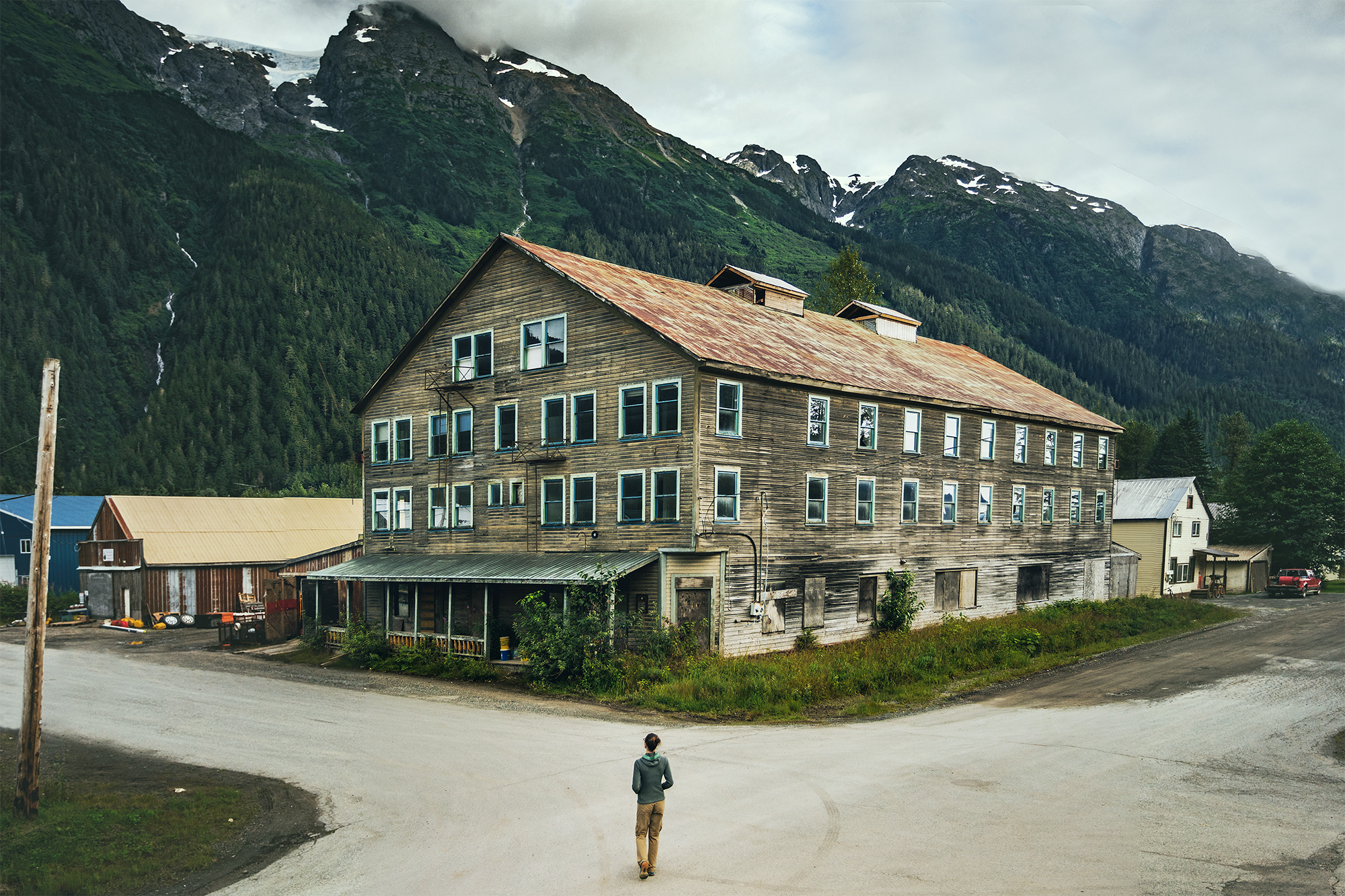
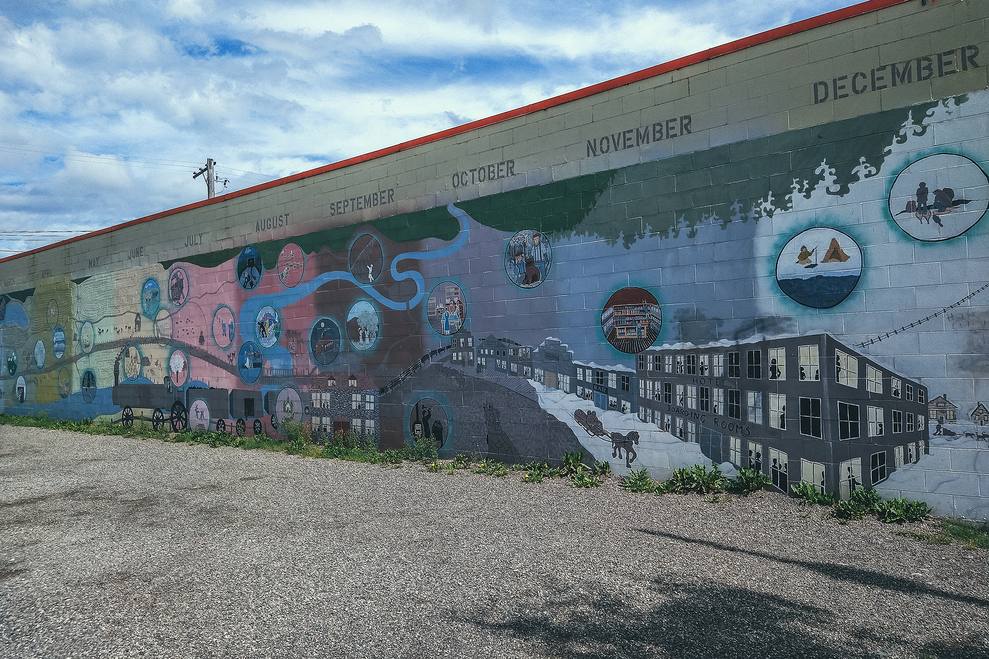
Once there, we went for a visit of the Binet House, a restored heritage building with a display of photos and artifacts, showing daily life in the small mining community that occupied the town in the late 19th and early 20th century. There was also as a small section about the geological characteristics of the area. All and all a pretty in-depth view of the mining era, and our first dive into that history, after following the roads that were built to make the mining possible.
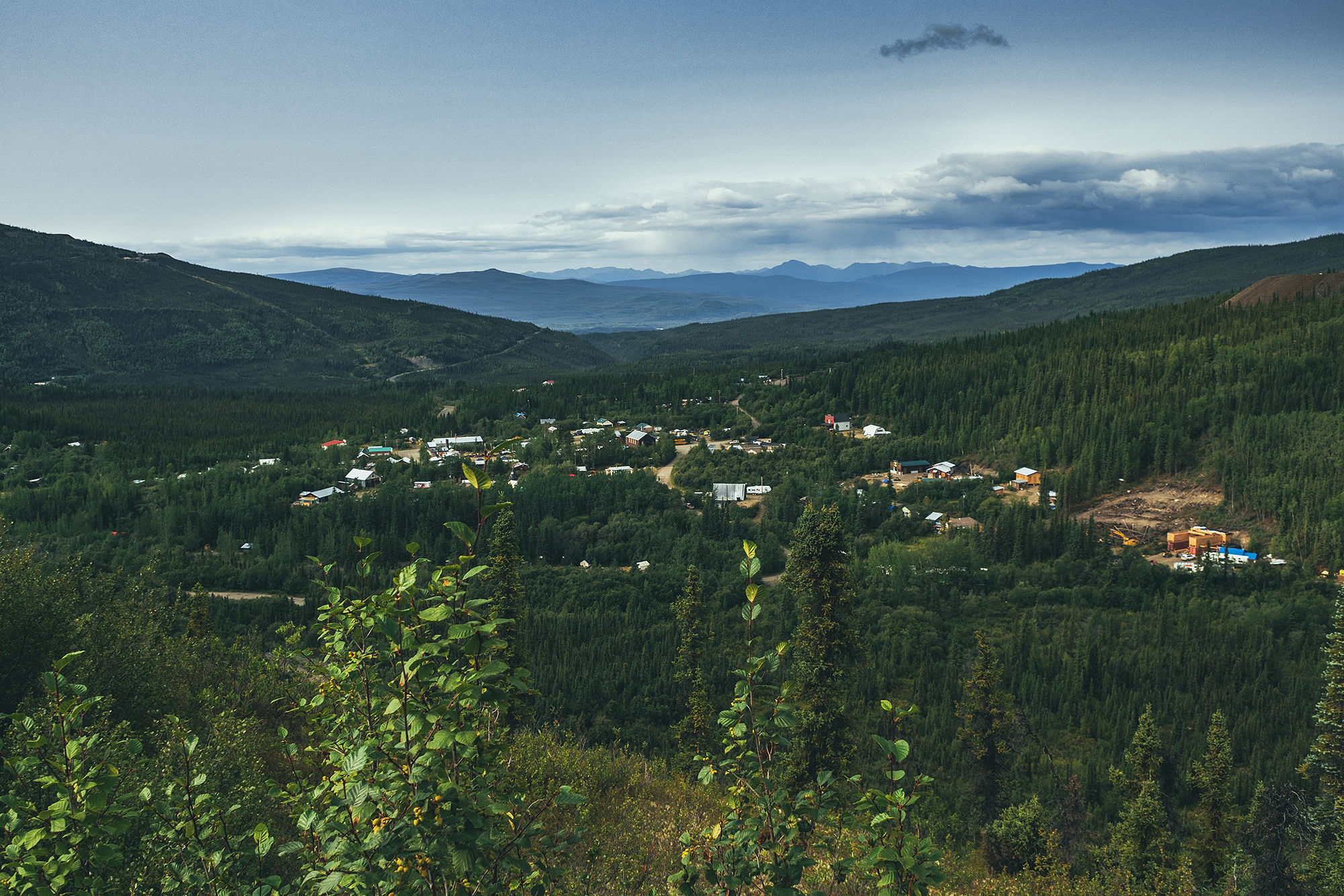
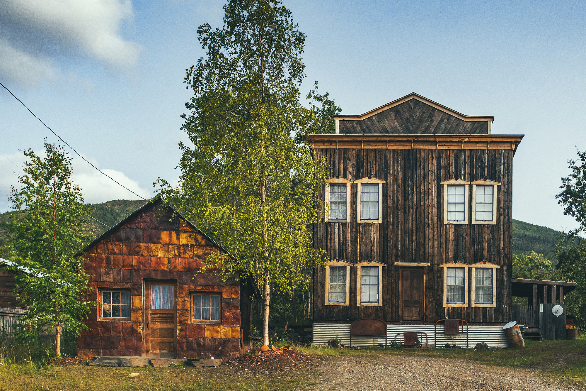
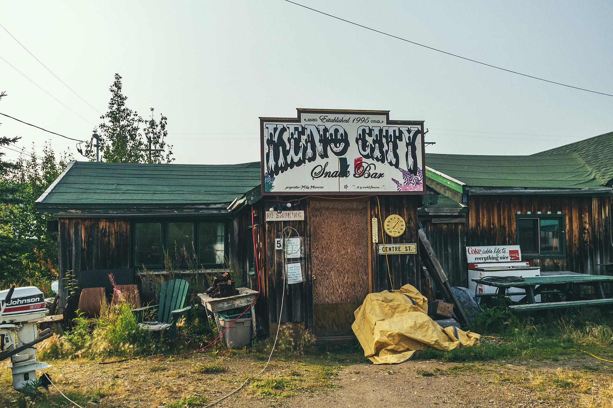
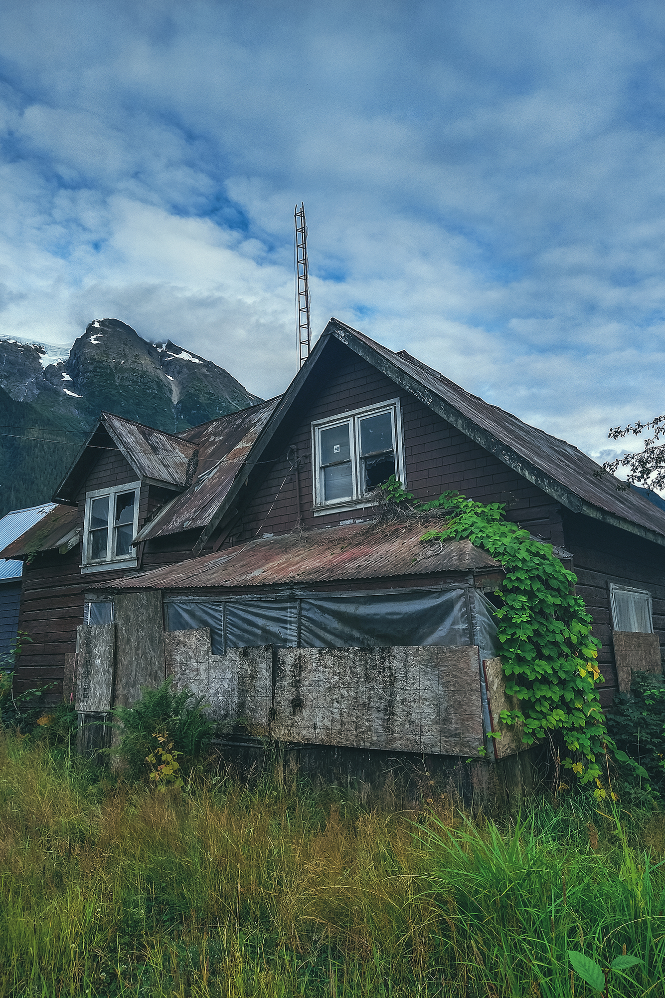
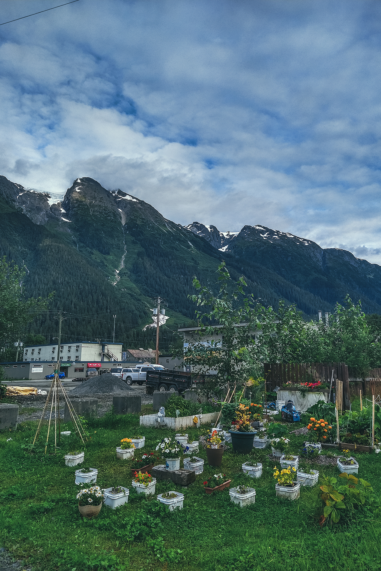
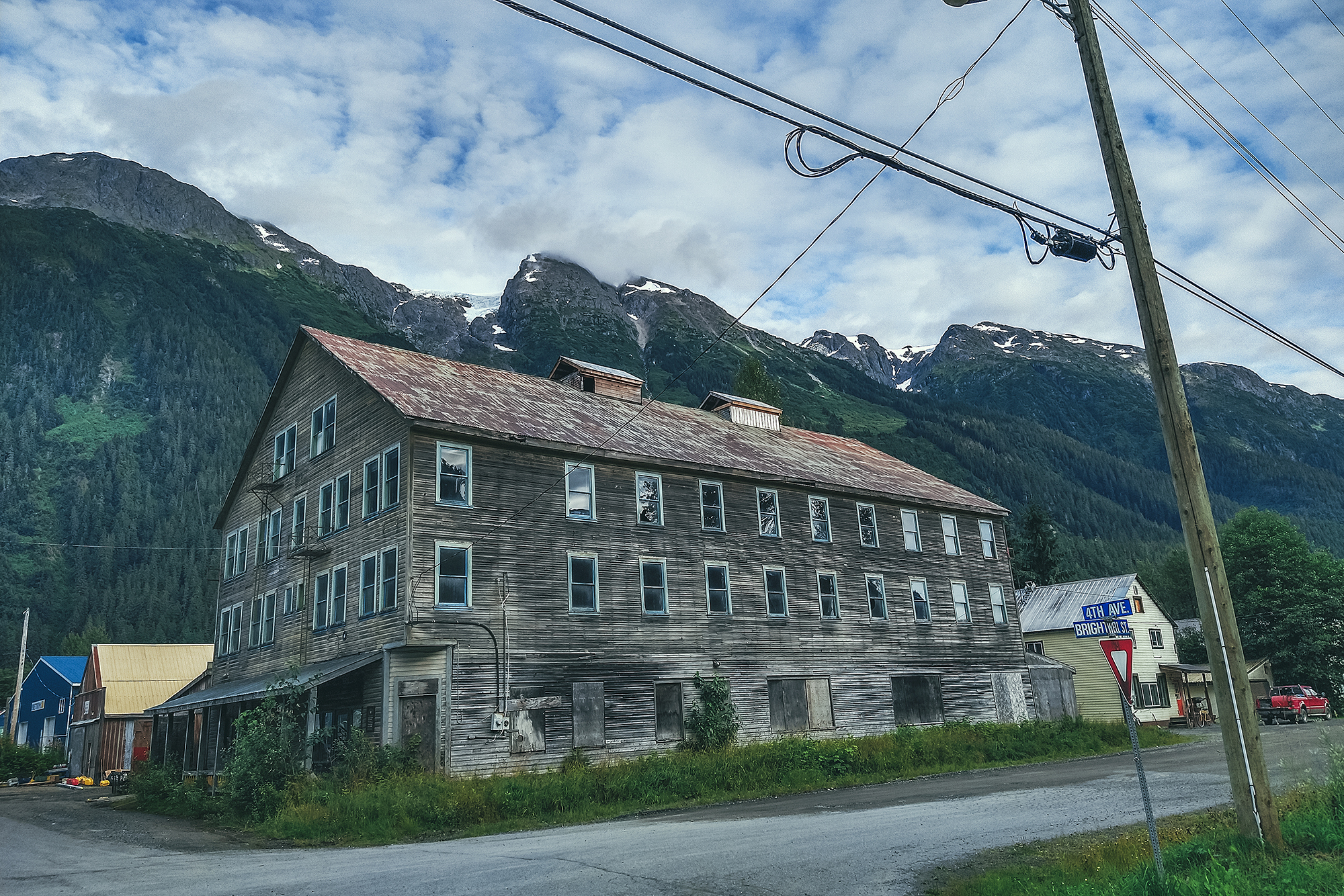
Both towns of Mayo & Keno were bustling with community life through the 20th century. Nowadays there are less than 500 souls in Mayo, most of which are First Nation born in the area. Keno, further down the road, has a population of 20!
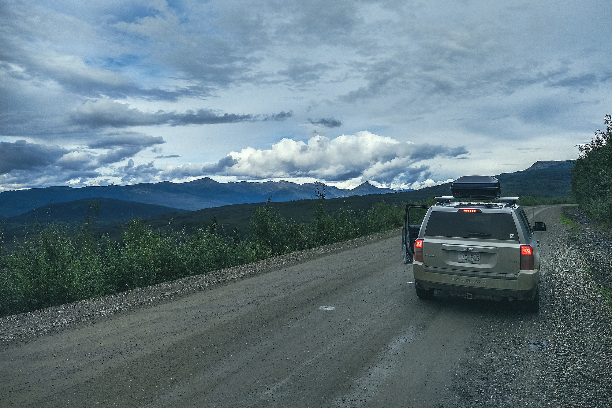
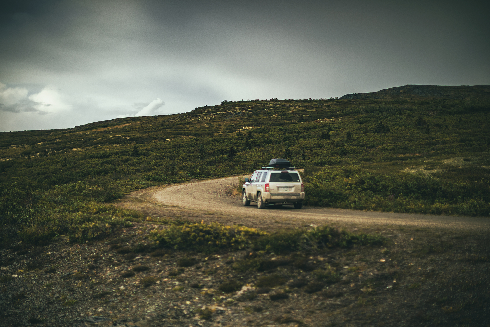
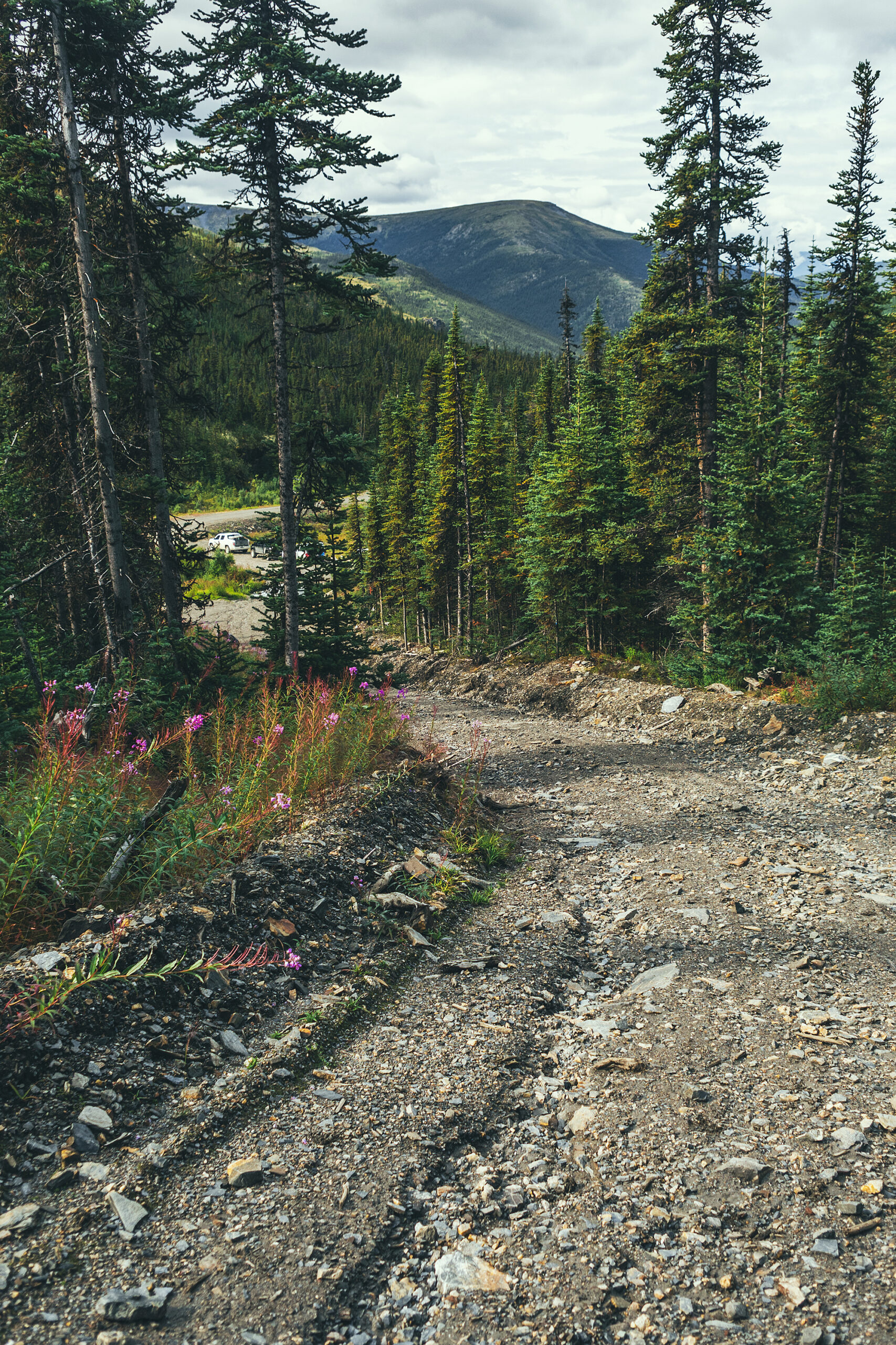
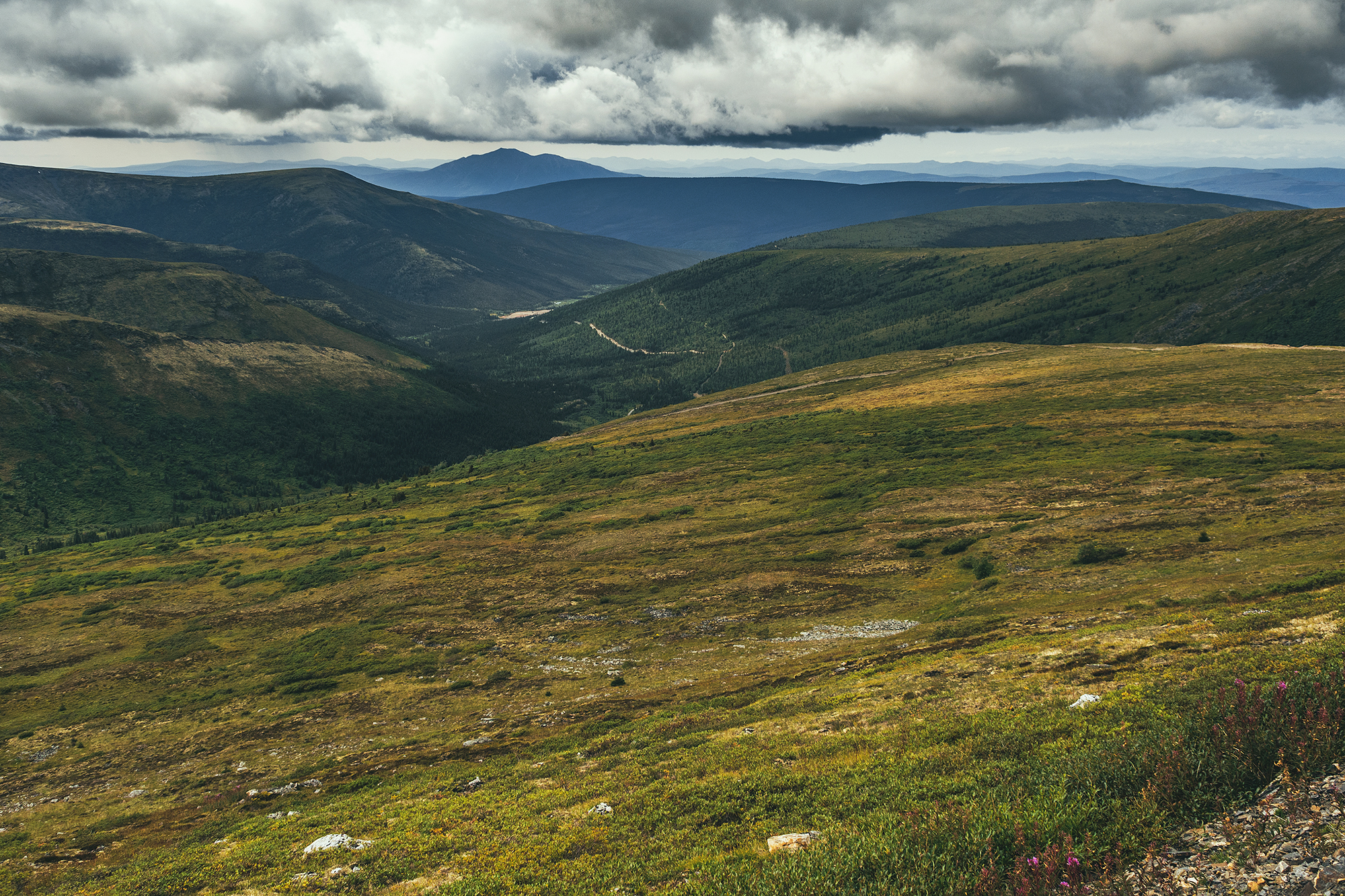
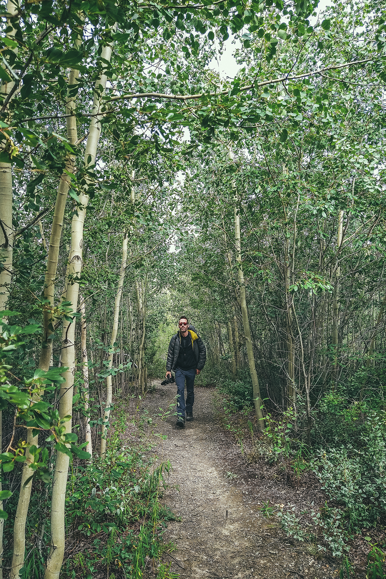
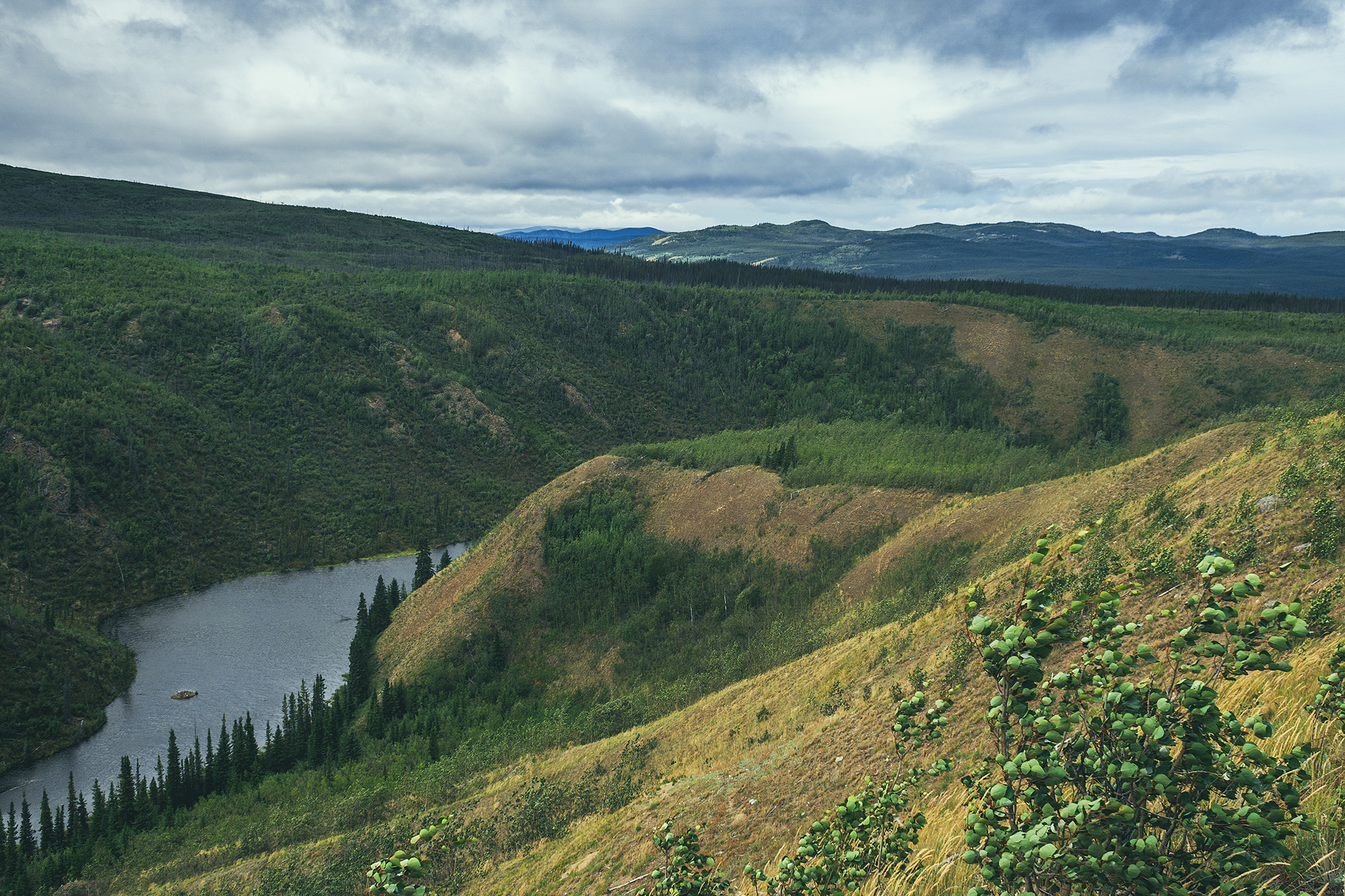
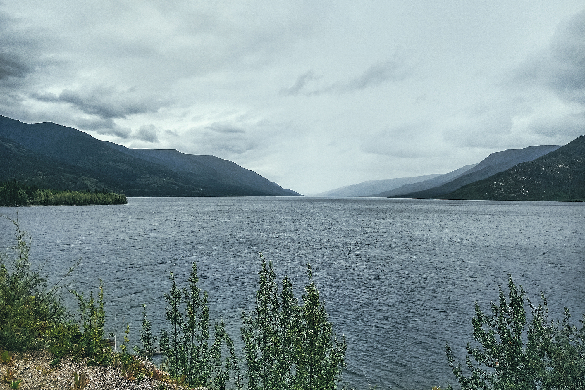
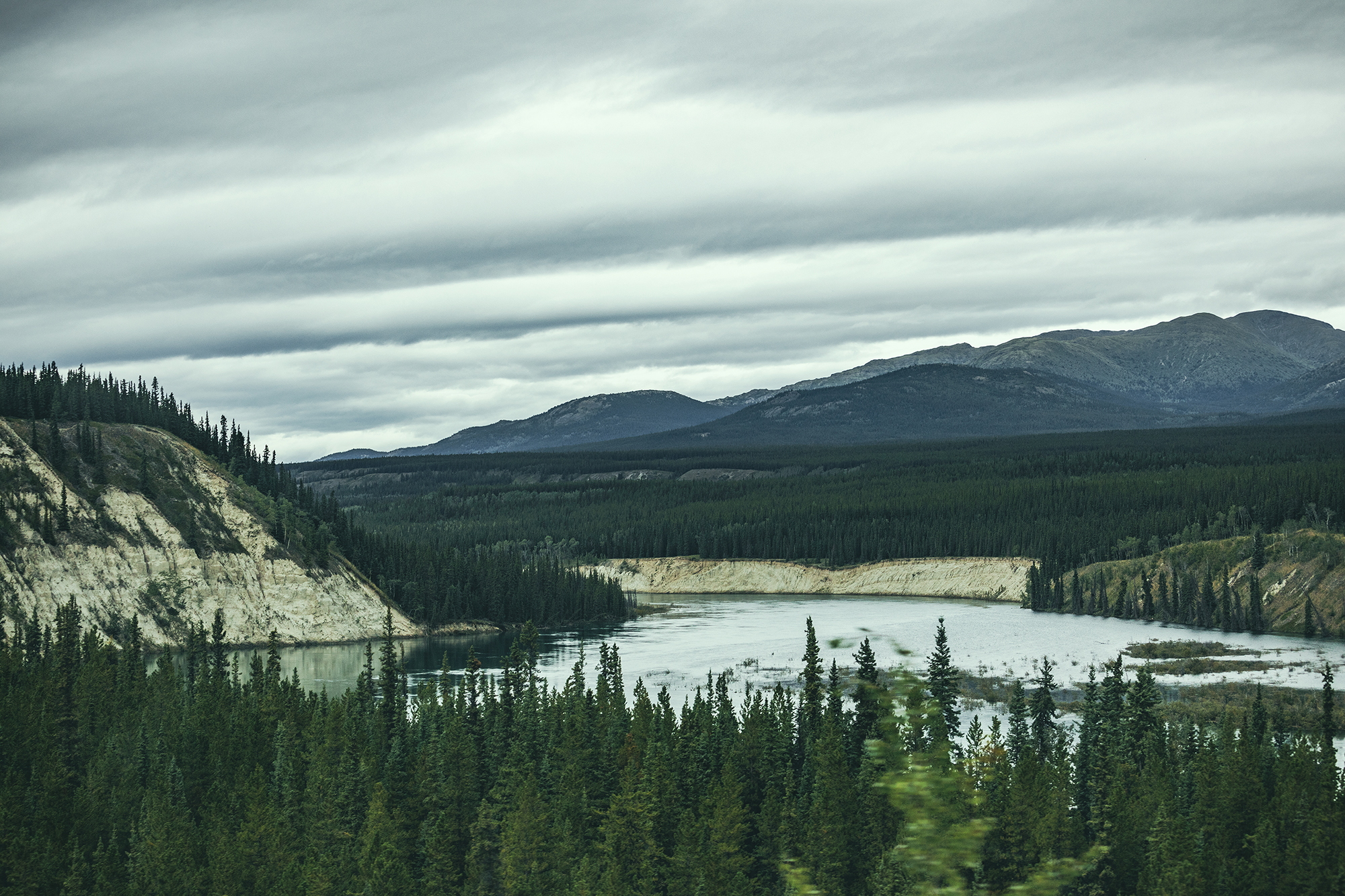
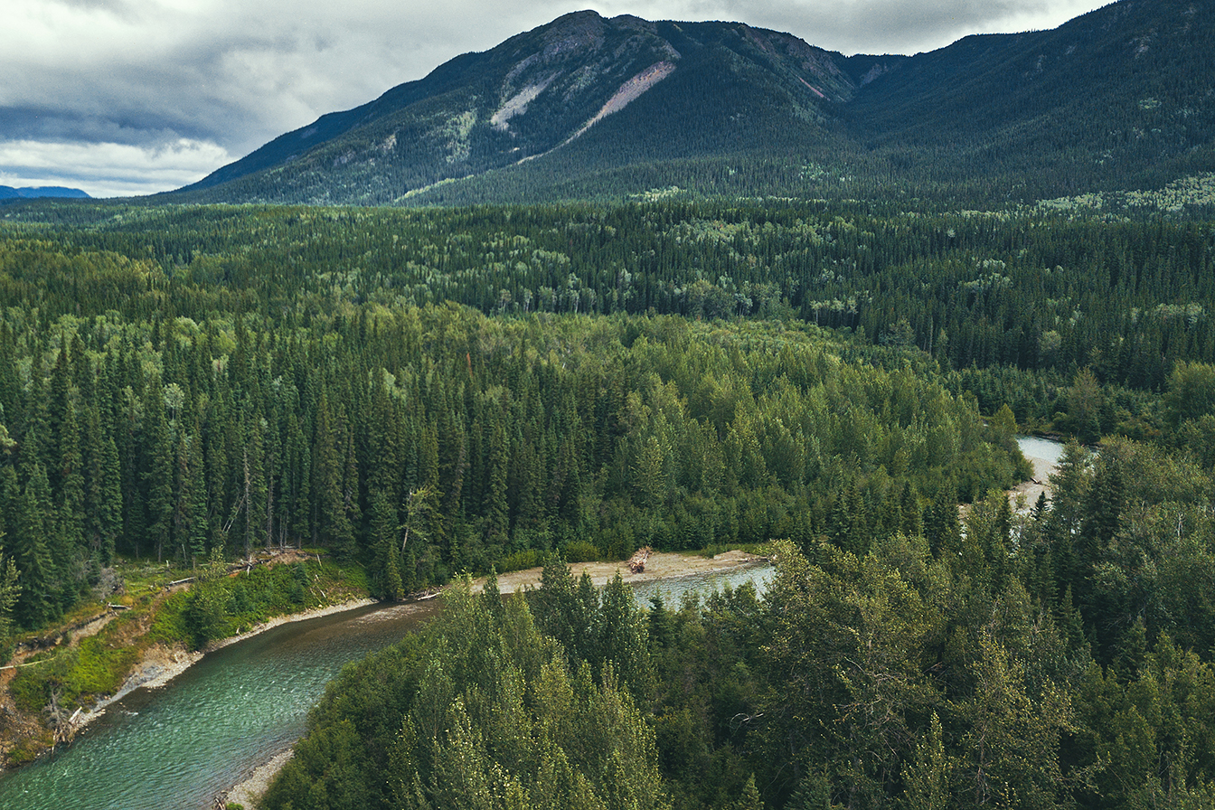
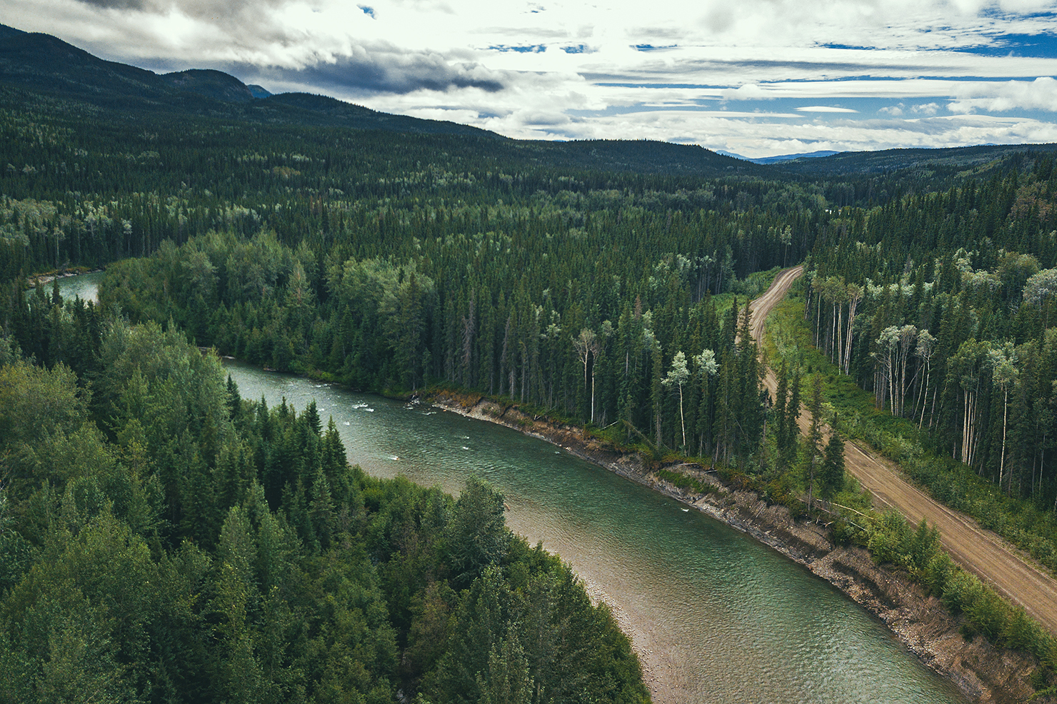
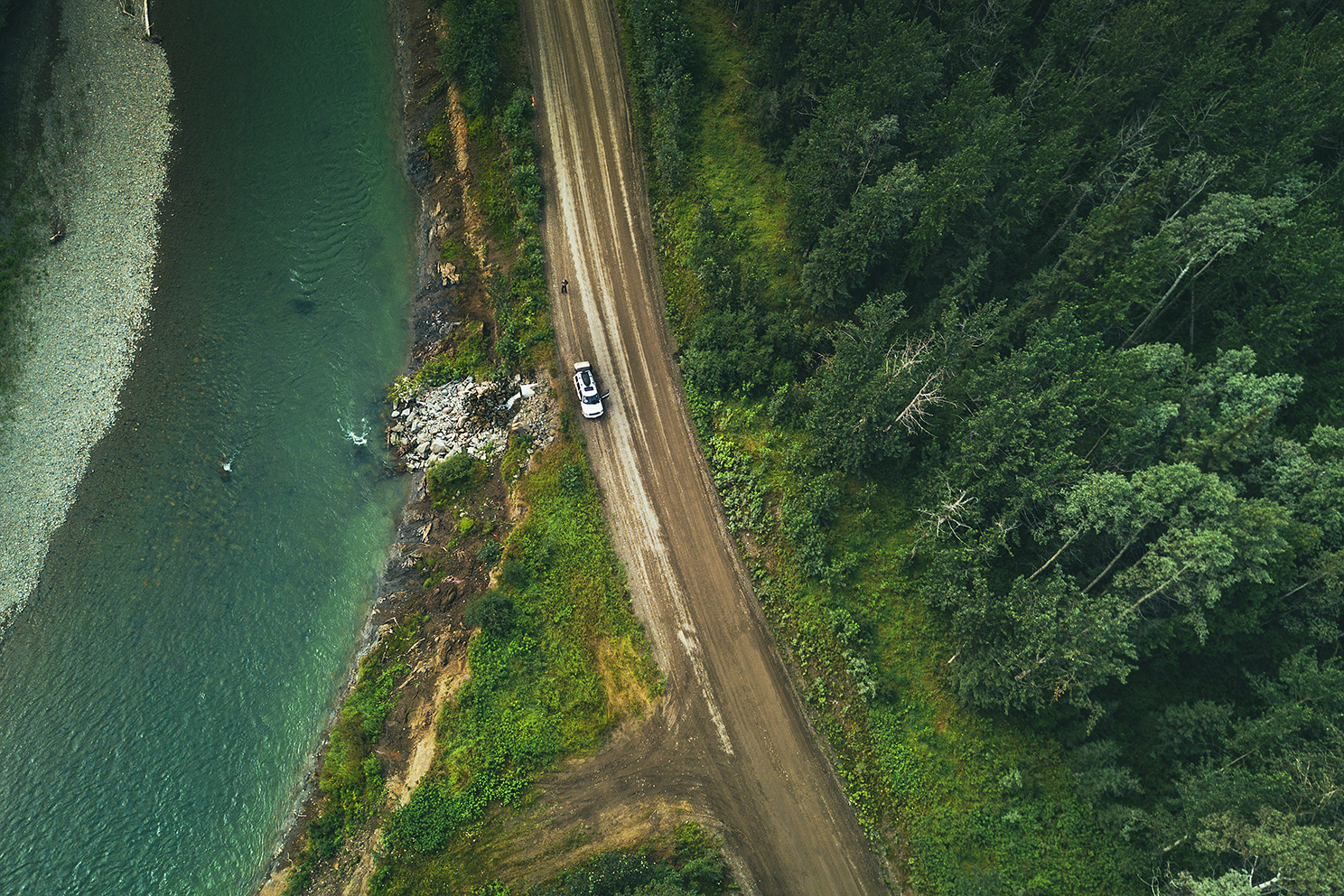
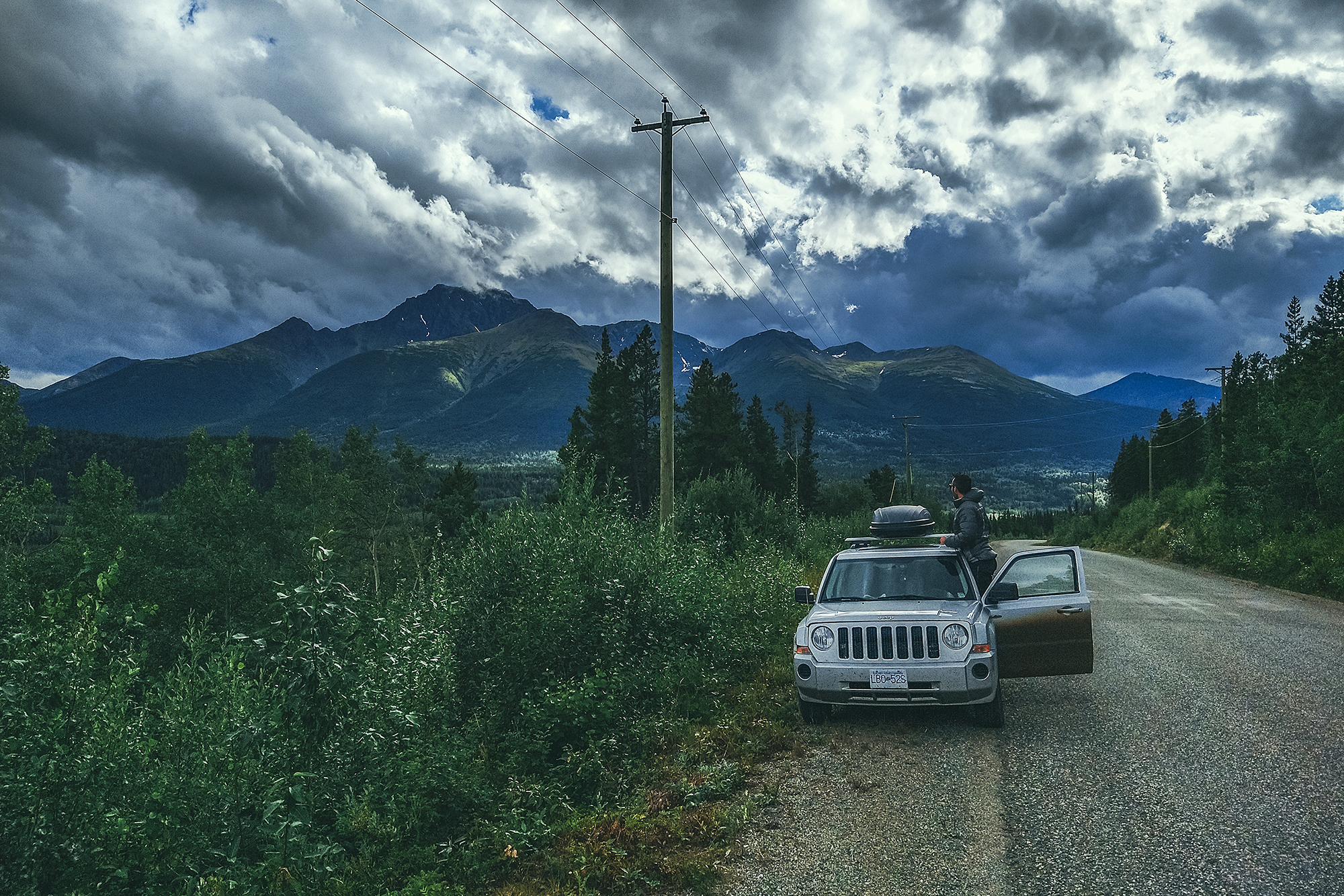
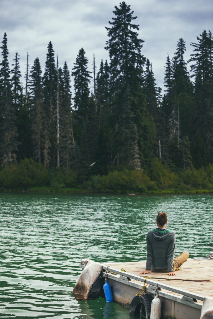
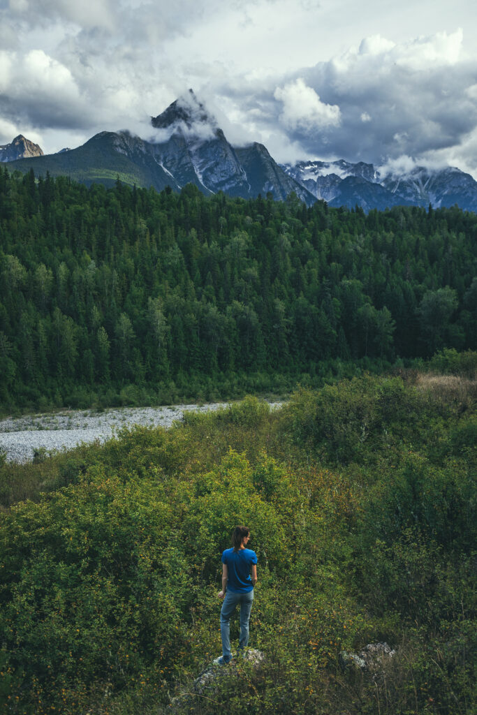
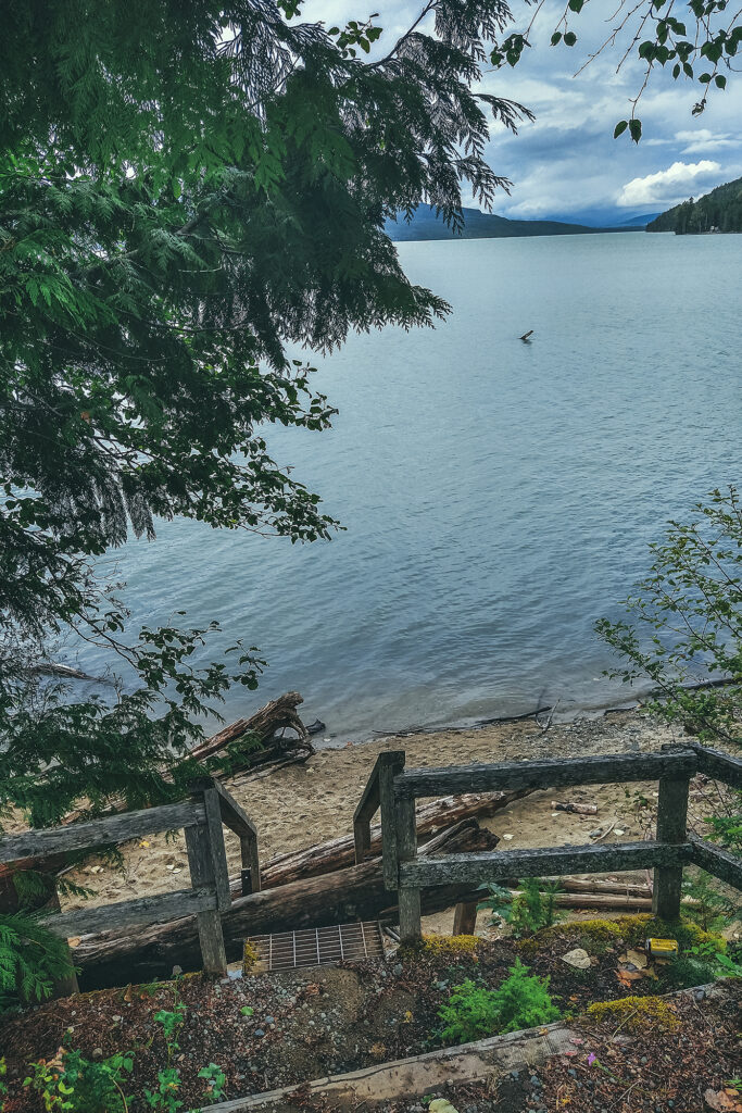
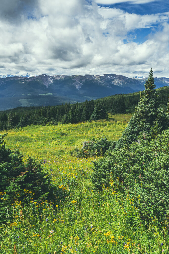
After the visit, it was still early in the day, so we decided to drive to Keno for the night. The way there was quite scenic, as we climbed the unpaved road surrounded by mountain ranges. The scenery up until that point had been mostly rolling hills with trees, ponds and lakes as far as the eye could see.
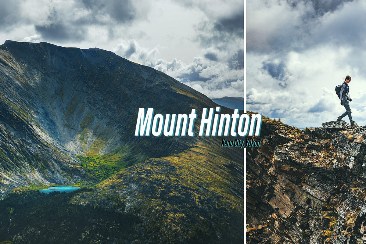
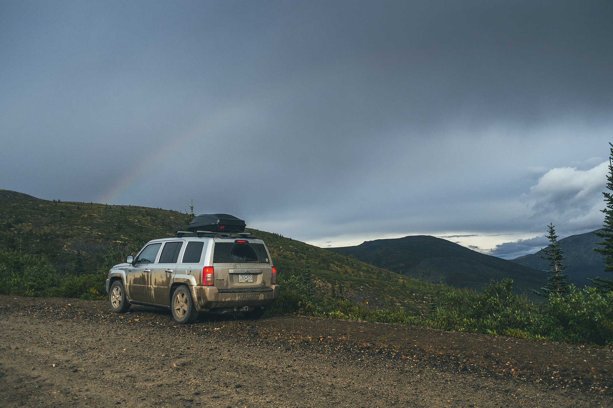
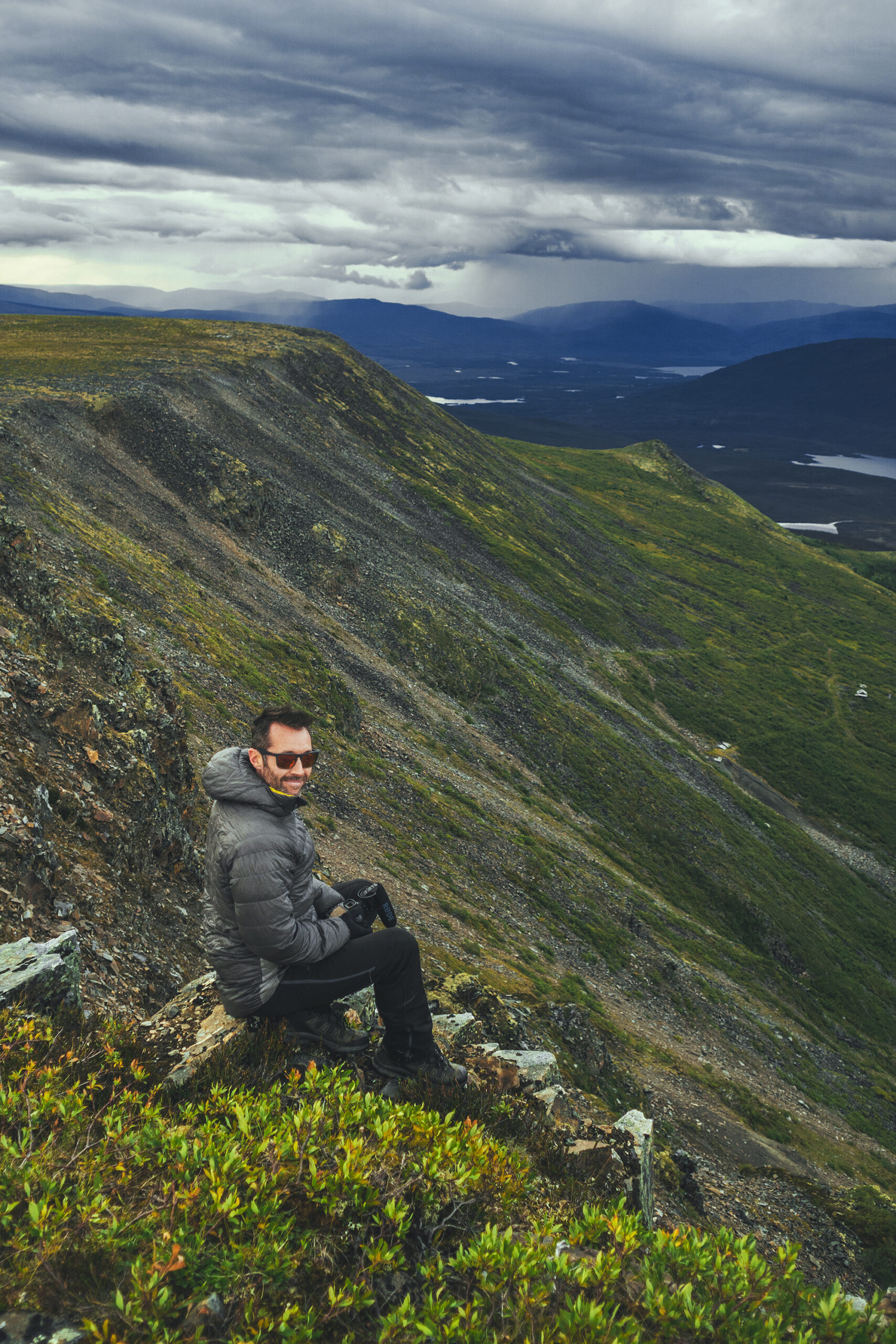
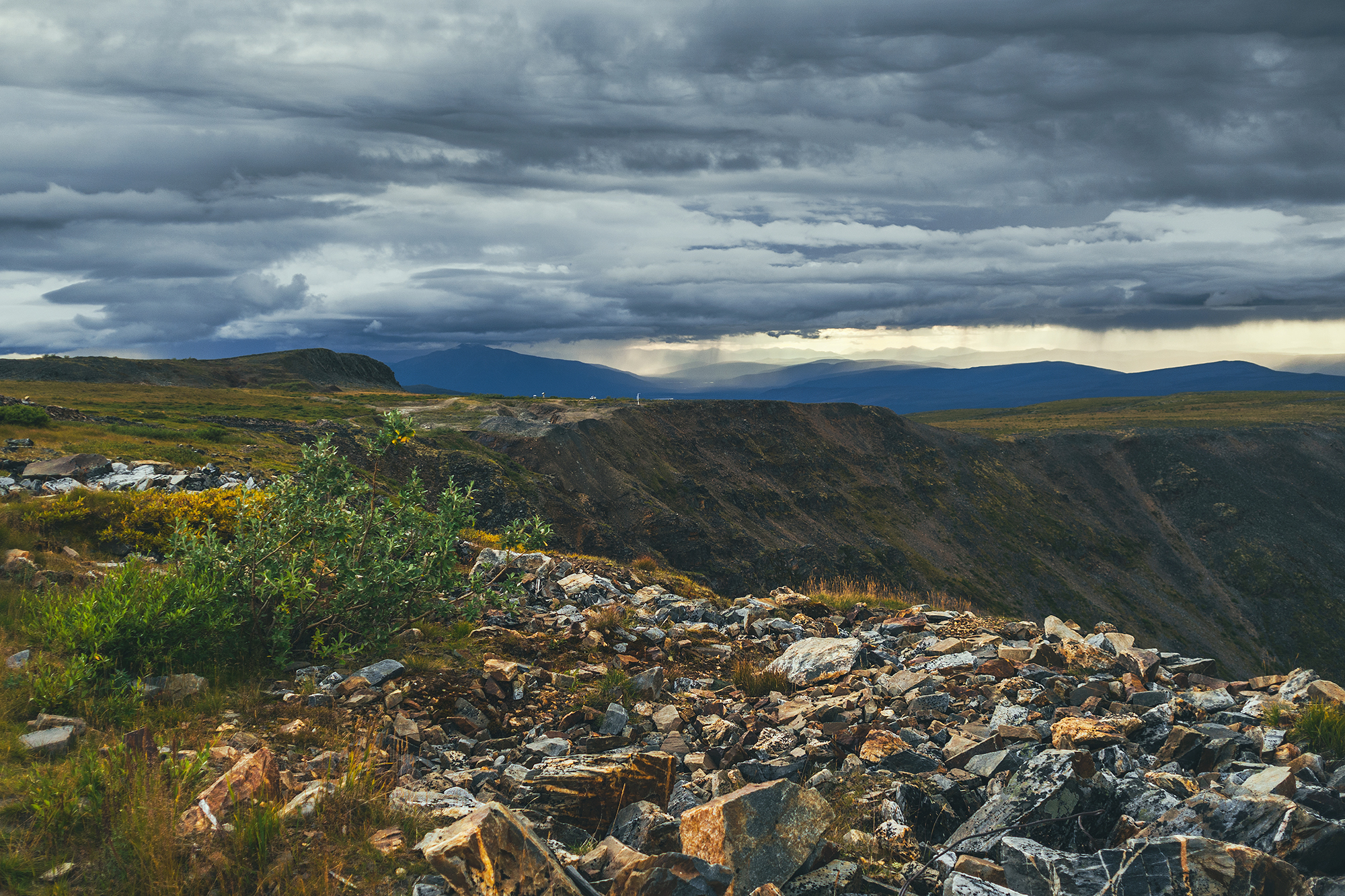
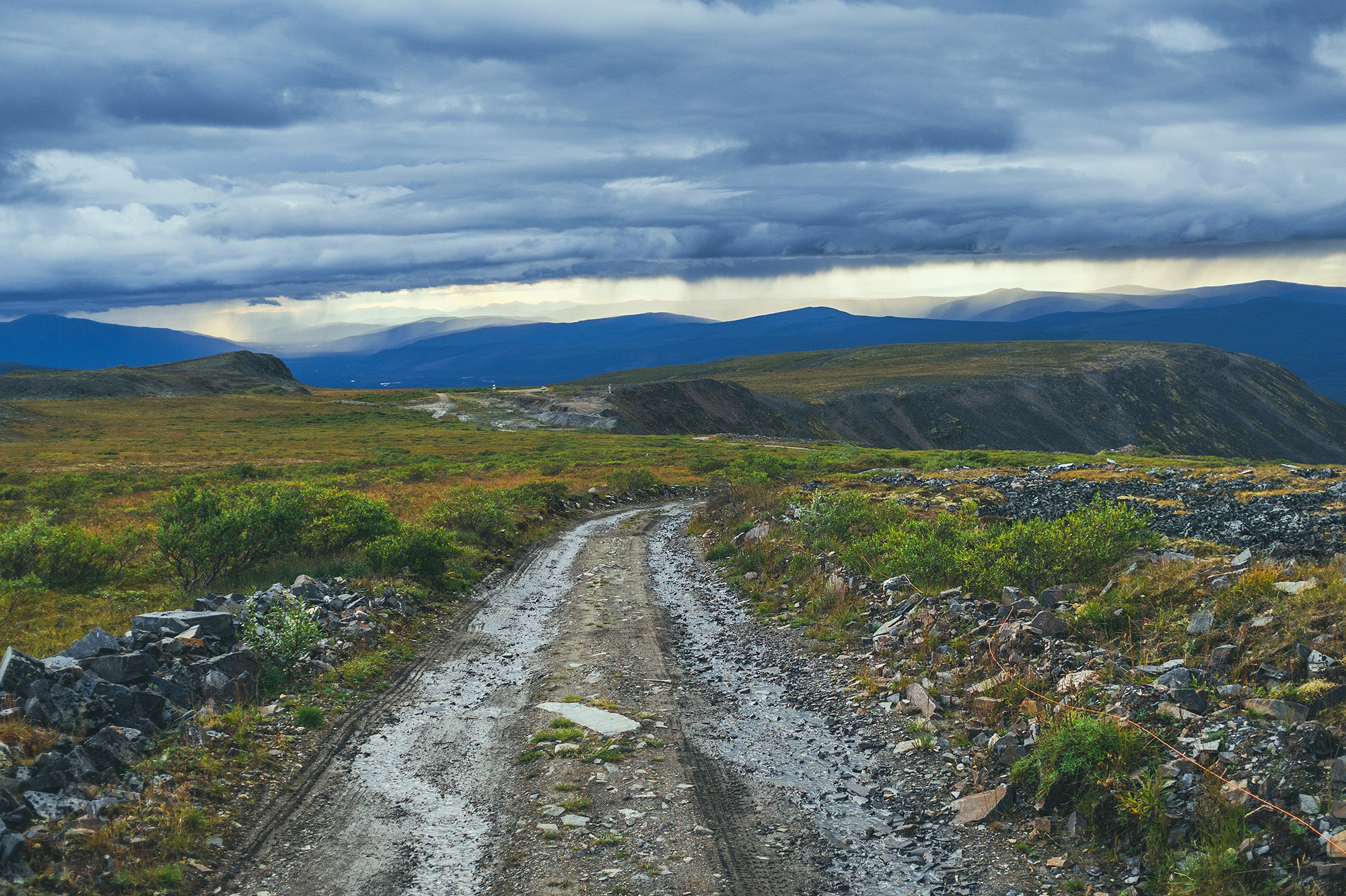
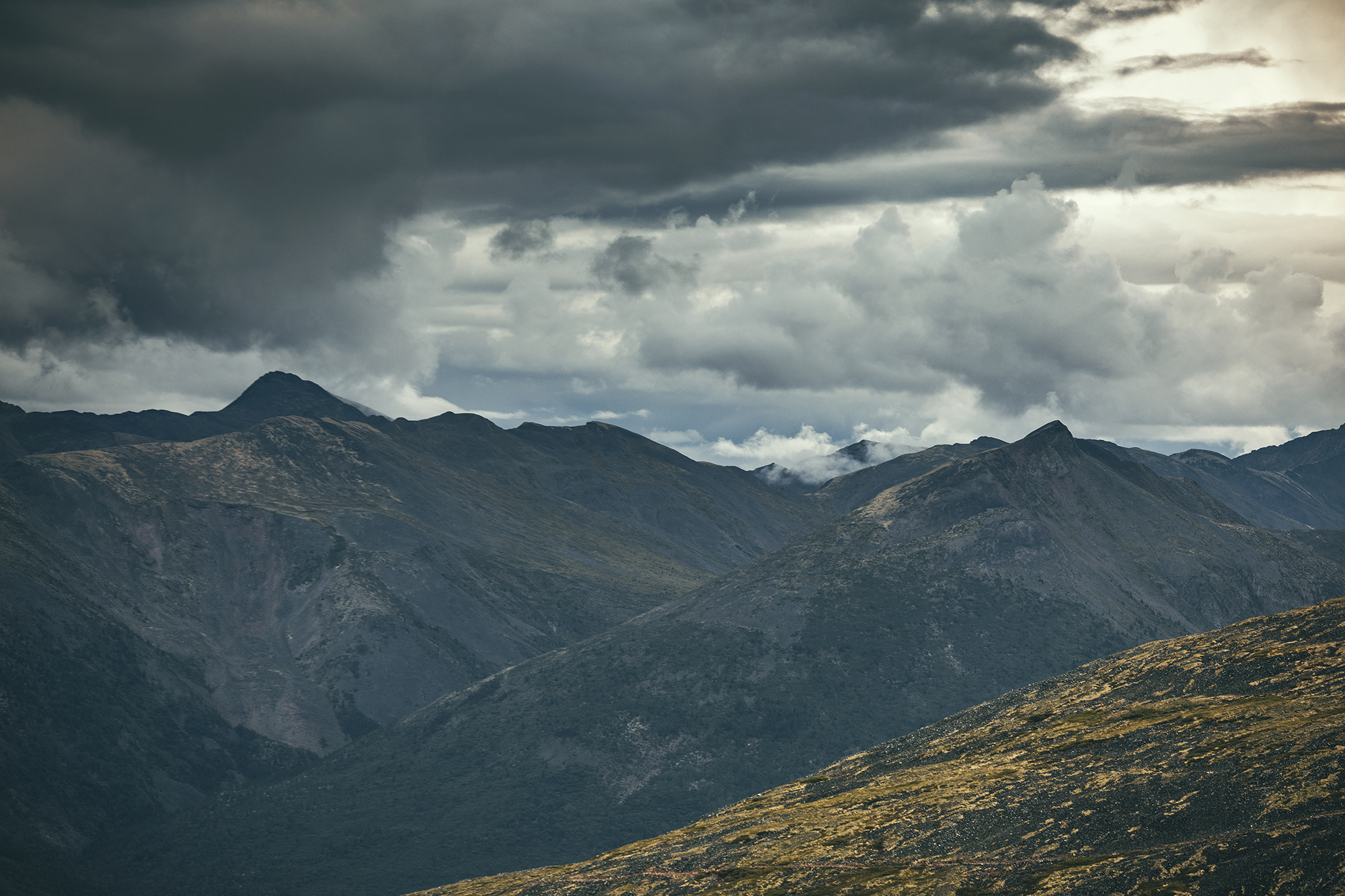
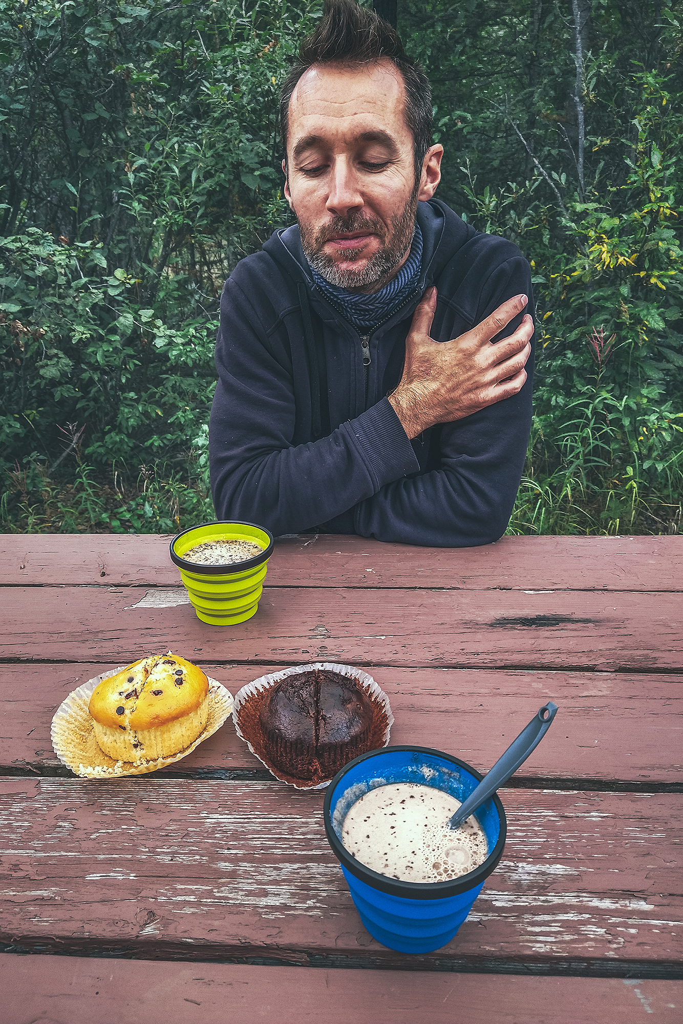
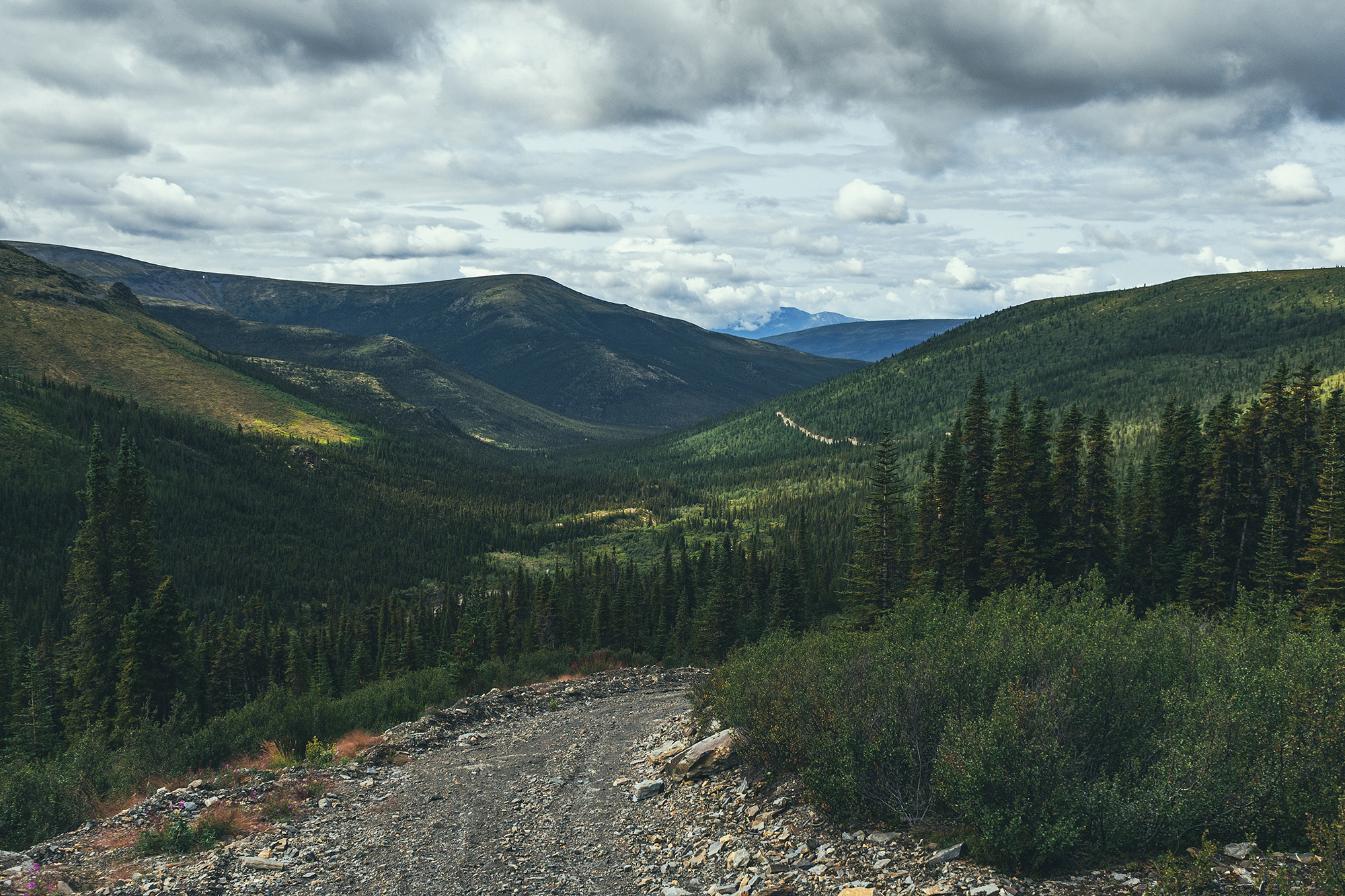
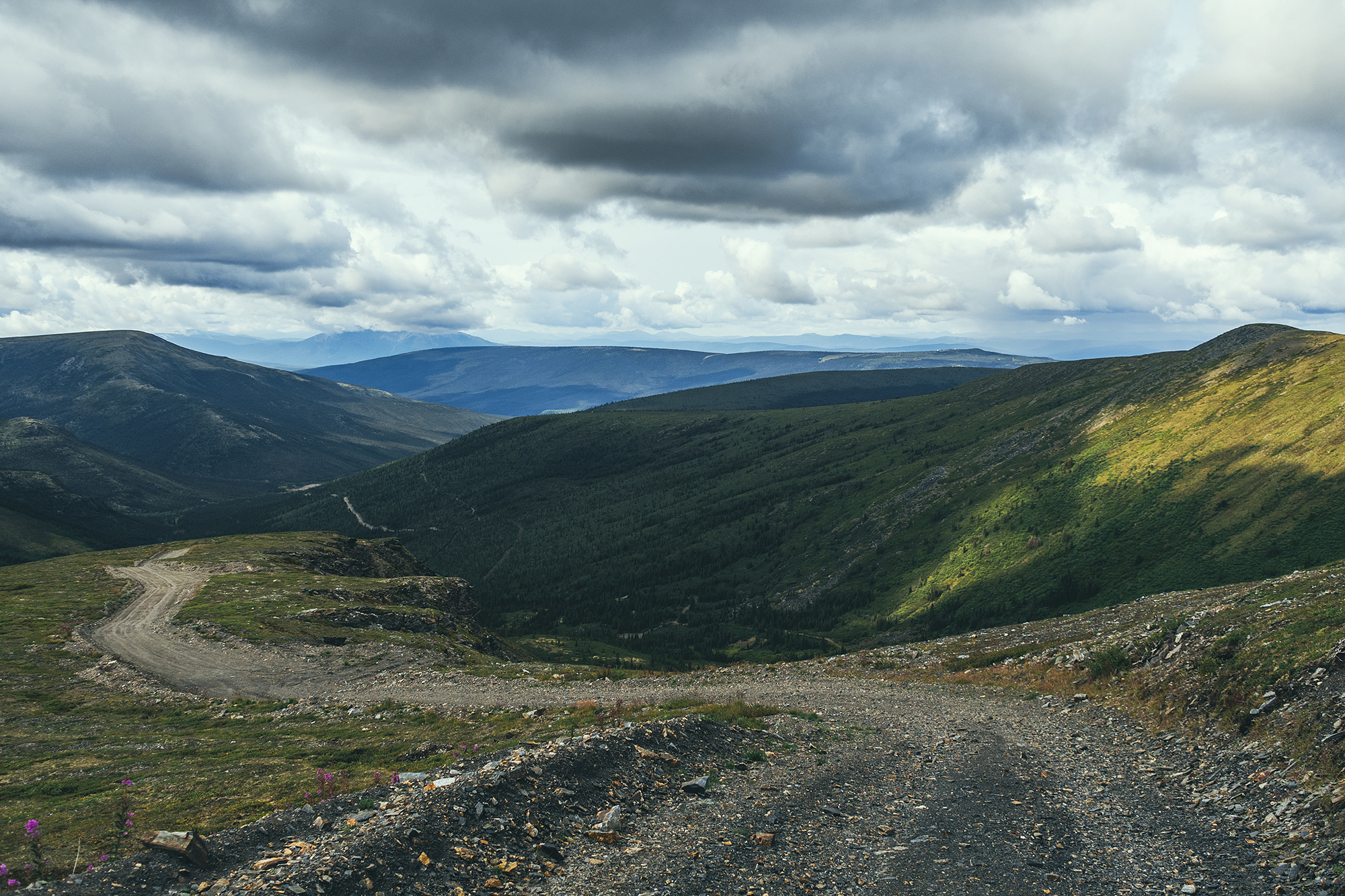
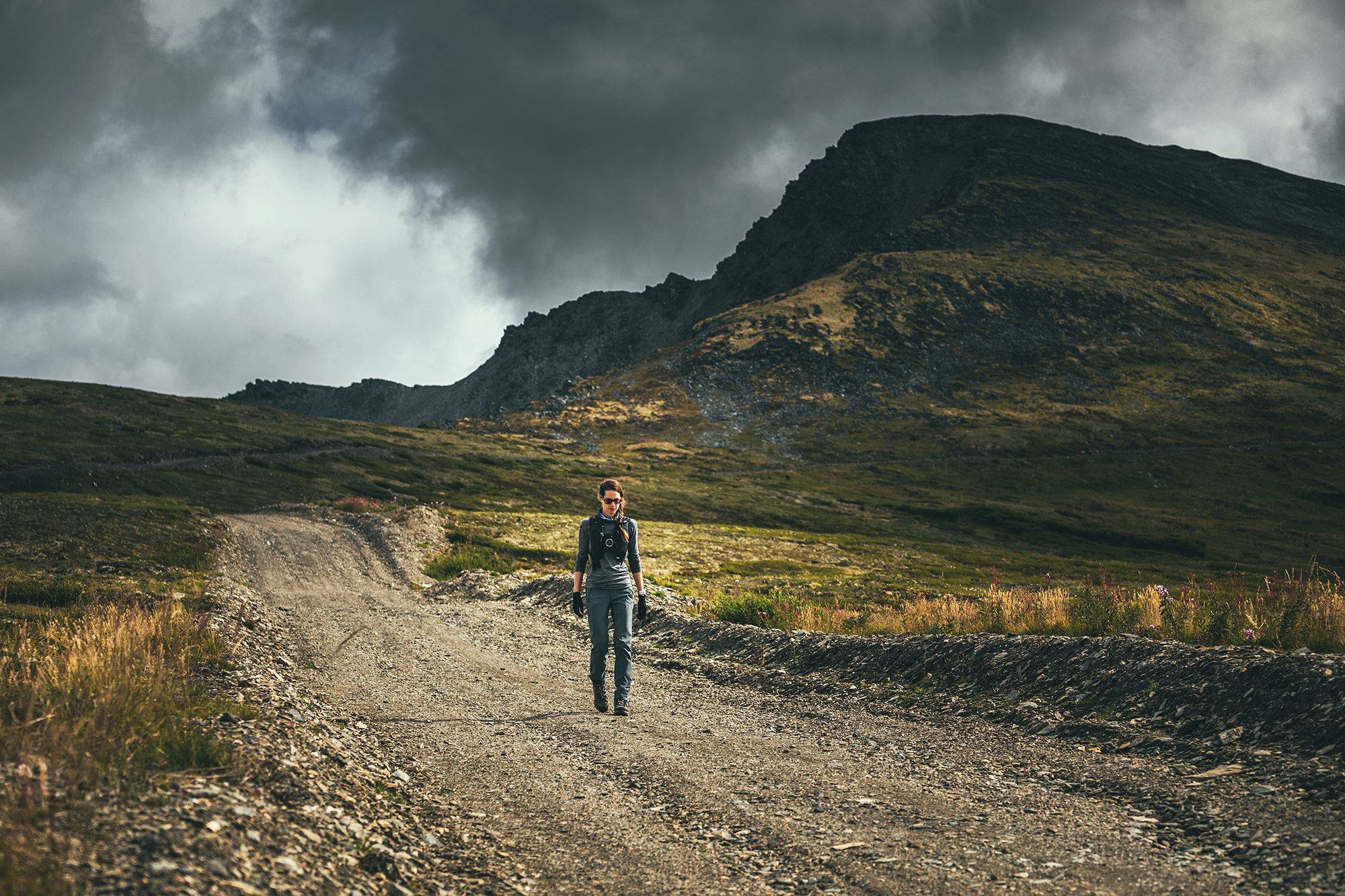
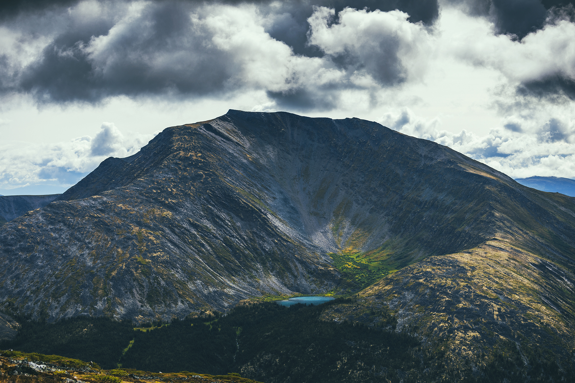
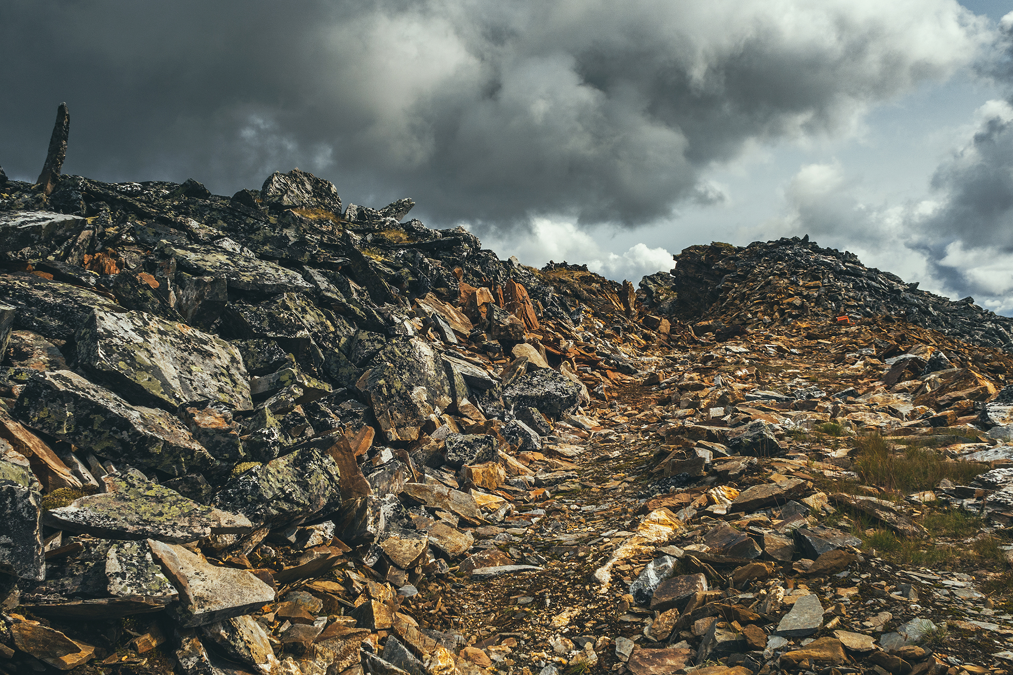
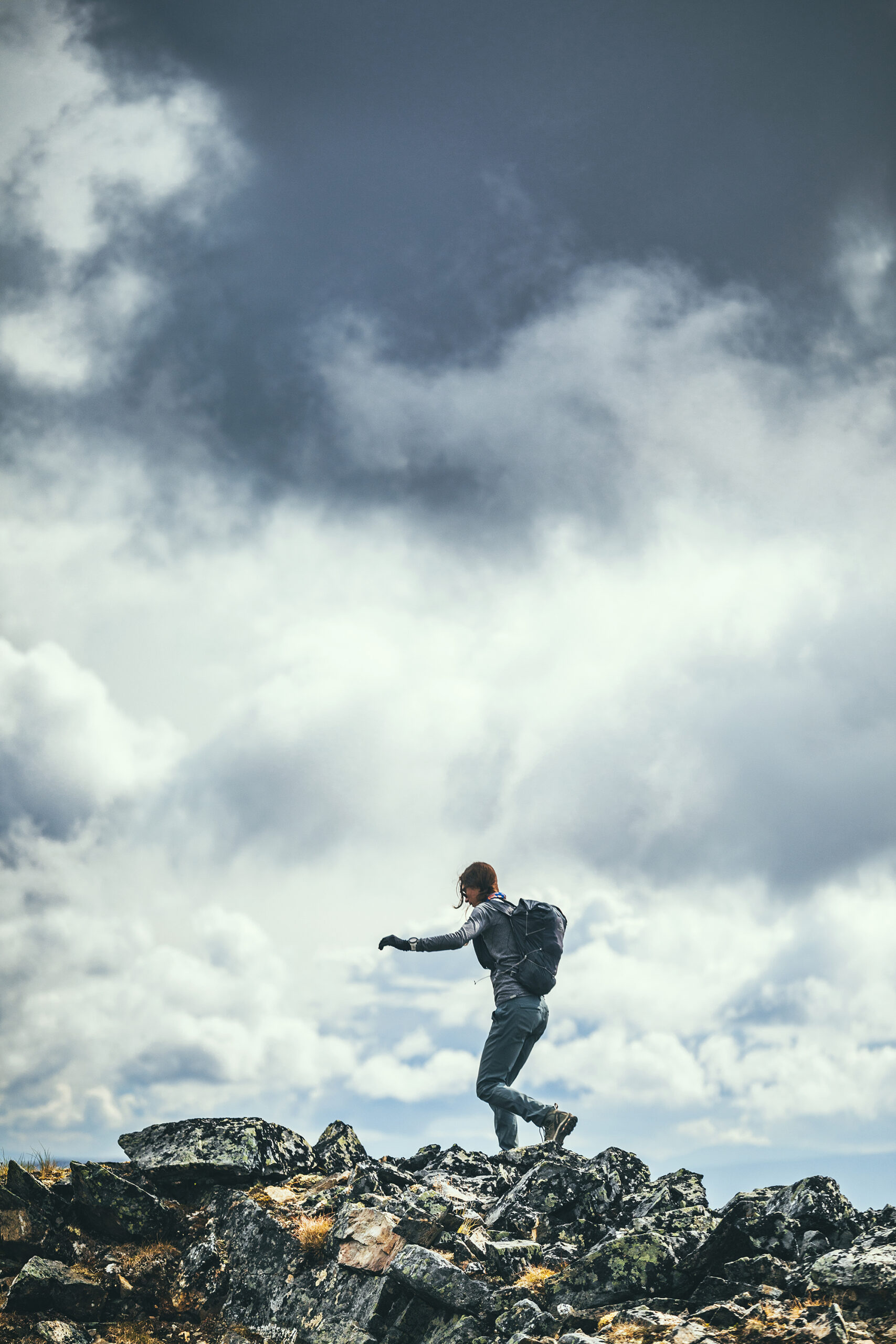
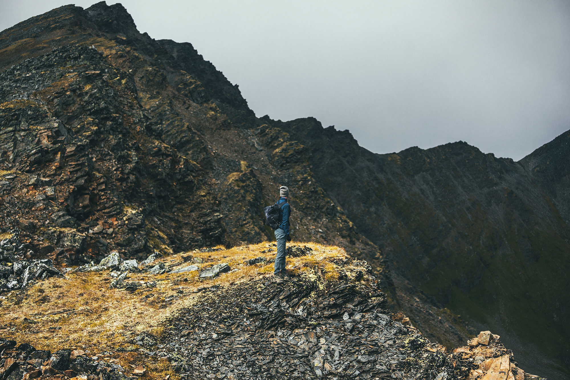
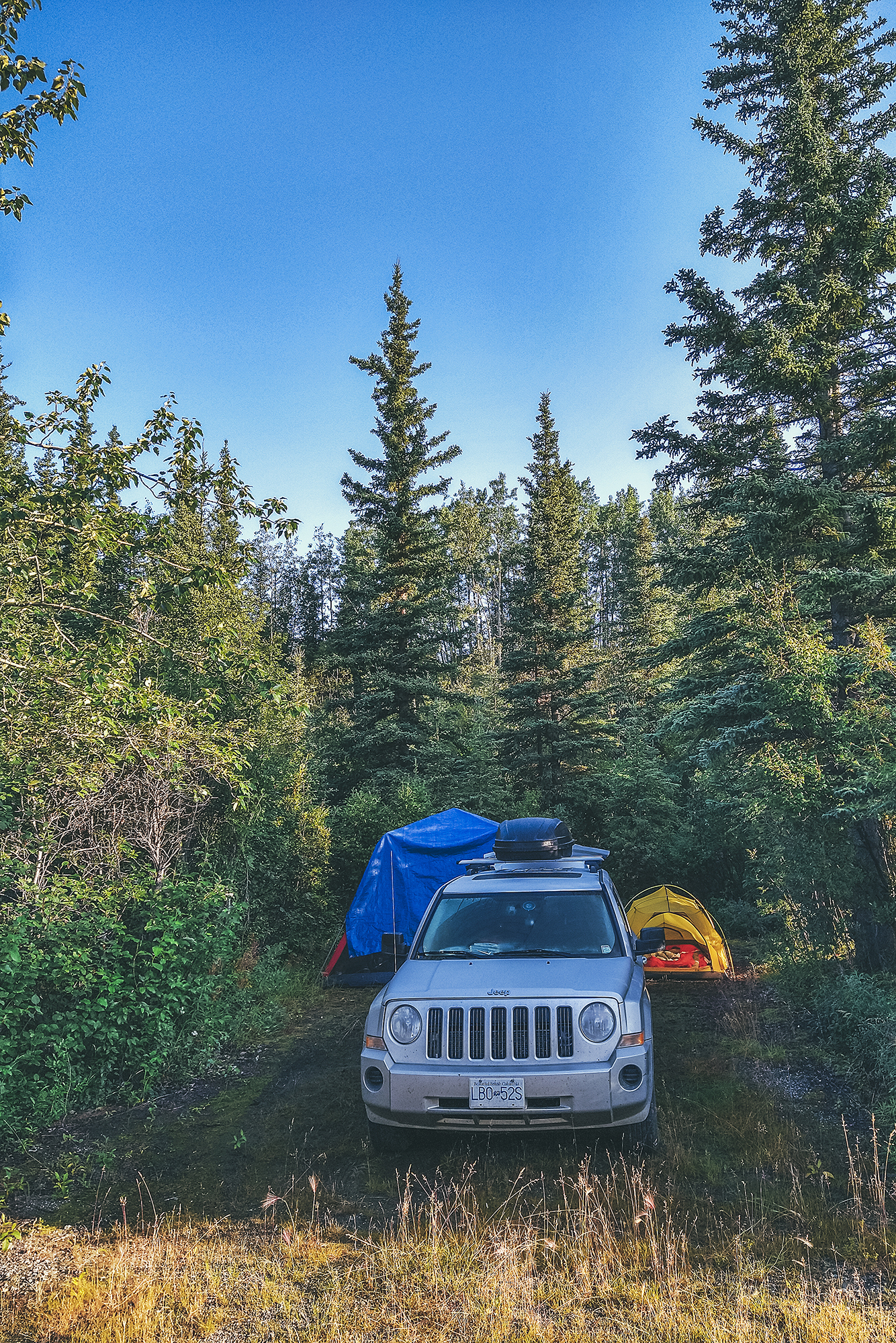
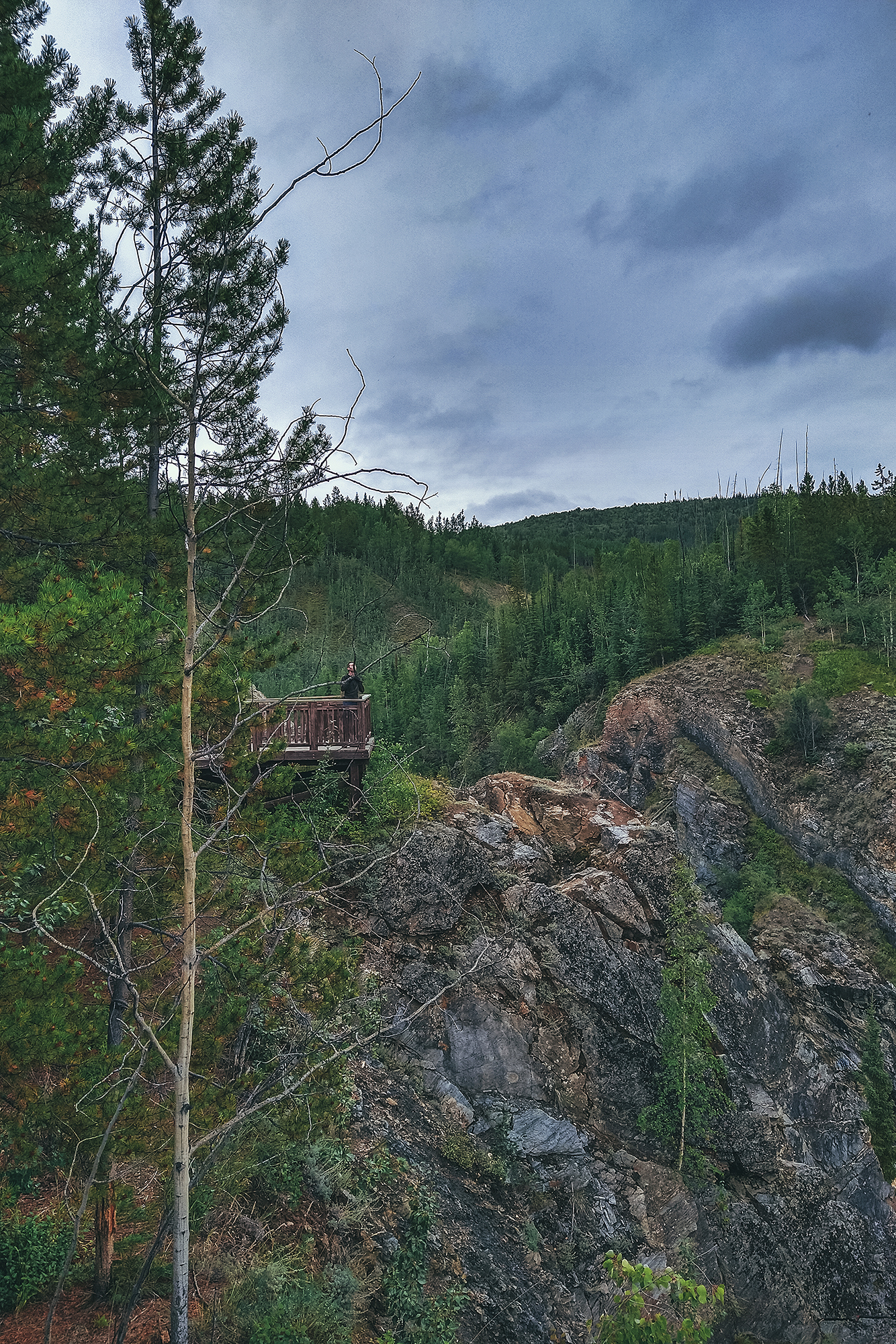
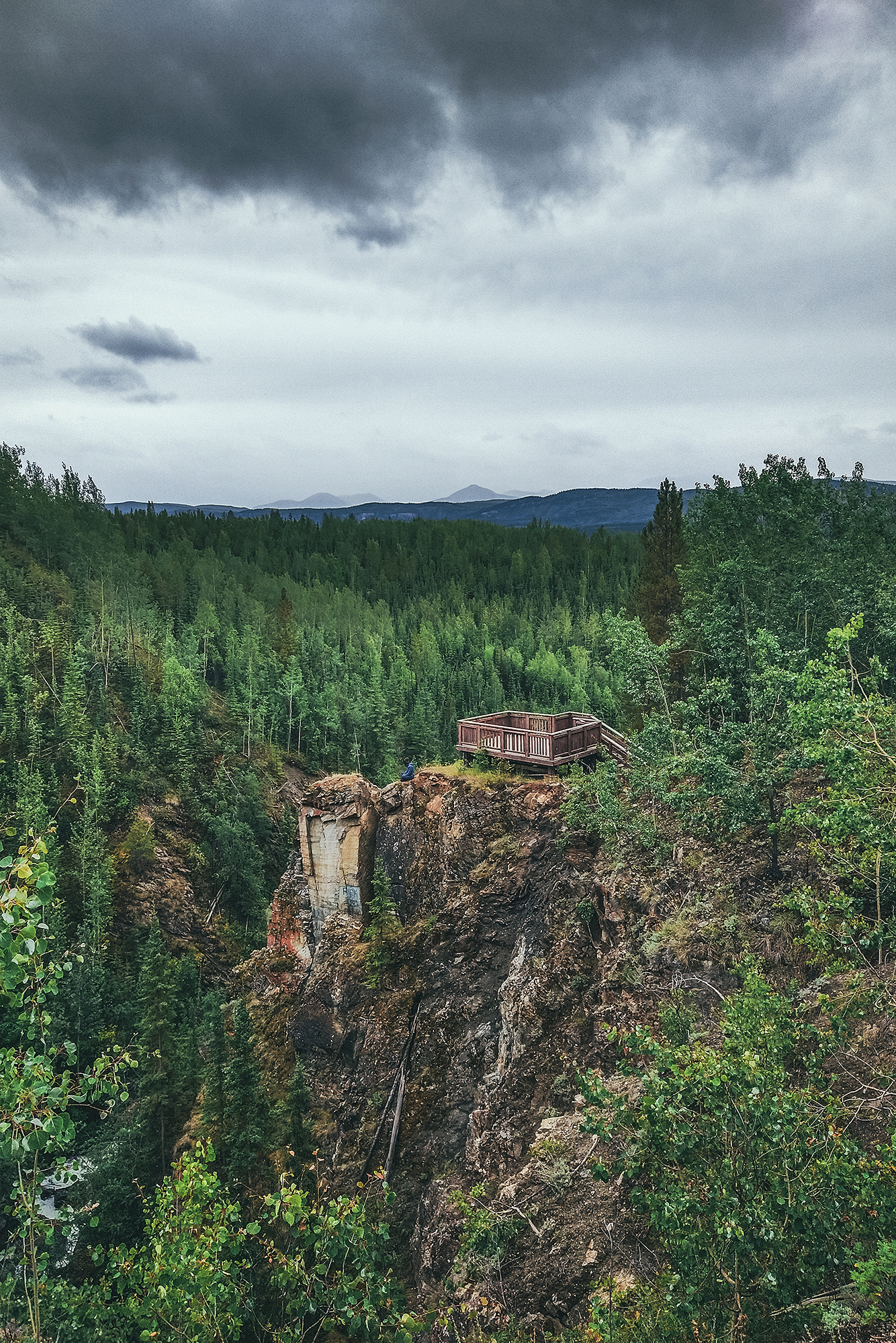
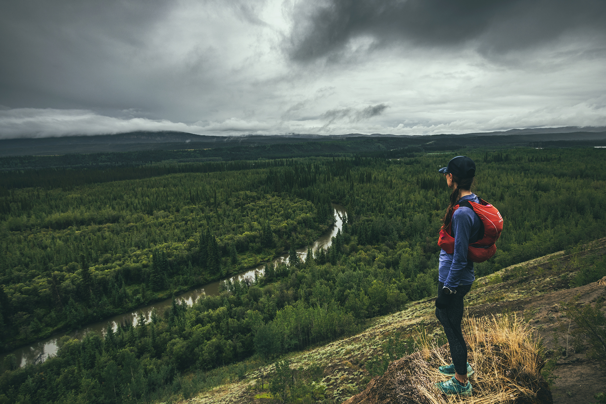
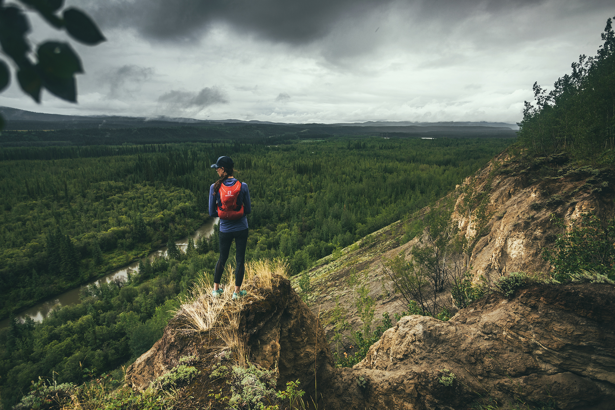
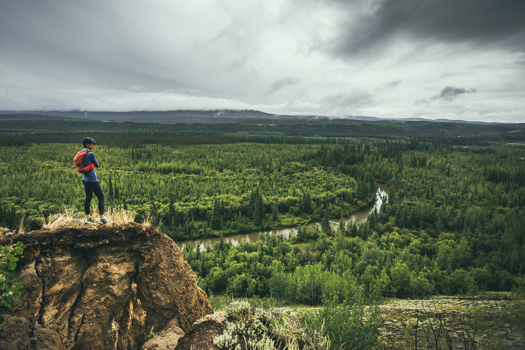
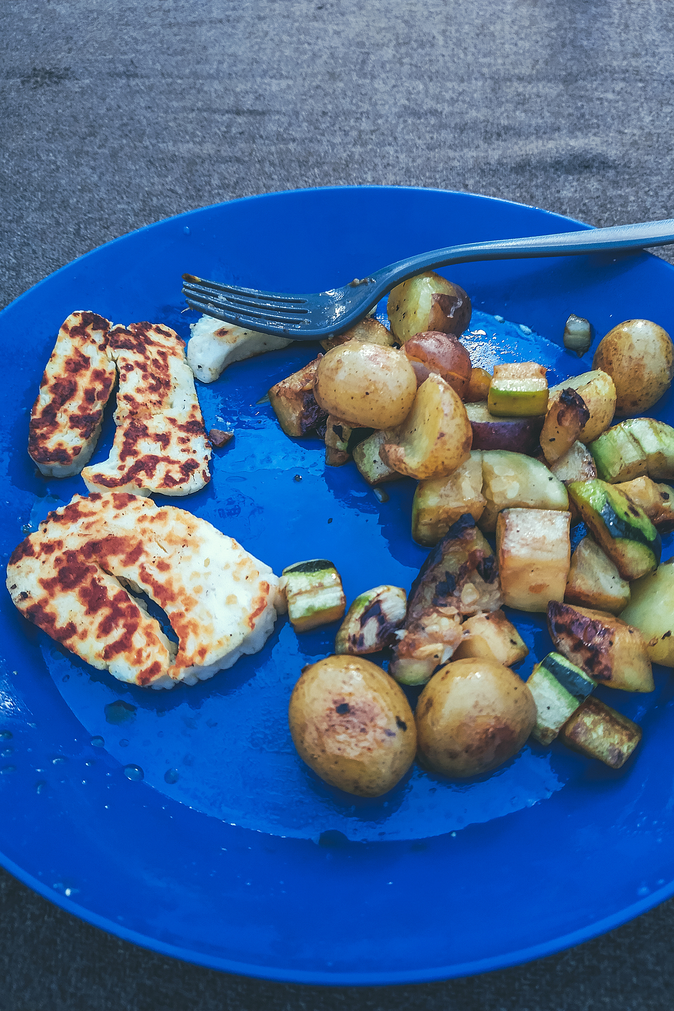
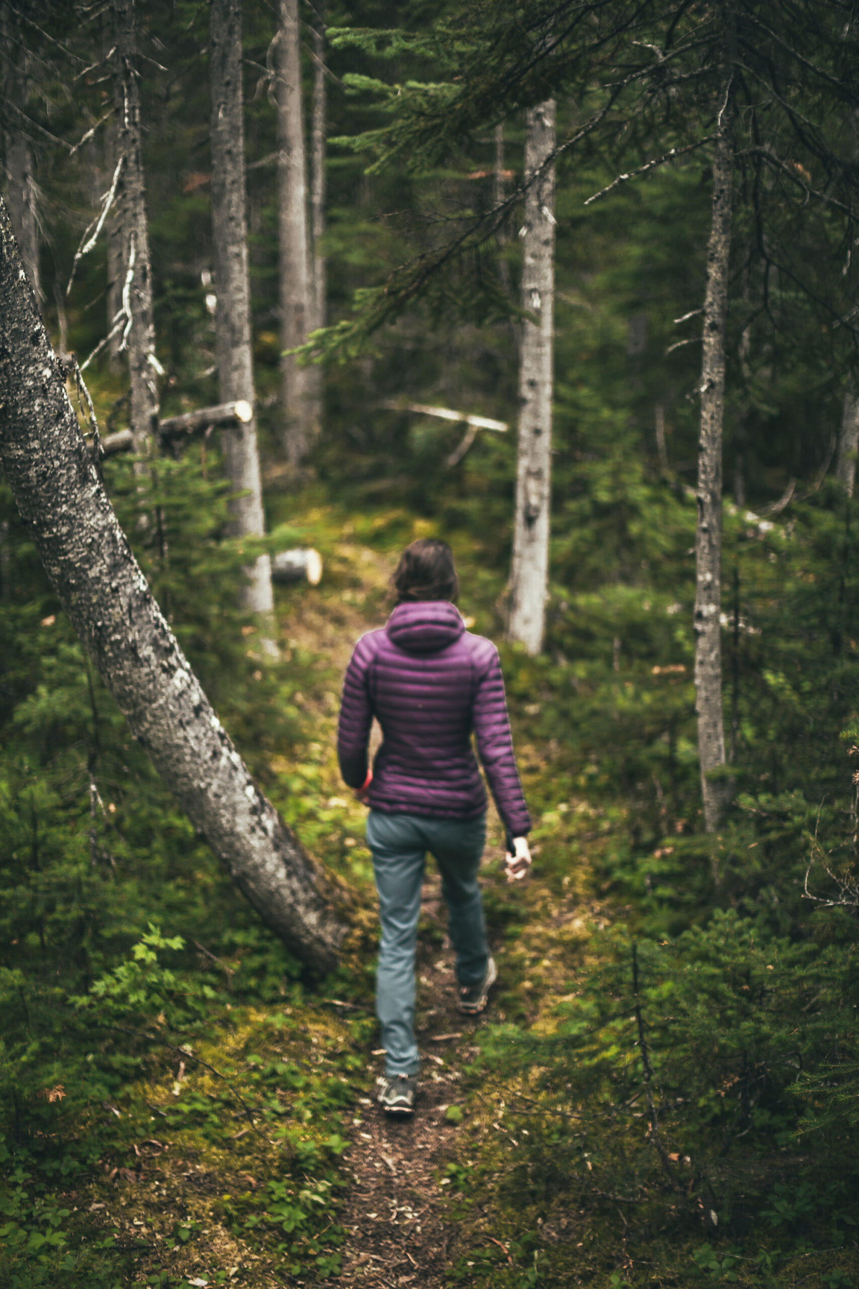
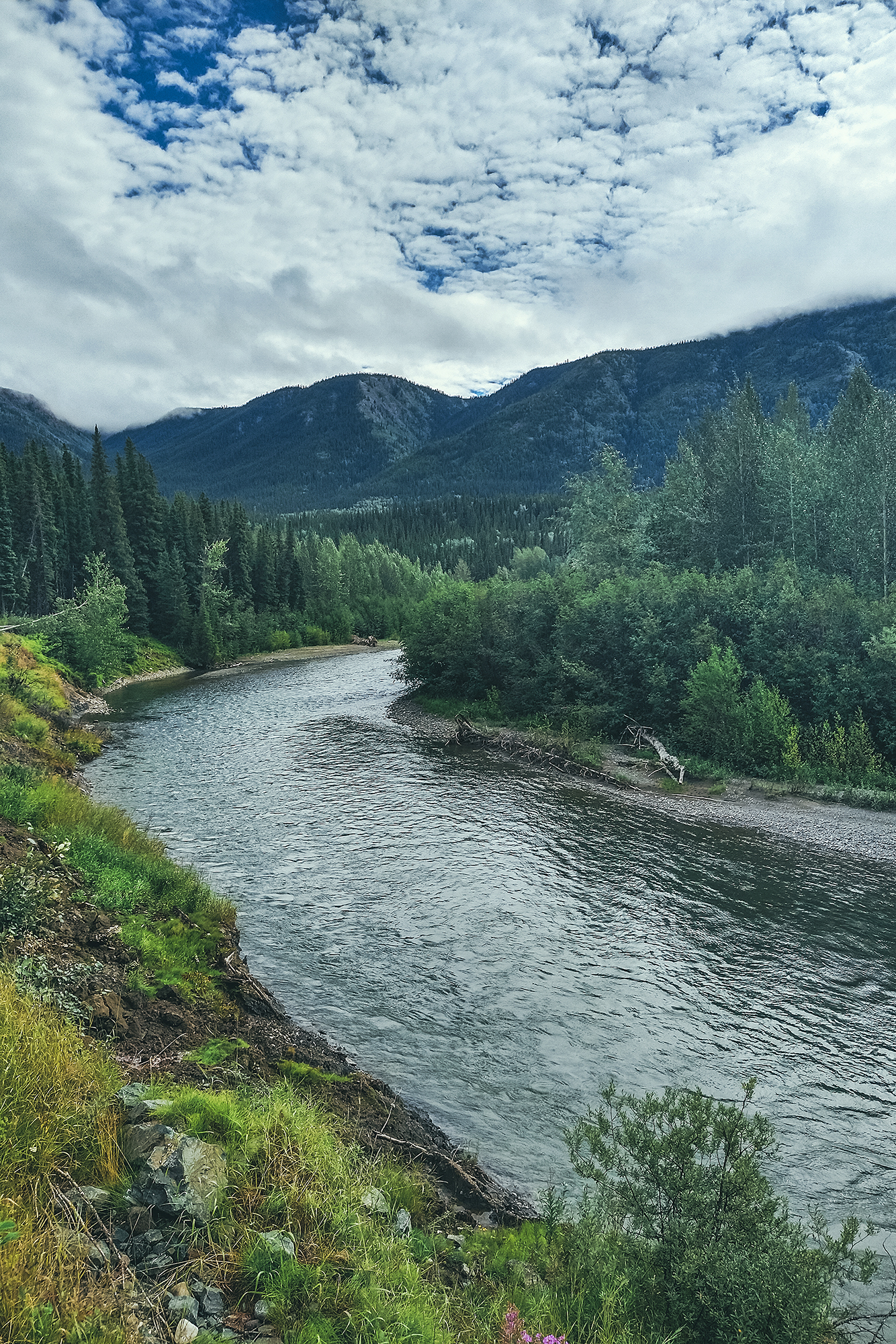
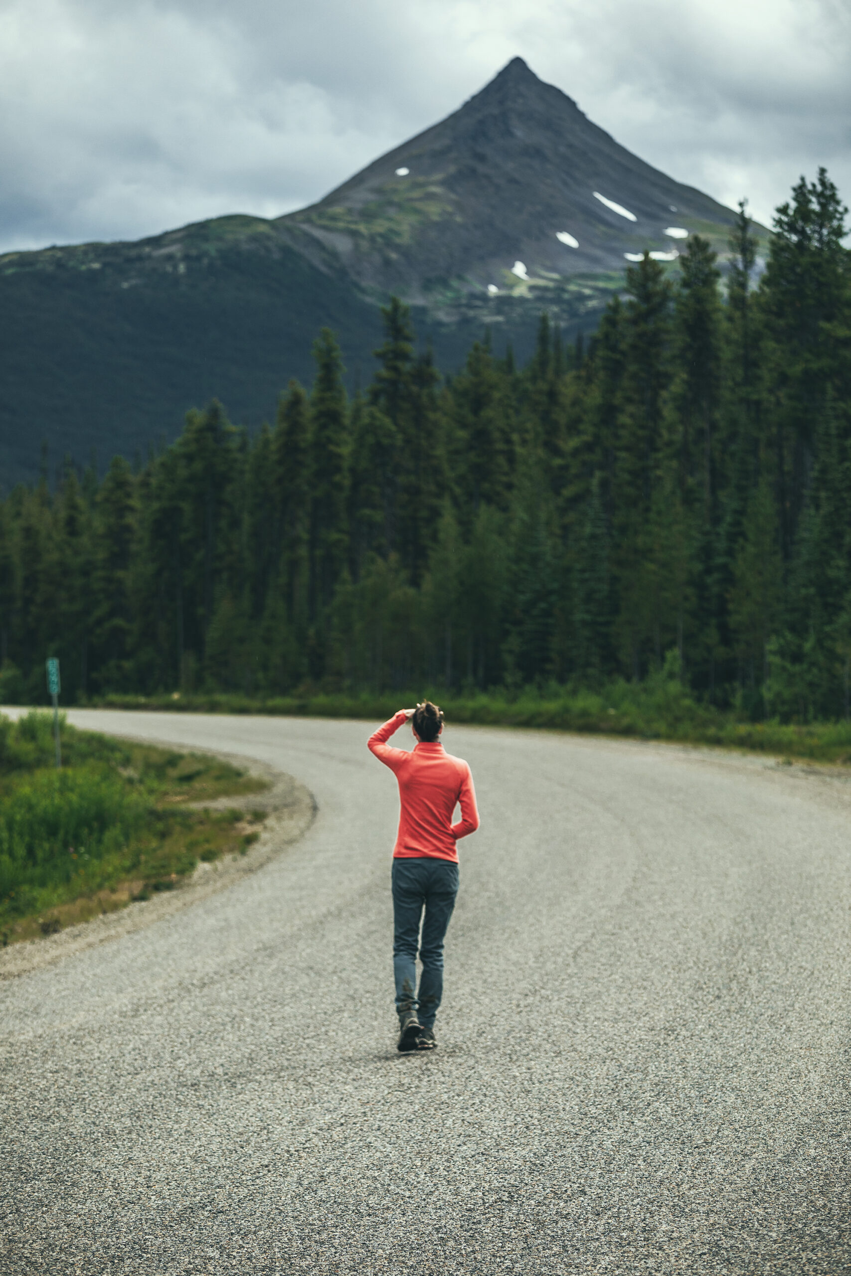
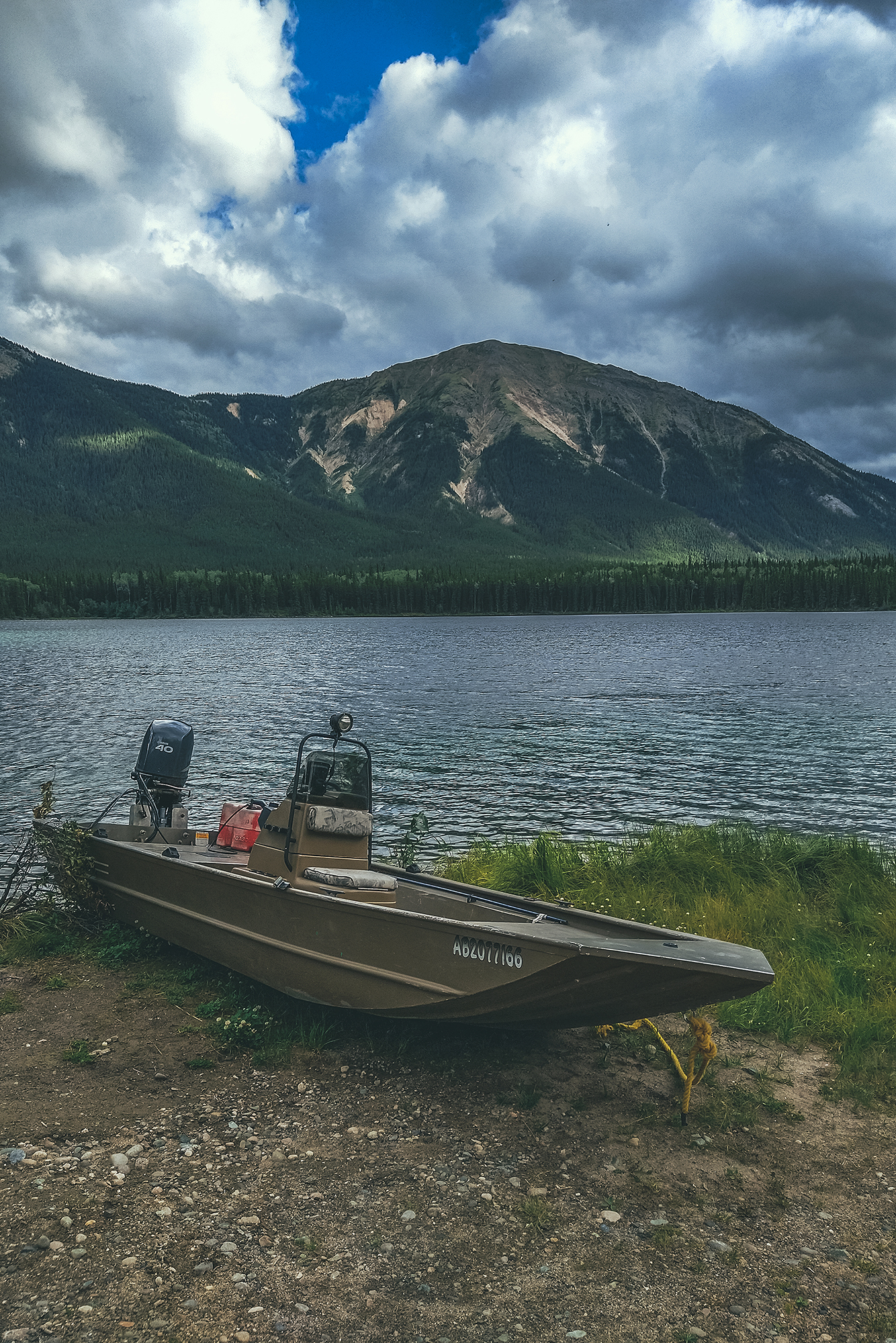
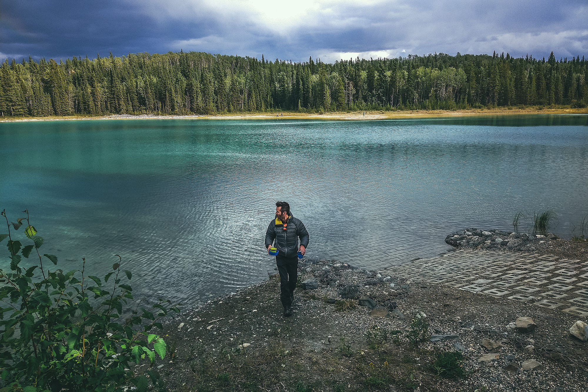
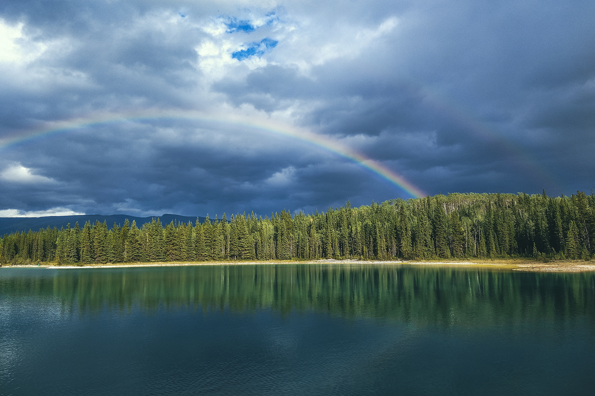
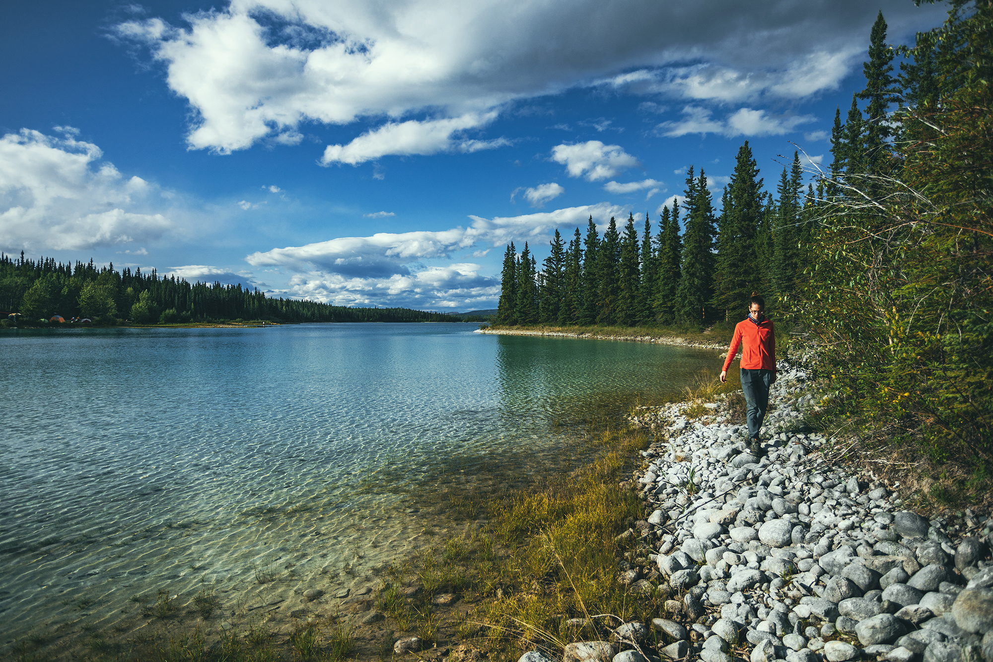
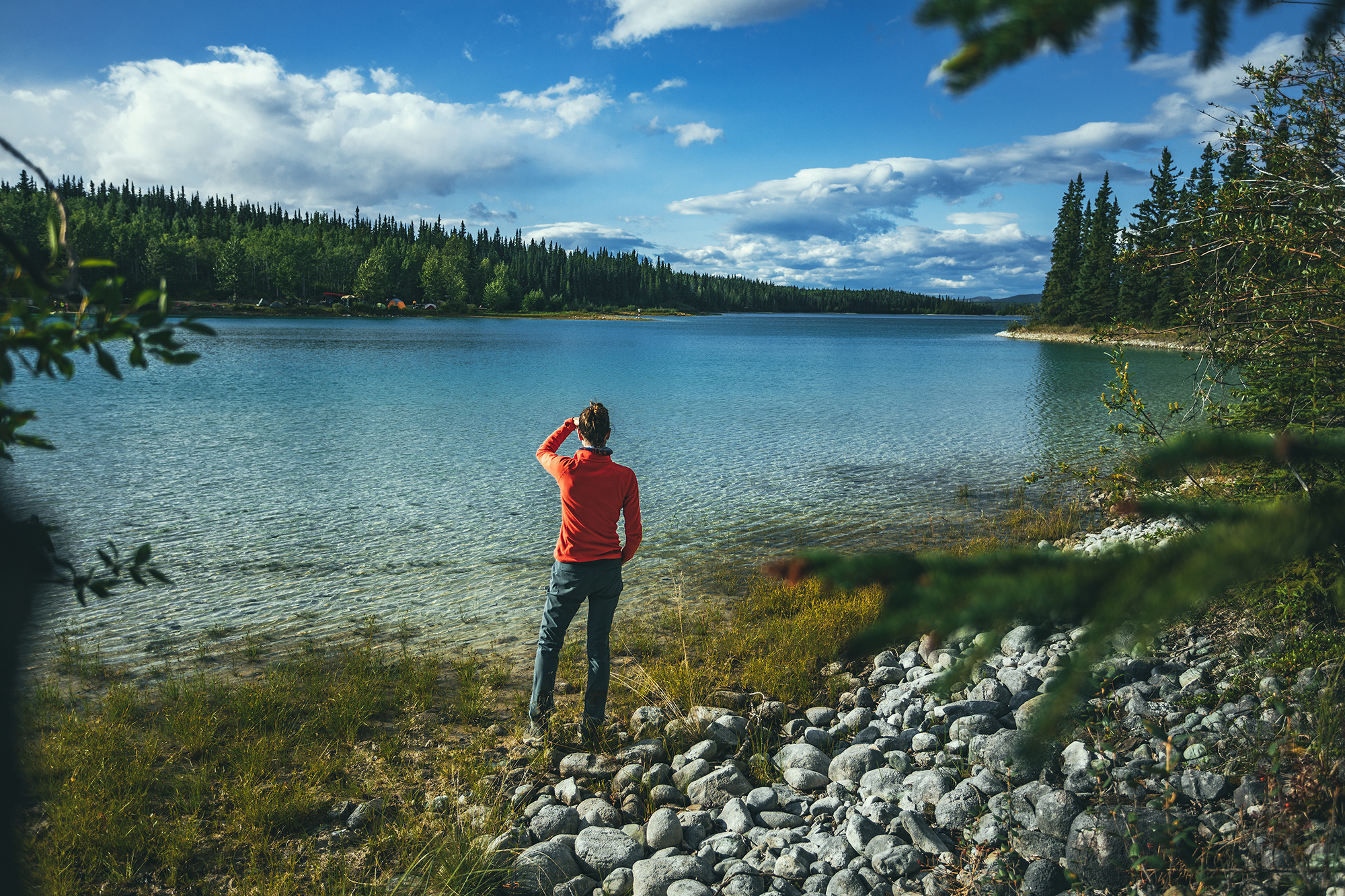
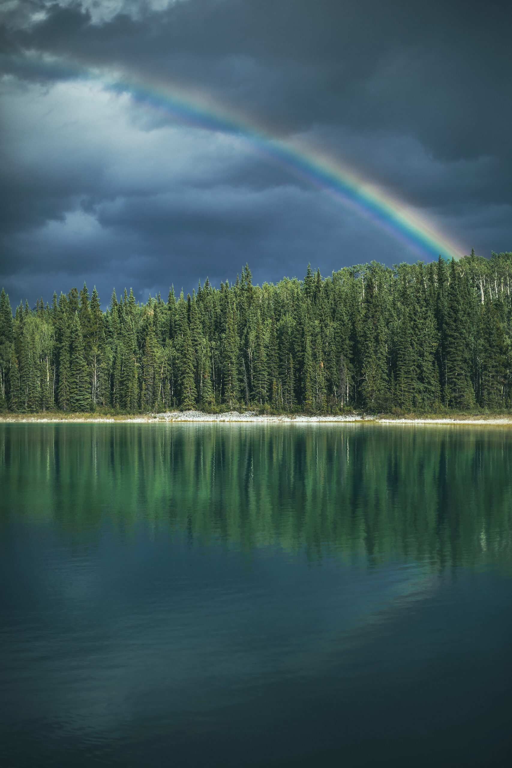
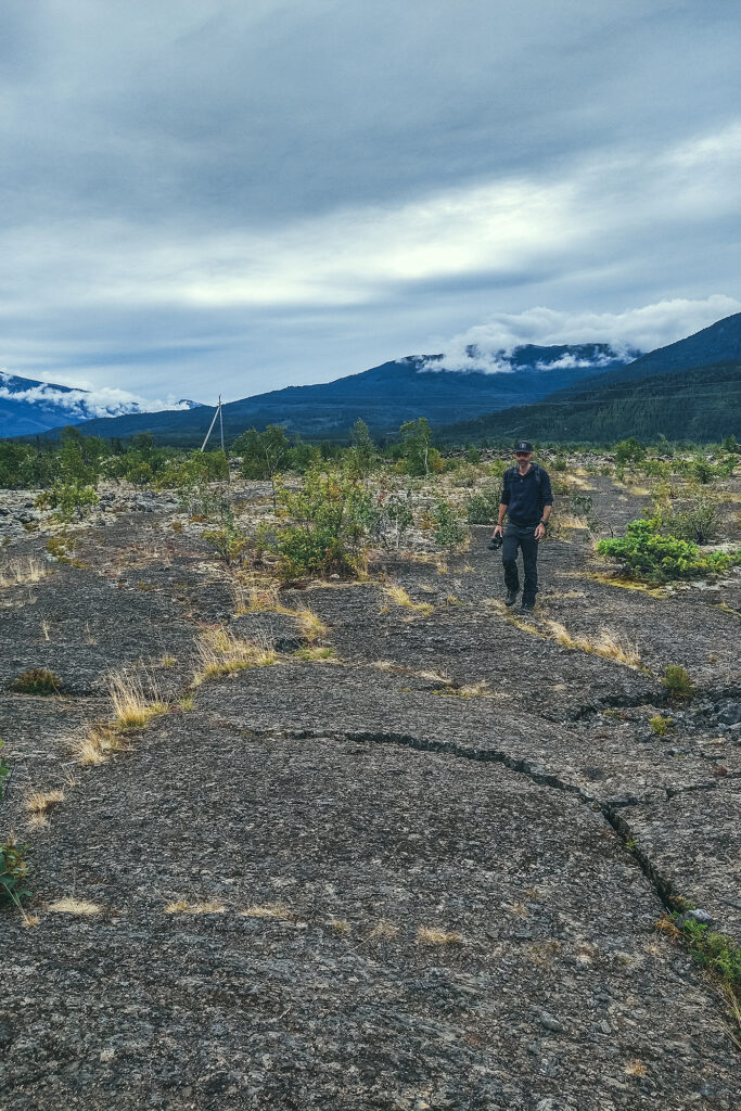
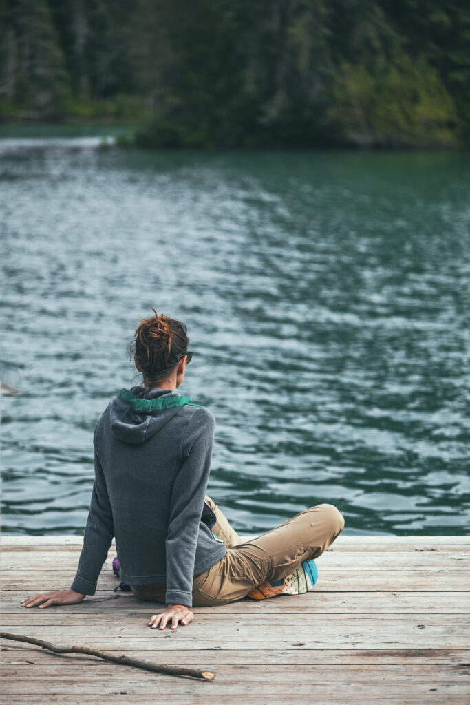
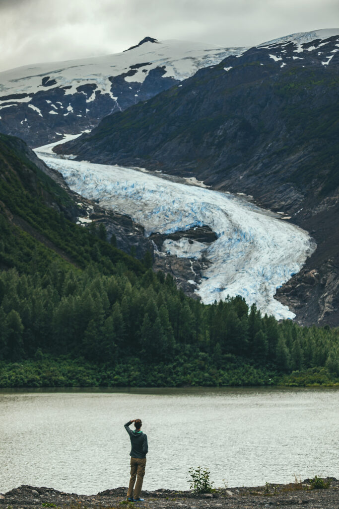
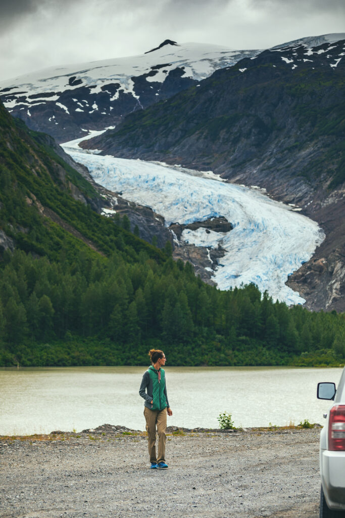
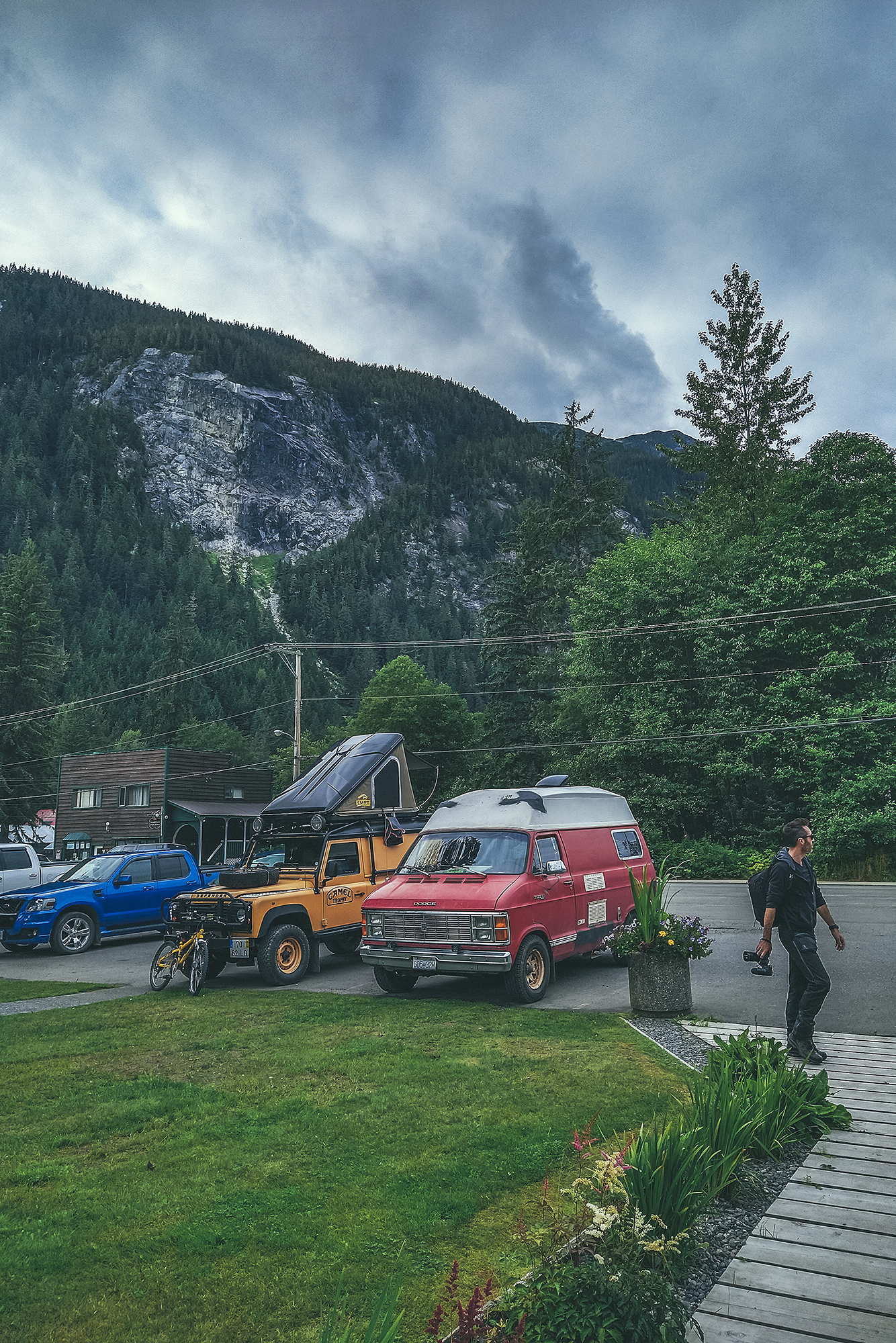
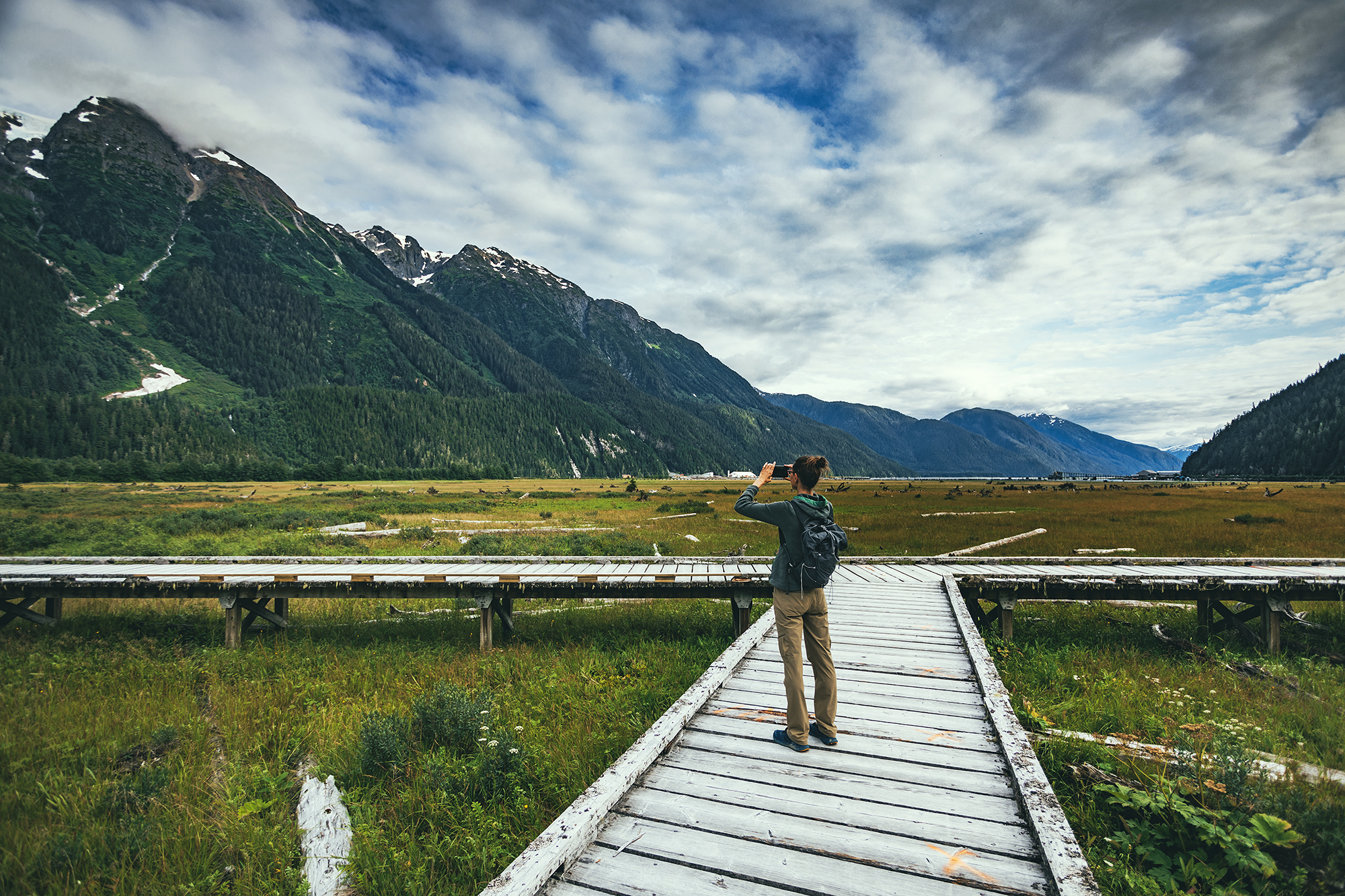
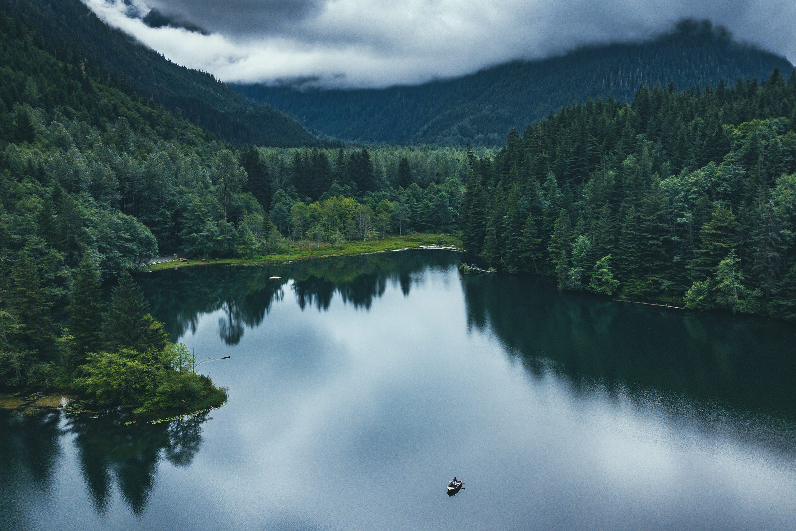
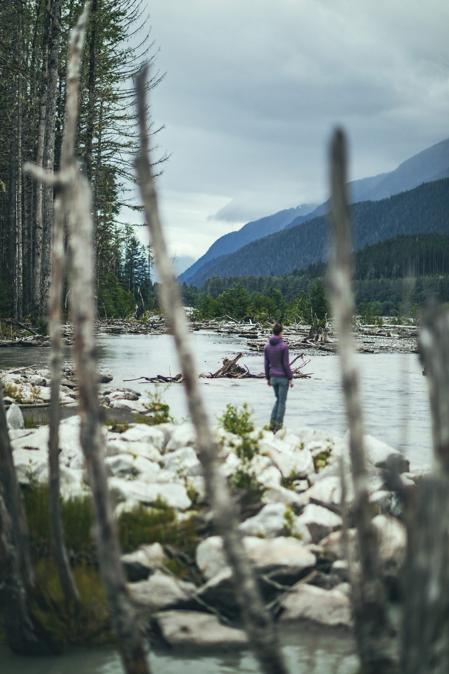
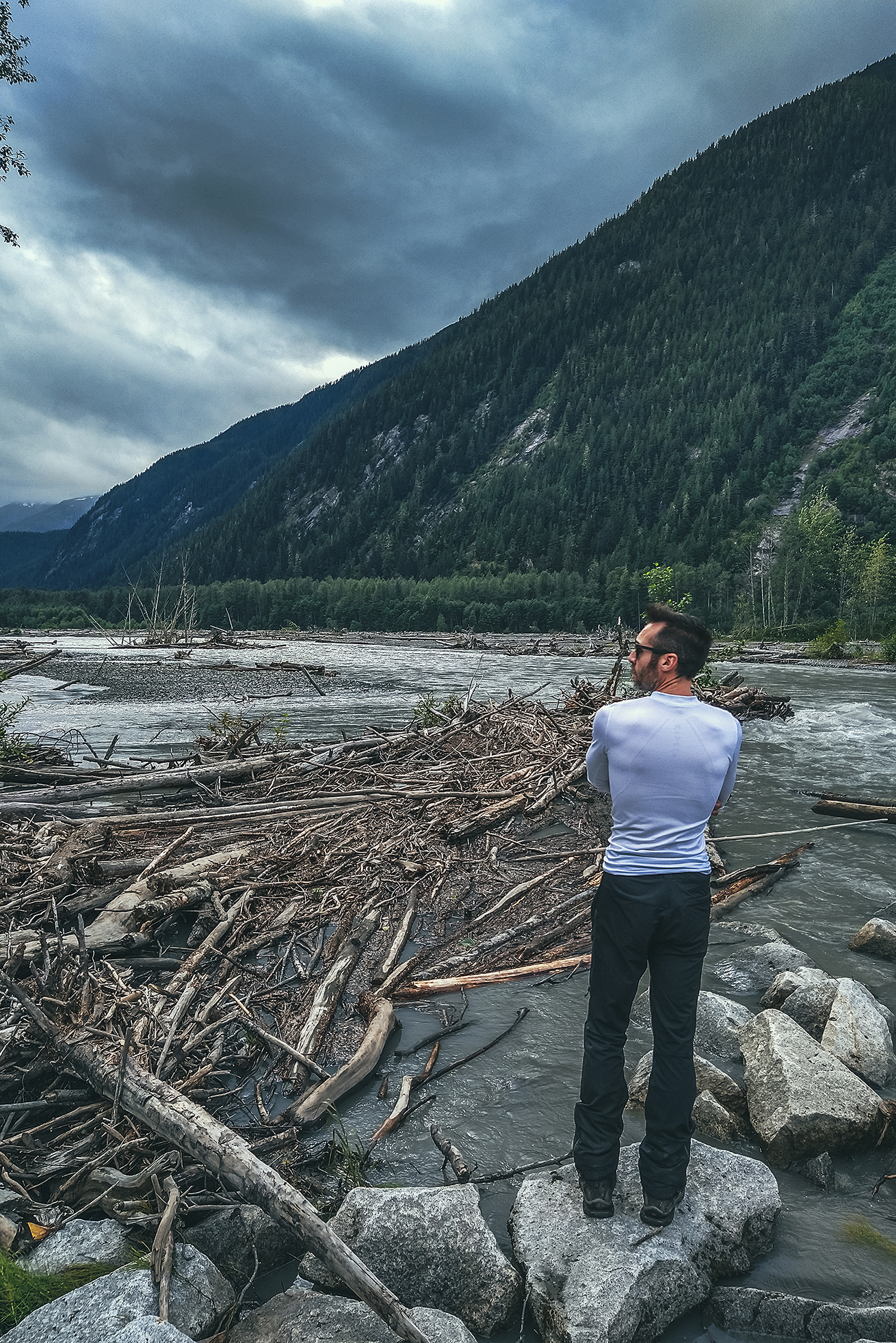
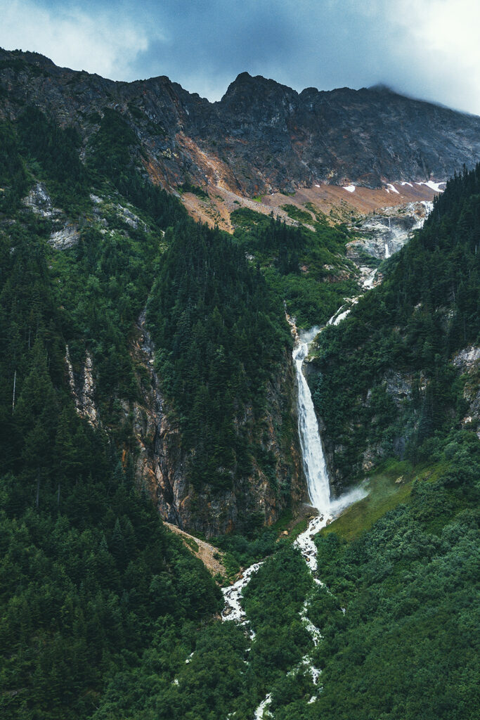
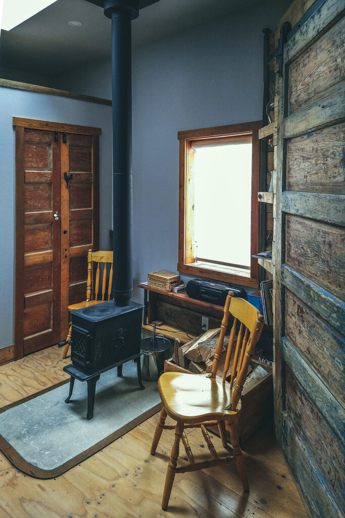
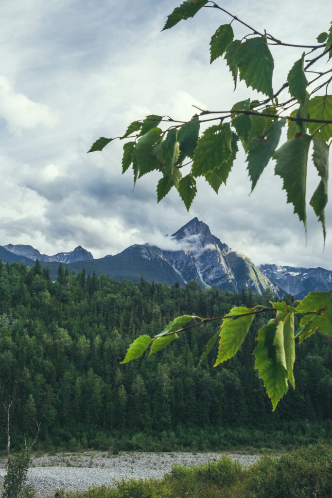
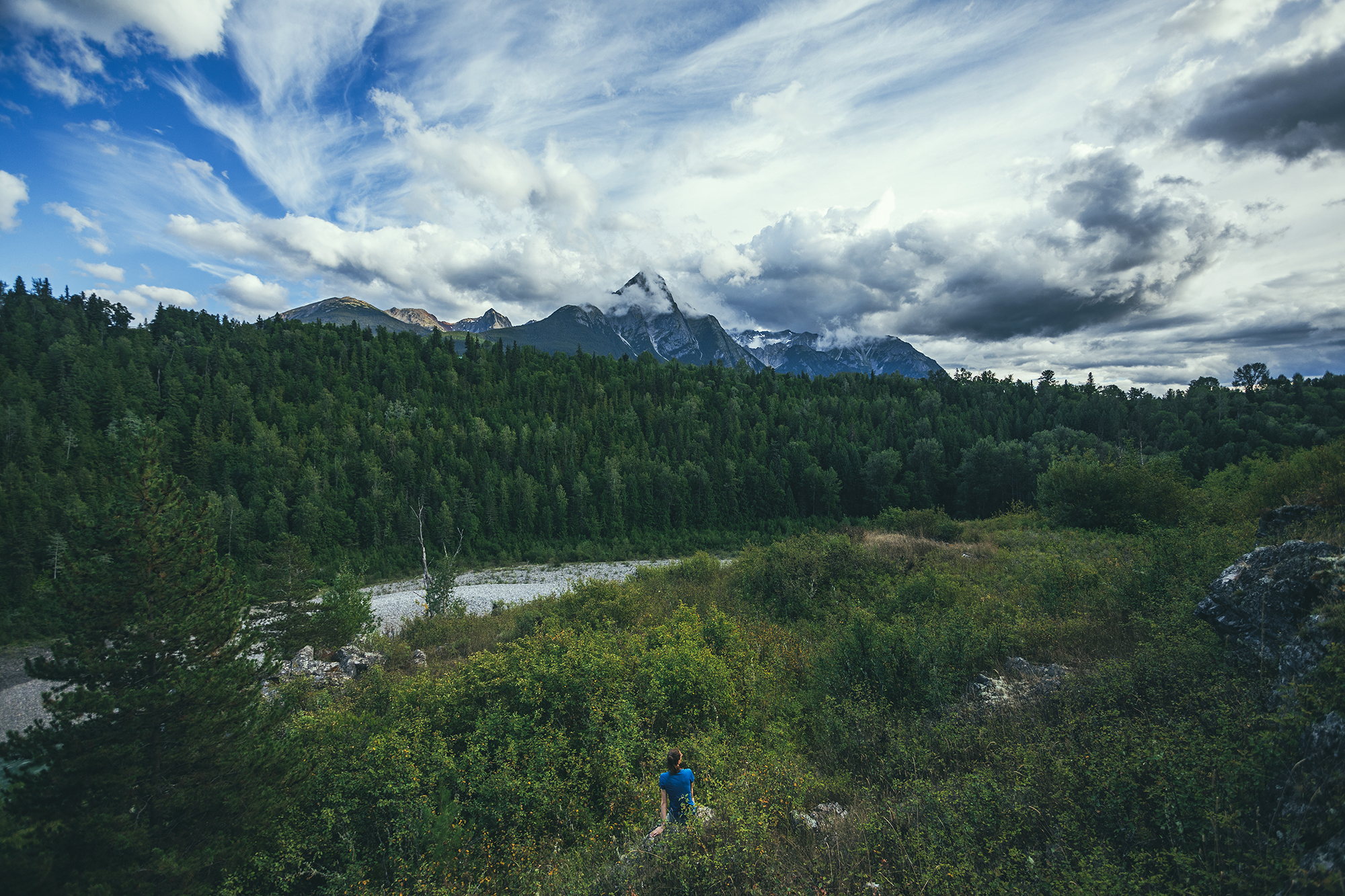
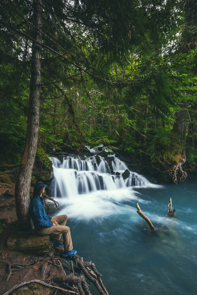
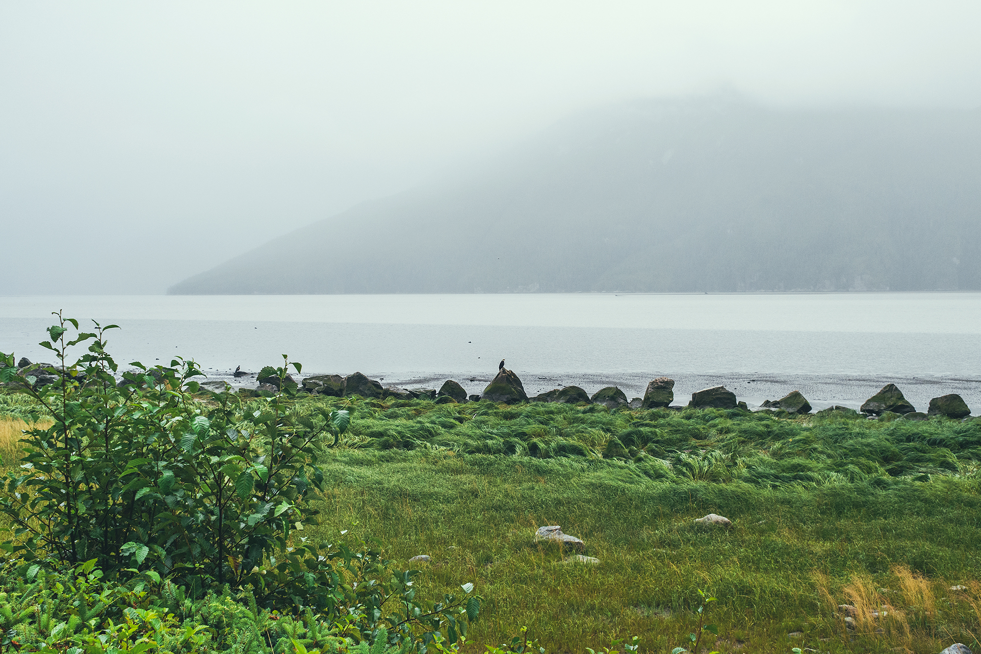
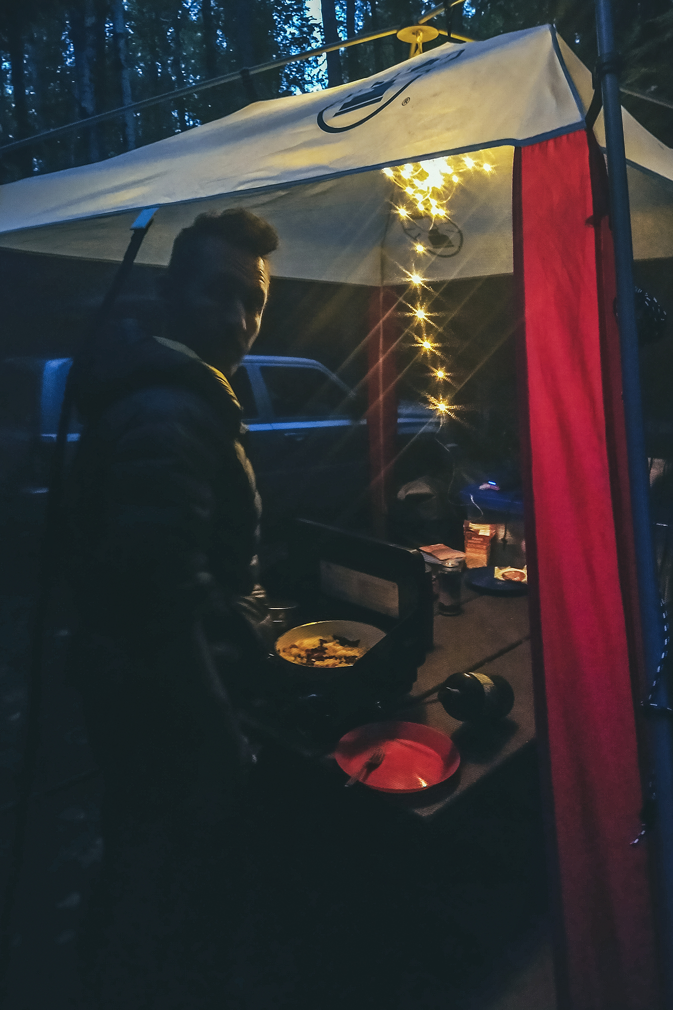
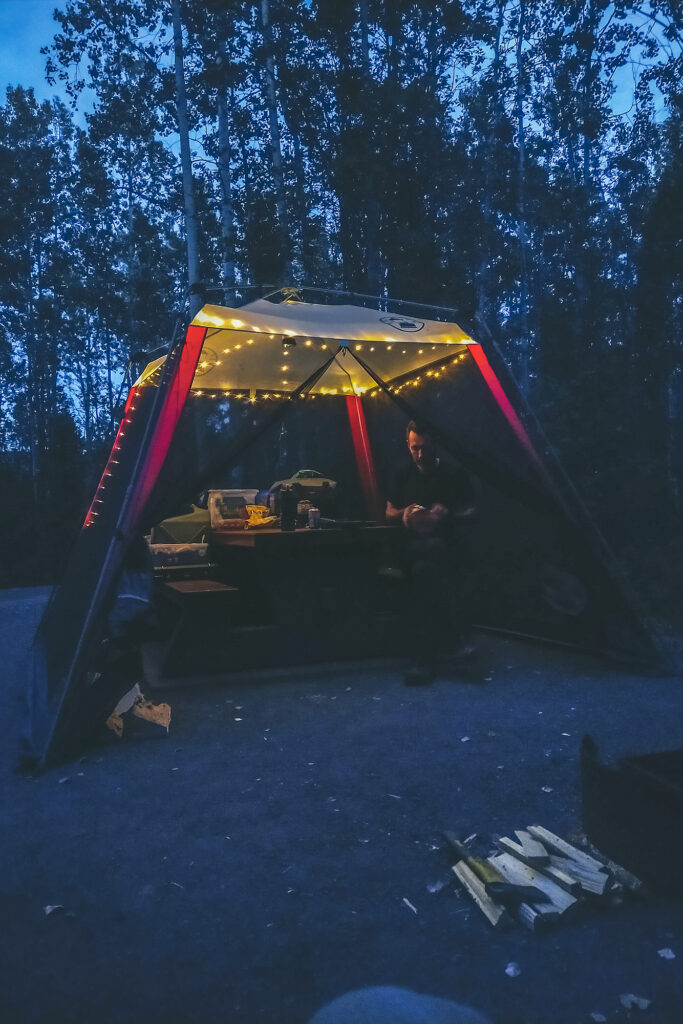
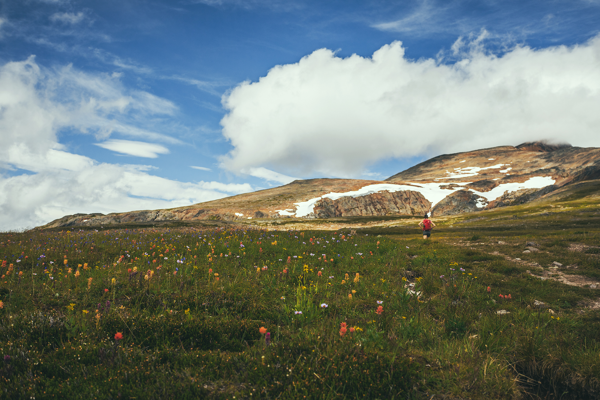
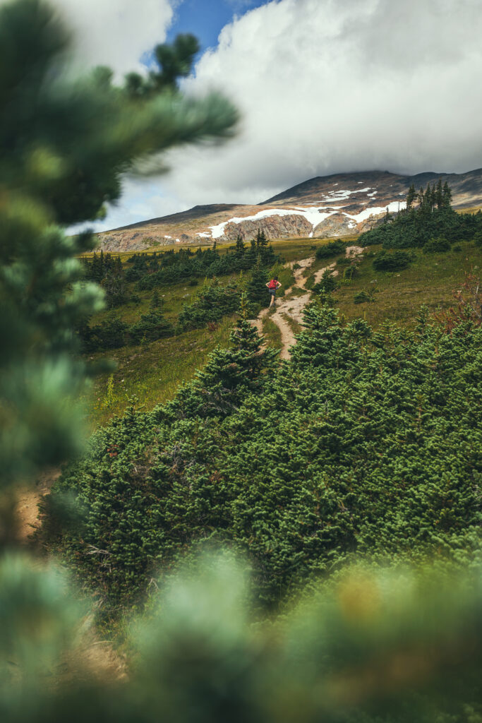
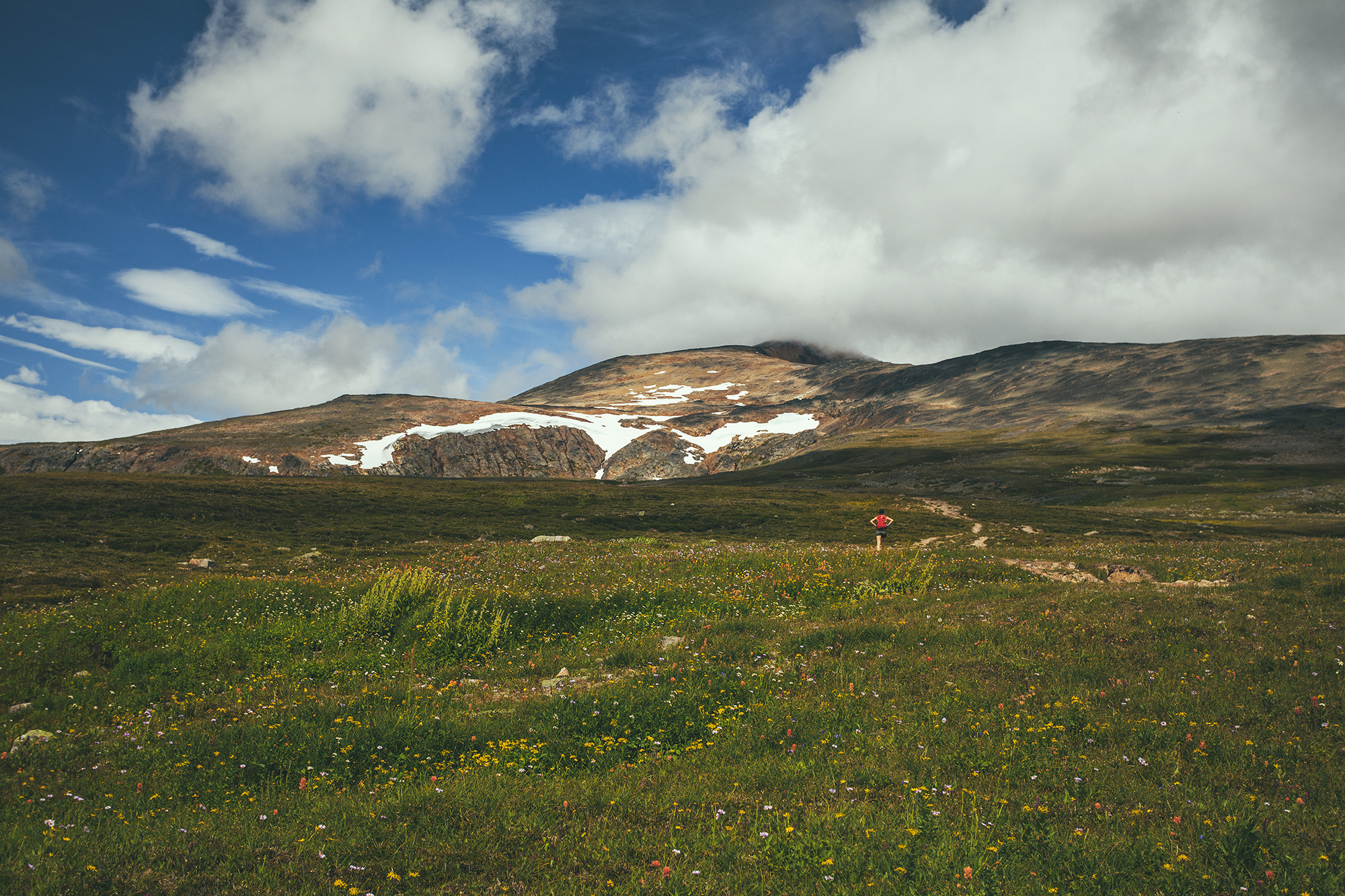
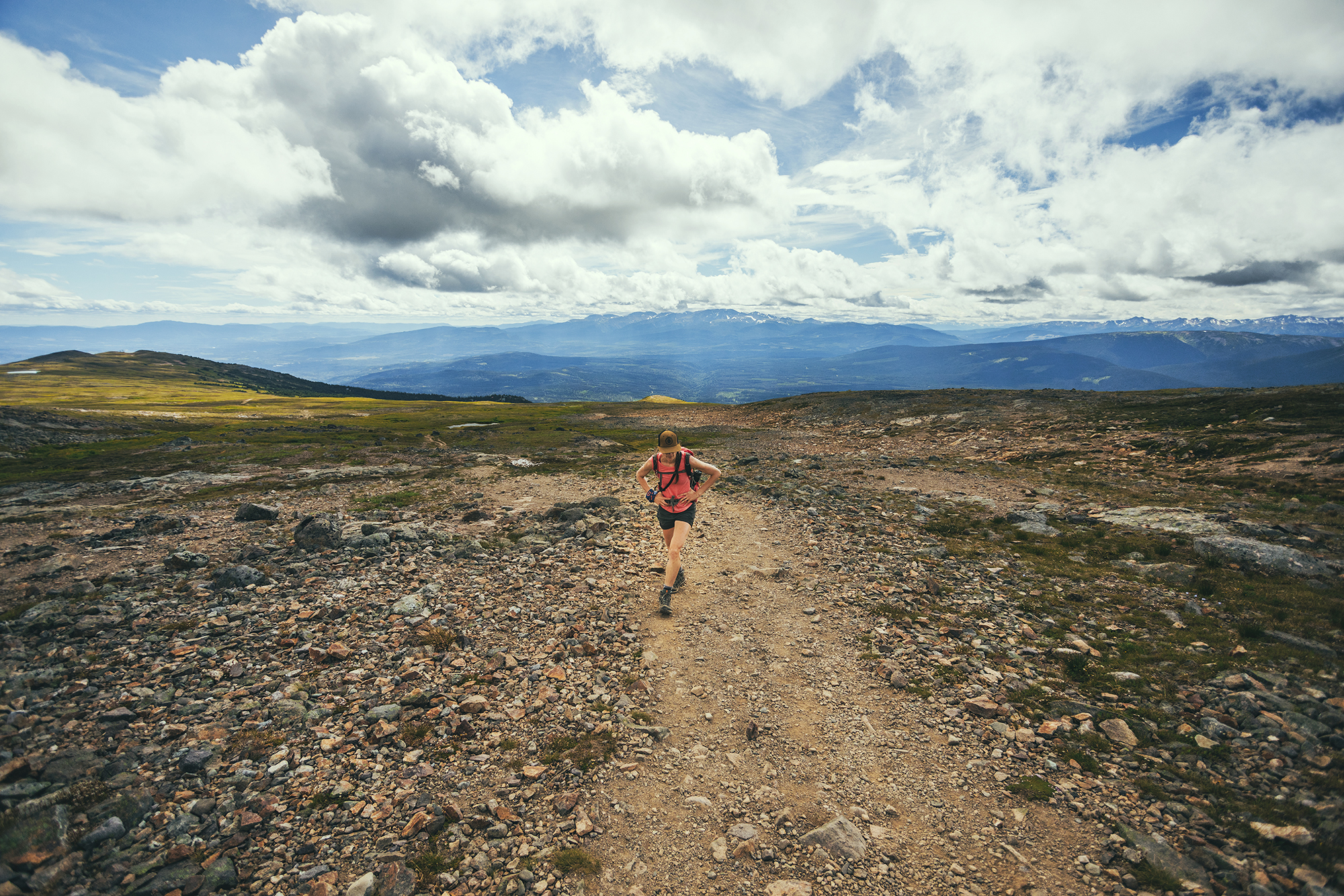
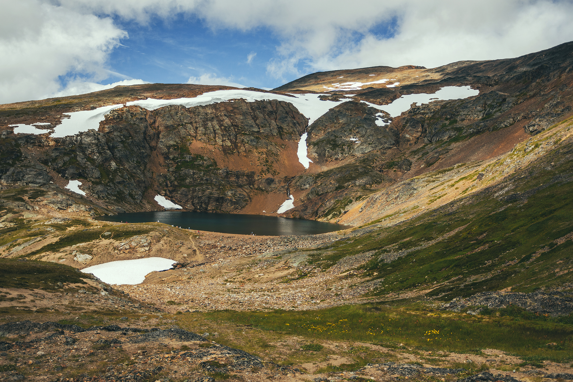
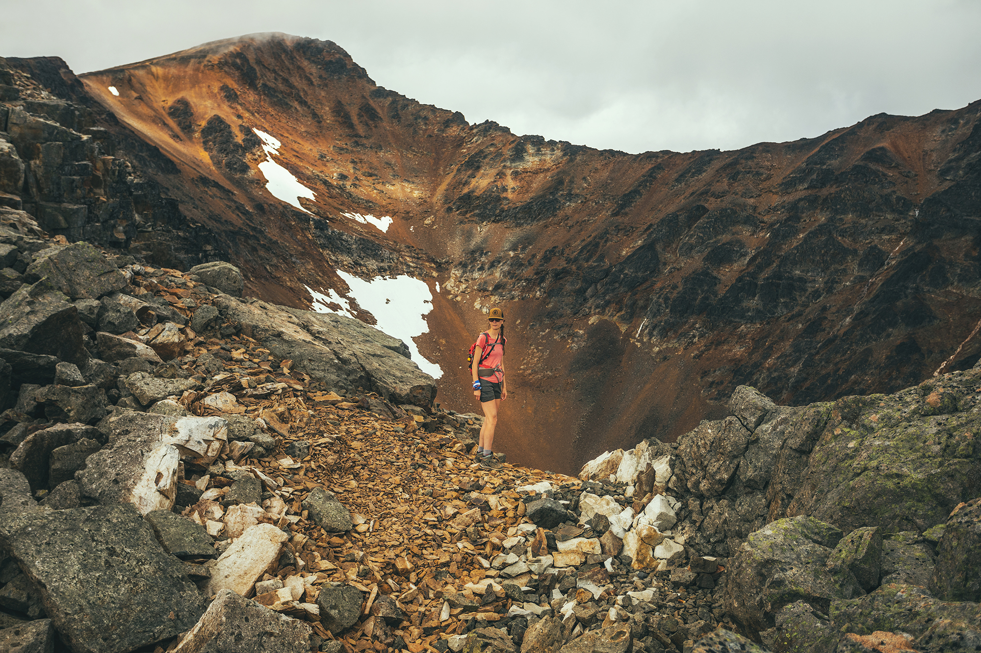
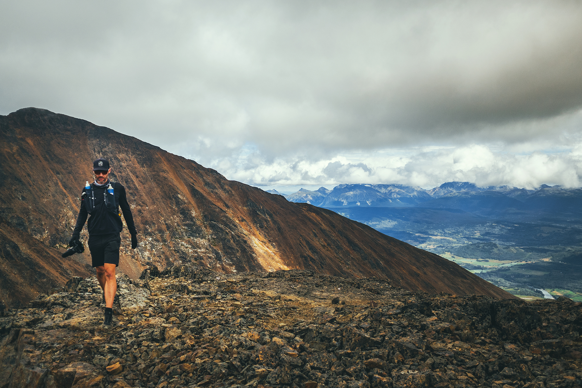
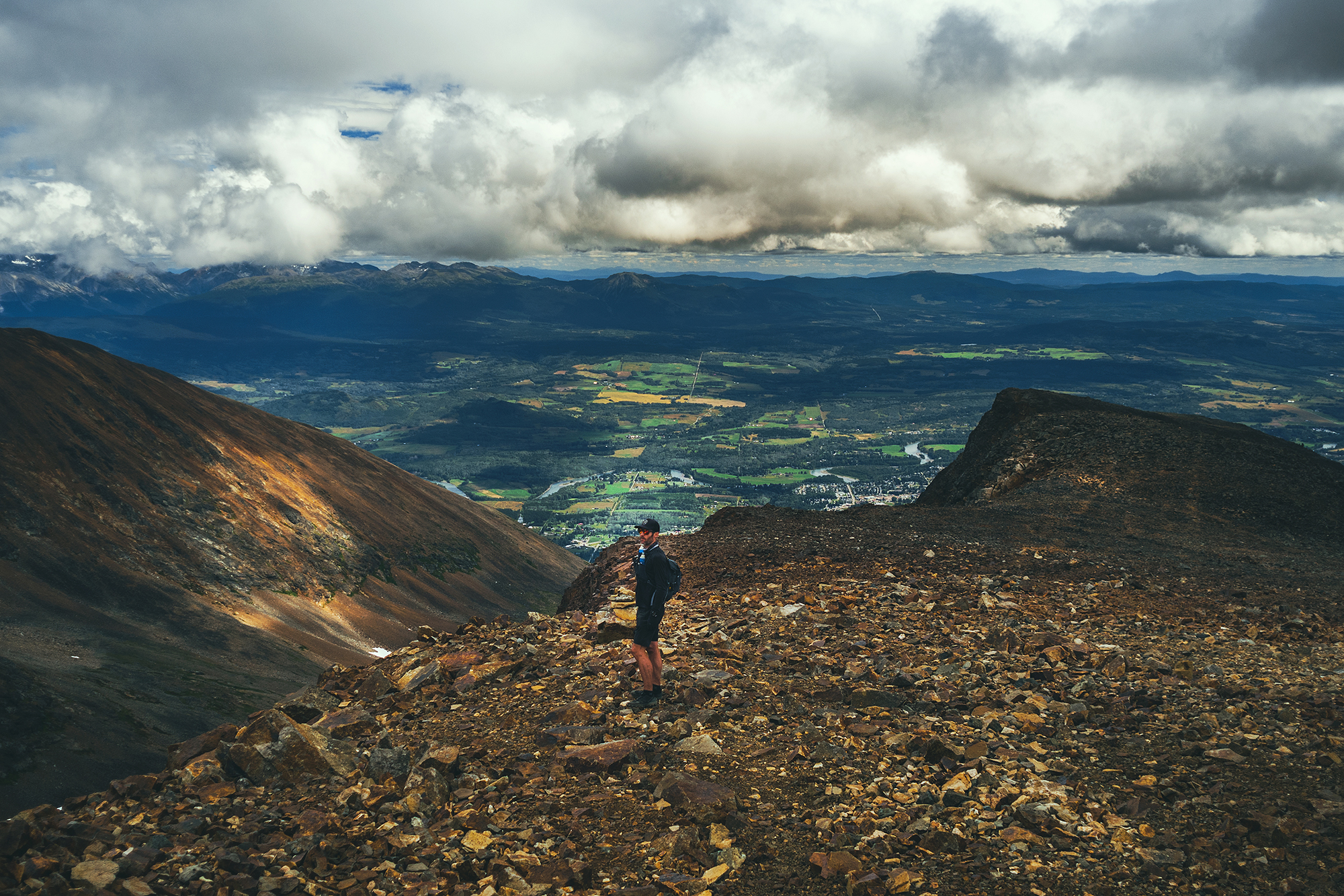
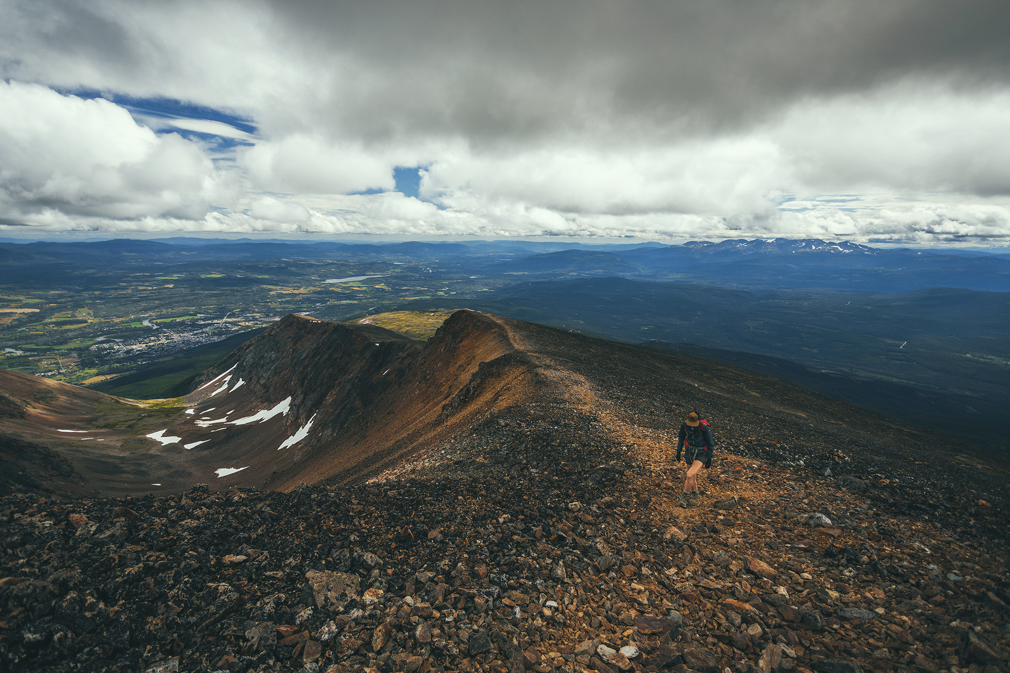
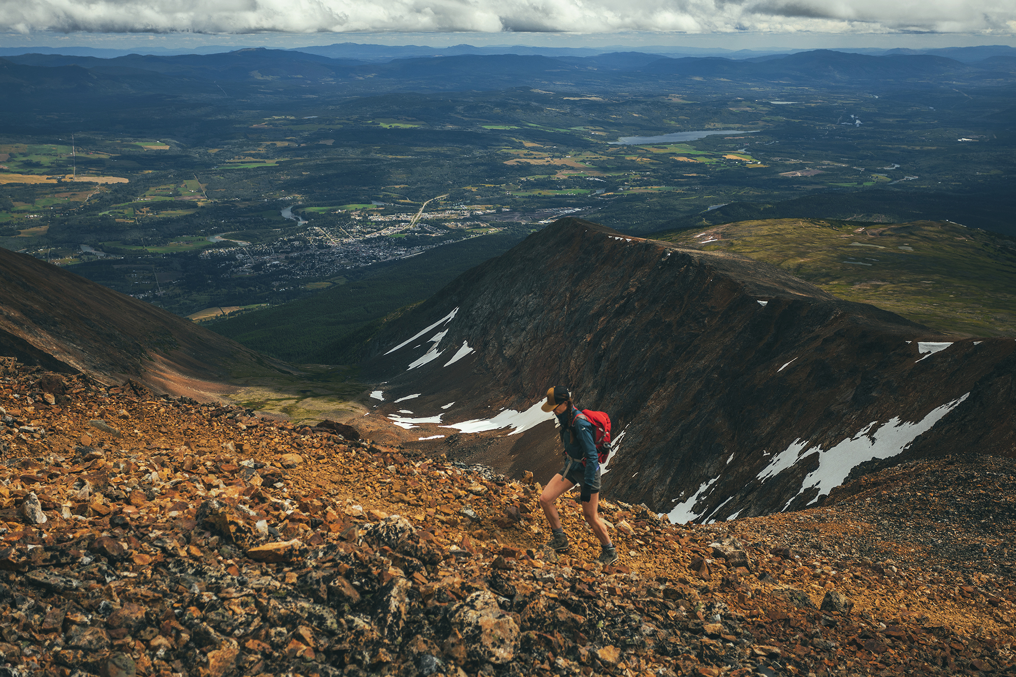
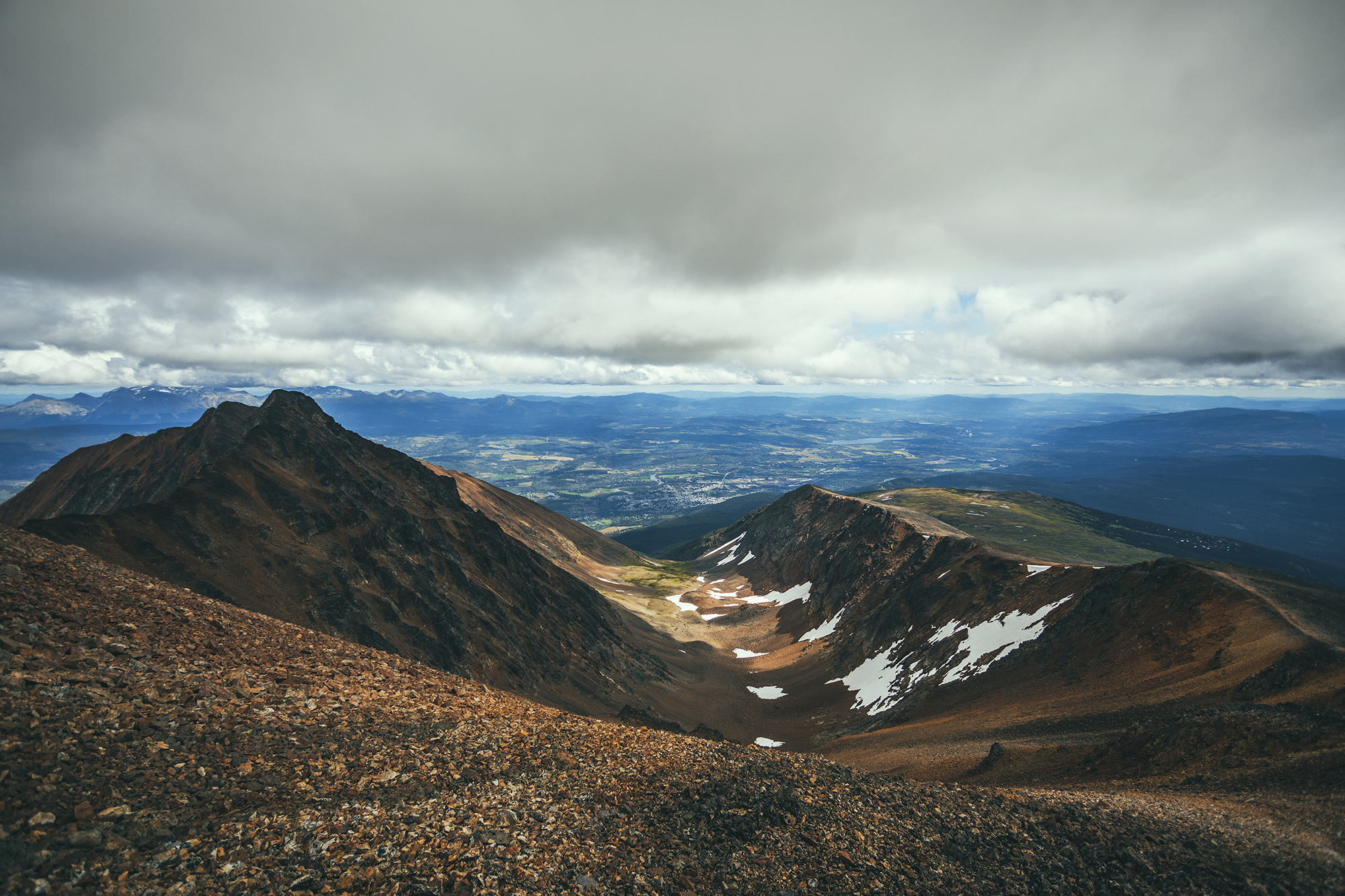
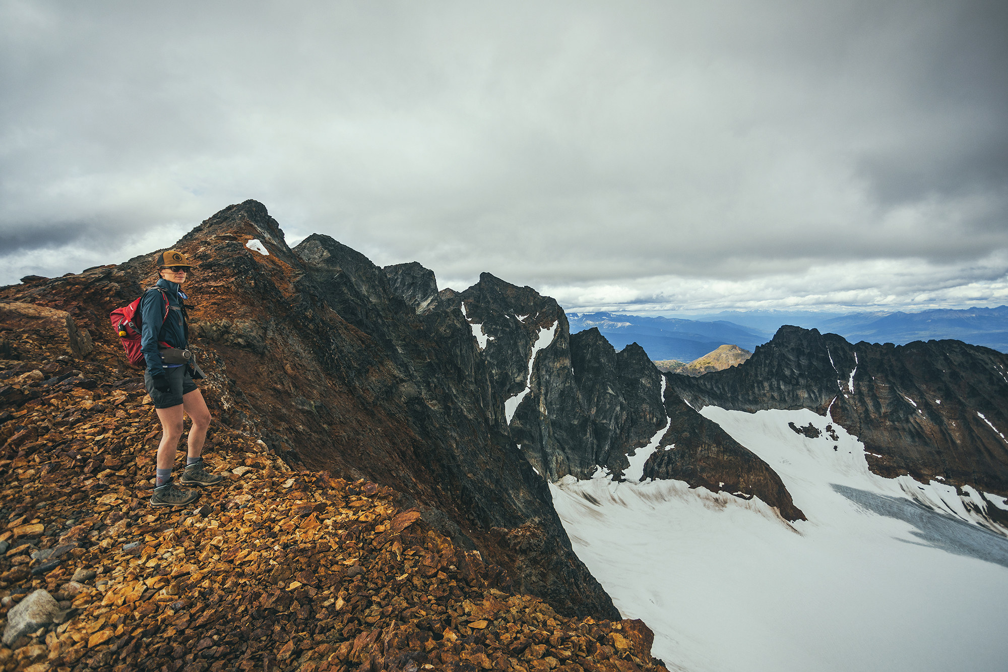
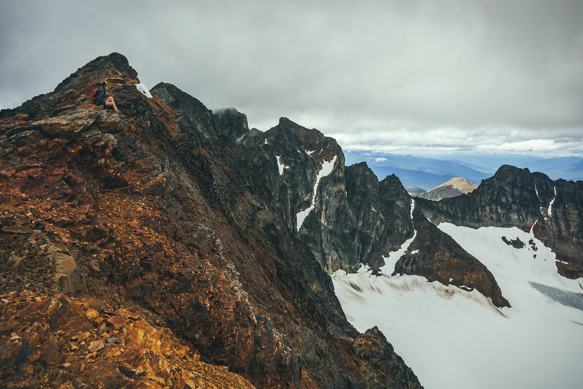
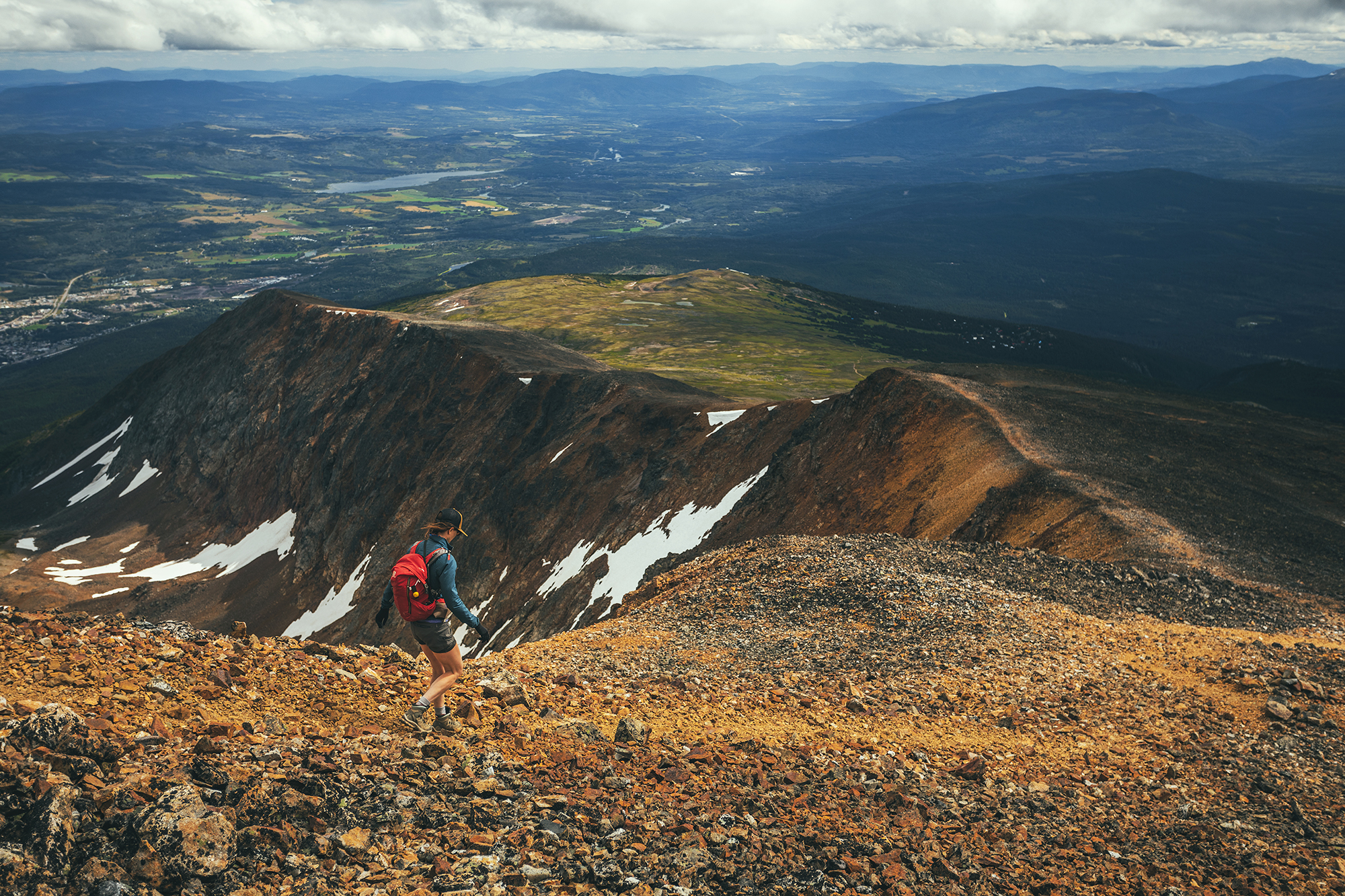
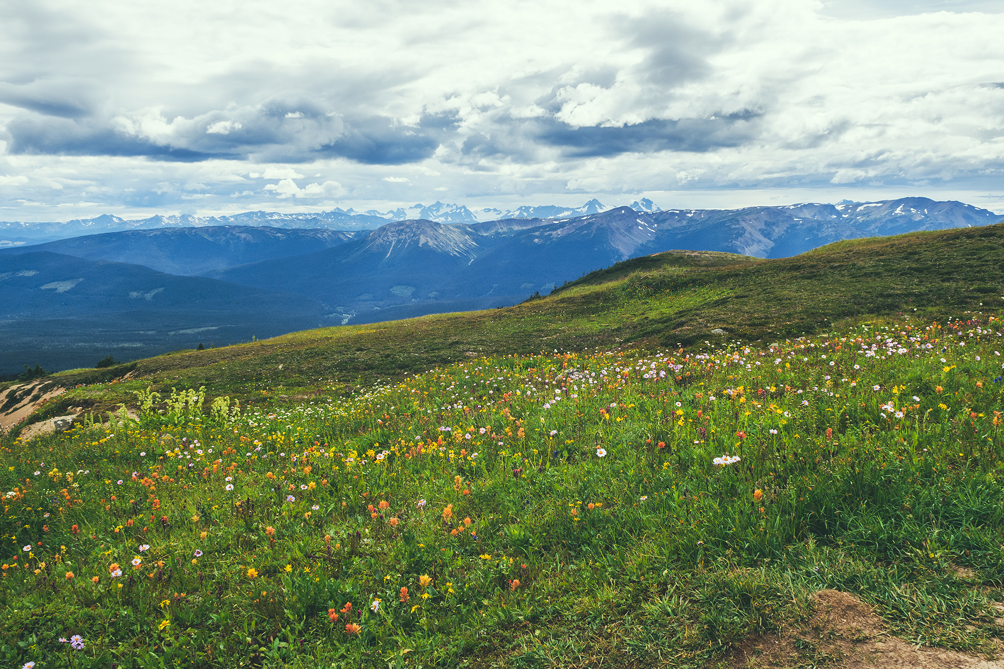
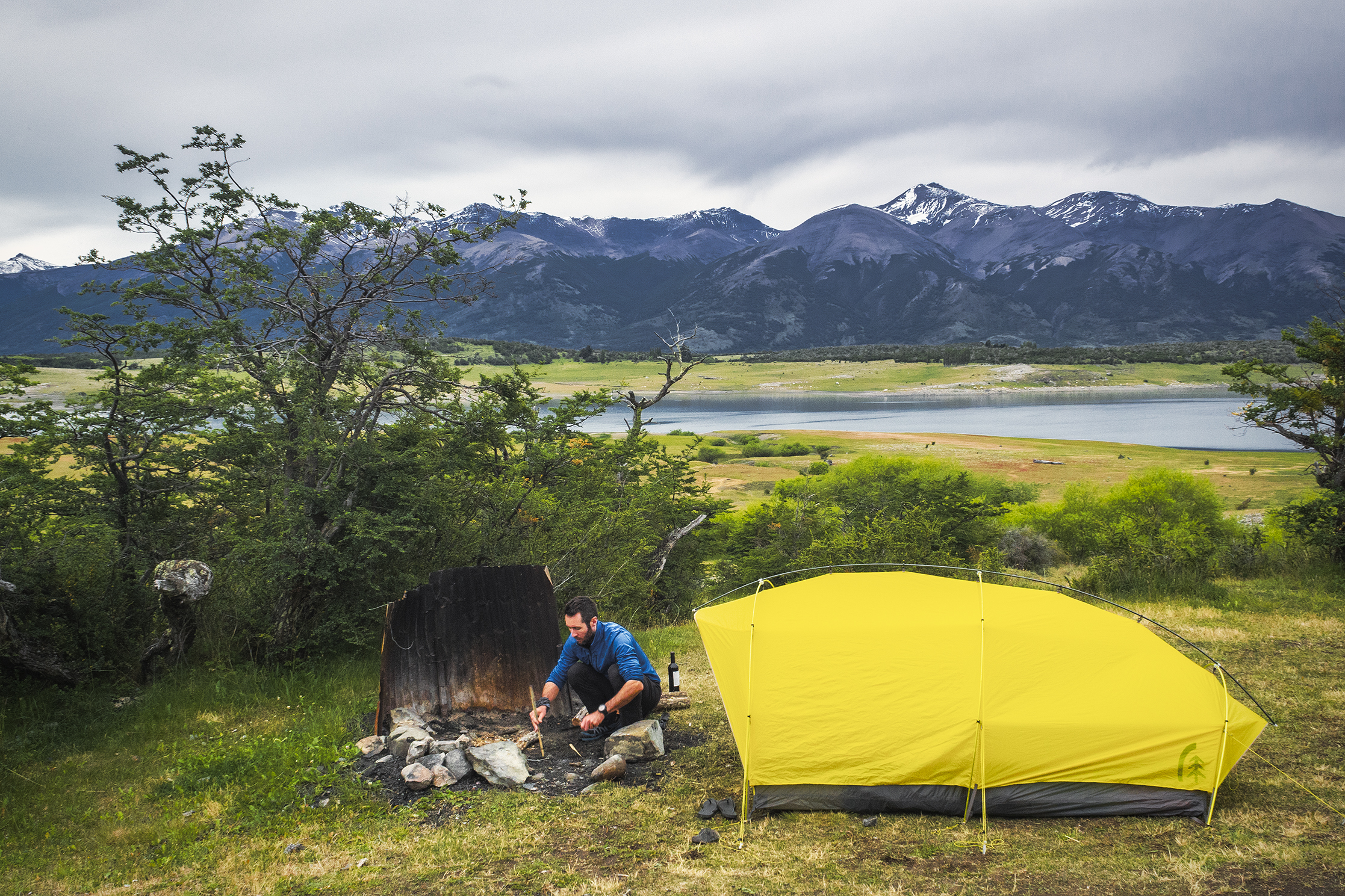
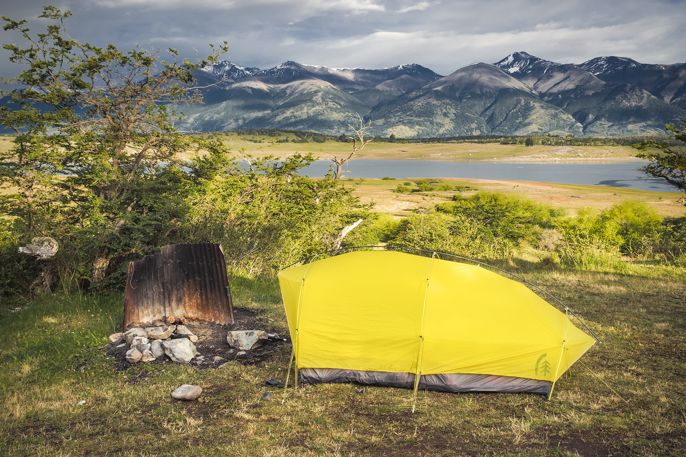
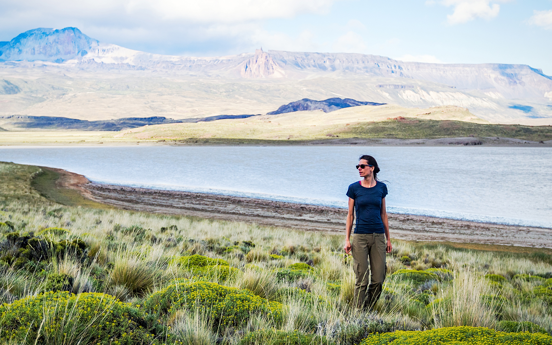
We arrived in the tiny town and drove to the small campground located down a short dirt road. We were the only ones there at that point. We set up camp and had a snack, and as it was starting to rain, we decided to drive up to Keno Hill, a viewpoint at 1800 meters accessible by car (4WD recommended).

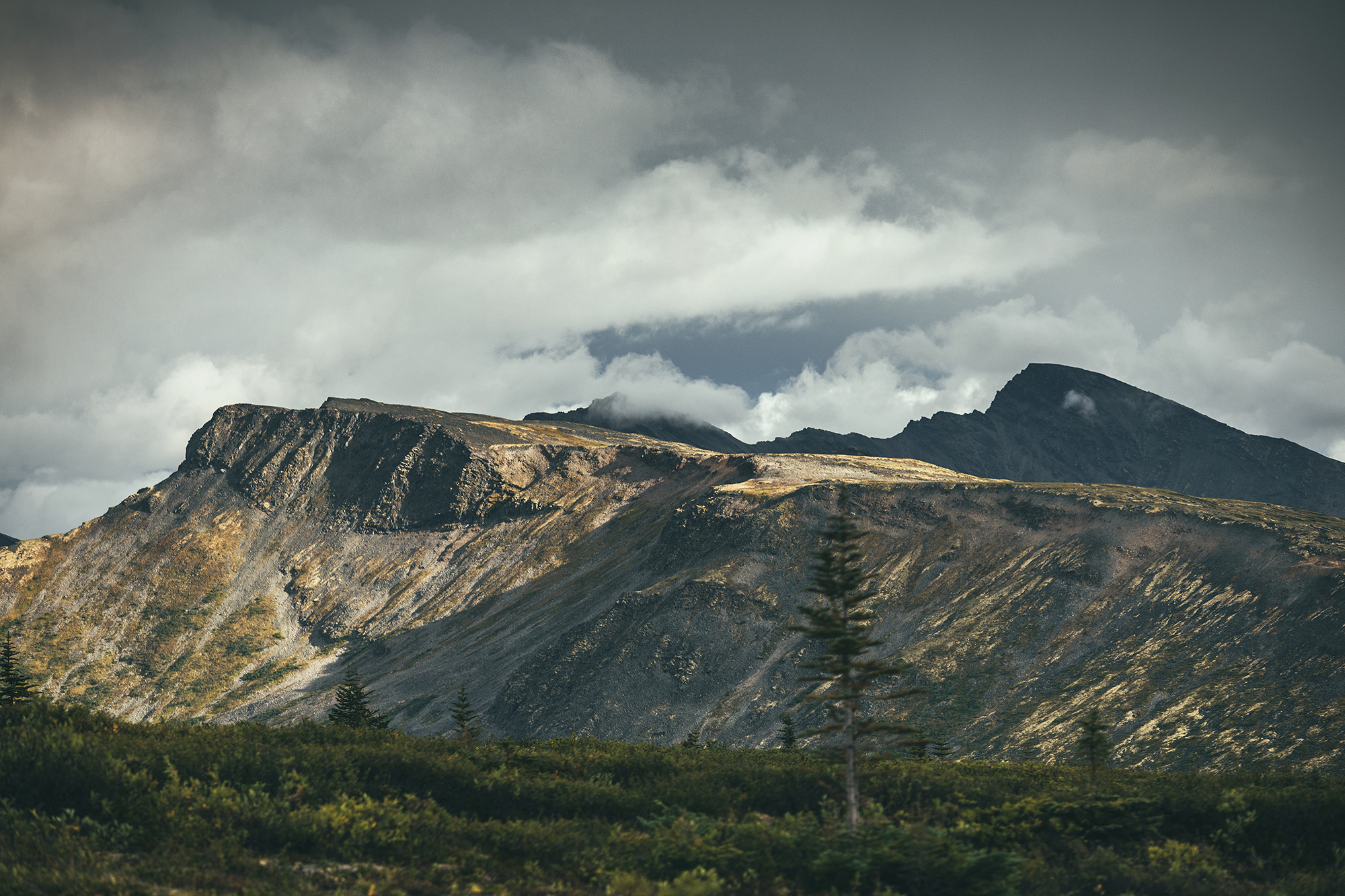
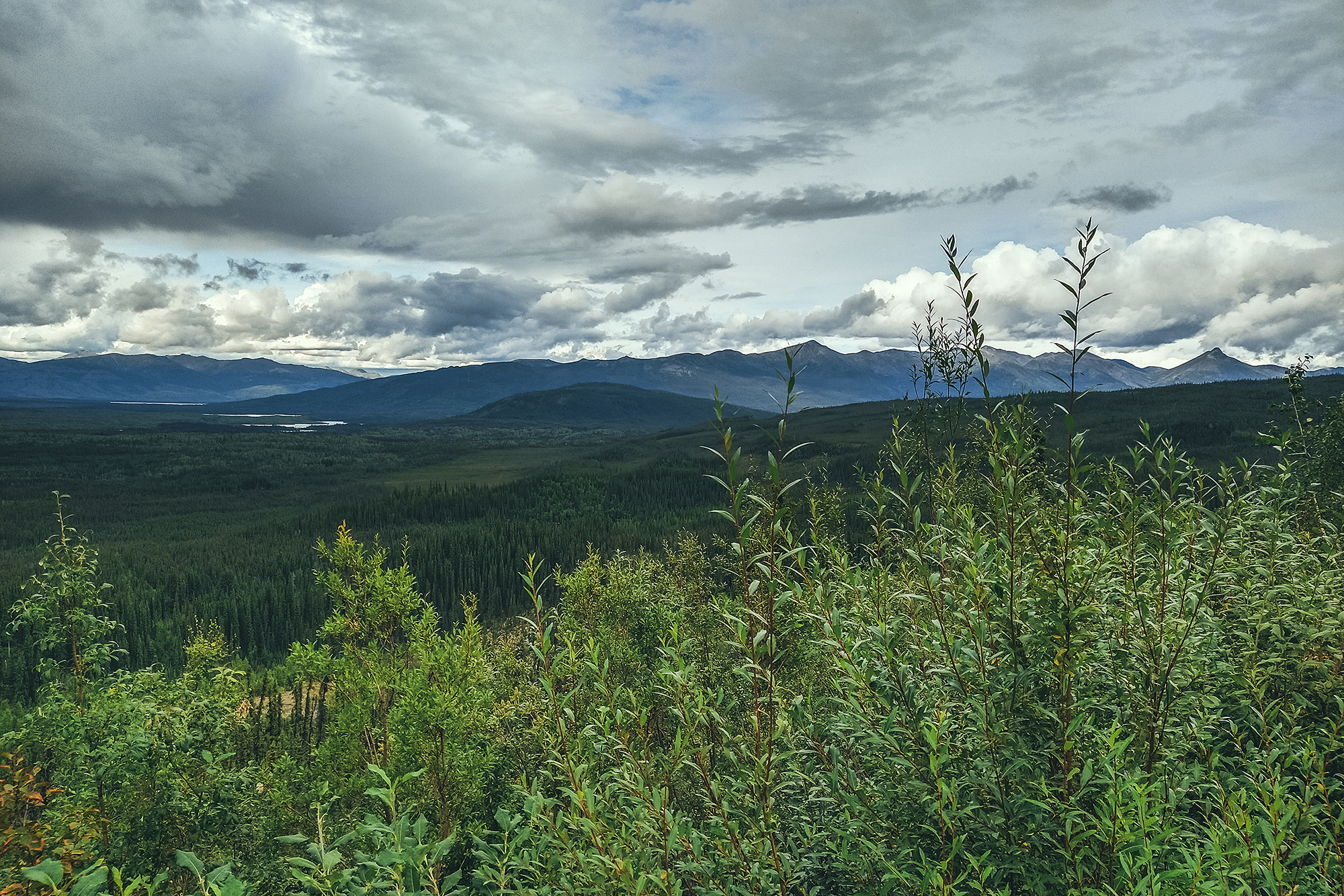
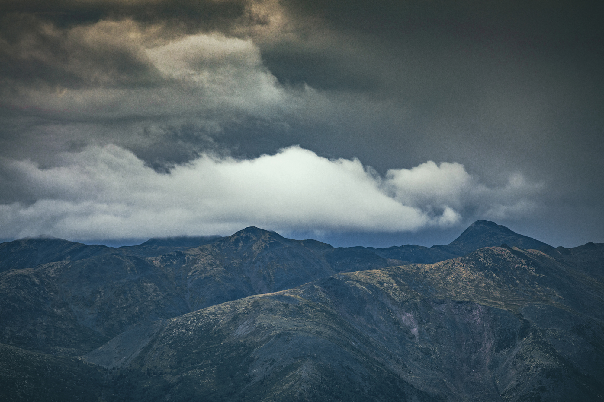
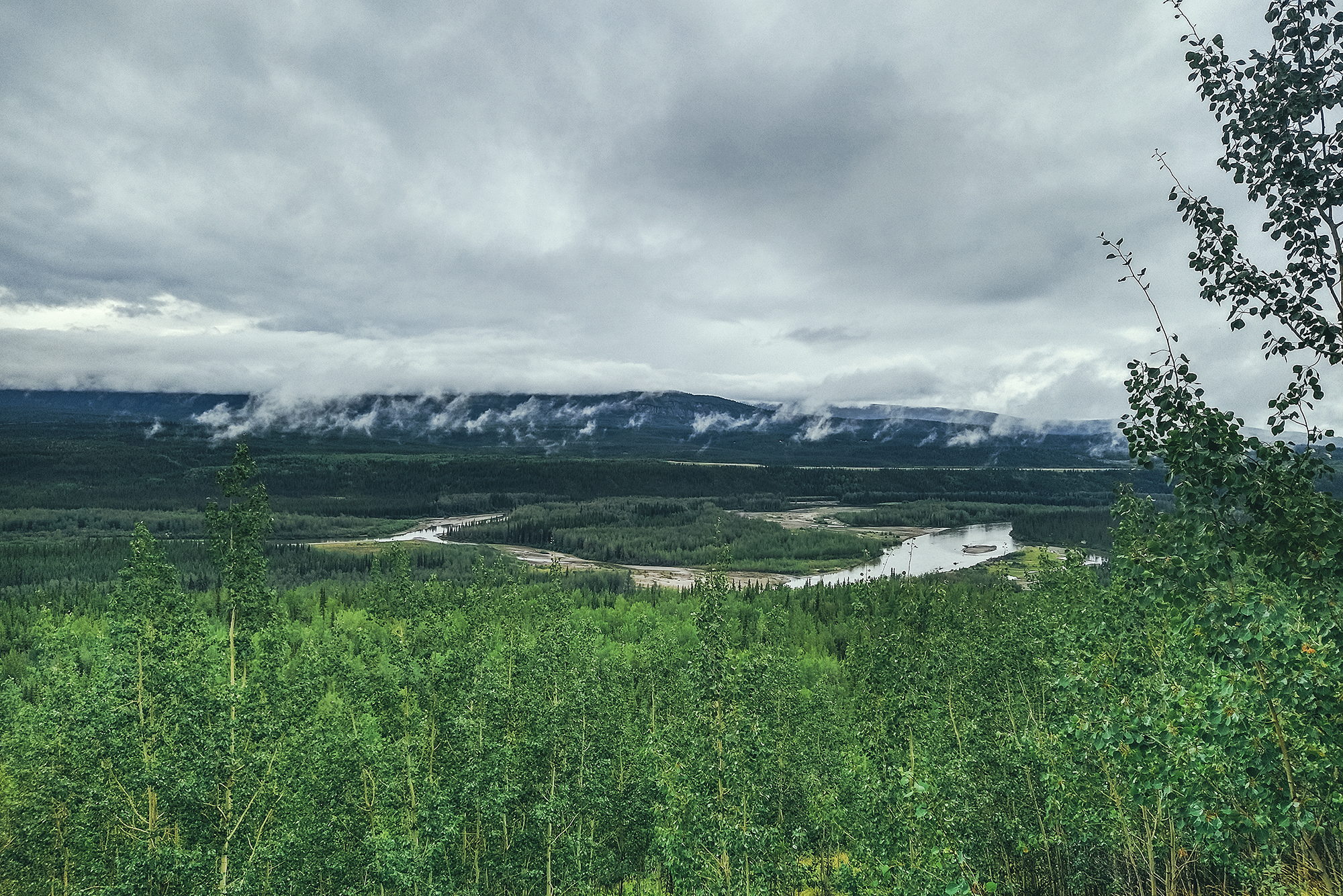
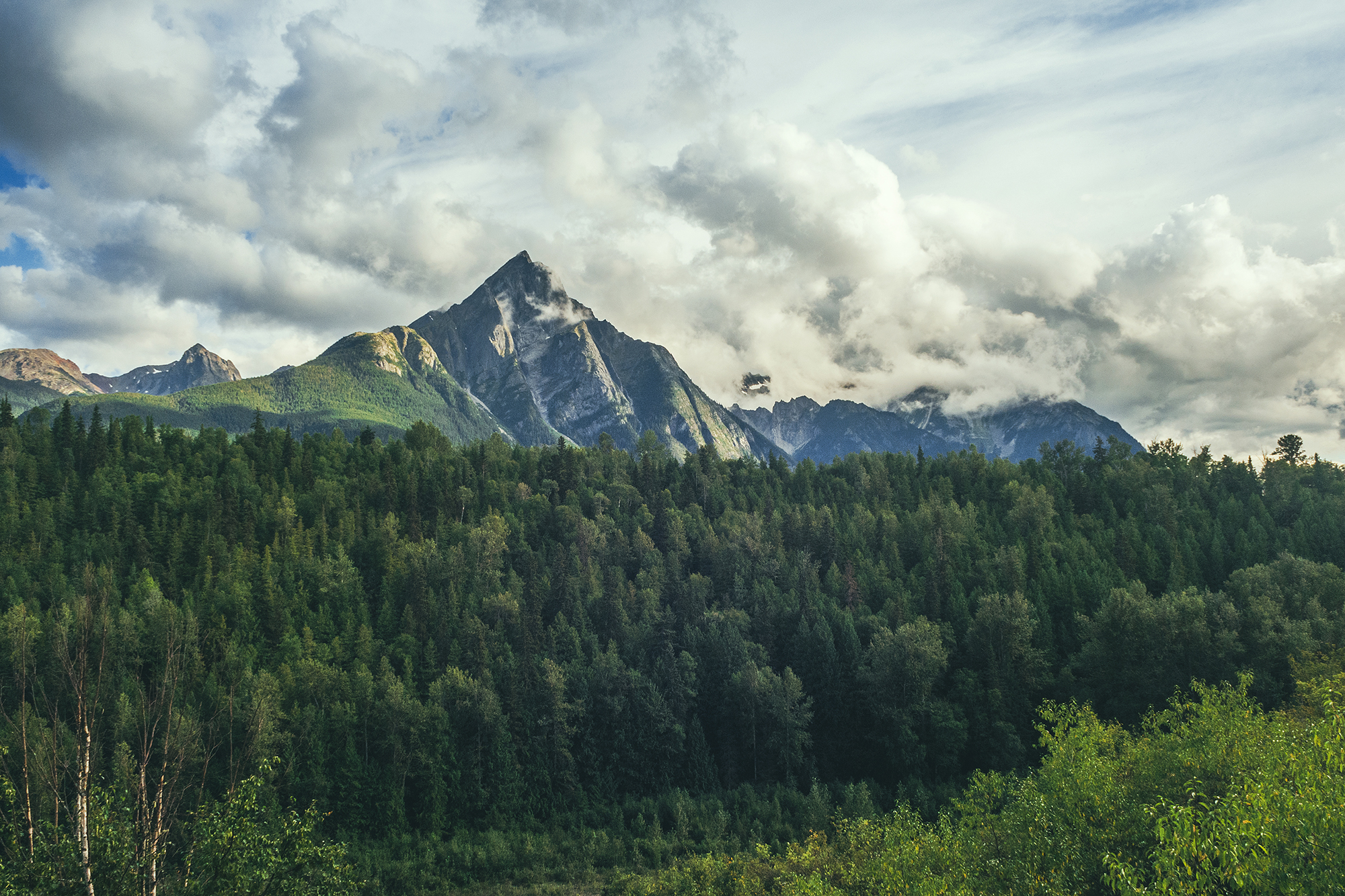
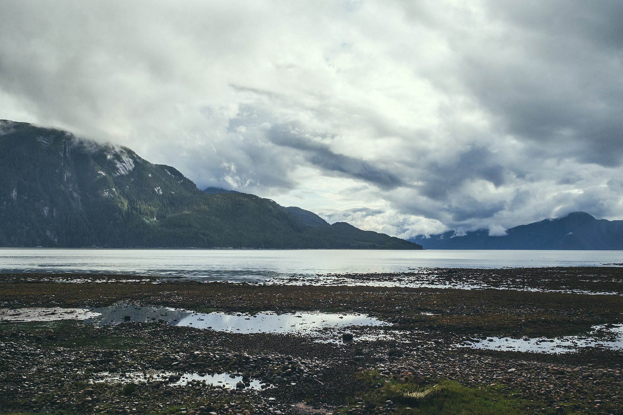
That was the best decision! The road there was incredibly scenic, revealing a different mountain range at every turn, and the sky was unreal. Blue with fluffy clouds on one side, dark and hazy, with rain curtains on the other. All the conditions were right to get a rainbow, which we did.
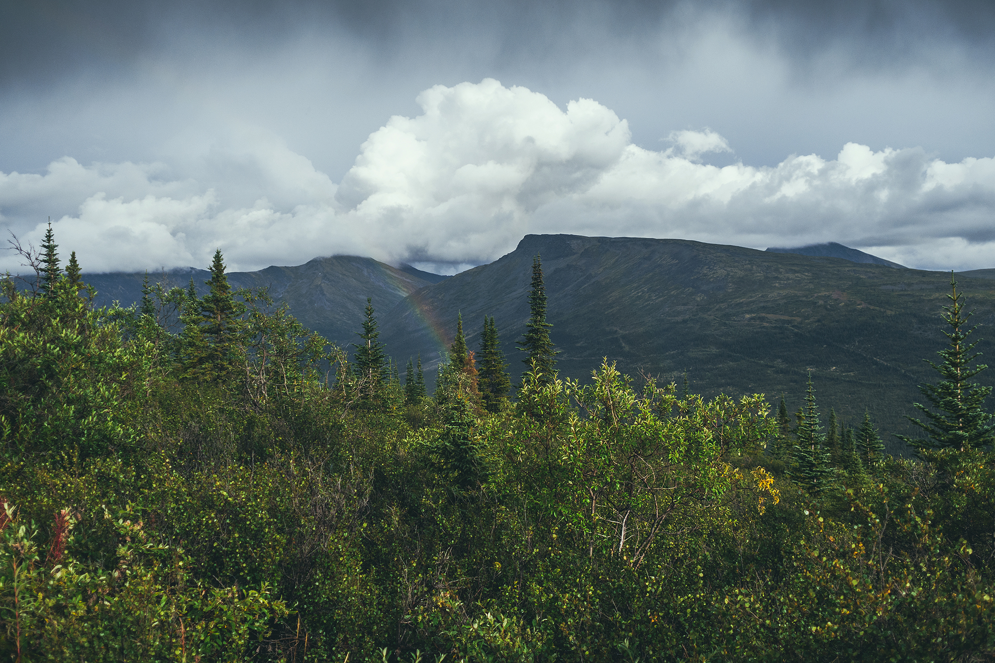
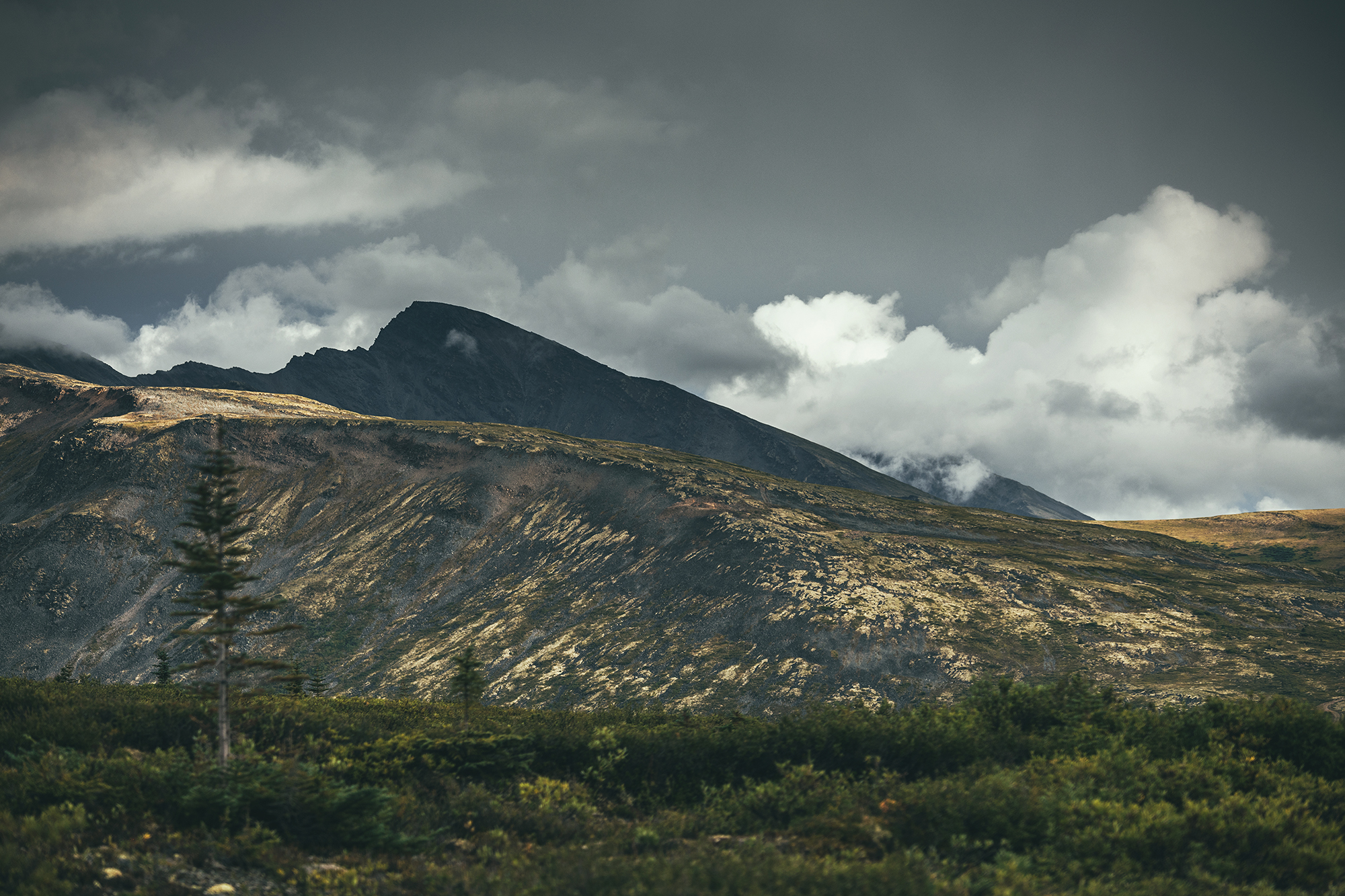
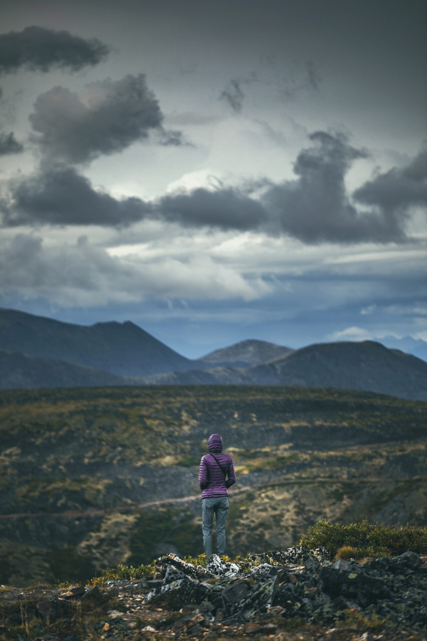
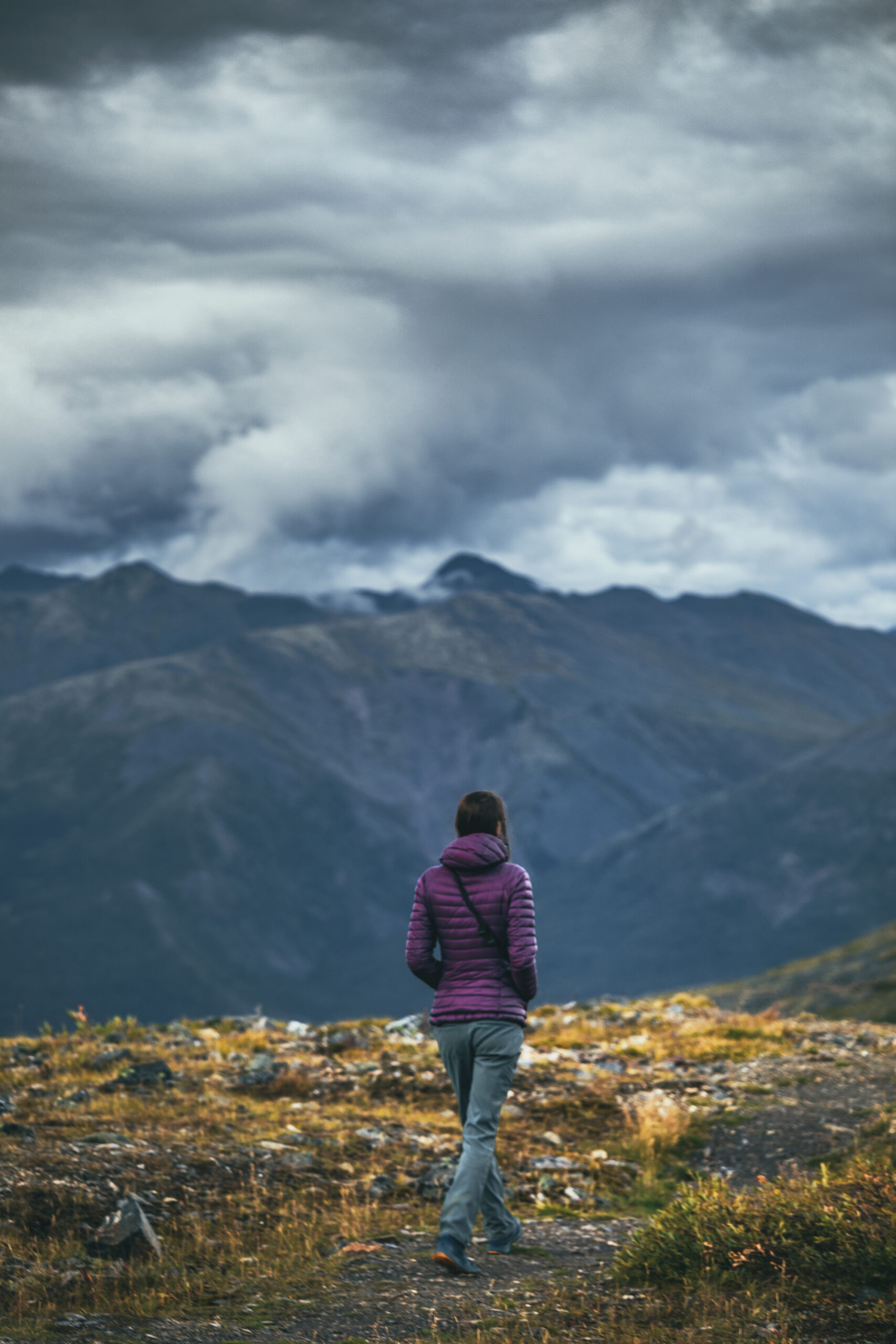
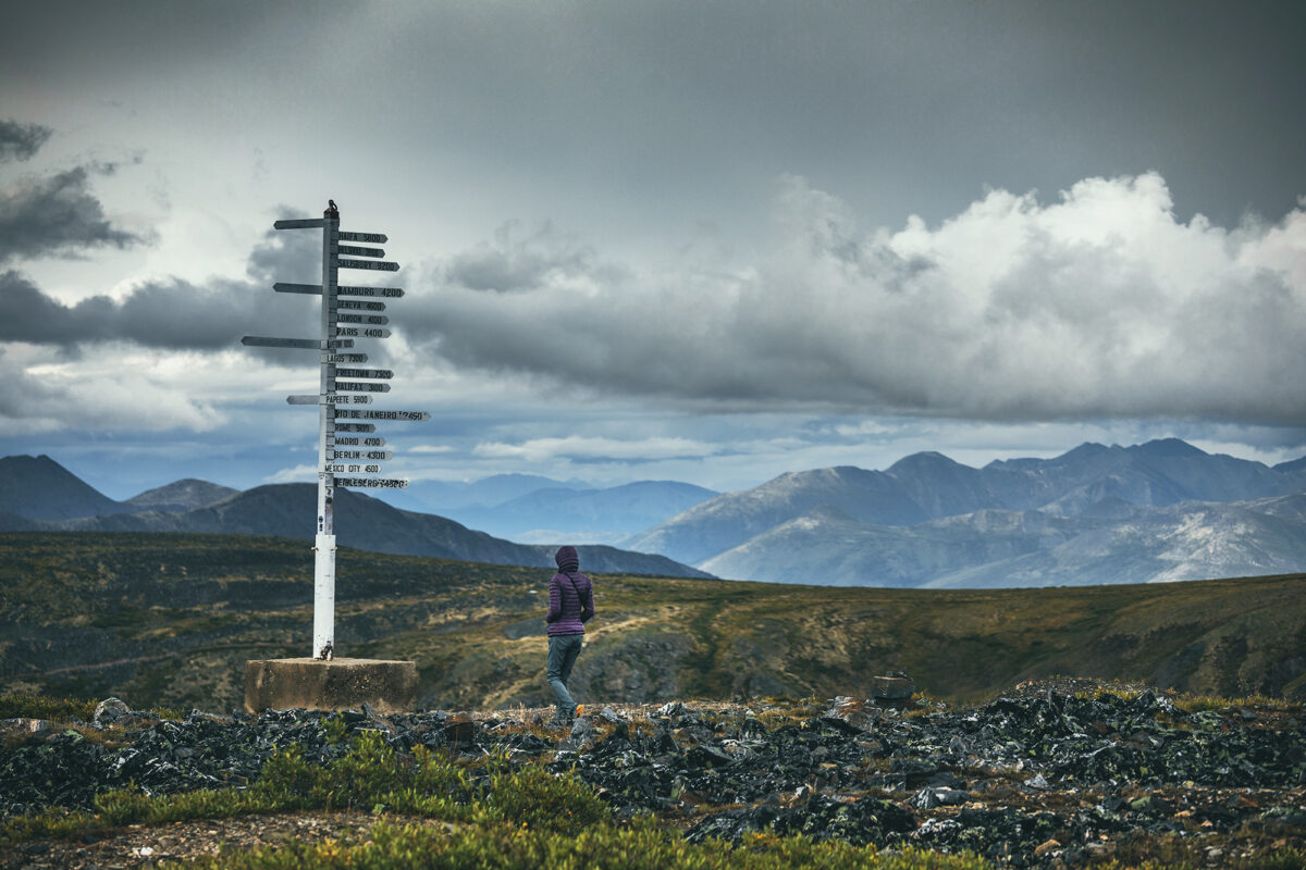
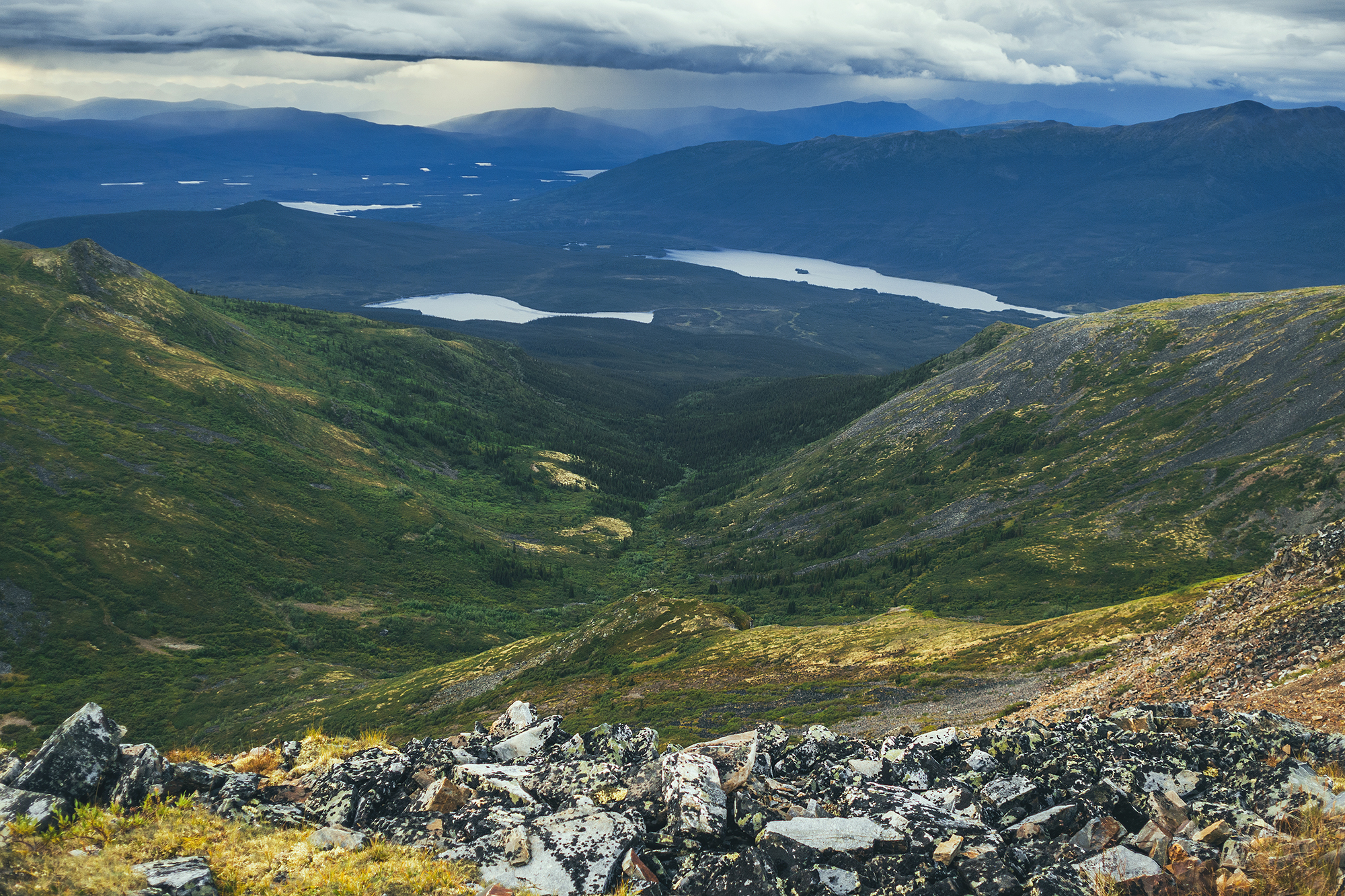
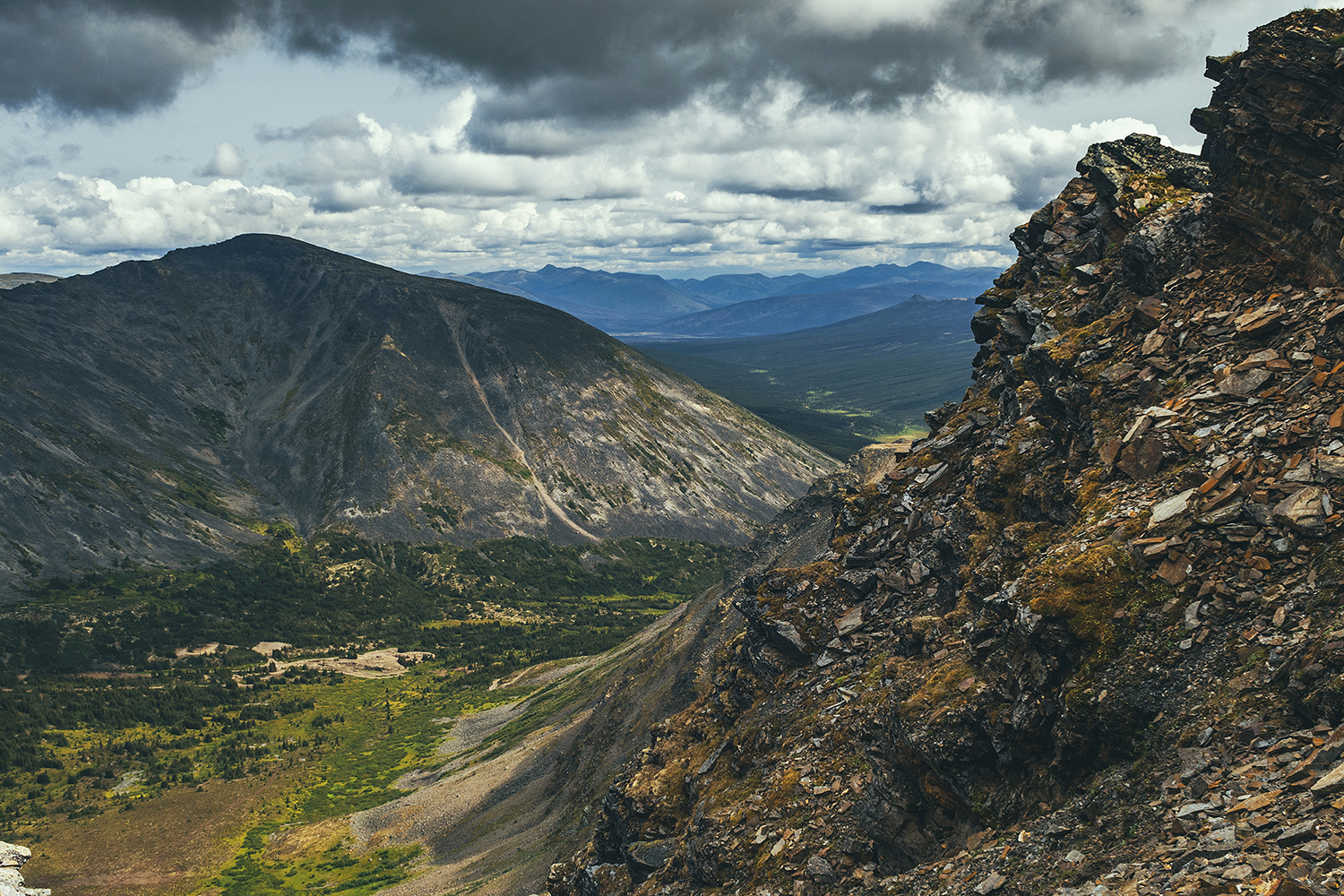
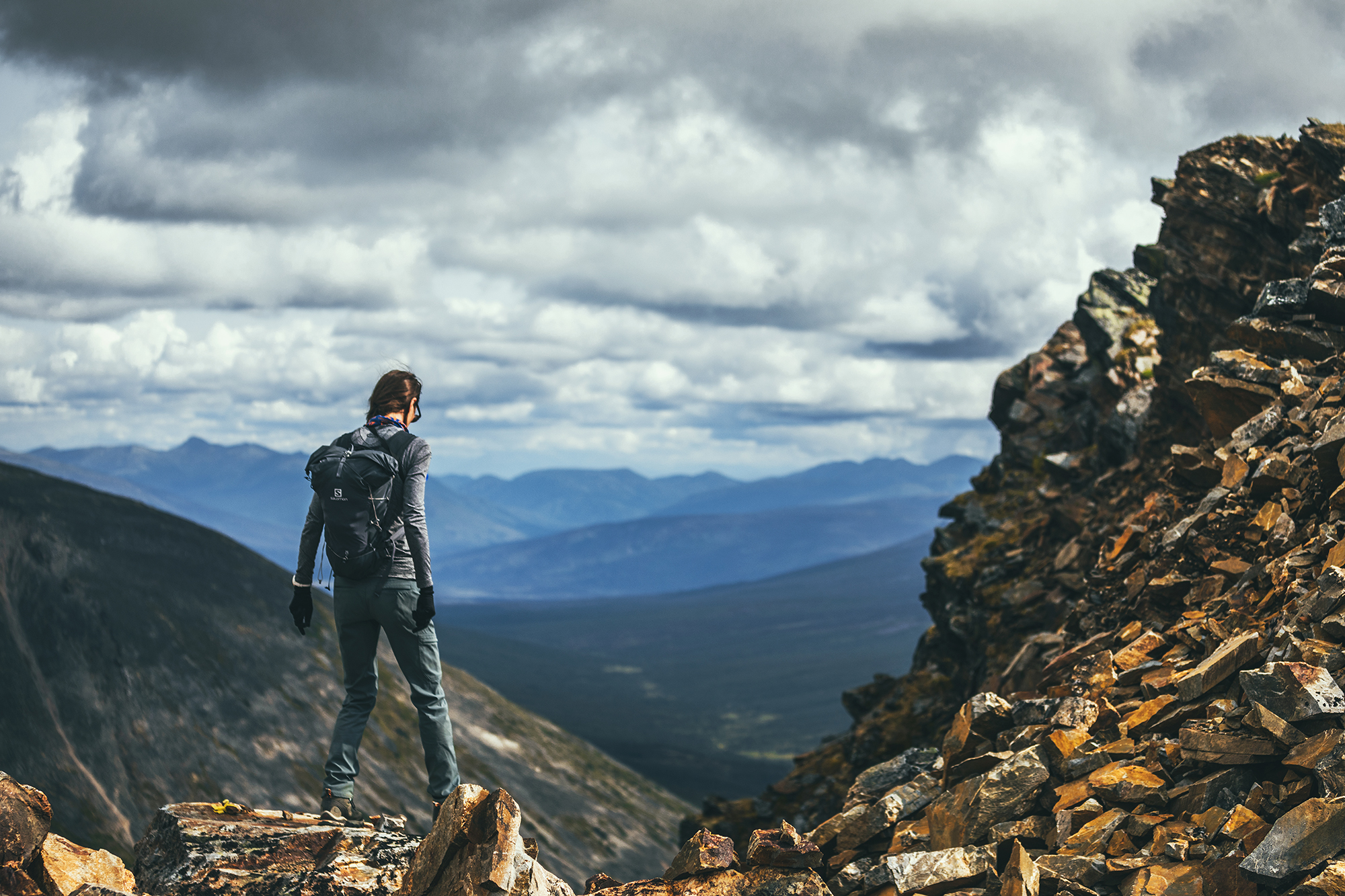
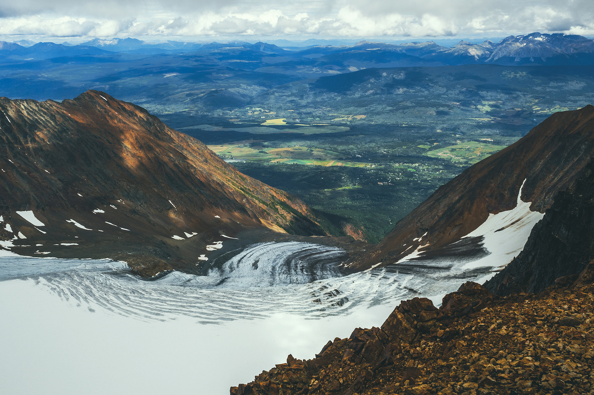
We reached the signpost at the end of the road, a couple of km from the summit, and the views were remarkable. The valley laid below under the dark stormy clouds, a sliver of golden light filtering through along the peaks in the distance – and still some blue sky over peaks in the opposite direction.

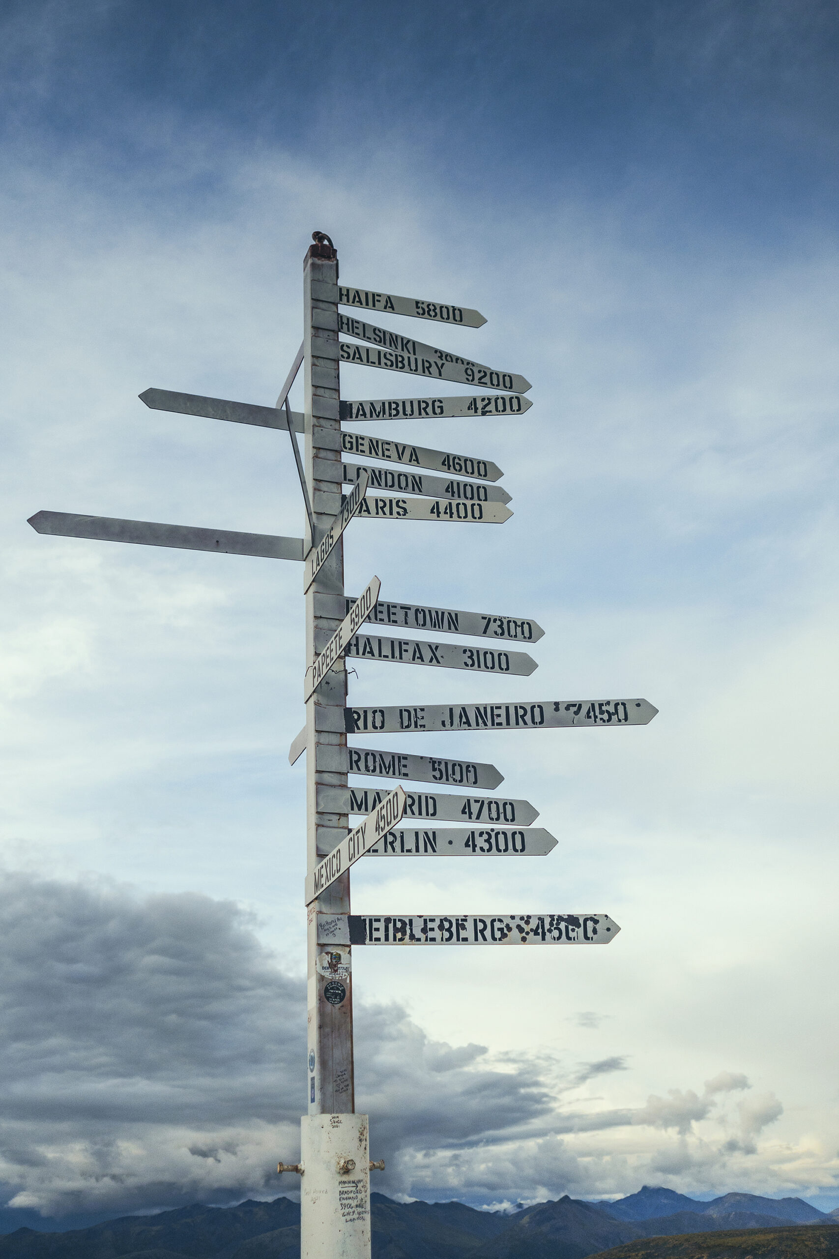
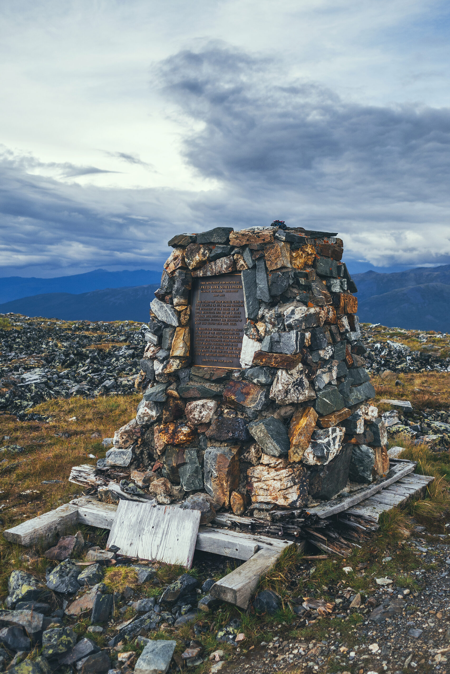
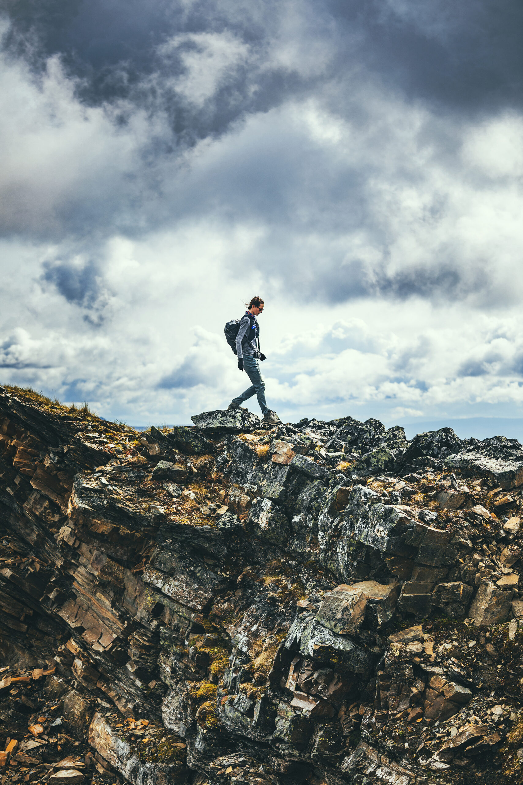
The sign post itself was erected for a geological convention of sort some years ago, and the various signs point to the cities around the world where the scientists attending the event came from.
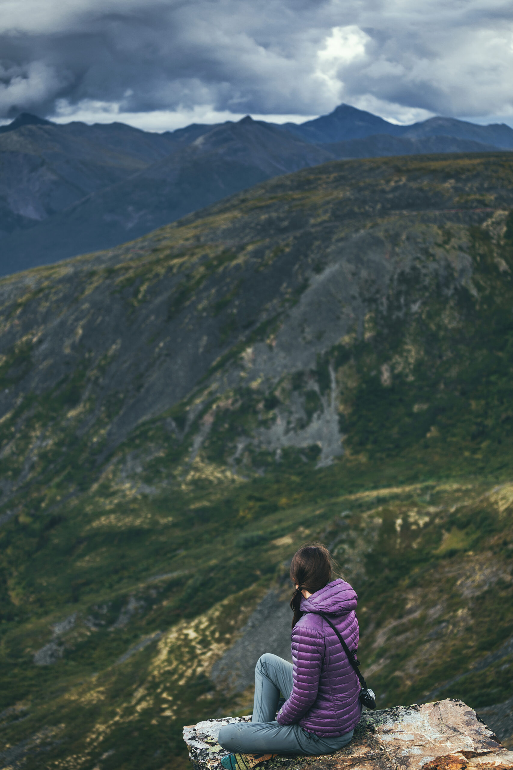
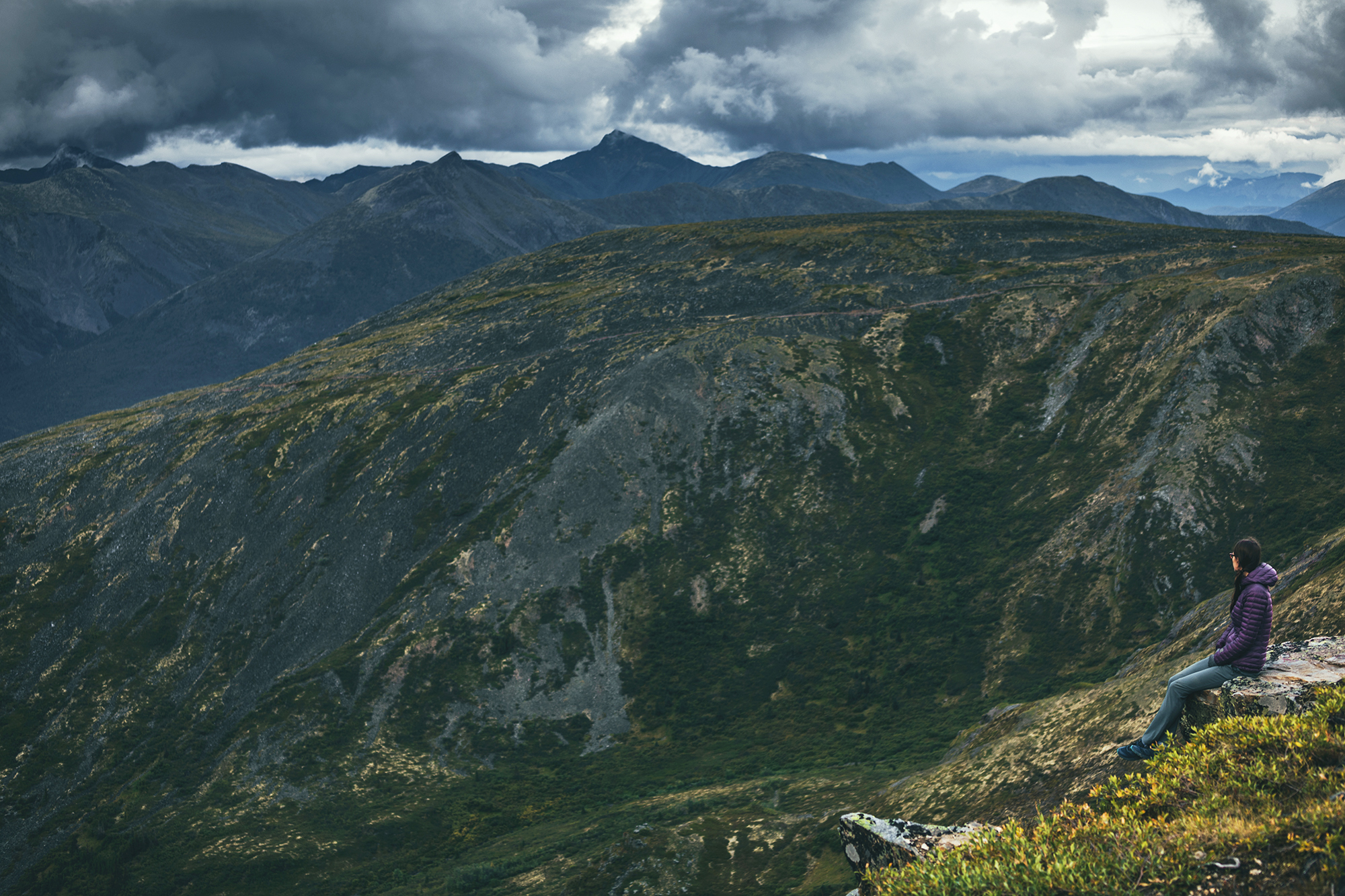
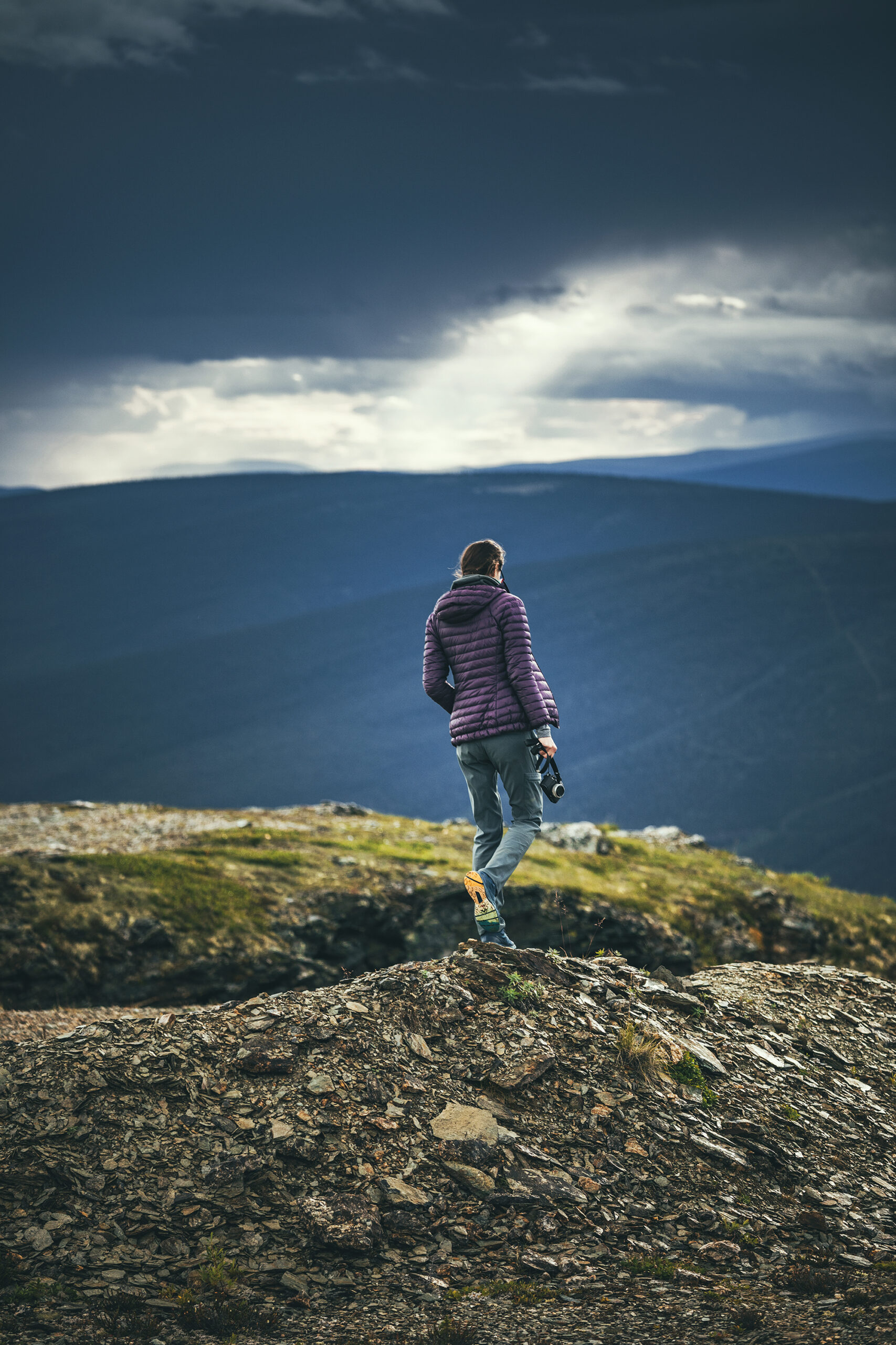
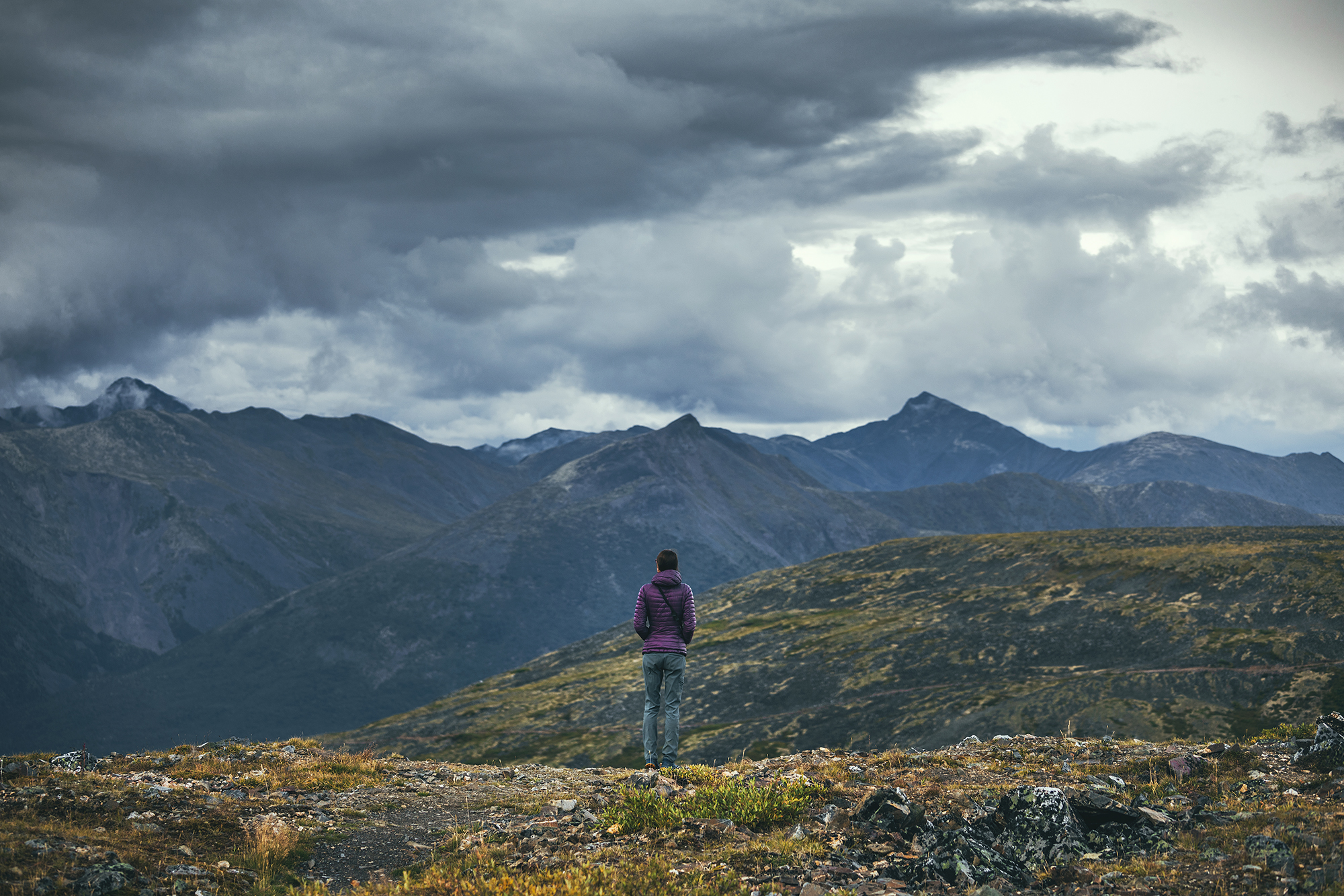
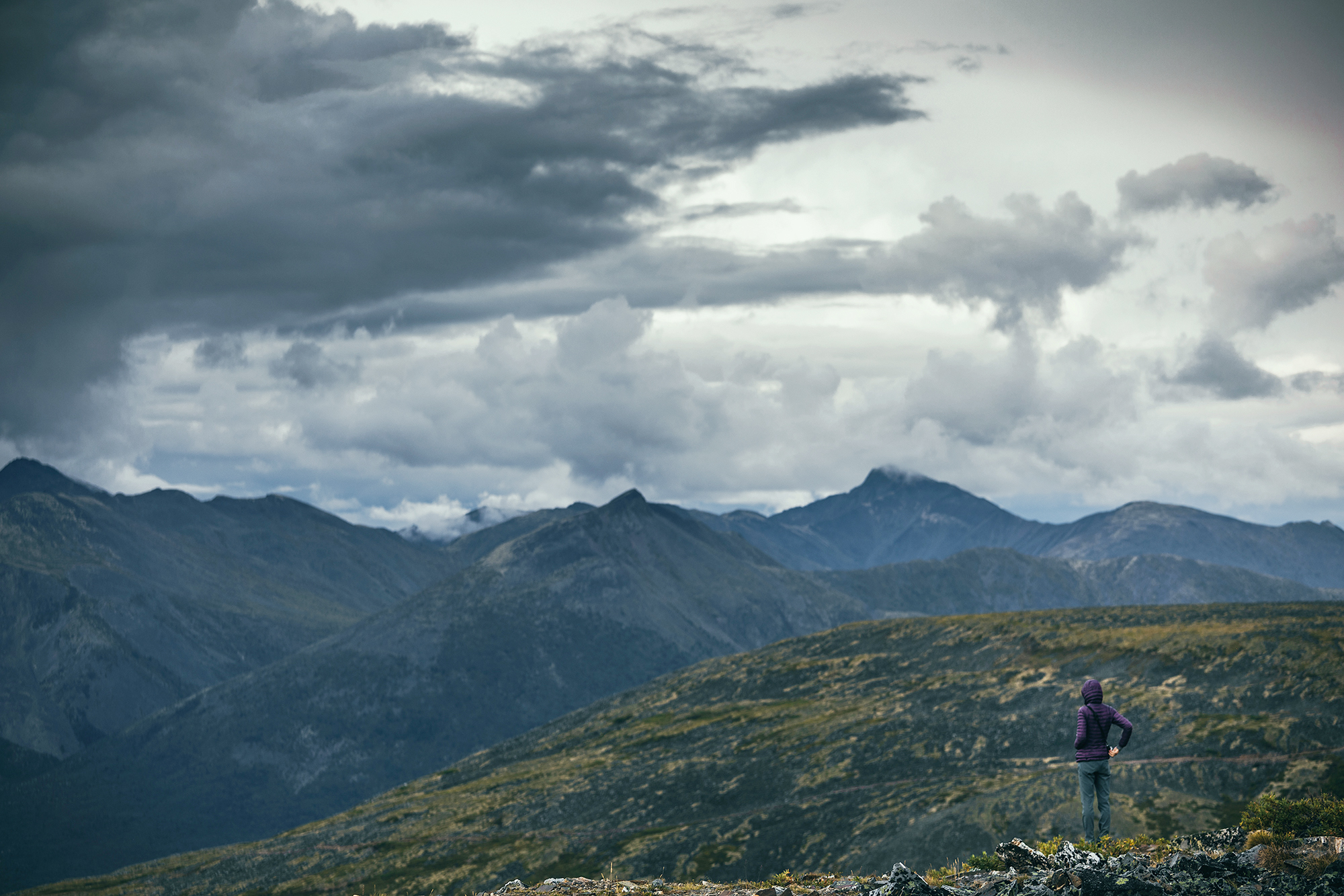
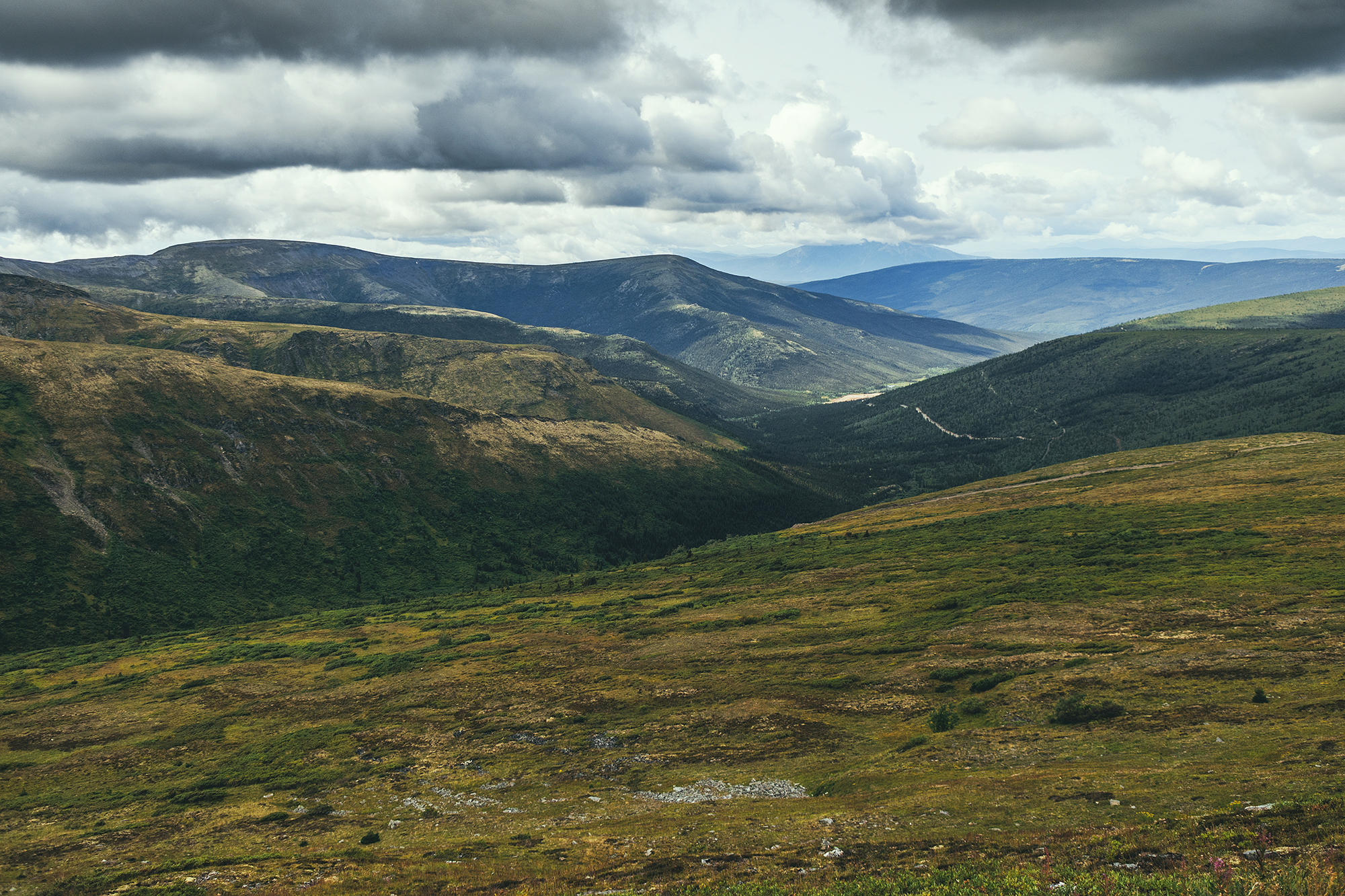
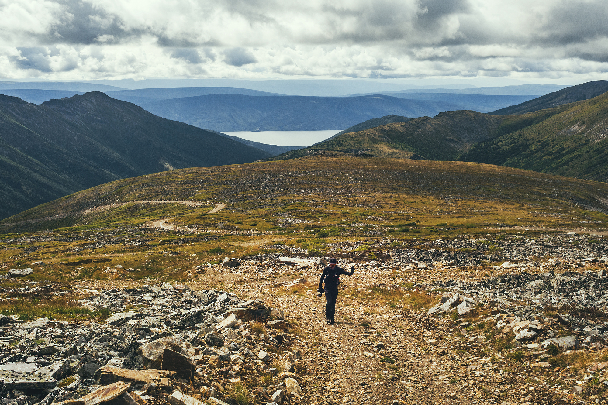
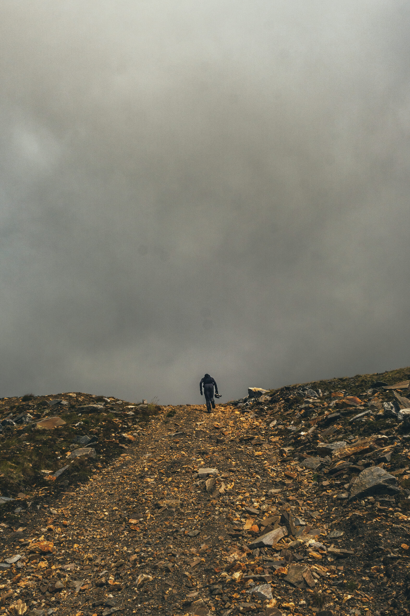
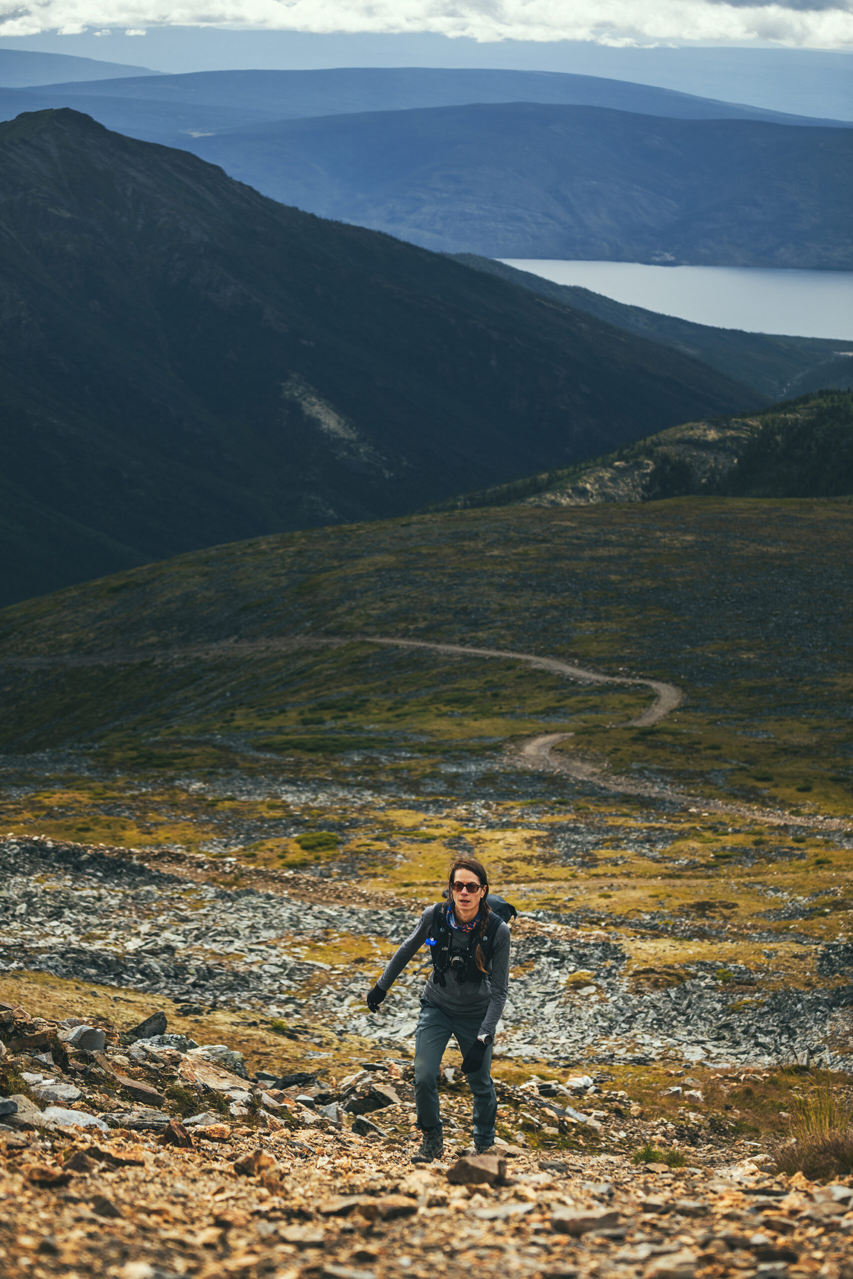
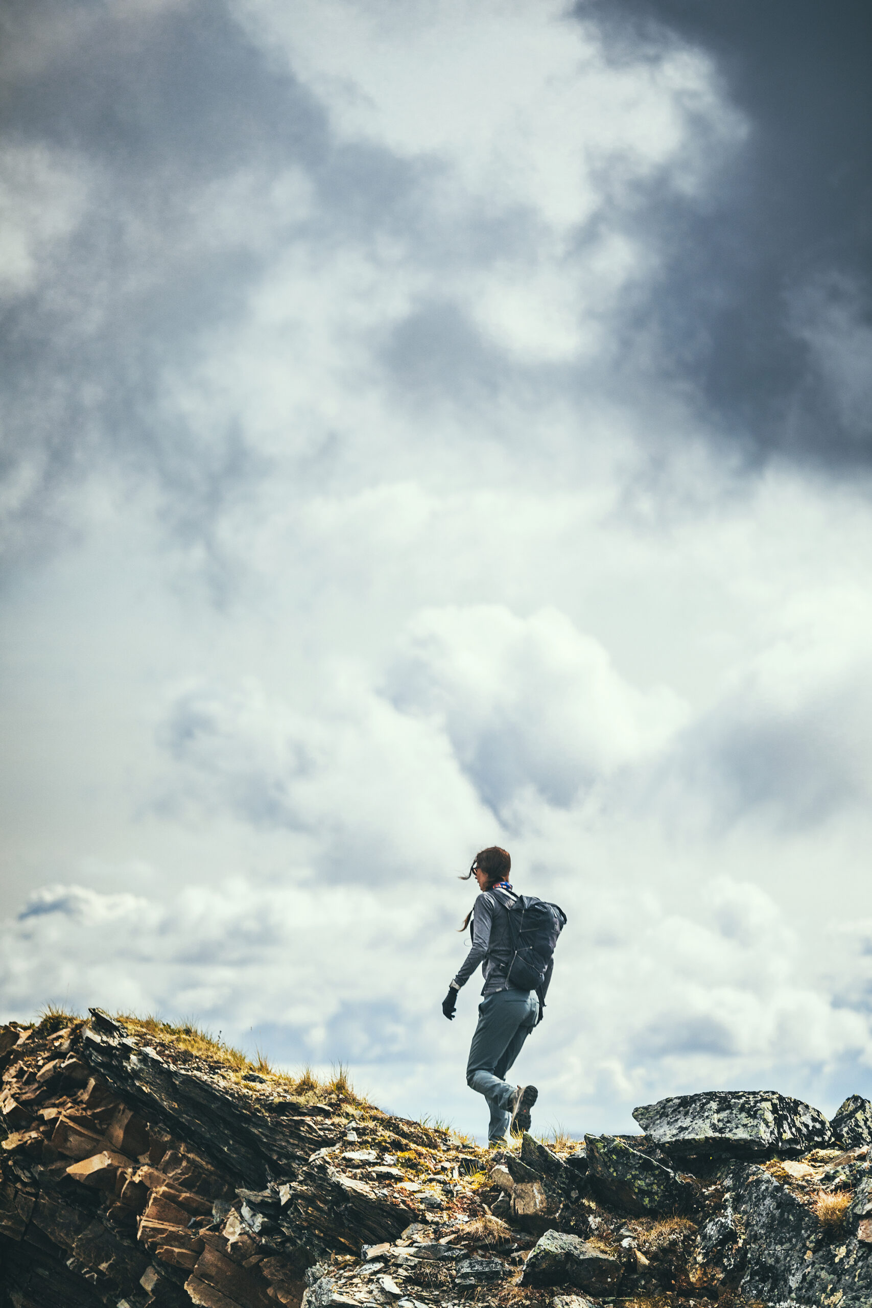
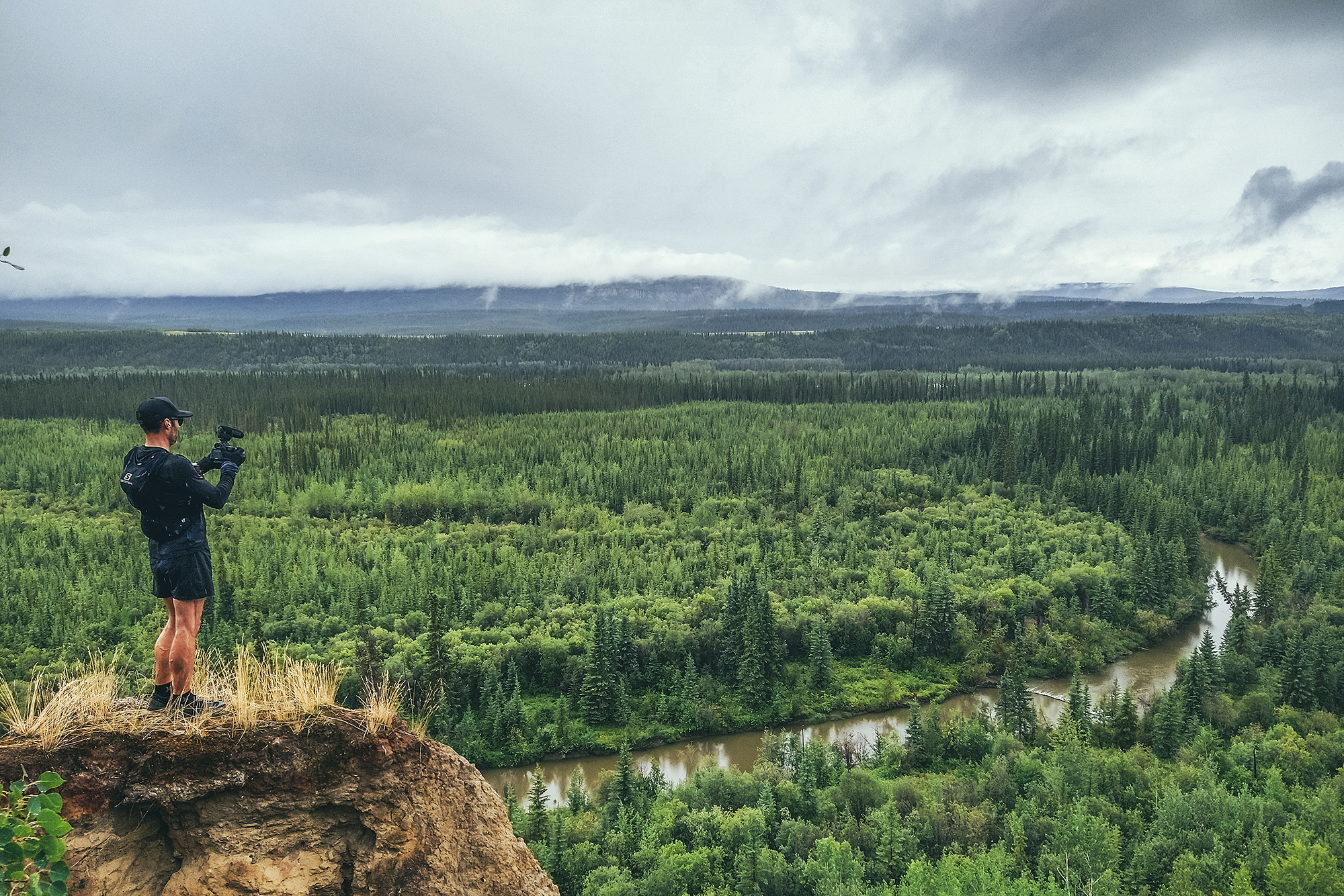
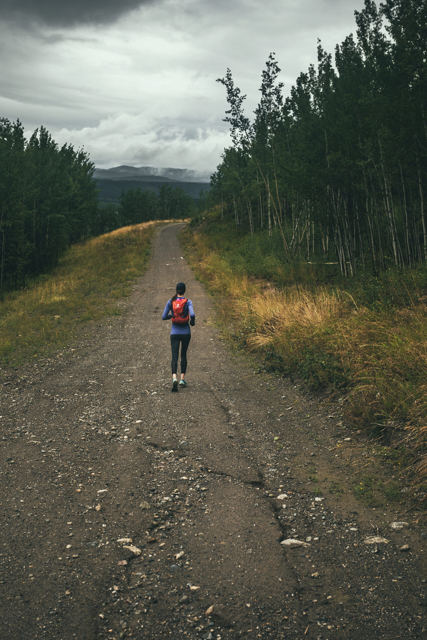
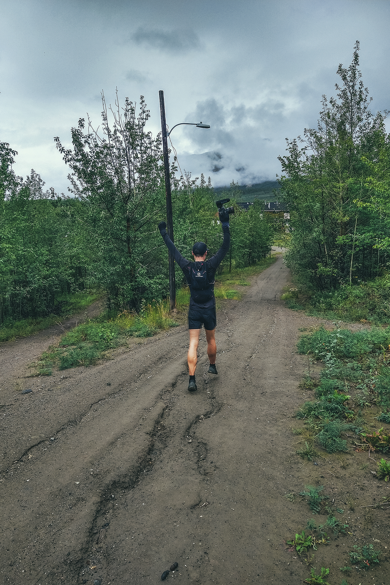
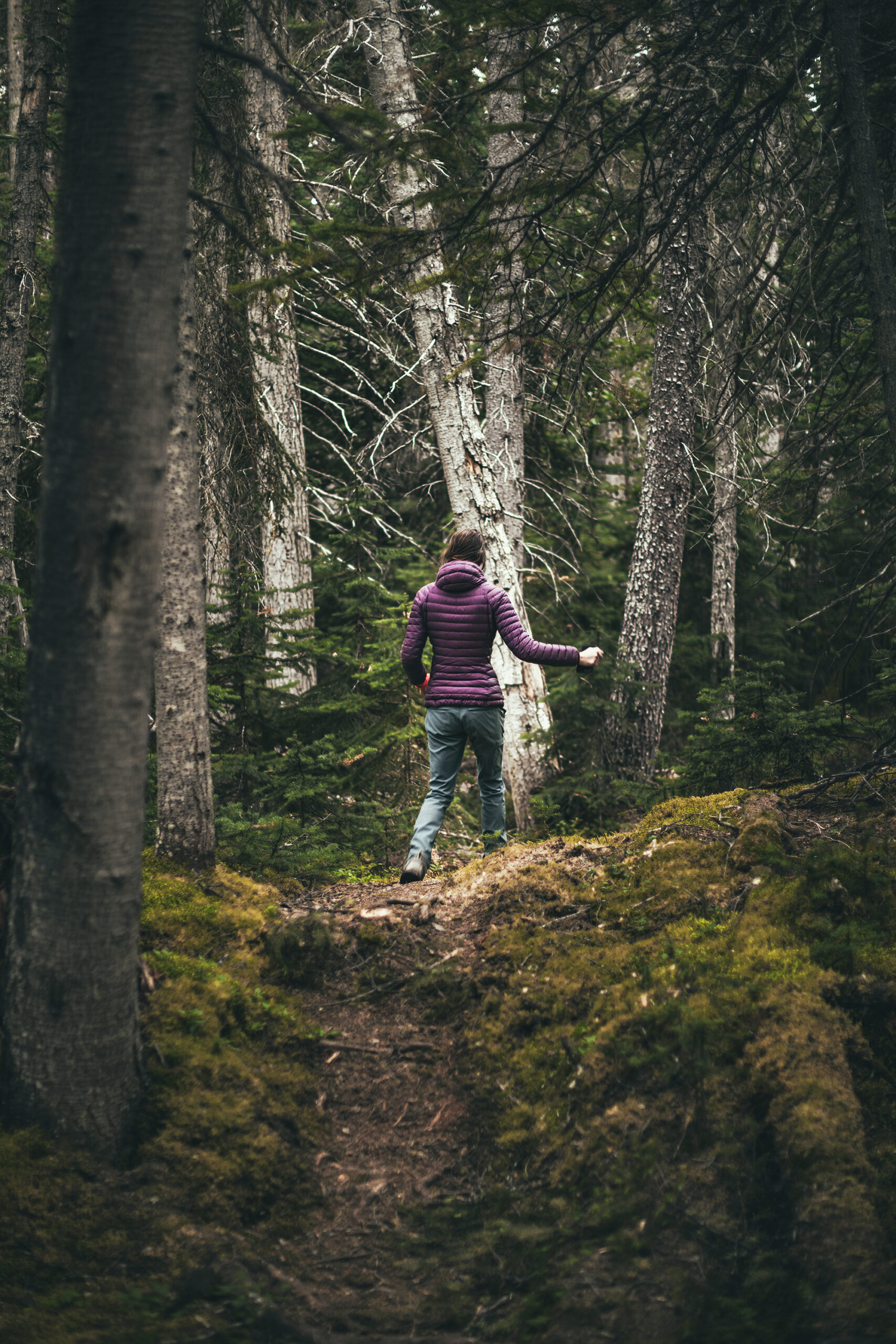
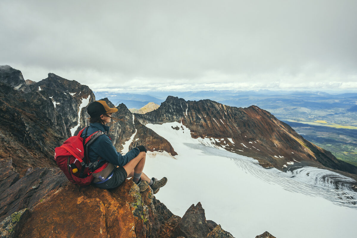
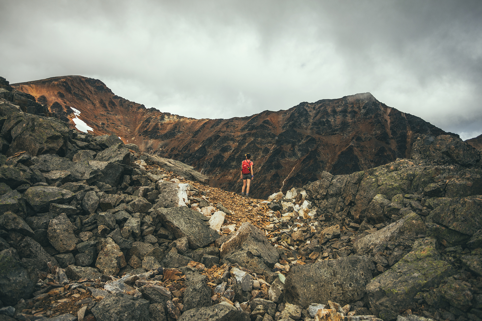
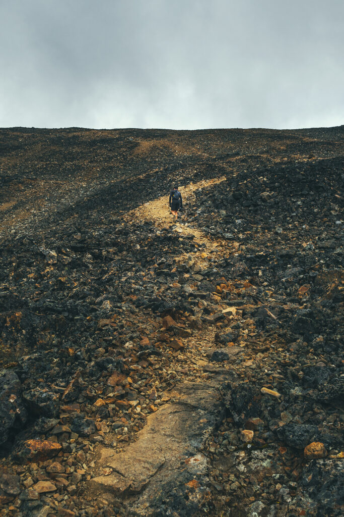
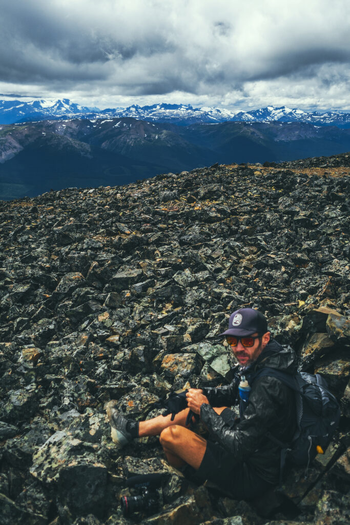
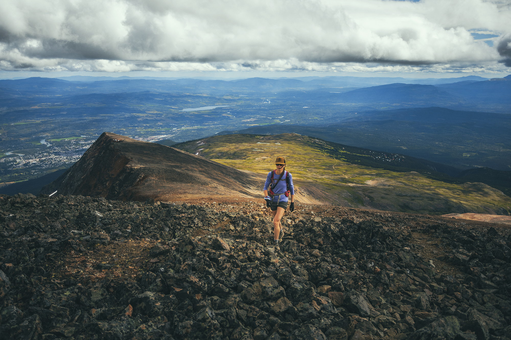
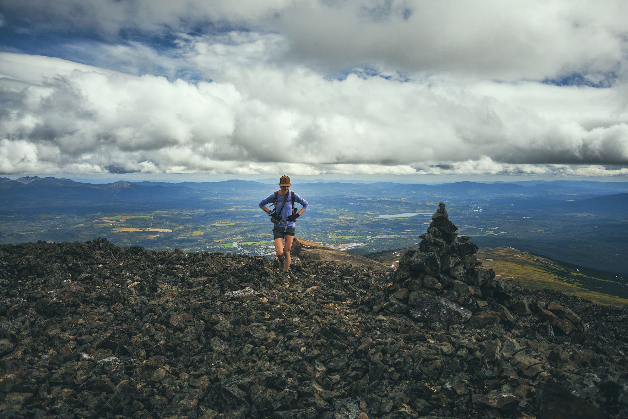
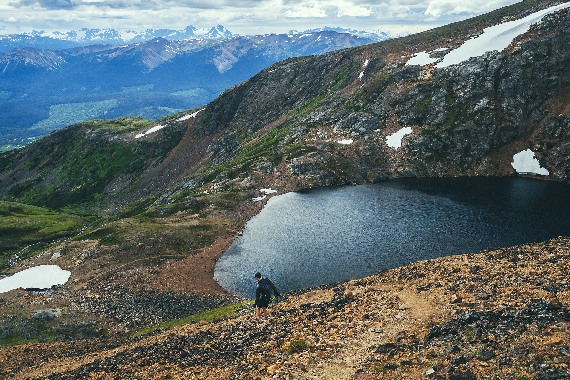
Past the sign post, the trail keeps going to a higher hill, easy to see as the alpine vegetation is all low shrubs. I decided to venture up there on foot while Brice flew the drone up. The summit seen from below was actually a false summit, as I found out when I reached it. The second (presumably true) summit was still some ways away still so I decided to turn around. I still got some really great views from the false summit and I enjoyed running down the wide, rocky track on the way back down.
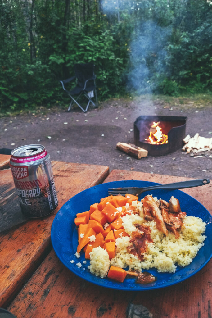
Once I got back to the car we drove back down to the campground for dinner. It was the first time in a few days that bugs weren’t all over us, and it didn’t rain, so we were able to sit by the fire and enjoy the evening outside the bug shelter.
As a side note, there was a group at the top of Keno Hill when we got there, and sure enough, it was a bunch of French people (Some from France, some from Canada, based on accents). Of course we found them back at the Campground (there is only one) – As we’ve often found in our various travels, no matter where we go in the world, how remote we get, we always seem to run into the French.
I wonder if other nationalities experience that as well and maybe we only notice French people because of the language…In any case it’s become a bit of a joke, and we can sometimes even identify French people just by looking at them…
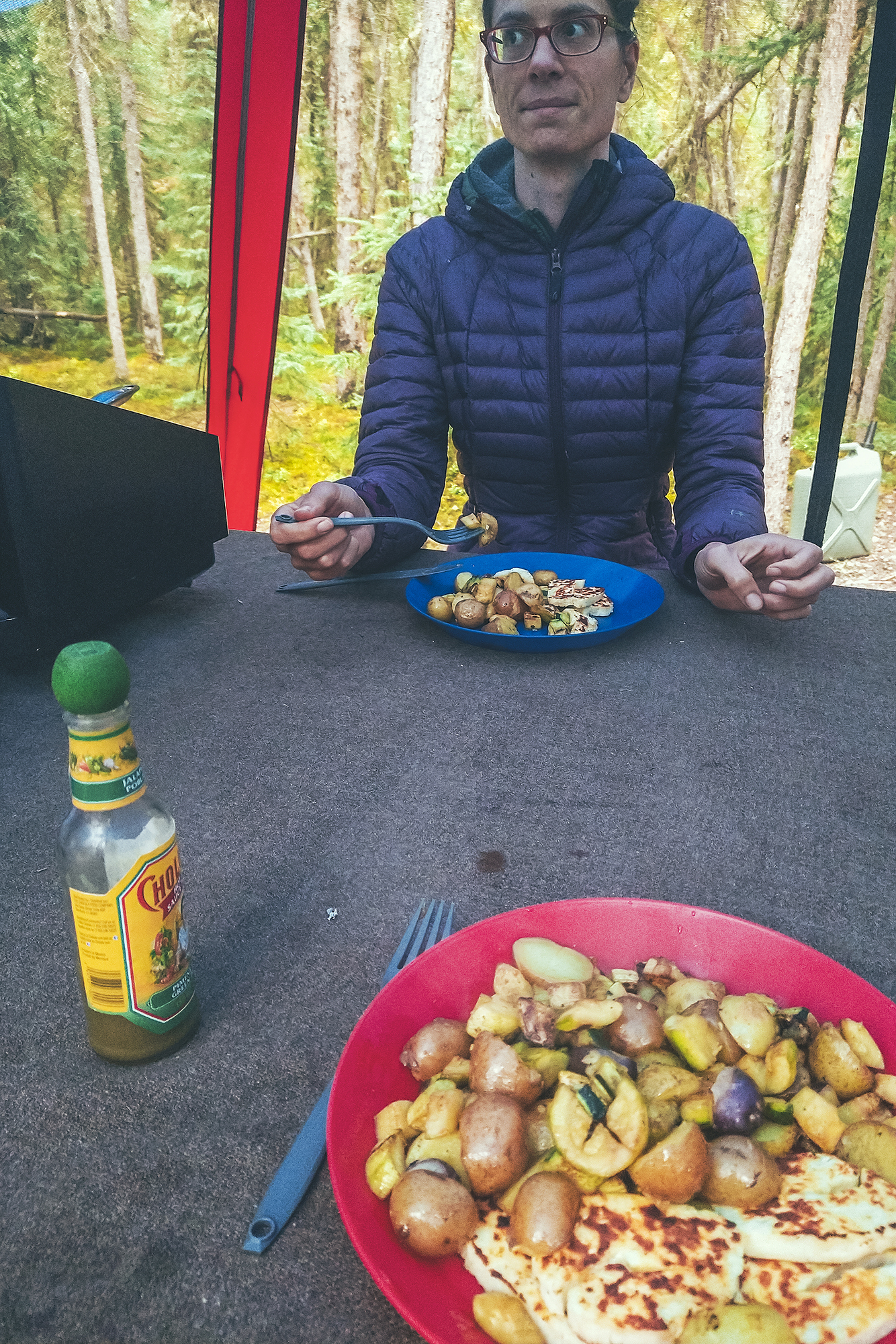
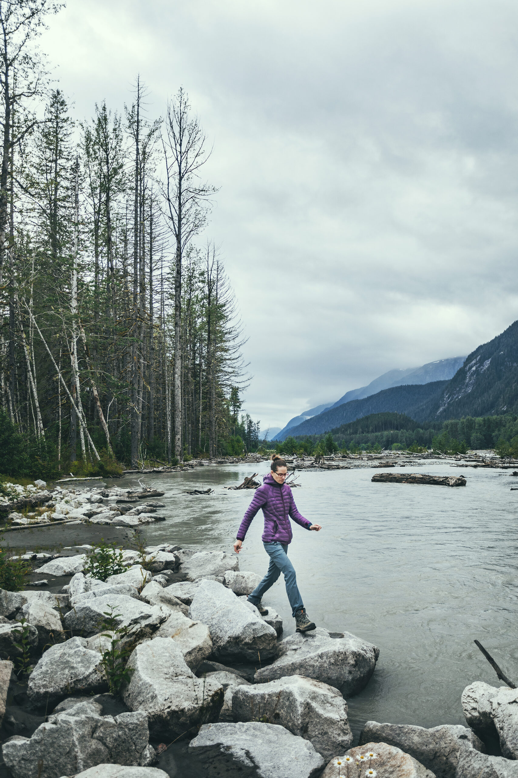
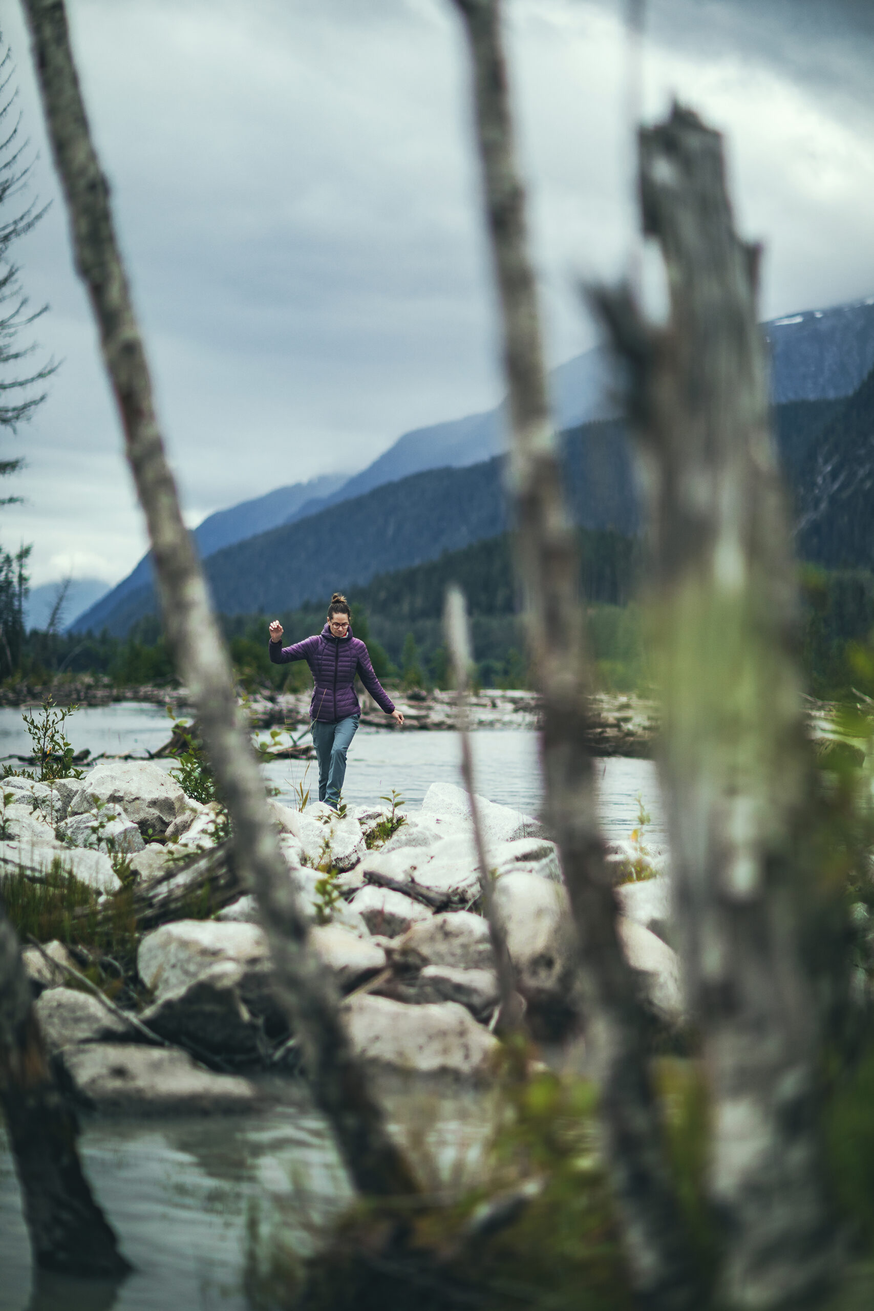
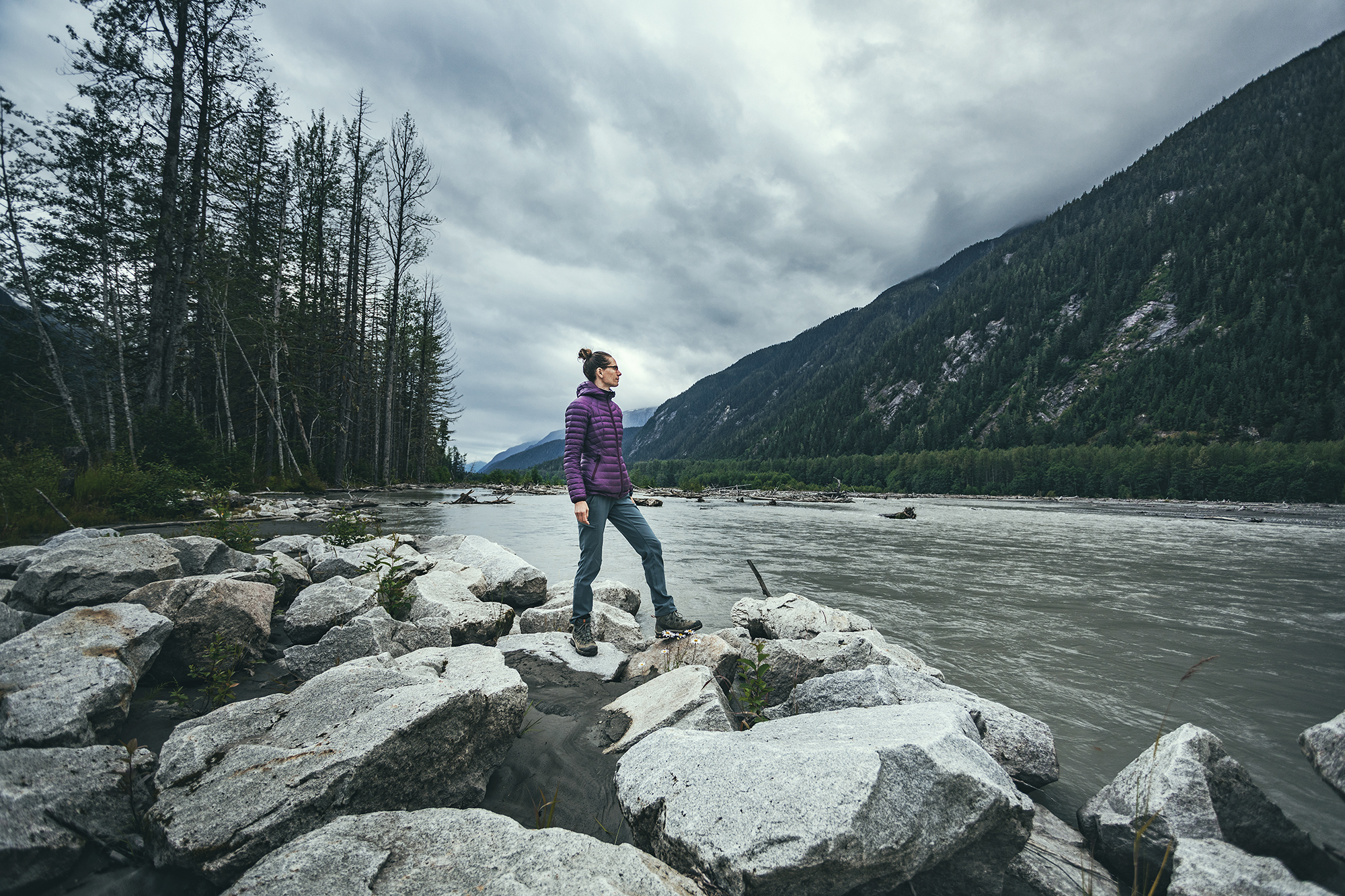
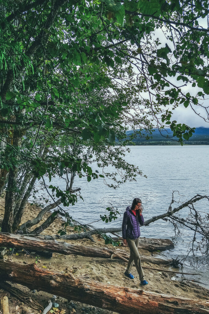
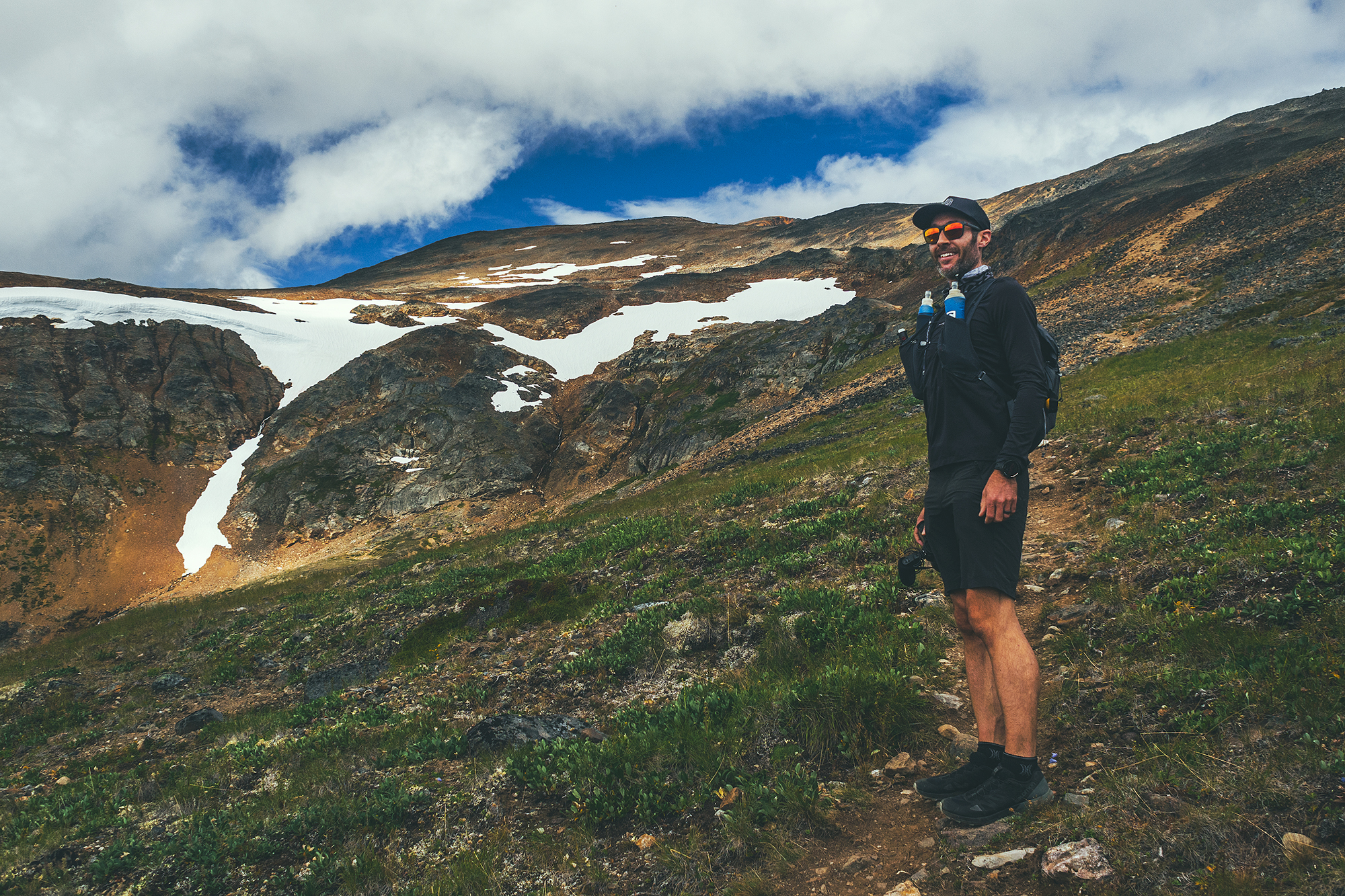
We decided to stay one more night in Keno, so we could take time to do a local hike.
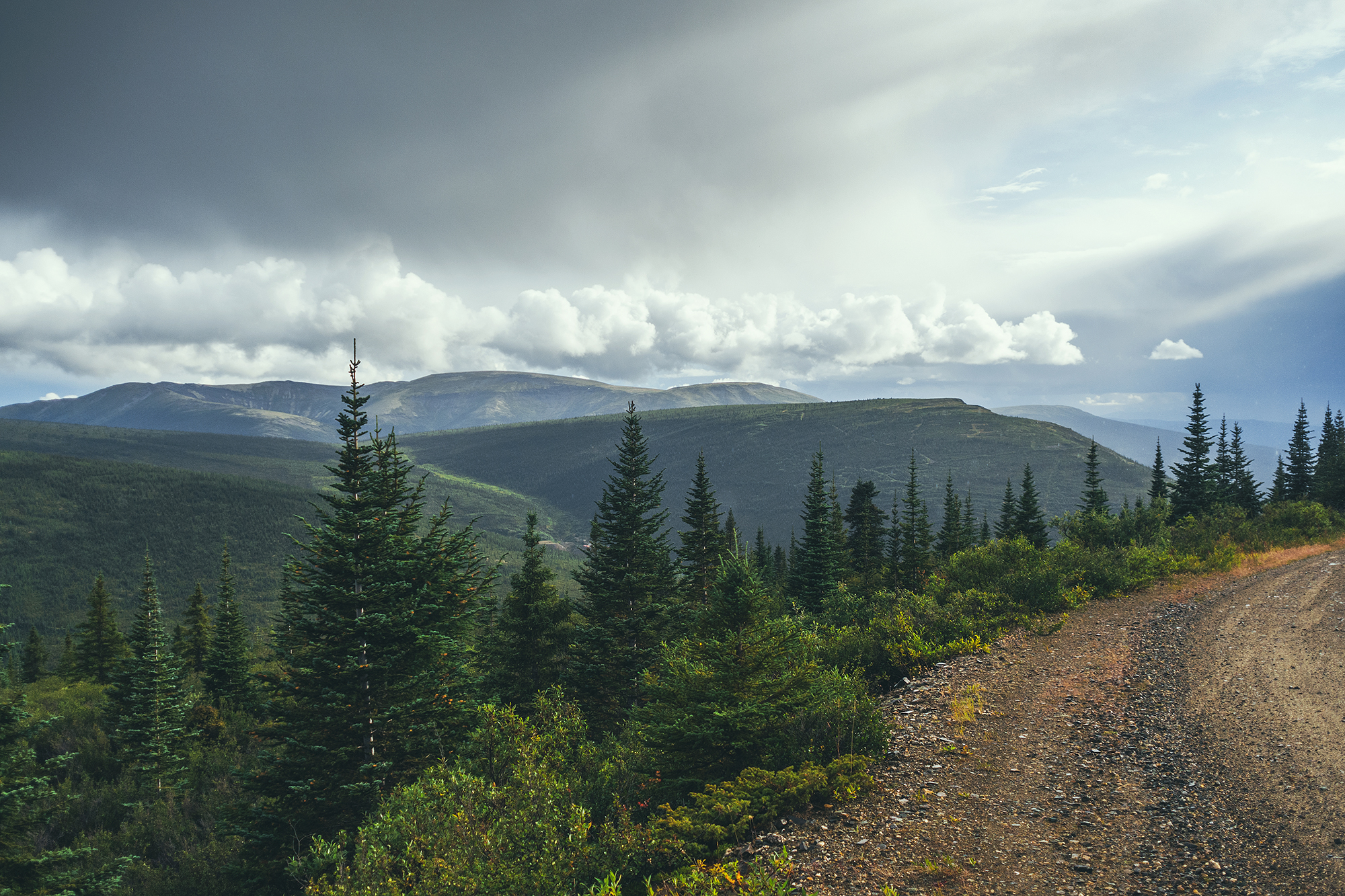
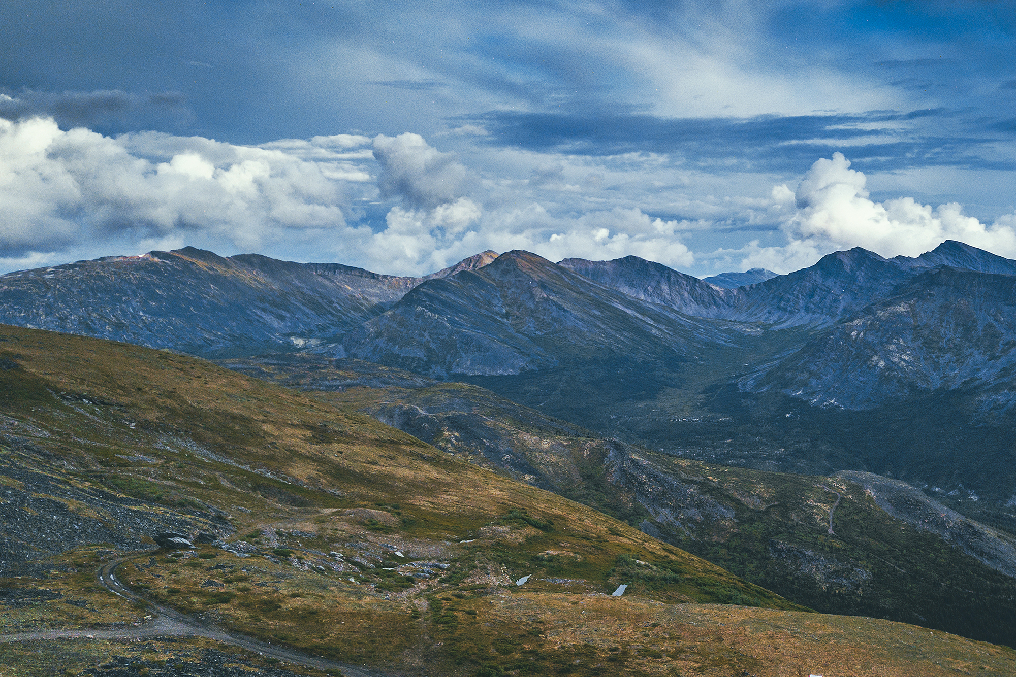
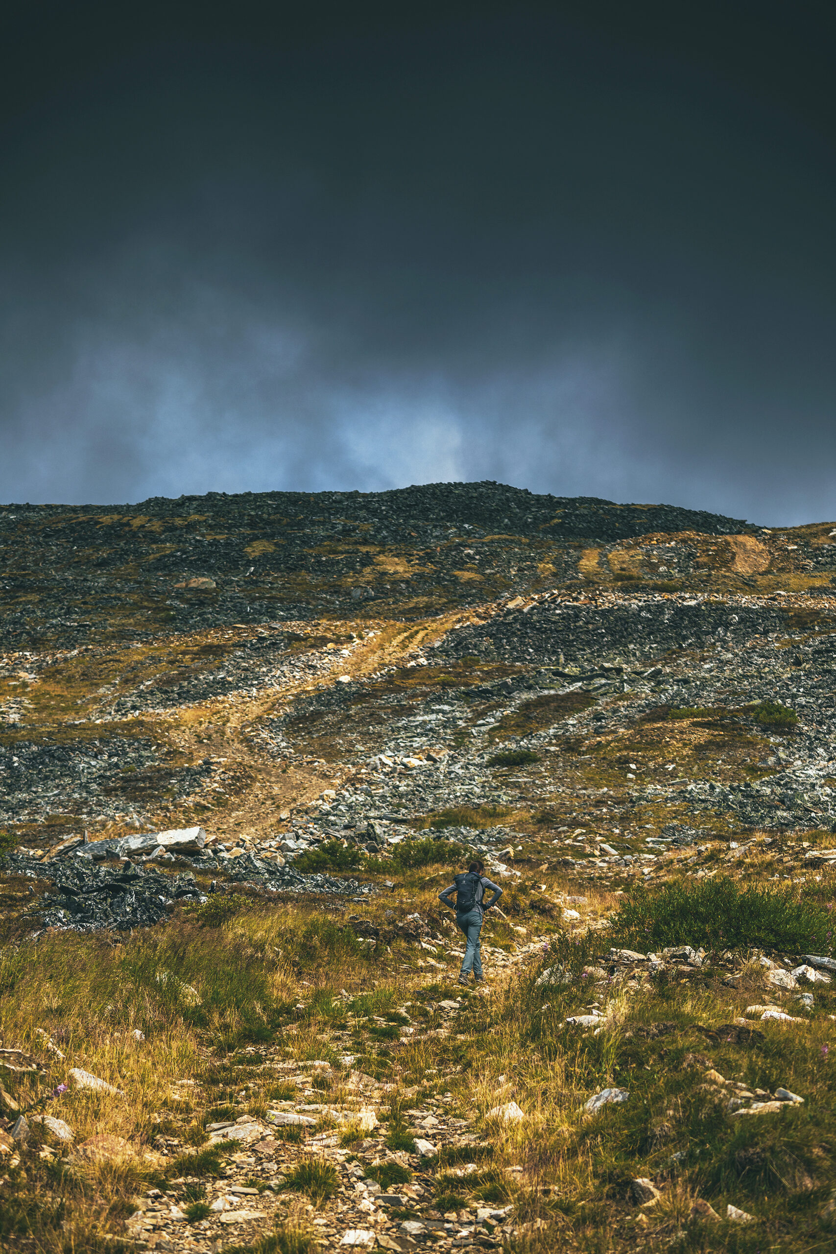
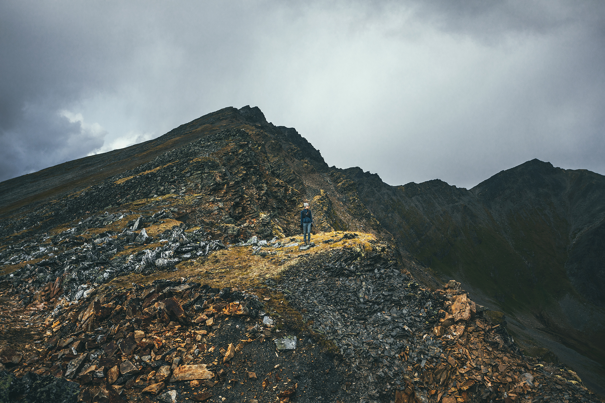
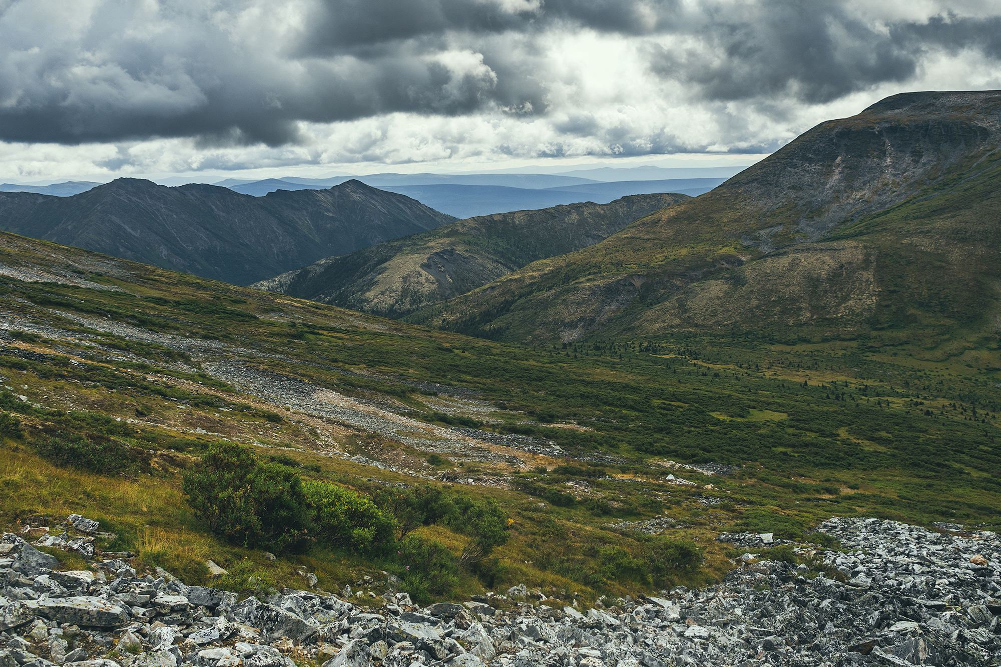
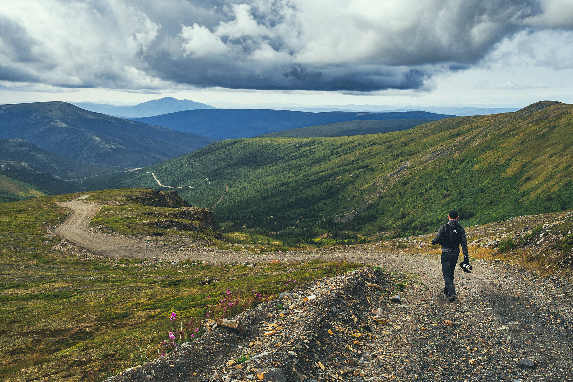
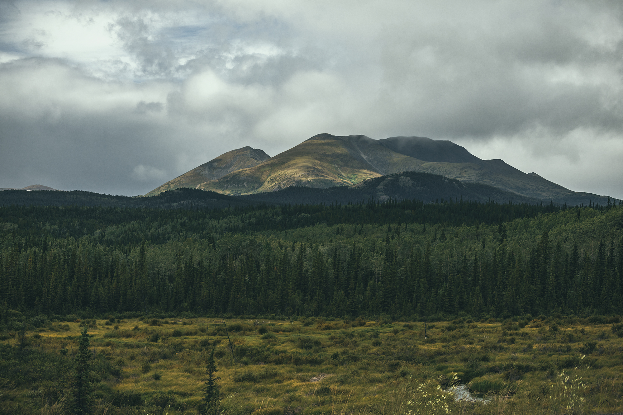
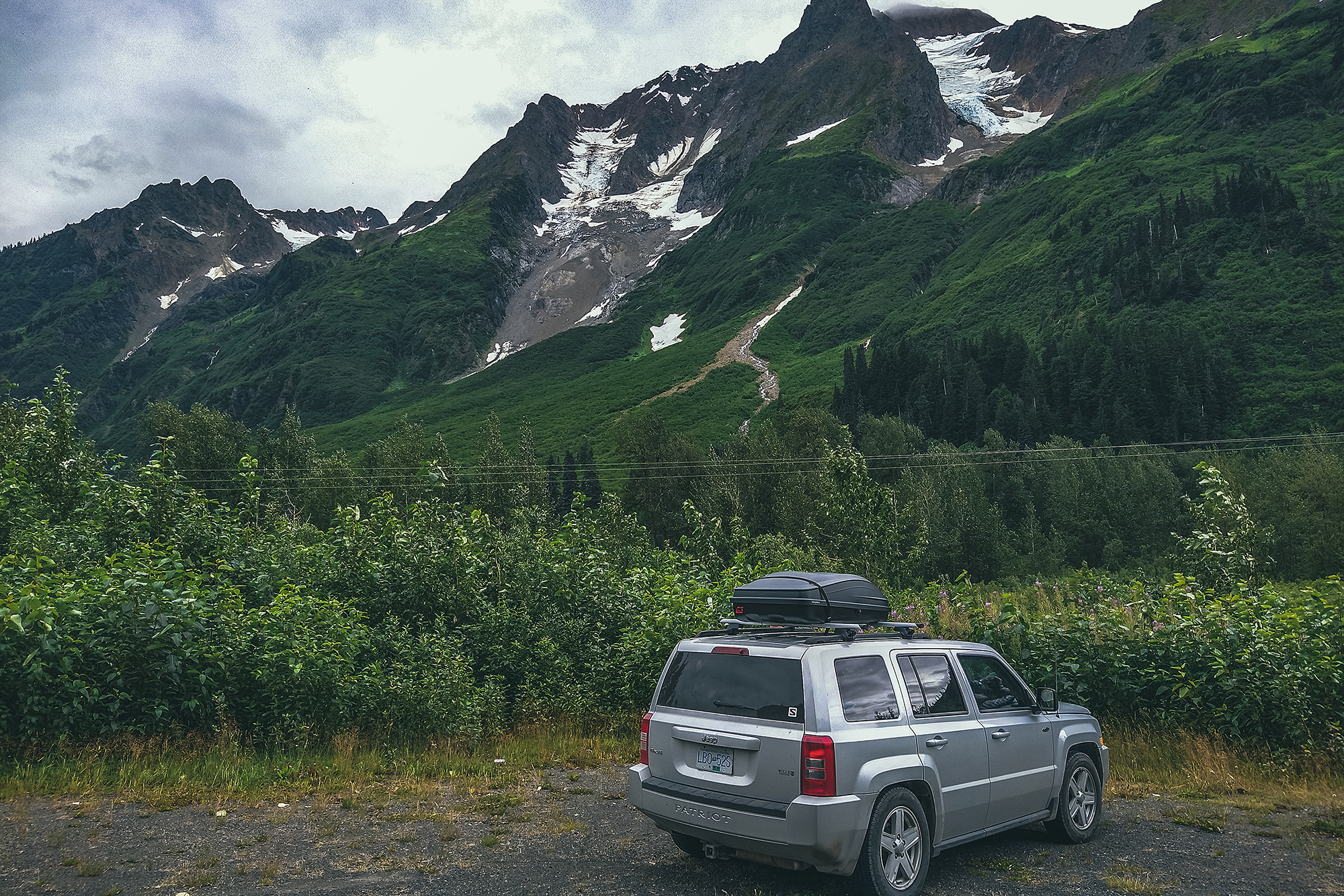
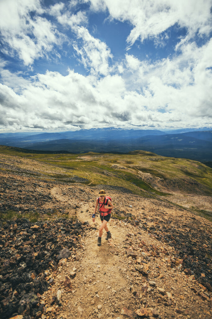
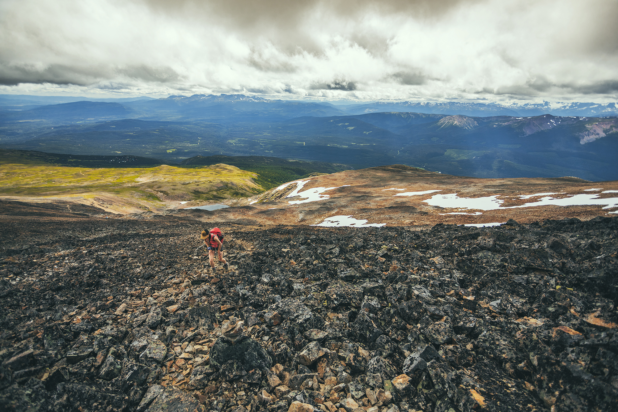
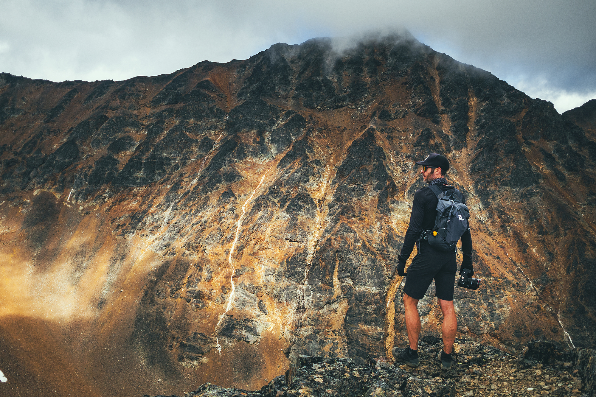
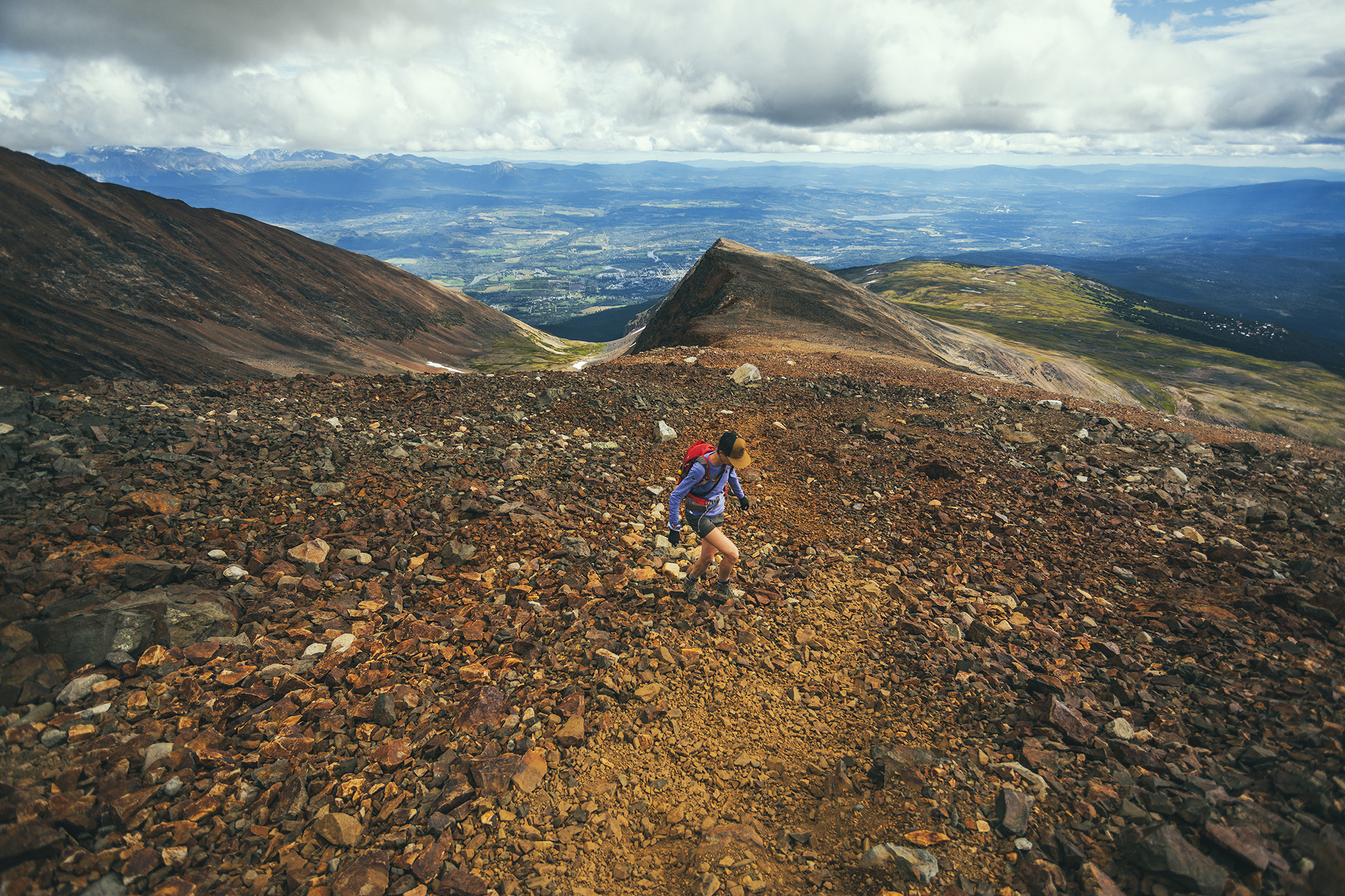
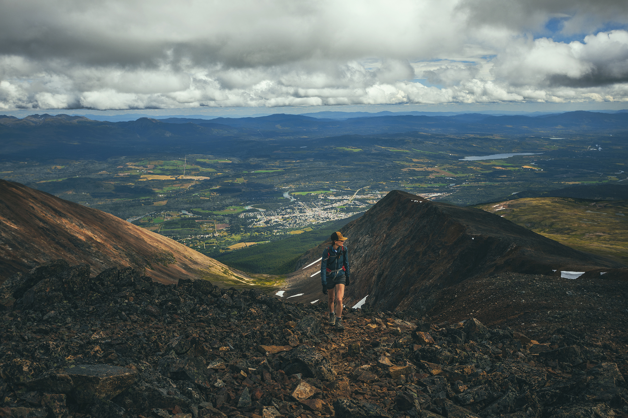
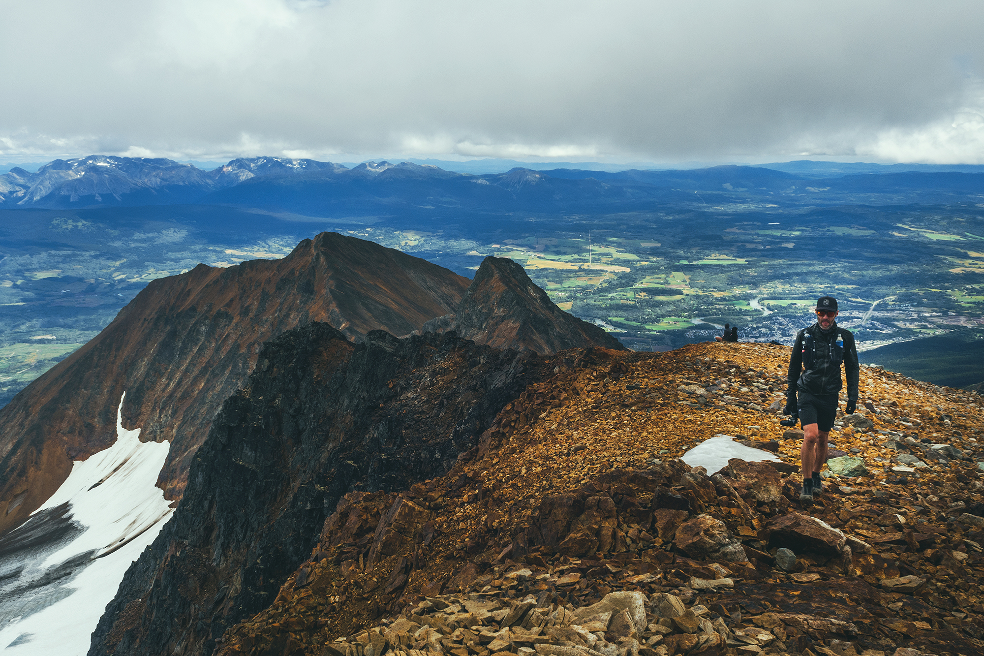
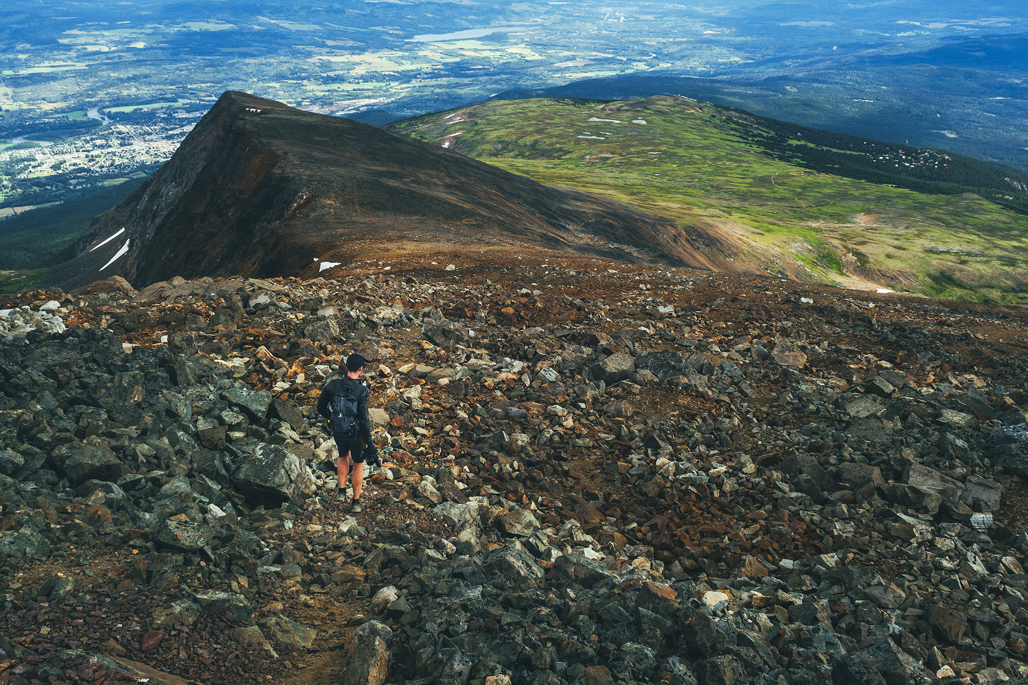
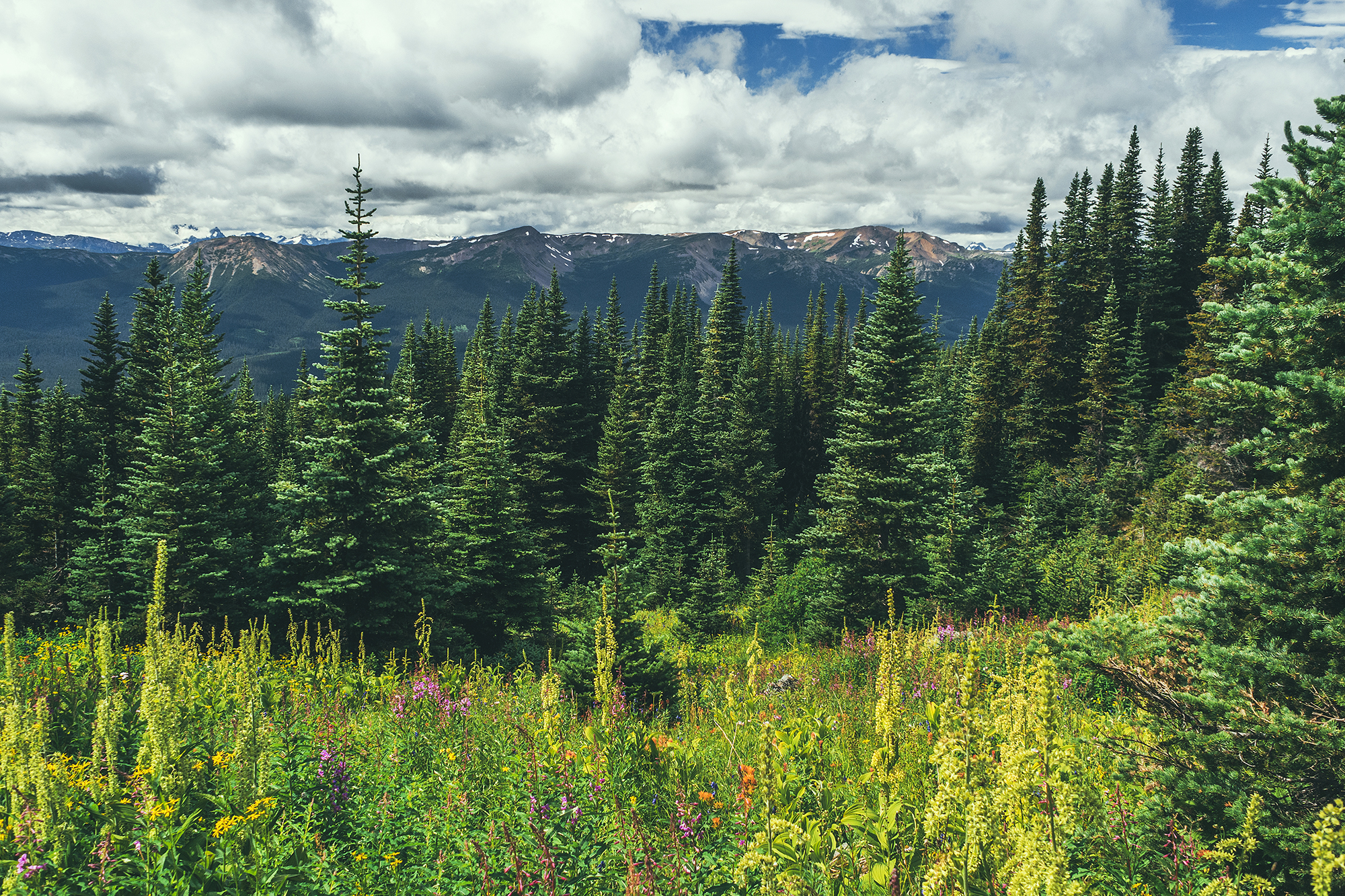
After breakfast we drove to the Mount Hinton trailhead. The directions from Alltrails were actually incorrect and took us down some random mining roads. We eventually found the correct directions, which basically consist of driving up the Sourdough trail, to the top of Sourdough hill, and then continue down into the next valley to a creek crossing. At that point, the road gets quite steep and rocky that’s where we started the hike.

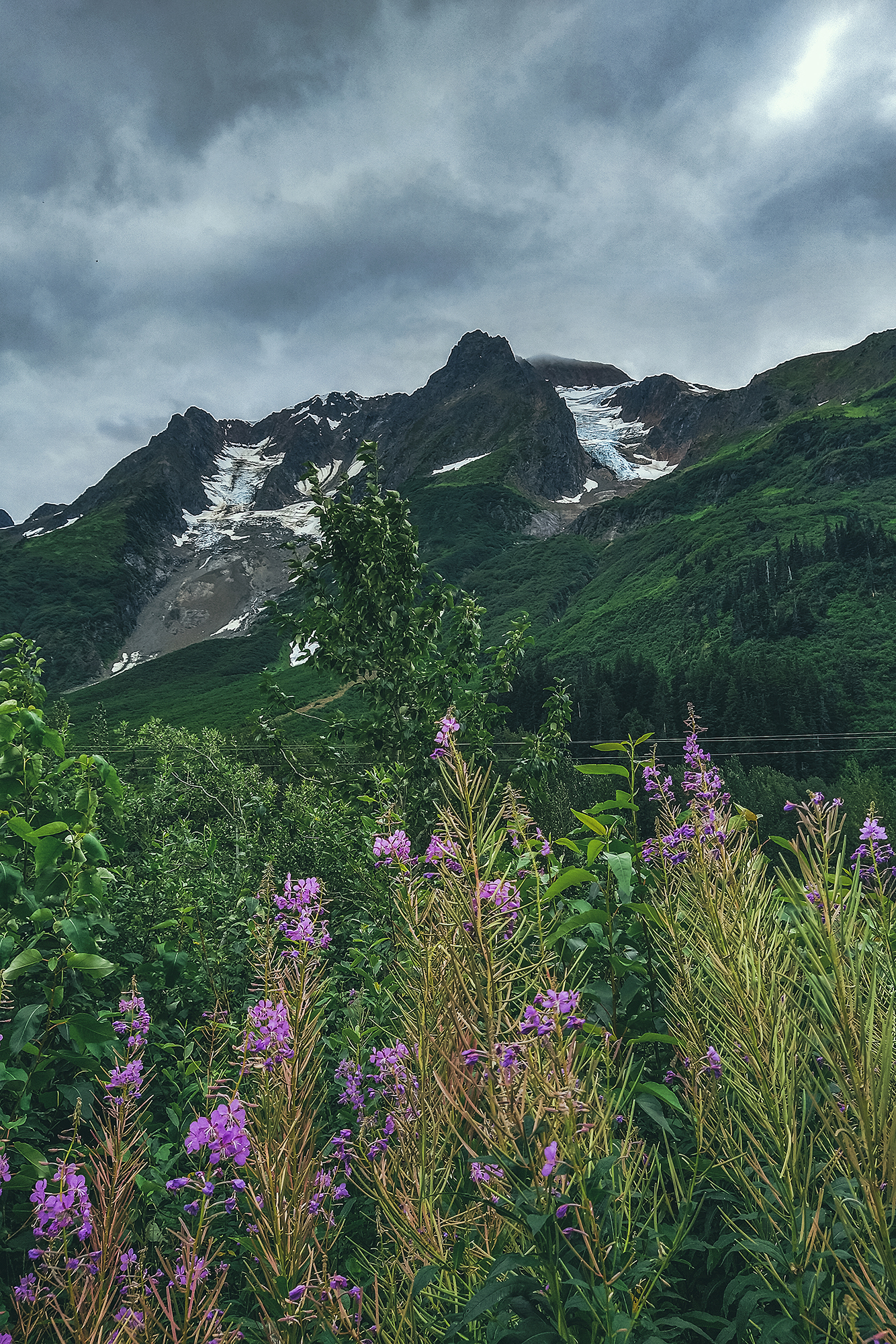
The hike follows a wide dirt path along the side of the mountain for a bit, with open views all around since the vegetation is quite low.
On route we passed two RTVs and for once I thought this could have been a better way to get up the trail.

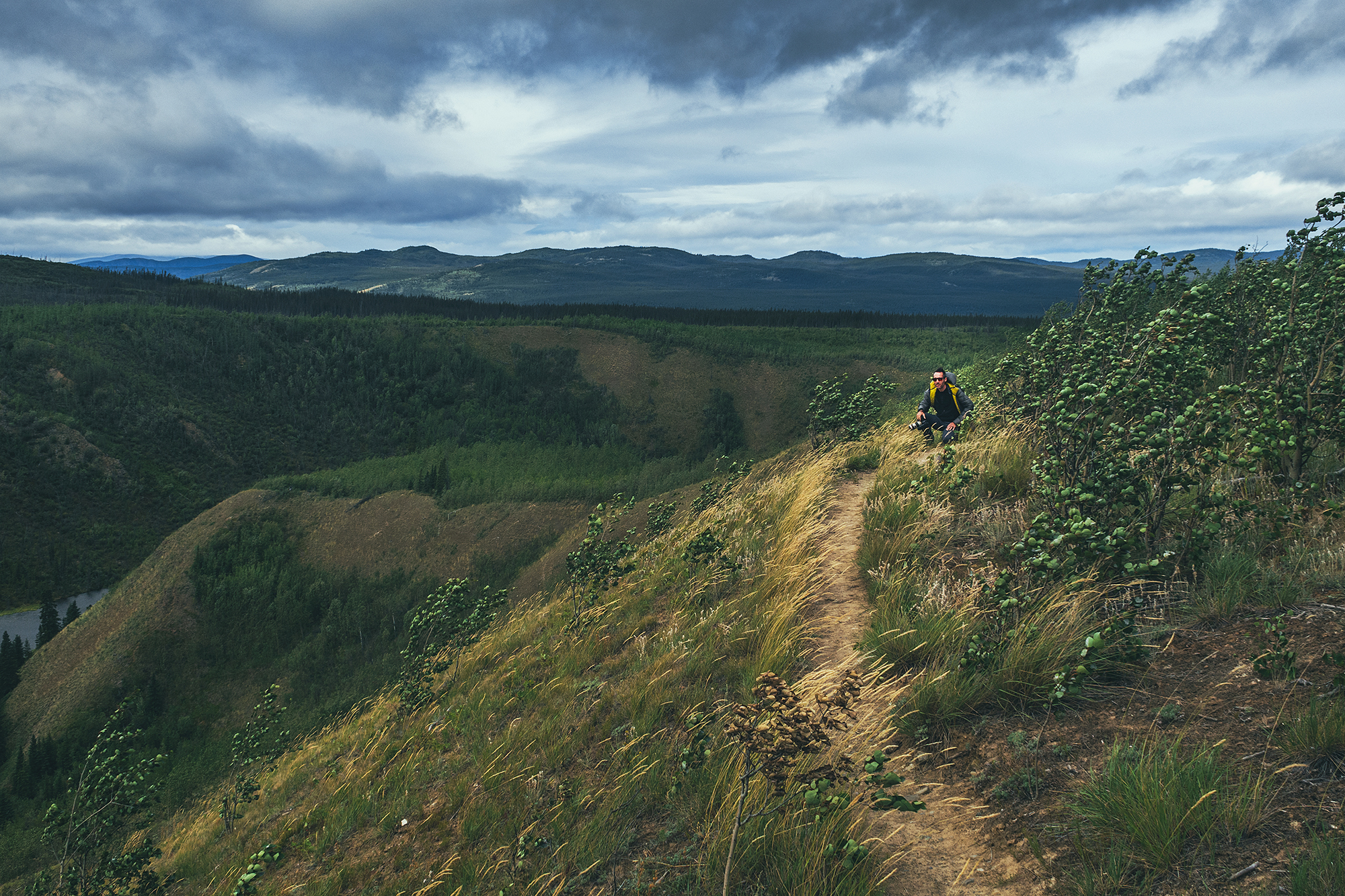
The trail is really the equivalent of a forest logging road, except in the area it would have been carved out for mining. After a few km of circumventing, we reached a split with one trail to the left going straight up to the ridge, while the other to the right seemed to go down.
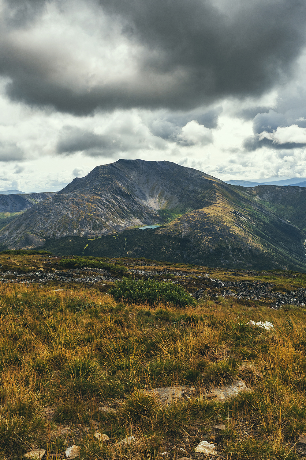
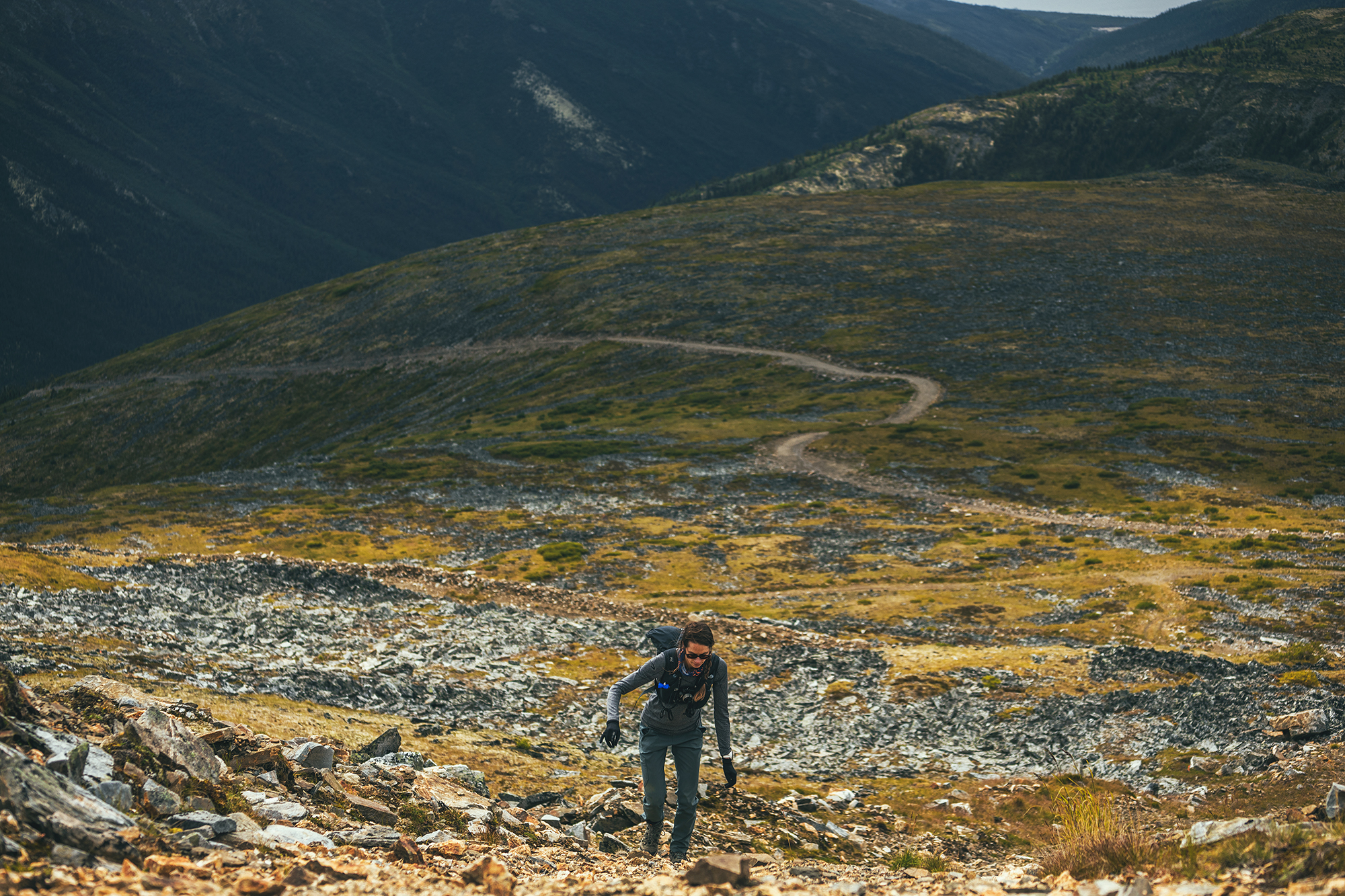
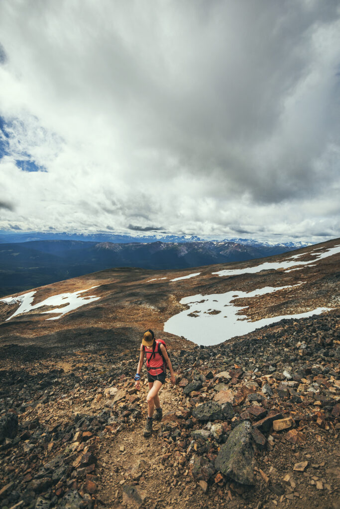
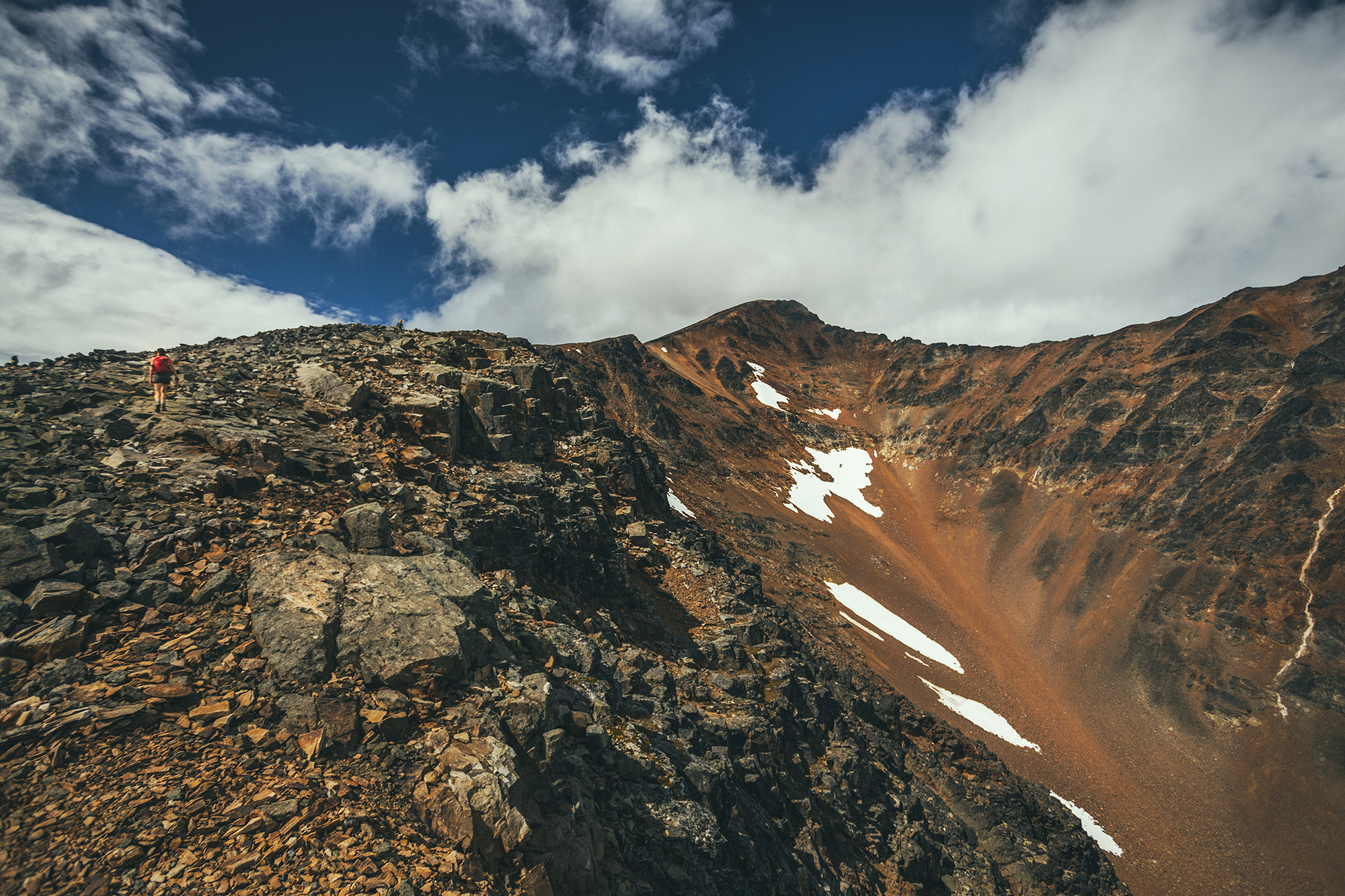
So we climbed to the left and reached the ridge for a pretty stunning view. Looking back at the Alltrails GPS later, I think we might have gone a bit further on the road and missed an earlier fork to climb to the summit, but we still got really great views.
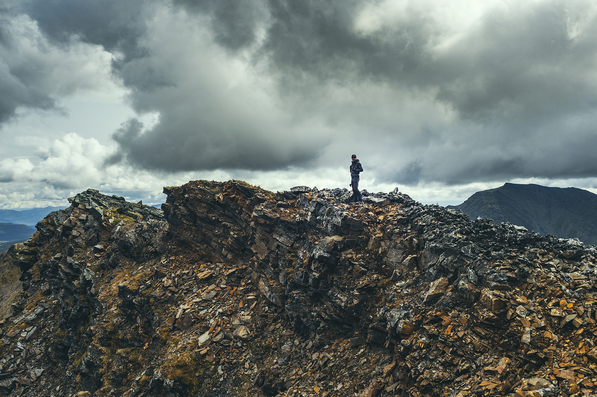
When we made our way down, we noticed an excavator next to the two RTVs seen on the way up. It was digging a trench into the side of the mountain. We stopped to ask one of the workers who was standing by the vehicles and he explained they were testing the ground for potential gold mining. The excavator was going to dig out a 100-meter trench followed by a 3m hole and they would assess the ground, to potentially come back next year to start mining.
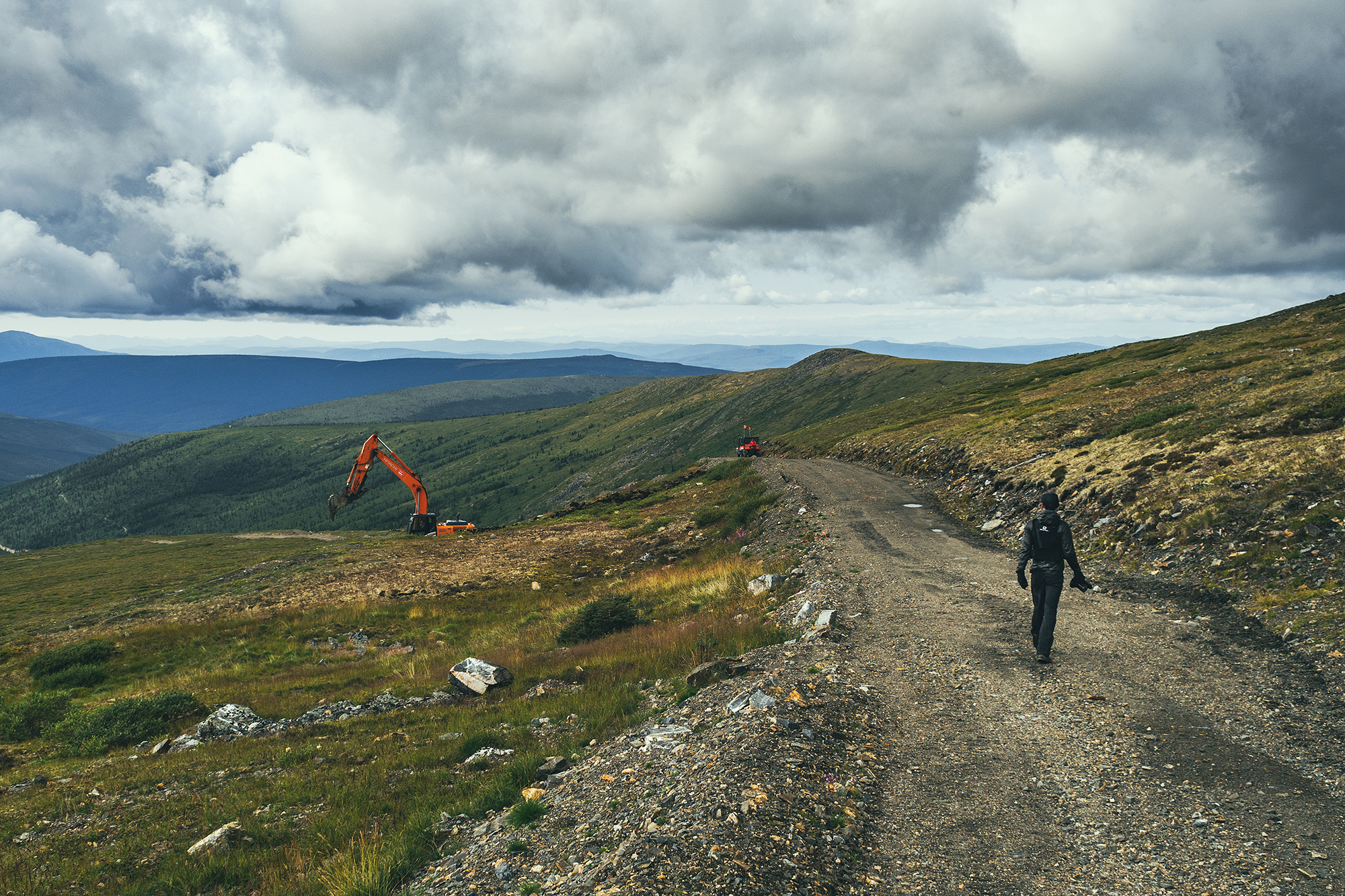
For some reason, I naively thought gold mining was a thing of the past and didn’t expect to see active digging. But it’s very much still alive, and there are apparently reality TV shows about it shot in the area. I wonder what it means for this hike and the surrounding landscape if the area becomes a mining site next year…
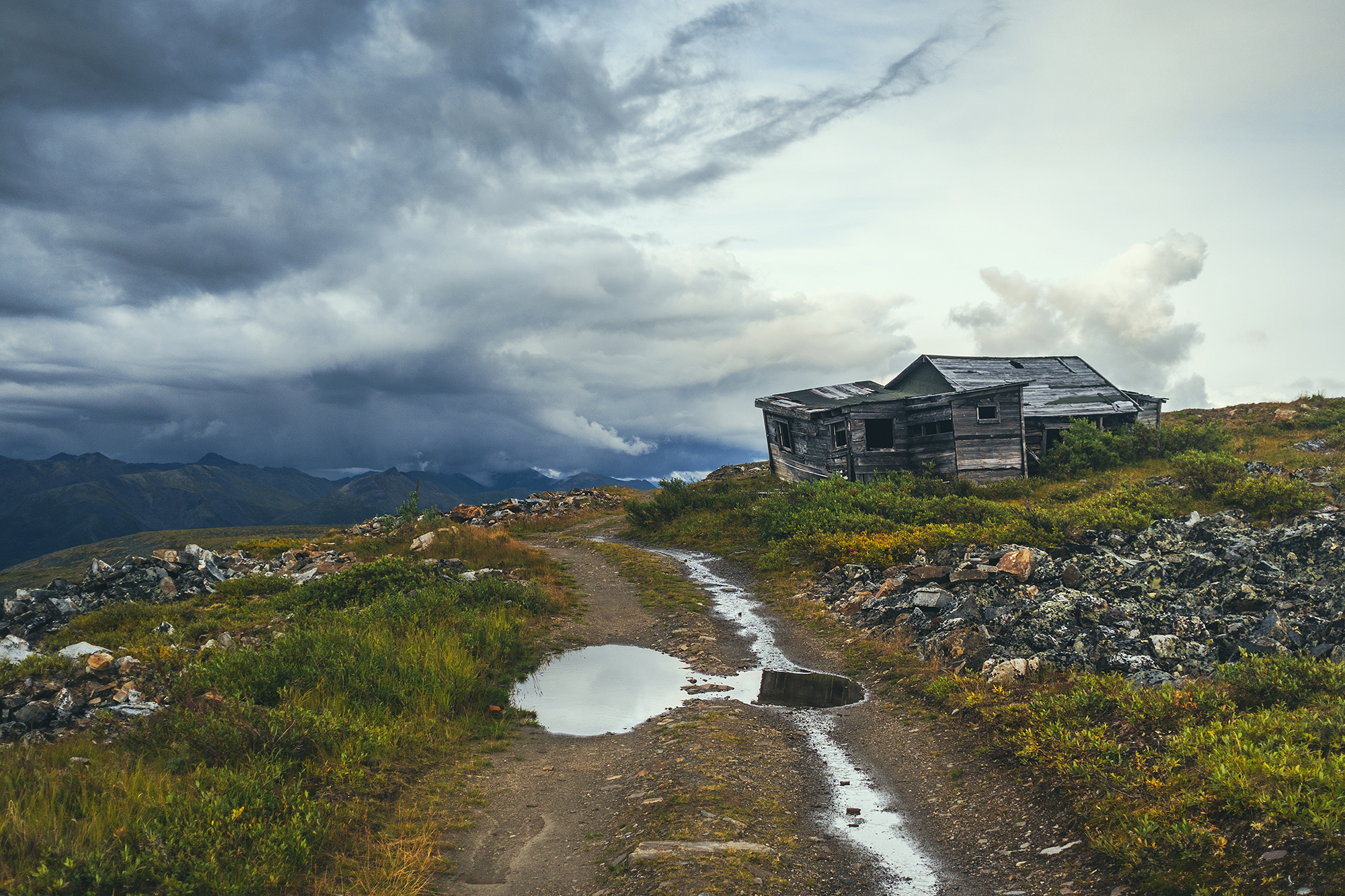
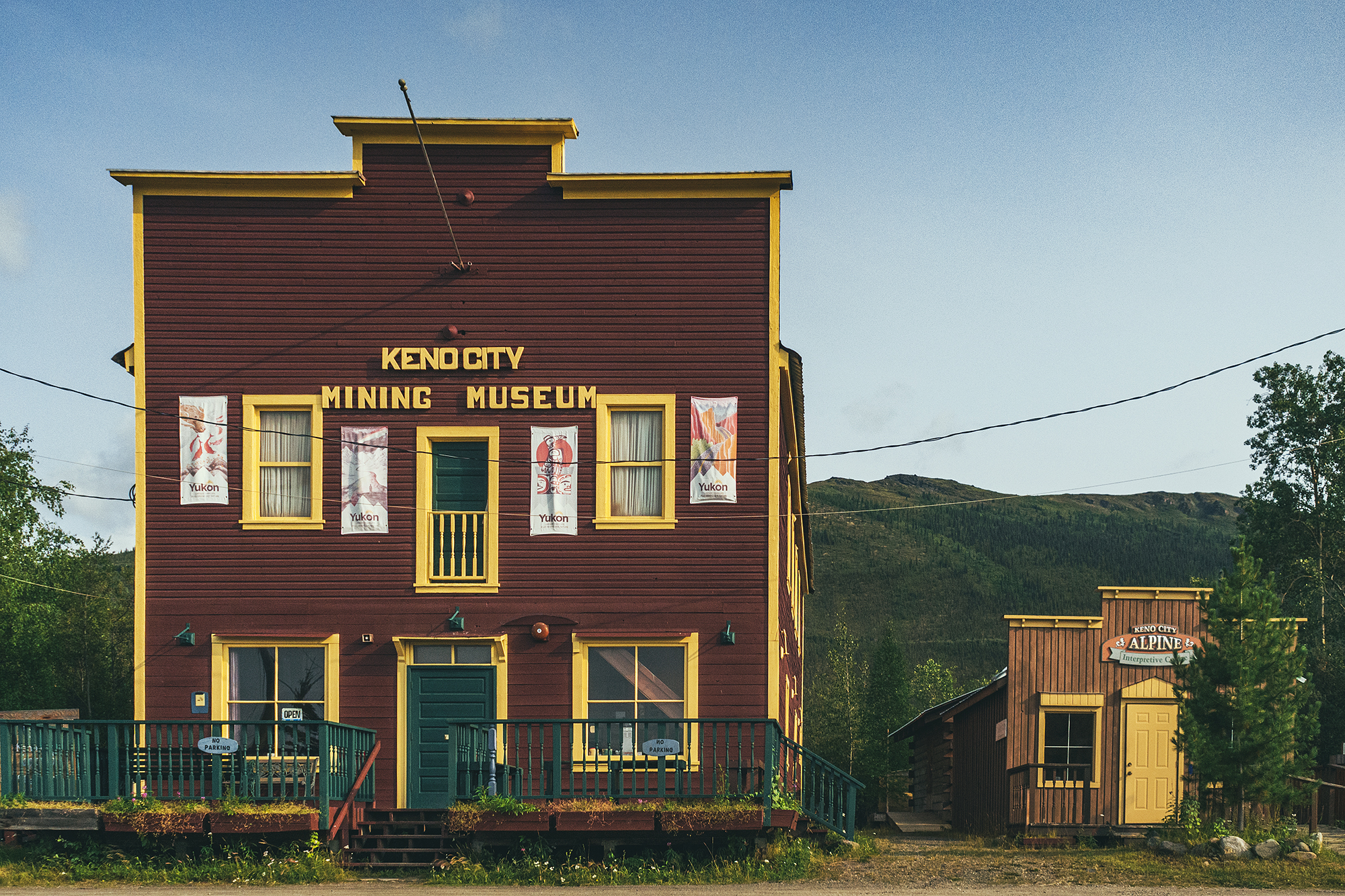
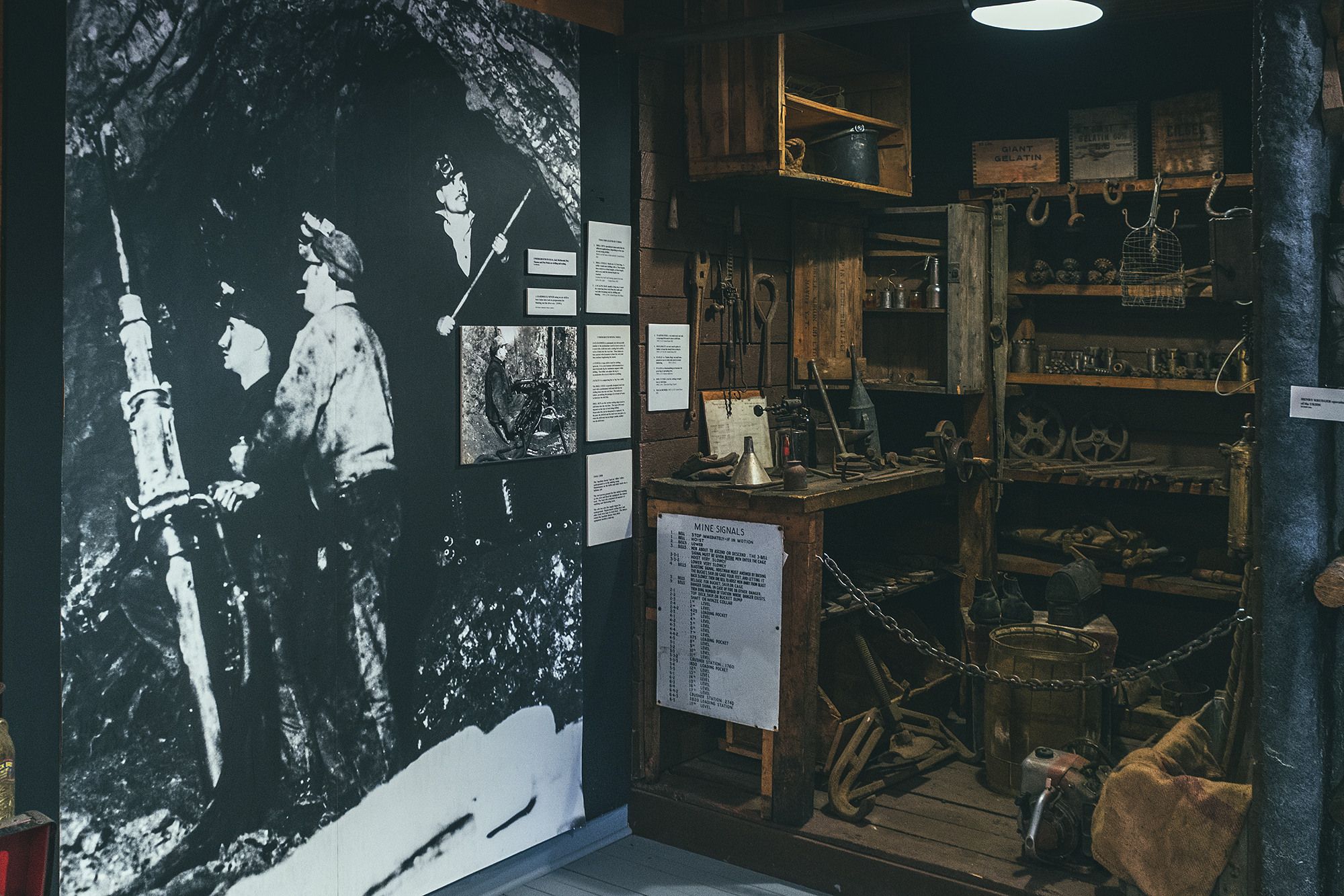
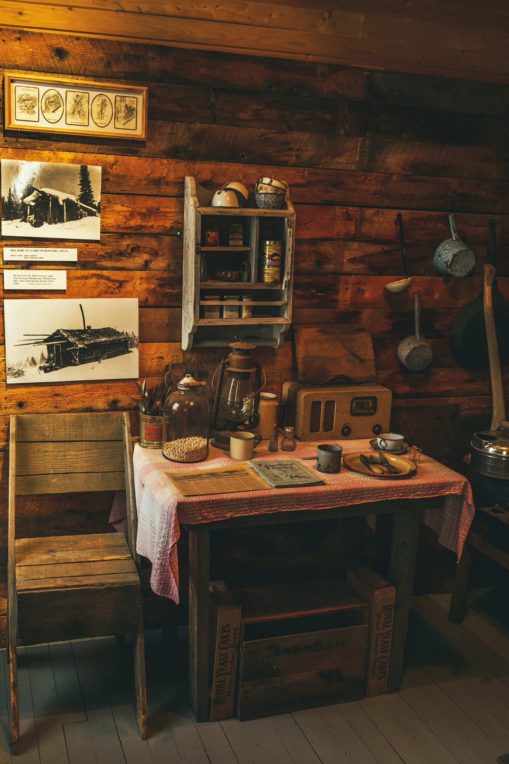
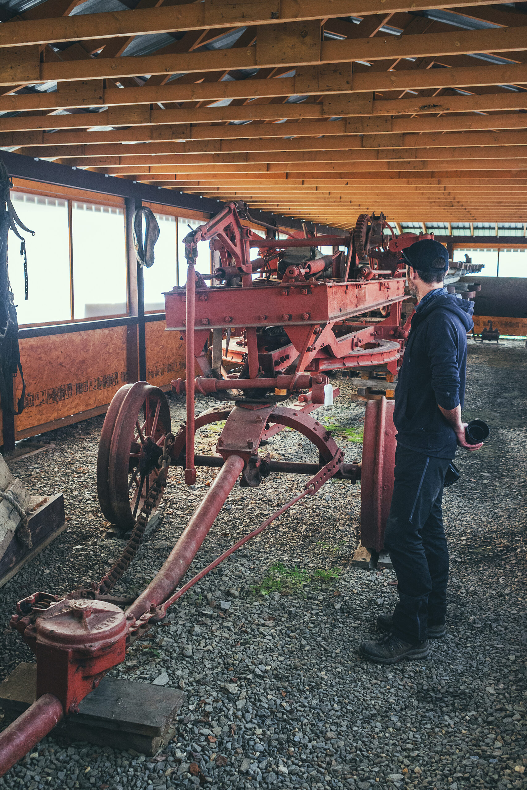
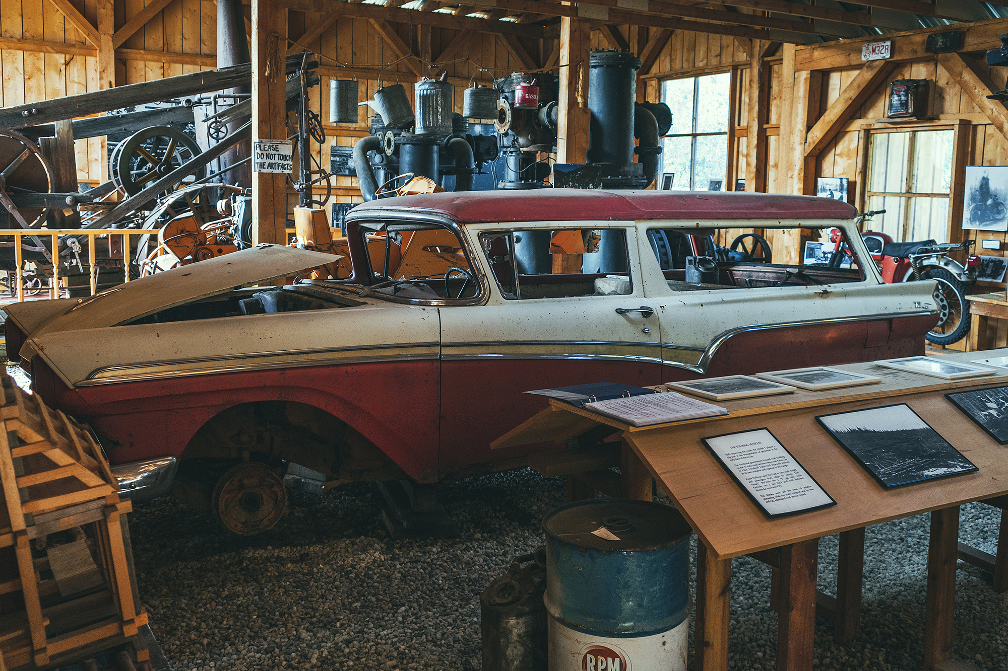
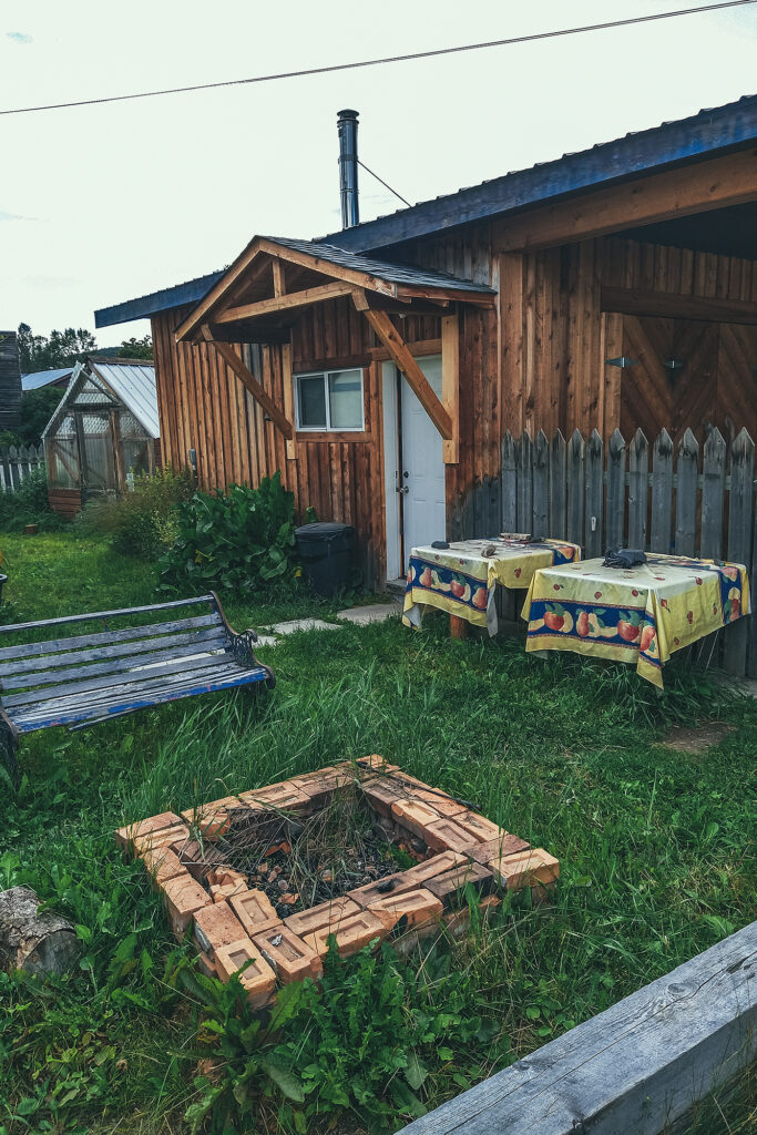
Back in town, we took a tour of the a local museum, which gives a very good overview of the beginning of mining, tools used, a bit about geology, the living conditions in the small mining community in the first half of the 20th Century.
Outside of the main building, two other large buildings housed old machines and vehicles used back in the day – examples of intricate engineering that go right over my head but still very interesting to learn about – and marvel at the technology that was developed progressively to facilitate the work.
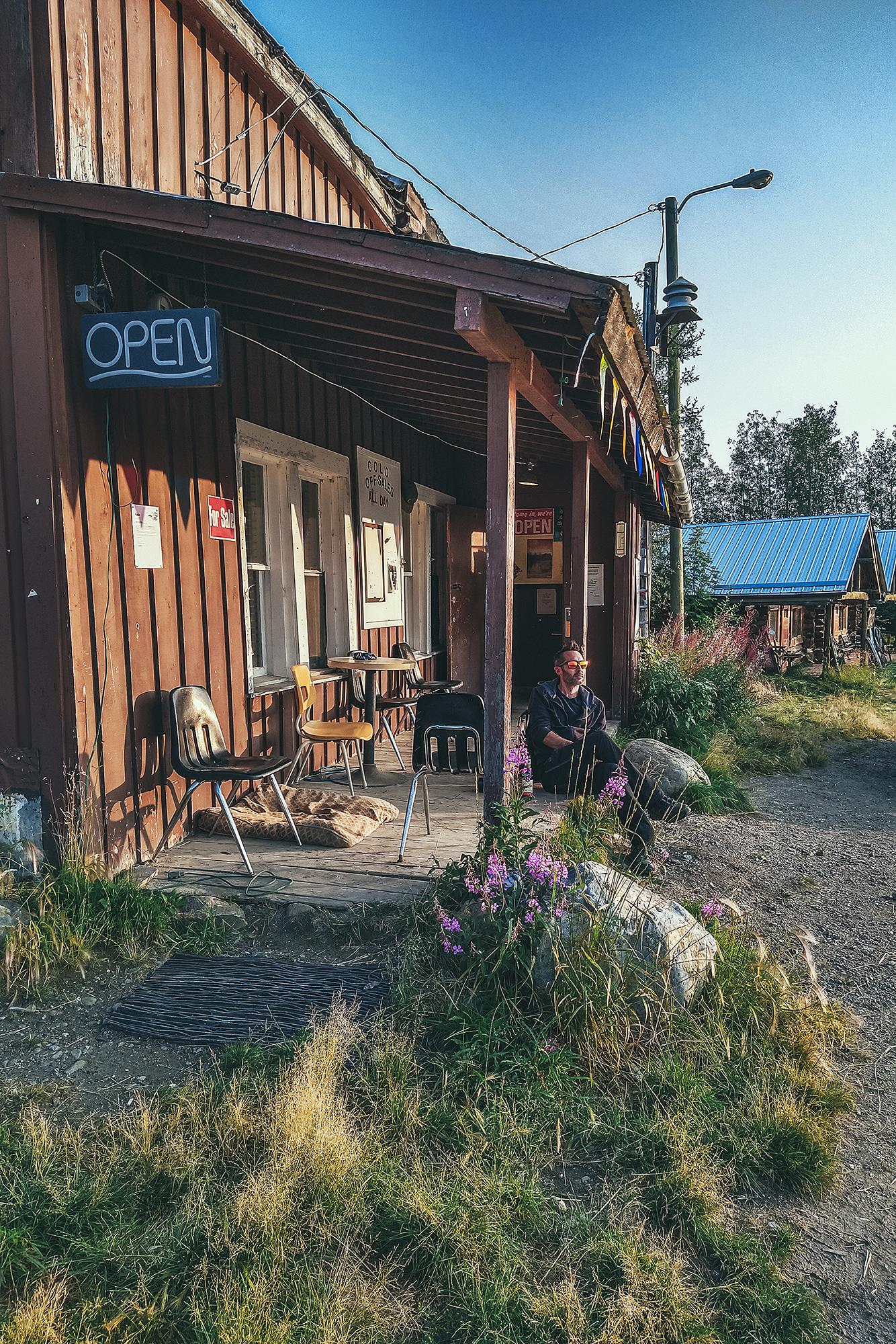
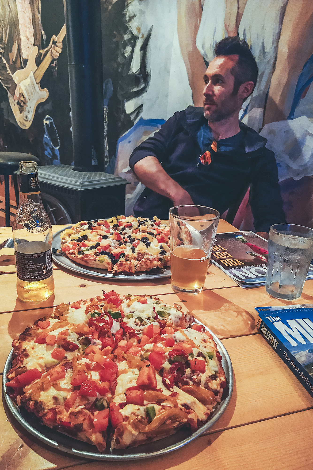
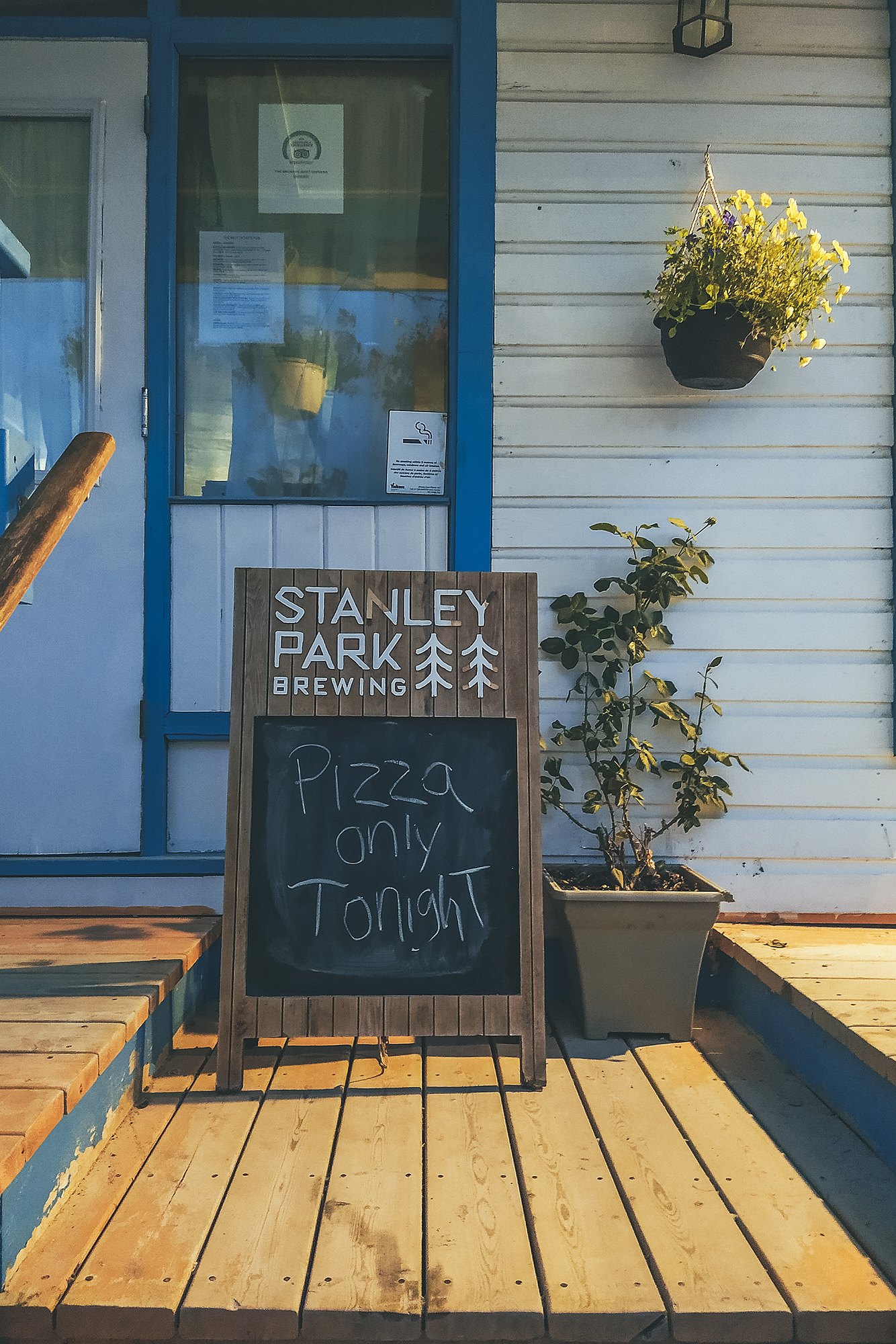
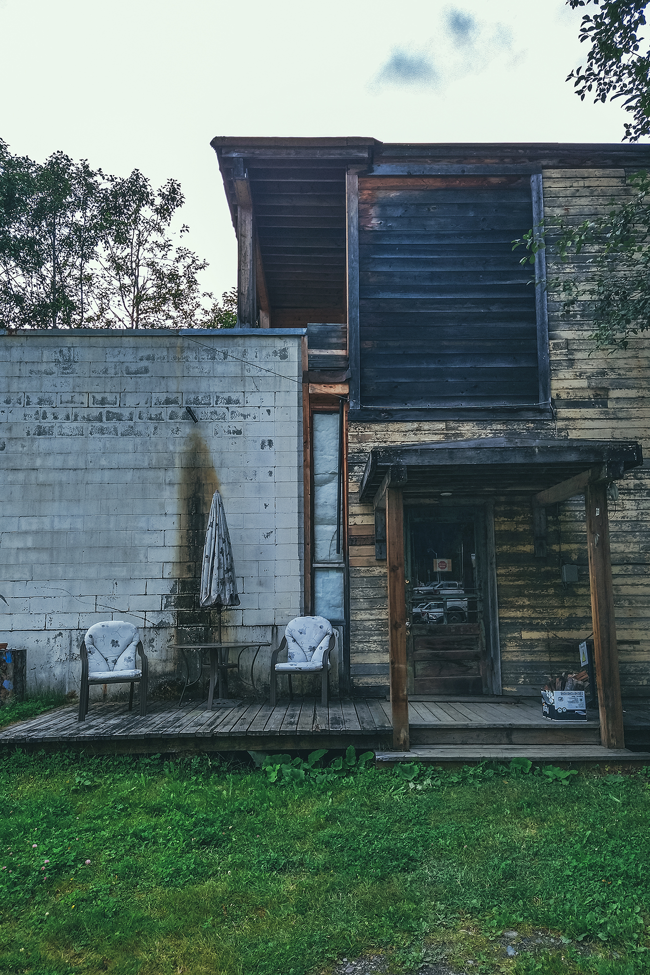
We were able to have a shower at the community facilities, for a small fee paid at the Museum front desk. We went back to camp for dinner then decided to go grab a beer at the local bar – the only commercial building still active it seems. Other services previously included The Snack bar, famous for its pizza, but it was presumably only open for take-out, and the former hotel across the street from the bar, which had burned down in Dec 2020 (and one would almost say a bit suspiciously, based on chatting with a couple of locals).
We hung out on the bar porch while listening to local patrons chat (that’s how we learned about Gold Rush and other reality TV shows going on at active mining camps nearby). Eventually we came back to the tent for a good night sleep.
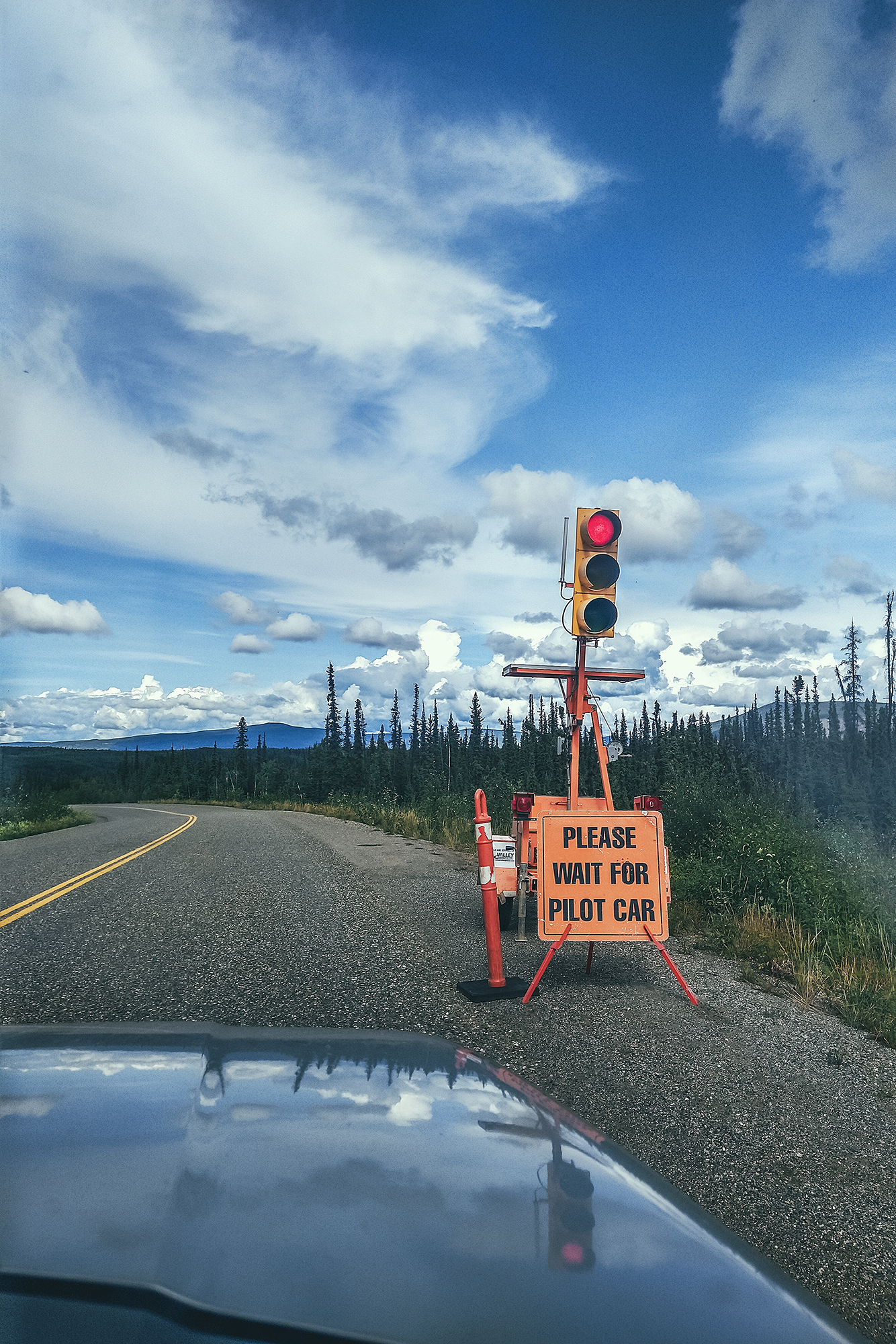
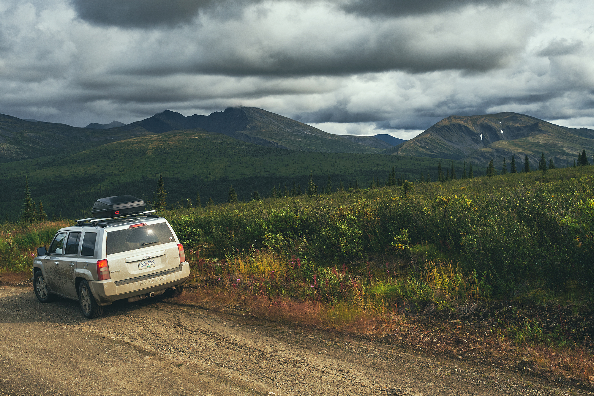
We drove a good portion of the day from Keno to Dawson city. There wasn’t too much to see on the way, and the drive was made a bit longer by all the construction zones and having to wait for pilot cars to go through them (we had at least 3). The road near Dawson changes from paved to gravel which slowed us down as well.
We arrived around 3pm and after doing some small gear purchases and doing a reset for our upcoming trek in Tombstone Territorial Park, we headed out for a dinner.
We had a very comfortable night in a cushy bed before our 6 am wake up the next day to drive to Tombstone.

In Watson lake we had our first experience of the Government campgrounds, which are peppered all over the Yukon. They only cost $12 a night, for a site with picnic table and firepit, and wood is provided for free. No amenities, but as we found out through our various stays, the outhouses were always remarkably clean and well stocked up in TP. Overall we never had a bad experience at one of those campgrounds, and we always knew more or less what to expect, as the set up was pretty consistent.
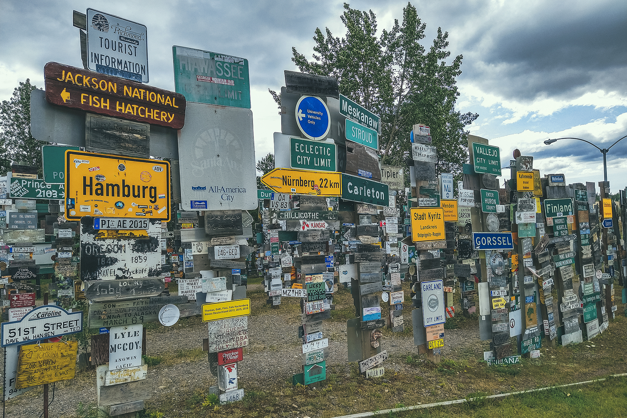
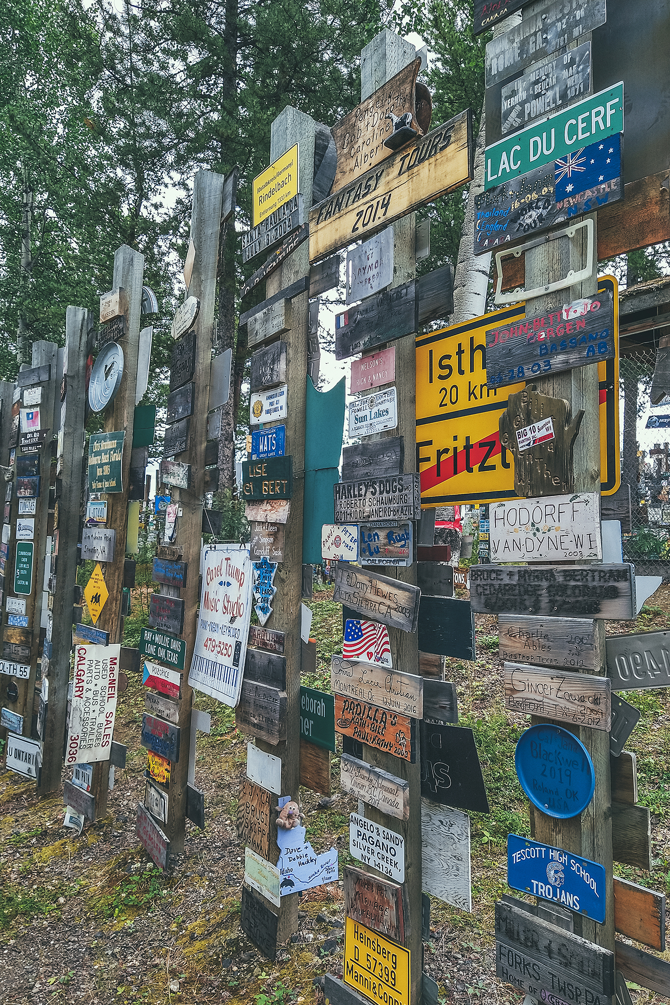
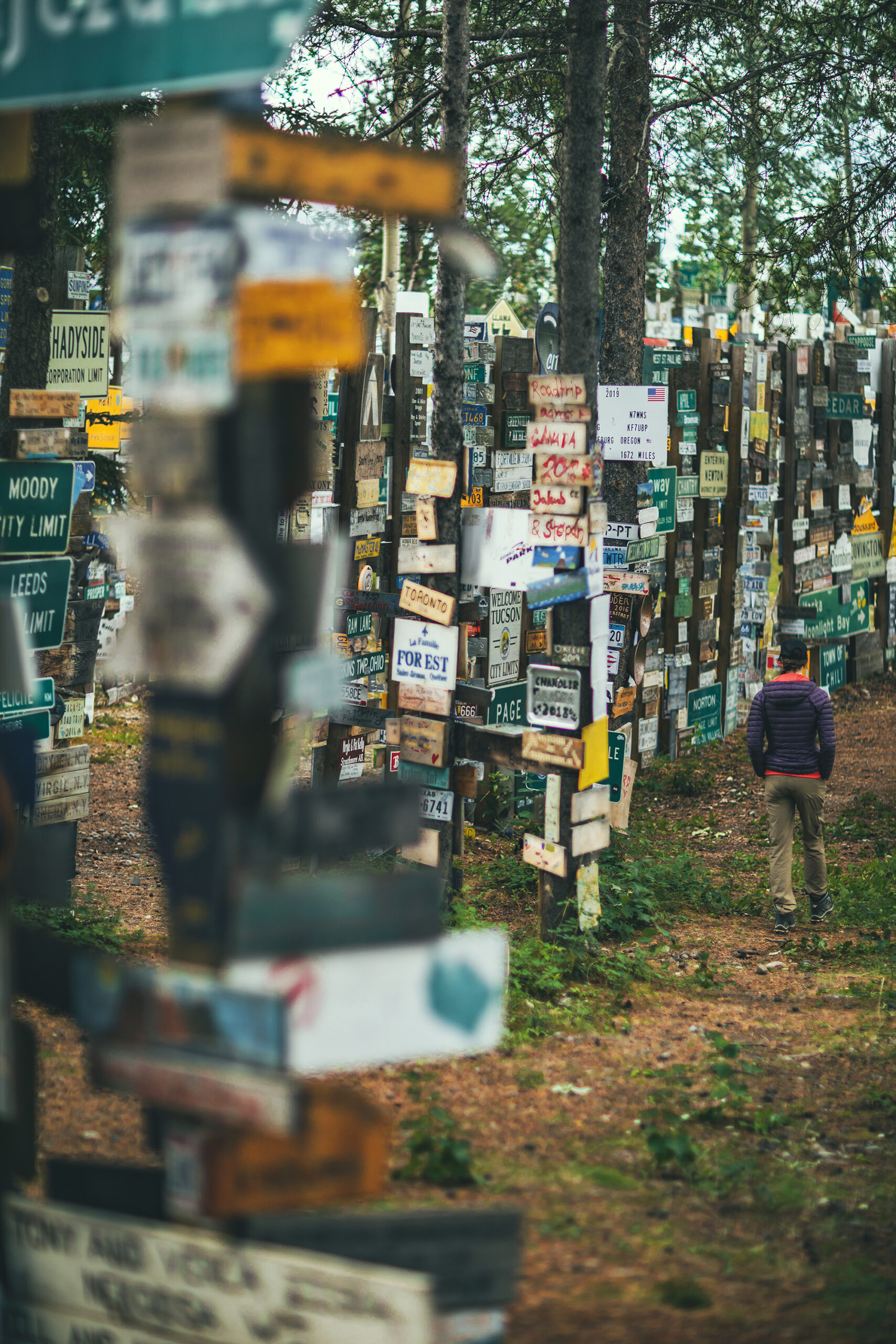
Brice made pancakes for breakfast (or tried to, they didn’t quite turn out how he normally does them). Then we left our camp. We stopped at the Sign Post Forest, which displays signs (or license plates) made by people who visited.
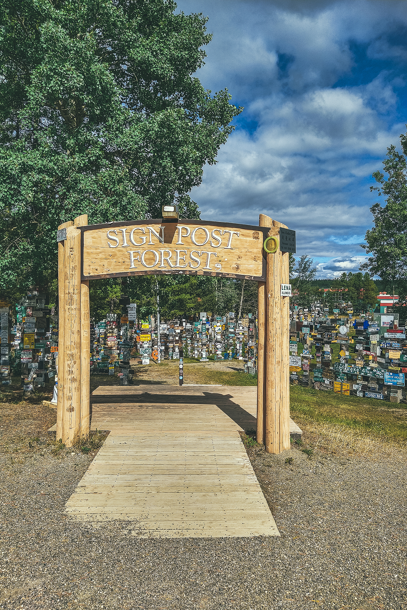
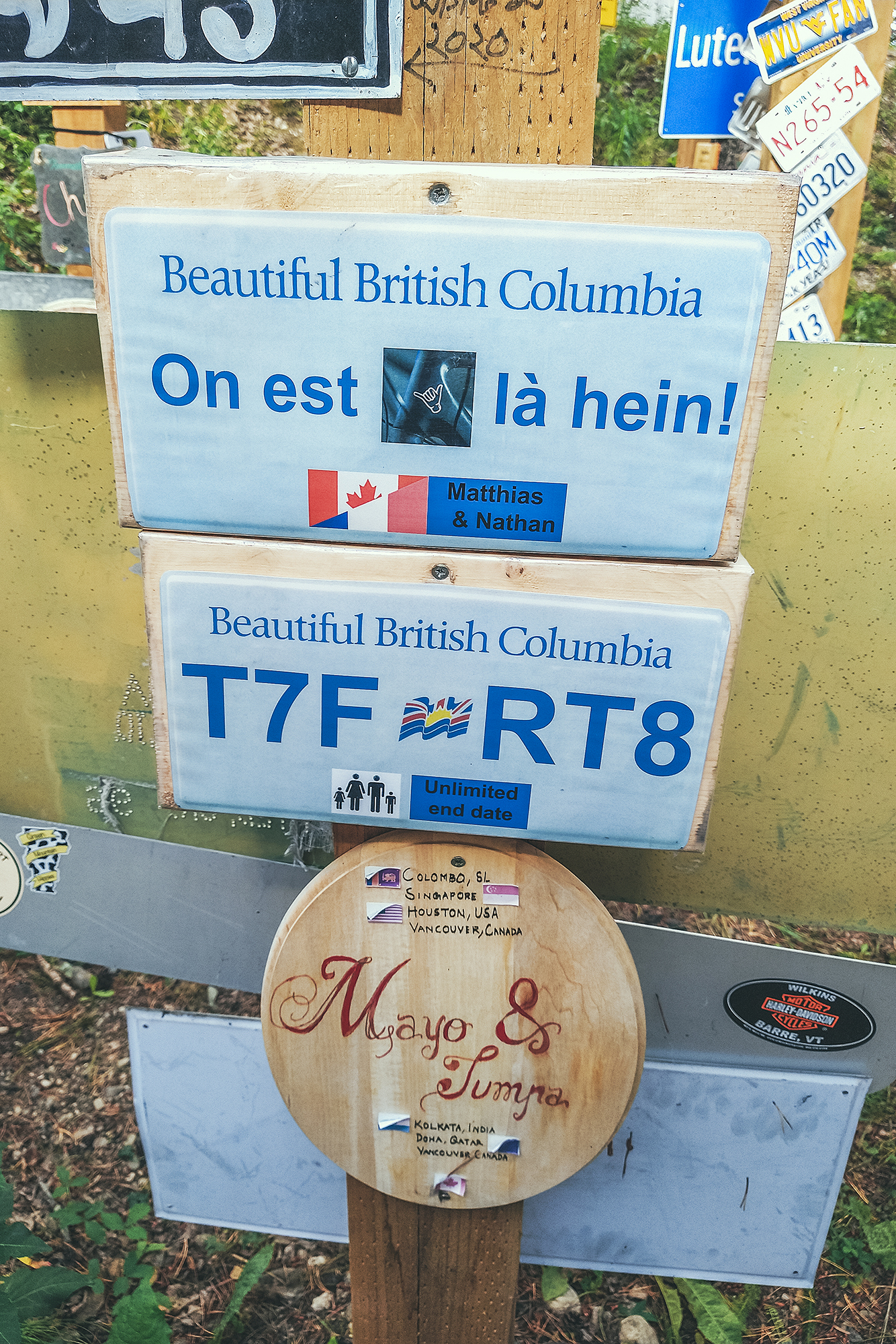
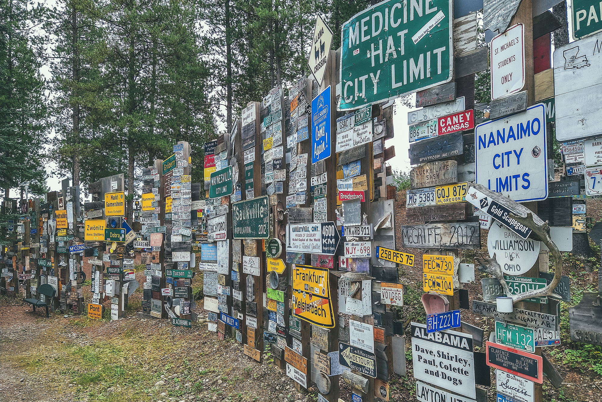
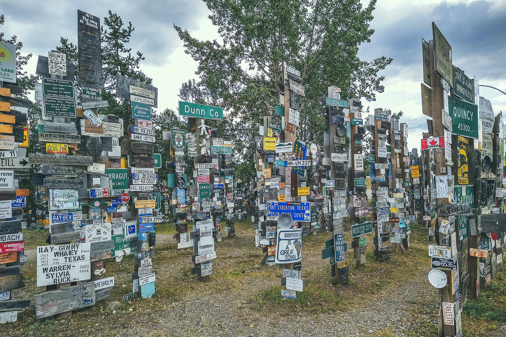
It was started in the 1940’s by a GI who was feeling homesick and was trying to make something that reminded him of home. It evidently became a thing that people do when coming through the town. Apparently there are now over 80 000 signs! I guess it’s the local equivalent of the bridge of locks in Paris – except there’s no danger of the forest of posts collapsing under the weight of the signs…it seems it could still expend for a bit.
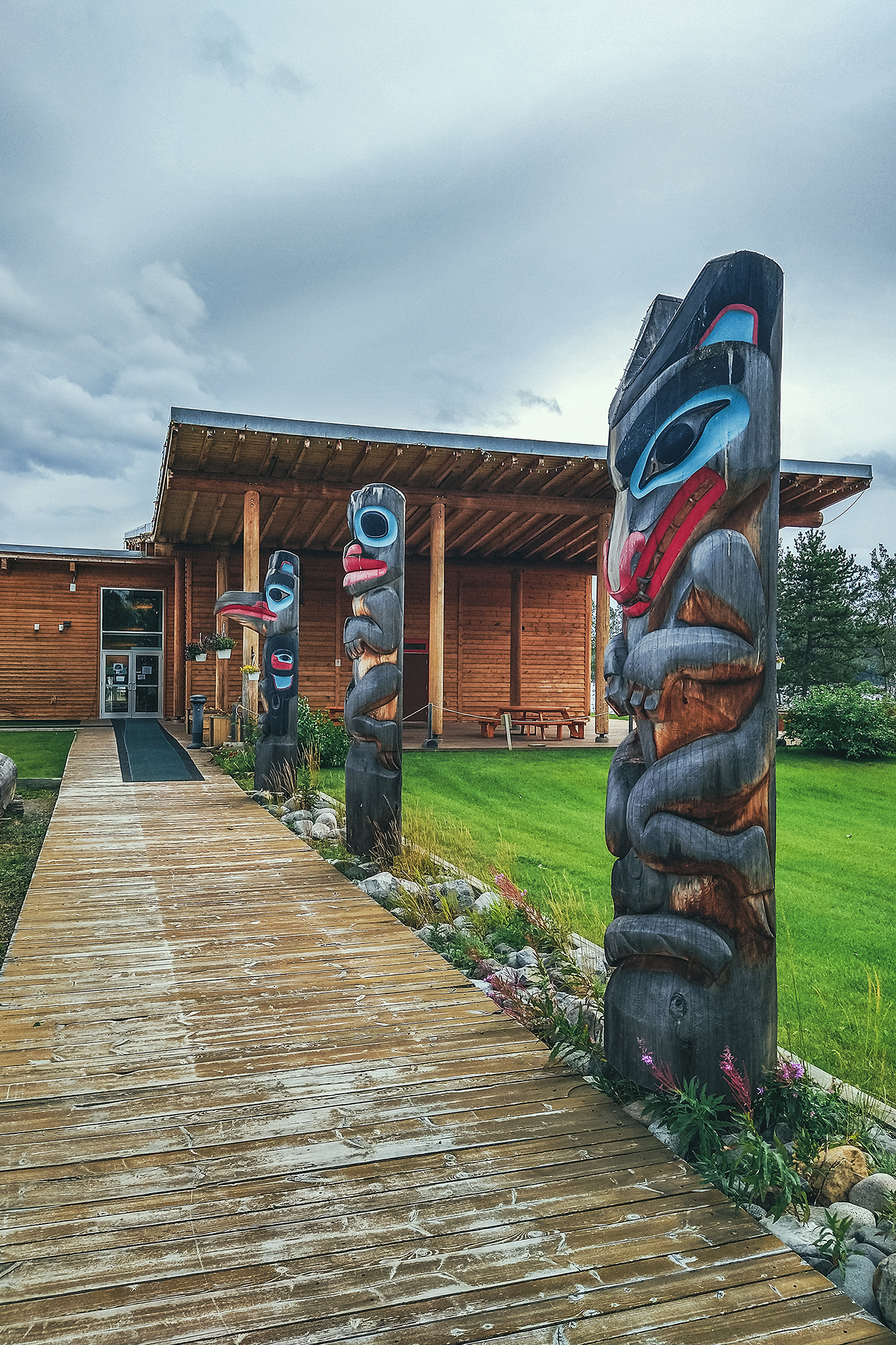
We then headed off and spent a few hours driving, making only one stop in Teslin (about halfway between Watson Lake and Whitehorse). We visited the Teslin Tlingit Heritage Center, which has a small display of Tlingit artefacts – small but impressive, with beautiful beaded garments and carved masks by local artists.
We watched a 15 min documentary about the celebrations the Tlingit people organize when their relatives from Juneau, AK come to visit.
The Tlingit people originated from Coastal Southern Alaska, but some migrated inland for fur trading, and as craftsmanship evolved they were able to spend more time in the cold interior winter, eventually settling away from the coast. The descendant of the migrants refer to themselves as the Inland Tlingit, but still have a very strong bond to their coastal cousins, which they celebrate with regular potlatches.
For a period of time though, these gatherings were restricted by the ban on potlatches, which was in place between the mid 1880’s and the 1950’s both in Canada and the US.
The celebrations take place in and around the heritage Center, which also serves as a meeting place. Normally open to visitors, they haven’t been in the recent 1.5 years due to Covid.
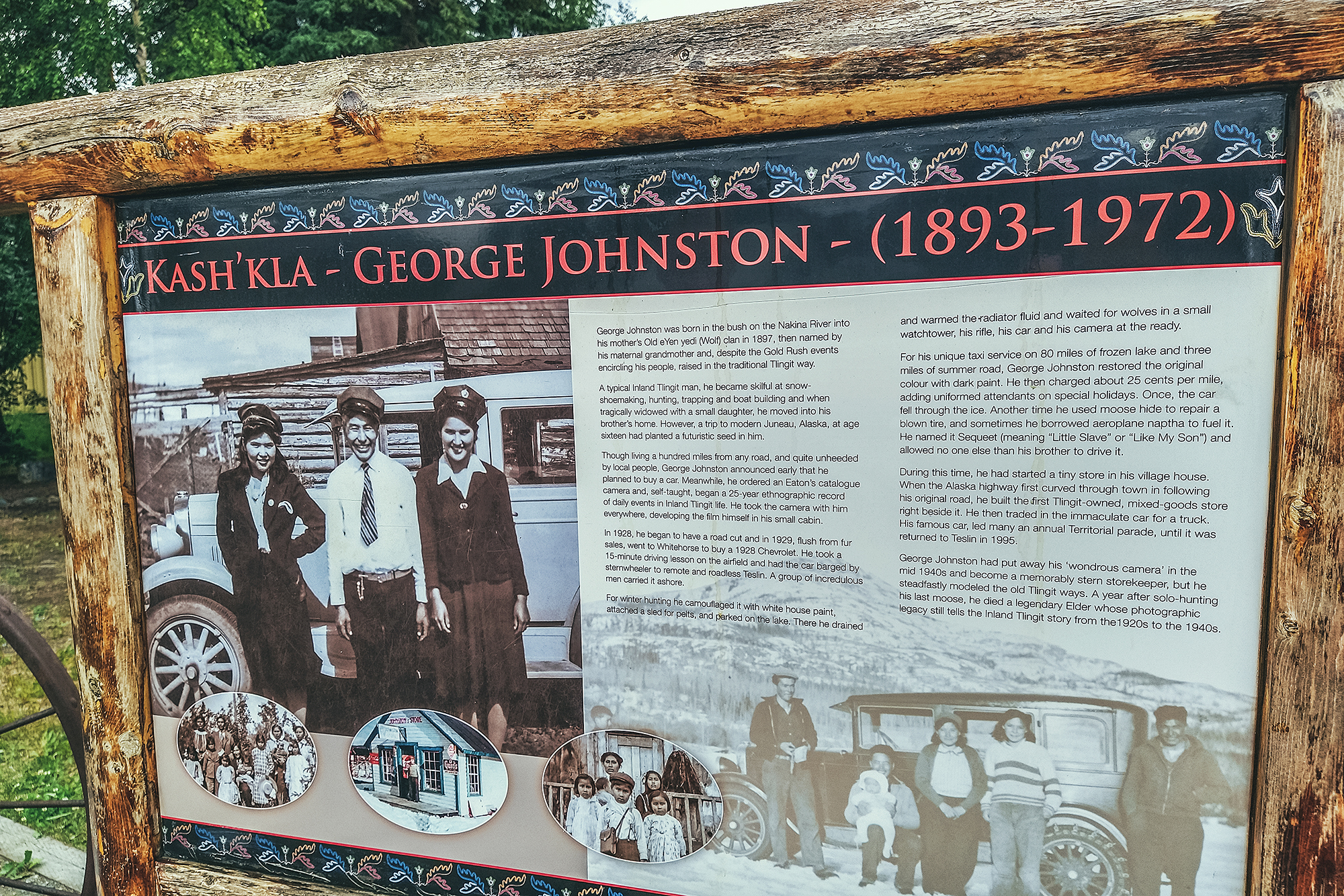
We also stopped by the George Johnston museum, but it was closed that day so we made a note to try and stop again when we drive back a few weeks later.
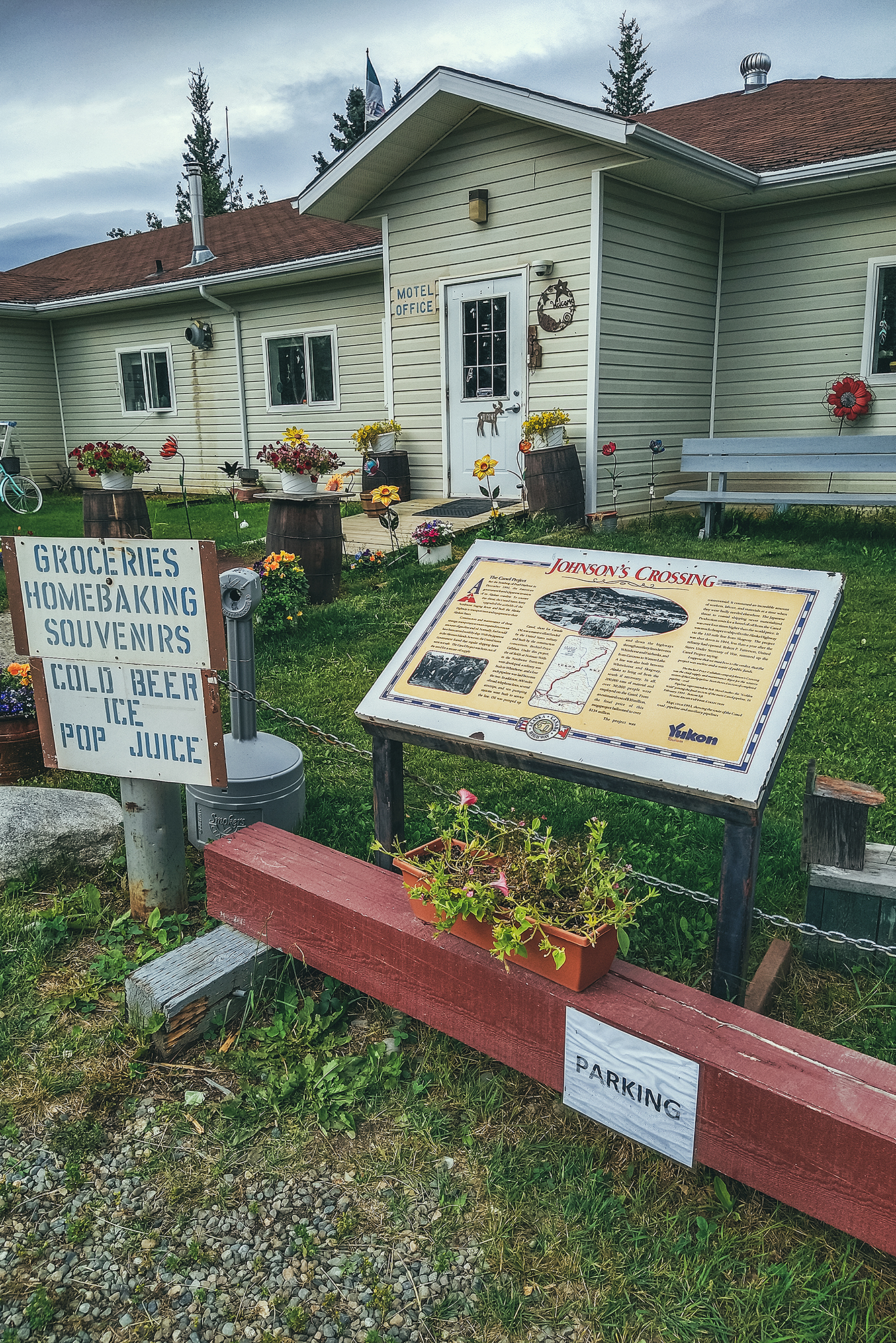
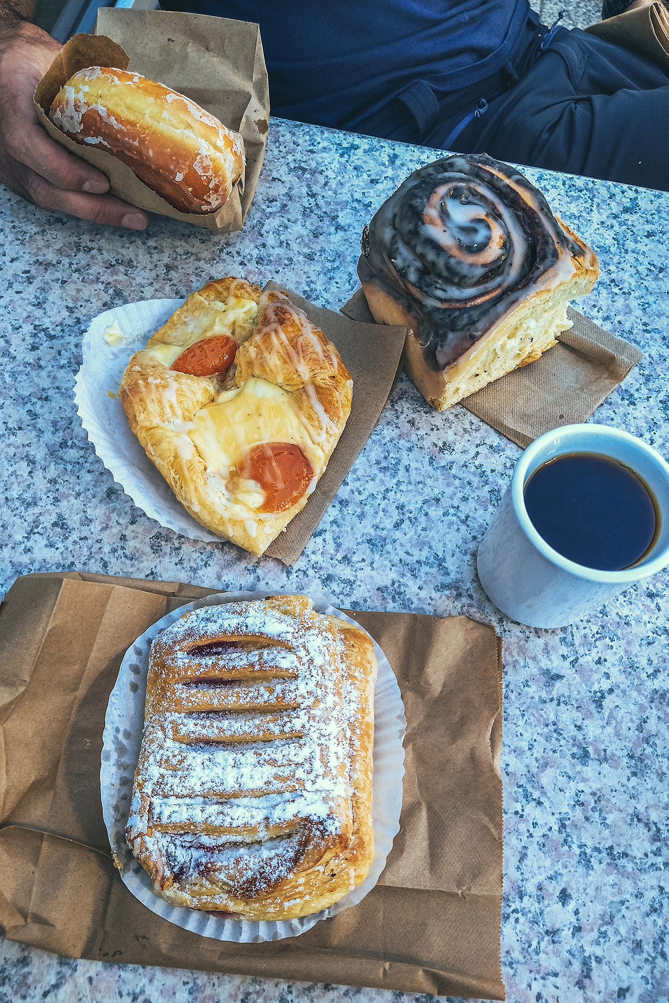
Our next stop was in Johnson’s crossing, after Brice spotted a bakery sign on the side of the road, and we had a couple of pastries for afternoon snack.

Eventually we arrived in Whitehorse and this will come as no surprise to anyone who knows Brice, our very first stop was at a Car-wash to rinse off all the dirt and mud collected along the way.
We had booked another Airbnb for that night. This time we had found a private Bed + Bath in a private house. The set-up was clean and comfortable, but the hosts were not super welcoming, barely saying hi when we got in. Mind you, the previous hosts in Old Hazelton hadn’t been super warm either, so it’s likely Covid had something to do with it. We hadn’t been in an Airbnb since before the pandemic, and our last experience before that was a 10-day stay in a private room in Austin, Tx, where we got to meet and interact with our hosts on a daily basis. But of course the pandemic would have had a huge impact on how much interaction hosts are trying to have (or not to have) with their guests.
We put our stuff down and headed out for dinner, taking advantage of being in a city to go to a proper restaurant. It was almost a bit strange to be sleeping inside a house, after all the camping, but still nice to be able to shower and sleep under a roof, and not have to set up and take down camp.
As we arrived in Whitehorse, I was checking the forecast, and it looked like a lot of rainy days ahead in the Kluane area, which is where we had planned on heading to next. I didn’t really feel like hiking in the rain and missing out on scenery covered in clouds, so we decided to head out to Dawson City early. But instead of driving there in one day, we would take the long way up and spend 3 days doing side trips to Faro & Keno, places that weren’t originally on the itinerary. In turn, we would go to Kluane after coming back from Dawson City, hoping that we would have better luck with the weather then. It also meant trading the Carcross Tagish/Aitlin loop we had also intended later on for this plan but so it goes. At least we had enough buffer time on this trip to be able to make these adjustments, as we didn’t have a set return date in Vancouver. And as we’ve learned on other trips, it’s always good to have a set itinerary, but be prepared to adjust it on the fly.
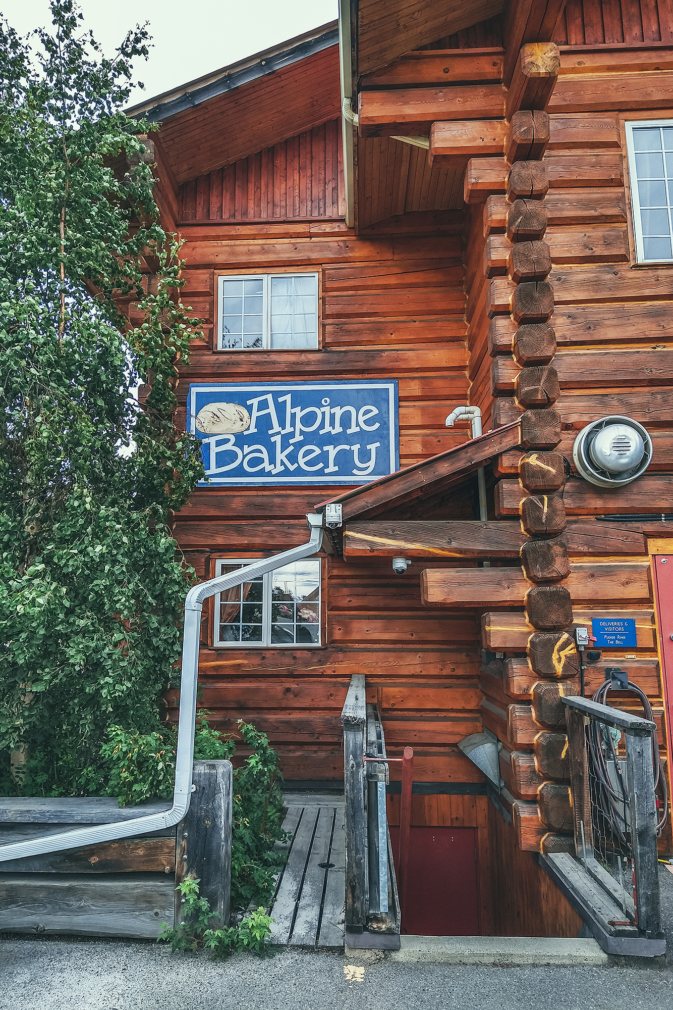
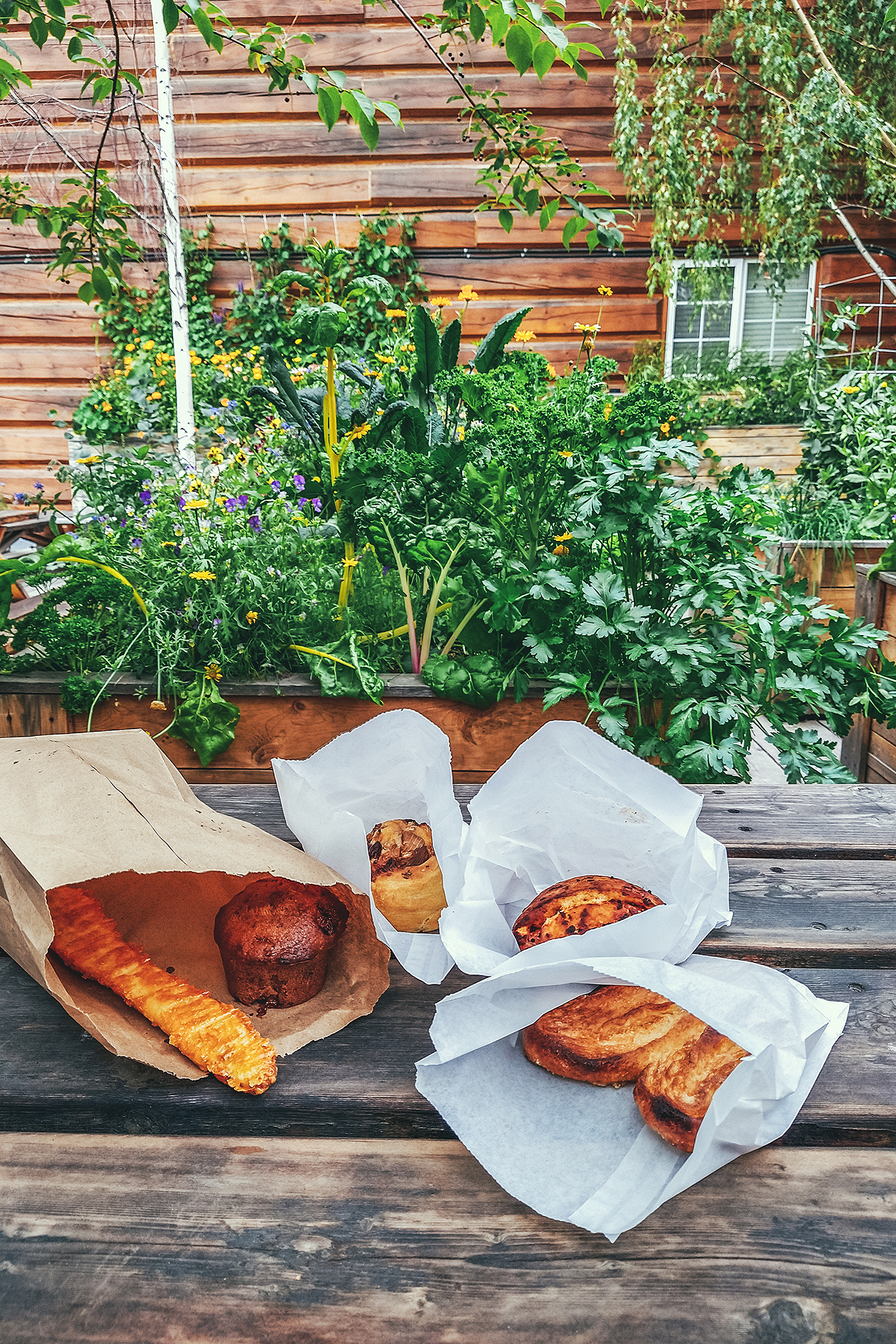
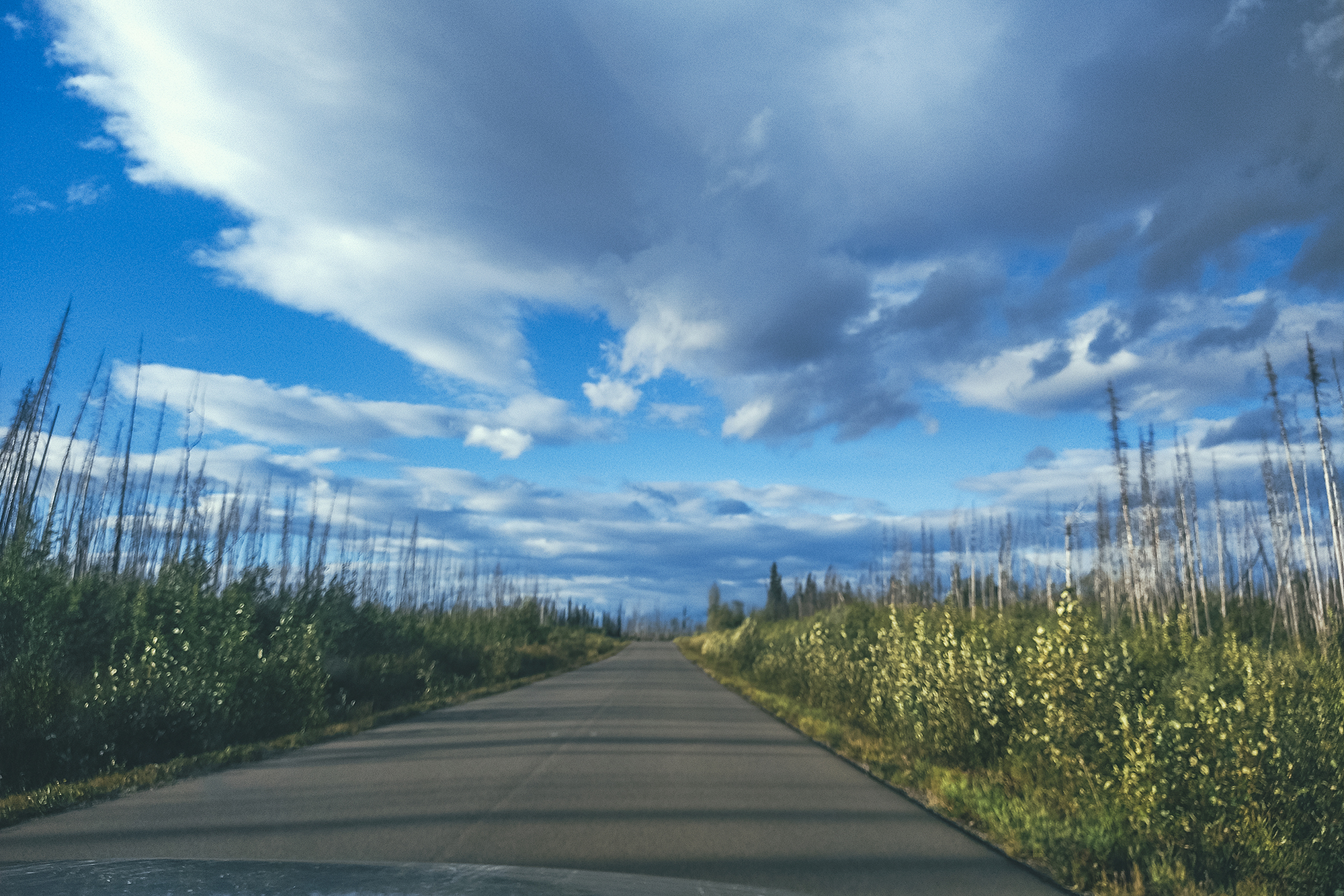
In the morning, we took advantage of the city to take care of a few errands, such as getting more cash for the campgrounds, and restocking on groceries. Then we stopped at Alpine Bakery on the way out, to enjoy a couple of sweet pastries in their cute garden patio, and grab some savory treats for lunch later. Then we got on the road, headed North on the Klondike Highway.
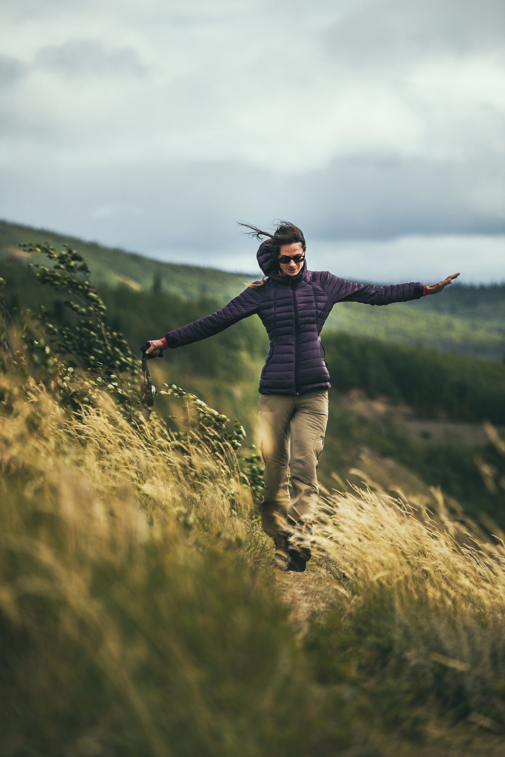
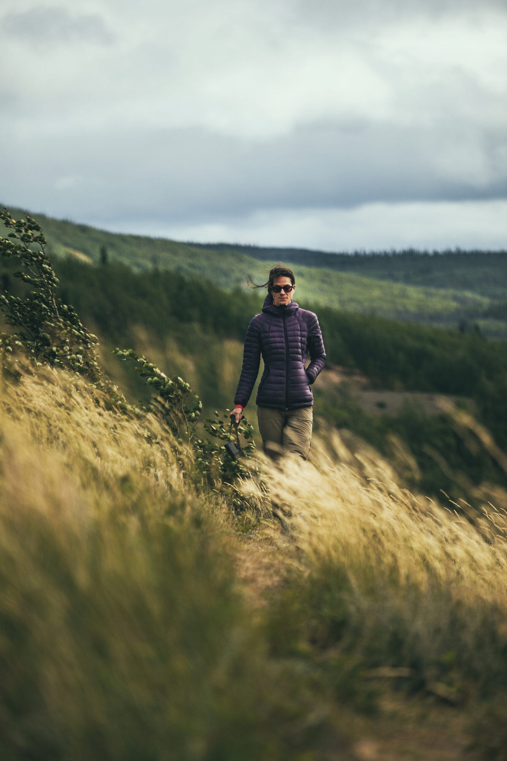
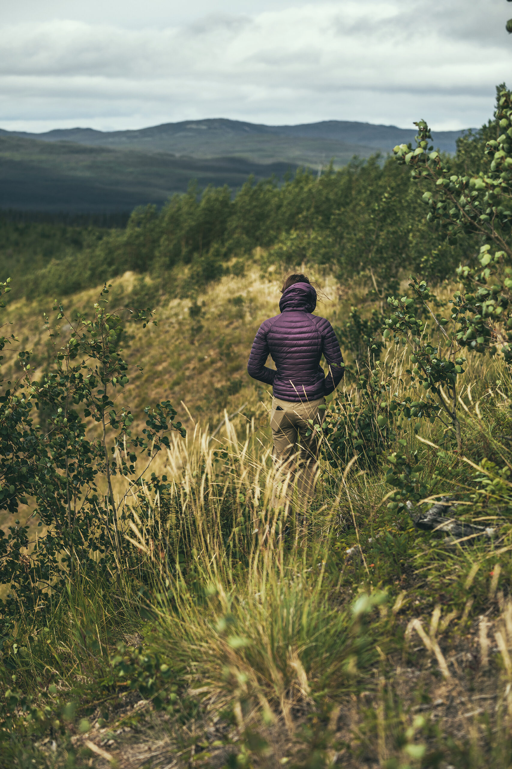
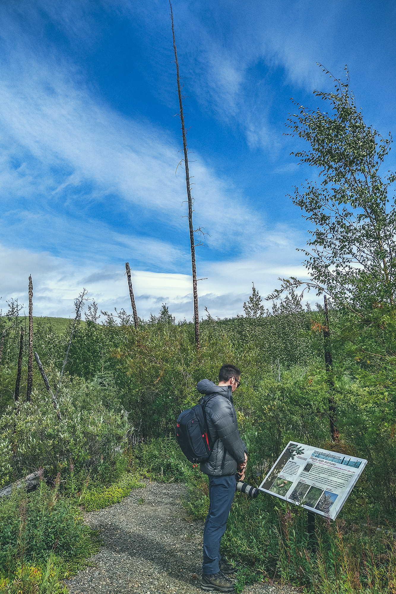
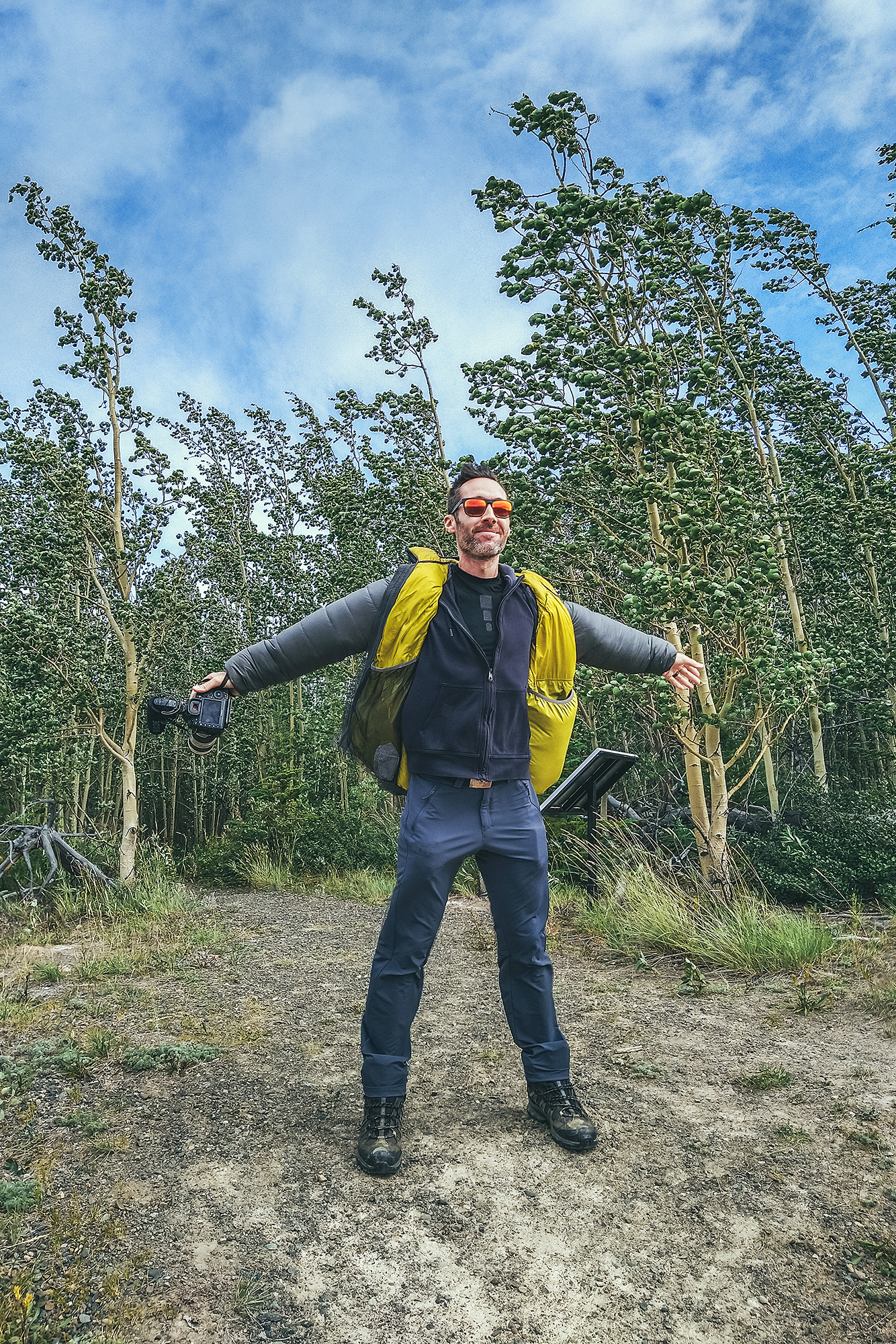
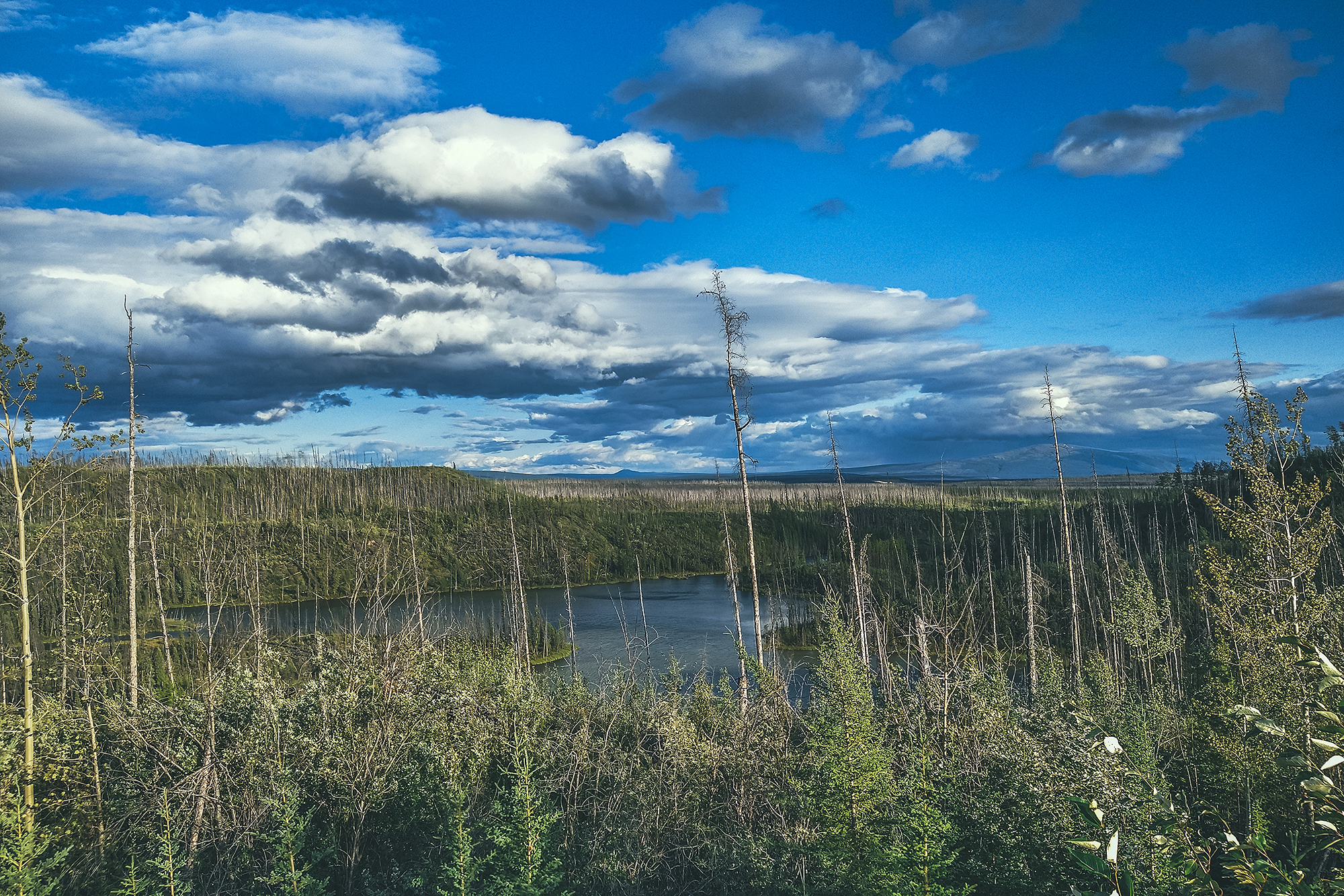
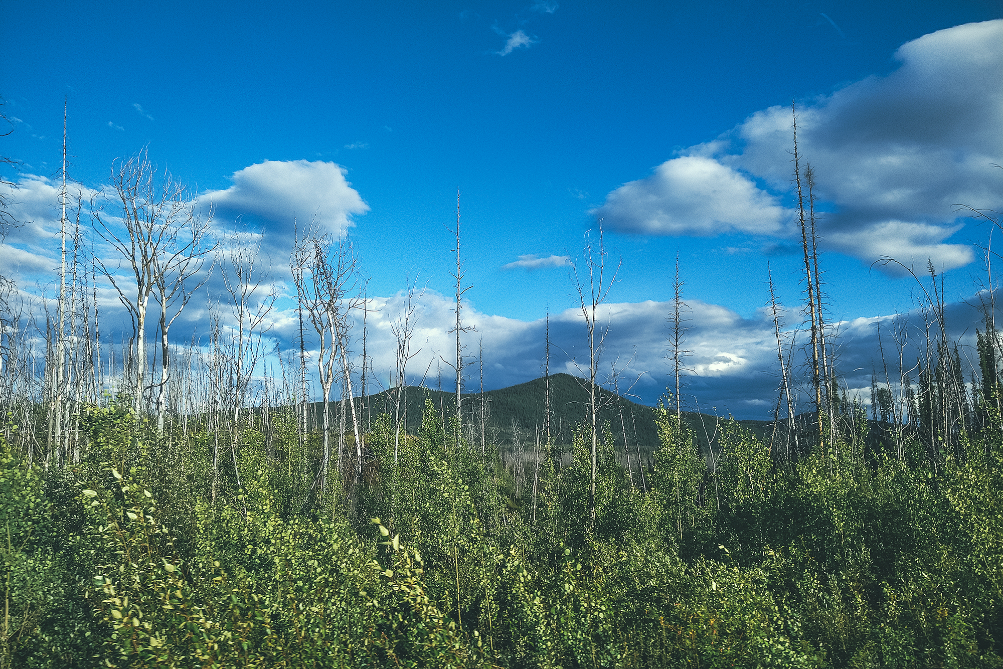
We made our first stop at the Fox lake Burn rest area, and walked down the short interpretive trail that leads to a ridge and provides information on forest fires. It described their impact on the ecosystem and how they can be beneficial in the natural cycle of things, allowing new plant and animal species to repopulate an area after a fire. A lot of the naturally caused fires (usually lightening) happen in more remote areas, and they are often monitored but not intervened on. Man-caused fires on the other hand tend to happen closer to populated area and of course cause bigger problems, as they impact human infrastructures and lives. And global warming is making it easier for fires to spread, with vegetation being a lot drier and the lack of rain to control them.
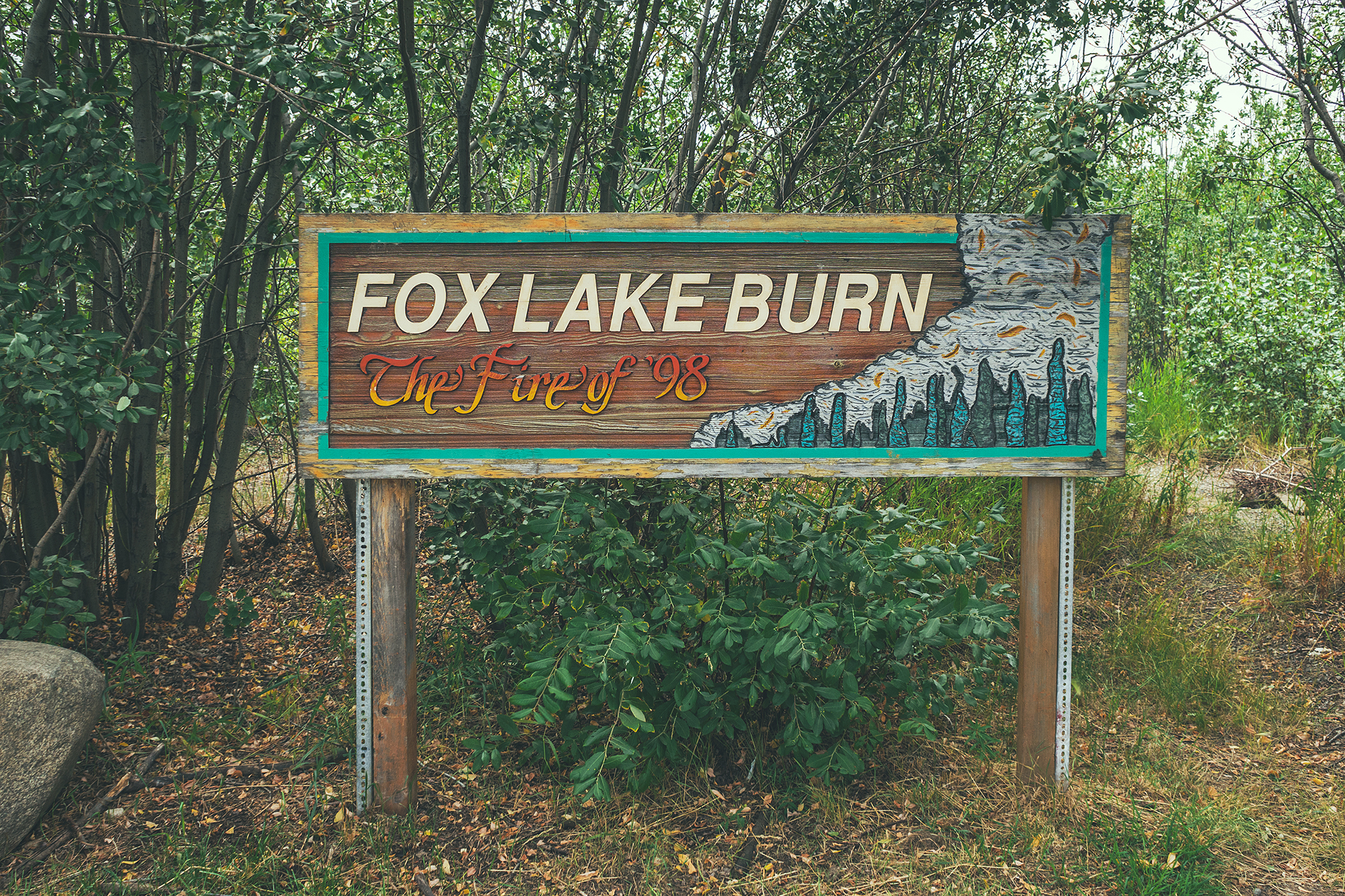
The ridge was incredibly windy! It reminded me of Patagonia, and the types of wind we encountered there, sometimes able to knock you off your feet. I could see how fire would propagate at incredible speed with winds of the sort.
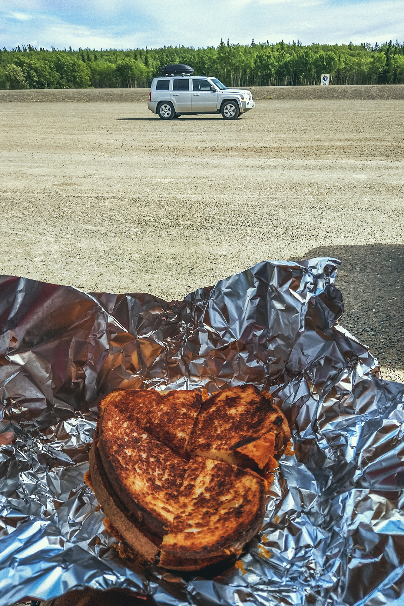
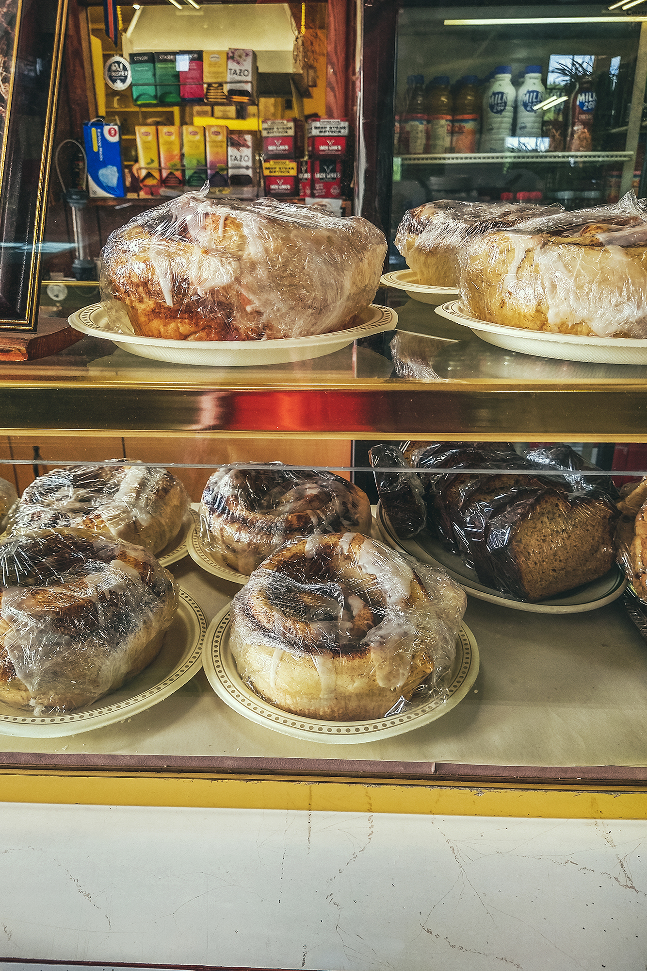
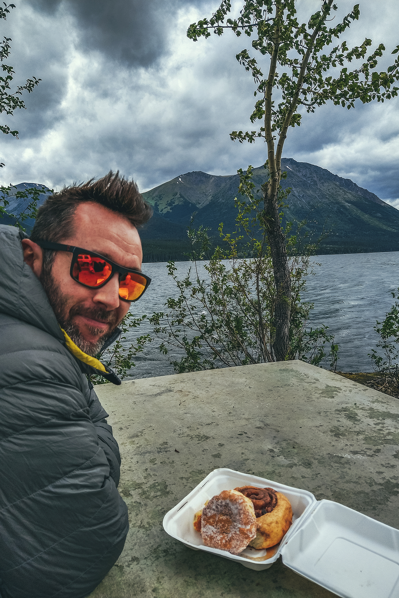
Our next stop was at the Braeburn Lodge. We came up to it just as I was reading in the Milepost that “their cinnamon rolls can feed 4 people”. Clearly we had to stop and check for ourselves.
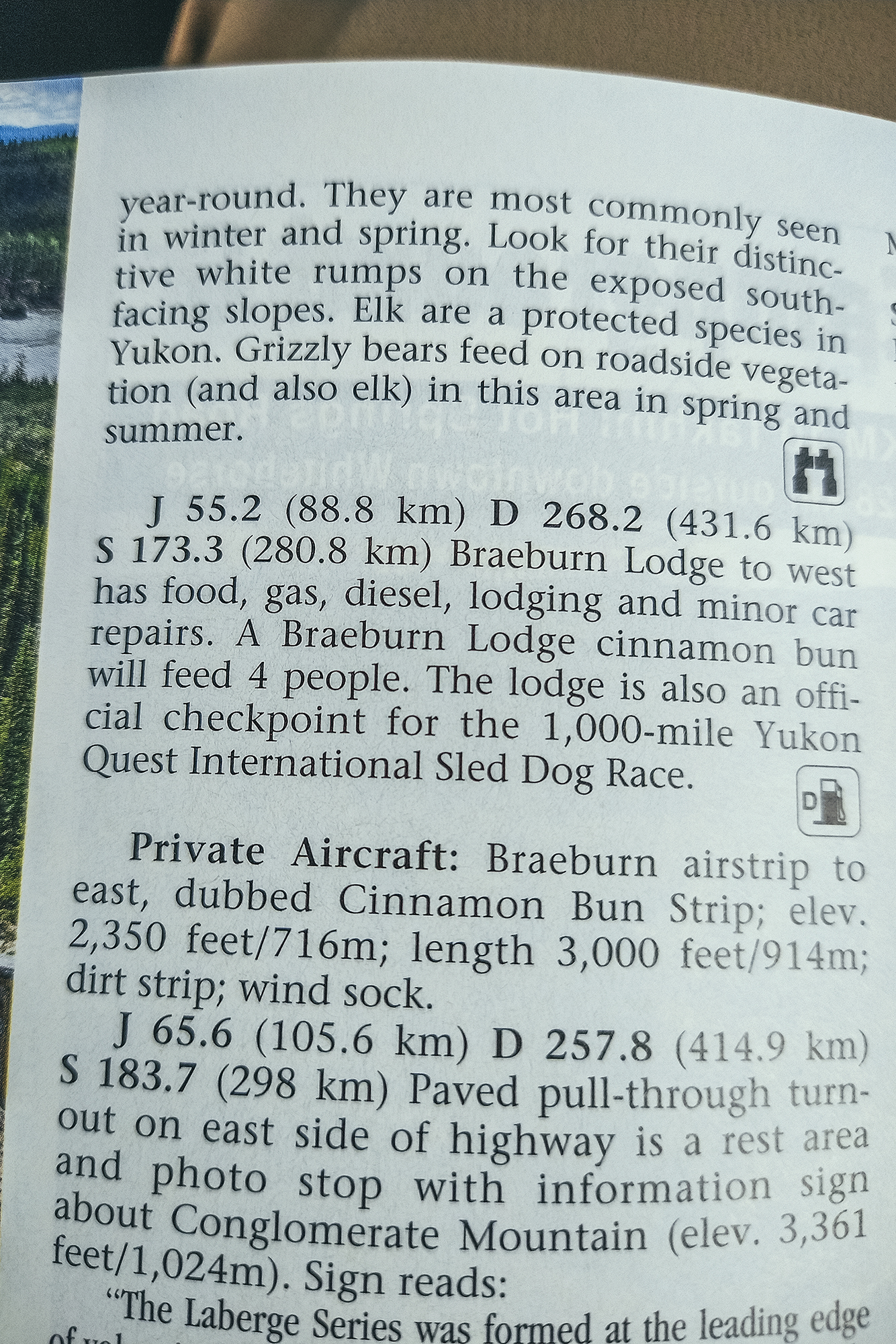
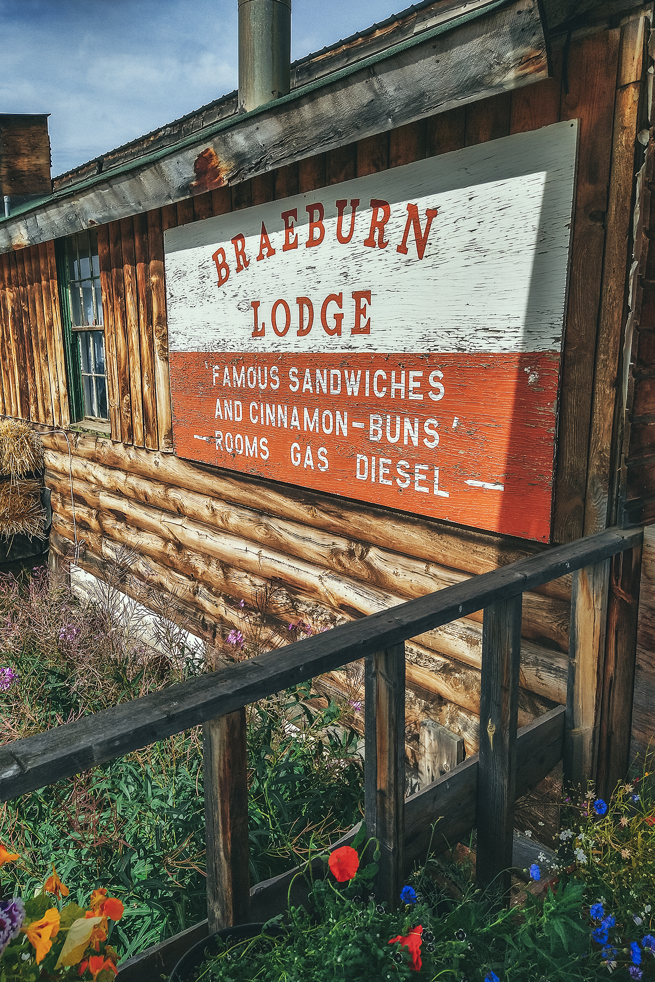
Sure enough, the buns where the size of a small cake. It was lunch time though, so we decided against buying one (also, they were REALLY big and as much as I like pastry, that was a bit too much for me), and instead went for a grilled cheese sandwich – which by the way could also have fed 4 people. It was super simple but very tasty.
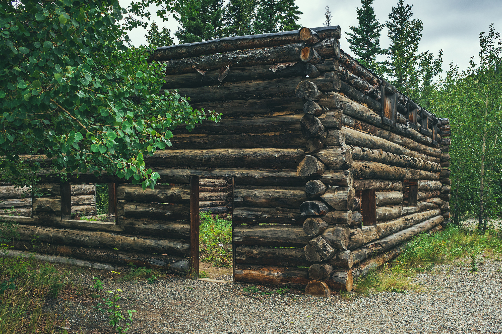
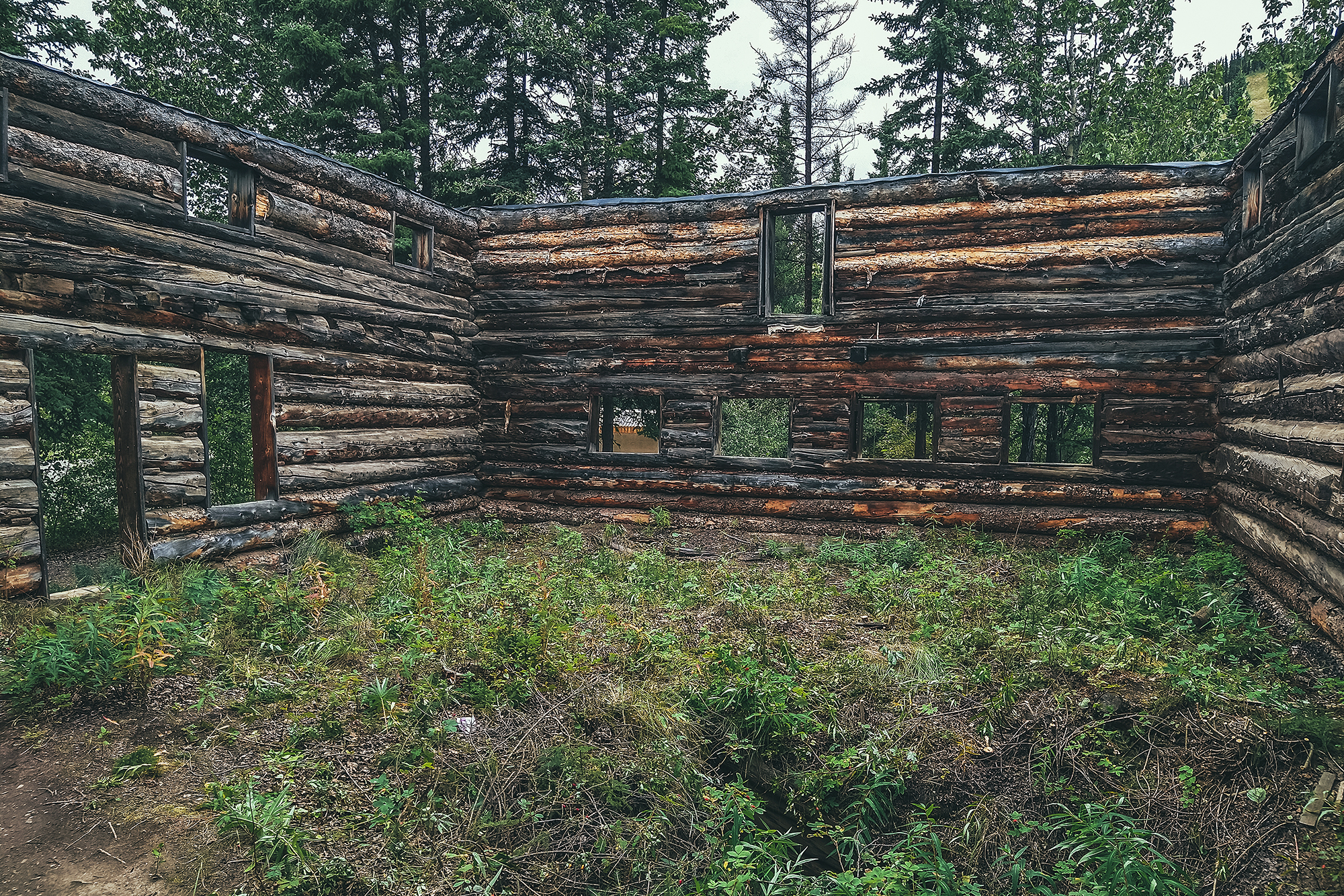
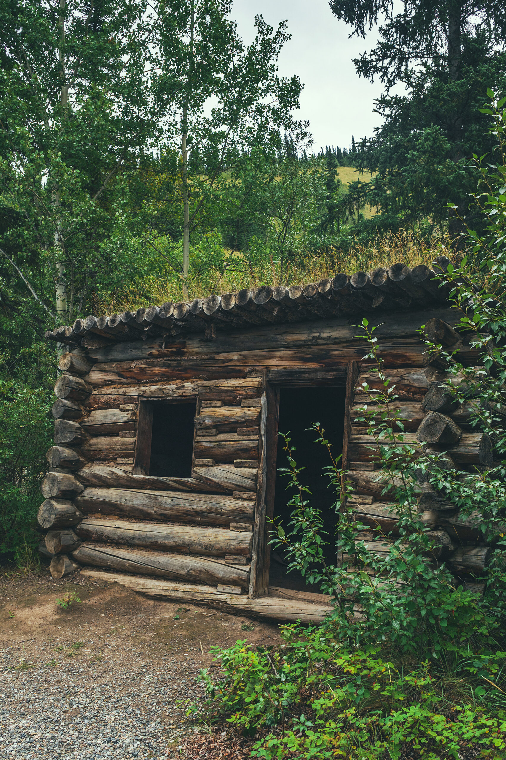
Our last stop on the Klondike that day was at the Montague Roadhouse Historic Site. Until the beginning of the 20th century, the Klondike river was the main way of transportation between Whitehorse and Dawson City. Then in the early 1900’s, the Overland Trail (now Klondike highway) was built to connect the two towns by horse and carriage. The Montague Roadhouse is the only remaining trace of the pioneer-era rest stop along the trail. Rest stops of the sort, with overnight accommodation, were found every 40 km or so along the trail. You can still see some of the main roadhouse building at the site, and read about the history of it.
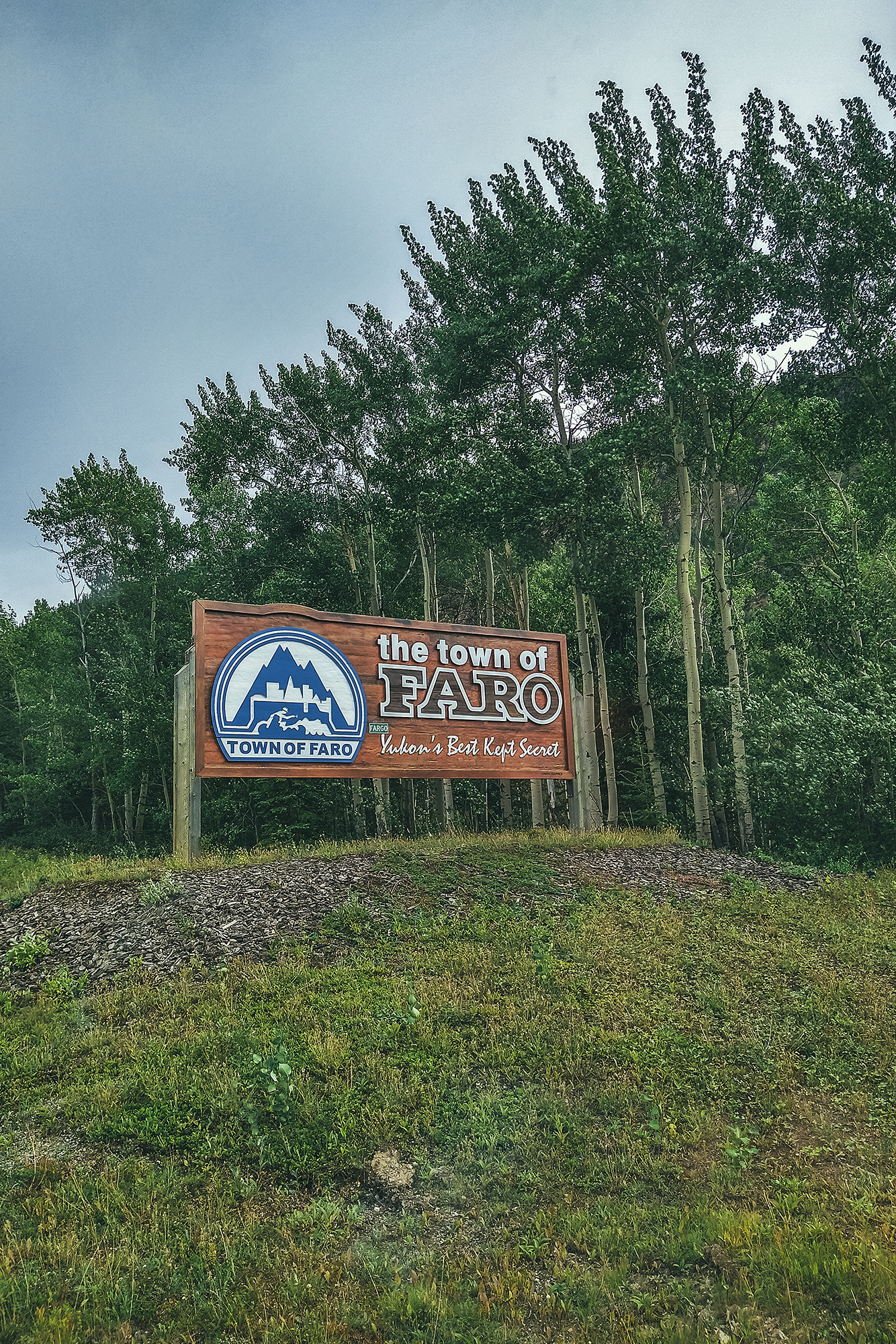
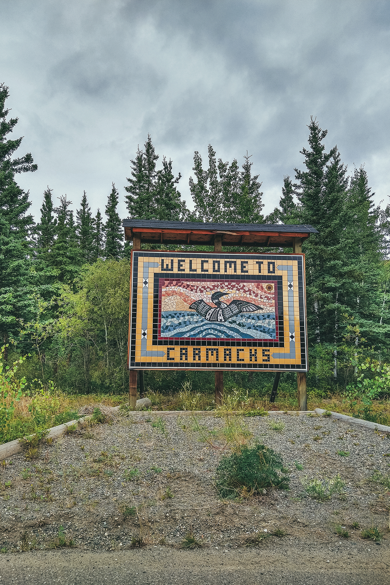
Once we got to Carmacks, we left the Klondike Highway for our first side trip, heading East to Faro on the Campbell Highway.
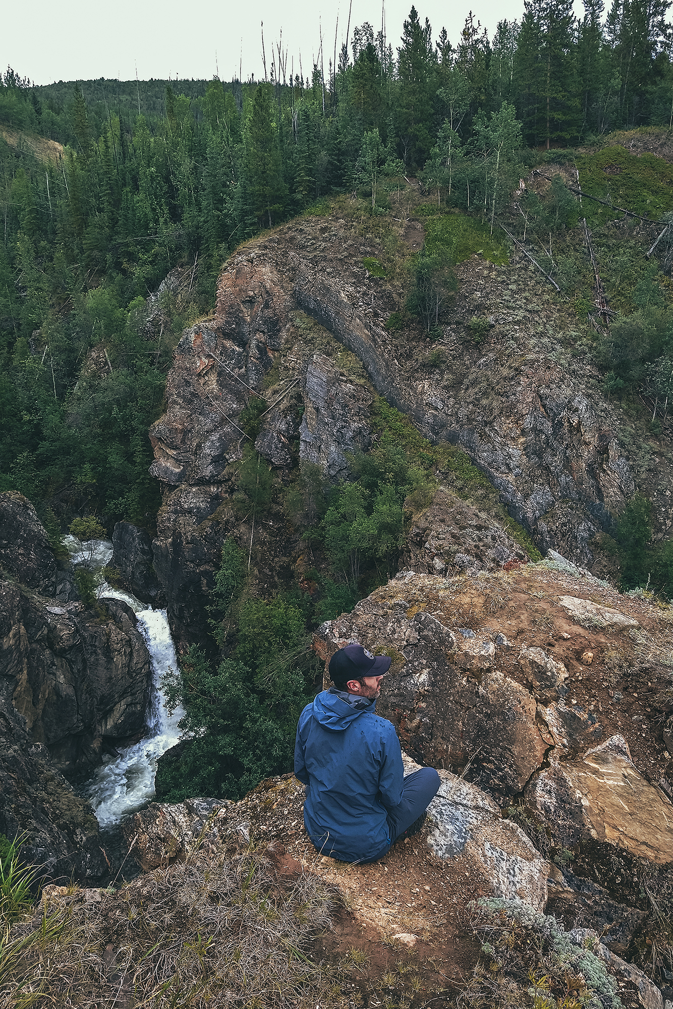
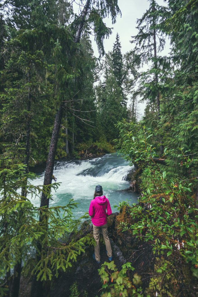
We set up camp at the John Connolly municipal park, a nice campground with hot showers (always a plus). We were quite tired from the long drive but decided to take the short hike along the Van Gorder waterfall trail to stretch our legs.

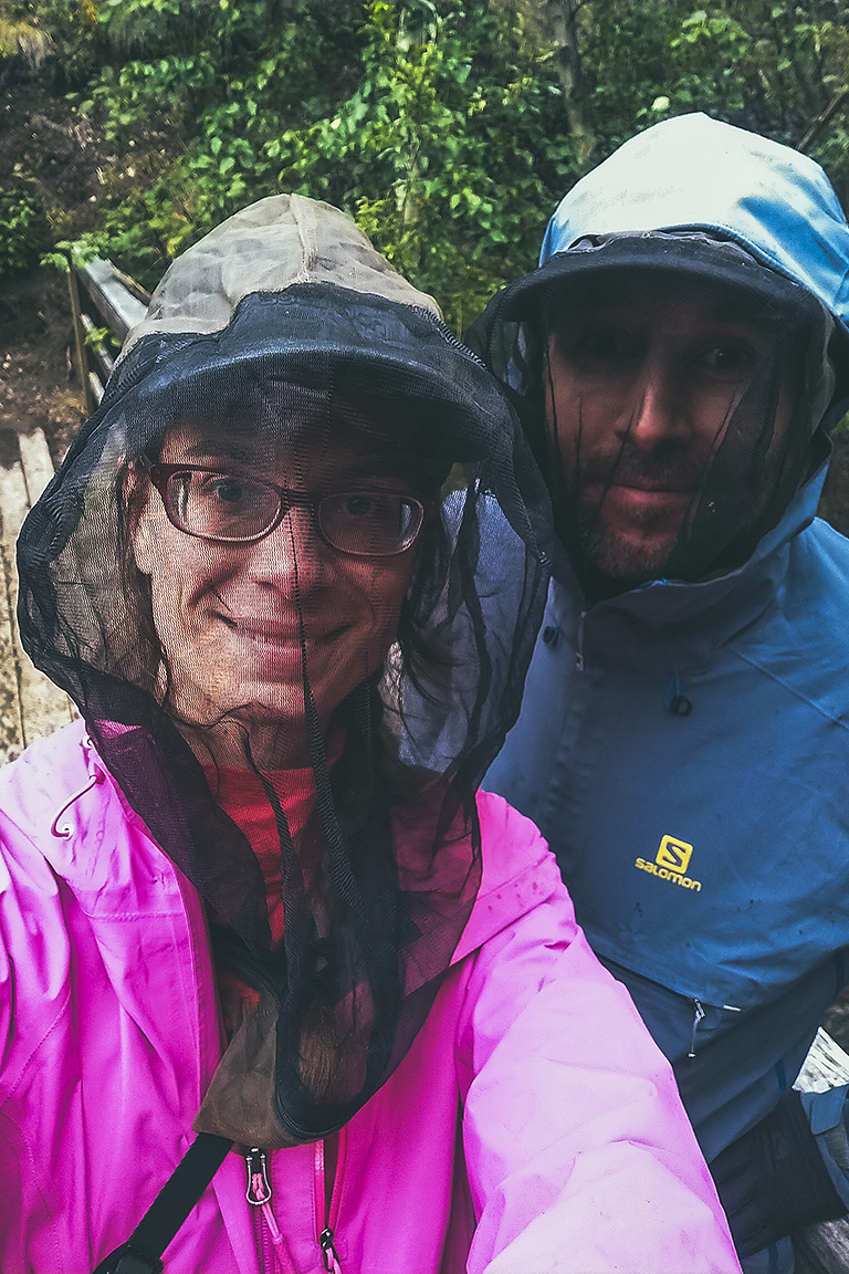
Mosquitos were, once again, a bit aggressive (we wore our bug jackets to the waterfall!), and it rained for a good portion of the night, but we still had a cozy sleep in our little tent.
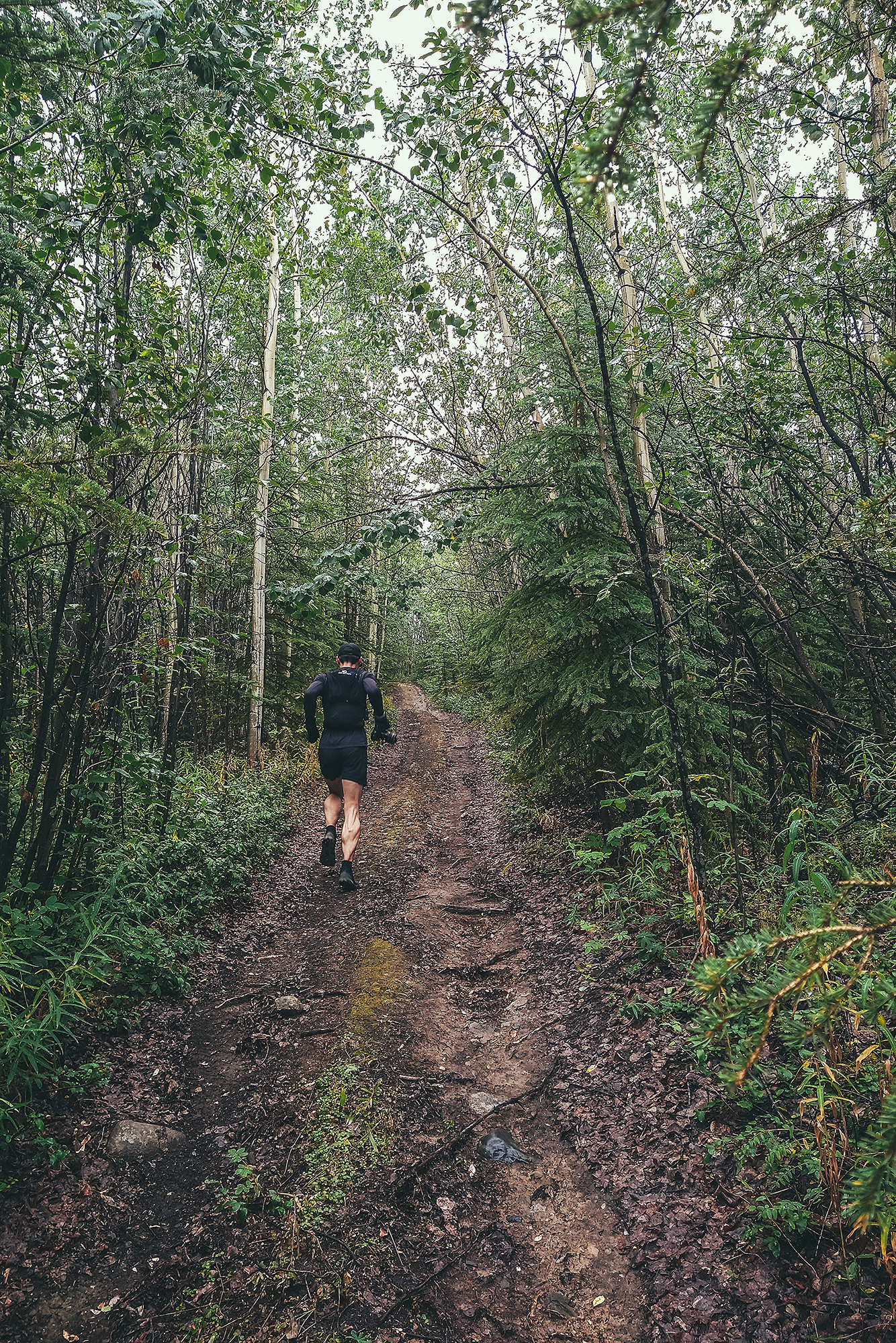
The next morning we decided to go for a trail run before heading back out.
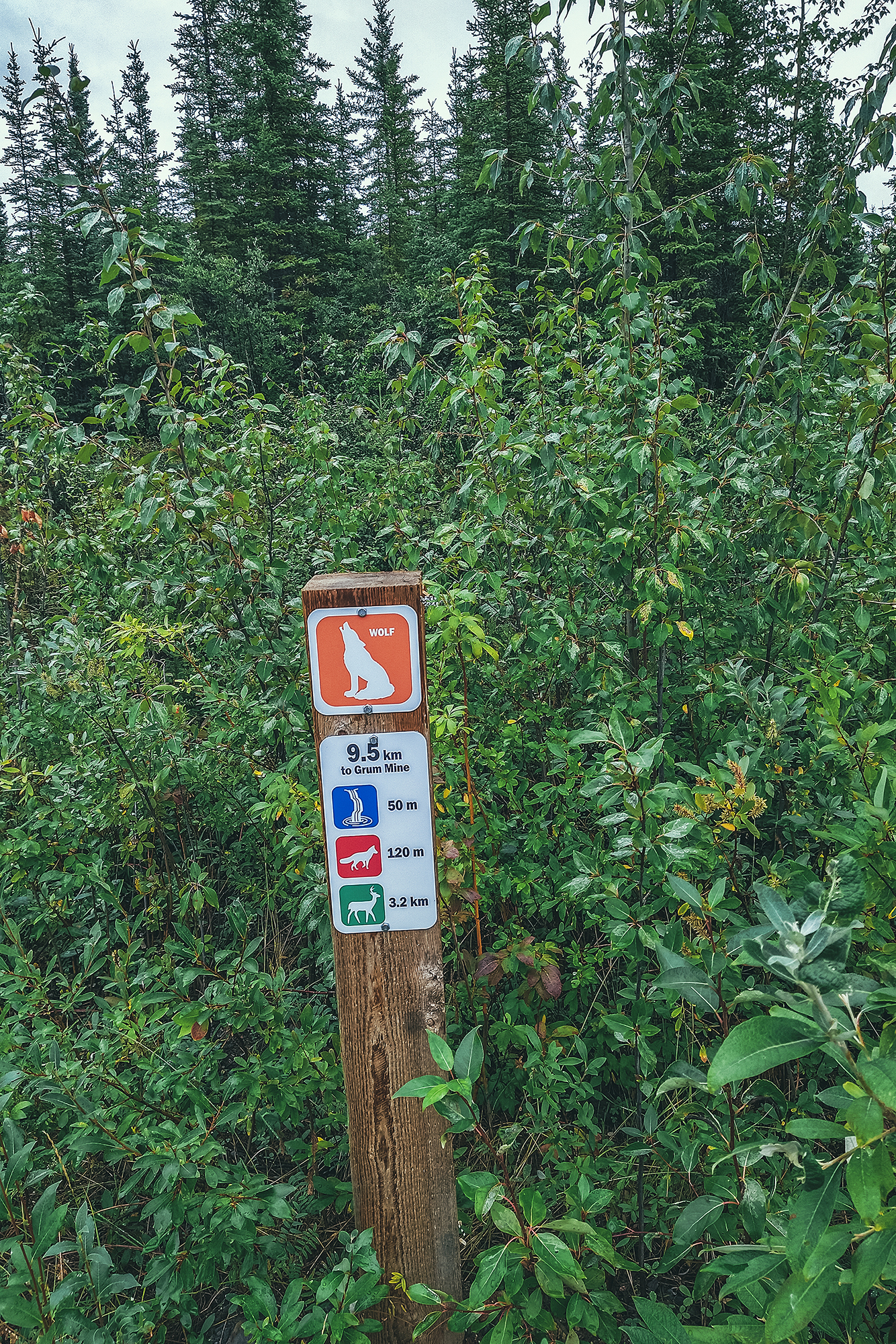
There’s a network of trails around Faro, which don’t actually seem to exist on google map, but I picked up a good old paper map from the visitor center across from the campground (they also have a pdf version here). Aside from the overall scale reference, there’s no indication of length, elevation, etc. but it did look like we could do a roughly 10km loop around the town, starting right at the campsite so that’s what we set off for. The trails all have animal names and signs at some intersections but it did take a bit of navigating with the map to stay on our intended route. The trails were not very technical, albeit pretty muddy, but we encountered a few decent hills – and we did get couple of nice views from above the town. As suggested by the map, these trails are likely more used in the winter for cross-country skiing and snowmobiles.
Mosquitos weren’t as bad when we were running, and we managed to stay mostly dry aside from the 93% humidity in the air. After the run, we enjoyed the hot showers then had our savory pastries from the day before for lunch. We ate them on the patio of the information center, which was looked after by the most lovely lady, who offered us free coffee. We then headed back to Carmacks, to continue our journey up the Klondike highway.
The campground in Carmacks sounded good on paper – offering waterfront campsites and burger joint, but when we got there it didn’t turn out to be that exciting – a messy-looking stretch of ground near the river, only separated from the main road by the parking lot, and the pub didn’t look very inviting. It was also quite busy, which was a third reason for us to continue on, to try and find a quieter, more appealing campsite for the night.
We continued North and landed at the Tatchun lake Government Campground, located a few km down a dirt road – away from the highway traffic noise. Note that there is a Tatchun Creek campground up the road, but that one is also near the road, exposed to traffic noise.
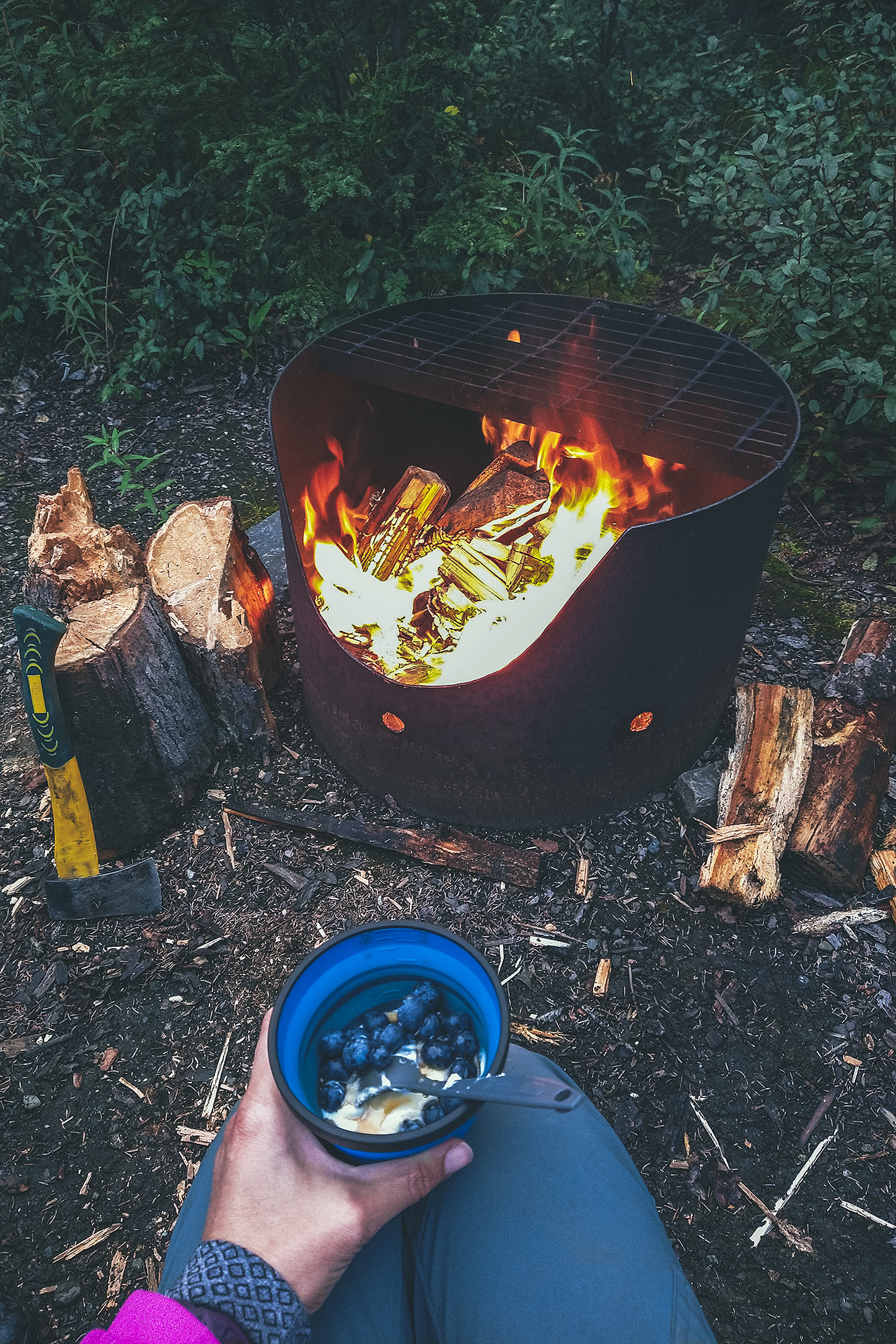
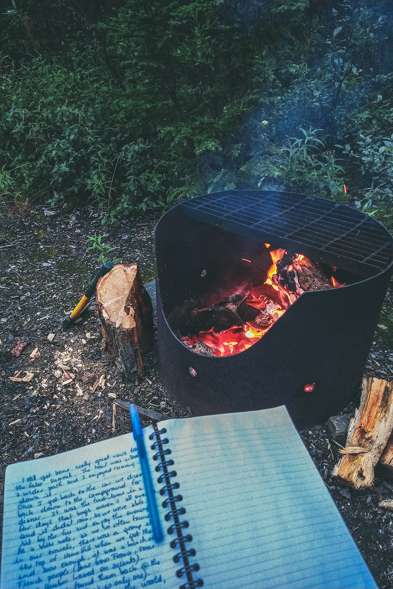
For the first time in our trip it felt like the mosquitos were less intense, probably because temperatures were starting to lower. We set up camp a bit earlier than other days, so we had time to relax in the evening, work on photos, write our travel journal, and enjoy some time by the fire.
On our last morning in Stewart, we grabbed pastries at Temptations bakery (raided it, really more like) and had a couple for breakfast in the park area off Main st. Then we got back on the road, driving back East to Meziadin junction, before heading north again on highway 37, also known as the Stewart-Cassiar Highway.
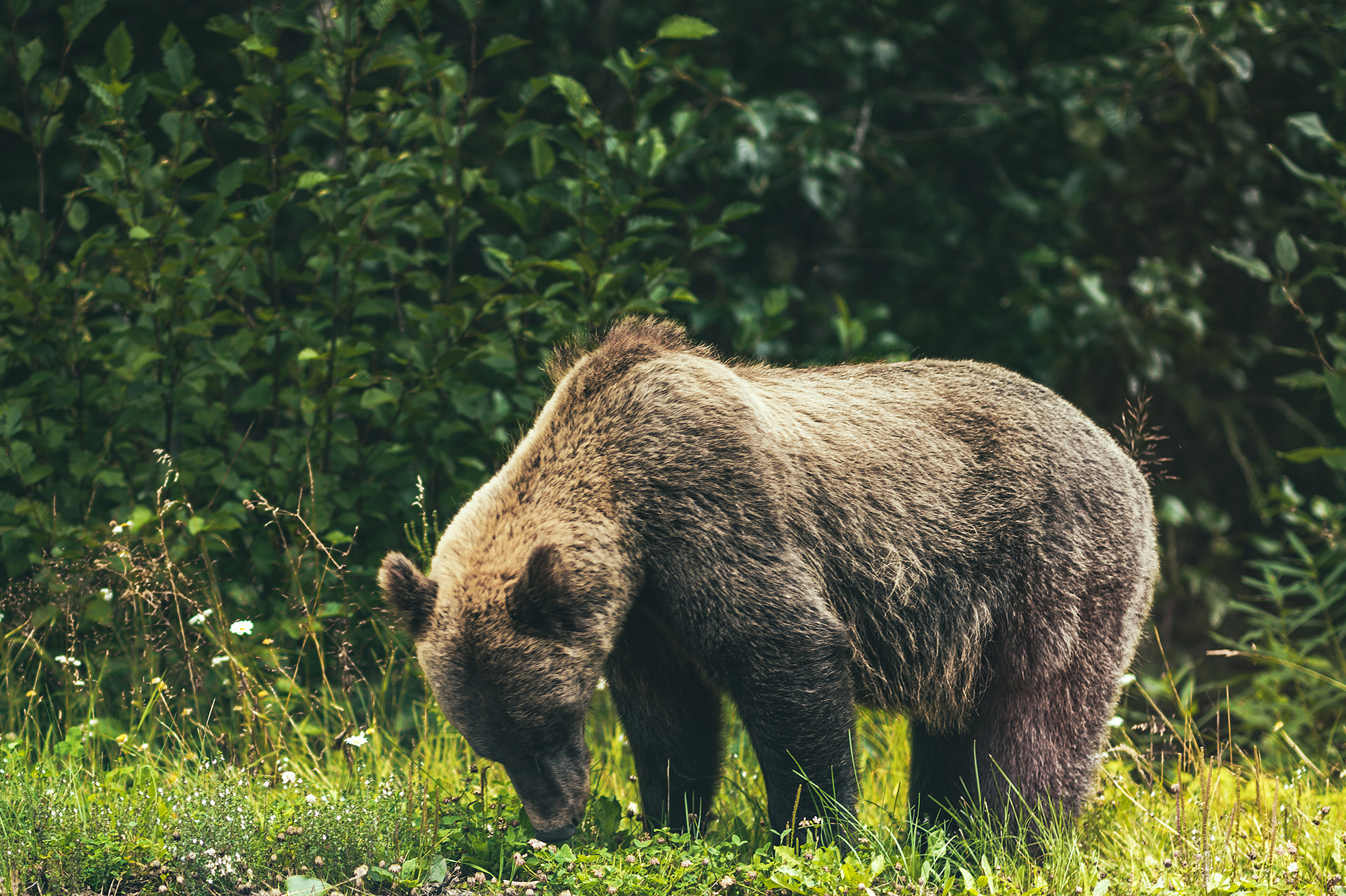
The road was pretty unremarkable at first, except for 1 grizzly bear we saw right off the side of the road.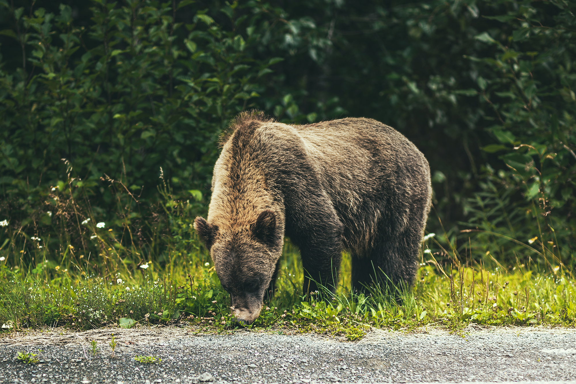
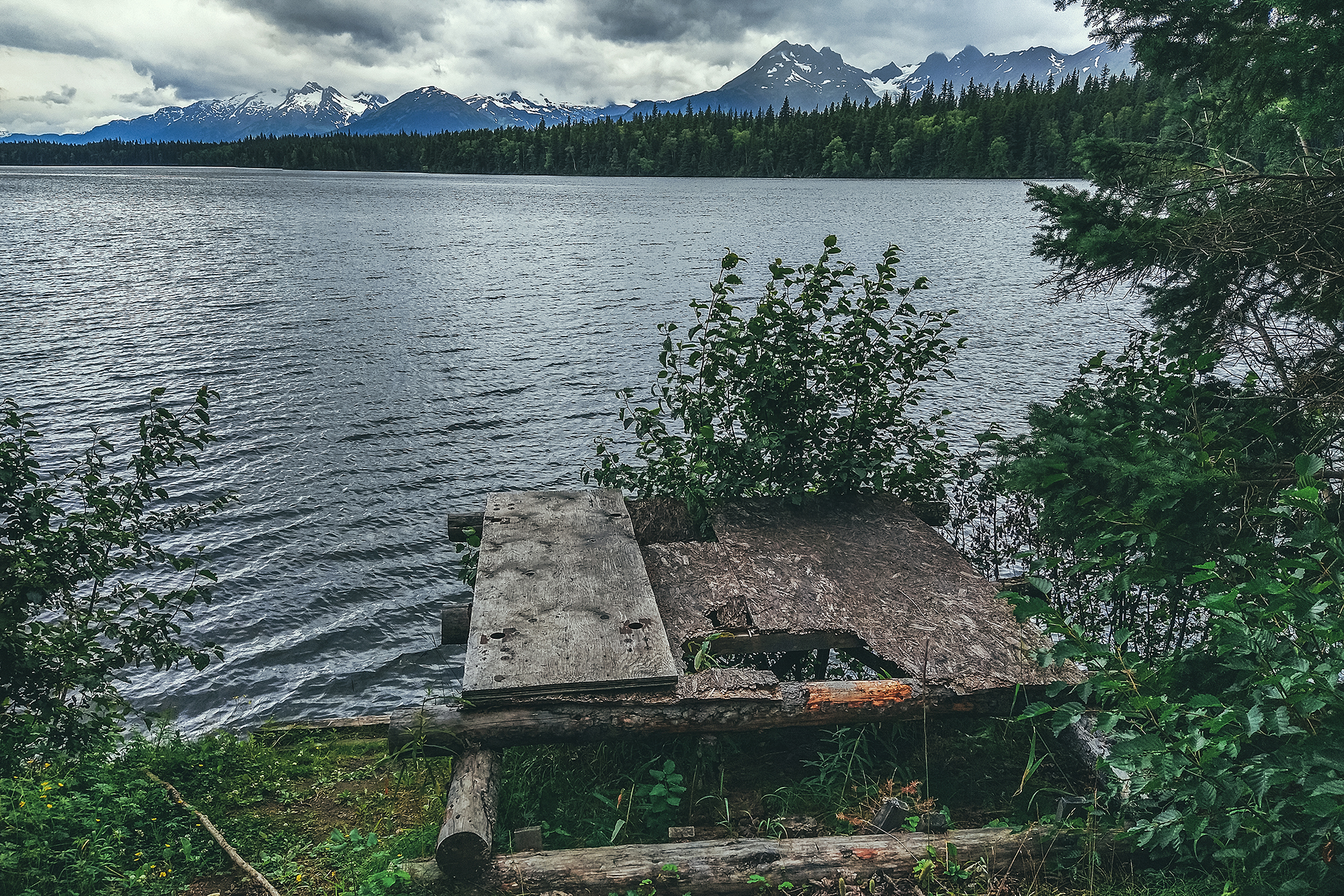
After the Ningunsaw pass, we stopped at Bob Quinn Lake for lunch.
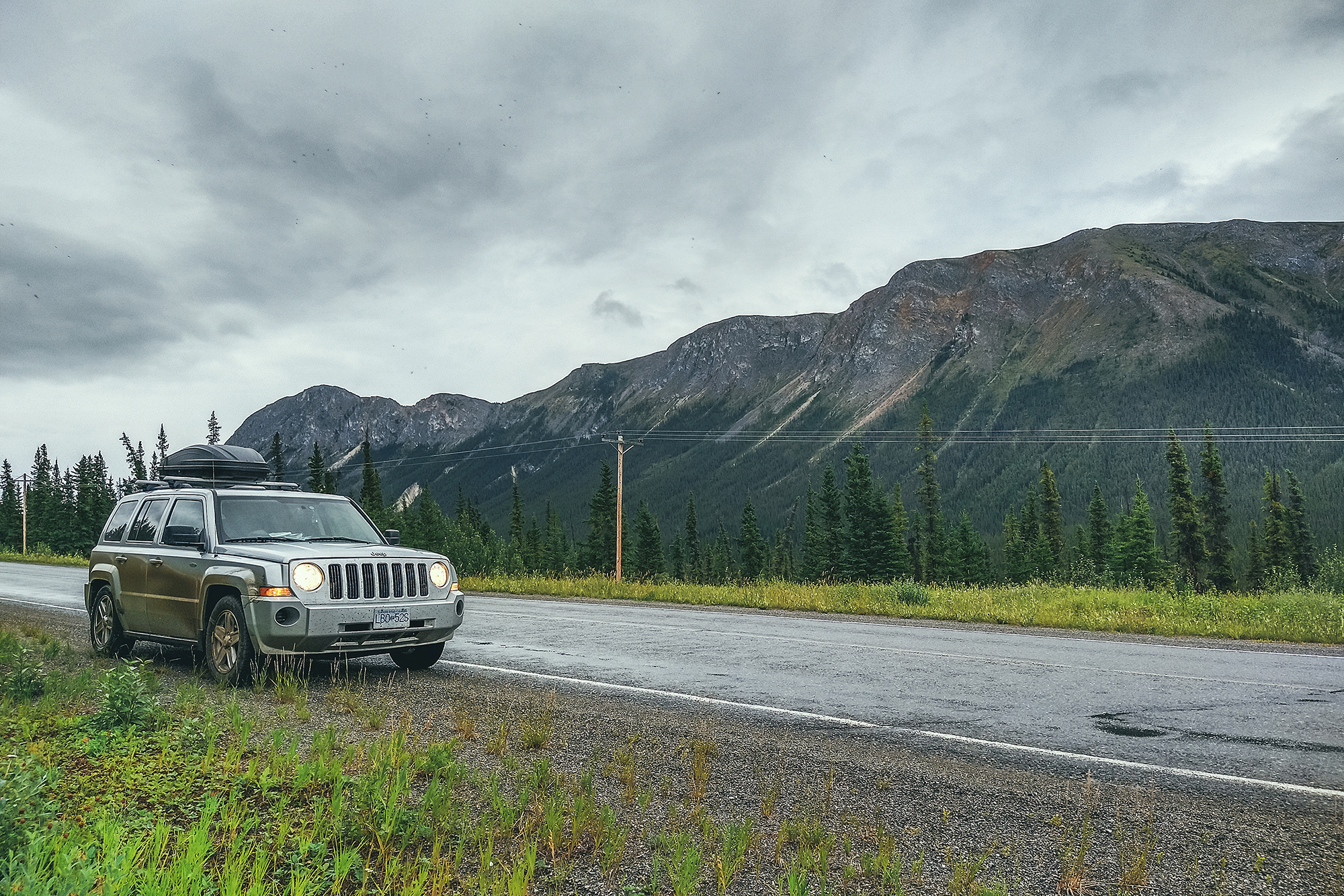
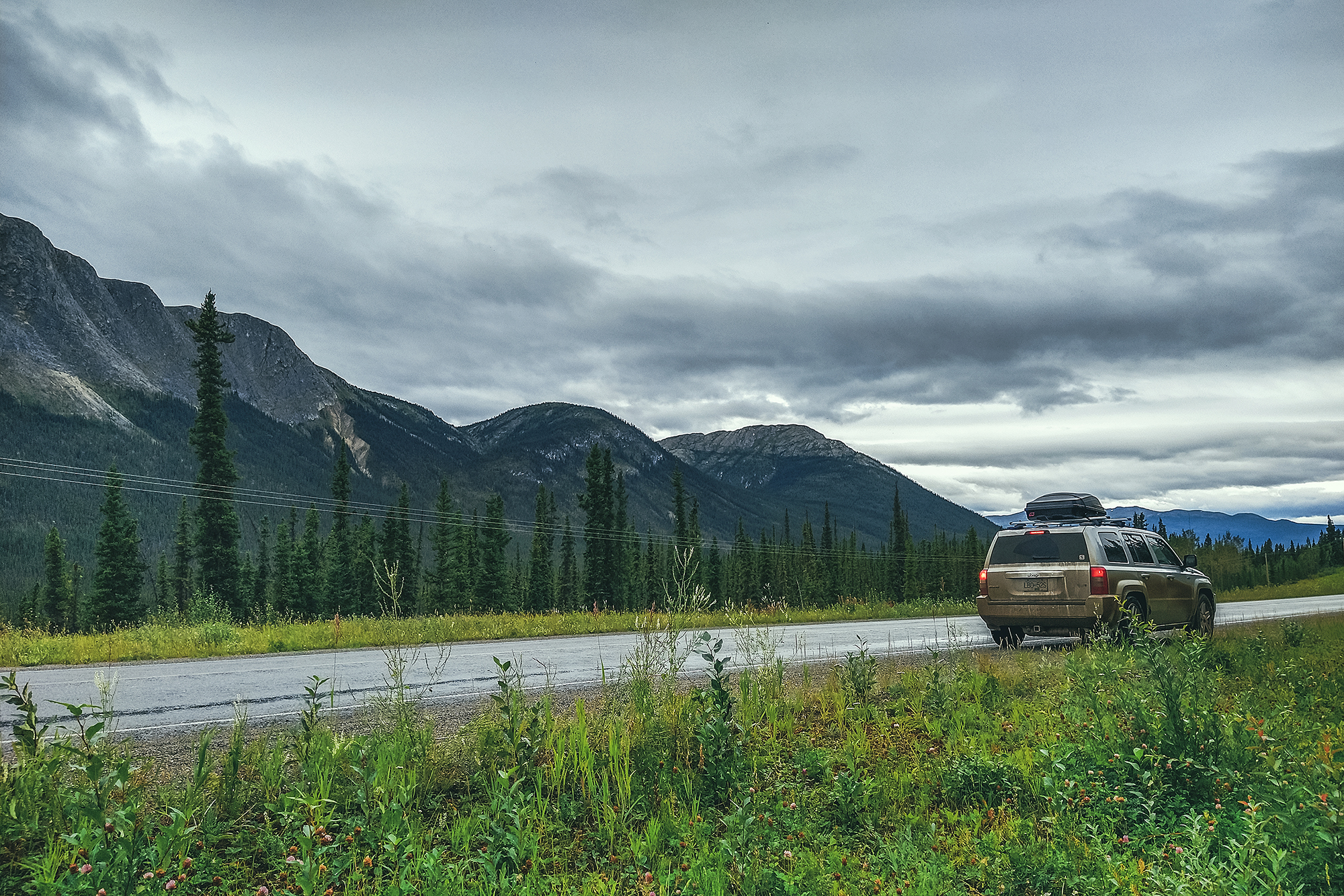
We started seeing bigger mountains on either side of the road, although a lot were covered in clouds. I was actually a bit bummed out by the weather, as I had hoped we could take the kayaks out for a nice paddle at one of the many lakes we passed, but the cloudy, windy and low temp weather didn’t feel very conducive to a water adventure.
I had also looked at the forecast for Whitehorse and Dawson city and it looked like a whole lot of rain coming up, which I wasn’t so thrilled about. But I guess it’s better to go expecting poor weather and be glad if/when the sun comes out, than the other way around? We had been warned by our friend Adele, who had done a similar trip a few years back, that they had gotten a lot of rain, so I was somewhat prepared for it, but still a bit annoyed when it turned out to be a daily occurrence.
I should note that this whole section of road is quite isolated, with little to no cell service and very few places to stop for gas (but not far enough apart that you would need to carry an extra container of fuel).
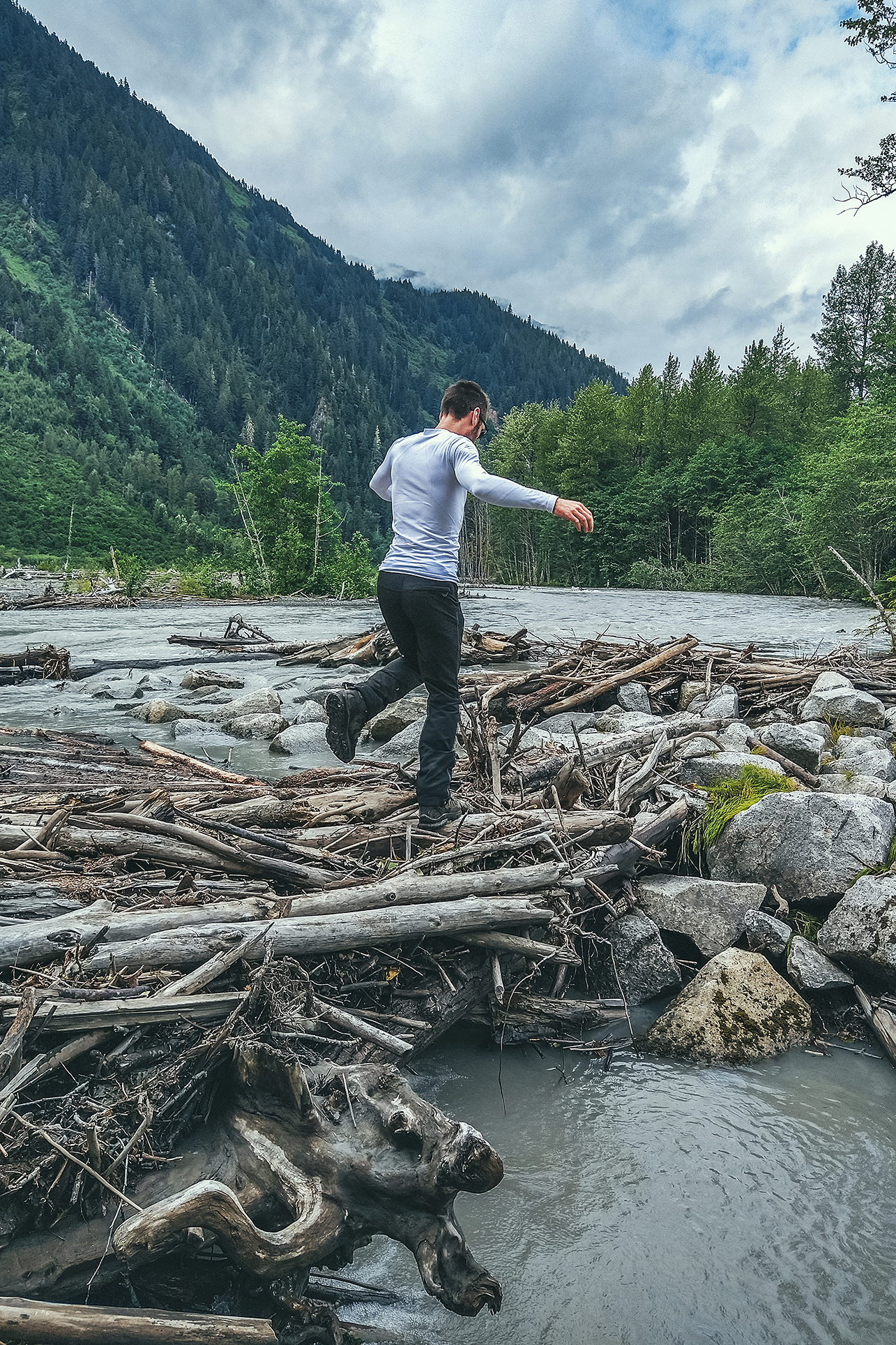
The one bit of excitement that day came when we decided to drive down a dirt road to see where it would lead (we didn’t have any indication that it would lead to anywhere particular, but sometimes you end up in a cool scenery by taking a random side road).
After driving 10 or 15 minutes down the path, we got to a bridge over a river and Brice asked me to drive over it while he was getting some drone footage. He got in the car with me and we crossed, but hit a fairly big drop upon touching the other side, car bumper hitting the ground heavily.
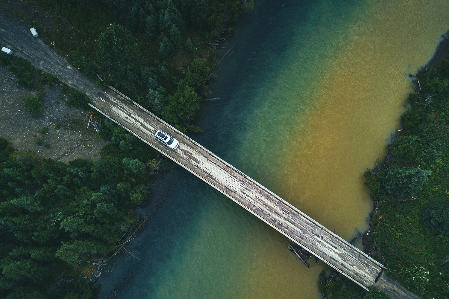
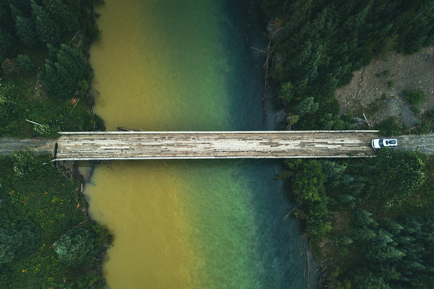
I turned the car around and we went to look at the drop. It was actually a pretty significant hole, at least 2 feet wide and 5 feet deep, across 3/4 of the width of the bridge, leaving only about 2 feet of connection between the bridge and the ground. No idea how I even managed to drive through it in the first place. It’s possible the hole was a bit smaller and a bunch of dirt fell off under the weight of the car. We tried driving back through, as close to the connected side as possible, but the right front wheel would dip into the hole and spin, unable to find traction, with the bumper resting on the edge of the bridge. For a moment I was slightly concerned that we found ourselves stranded down this random road with no cell reception, but we quickly started looking around and figured we could build a makeshift platform to connect the gap.
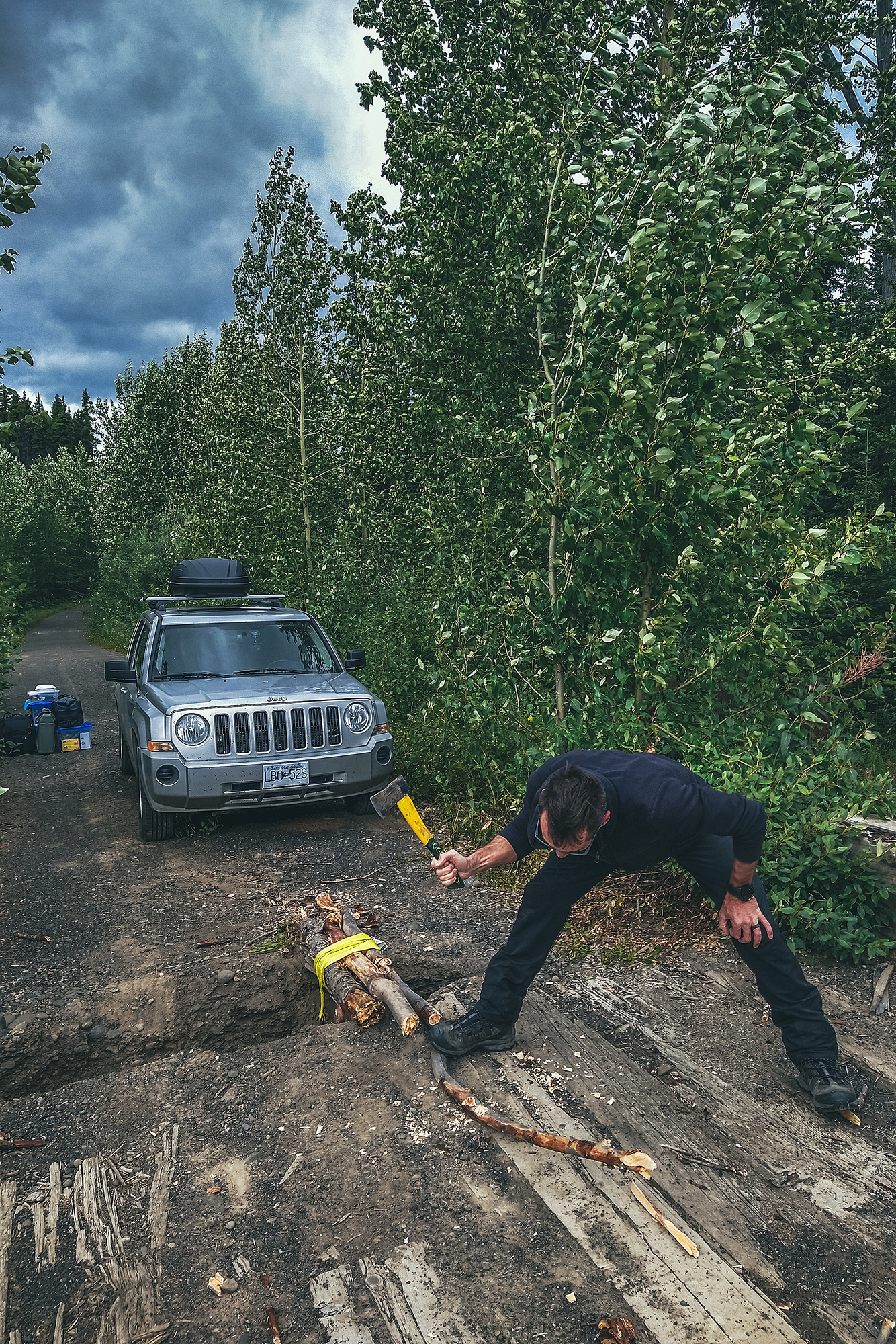
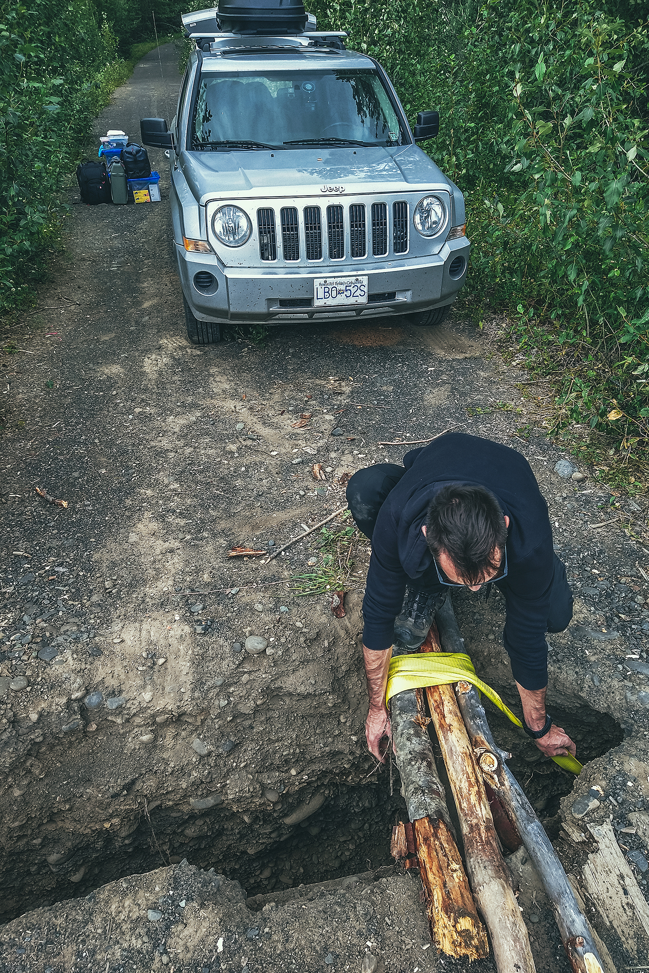
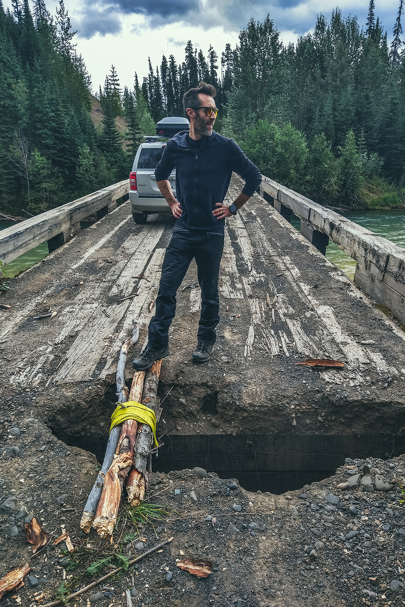
Thankfully we had all the equipment needed in the car, and lots of fallen branches around to chop up and strap into a small bridge, which the car was able to drive over. While I was pretty relieved to see the car back on the other side, Brice says he was never worried as we had everything with us to figure out a solution. Takeaway from this: always check the full condition of the bridge, before driving across it.
After the bridge mishap and getting back on the main road, we made another bit of rookie mistake a bit later on (seems like it was the day for it).
On the map I had seen a short trail leading to a lake. We got to a spot in the road near where the trailhead should be, and actually saw people returning from the trail, so we started walking down it without even checking for a sign or anything (which is VERY unlike me).
As we walked down, the trail kept going and we realized:
After that realization, and walking down another 15min without seeing the end of the trail, we just turned around and walked back with lots of loud singing and noise making. Turns out it wasn’t even the right trailhead to access that lake, the correct one was a bit further, and a few kilometers out and back, so we decided to skip it and go to a lake we could drive to instead.
We also had had our quota of lake for the day, having stopped at Bob Quinn lake for lunch, a rec site with dispersed camping, and at the Eldontenajon lake rest area (the lower area right by the lake) for a snack later. There was definitely no shortage of lakes off the side of the road.
I had pinpointed Tatogga as our place to stop for the night but we ended up driving just a bit further. We set up camp at Morchuea lake Rec Site, a pretty scenic lake with views of Mount Edziza, but probably the highest concentration of mosquitoes we’d seen so far. For the first time on the trip we made use of our bug jackets, pretty invaluable to keep calm when trying to set up camp in a swarm of hungry mosquitoes. And thankfully the net shelter did a good job at keeping them out as well, and ensuring a relaxing evening.
As a side note, Mount Edziza wasn’t on the list for this trip as there is no road access, and it would be a whole other trip to plan on its own. But our friends Adele and Thierry’s trip from a couple of years ago certainly made us want to put it on the list for the future.
Given the poor conditions at the Morchuea lake Rec Site (mainly the fierce mosquitos), we had packed most things into the car the night before, as we knew we wouldn’t stick around for breakfast.
It rained quite a bit that night but it stopped by the time we got up. We had put the tarp over the tent for the rain but also to create a vestibule preventing mosquitos to come in, which prove pretty effective (our tent does come with an extra vestibule that you can zip on, but we’d only ever used it once, found it a bit cumbersome, and didn’t think to bring it on this trip).
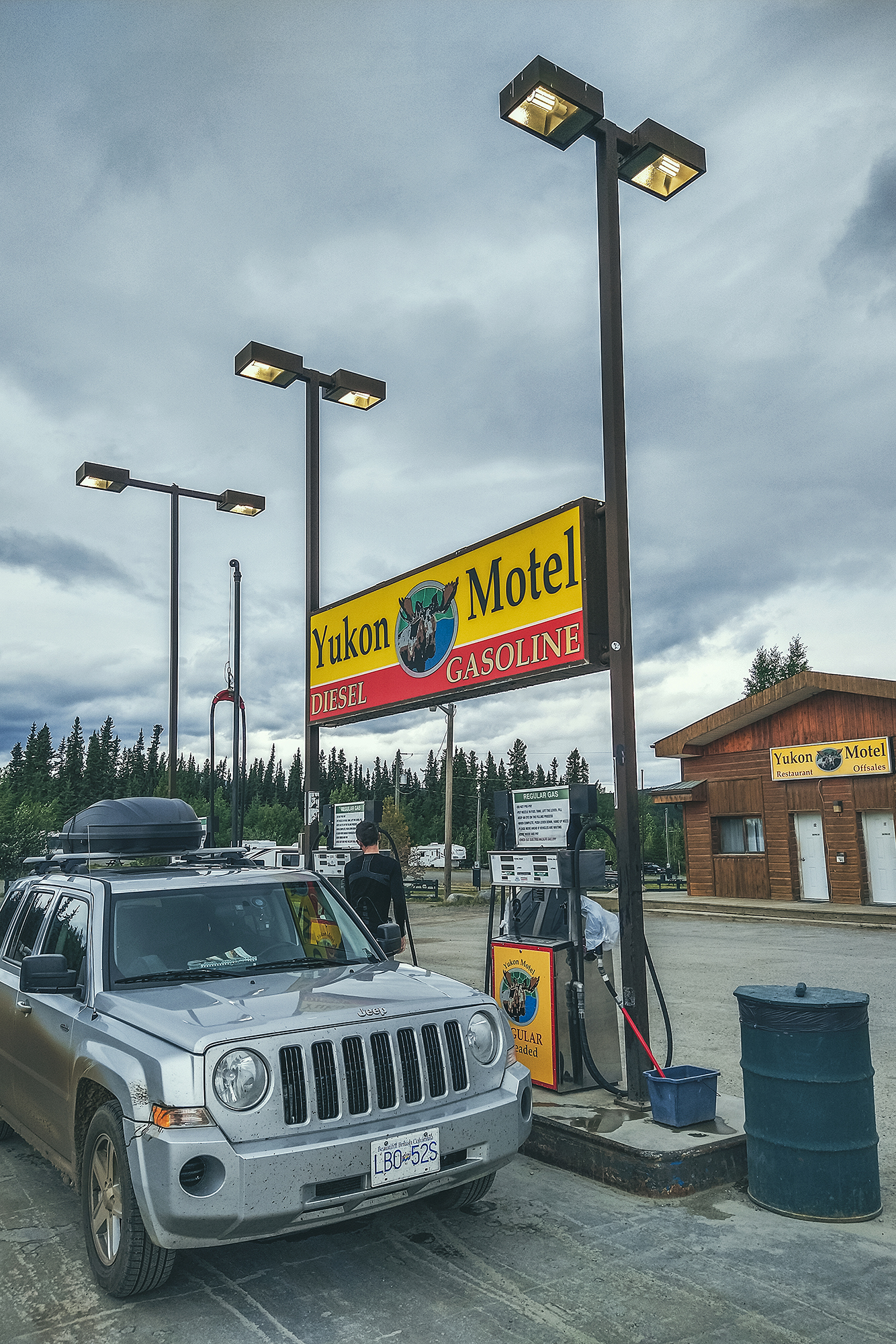
We left camp and drove to the closest gas station for a refuel and coffee..
Then we drove to Dease Lake. BRMP indicated a hot spring nearby but at that scale, the map was a bit vague and didn’t describe a clear access point. We looked for it in the forest along the stream but couldn’t find it. If it existed, it definitely wasn’t one that was advertised by the locals.
We picked groceries up and some lunch, then decided to drive down Telegraph Creek Road, to get a peek at the Stikine River Canyon, described as the “Grand Canyon” of Canada. While the road goes for over 100km to Telegraph Creek, the Milepost indicated a good viewpoint at around 60 km, which is what we were aiming for. Unfortunately, we somehow missed the big sign at the beginning, saying that the road was closed for work at around km 40, and only found out when we got to a road block and a construction worker told us we couldn’t go through. So we turned around, but still found a spot with view of the river for lunch.
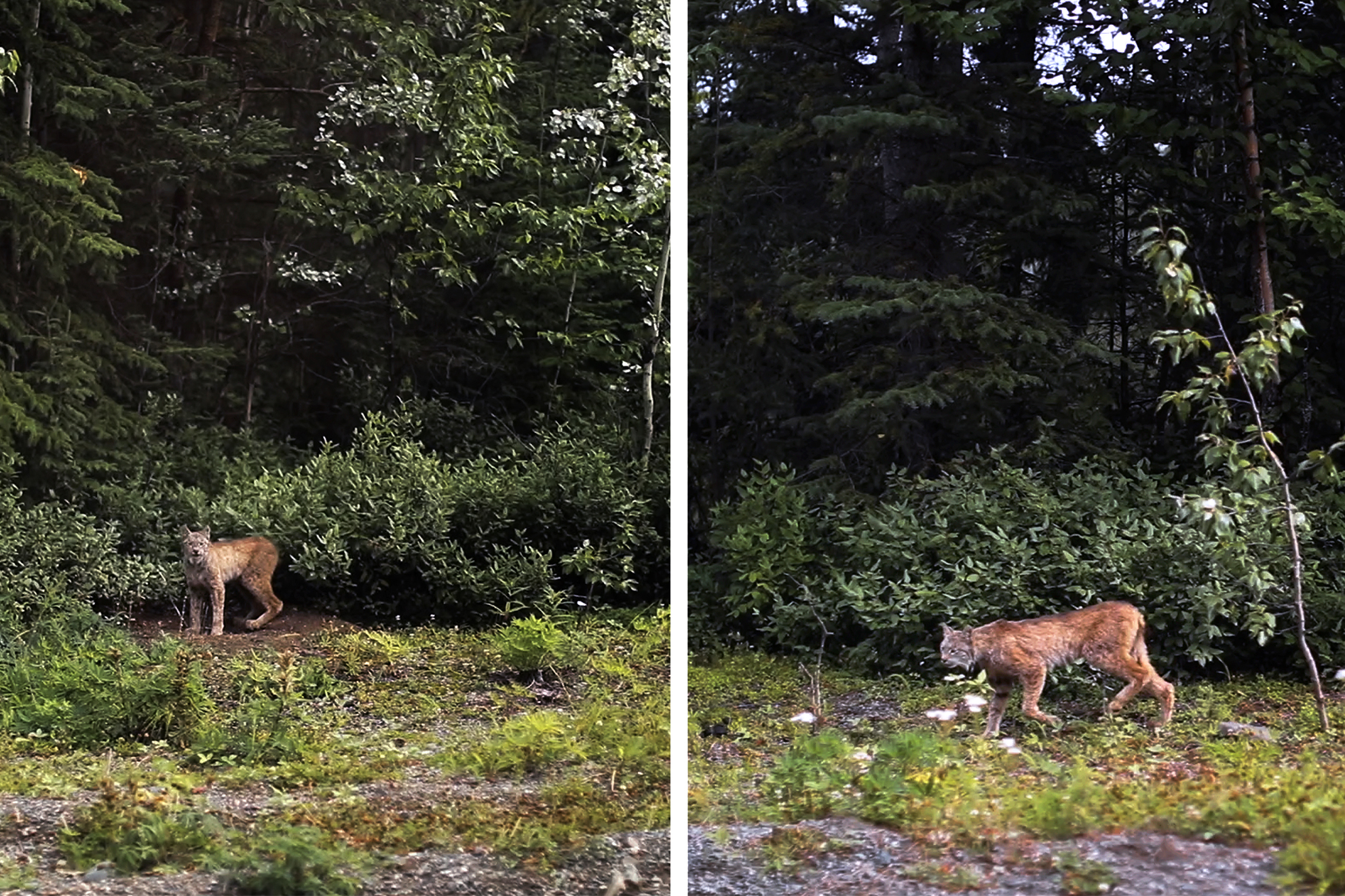
It wasn’t all wasted as we got to see a lynx off the side of the road, as well as a porcupine, neither of which we’ve ever seen in the wild!
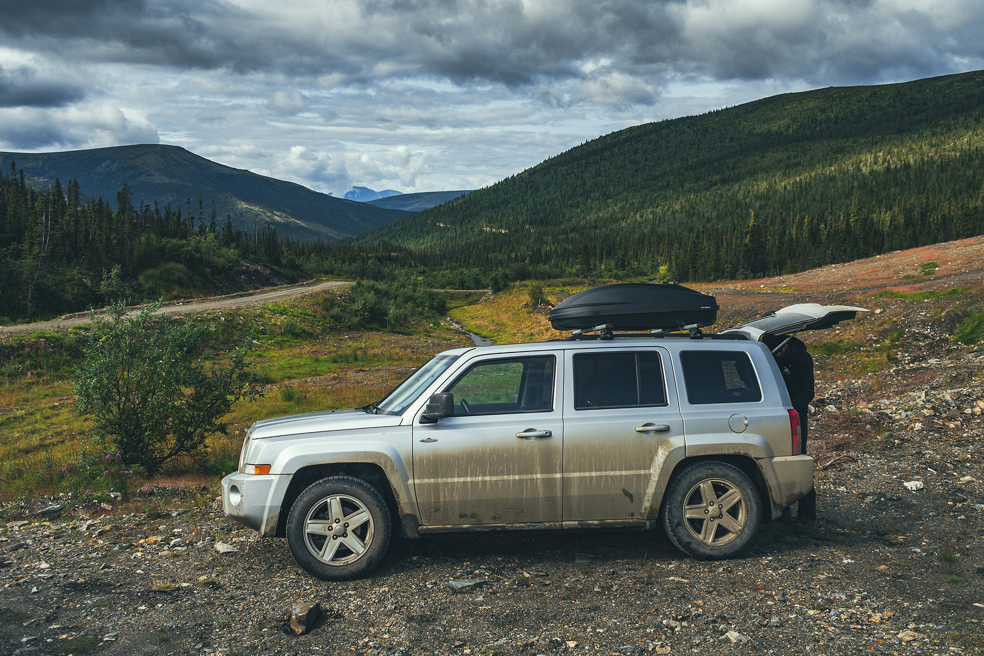
The road wasn’t paved but was very smooth and easy to drive, so we traveled relatively quickly. But didn’t realize until we stopped for lunch how dirty the car had gotten, with layers of mud accumulated into the wheel wells.
We then drove back to Dease lake, to continue our way up the Stewart-Cassiar highway into the Yukon, and we made a couple more stops on the way to Watson Lake.
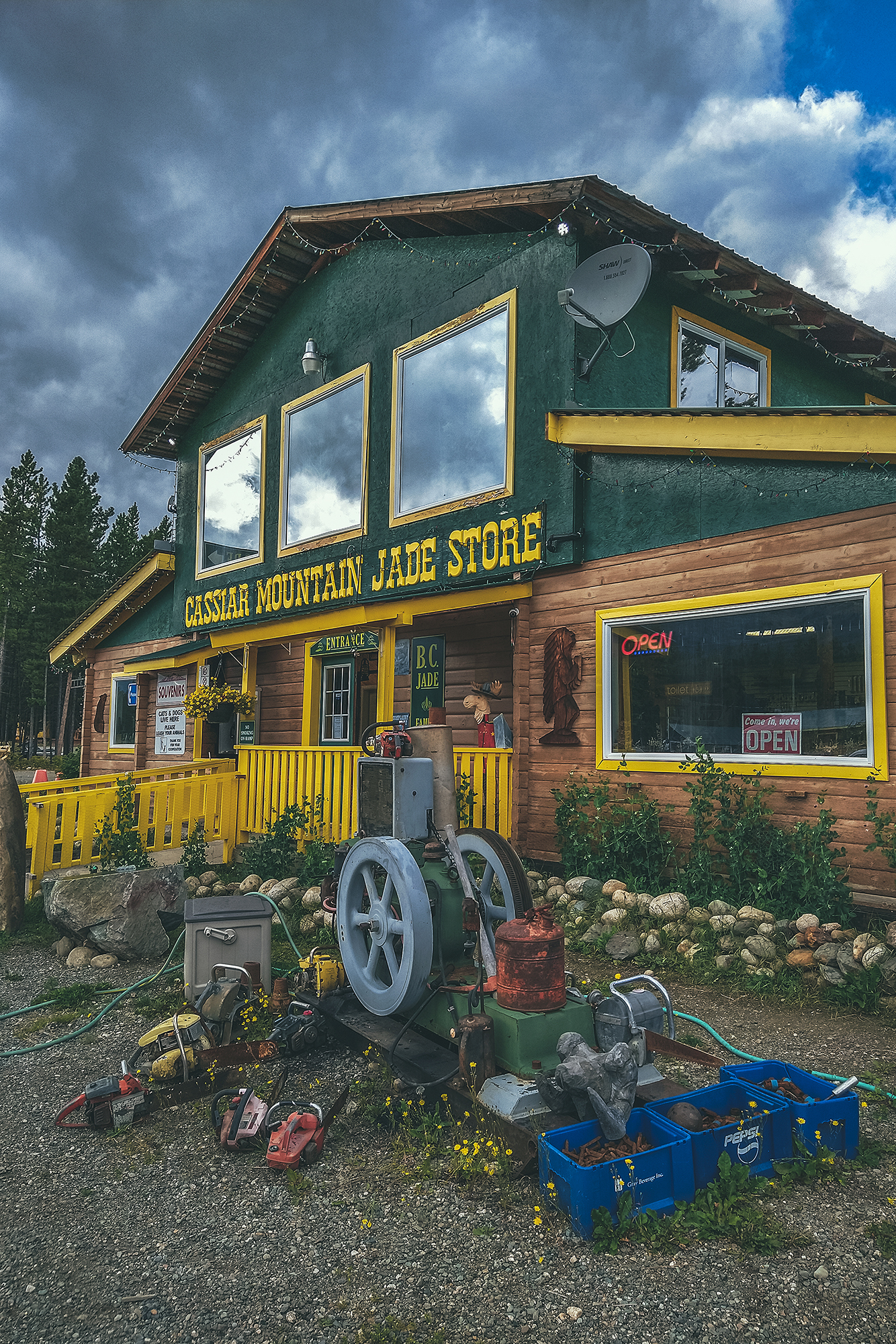
First we stopped at Jade City – which is really more of a trading post, featuring a store off the side of the road that sells all things stones & crystals and specializes in jade, as there is a large resource of it in the area.
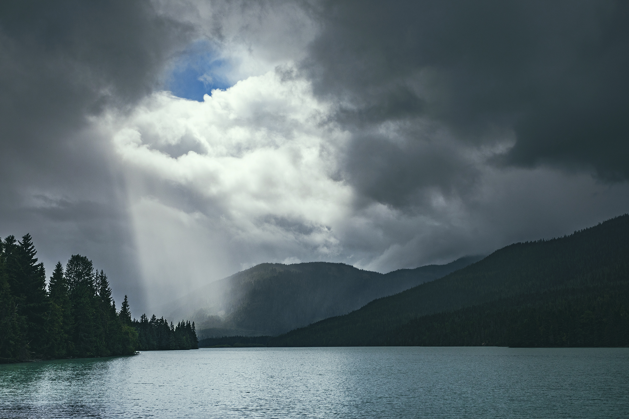
We made a quick stop at Good Hope Lake to admire the colour of the water, changing with the movement of the clouds.
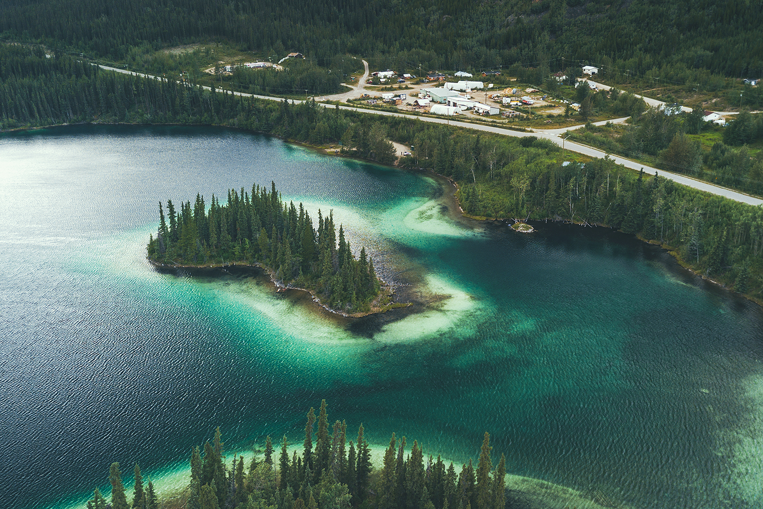
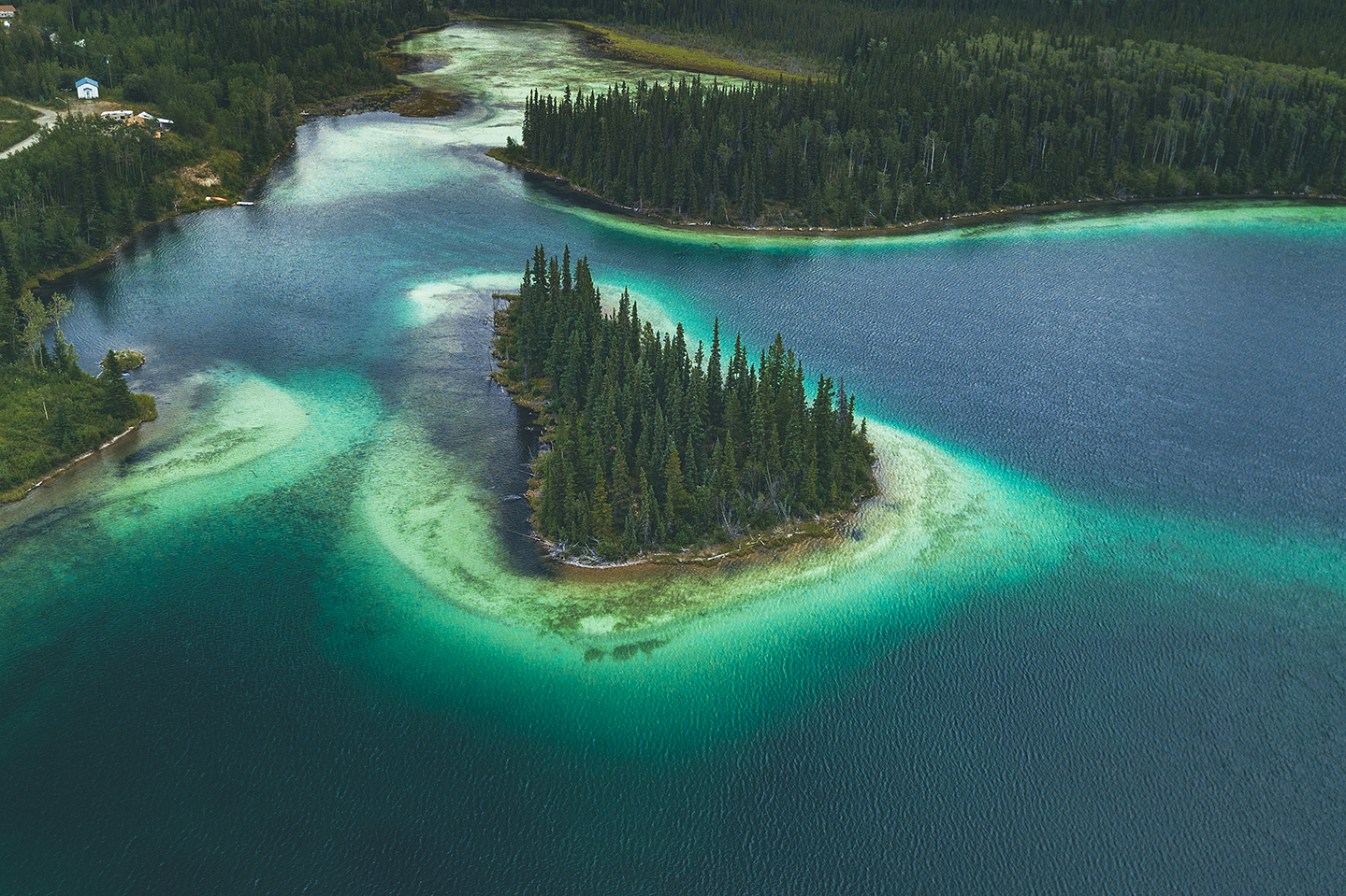
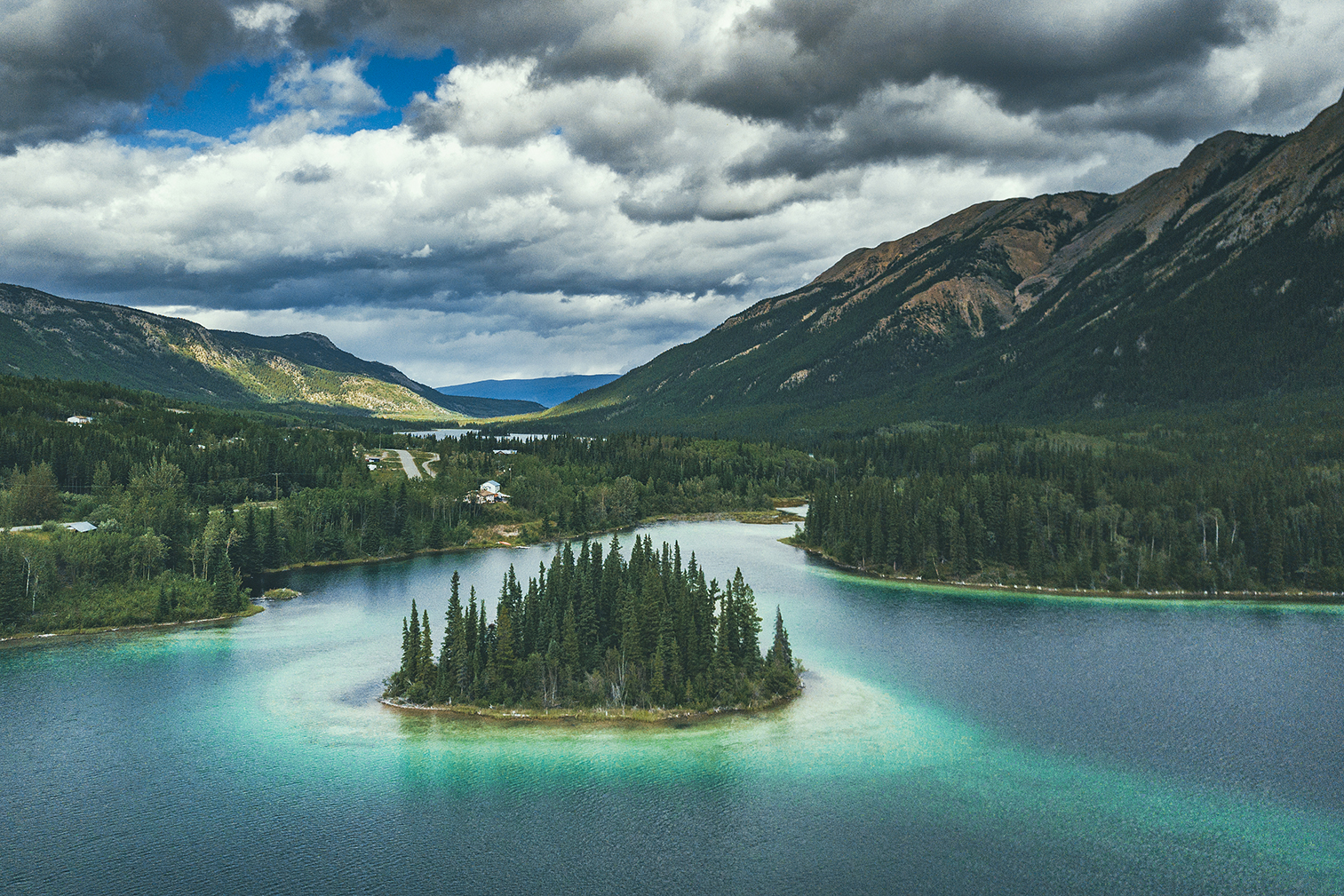
Finally we arrived at one of the places I had read about and was on the list of “must see” stops: Boya Lake
Boya lake Provincial Park is evidently a very popular camping destination and that is not surprising. The lake has shades of blue waters that make it look like the tropics. Islands are peppered all around and campsites line the shore, right on the water. The campground was pretty much full, but we weren’t planning on staying there for the night anyways, only spend a few hours and maybe get on the water.
I regretted a bit getting there late – it was already 6pm and we had another 1.5 hour drive to Watson lake. With more time, I would have loved to take the kayaks out on the lake. It was one of the potential paddle stops I had originally planned, but with the weather that morning I didn’t think it would be nice enough to do so, hence the Telegraph Creek detour. But oh well, that’s how it goes, plans don’t always work out and that’s ok. We still got to enjoy the sight of the lake in the sun and really got a sense of how beautiful the water was. Mosquitoes however were still pretty relentless. We had a snack in the day use area then took a quick walk on the trail along the lake before heading out.
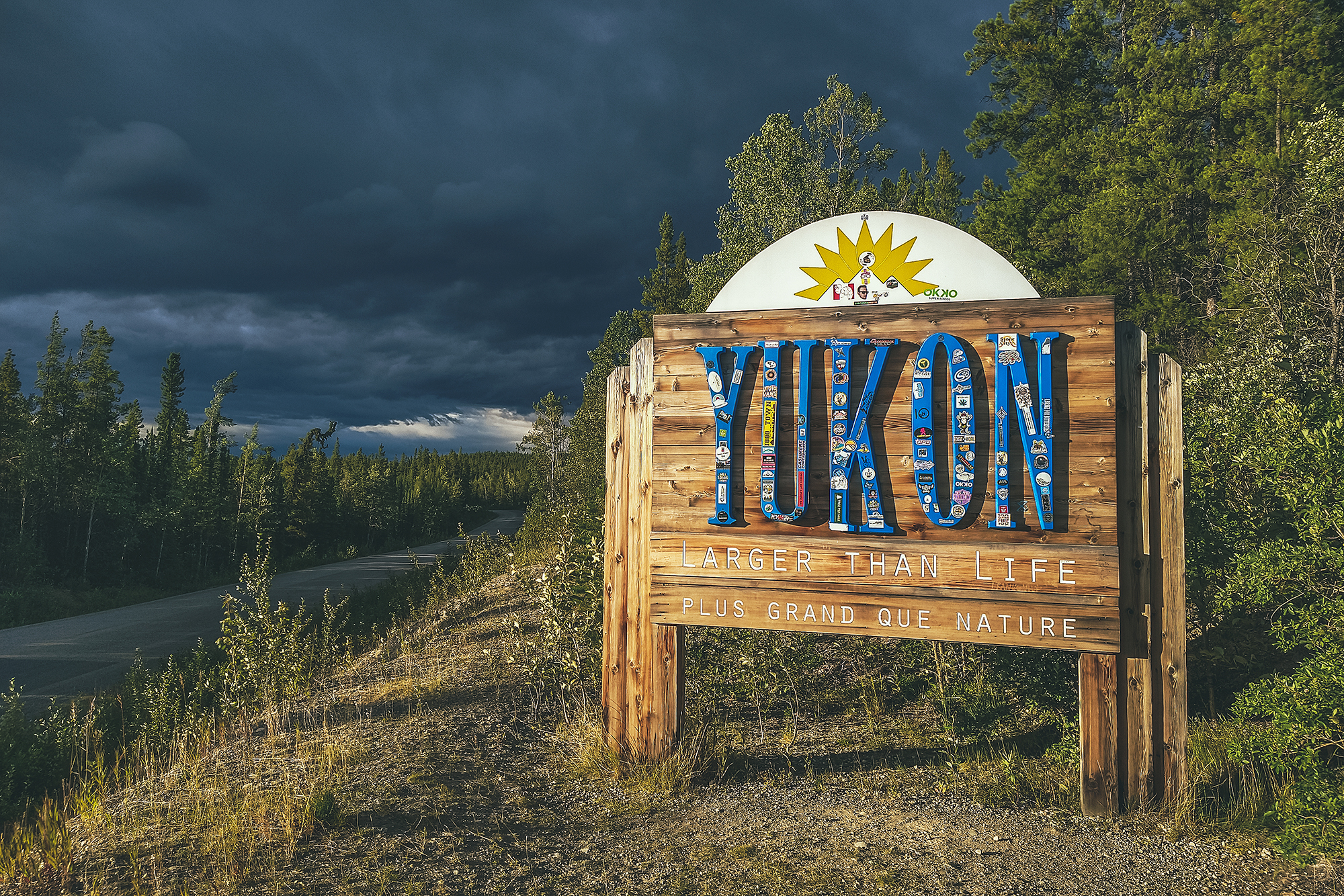
We got back on the road and drove to Watson lake to spend the night, stopping only to snap a shot of the Yukon sign as we crossed the provincial/territorial border.

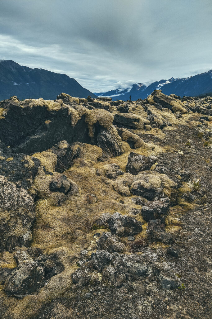
Before leaving the Nass valley that morning, we took some time to check out the two lava flow trails near the campsite. The visitor center at the entrance of the campground was open, so we walked in to read more about the the volcano eruption.

The Nisga’a oral tradition tells the following story of how the volcano erupted (from nisgaanation.ca):
Long ago, two children were playing down by the river. One child caught a salmon and slit open its back. The child stuck sticks into the salmon’s back, set them on fire, and returned the fish to the river. The children were amused to see the salmon swim erratically, smoke rising from its back. The other child caught a salmon and slit open its back, inserted a piece of shale, and put it back into the river. The salmon floated on its side, weighed down by the shale. The children laughed at the struggling fish. An elder happened upon the scene and warned the children, “Take care what you do. The salmon will curse you and the Creator will respond in kind.” The ground began to tremble and shake. Nature’s harmony had been upset. A scout was sent to investigate. From the top of Gennu’axwt, he saw smoke and flames and ran to warn the people of their fiery destiny. In panic, some villagers fled up the mountain. Others canoed to the far side of the river but were killed by the lava. As the people watched the lava flow over their villages, Gwaxts’agat (a powerful supernatural being) suddenly emerged to block the lava’s advance. For days, Gwaxts’agat fought back the lava by blowing on it with its great nose. Finally, the lava cooled and Gwaxts’agat retreated into the mountain where it remains to this day.
The shortest way back to Highway 37 is via the continuation of the Nisga’a Highway, east of Gitlaxt’aamiks. The road is barely more than a dirt track, and a bit narrow in parts so I could see how it would be a bit challenging for big RV’s, but our Jeep had no issues.
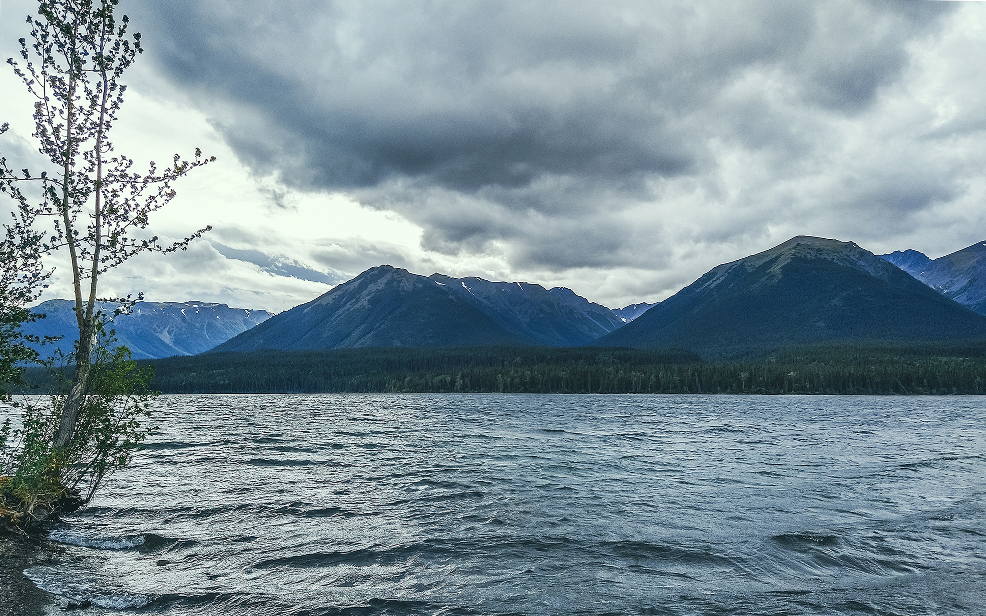
Upon reaching Highway 37, we headed north to Meziadin junction, and stopped at Meziadin Lake, a really pleasant provincial park and campground, with RV spots right on the water.
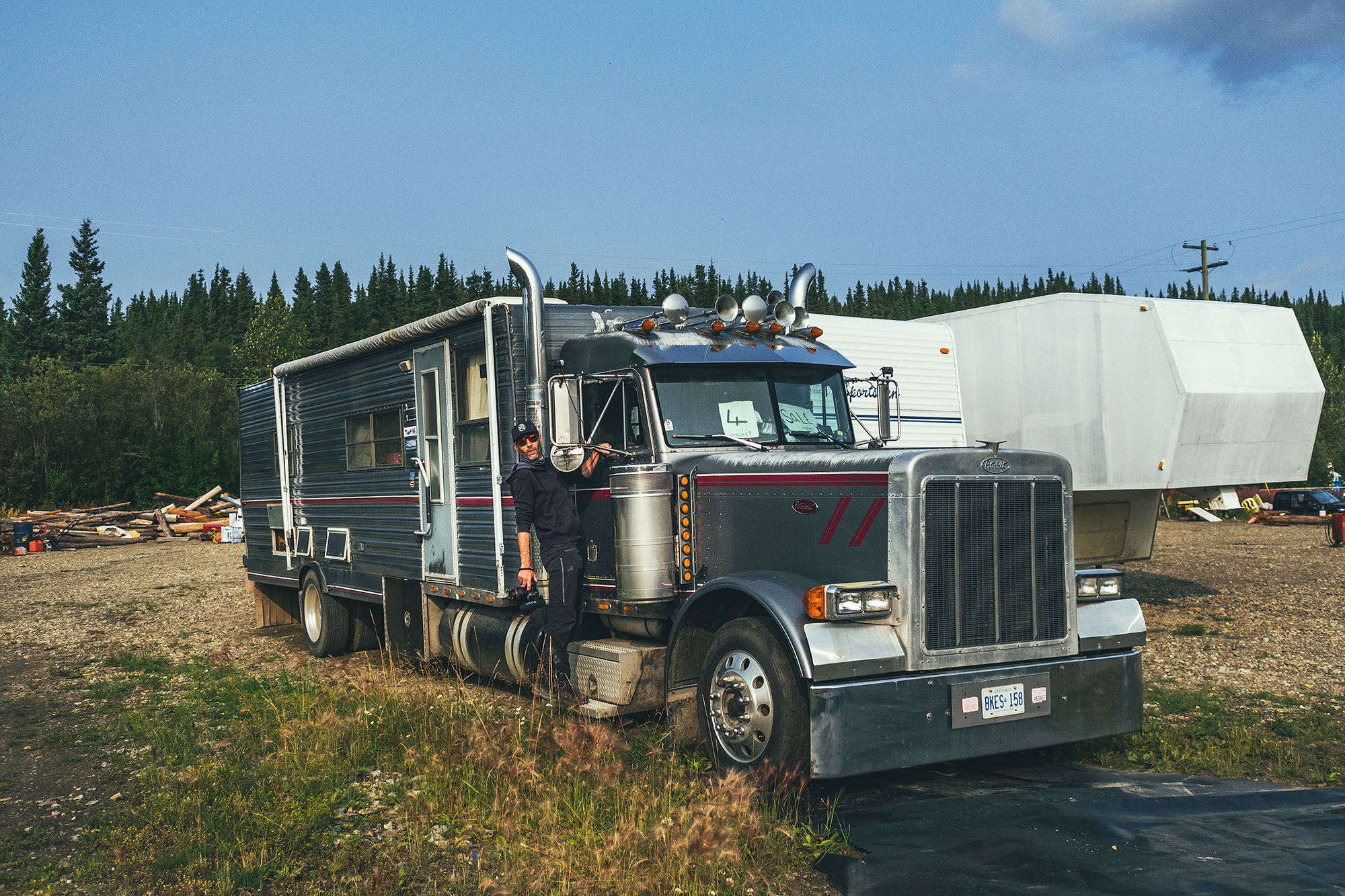
We had lunch and Brice chatted with another traveler about RVs and brake systems, etc…We’ve been enjoying sleeping in a tent so far, but I could definitely see how traveling this way for a long period of time would warrant a more sturdy set-up. We saw some really big rigs along the way, people whose home was basically on wheels and traveled up and down the country year-round. To that effect, we saw lots and lots of campgrounds and RV sites along the way, and never had any issue finding a spot to camp – although maybe our timing had something to do with it, as campgrounds might have been busier earlier in the summer.
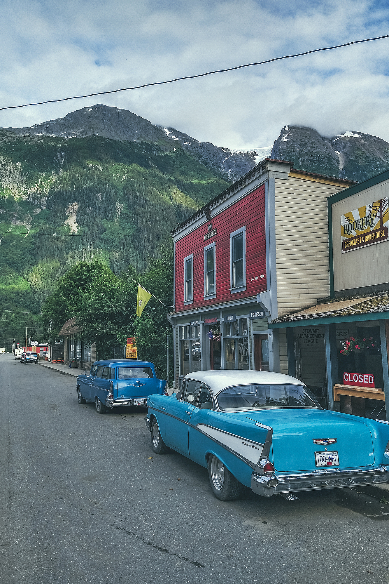
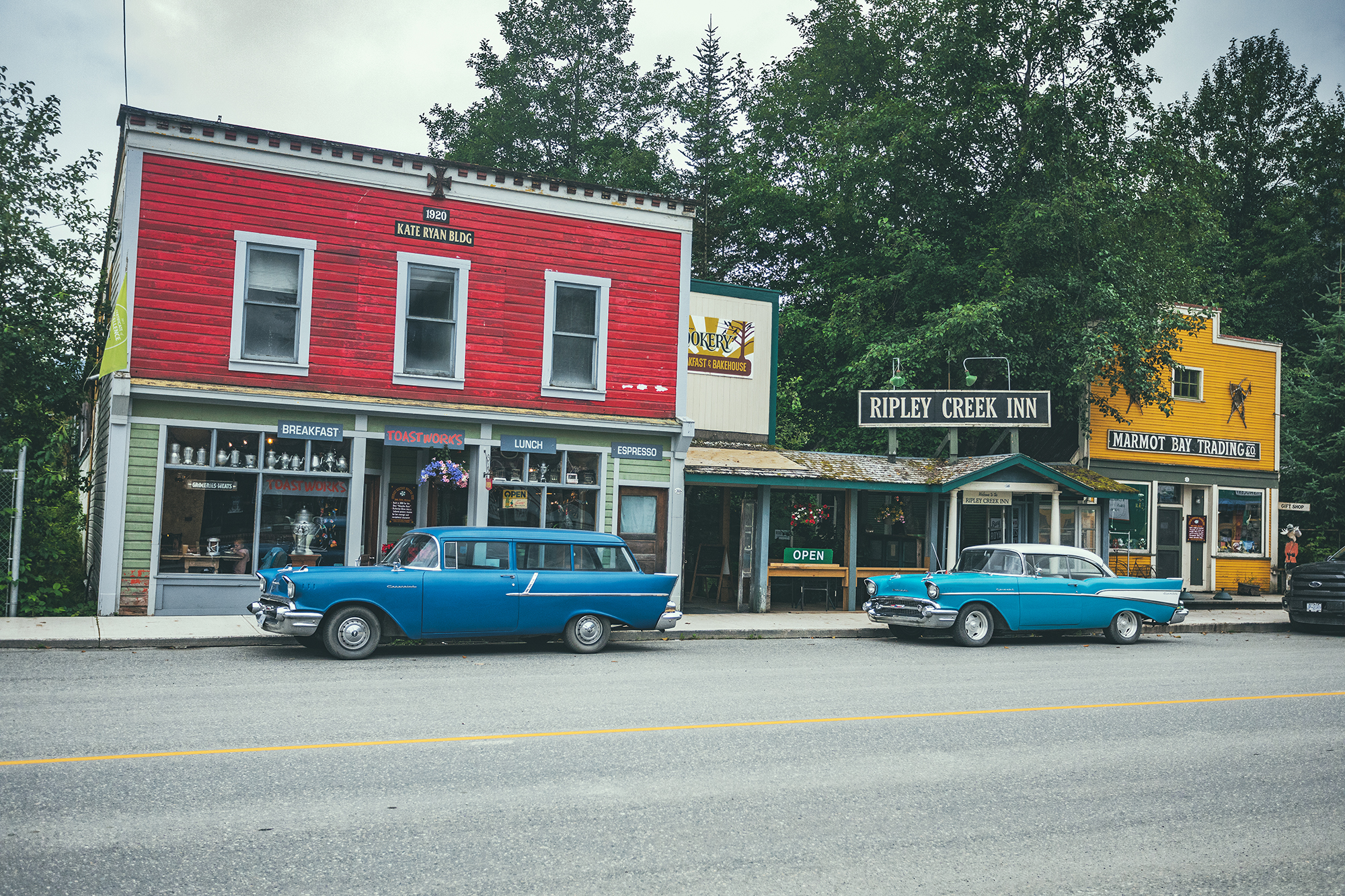
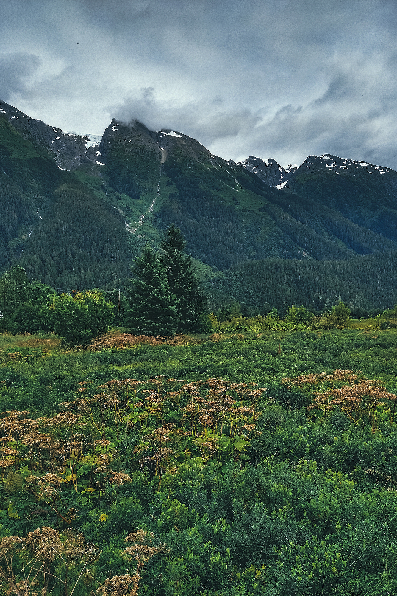
After this lovely sunny break, we got back on the road and headed west on Highway 37A, towards Stewart. On the way we stopped to admire the imposing Bear Glacier, which is visible right off the side of the road.
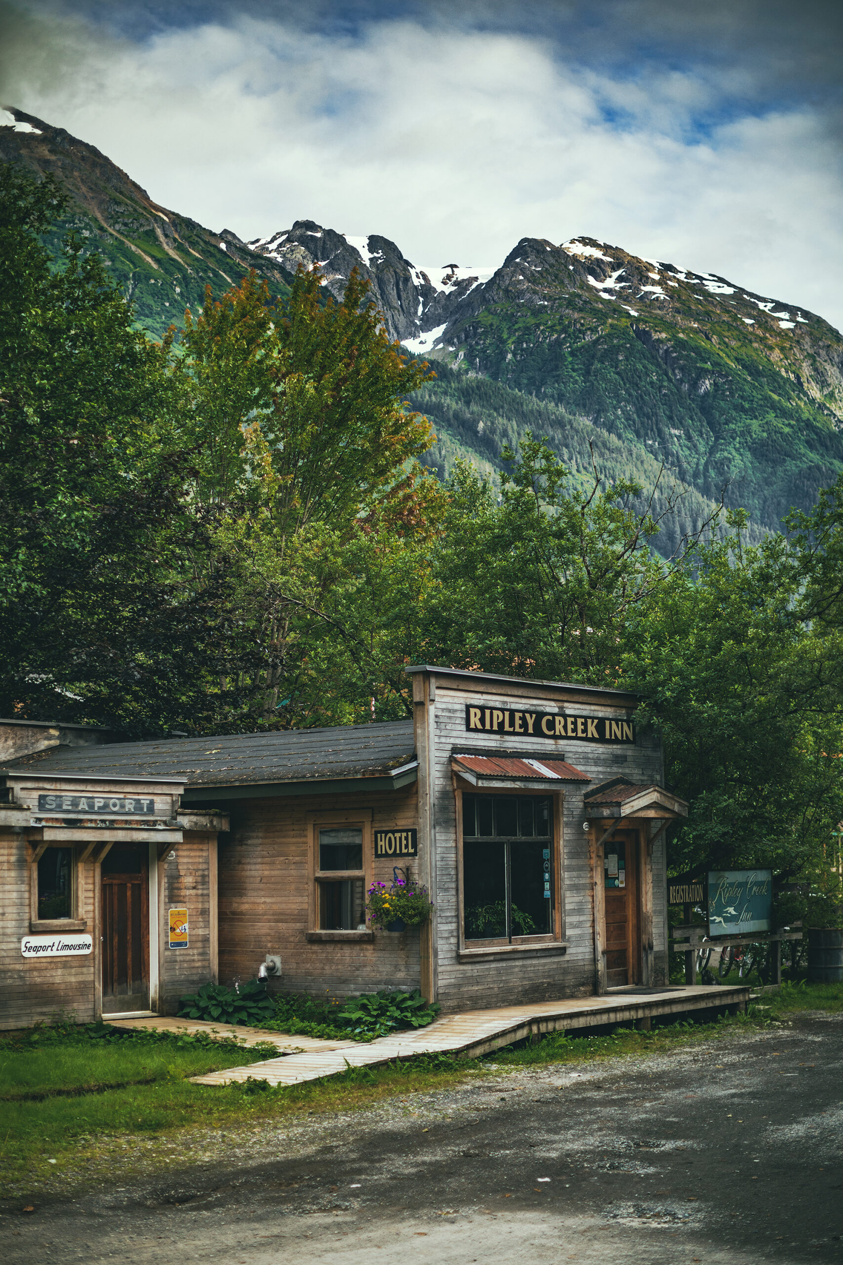
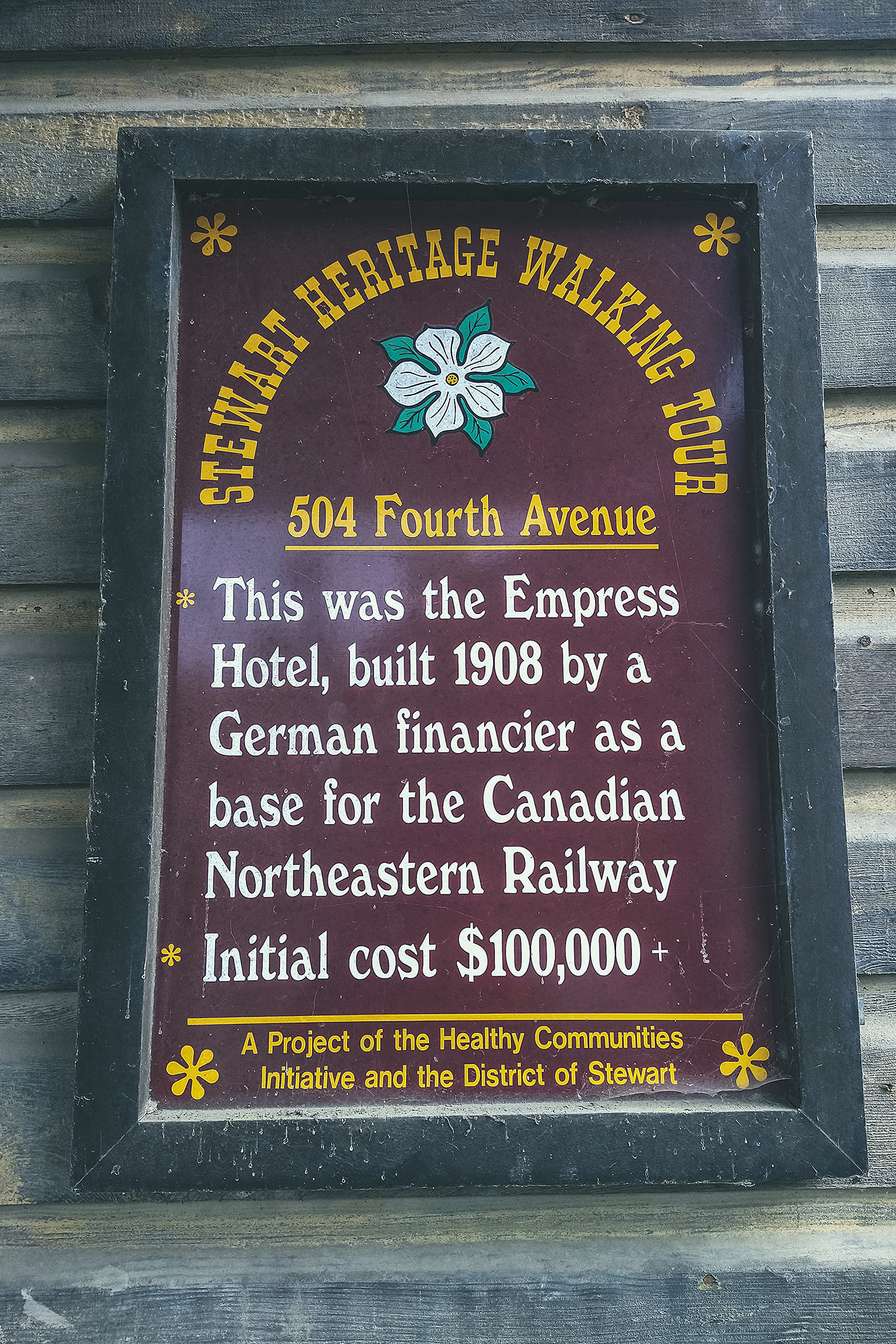
The town used to have a population of about 10.000 at the start of the 20th Century, thanks to gold and silver mining, but it is now down to roughly 500.
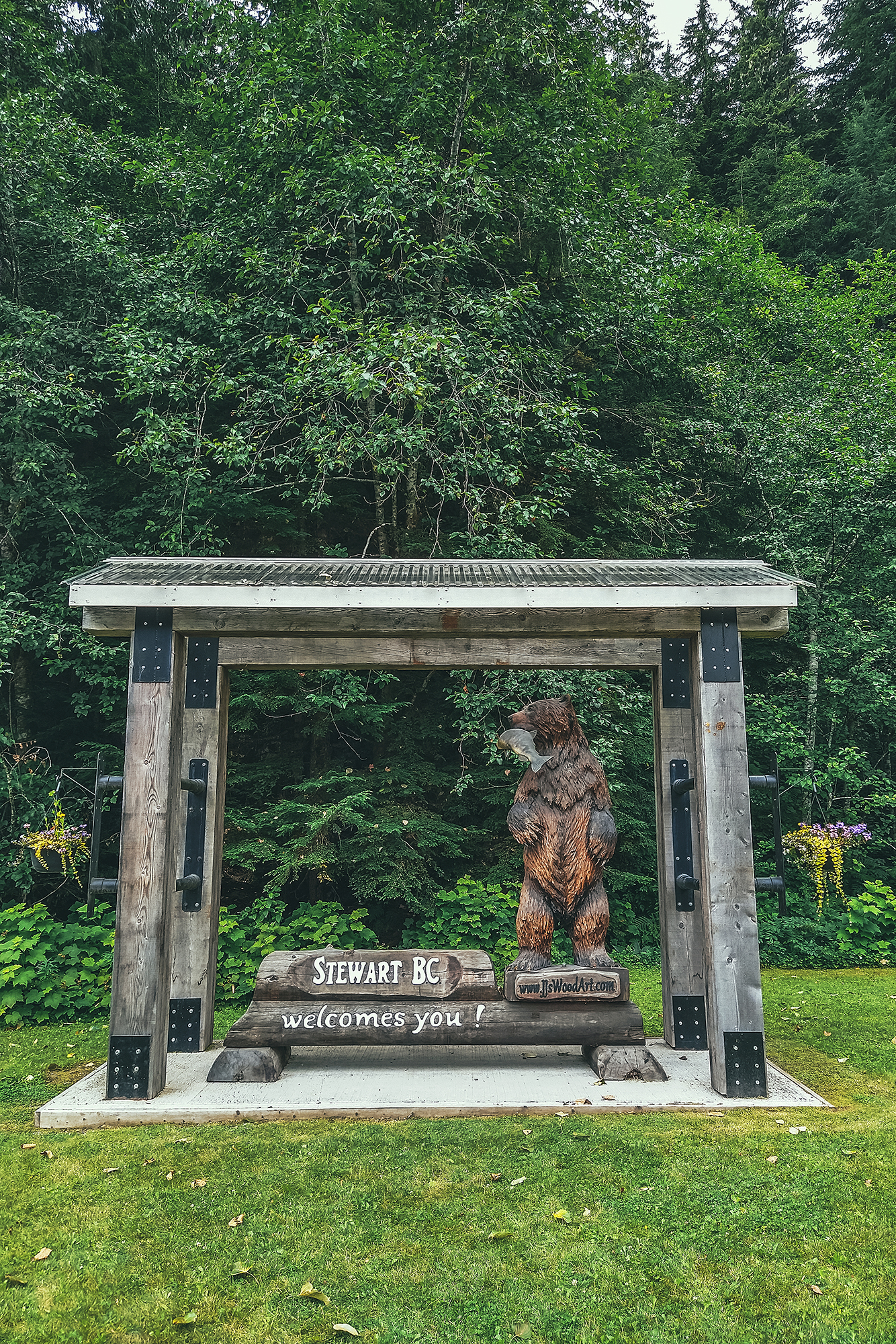
It is still a tourist destination, set in quite a scenic spot, on the edge of the Portland Canal and framed by mountains on either side. It is also right on the border with Alaska – although there is only one small hamlet on the other side, Hyder, AK, population 40! We drove to the “border”. There actually isn’t an American custom to get in, but there is a Canadian one to come back. As expected due to Covid, the border had a big sign indicating “locals only”, so it confirmed that we weren’t going to be able to cross into the US on this trip.
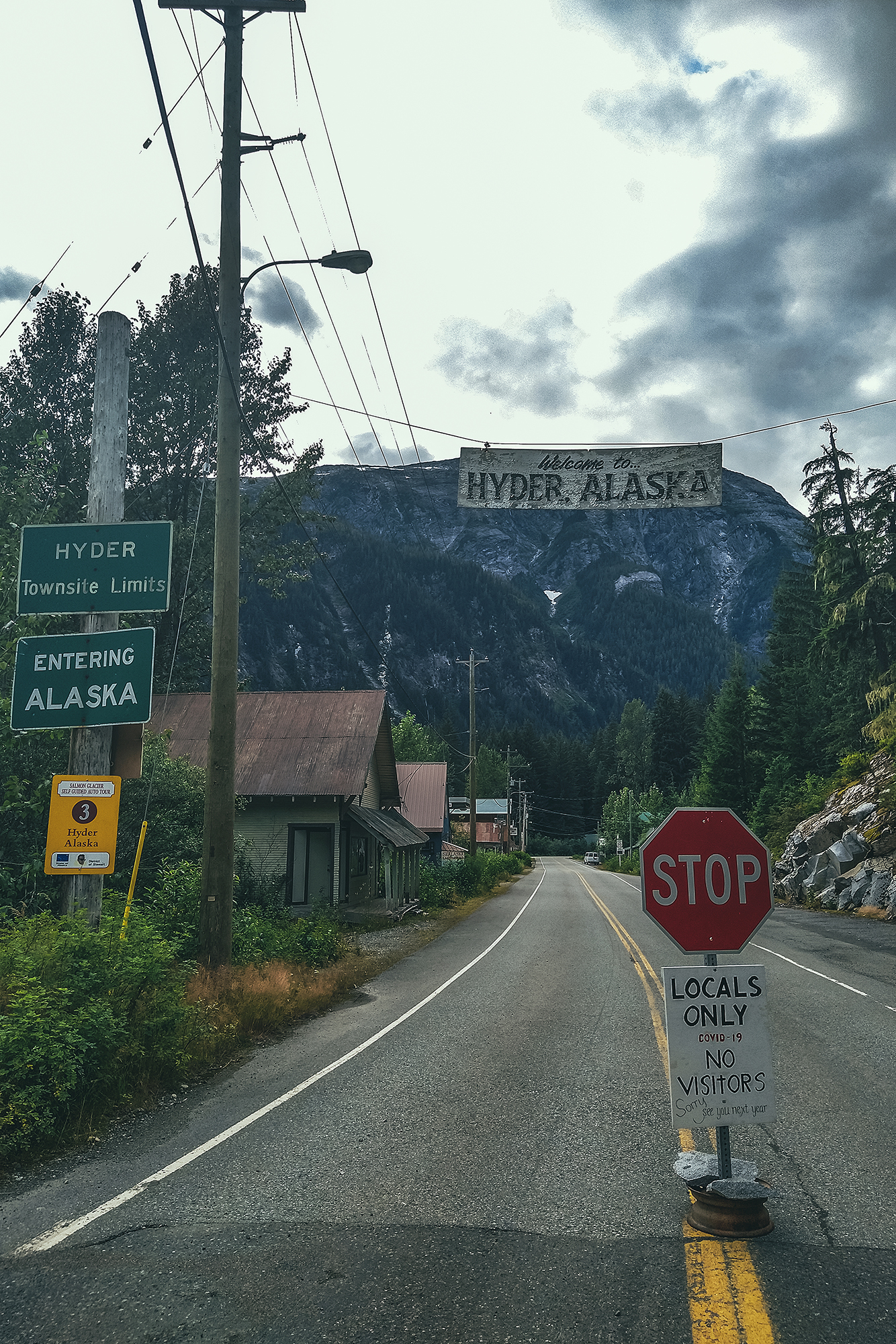
When we got to the campsite, we asked the manager about the border and she said that if we crossed, we’d have to isolate for 14 days upon returning – since there was no way of getting a Covid test done on the other side. We asked about the people in Hyder, who have no other road access to the rest of the continent, let alone the US, and she said they were basically stuck there, only allowed to come into Stewart once a week for a few hours, to get groceries.
I had hoped that we could drive all the way to Salmon glacier in Alaska, which can be seen off the side of the road, but that clearly was off the table. We still decided to stay 2 nights in Stewart, to get some time off driving and explore the area near town.
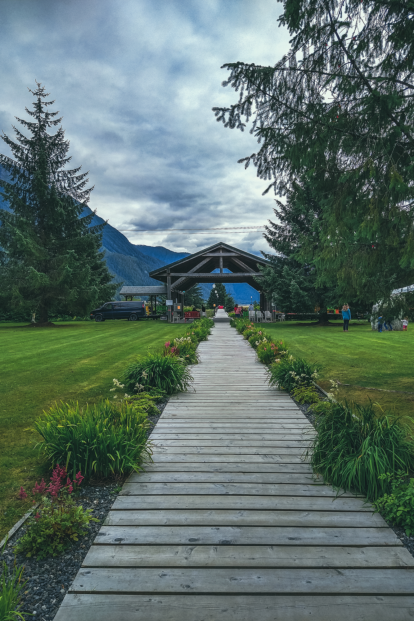
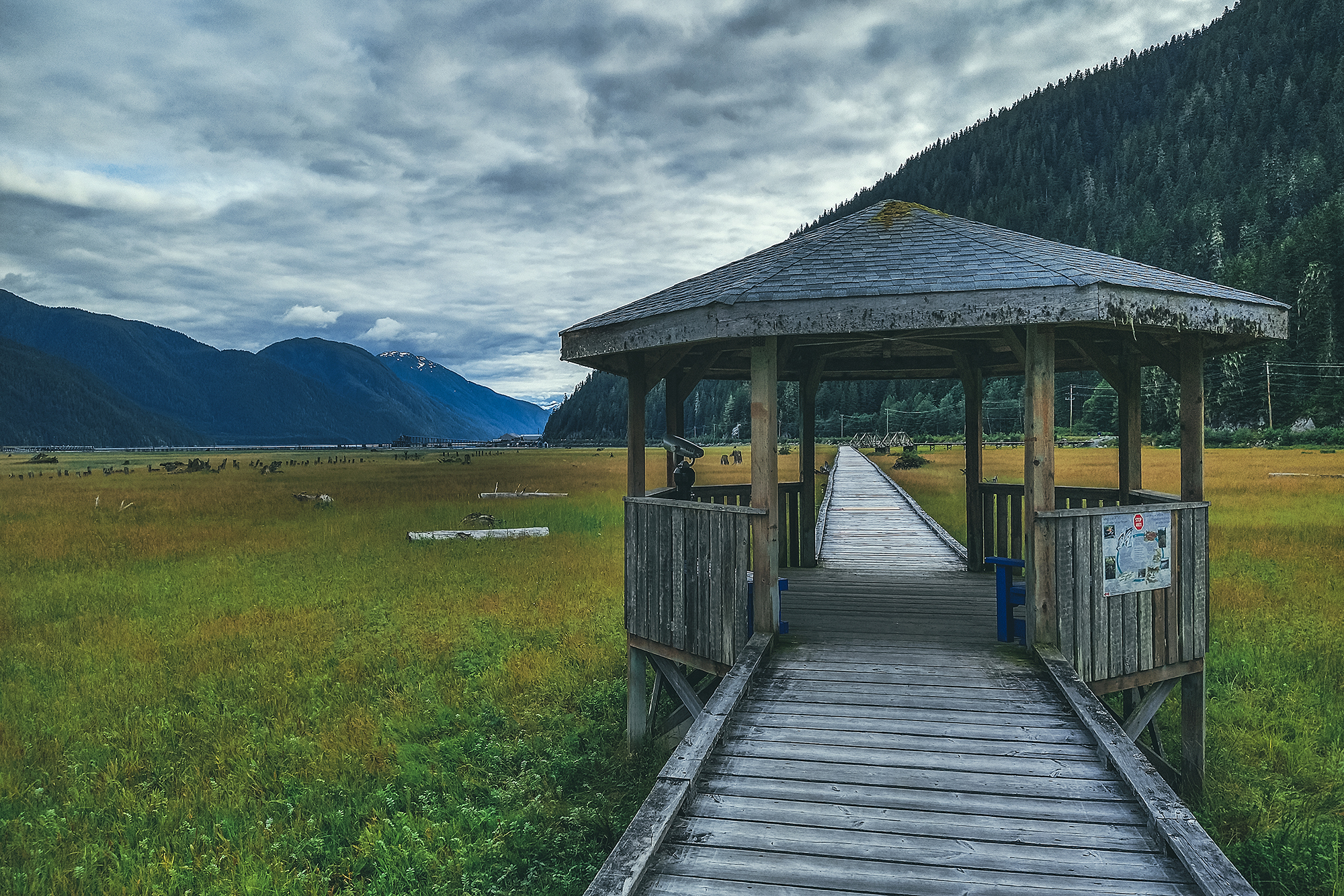
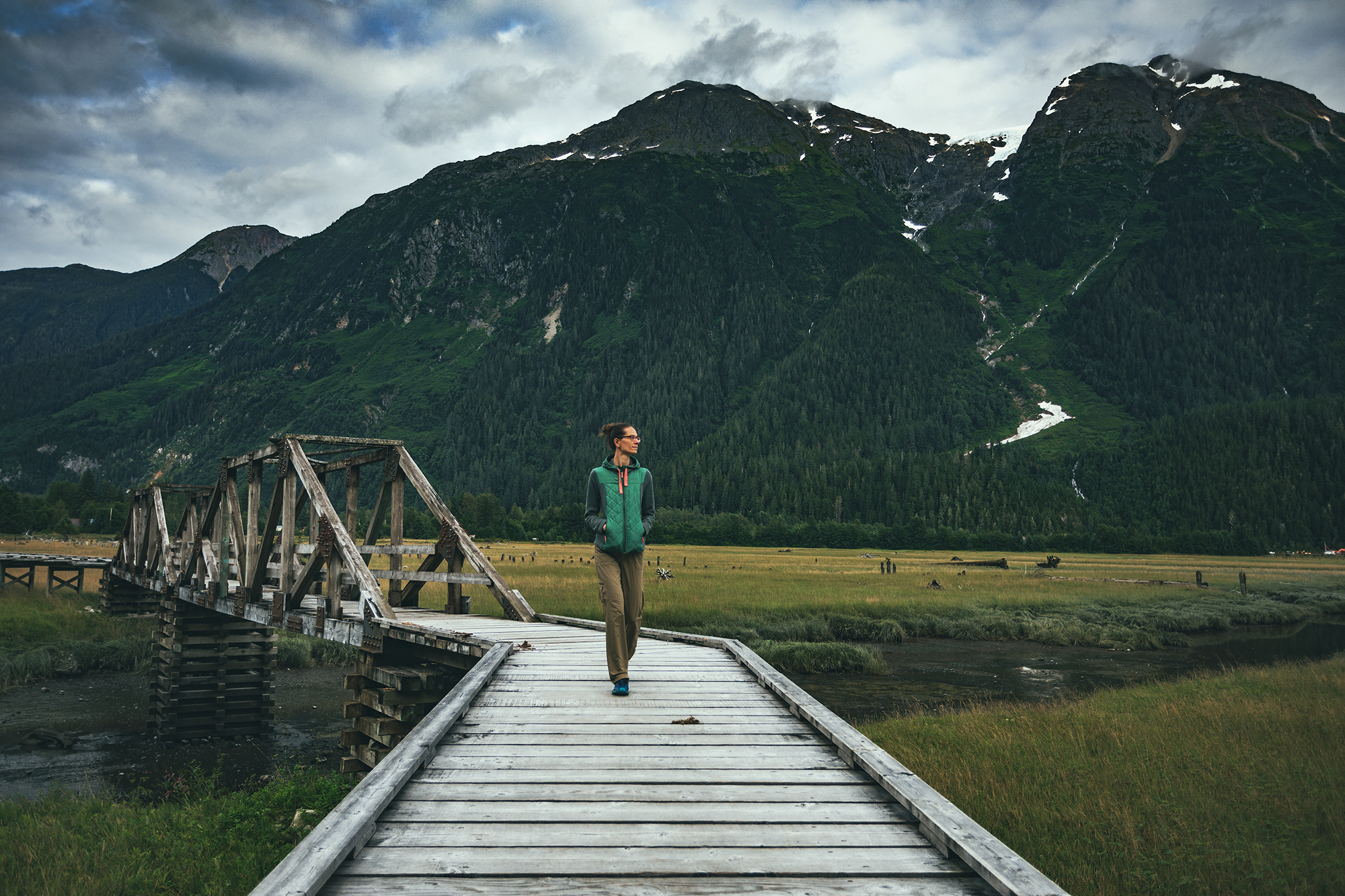
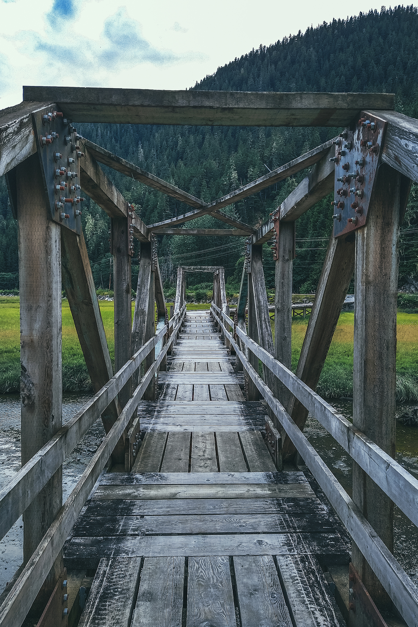
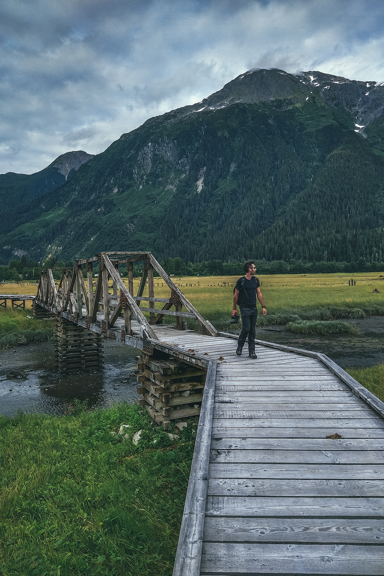
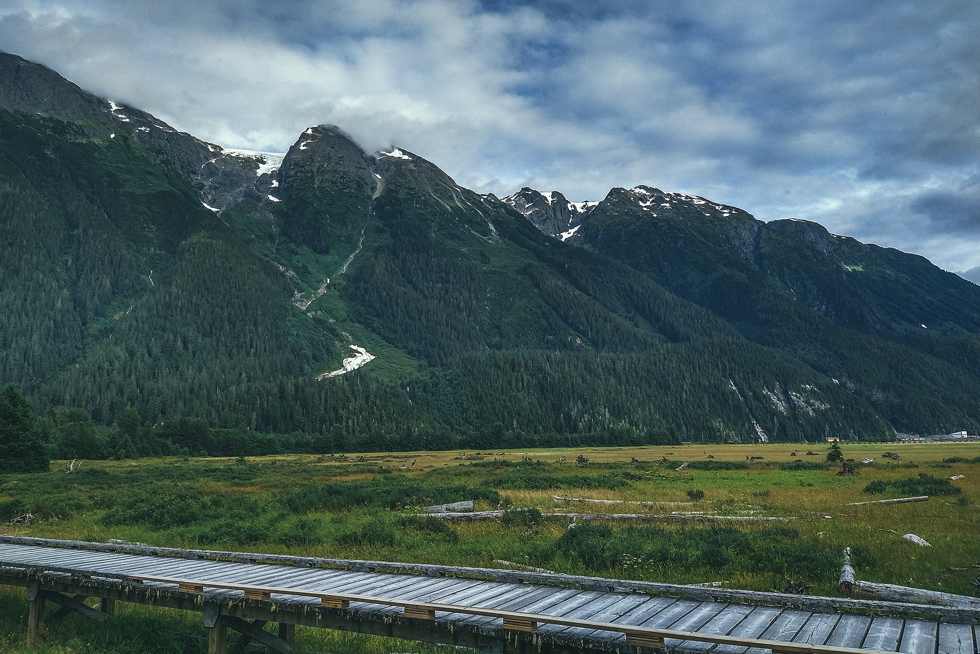
The weekend we arrived happened to be Stewart Community days, so there was a BBQ happening in the town park. We took a stroll down the boardwalk that stretches over the marshy ground of the inlet, right off of Main St, and chatted with a retired couple who had sold their house and were now living in their RV year-round, traveling around Canada and the US.
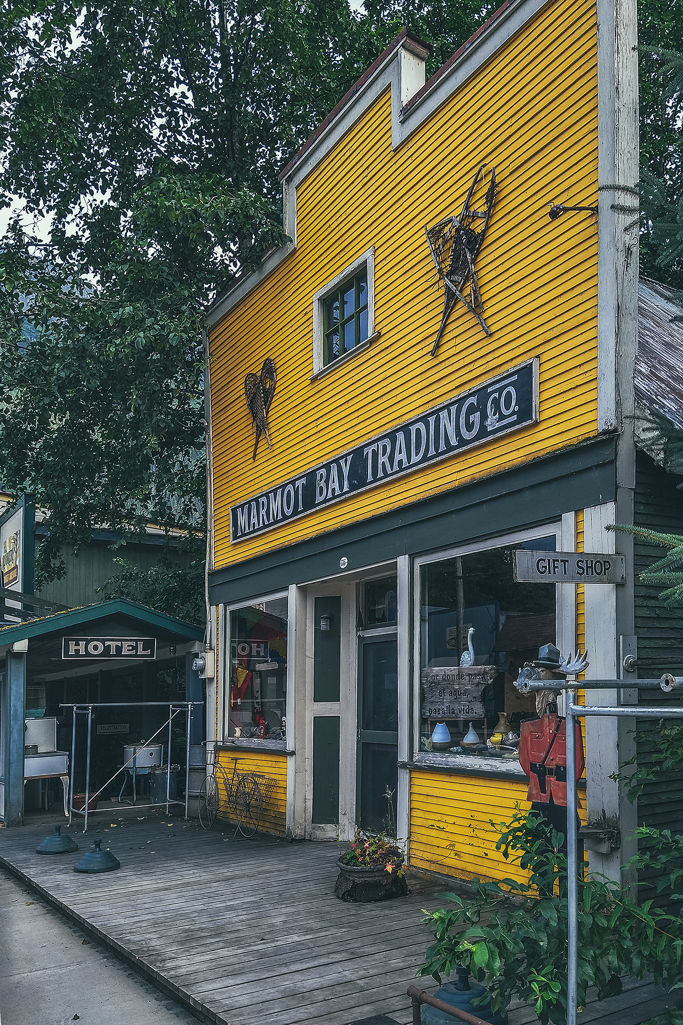
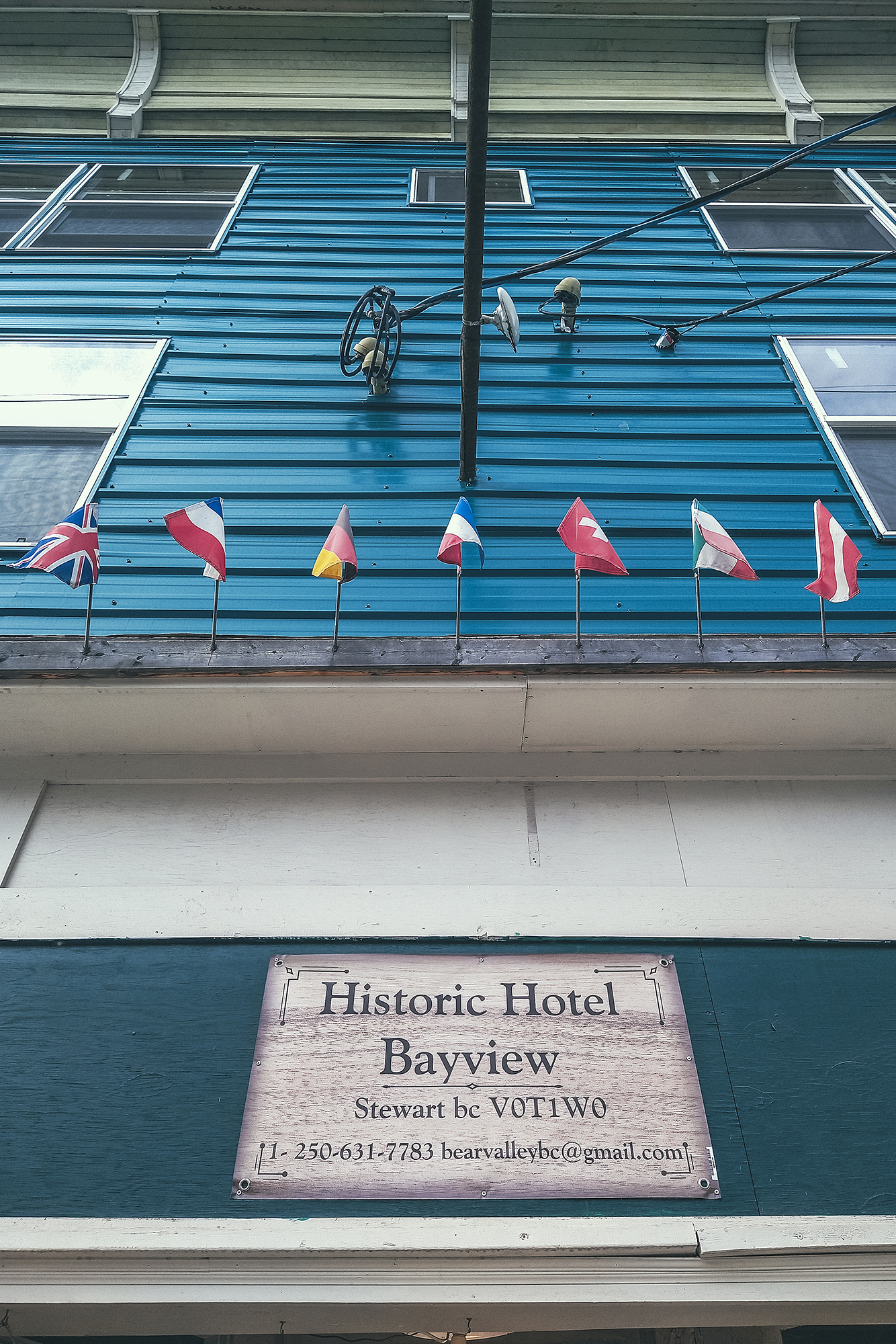
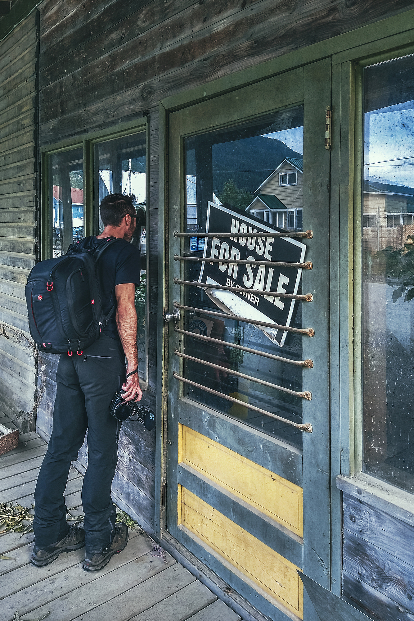
We also walked down the few blocks on and around Main Street, lined with old-timey shop fronts. The rest of the central area of town looked half abandoned, including the very spooky hotel. We did see a few newly-built houses here and there, but the town definitely had a bit of a ghost town feeling in some areas.
The main campsite was located right on the edge of town, so we were able to walk to and from there easily, a nice break from all the driving.
In the morning, we had breakfast at the Rookery, local joint which doubles as a toaster Museum (aka Toastworks) displaying an impressive collection of toasters and other vintage looking artifact.
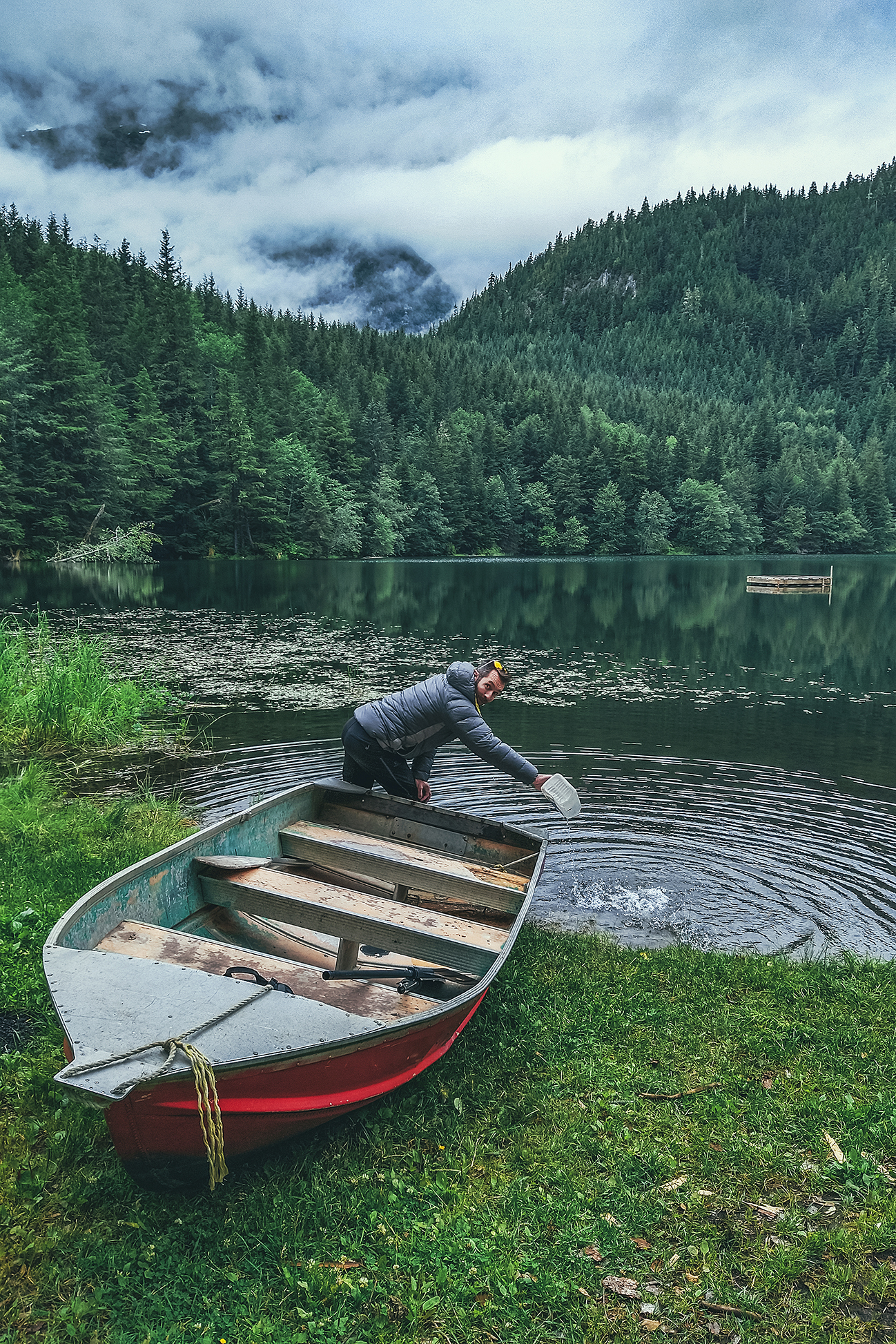
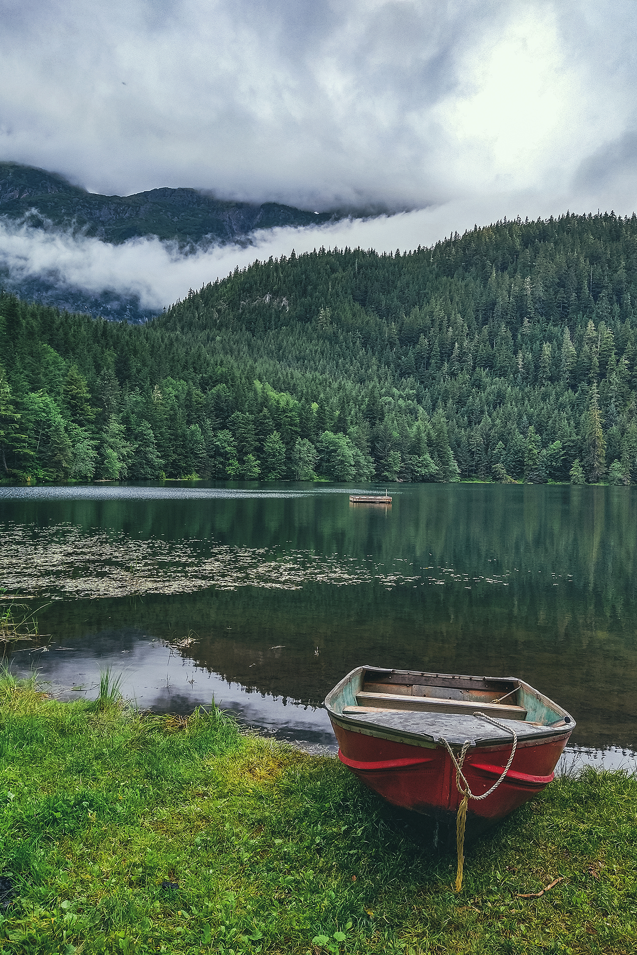
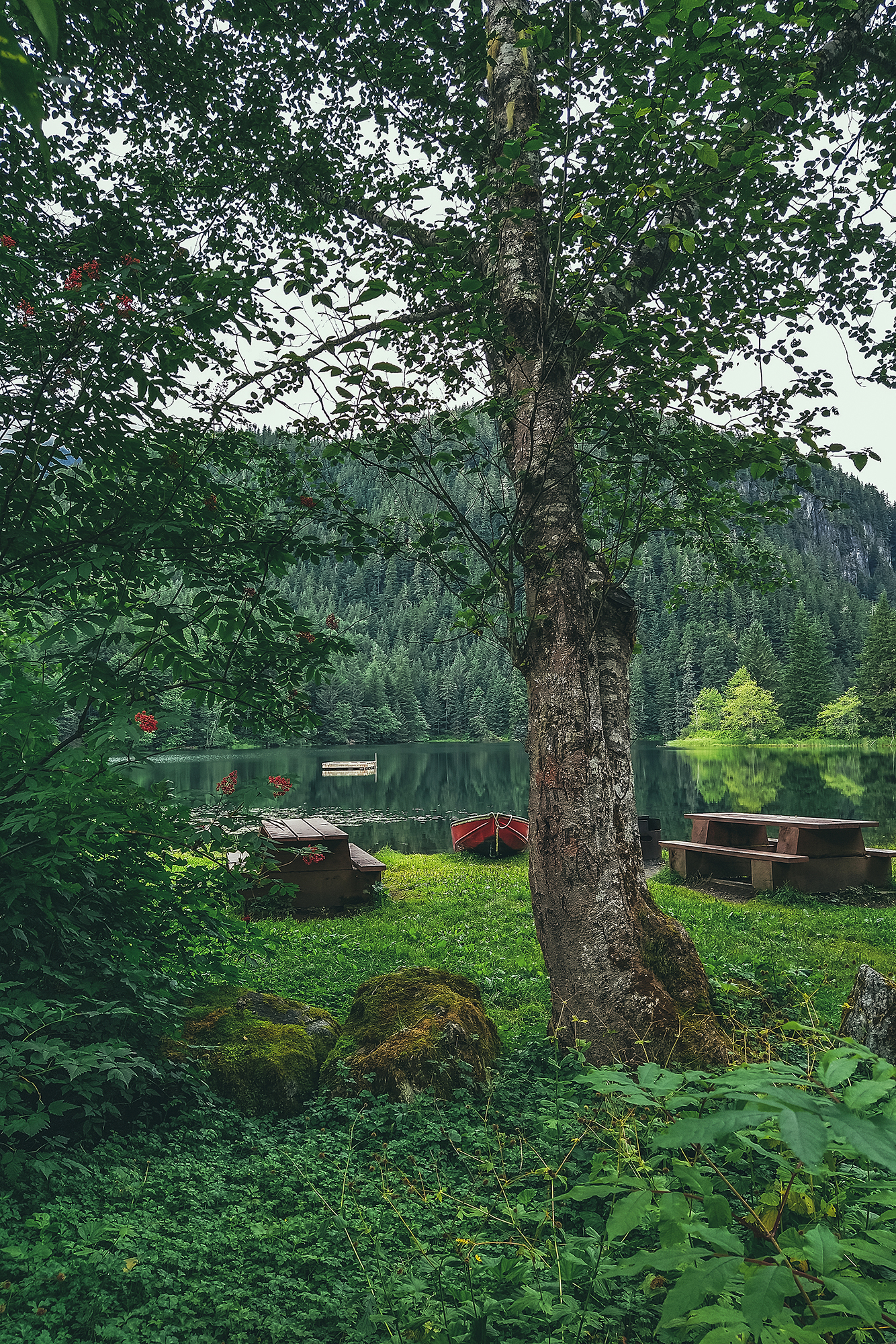
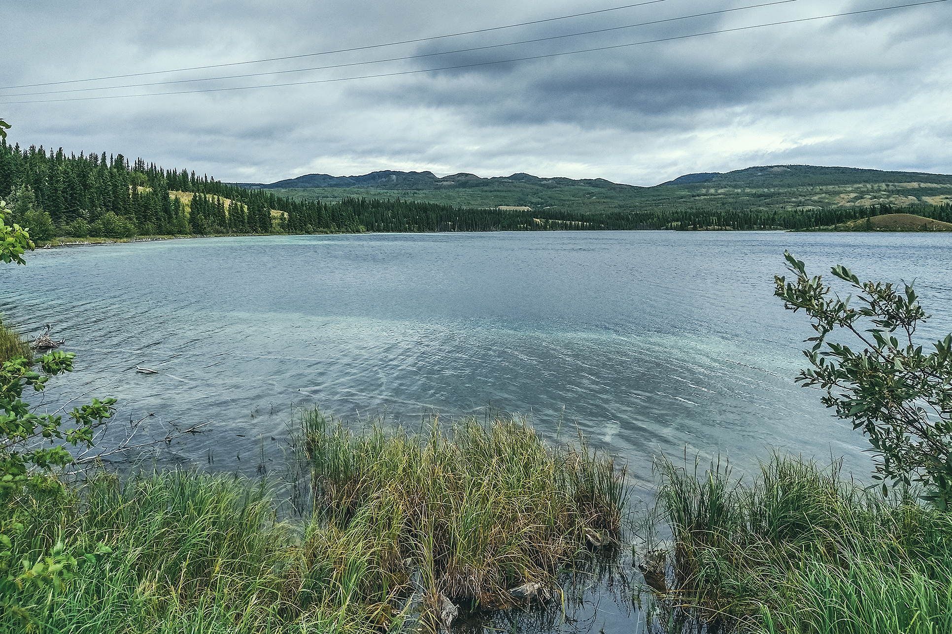
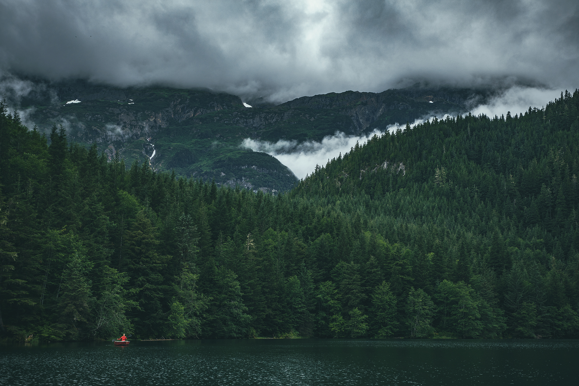
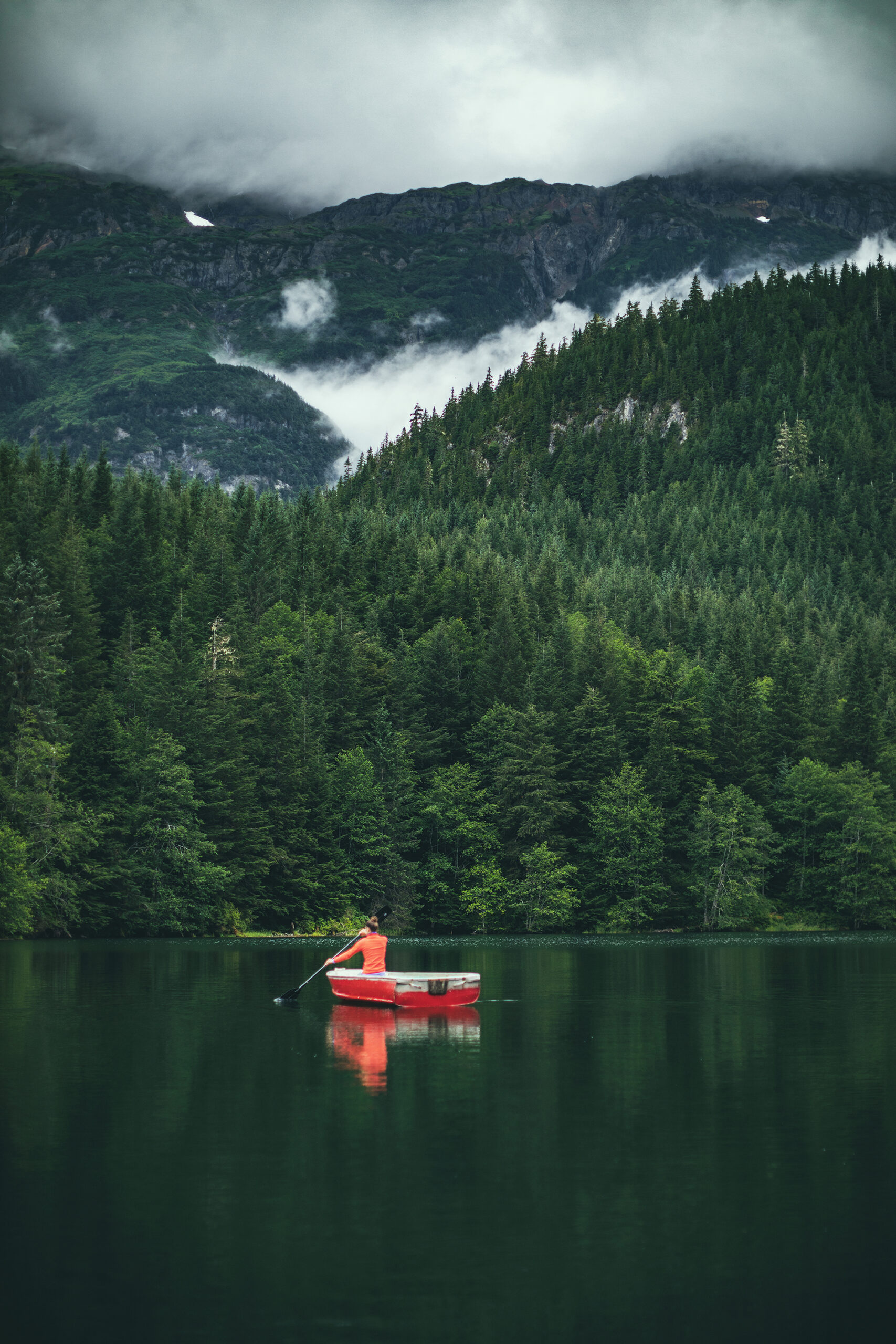
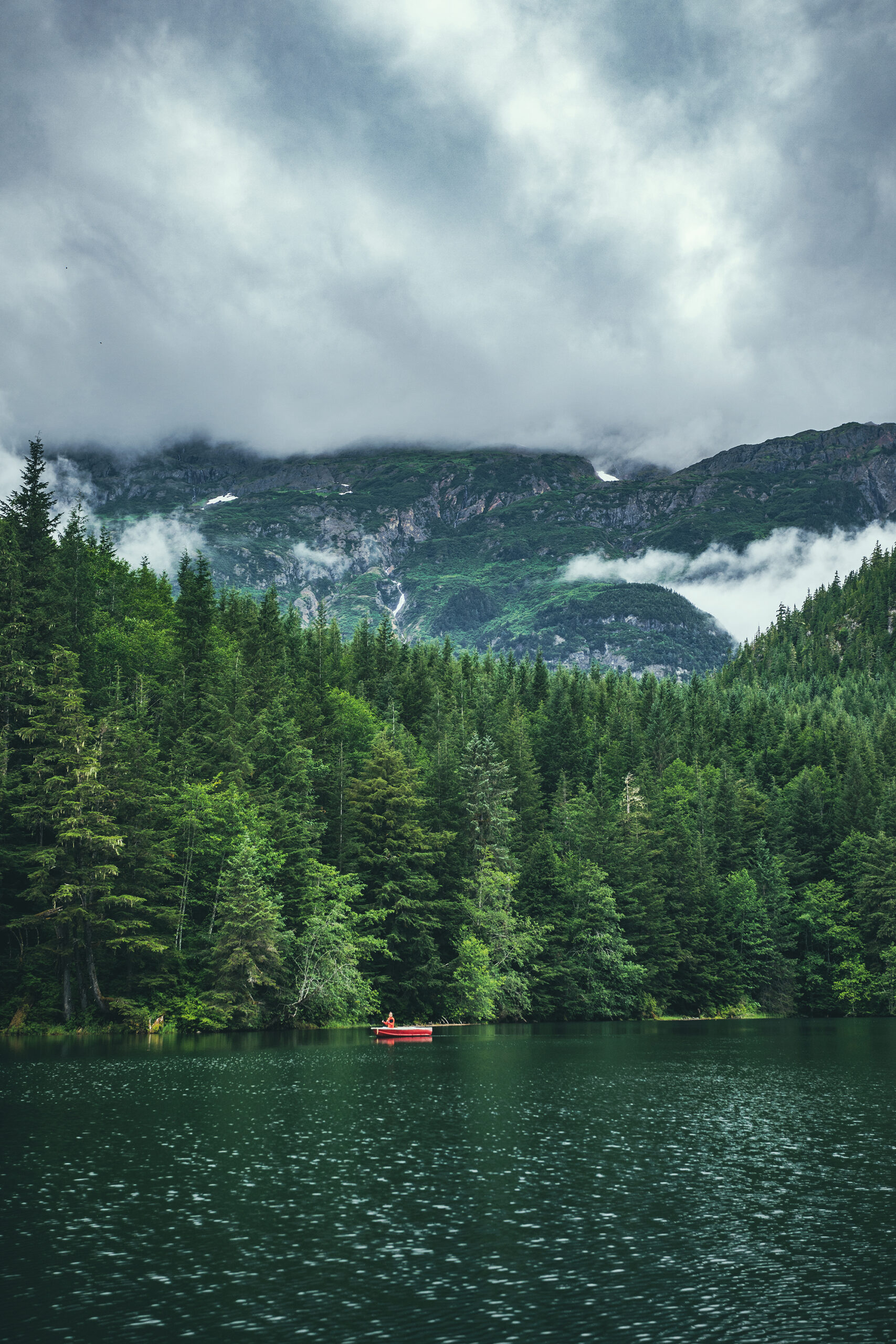
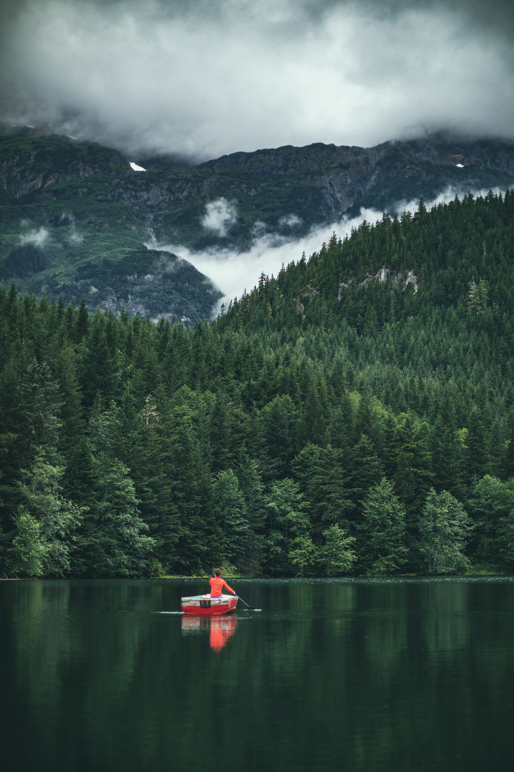
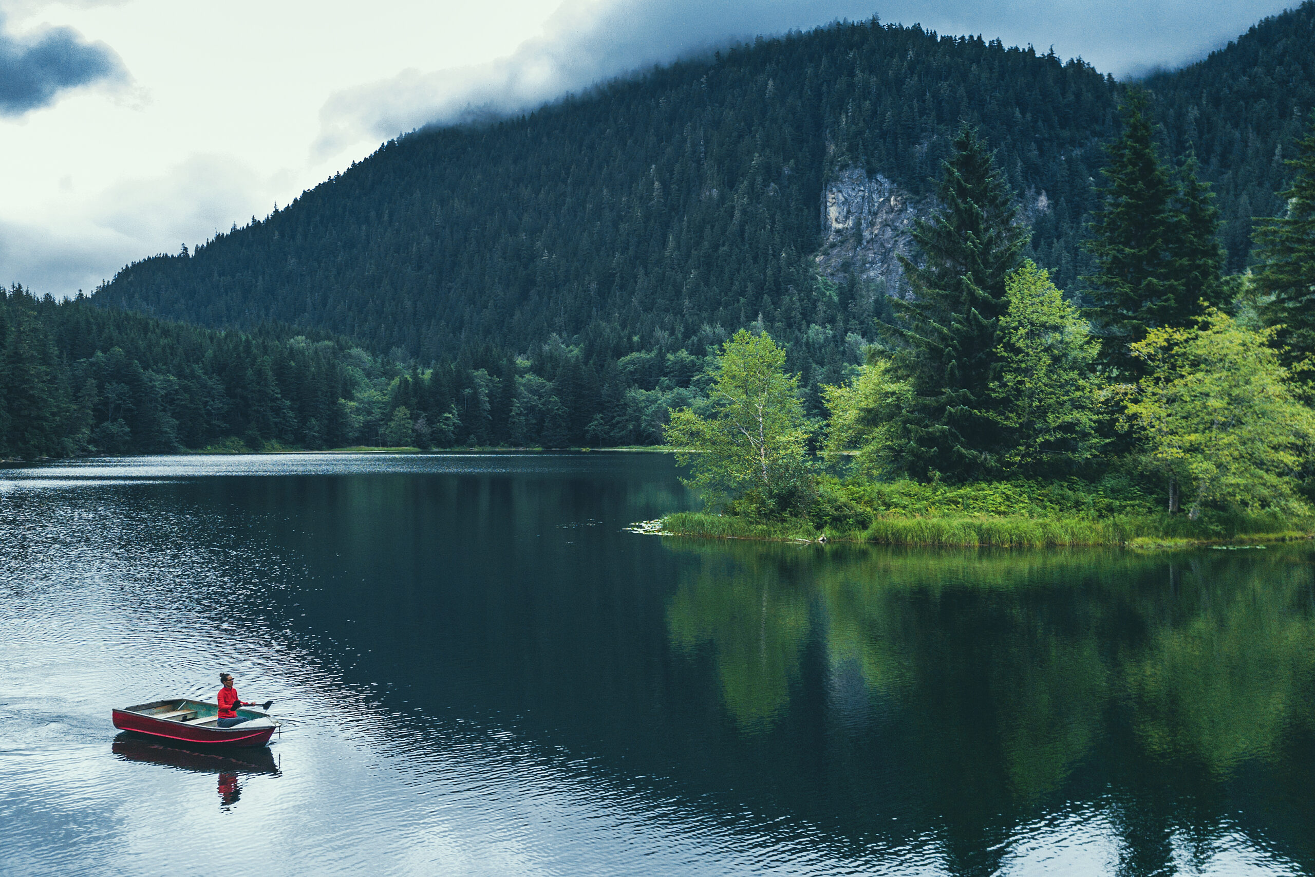
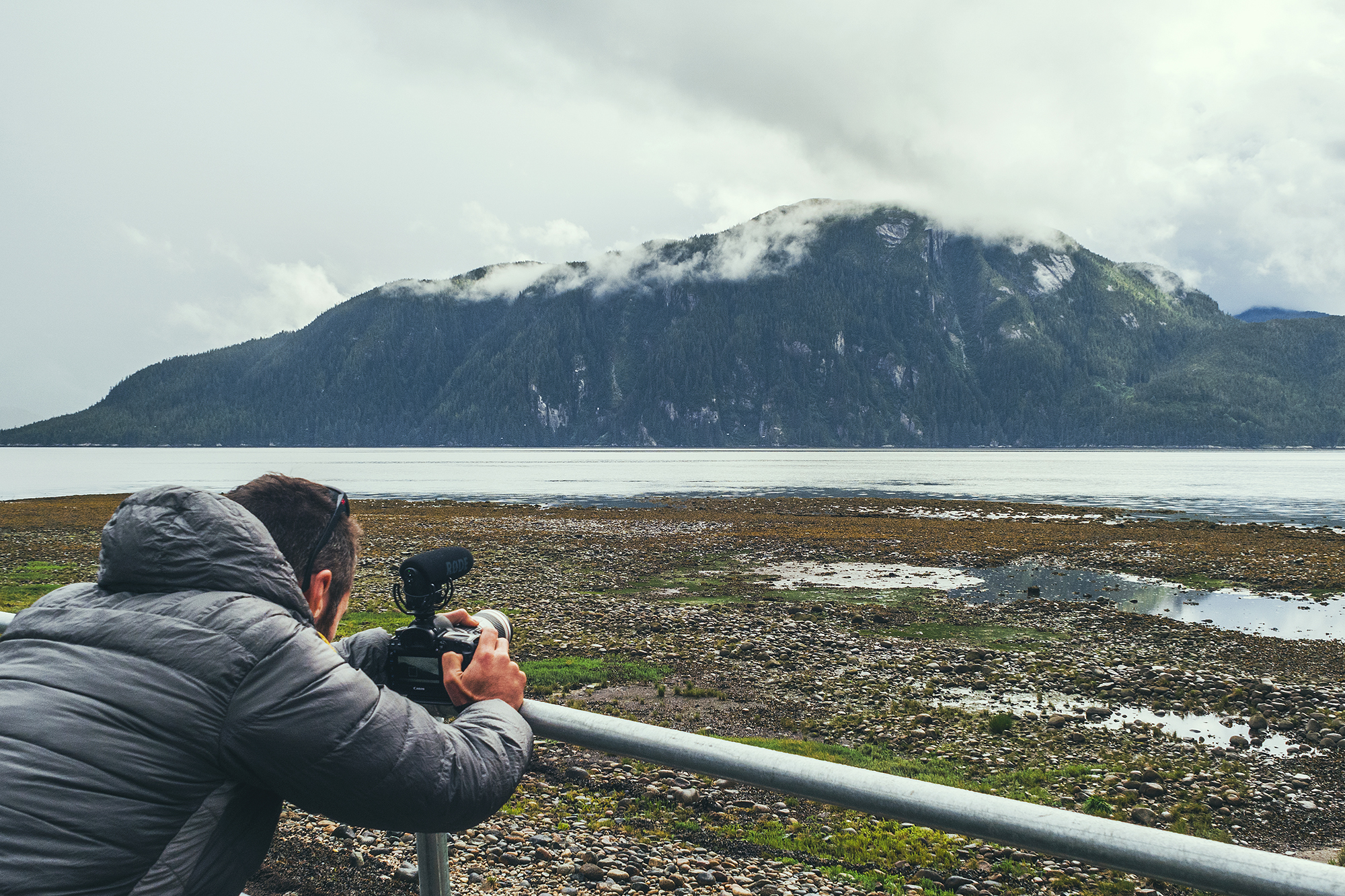
I was looking for a potential hike to do that day, but there weren’t many listed on BRMP or AllTrails, and most of them seemed to involve some amount of bushwhacking, plus the mountain tops were all covered in clouds, with no sign of clearing. So we opted to drive out to nearby Clements lake instead. It turned out to be a lovely little lake with even a small dingy left on the shore – for anyone to use we assumed.
So we did and paddled around for a bit, then had some lunch.
In all we spent about 3 hours there, then we drove back and stopped at a few scenic spots along the river. Eventually we got back to camp and spent some time relaxing by the fire.

Later on we went into the local grocery shop and were quite surprised to see how well stocked it was, with little quantities of everything – which I guess it would have to be when the nearest store is otherwise several hundred km away…
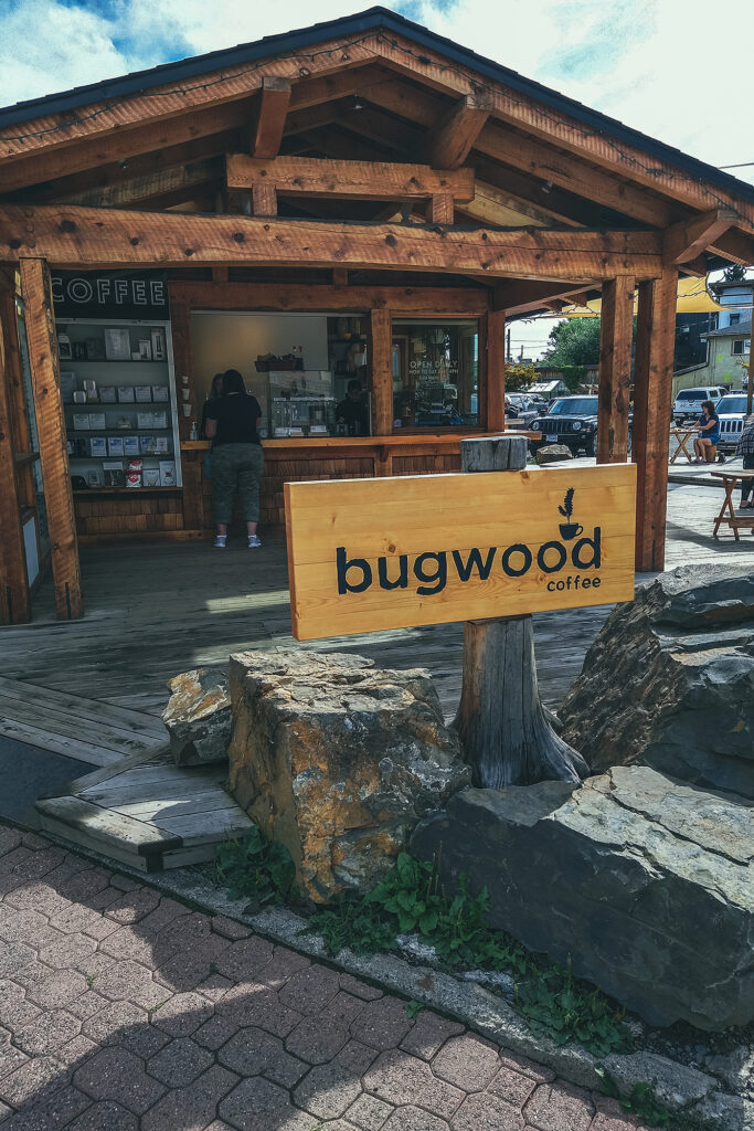
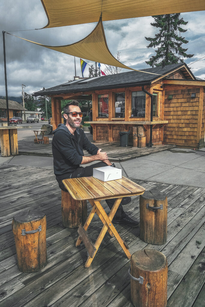
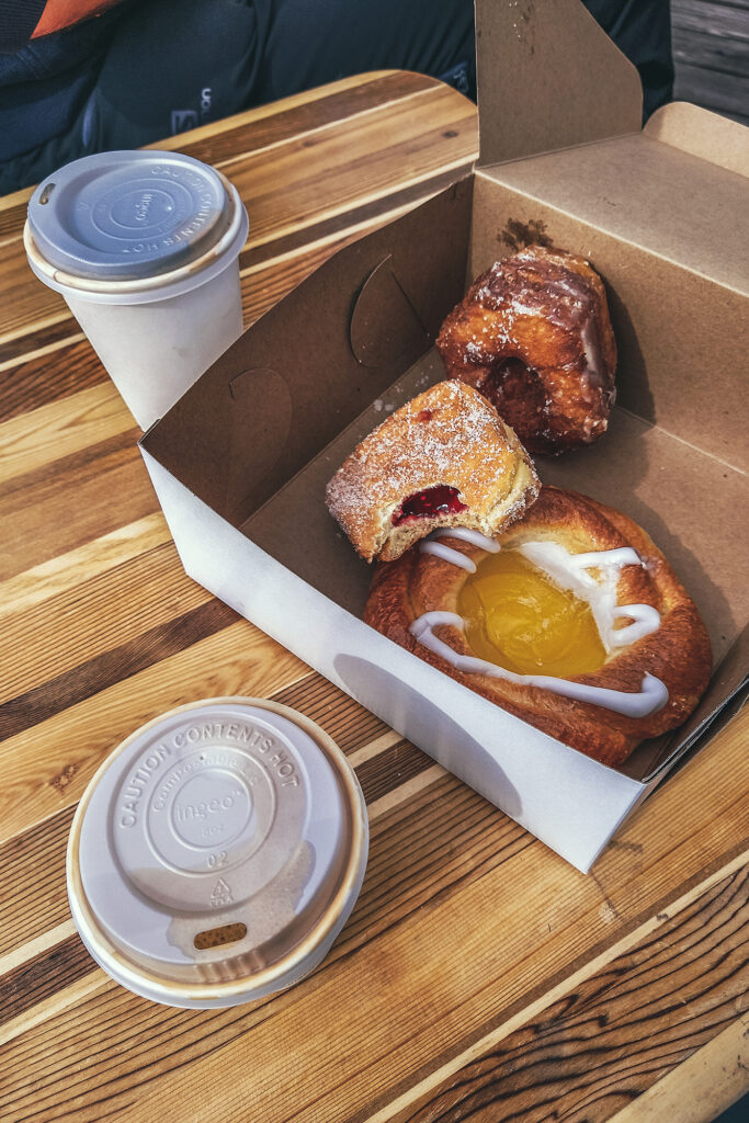
We got up and packed up camp, then headed to Smithers for breakfast and a stroll – We grabbed pastries at Paul’s Bakery and enjoyed them, along with a coffee at the outdoor space behind the Bugwood Coffee stand. Then we took a walk down the three or four blocks along Main St.
Smithers is located on the traditional land of the Wet’suwet’en Yintikh Nation, who live along the Buckley river and Burns Lake.
Smithers has a classic small town vibe of old vs. new: Second-hand bookstore and family-owned butcher shop and bakery, meet new “hipster” stores selling everything clay and linen, a buzzing brewery and an outdoor coffee stand with public piano. It’s a bit of a mixed feeling to witness another old timey town evolving into the same format of “modernity” that has spread in many places. When you’re in one of these newer shops, you could really be in any town in North America, it gets harder to pin-point a town’s identity or original cultural make-up. I guess it’s a good thing that small towns stay alive but it doesn’t feel like the change involves much of the indigenous peoples of the area, who remain on the fringe of the evolution.
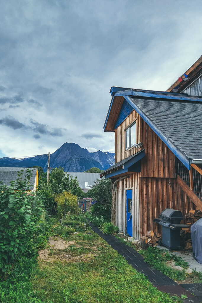
Leaving Smithers, we headed out for a quick visit of Twin Falls, two waterfalls that originate from the Kathlyn and Toboggan placiers – one of which we saw from above the day before. The falls are very accessible, with a viewing platform 5 min down the trail, and another viewpoint almost at the base, another 3 minutes further. After a quick picnic, we continued North to the Hazeltons.
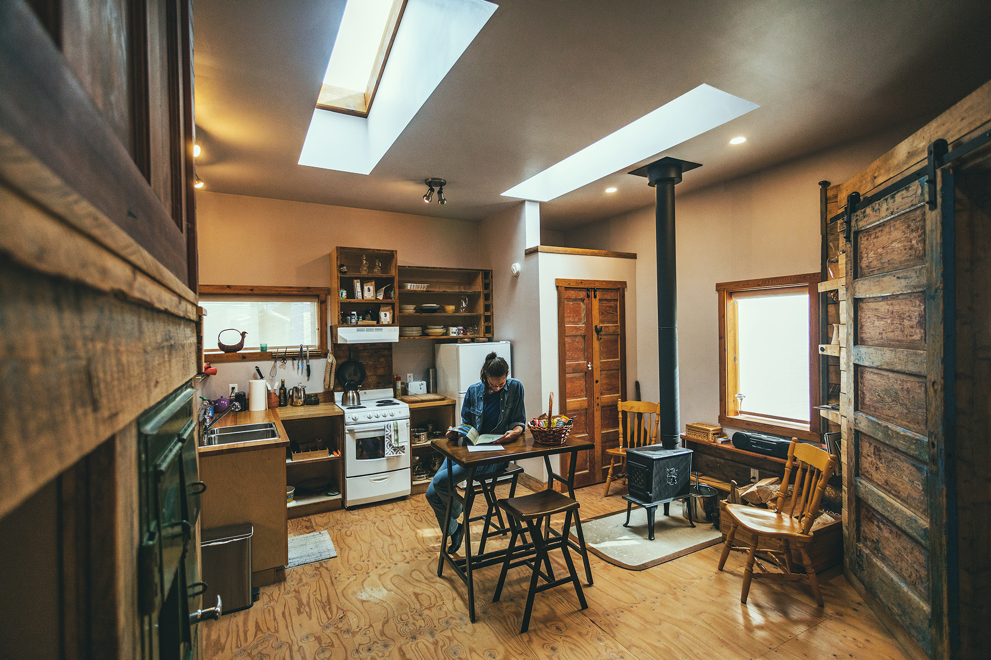
The Hazeltons refers to two small towns, on either side of the Hagwilget Canyon. Old Hazelton is located in the Gitanmaxx Band territory. The Old Town is more or less 2 blocks of of pioneer-era Buildings, most of which have been repurposed for modern use but preserved in their former state. Our Airbnb actually happened to be a small laneway house at the back of one such old town building, now a residence & guest house.
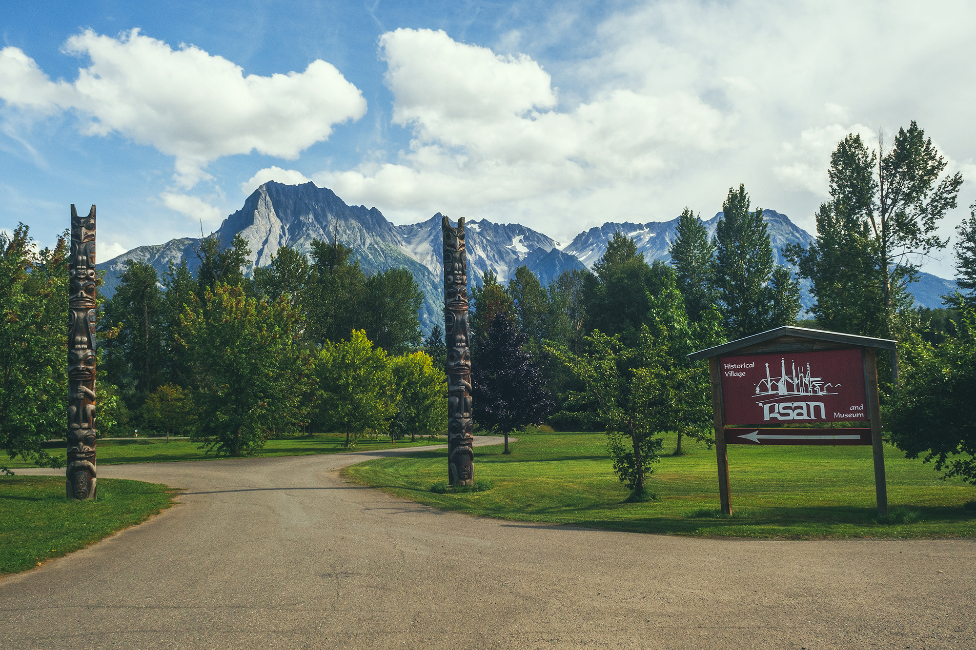
Before settling down for the day, we headed to the ‘Ksan historical Village & Mureum. The site is a replica of a traditional Gitxsan village. Gitxsan people have lived at the confluences of Buckley & Skeena river for over 8000 years and the museum is a great showcase of their ancient but still observed traditions.
We visited 3 longhouses, the building where members of one clan, or family, gather to celebrate special occasions and organize potlatches.
Each house displayed items of every day life, including Bentwood boxes, made by folding Cedar sheets after steaming them to make them pliable. Traditionally, most common items where made of cedar, including some clothing. Other material used included copper, which made the shield of the chief, a well as was used for helmets and decorating or dyeing garments. Copper isn’t native to the area but was a abundant resource of the Nass Valley, home of the Nisga’a people, with which the Gitxsan people traded often.
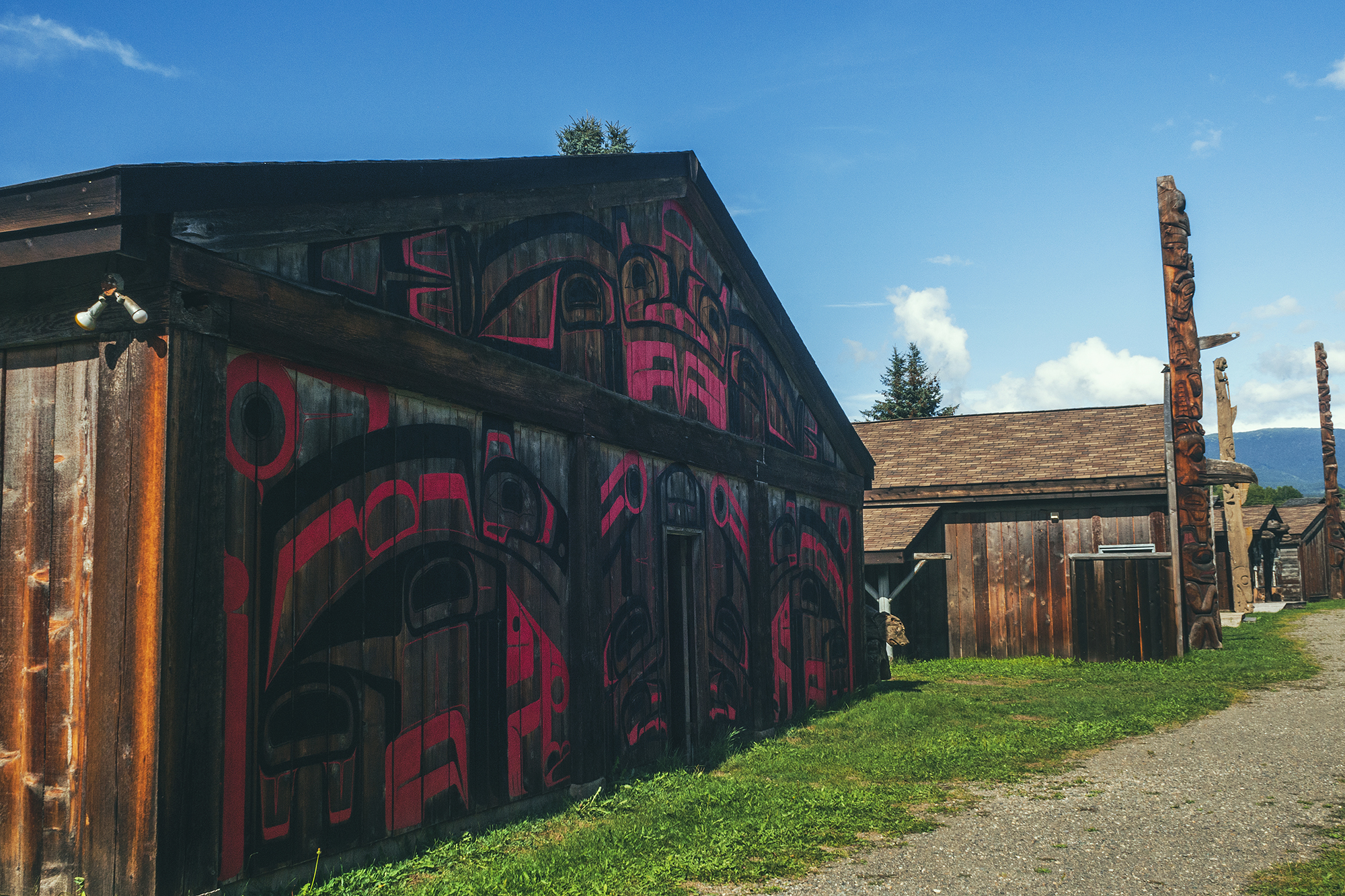
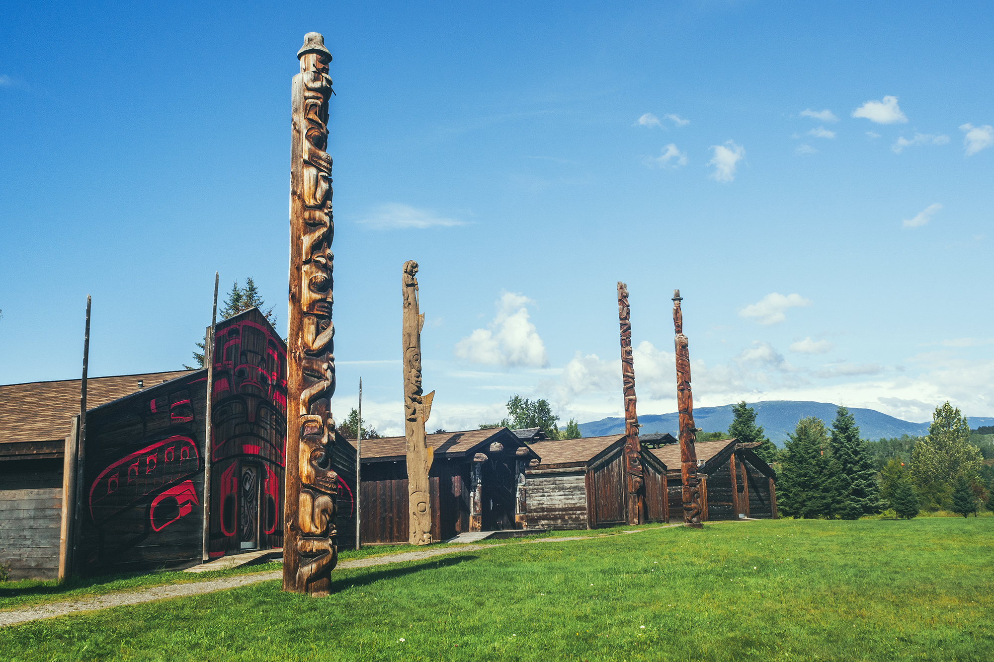
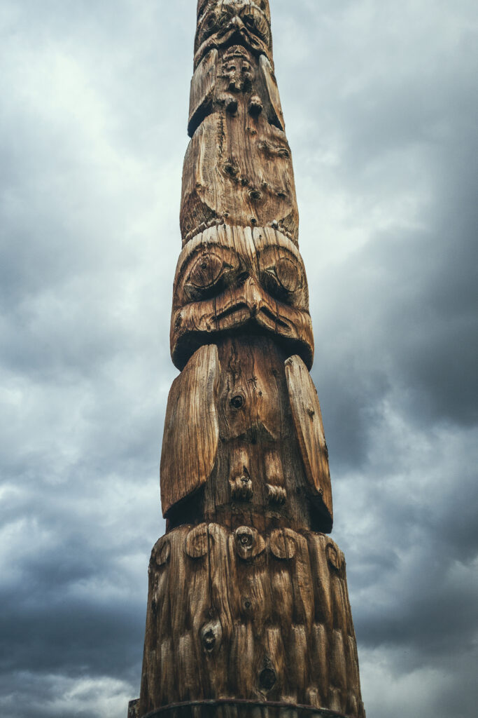
The village also displayed many totem poles and we had the opportunity to listen to a resident Carver, who explained his process in carving a pole, from inspiration, to design to the actual carving.
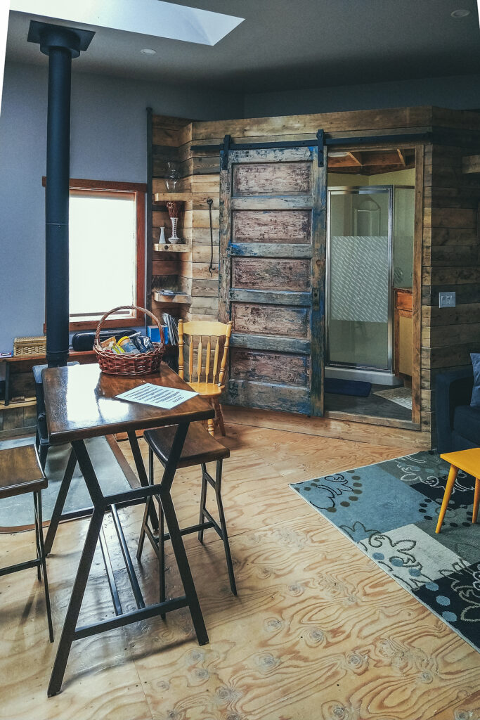
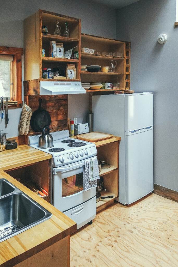
After the Museum, we headed to our airbnb to unpack and have a snack. It was probably one of the coziest, most well set-up place we’ve stayed at!
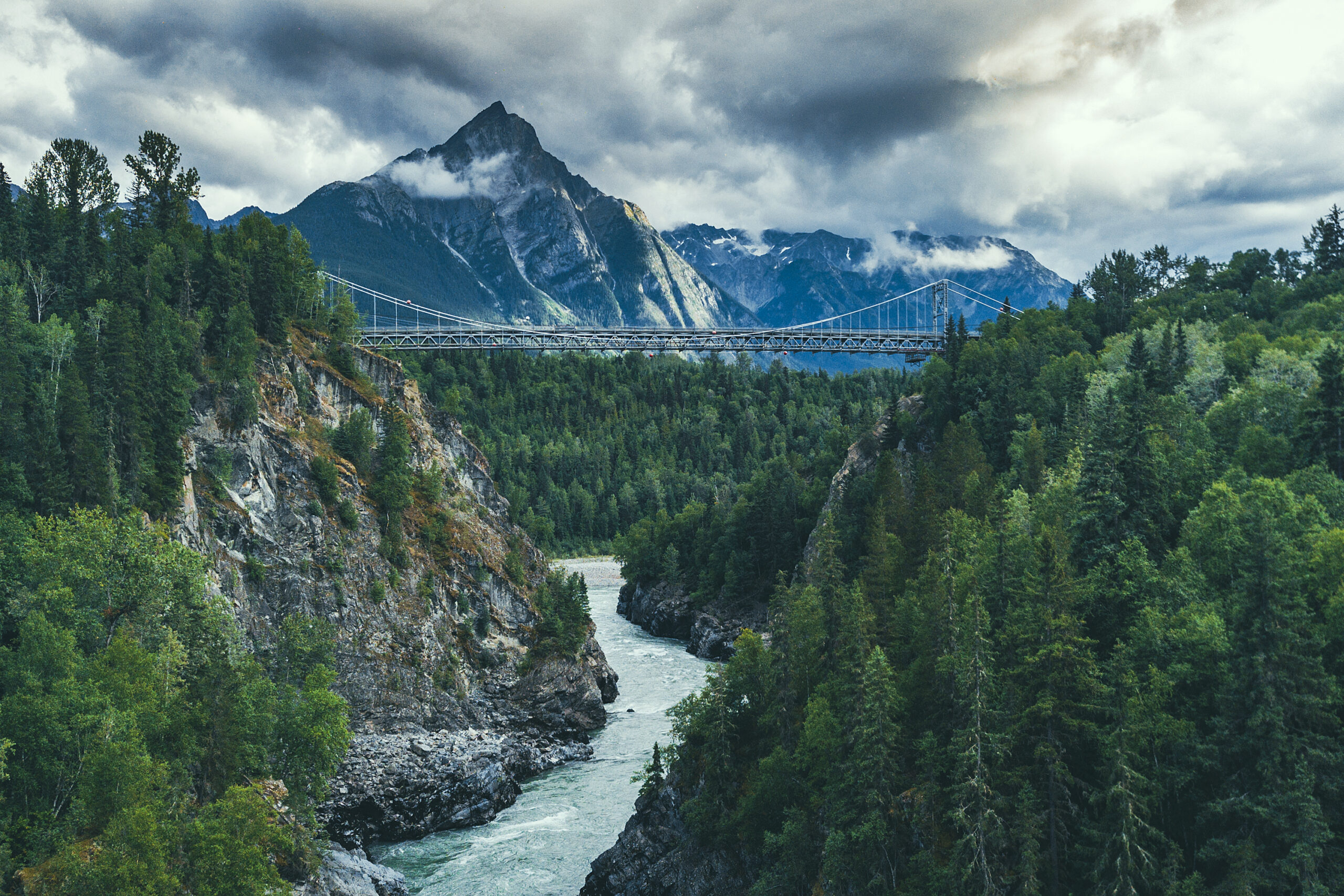
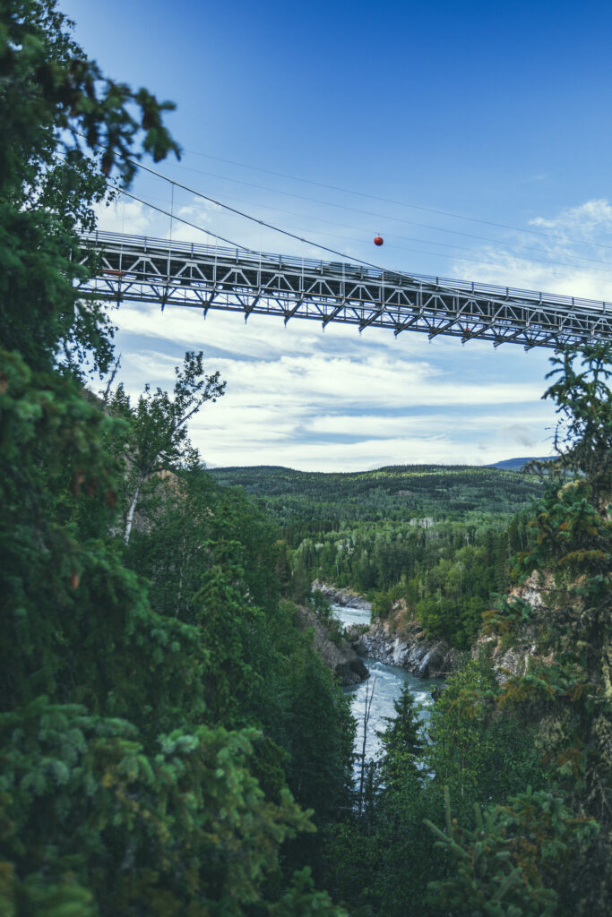
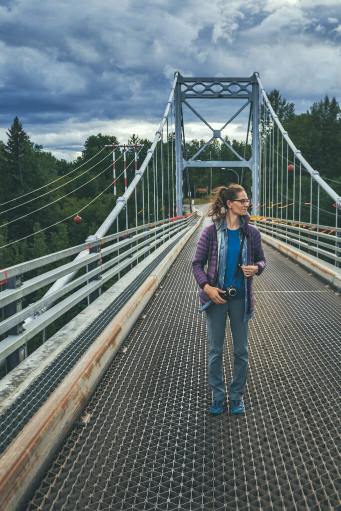
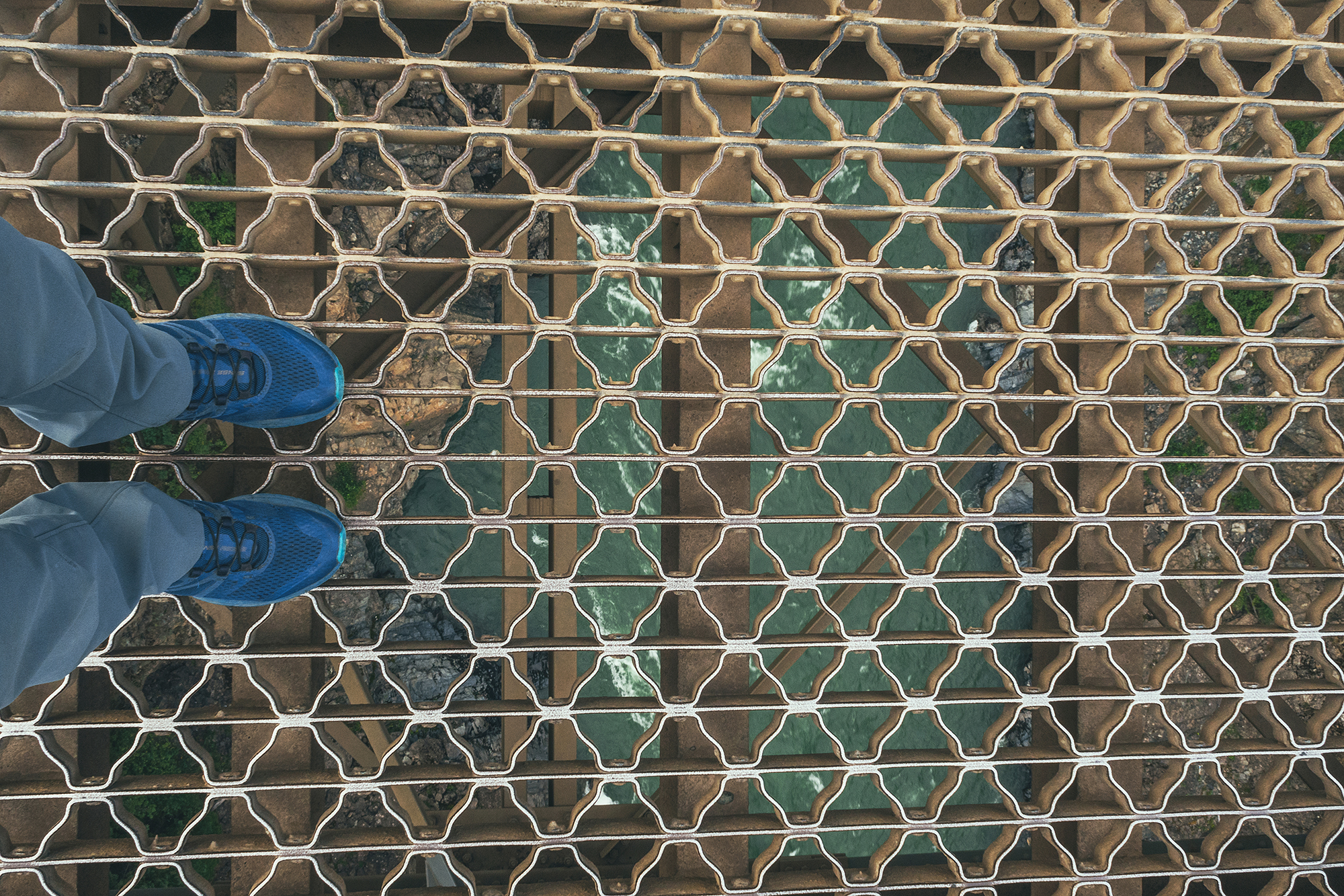
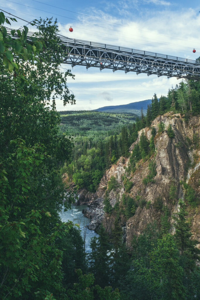
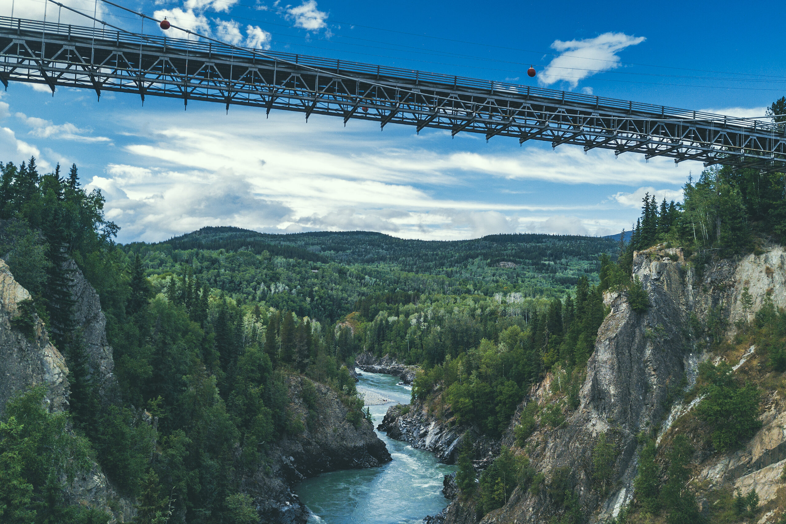
There was still lots of dailight time ahead of us so we drove to the Hagwilget Canyon & Bridge to check out what the Northern BC guide referred to as “one of the most photographed places in Canada” and also one of the highest suspension bridge in the country, hanging 262 feet above the river. It is surprisingly “un-secure” as the railing is barely waist-high and it wouldn’t take much to jump or fall over. I’m not usually afraid of heights but I felt much more comfortable walking down the center of the bridge (on the road) rather than the side.
We managed to find a trail descending halfway into the Canyon for a different view of the bridge and the river below.
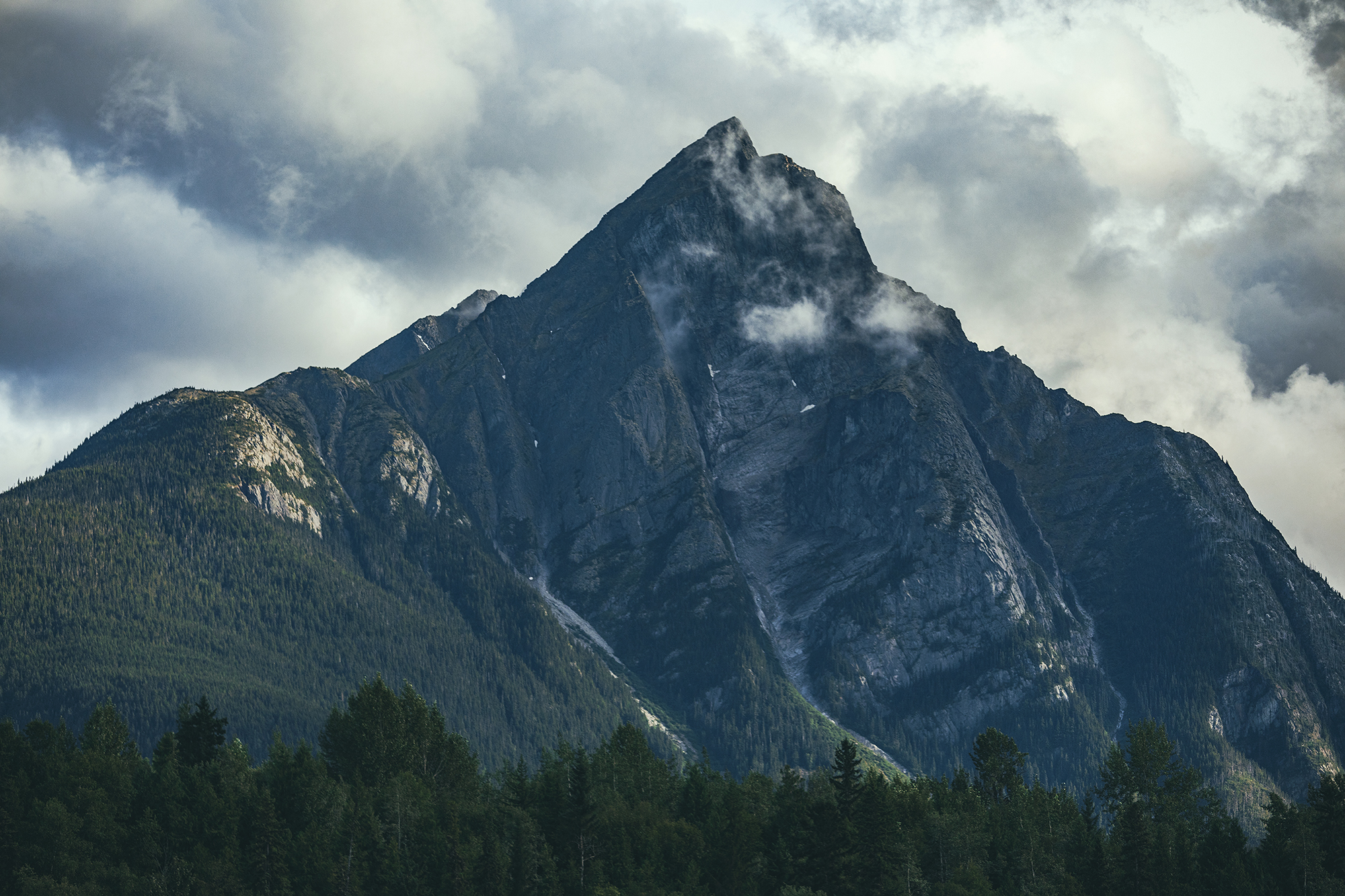
Stegyawden, a Tsimshian name meaning, ‘painted goat’, is also known as Hagwilget Peak or the Roche de Boule mountain range. It’s a prominent mountain in the area and its peak can be seen from many locations.
As we walked back to the car, a man who we had seen walking along the river bank earlier, approached us and gave us an eagle feather from several he had collected at the bottom of the canyon. He offered it as he wished us welcome to his village and an enjoyable stay.
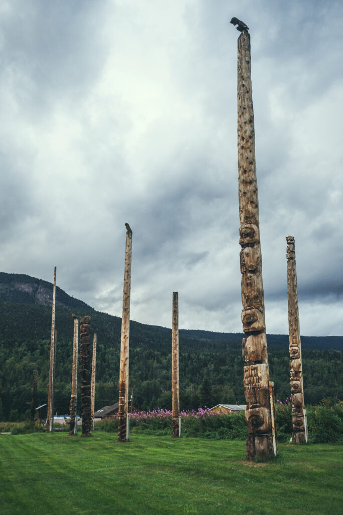
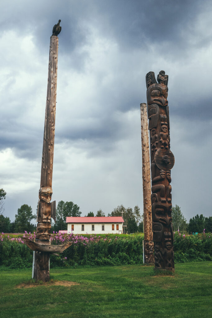
We made one more stop before calling it a day, by driving to Kispiox, 10km north of Hazelton, to see the totem poles displayed in the town. They stand where there was once the site of a Telegraph building post. At some point, settlers were trying to build a telegraph line to Asia, but the project was stopped before it was completed and the site abandoned. The miles of wires left behind became a source of supply for the indigenous peoples nearby.
We had a lovely evening at the airbnb, making use of the well equipped kitchen weirdly though I didn’t sleep very well. I got up at ن 3am and as I went to the bathroom, realized the toilet seat was up, which was weird as I was the last one to use the bathroom and I knew i hadn’t left it that way.
I kinda rattled me as I couldn’t make sense of how it ended up that way my two explanations, after all plausible ones were exhausted:
an animal spirit who entered the bathroom in the form of a beetle, which I found on the floor and probably came tangled in our tent when we hang it in the shower to dry – OR – a ghost from old-timey old town. Either way, some cheeky immaterial being clearly played a prank on me and I couldn’t fall back asleep for 1.5 hour after that.
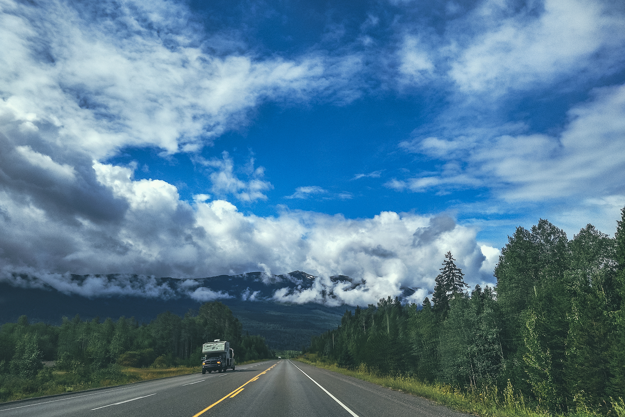
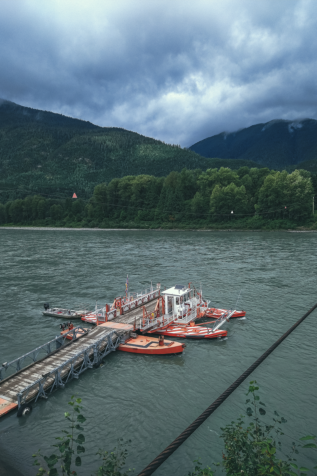
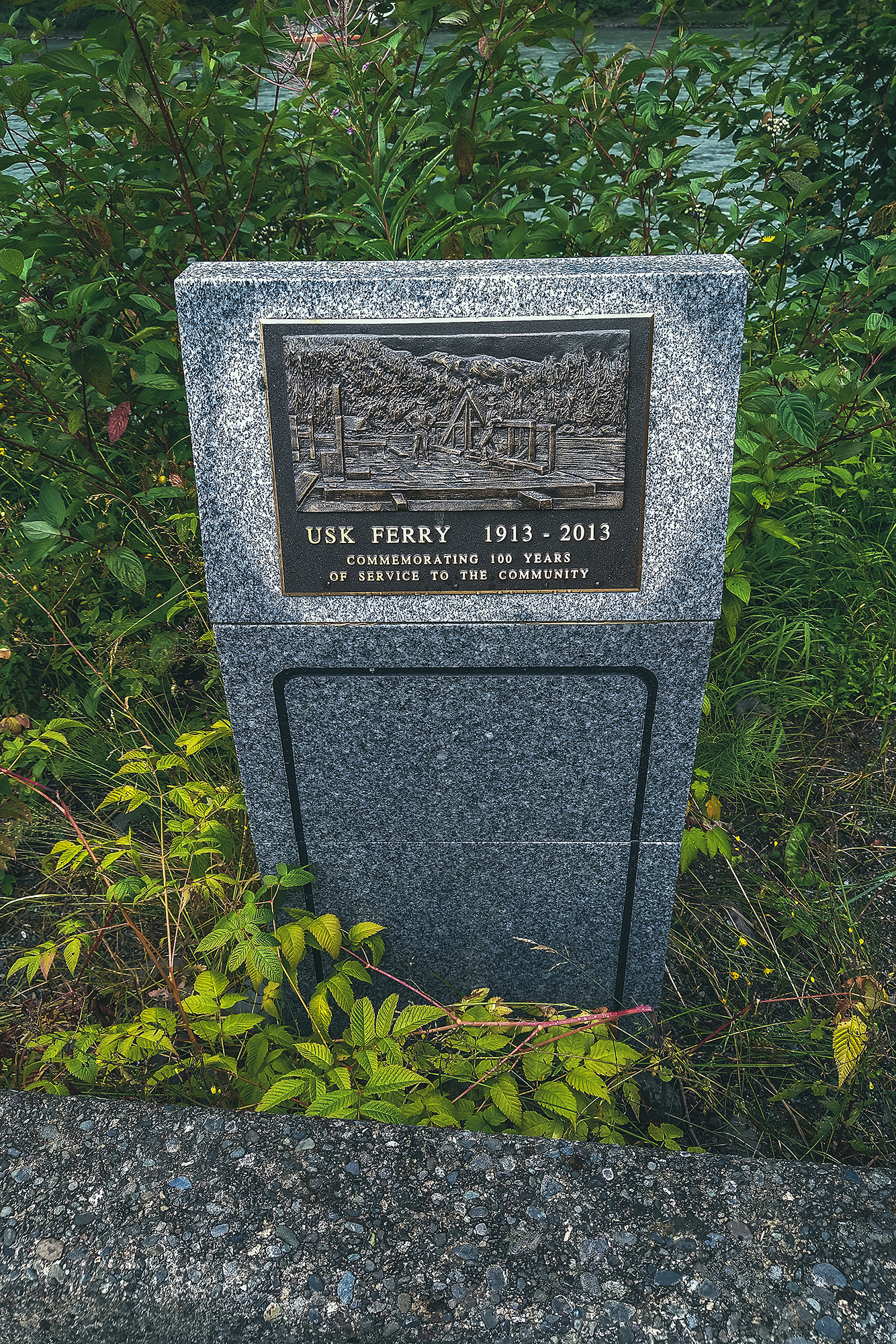
We left Hazelton and headed south west towards Terrace. The drive was pretty uneventful but scenic in places, as we drove along the Skeena River. We made a quick stop in Usk, to see the small ferry crossing, built in 1913.
Terrace is a bigger town with strip malls, we didn’t stop and kept going, this time aiming North on Highway 113, aka the Nisga’a highway. After a few kilometres of road lined with houses, trees took over and it was more or less nothing but dense forest on either side, for the rest of the way.
We made a stop at Kitsumkalum lake for lunch. The lake is indicated as a provincial park on BRMB, but there wasn’t any sign pointing to the entrance. We saw an unmarked road going down near where the entrance was indicated on the map, so we drove down it and sure enough it took us to the lakeside. The site is labeled as a “user-maintained” so it was pretty rudimentary. The road was very pot-holed and for once, I didn’t even want to take a look at the outhouse.
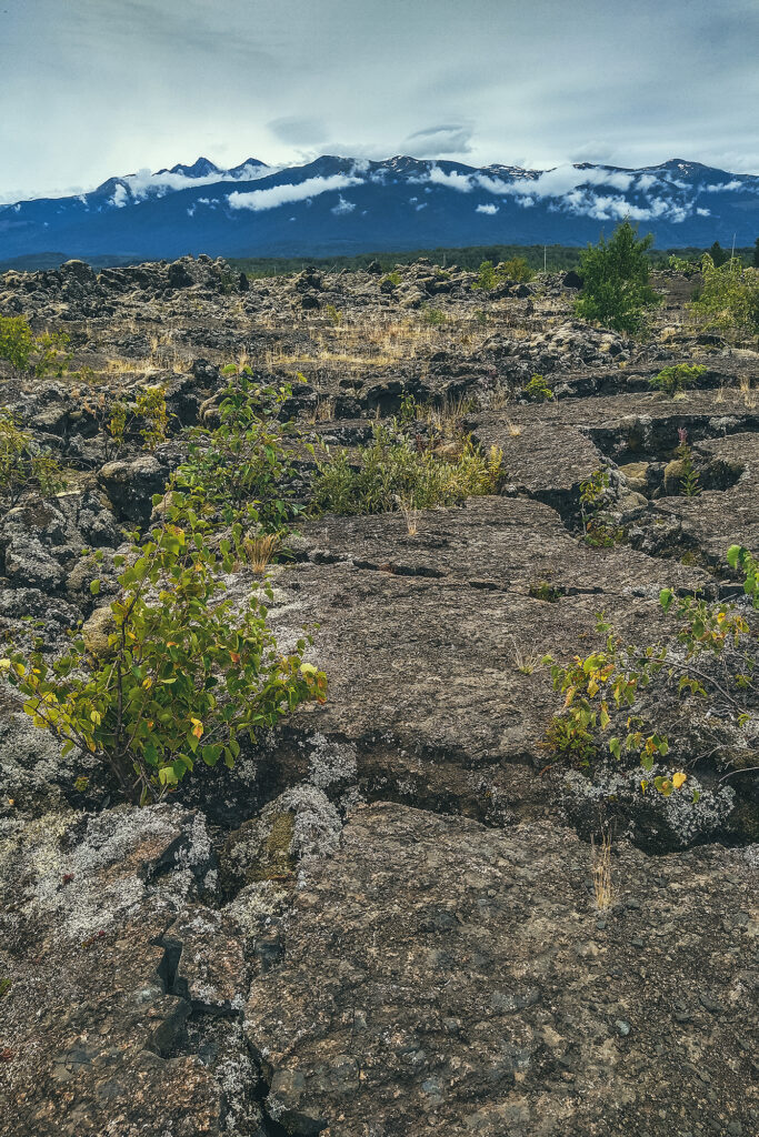
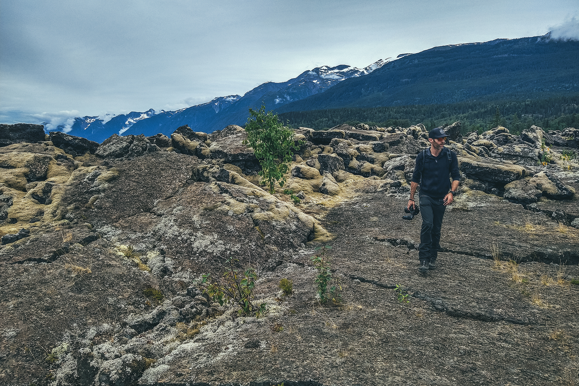
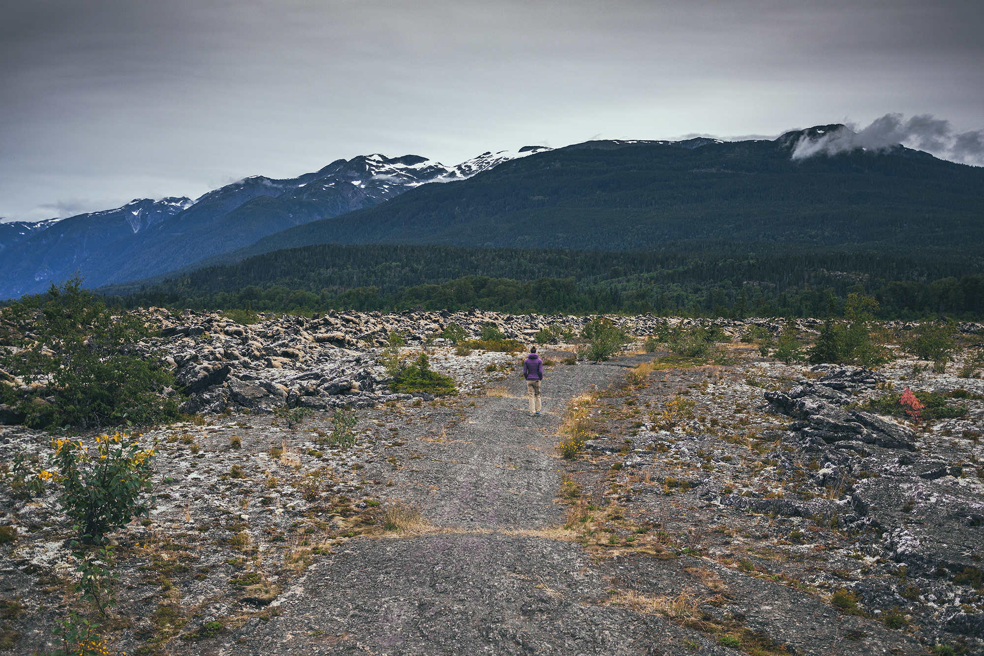
We kept driving until we started seeing signs for the Nisga’a Nation auto-tour, which indicates various points of interest in and around the Nisga’a Lava flow.
We first stopped at the drowned forest, where the stream of the Treax river rushes through the trees, covering the ground around them (hence the name “drowned”).
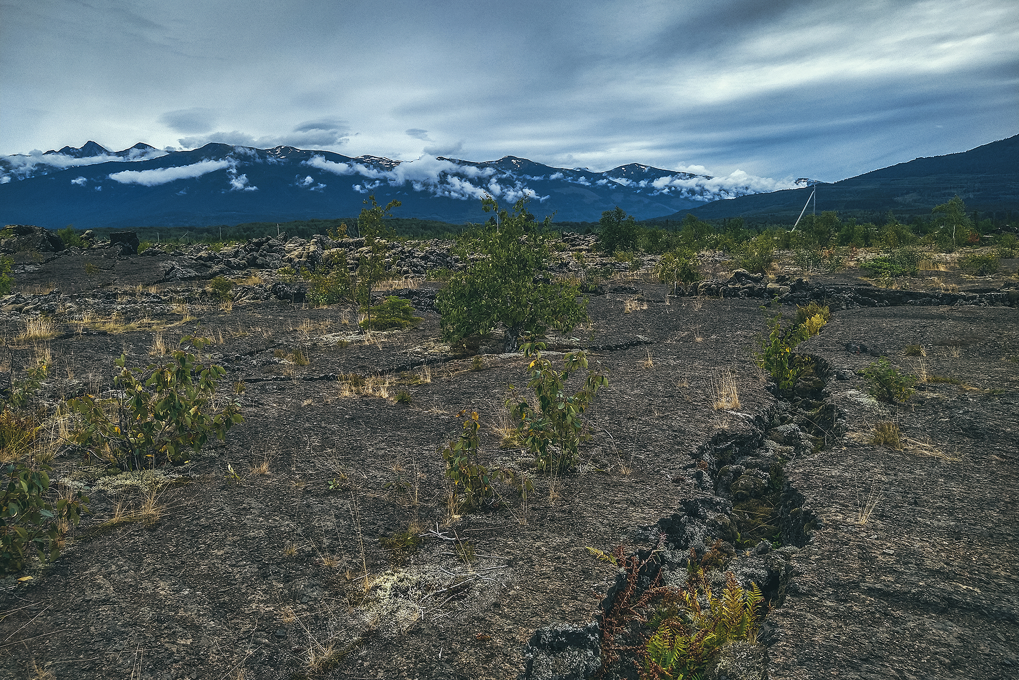
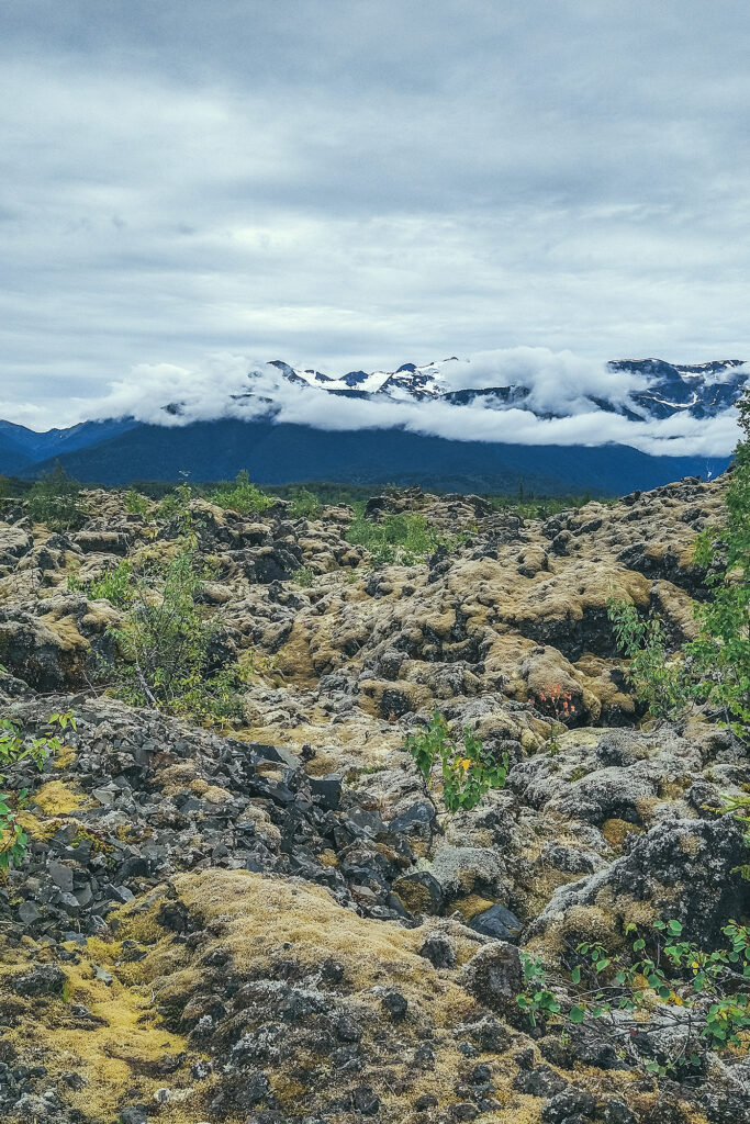
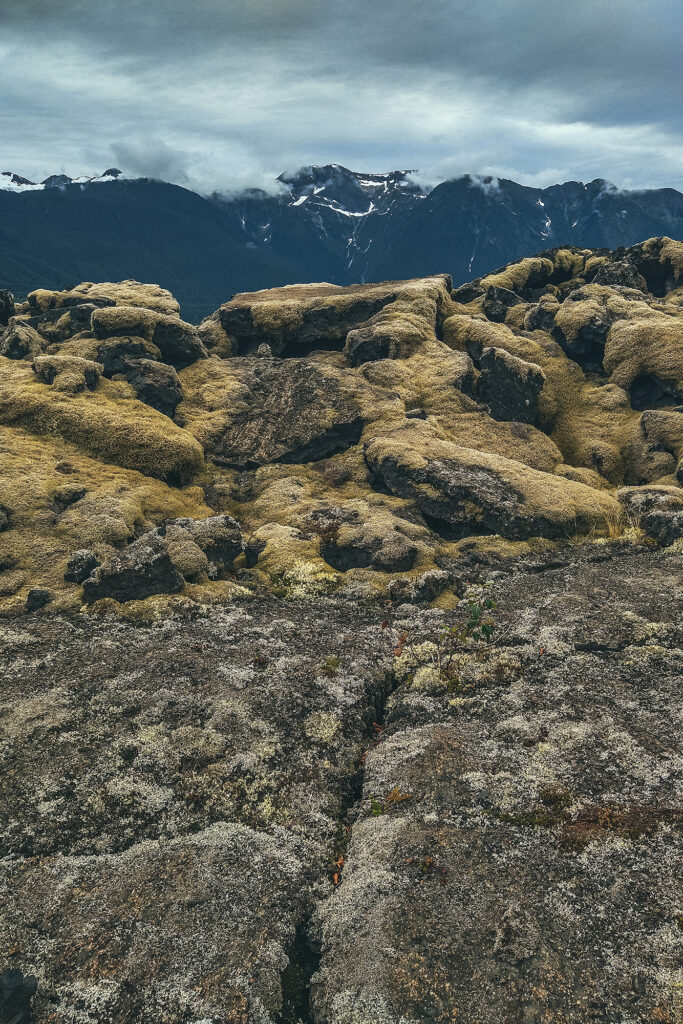
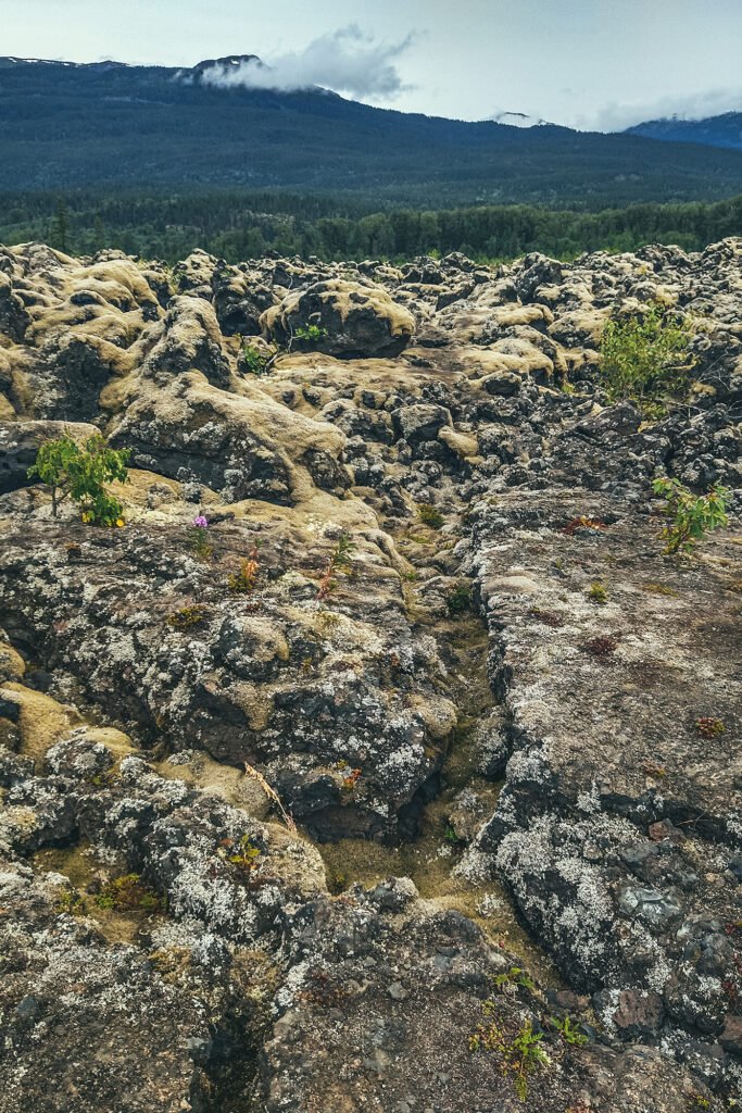
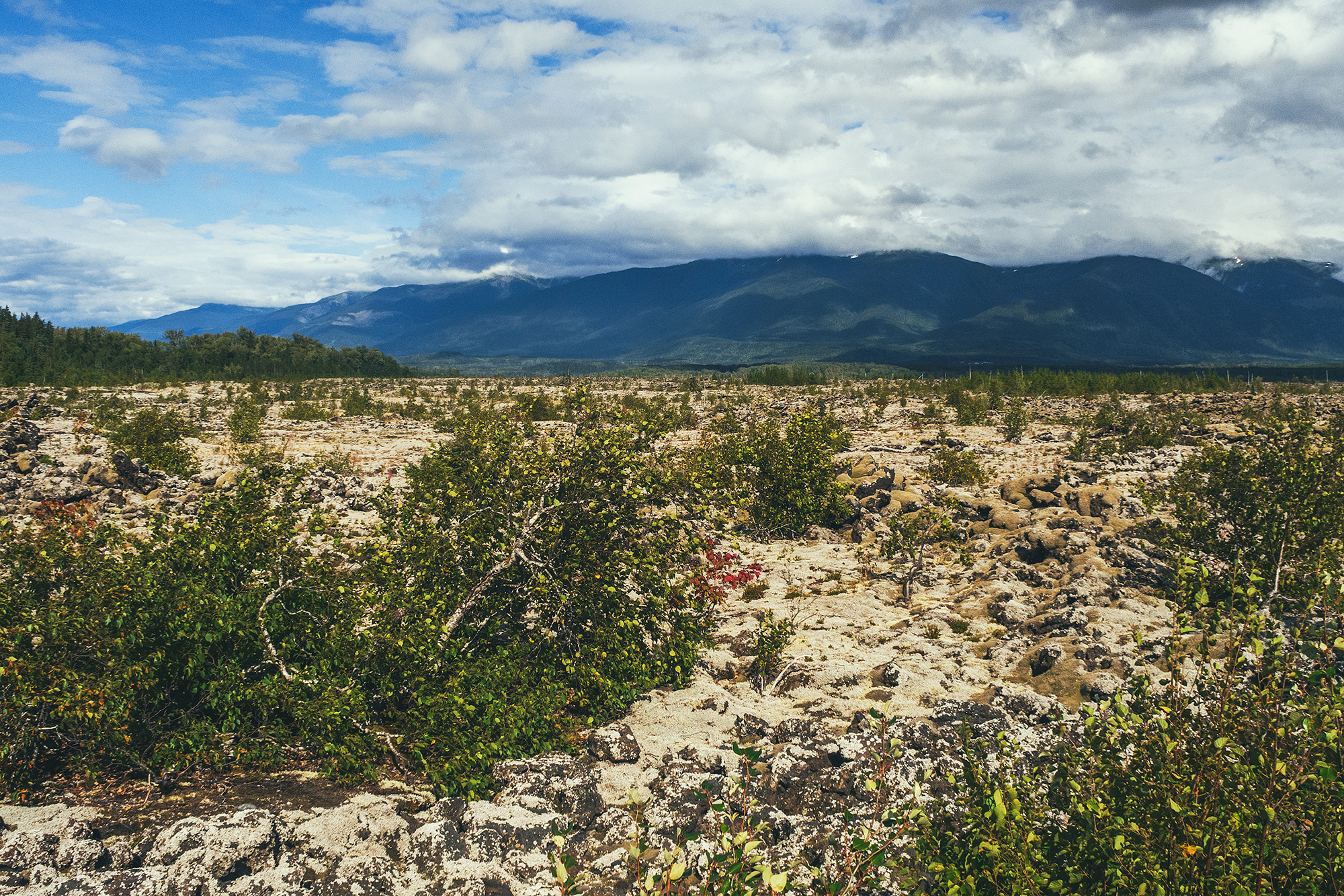
We stopped at Lava lake, then at a couple of scenic water falls along the way. Eventually the trees disappeared, instead replaced by the dramatic landscapes of the lava flow.

Less than 300 years ago, a volcano in the Nass mountain range, the Treax Cone, erupted violently and the lava from the eruption covered a large area of the valley, destroying several villages and taking the life of an estimated 2000 indigenous people..
The solidified lava that remains today has high cultural significance for the people of the Nisga’a nation, and only a few marked trails allow venturing around the rock features.
Due to Covid, all tourist services and attractions were closed, including the museum, the hot springs, and any cultural event that would normally be held and open to visitors.
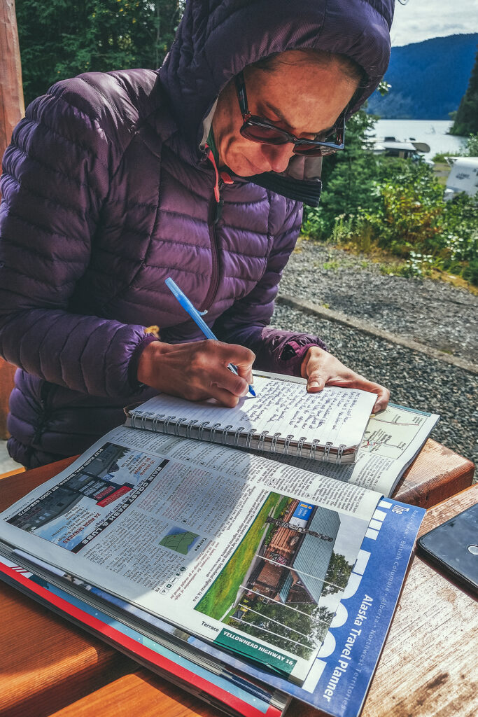
I had planned for us to spend the next day driving out to Gingolx, the furthest village at the end of the Nass valley, and making stops along the way. But without access to any of the afore-mentioned activities, it was ultimately only a 2-hour drive and back.
It was 4:30pm when we got to the small visitor center, so we decided to take the drive out to Gingolx, if only for the scenery along the way, and come back to spend the night at the Nisgala Memorial Lava Bed Park Campground which was still open for use.
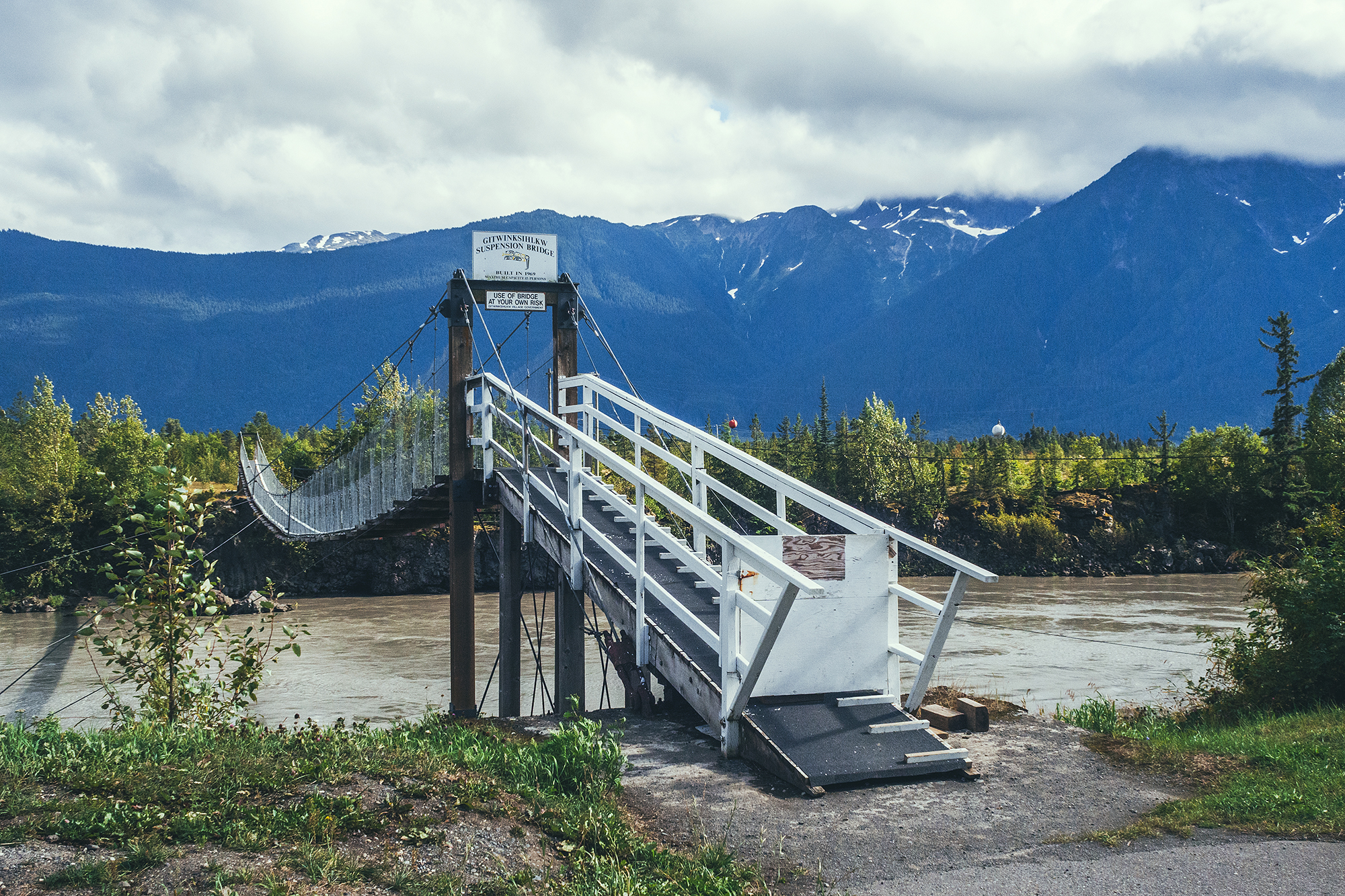
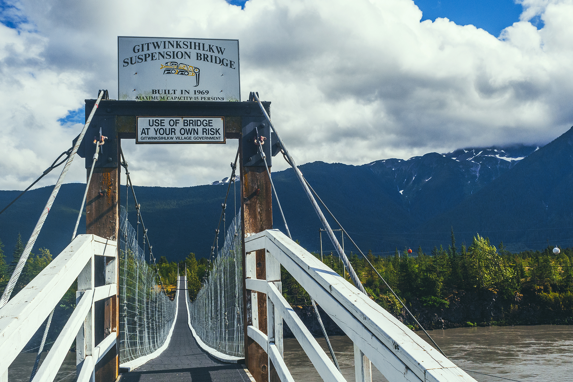
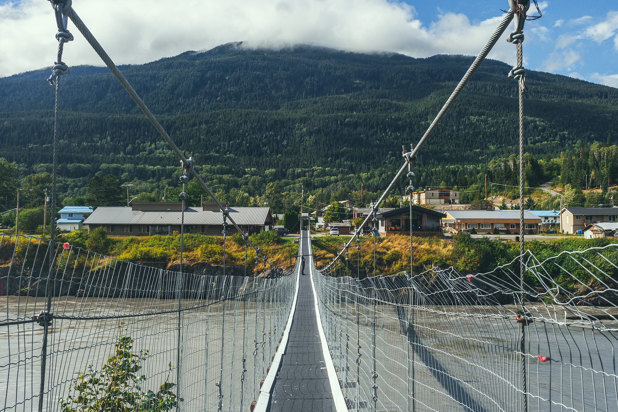

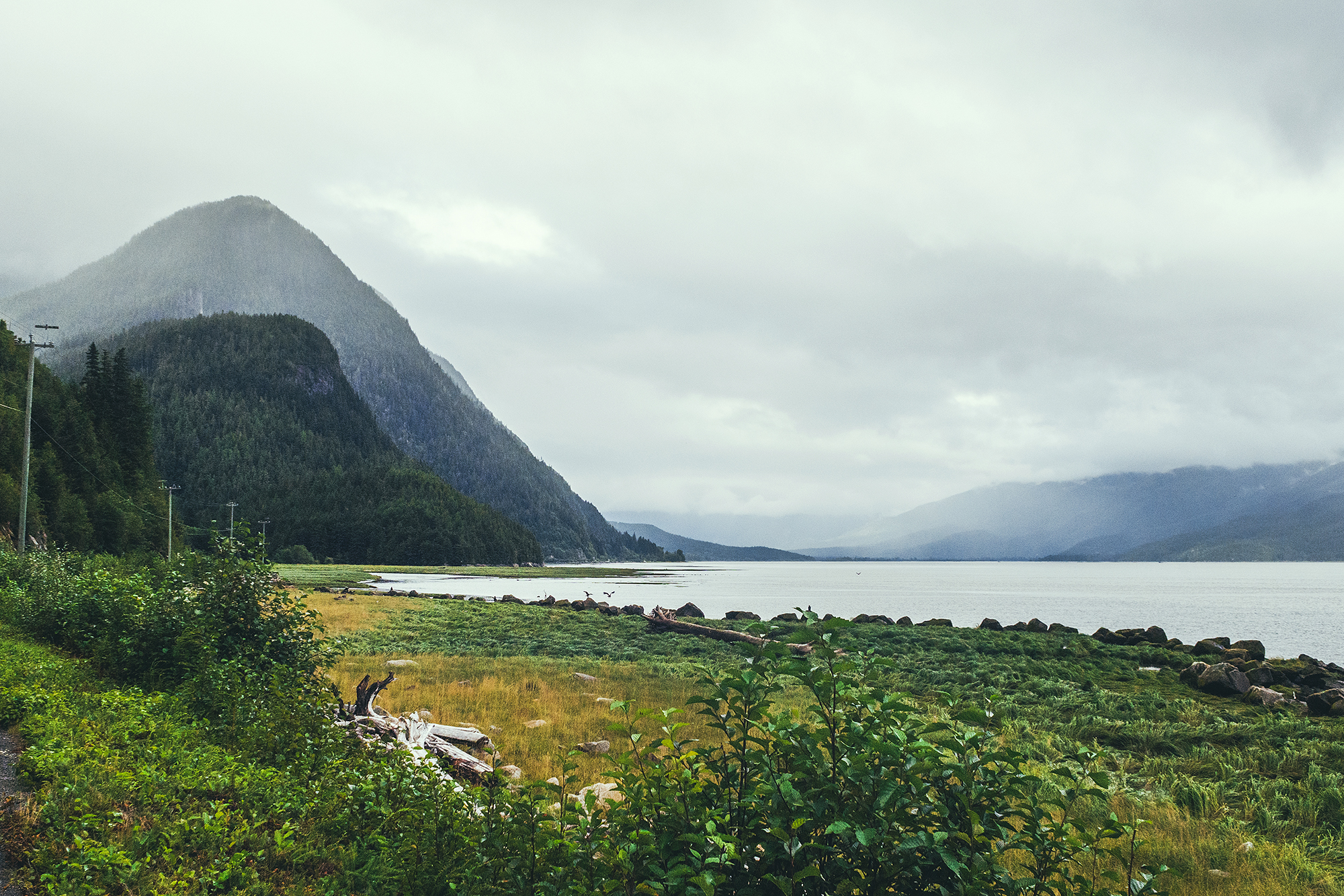
There are four main villages of the Nisga’a Nation along Nass Road, which travels paralell to the Nass River. Gitlaxt’aamiks is the eastern most, more or less located at the intersection of the Nisga’a Highway and Nass Road. Next is Gitwinksihlkw, with its scenic suspension bridge, Lax̱g̱altsʼap is home to the Nisga’a Museum. Ging̱olx is the last village, at the mouth of the Nass River.
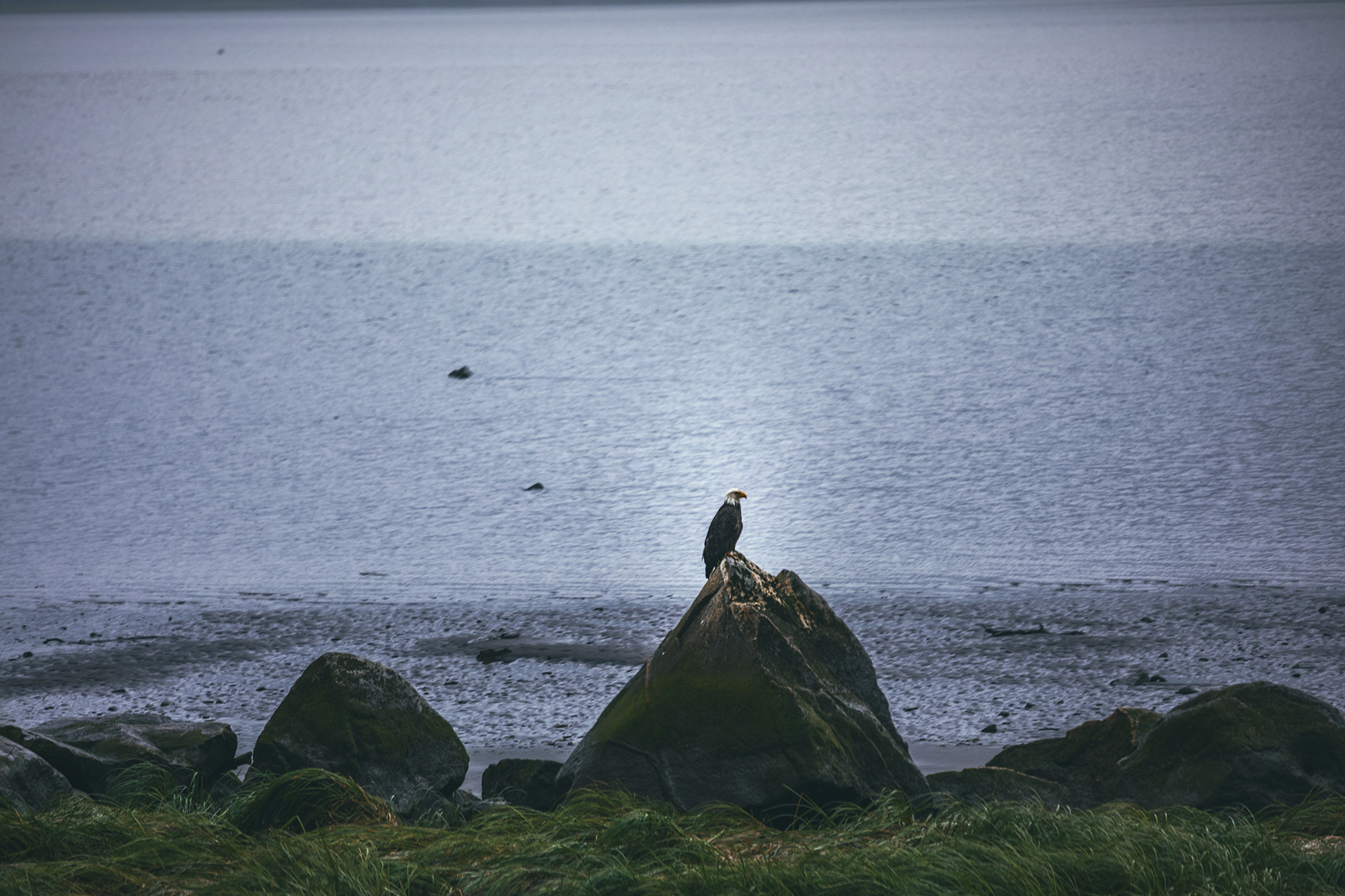
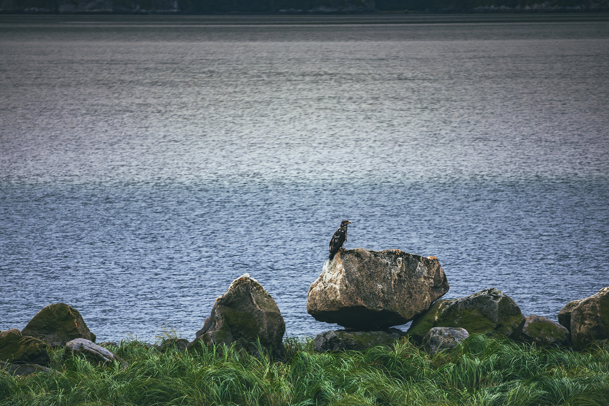
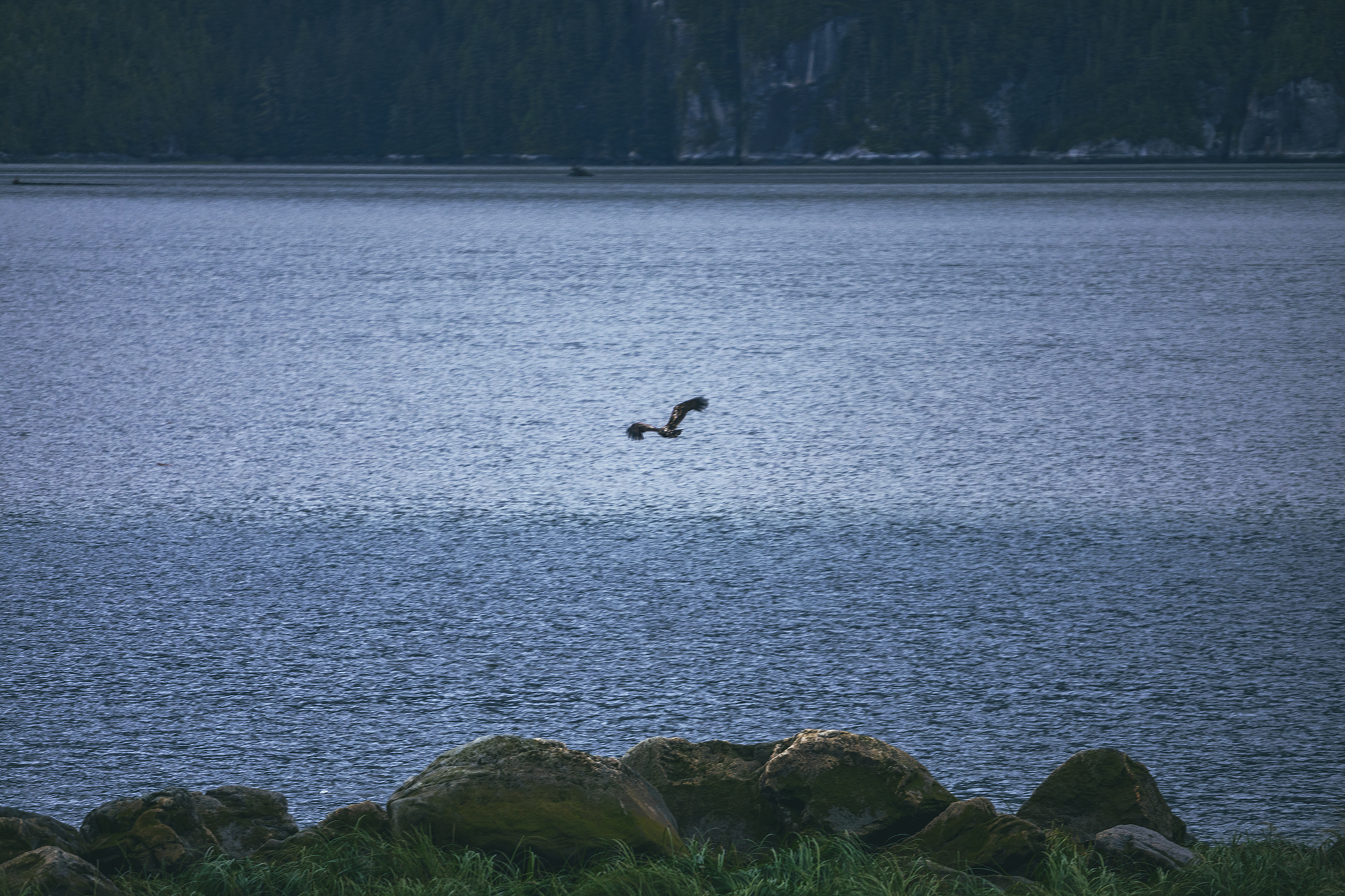
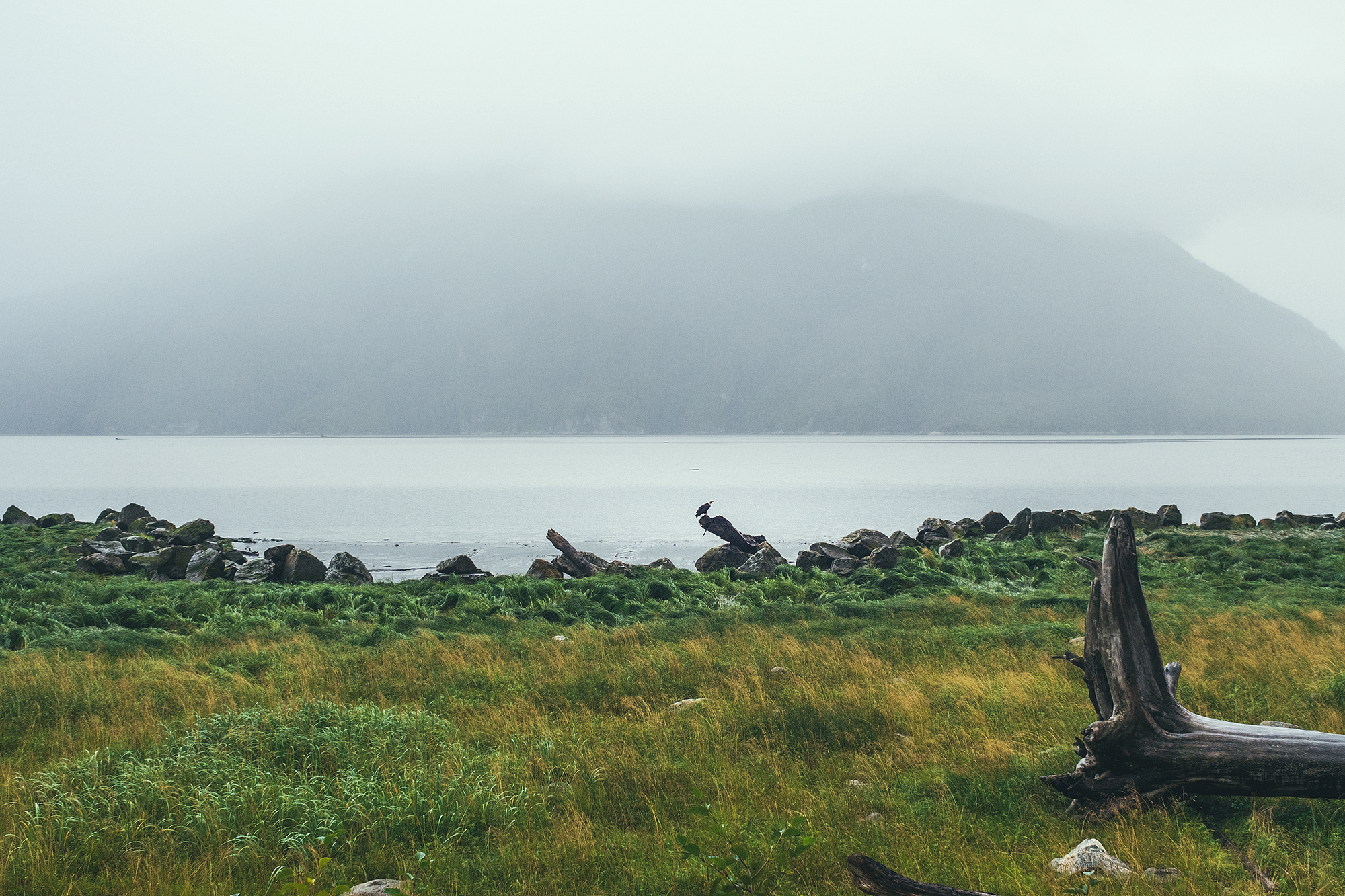
We stopped at the Gitwinksihlkw suspension bridge then later down the road saw a bunch of eagles perched on rocks and stumps by the river. They looked young, as not all of them had white heads and their feathers looked pretty shaggy (we had binoculars to look at them).
Eventually we made it to Gingolx, which sits at the very end of the road and on the scenic shores the river mouth. We had a snack then made our way back to the campground for the night.
In the summer of 2021, after 2 years of working through a very challenging project, not to mention a world-wide pandemic, I was able to take 2 months off work. Yukon had been on our list of places to travel to for a bit, and with flying and travel restrictions still in place, it seemed like the right opportunity to take this trip.
I kept a journal as we drove through Western Northern BC, into the Yukon, up to Tombstone Territorial Park, back down to Kluane National Park, then down through Eastern Northern BC before returning to Vancouver. The next few posts are a transcript of that journal, complemented by the 1000s pictures we took along the way…
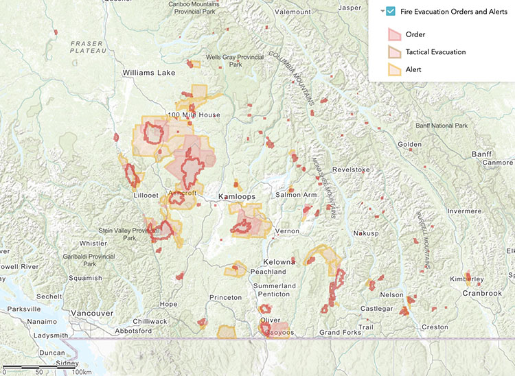
That summer, BC experienced a gnarly heatwave (due to a meteorological “heat dome”), followed by dramatic wildfires spreading in all areas around the lower mainland. When we left Vancouver around 10am on Aug 2nd, I was a bit worried about the wildfires in the Okanagan, and what that would look like for our itinerary. Looking at the Emergency BC App and the BC Wildfire Map, I could see that the shortest route, through the Fraser Canyon, would take us right through the main evacuation alert/order zones. Not Ideal.
So instead we took a slight detour, following highway 5 through Merritt, Kamloops, and then rejoining Highway 97 via route 24. We also decided to drive further on that first day than originally planned, as the air quality at Lac La Hache, where we initially planned to stop, was not the greatest.
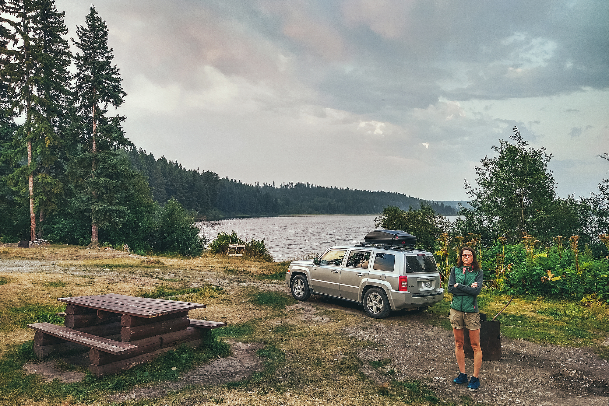
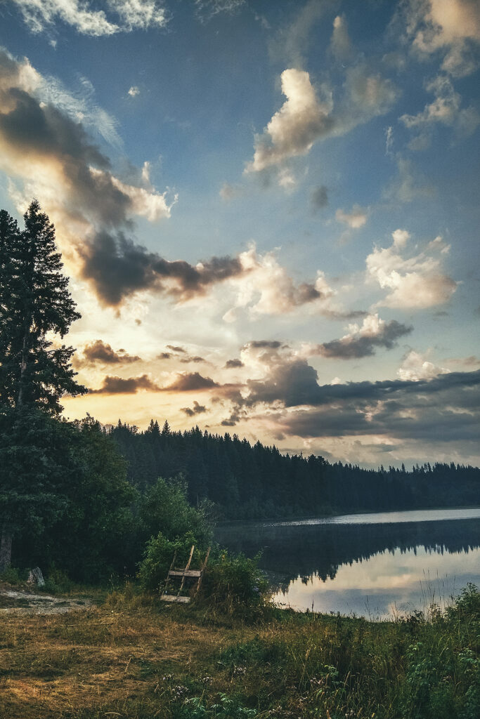
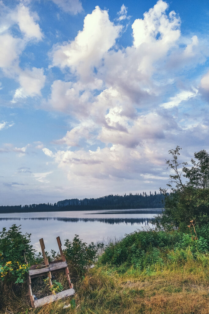
We drove an extra 2,5 hours past Lac La hache and landed at Chubb Lake, a small Recreation Site off the highway past Quesnel, with campsites on the water. It was a perfect spot for our first night on the road!
Although it hadn’t rained in Vancouver for weeks, the weather forecast was calling for a thunderstorm. We did get some brief, heavy rain falls on the road between Williams lake and Quernel, but no rain at the lake, only a bit of distant lightning & thunder.
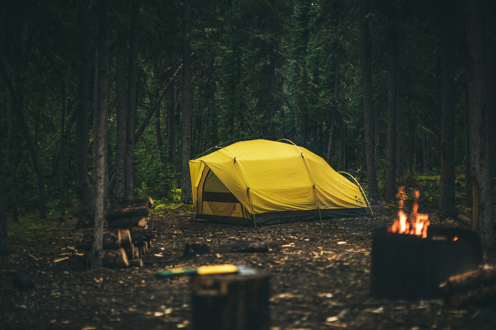
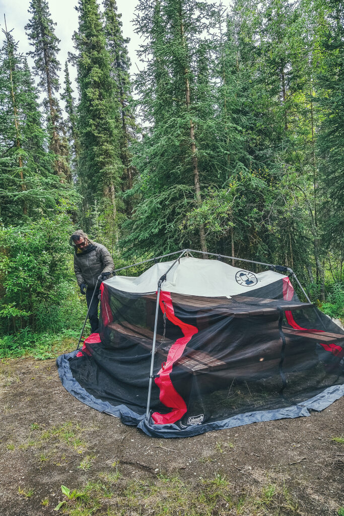
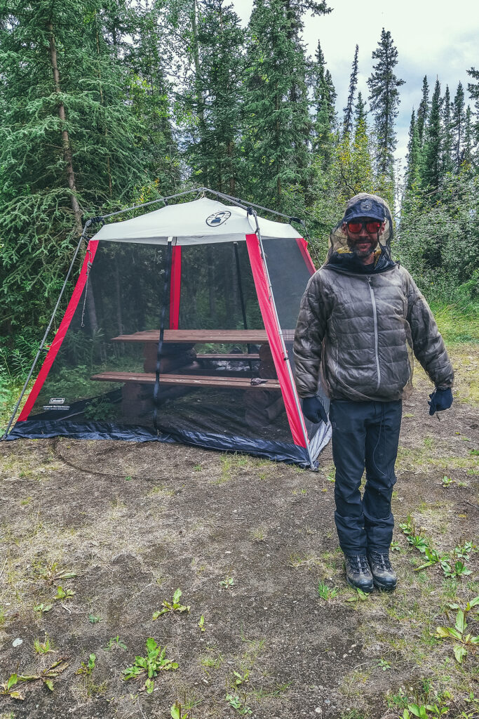
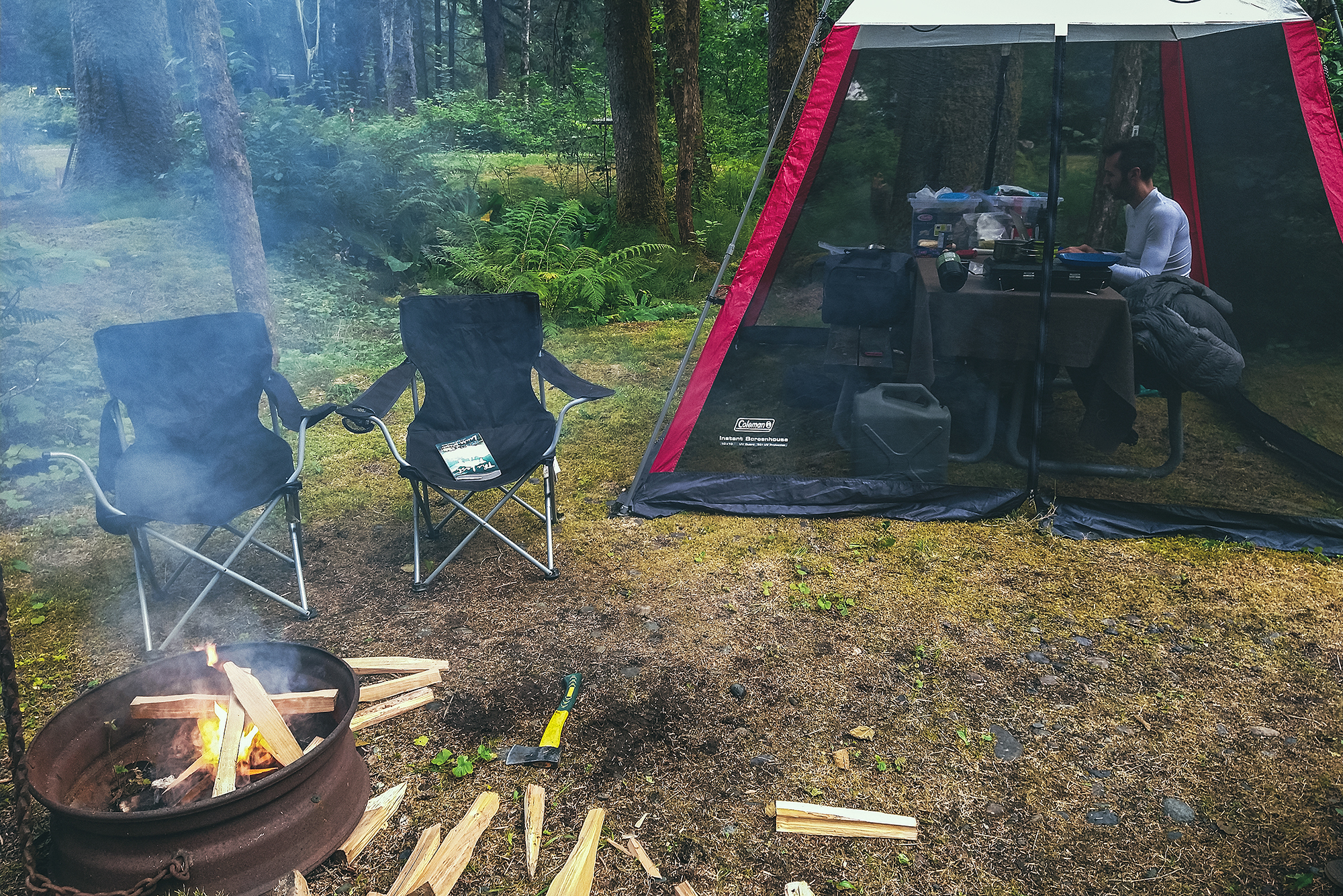
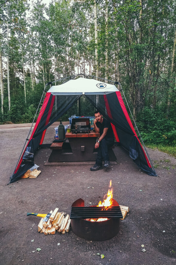
That first night gave us a taste of the bug situation for a good portion of the trip. Mosquitos at the lake where quite intense, especially with being right on the water. Thankfully, one of the main pieces of gear that we purchased for this trip was a net shelter, big enough to fit over most of the picnic tables at campgrounds and keep the mosquitoes away. It turned out to be a game changer for our camping experience, acting as both a bug shield and rain cover (with the added help of a big tarp), and ultimately creating that homey feeling every night, after we’d set up everything on the picnic table.
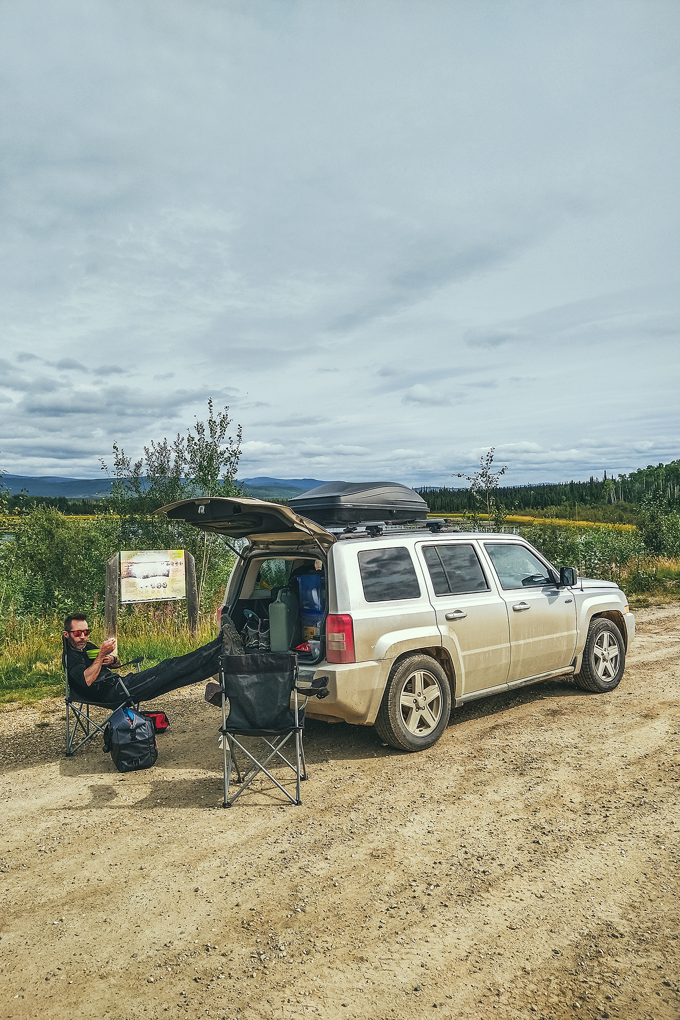
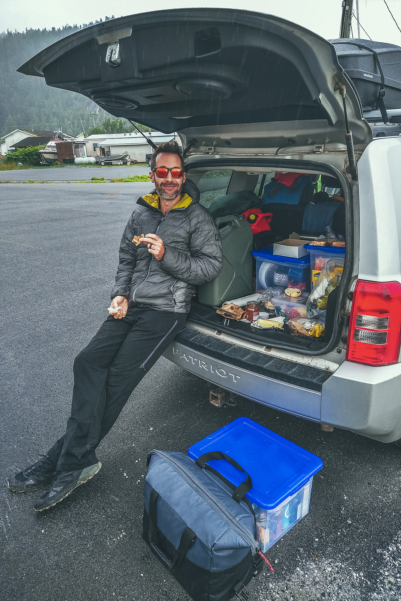
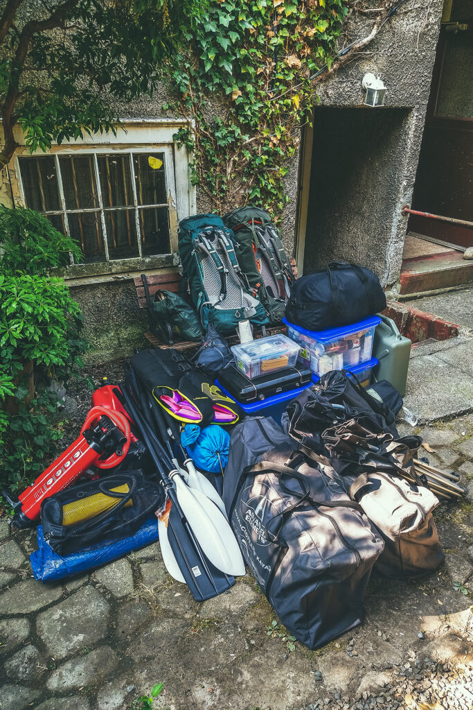
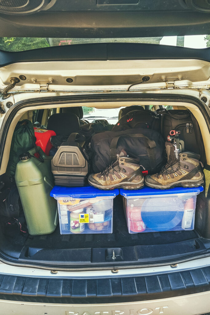
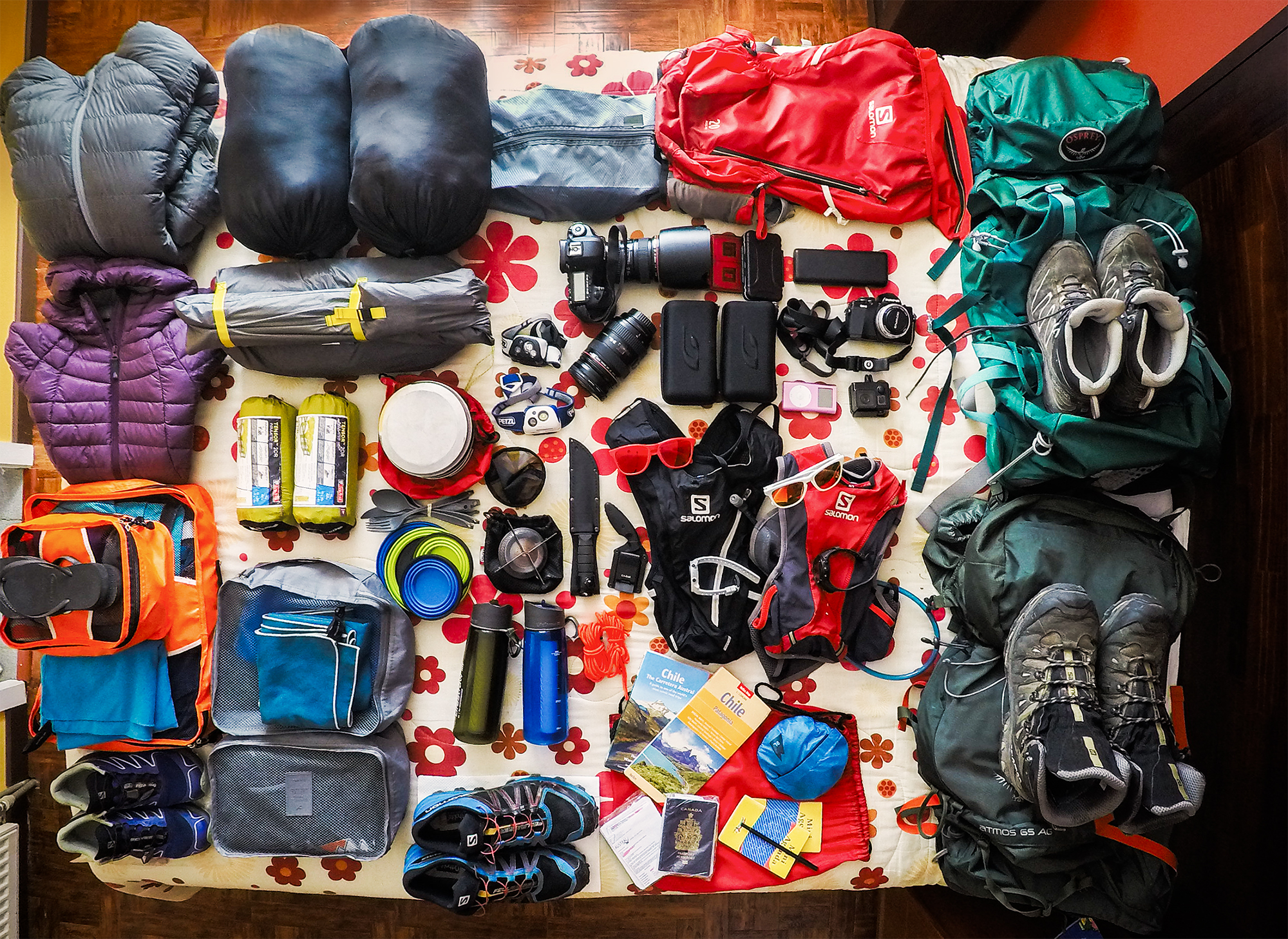
We’re not used to packing this much for a trip, generally limited in weight when flying somewhere, or if we’re going backcountry camping. But since we were driving, we were able to bring a lot more along, including the extra comfort items such as a table (we ended up not using it since all campgrounds had a picnic table) chairs, shelter and extra tarps, boxes of food, two-burner cooking stove, etc…. We even brought an extra tent (didn’t end up using it) as well as a back up sleeping mat (which we did use when my mat got punctured).
After packing up camp, we drove to Prince George and stopped at our first (of many) local bakery for pastries, at a place called Pastry Chef Bakery. Then we got back on the road for another day of driving. We stopped at Beaumont Provincial Park for lunch, and enjoyed a picnic in the shade with view of Fraser Lake.
After a few more hours of driving, we arrived near Smithers, and set up camp at the Tyhee lake Campground 10 min south of town. Since we were one day ahead of schedule, we decided to stay two nights.
Thanks to recent rain, the fire ban had been lifted for the area, so we were able to enjoy a nice campfire that night, always a big part of the camping ambiance.
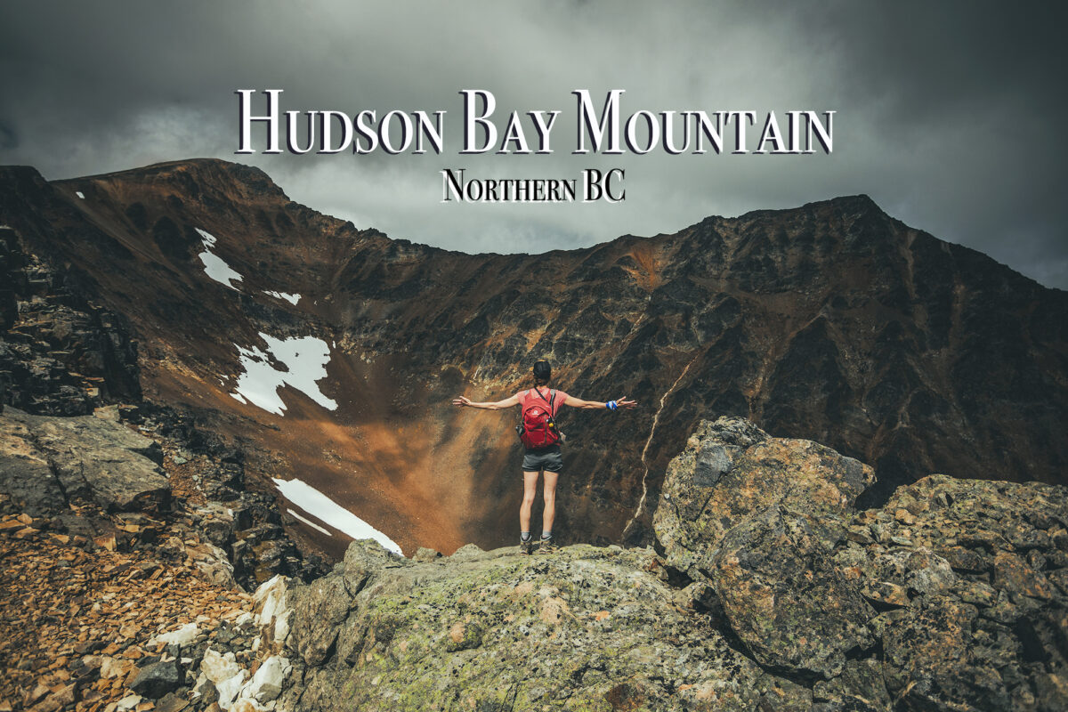
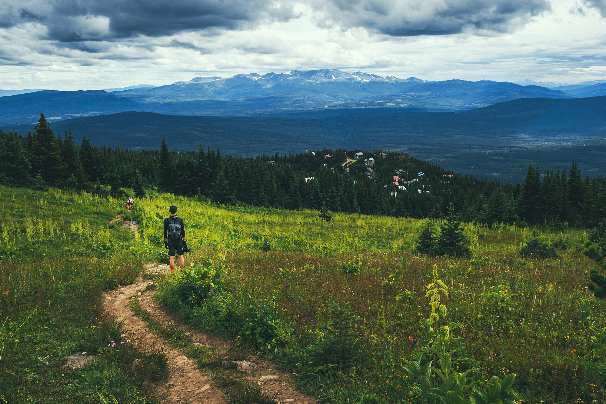
Since we set up camp for 2 nights at Tyhee Lake, we were able to take a day off driving and go out for a hike. Our friend Adele had mentioned Crater lake as a good hike, so we decided to go for it.
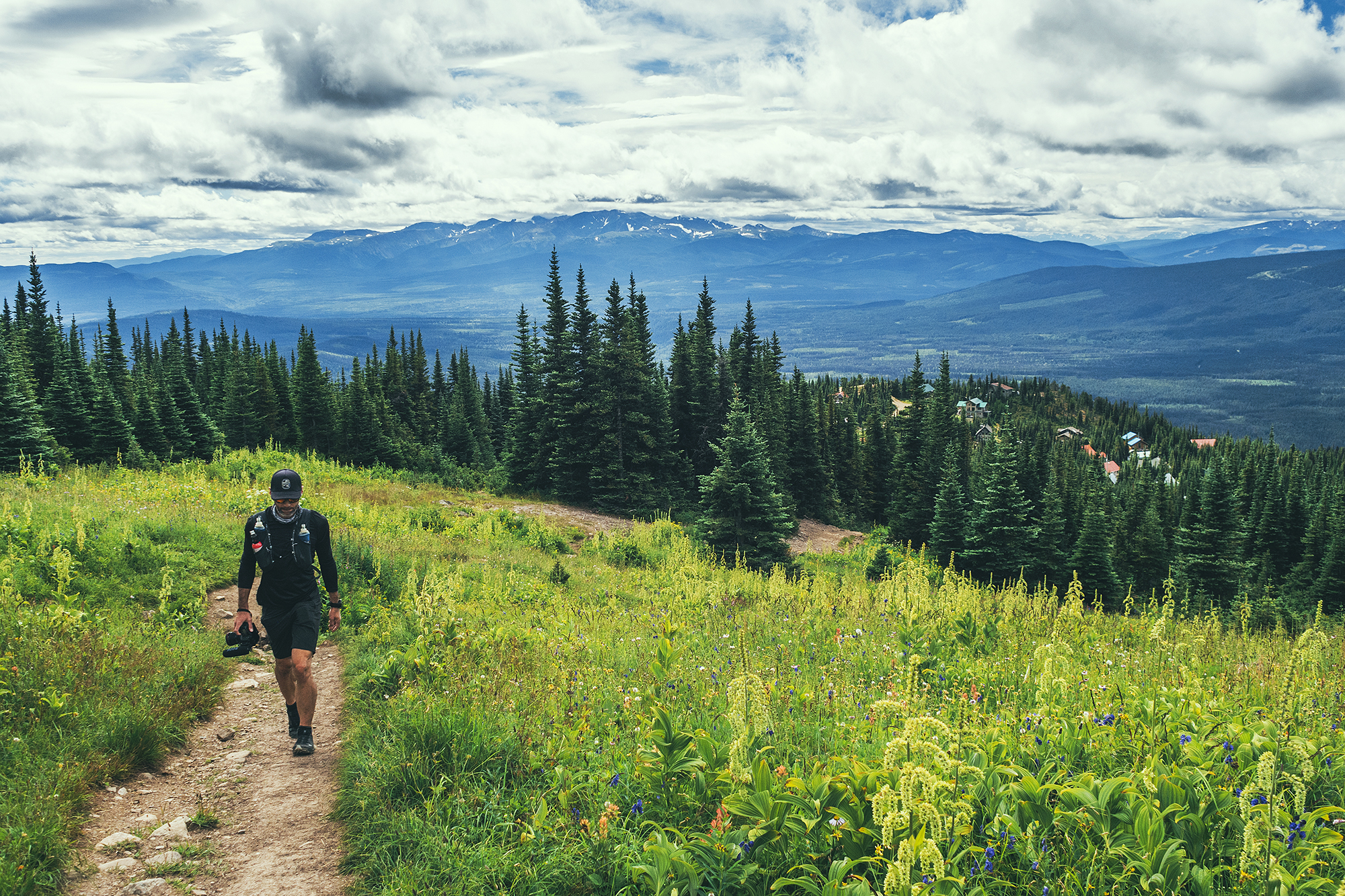
The trail starts from the Hudson Bay Mountain resort, and thanks to the road taking us a good way up in elevation, we reached alpine meadows within just a few minutes of starting the hike.
From there, we had views all the way to the top. In only took us about 40 min to reach the lake, so we kept going right away, along the ridge.
From the top of that first section, we found ourselves overlooking a steep chute and couloir – probably be a great ski objective for more adventurous backcountry skiers.

After that, the trail was a bit more faint, traveling over rocks and scree, but it was easy to aim for the next summit. This time we looked over the edge to an impressive glacier.
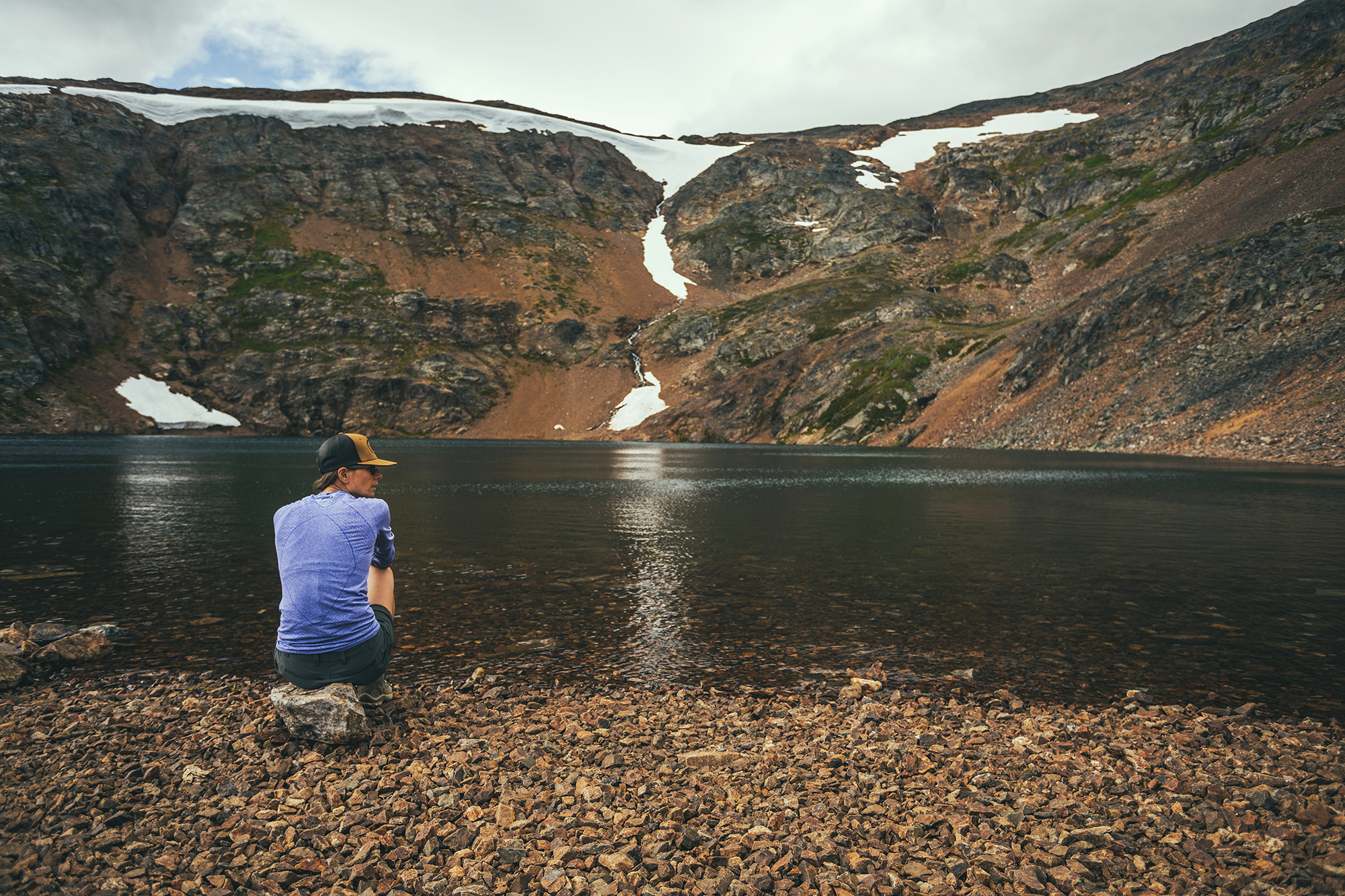
We saw that there was one more climb possible to the top of a prominence that from afar, looked like a dorsal fin, but clouds were coming in and the wind was strong so we decided to head back down. We stopped at the lake for a quick break before heading down through the meadow, back to the car.

On the way back to camp we stopped in Smithers to grab some beers at the local brewery and give the small “downtown” strip a first look.
There were hot showers at the campground, which we much appreciated after after having a good day out. It rained pretty strong that night but it had stopped by morning so it wasn’t too much of a pain to pack everything up, even with both tents being wet.
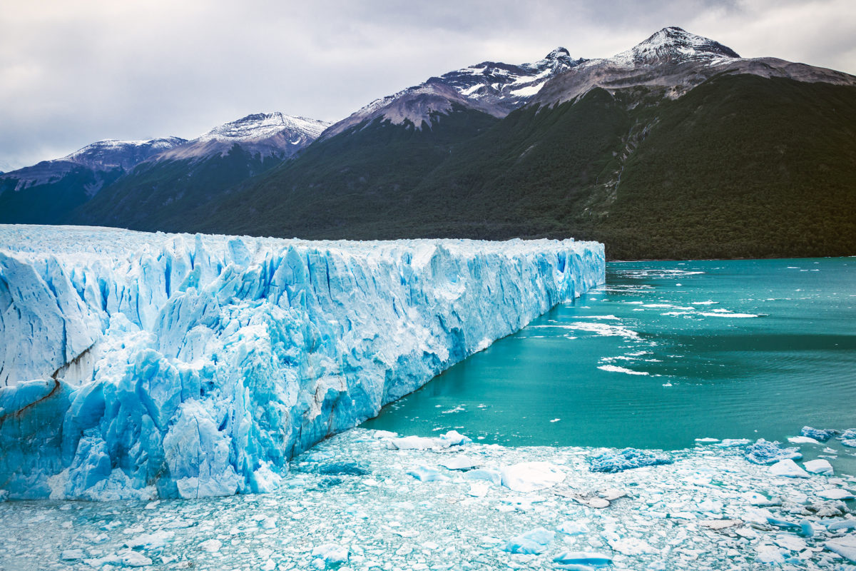
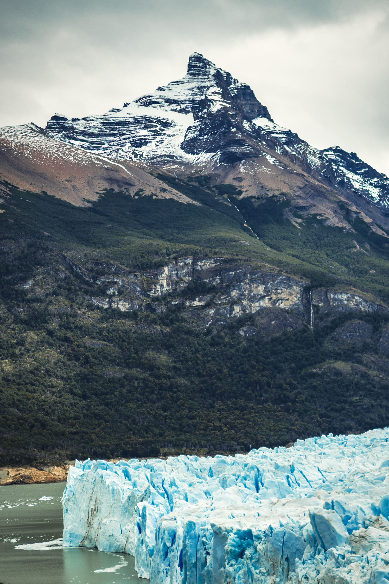
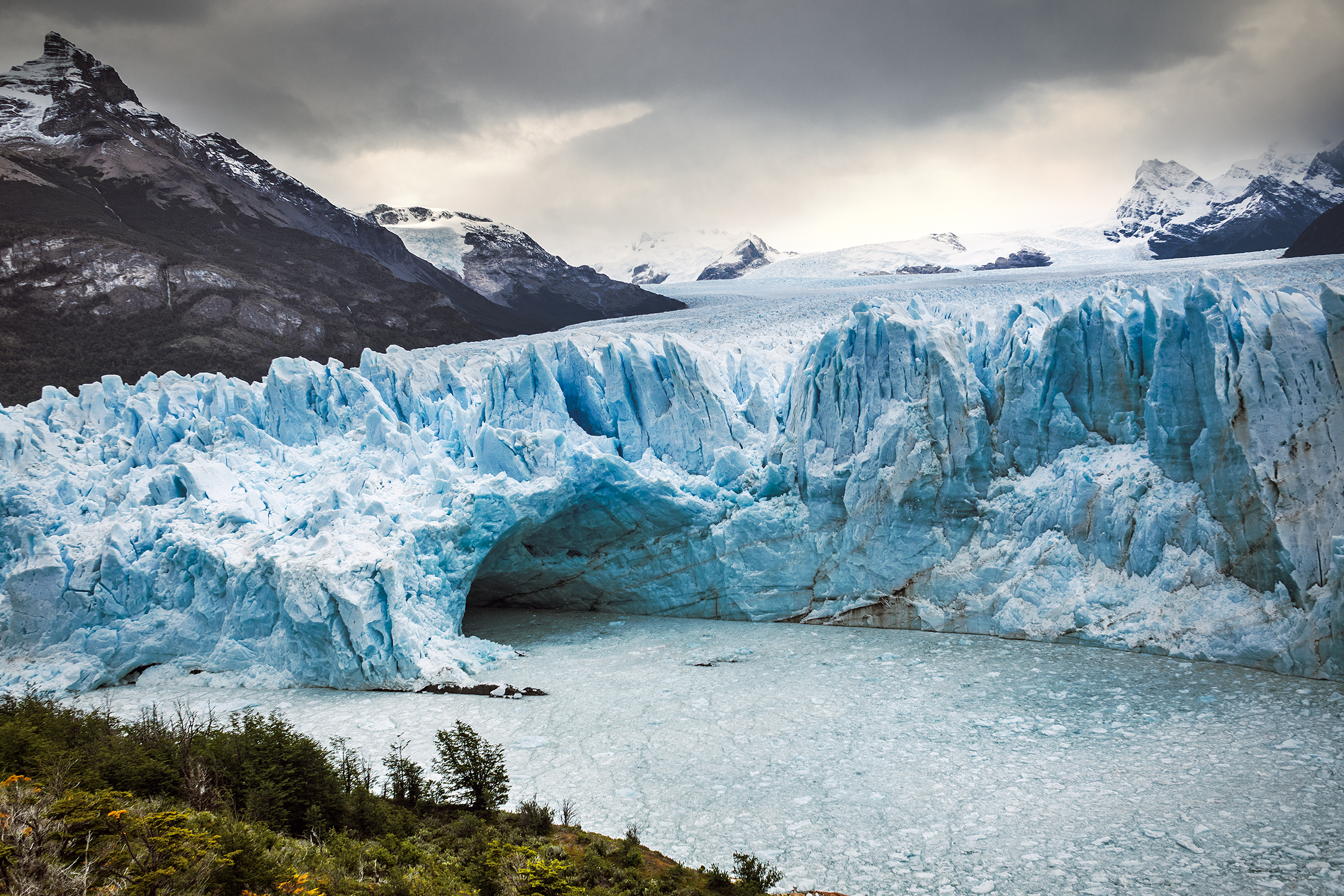
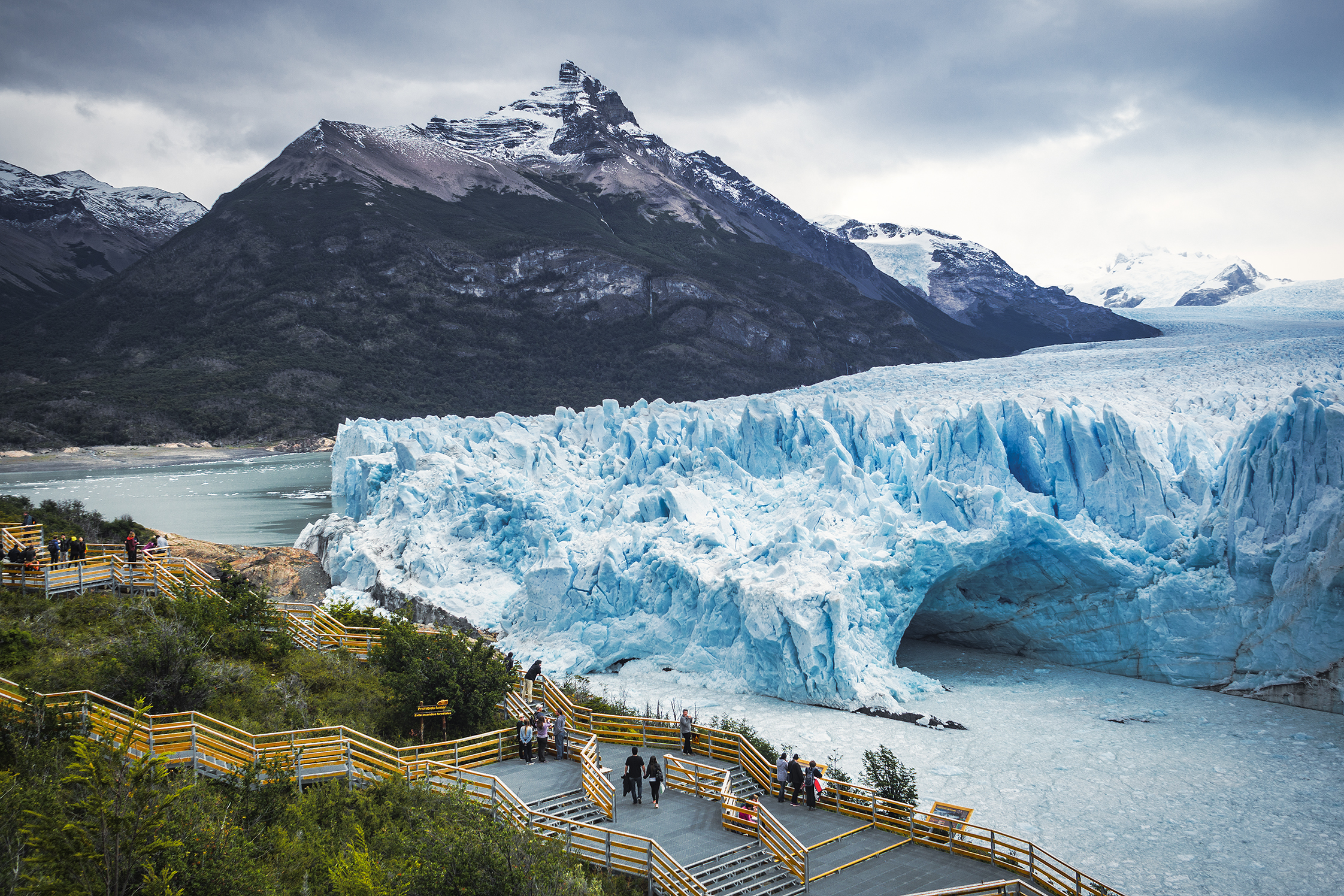
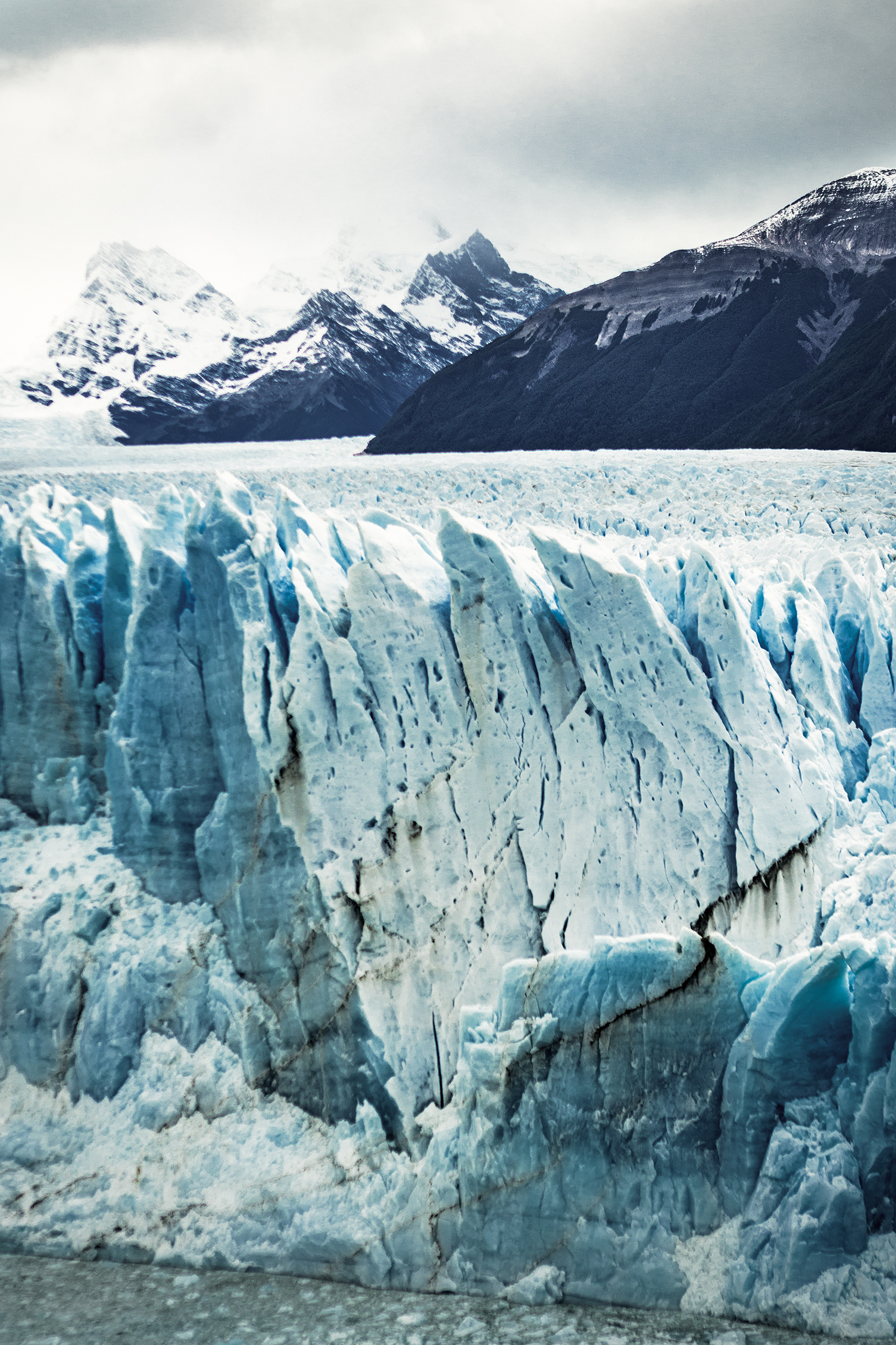
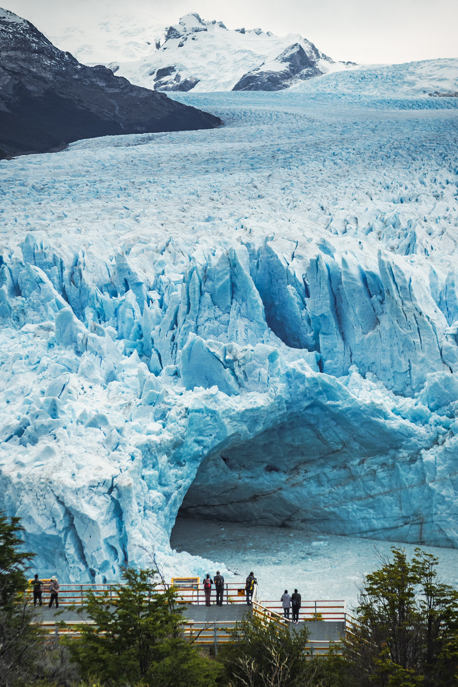
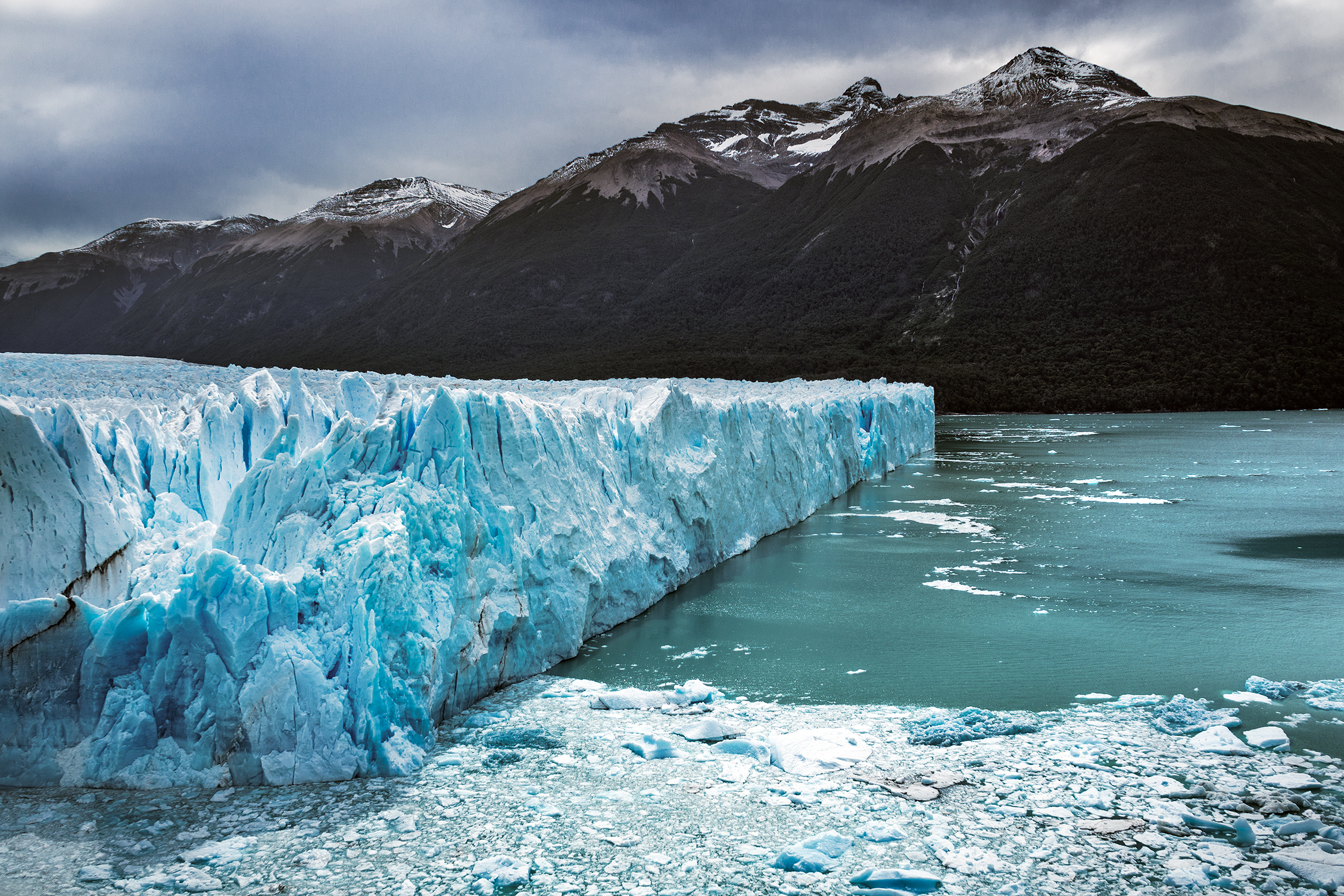
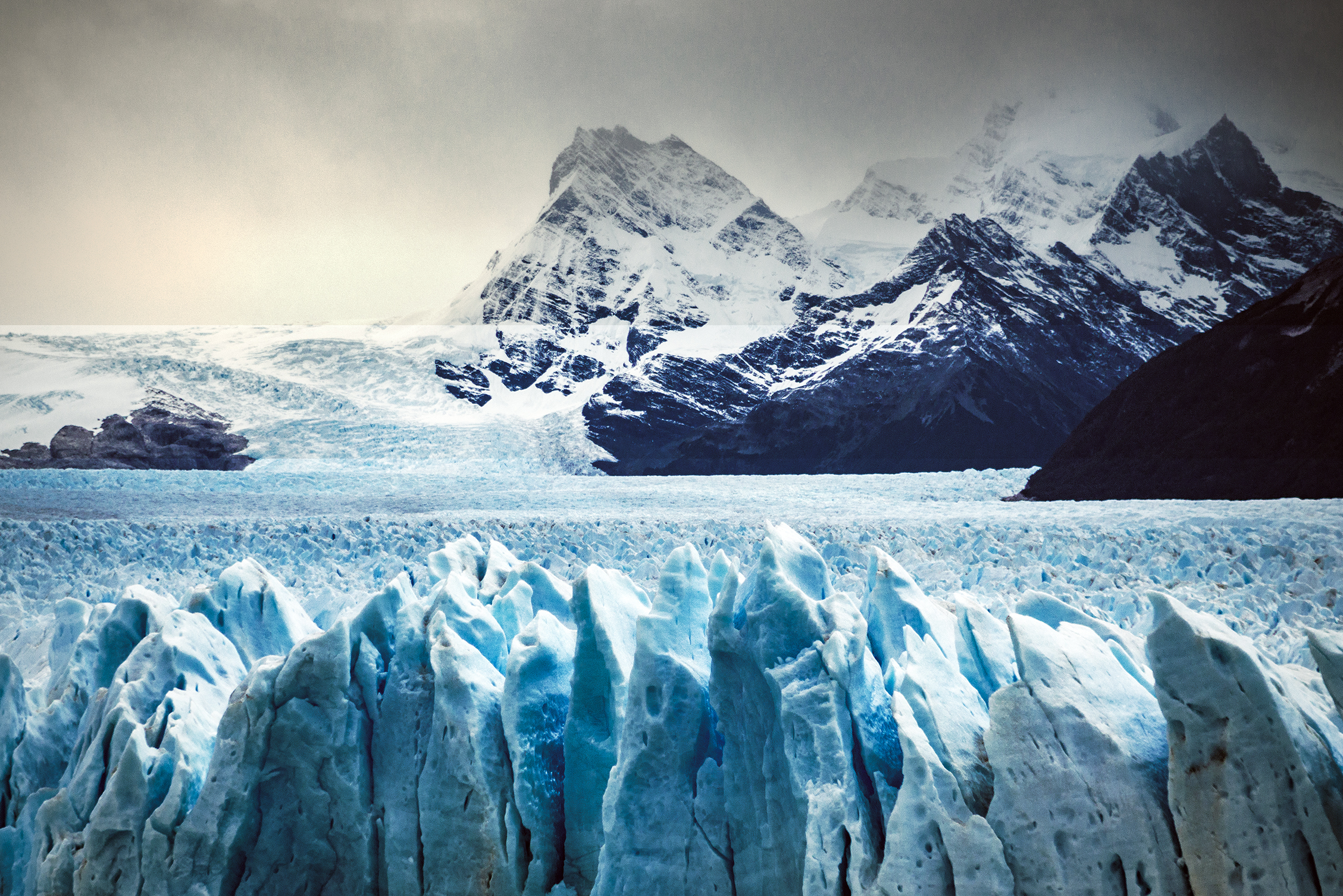
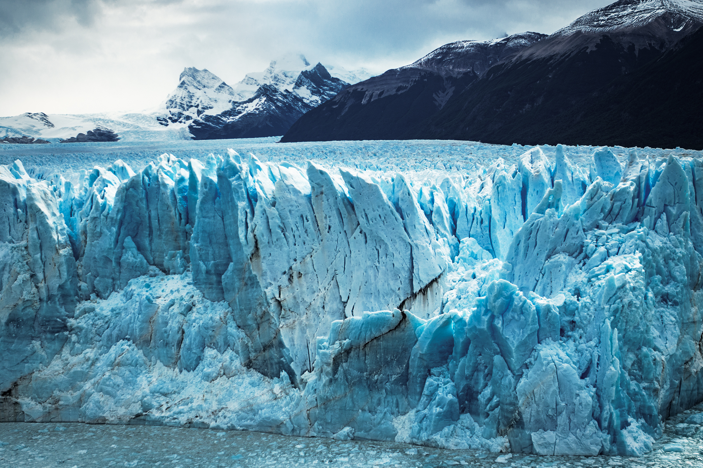
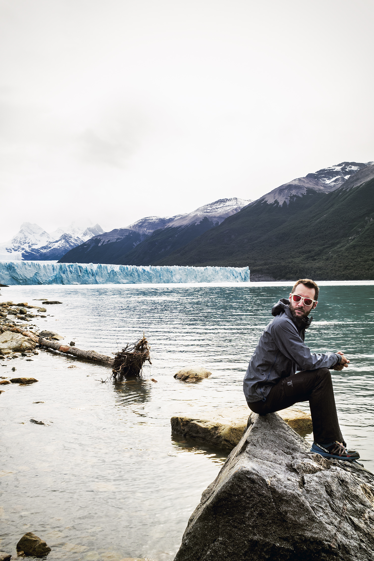
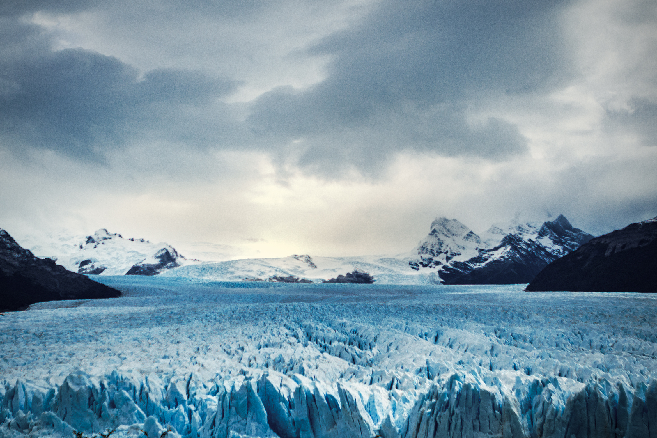
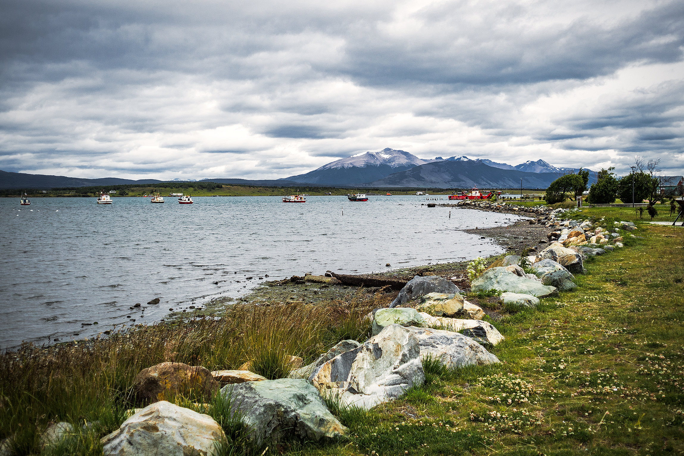
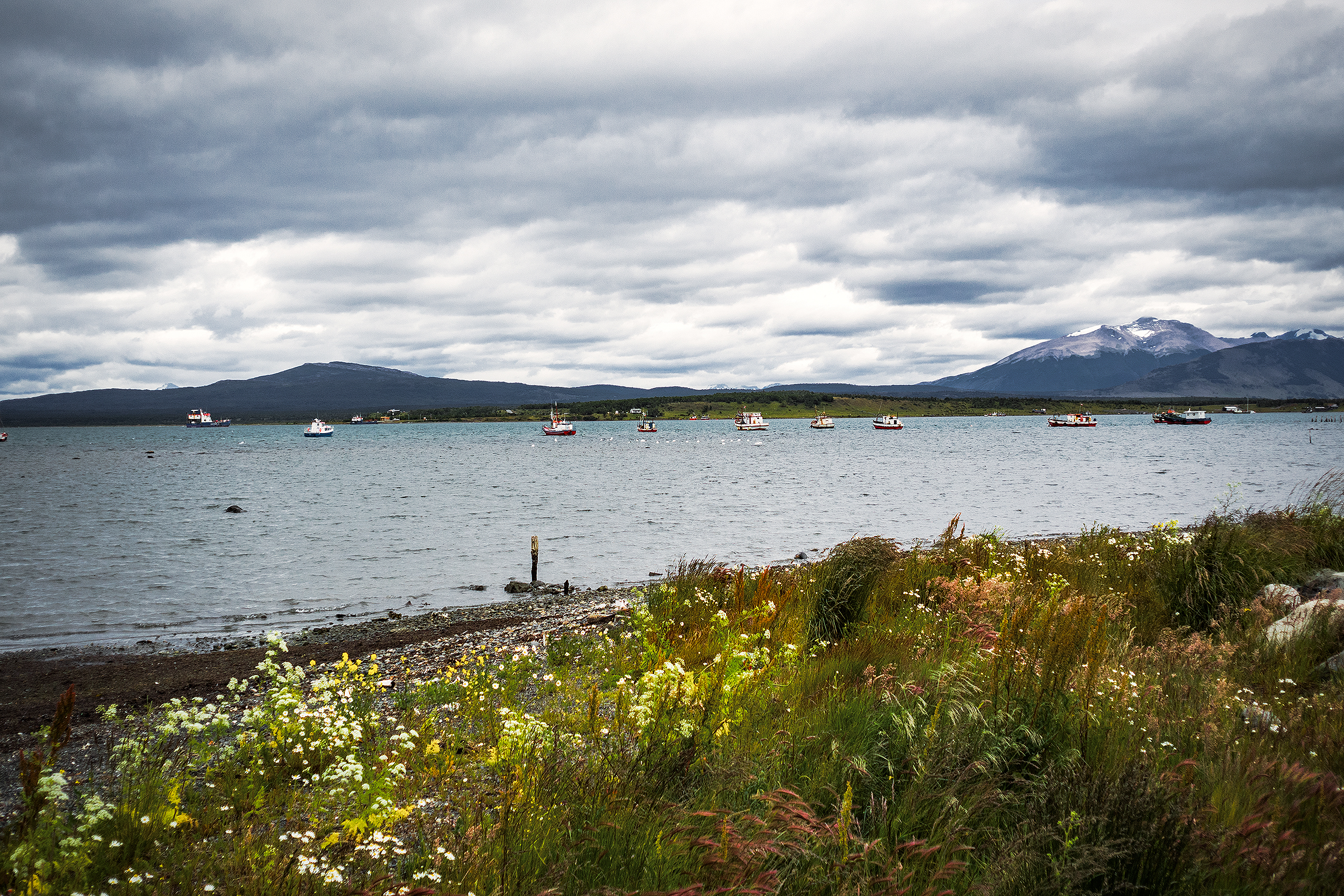
On December 23rd, we headed for El Calafate, and the Perito Moreno glacier. El Calafate was a much bigger town on the shore of Lago Argentino. After the 3-hour drive from El Chaltén, we stopped in town to have sandwiches by the lake, then continued on to the southern portion of Los Glacieres National Park. It was 660 pesos (55 CAD) to enter the park, which seemed a bit much at first but in the end totally worth it to admire the impressive glacier. With a surface of 250 square km and 30km of length, it is the third largest reserve of fresh water in the world.

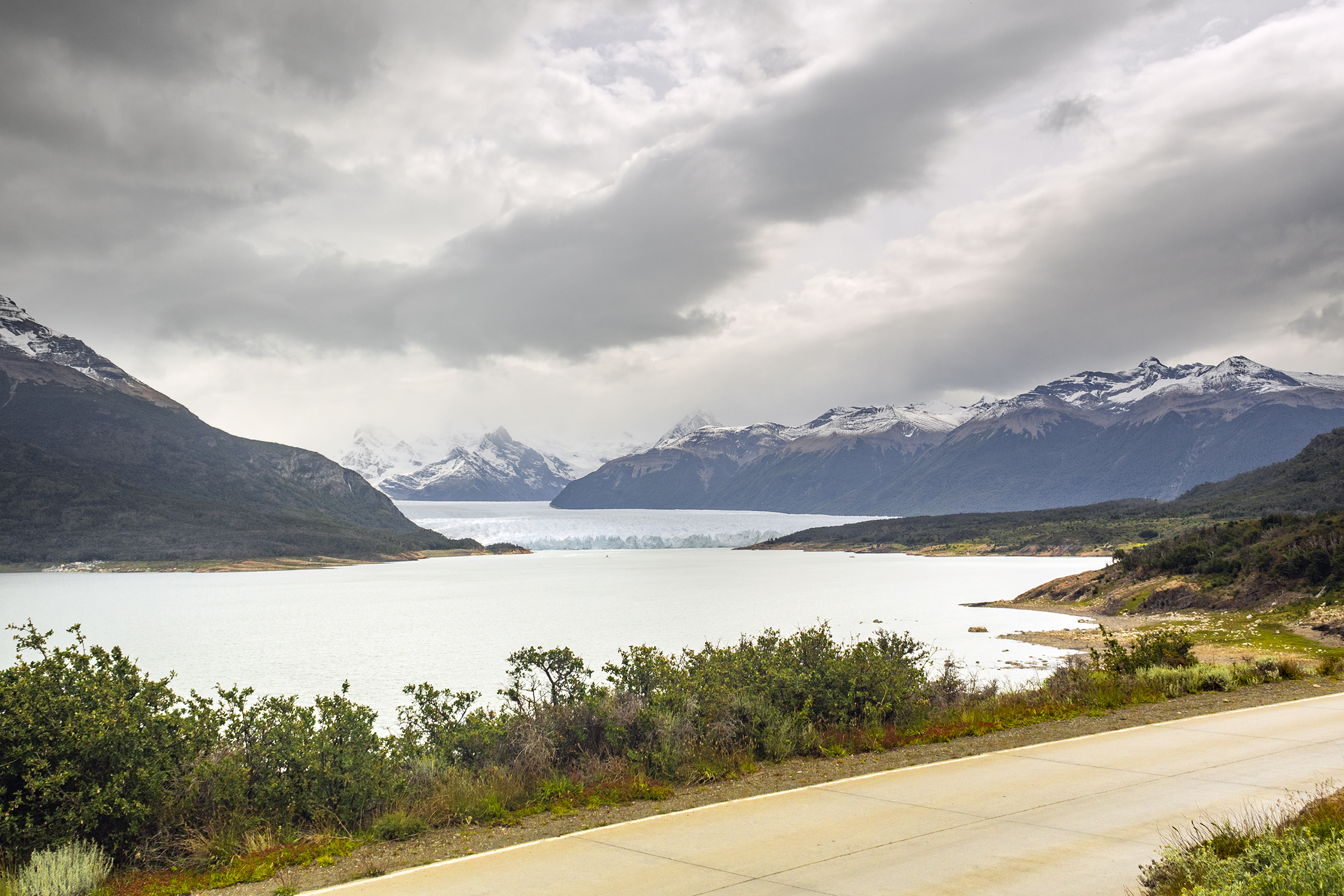
A network of stairs and platforms were built in front of the lake, providing multiple vantage points of the glacier. As it is often the case when staring at an immensely large landscape, it was hard for our brains to grasp the scale of this giant, and realize how far we actually were even though the lowest platform made us feel like we could almost touch it. We were there later in the afternoon, which apparently was good timing as it was the best time of day to witness large shards of ice breaking off the vertical walls and falling into the lake.
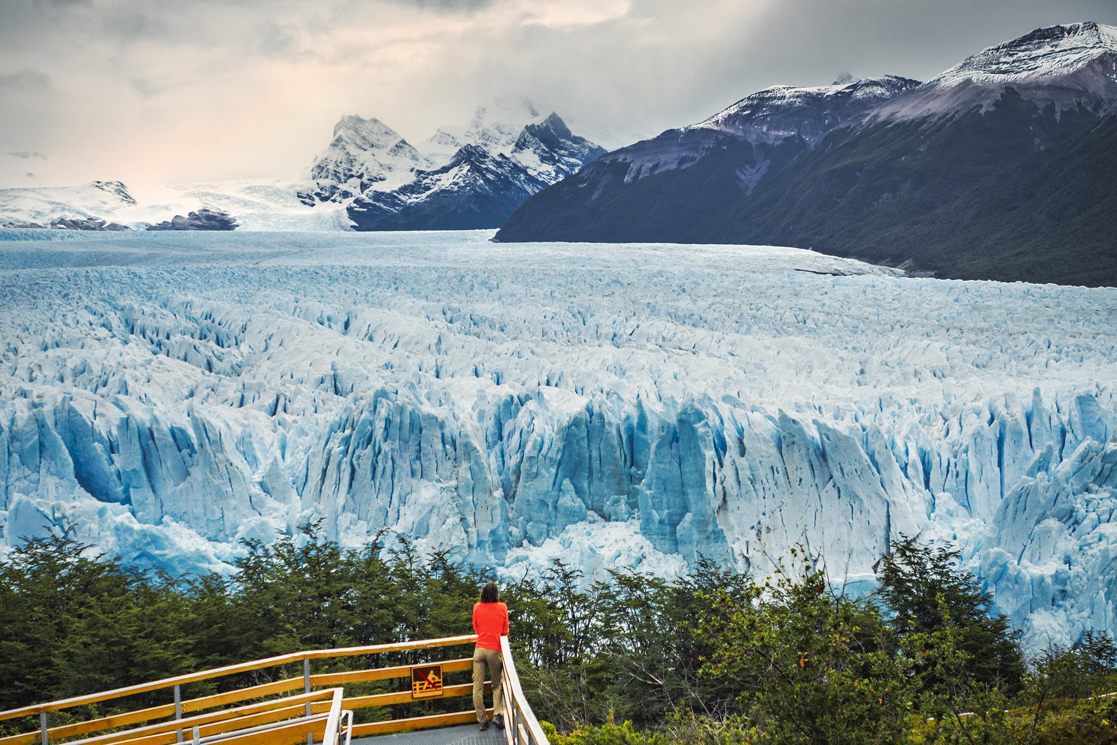
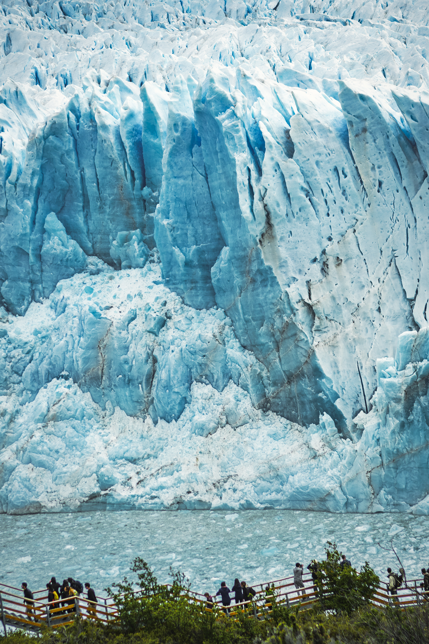
The sound it made was incredibly loud, probably amplified by all the crevasses and cavities in the ice and reminding us of the real size of the beast. It’s pretty funny to think that with growing popularity, tourists flood the park every year to take a look at – ultimately – a huge chunk of cracking ice. But what a mesmerizing chunk it was.
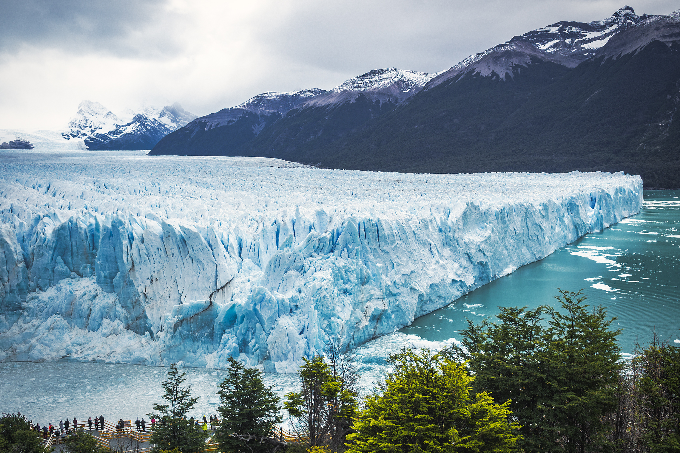
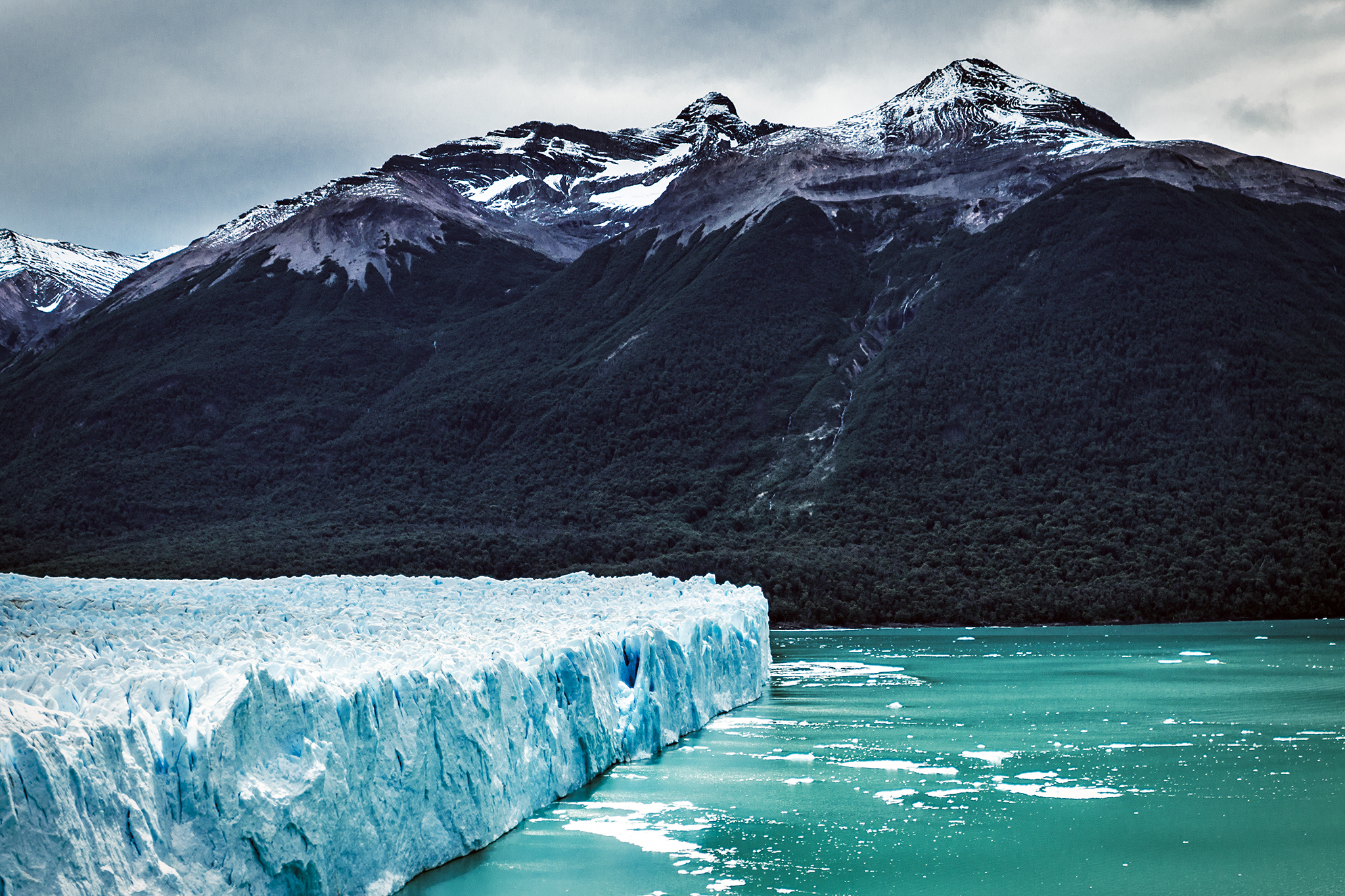
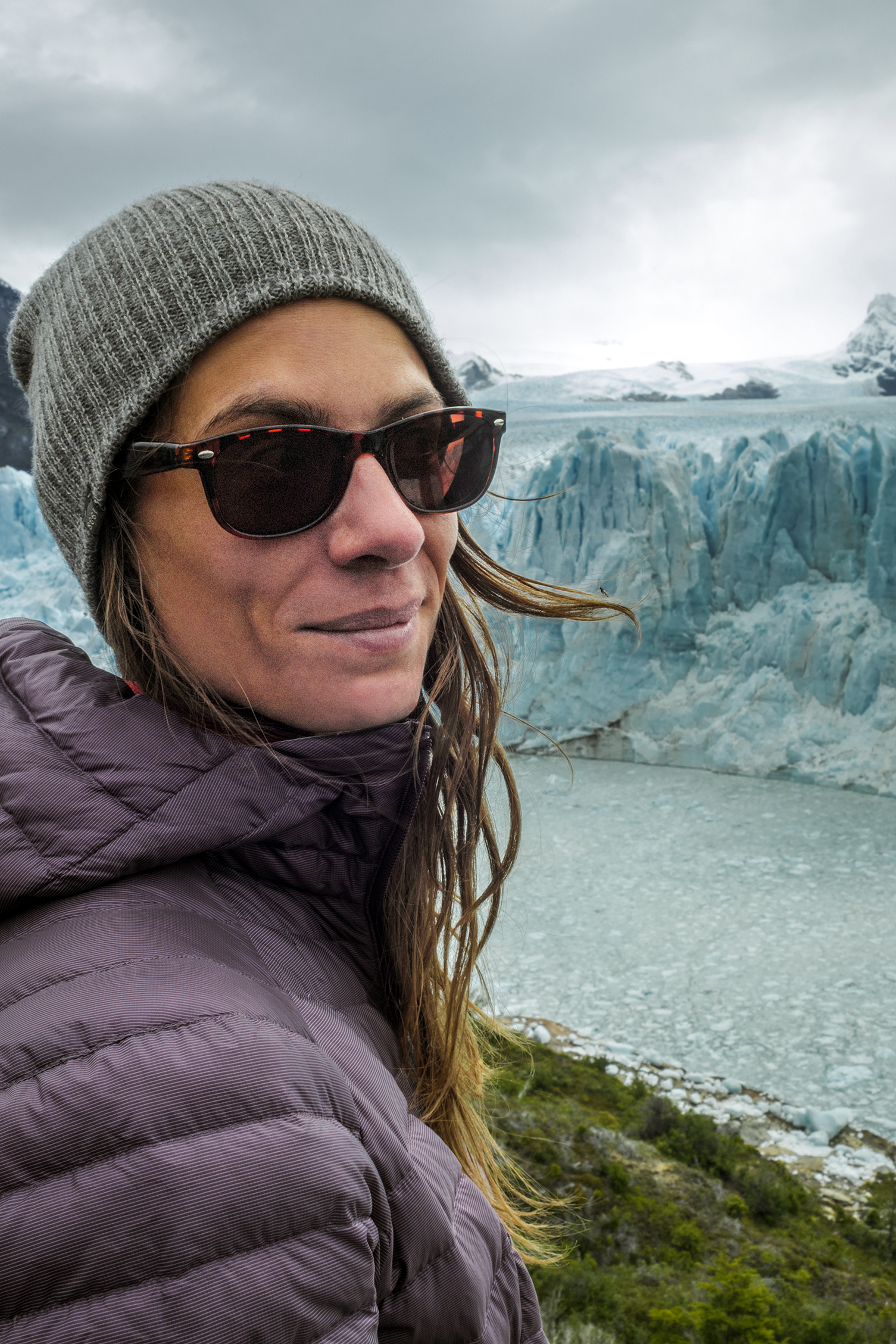
We spent a couple of hours marveling at the natural phenomenon. Then we took a quick walk on the shore of the lake further away before leaving the glacier behind us, probably one of the most memorable sight of this trip.

Our favorite app led us to a free campsite on the southern side of the lake with firepit and mountain view. The perfect spot for our last night on the road before we reached Puerto Natales, our base camp before embarking on a 6-day trek around Torres del Paine.
The next morning we had to cross the border again to go back to Chile. The 60km of road prior to the border were some of the roughest we’d driven on, with once again not much to look at. Thankfully we had loaded up the ipod with podcasts, so that kept our minds entertained while driving on these long stretches of road for hours.
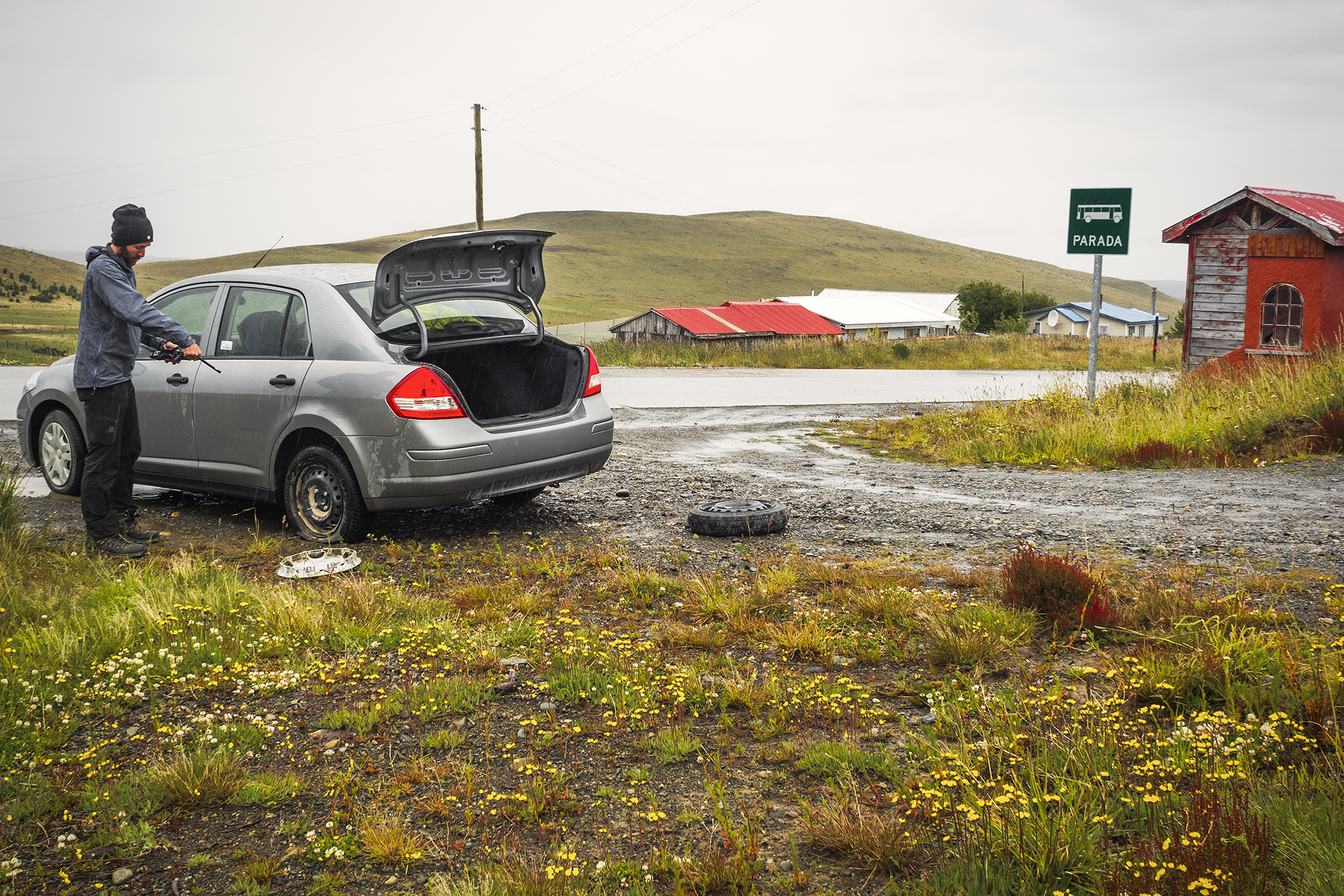
The border crossing near Rio Turbio was quite a lot bigger this time, with a good number of people going through. We went through the Argentinian side first, to exit, then drove 3km to the Chilean entry point. We had been warned that you couldn’t bring any food in Chile, but they let us go with what we had left – again it was mainly canned and dry food, no fresh produce, so it looked like it was fine. As we were crossing the border, we noticed we had another flat tire. So we had to pull over a bit further and replace it with the spare once again. We were only 25 km from Puerto Natales so we just kept going on the spare.
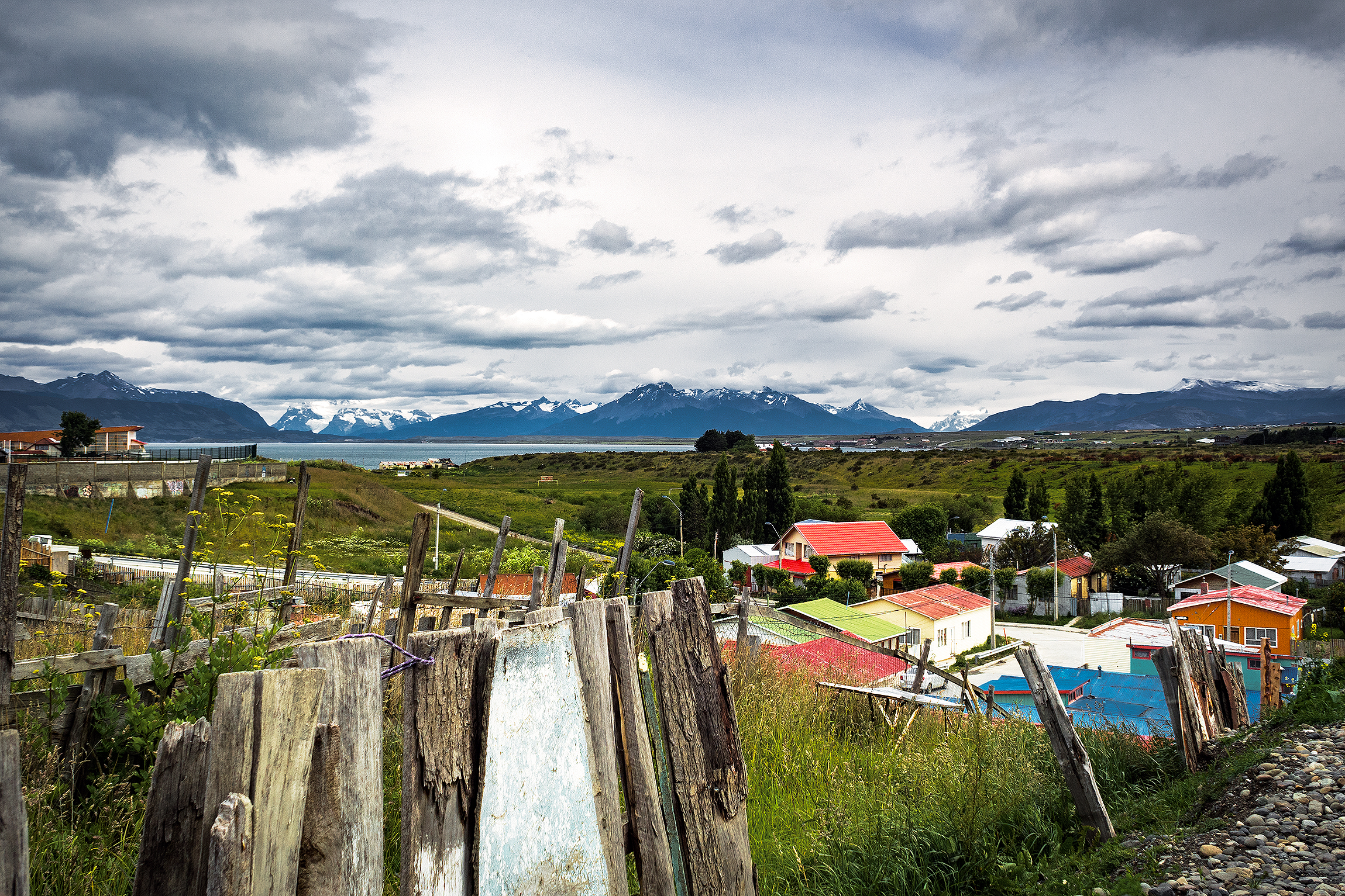
We arrived in Puerto Natales around 3pm. The first thing I wanted to do was buy food for the first few days of the trek (we had read that there were small shops in every campground so there was no need to buy for the whole week). Since it was Christmas eve, I thought stores might close earlier than usual, and they would most definitely be closed the next day. So as soon as we arrived we looked for a grocery store. We found one on the main street (Manuel Baquedano) in the center of town. The store was of decent size but not huge and we were able to get everything we needed, including a couple of nice freshly made empanadas for lunch. Turns out there was also a big Unimarc a couple of blocks away, but it’s a good thing we avoided it as apparently, the lines to the cash registers where insane that day. Once we had all our supplies, we started looking for accommodation.
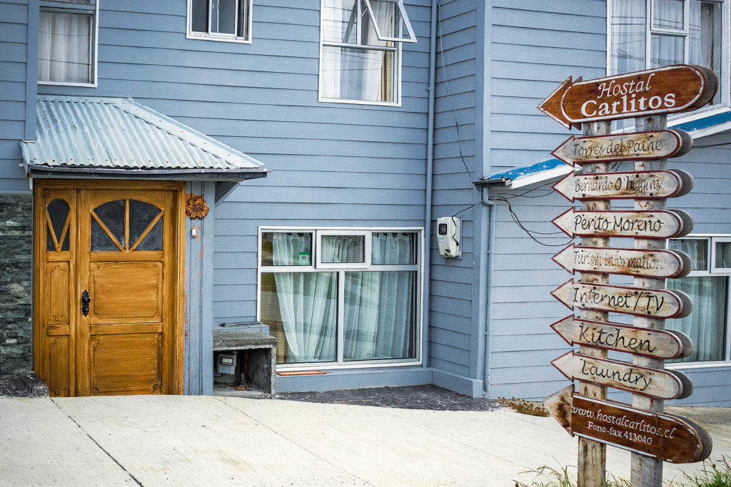
Puerto Natales is the starting point for anyone going to Torres del Paine. As such, it is a pretty big tourist hub, and accommodation is everywhere. We walked around the center of town to check out hostels in the area, but then decided to drive just a few blocks away from the center, where it would be quieter.
There were “Hostal” signs pretty much every block, so we went into a few of them to check them out. Eventually we settled on Hostal Carlitos – the selling point was the big wood burning stove in the main room that gave the place just the amount of cozy we were looking for.
Hostal Carlitos was a family run business. There was a big Christmas tree in the main room, with presents underneath. The girl at front desk told us that the whole family was getting together that night and was having a traditional Christmas eve dinner, and that we were welcome to join. Dinner would be at 12am. Although we were honored that they invited us, the chances of us still being awake at midnight were pretty slim – and sure enough, we were out by 9:30pm.
The next day was December 25th, and everything in town was closed. We took this opportunity to take a “day off” from traveling, and reset. In the morning we took a walk around the town and along the water. We also found out that the bus station was only a few blocks away, so we first headed there to see if we could book our tickets to go to Torres del Paine the next day. At first it looked like everything was closed, but a couple of companies counters were open. We bought our tickets from Buses Fernandez, but there were about 8-10 different companies there offering trips to multiple places, including Ushuaia and Punta Arenas, the city we would be flying out from to return home.
Once we had our tickets, we took a walk around then headed back to the hostal. We were due to return the car that afternoon. Enrique (our car rental guy) had told us to just email him with our location and he would send his friend Raul to get the car. Sure enough, around 4pm Raul showed up and after handing him all the paperwork, we said goodbye to our ride.
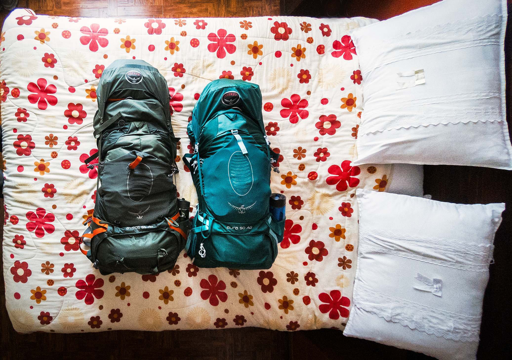
Then we just hung out for the rest of the day. With no more car to throw our stuff in, we now had to make sure everything still fit into our backpacks, including food. It was impressive to see the amount of stuff we had, when all laid out on the bed, and that somehow everything fit into those two backpacks. Even though we had done our best to pack light originally, we admittedly had a bit too much for the treck, especially the summer clothes we wore in Costa Rica. We could have maybe looked for a place to store some of it, or even mailed some stuff to Canada, but at that point we figured it would be fine. My pack was about 12kg and Brice’s 18kg – before food. So yes, heavier than it could have been, but in the end we managed.
The hostal had a little kitchen that we could use and a couple of long dining tables, so we had breakfast lunch and dinner there and took the day to rest.
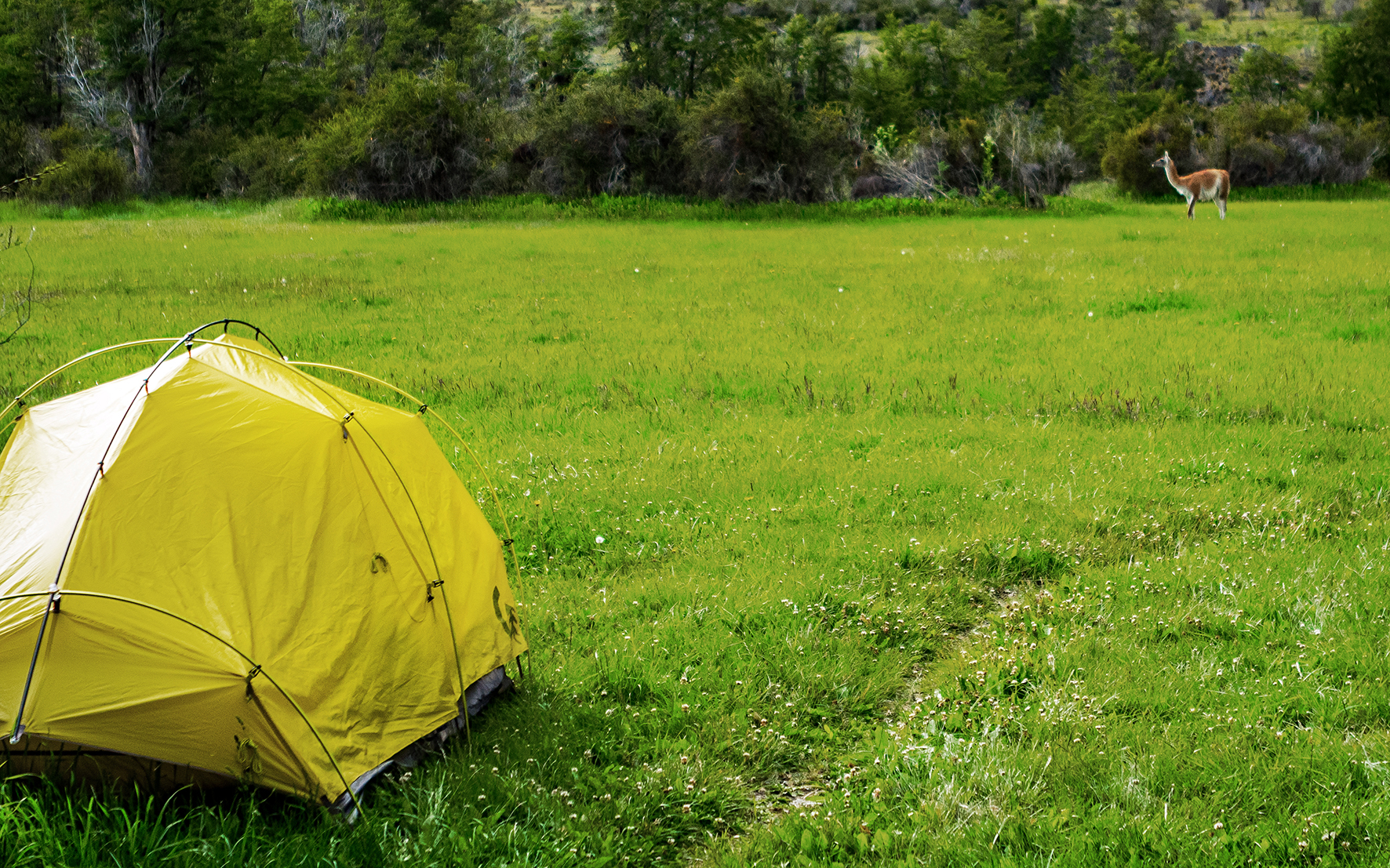
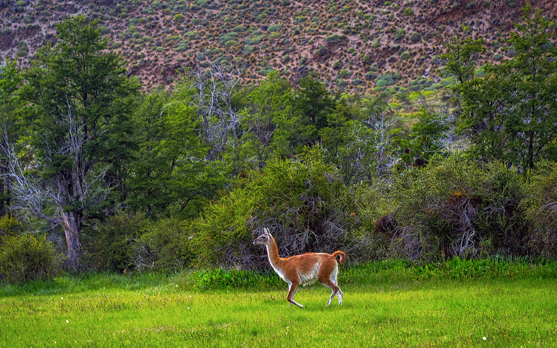
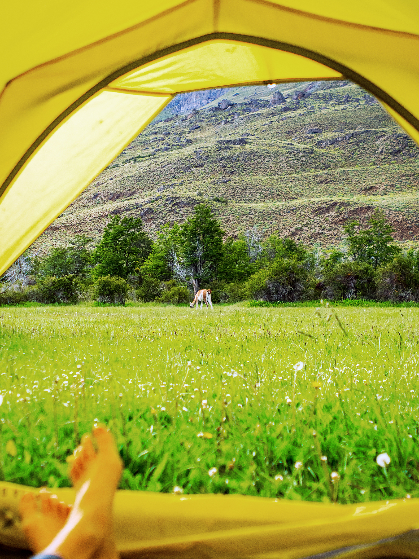
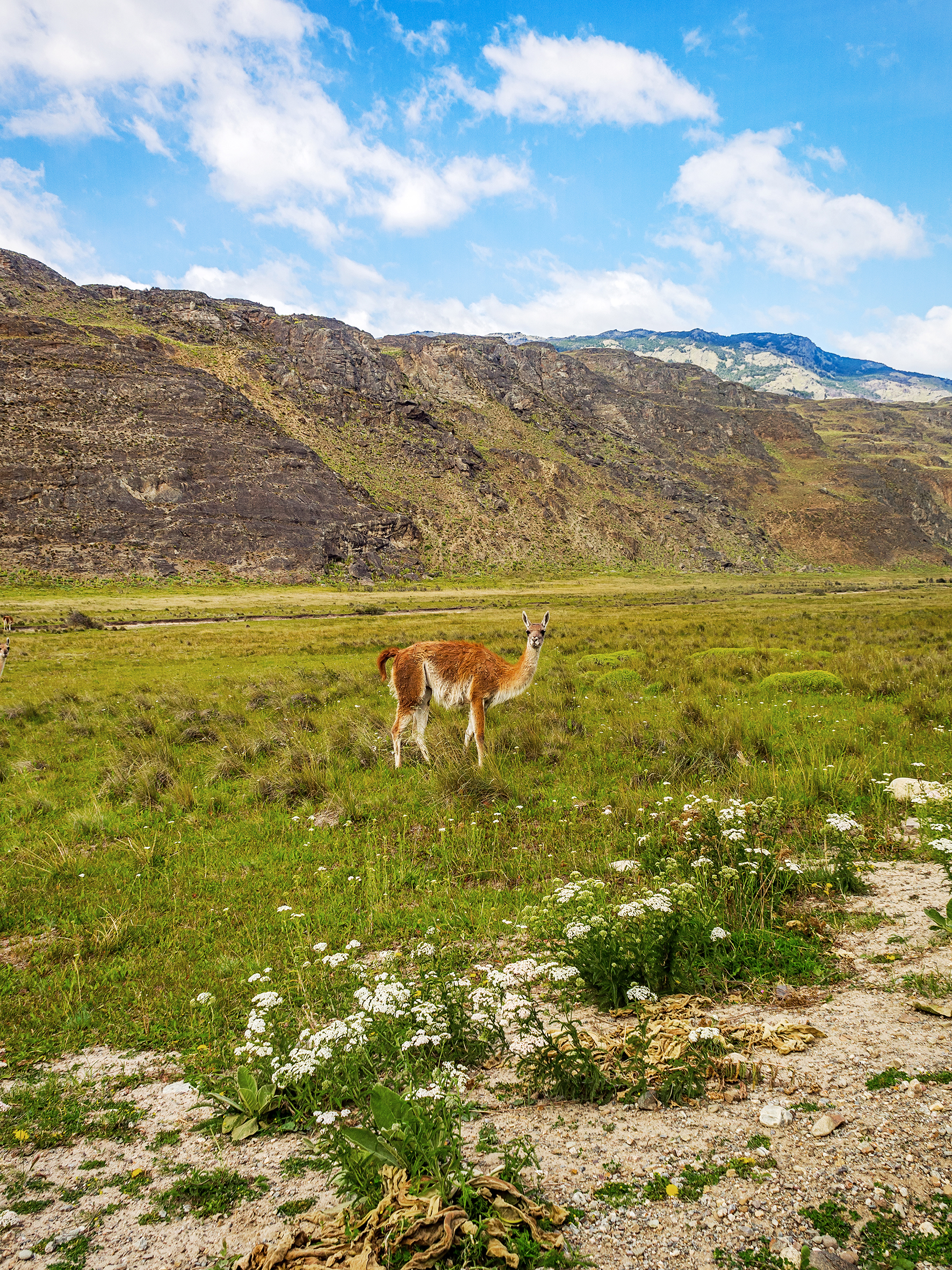
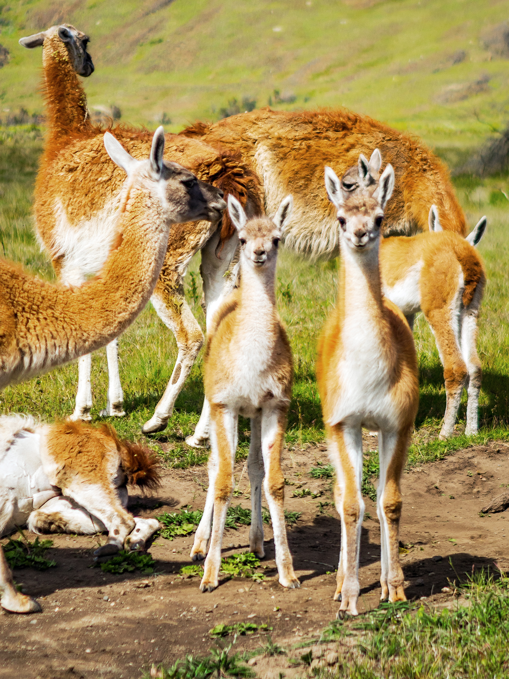
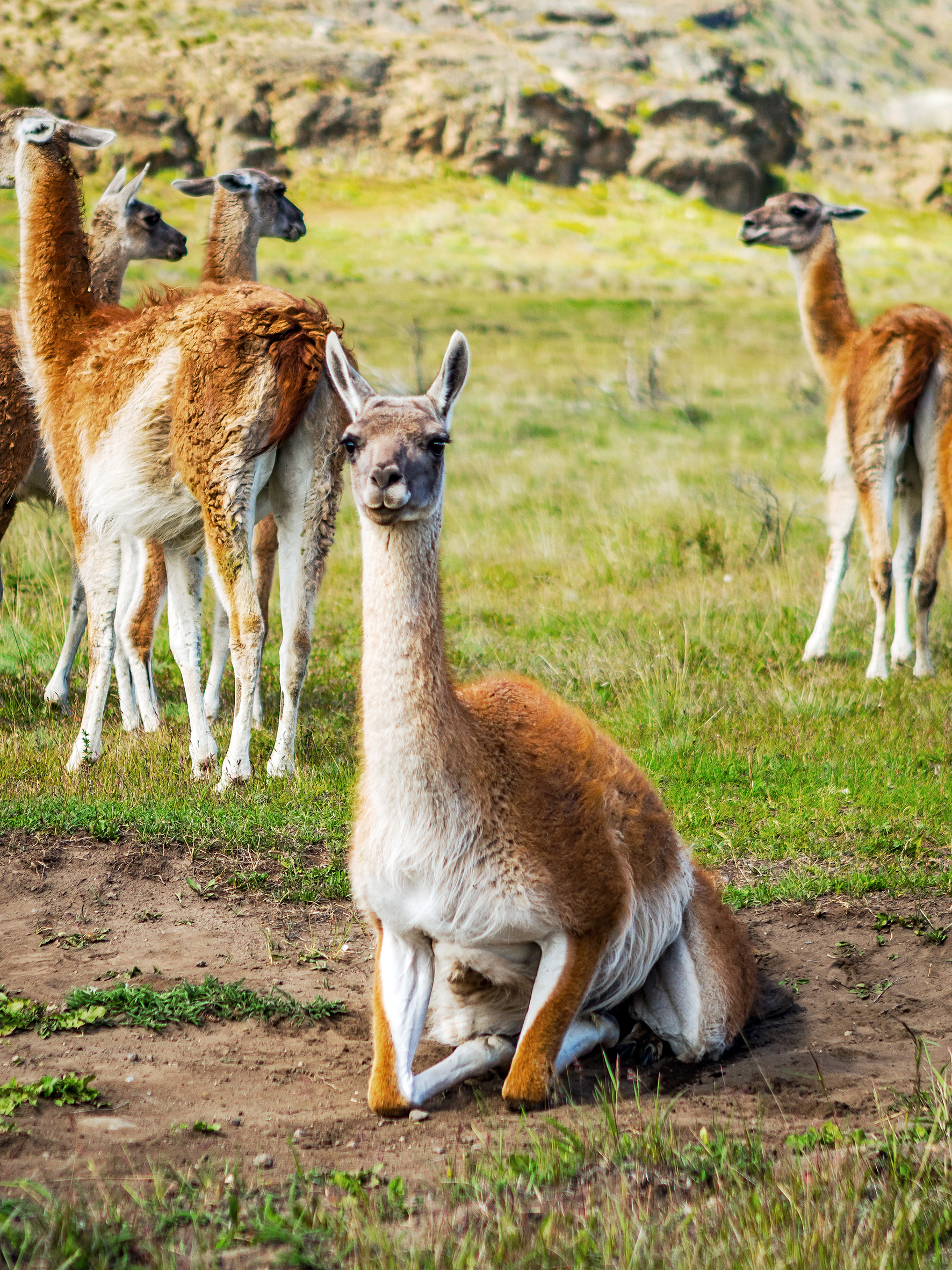
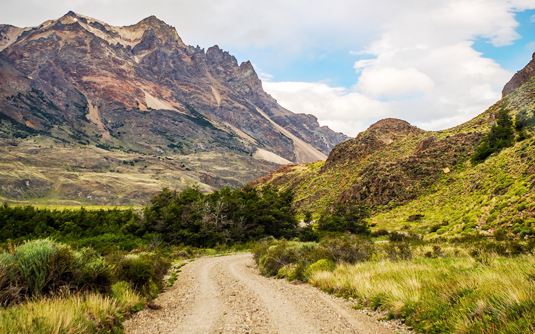
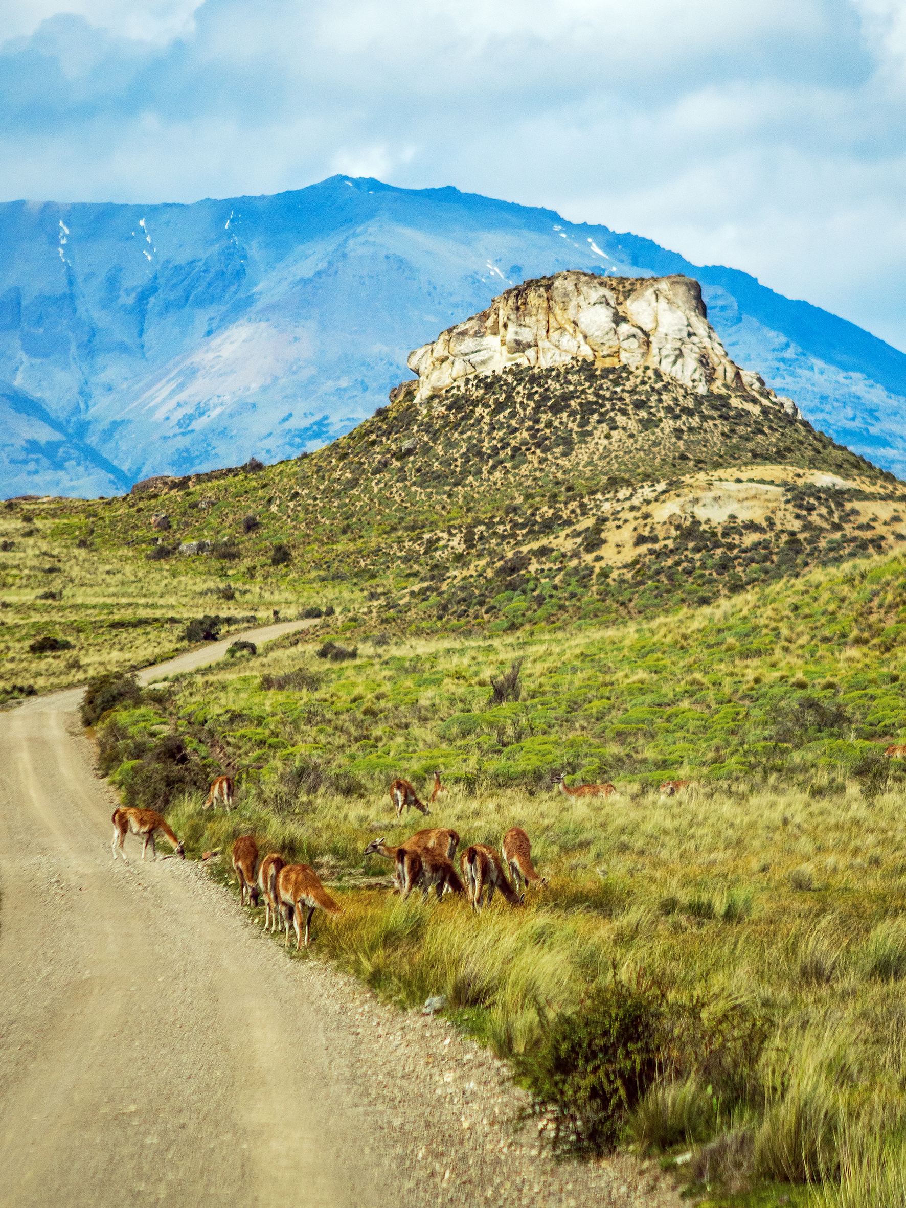
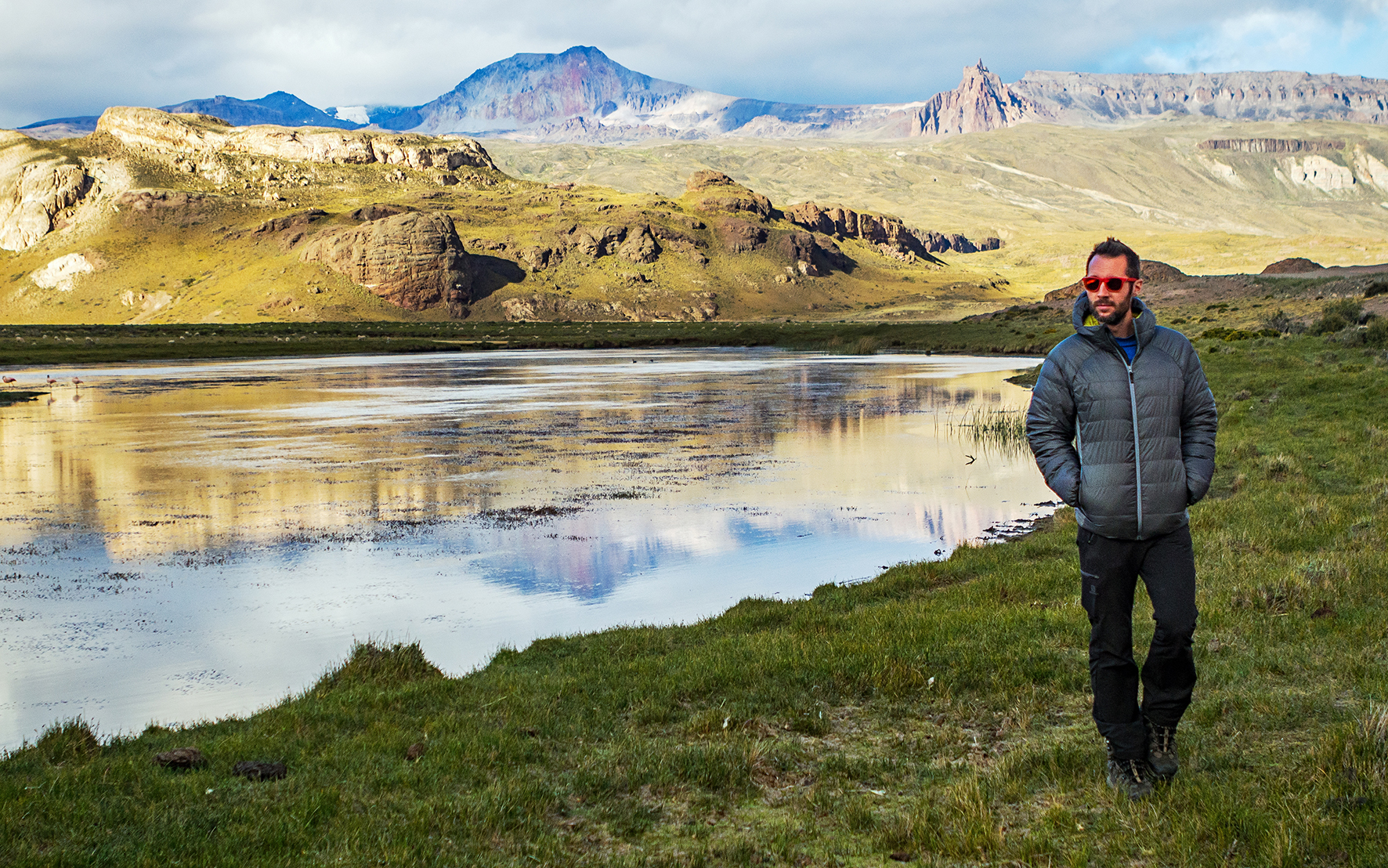
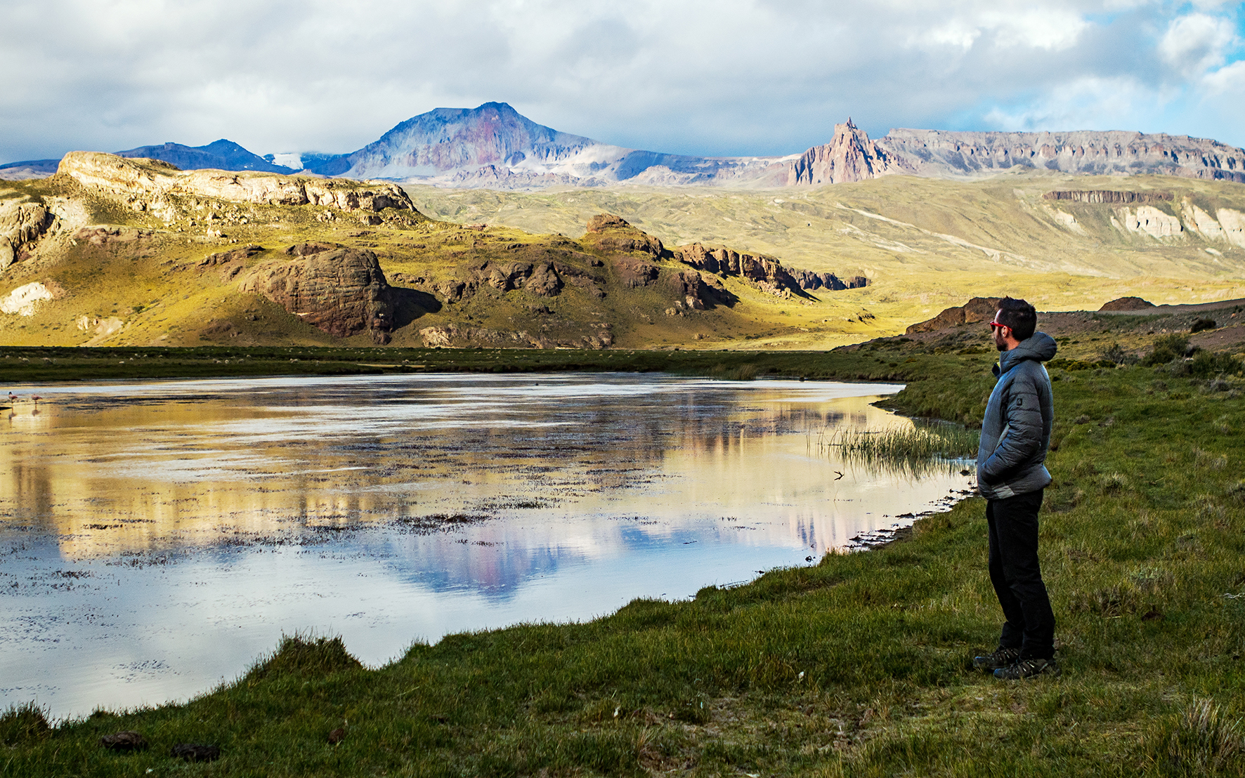
On the morning of day 6, we woke up in Valle Chacabuco, to the sight of Guanacos grazing in the field.
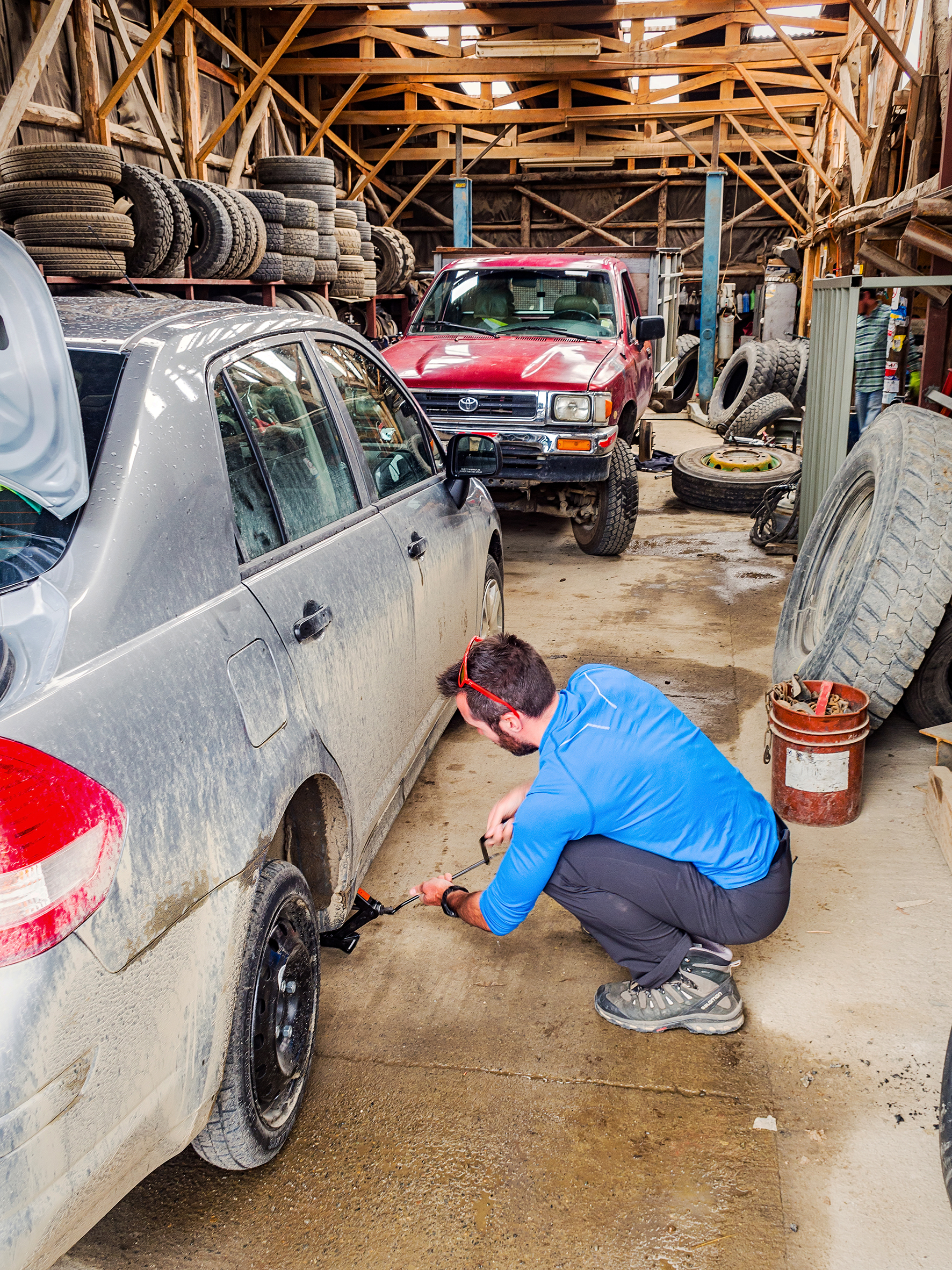
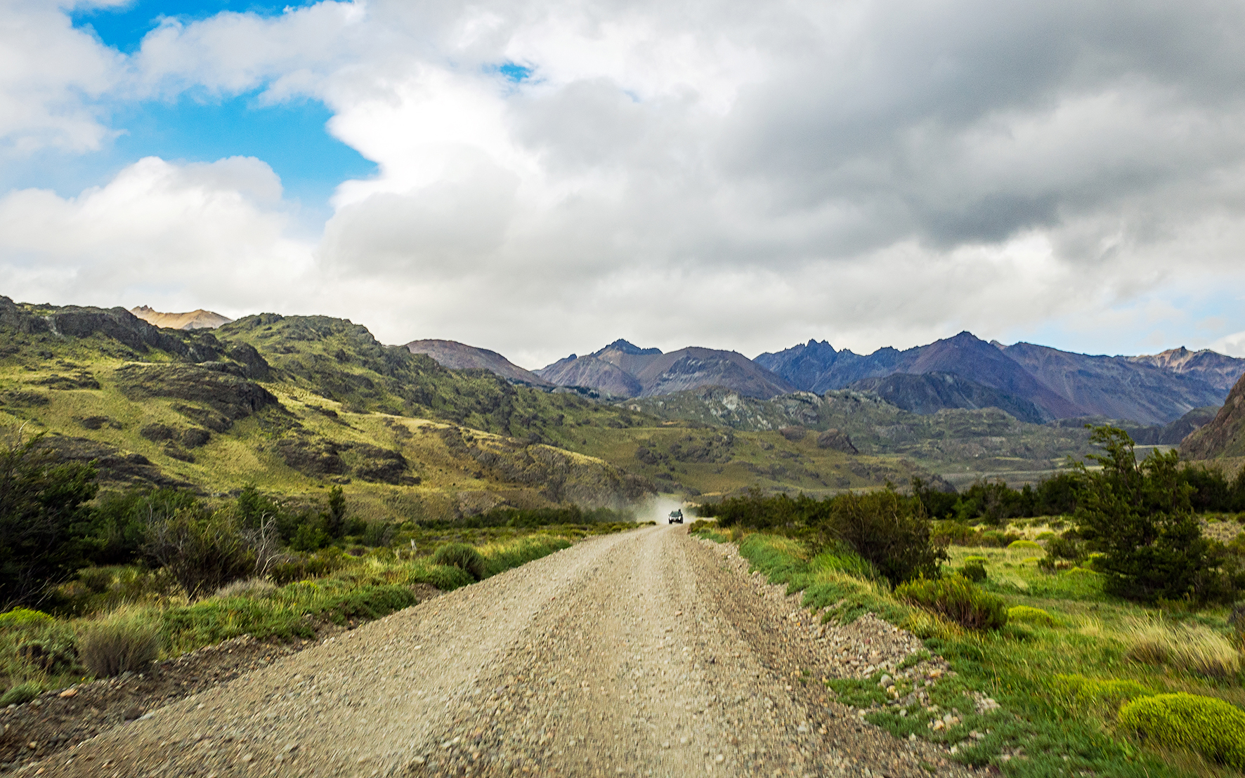
When we got back to the car, we realized one of our tires was flat. Ironically, we found out after taking it off that it was caused by a screw, that we probably picked-up in the campground, as we drove on a path that was still under construction. So much for all that rough pot-holed and corrugated Carretera, it was a screw that gave us our first flat tire. In any case, we had to make use of the spare tire, and we also realized we were going to have to drive back about an hour to the town of Cochrane in order to get our tire changed, as it was the closest town to our current location (anything on the Argentinian side was more than 2 hours away).
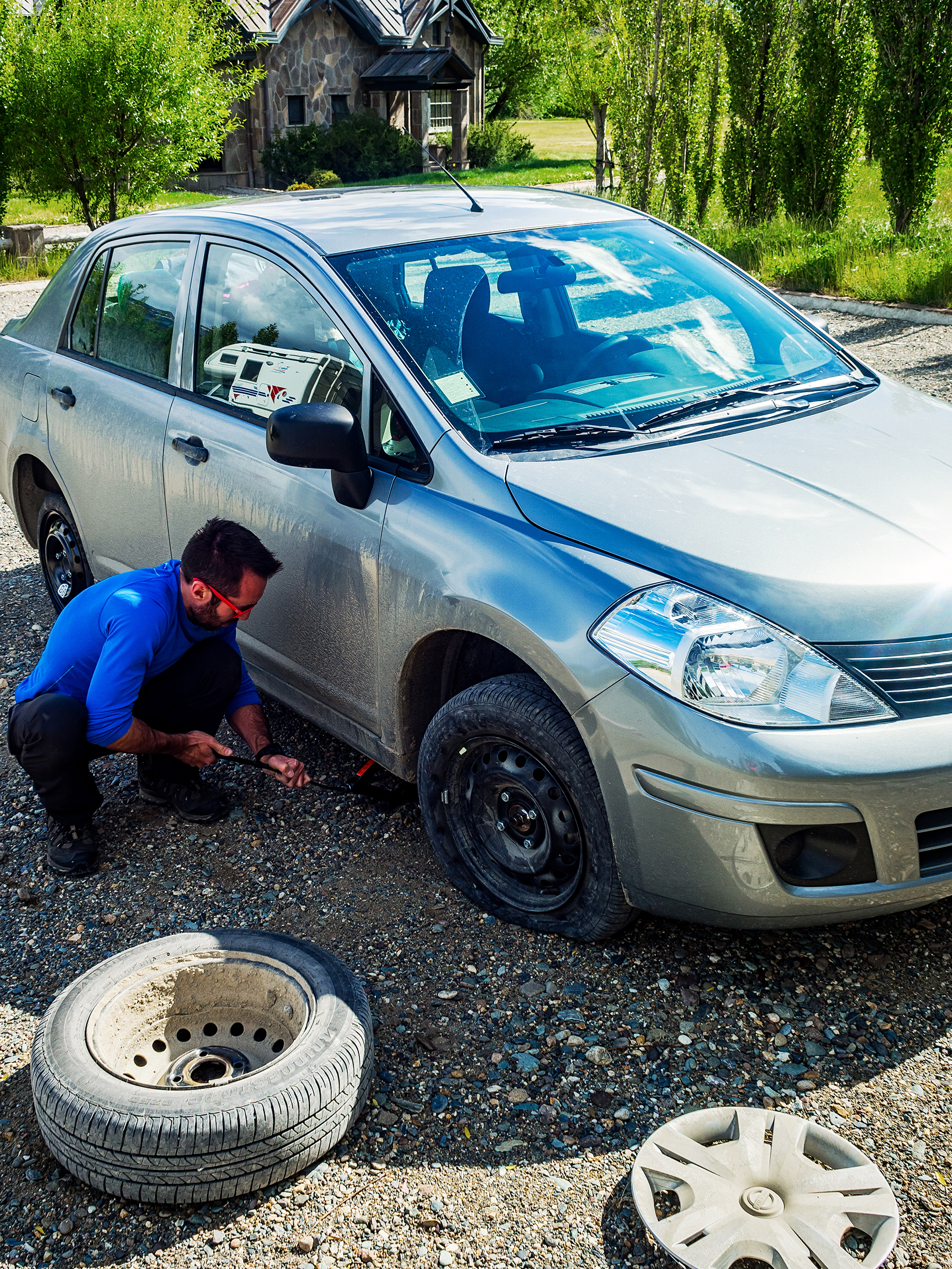
So we drove back through the park and to the junction of X-83 and the Carretera, and from there headed south to reach Cochrane. Between iOverlander and the guide book, we were able to easily find a place that sold tires. Turns out the place didn’t actually install them, but they gave us direction to another shop that would change the tire for us.
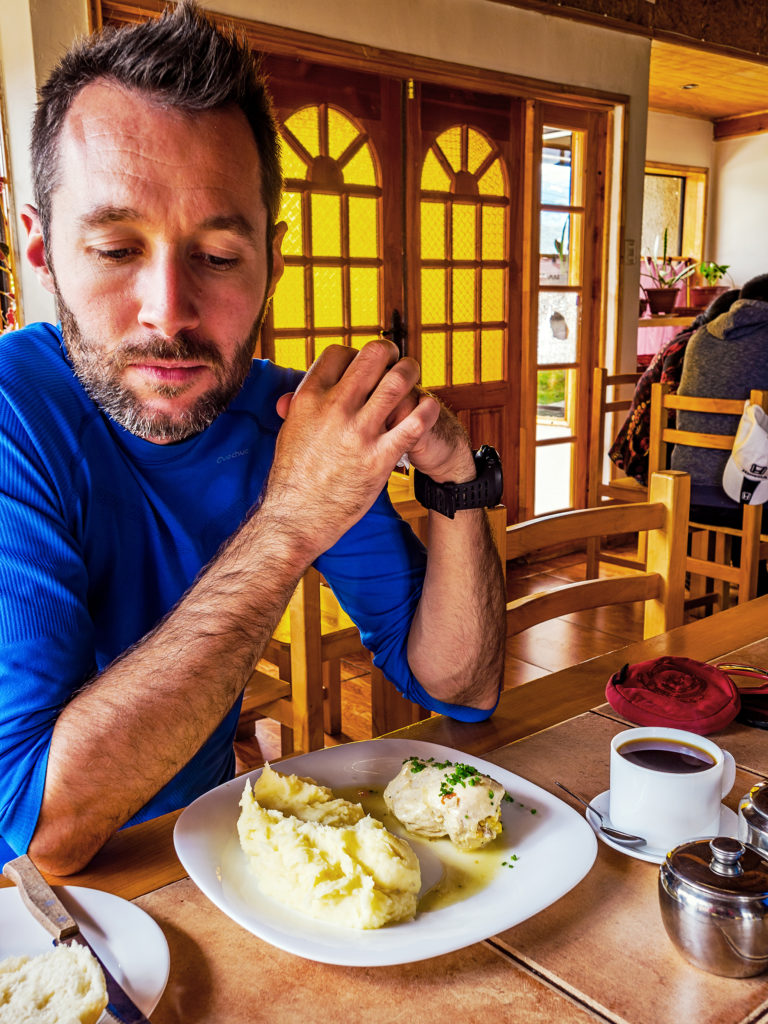
Once that got taken care of, I suggested we found a place to have a proper meal rather than sandwiches. We decided to try the Centro de Comida Lago Brown. Aside from a regular restaurant menu, they offered a lunchtime “Plat du Jour” for 4000 CLP (about 6USD). That’s what we ordered and it turned out to be one of the best meals we’ve had during our trip (aside from all the amazing food prepared for us at Chakra Lodge in Costa Rica). The dish was really simple, mashed potatoes with chicken breast in a buttery herb sauce. But it tasted like our grandmas had made it. The potatoes were super flavorful and the chicken incredibly tender, as it would be after, we assumed, roaming around in one of the local backyards. Somehow the dish had, there again, a taste of childhood…
Since we were in a somewhat bigger town, with potential access to internet, there was one thing I wanted to check before crossing the border. I had read that Canadian residents had to pay a reciprocity fee upon entering Argentina. The fee had to be paid online and the receipt printed to be presented at the border. We hadn’t really worried about it until now, but since we already had to take a detour because of the flat tire, I didn’t want to drive all the way to the border, only to be turned away because of paperwork, and having to drive all the way back to Cochrane again.
So first we walked into a small hotel to see if they would let us use their internet. They say they didn’t have any, but there was an internet café just a couple of blocks away. There were two or three computers available, but the woman at the desk asked if she could be of any help, so we showed her all the paperwork we had for the car, and asked if she knew if we needed anything else. Aside from the reciprocity fee, she said we were missing an international insurance for the vehicle – the one we had was for Chile only. It was actually really easy to purchase, and she was able to get one online for us for about 15,000 CLP – the printing of the paper actually took forever as her computer was old and she wasn’t able to open the pdf file. There was a very frustrating period of about 20 minutes where I watched her try to repeatedly open the file and fail, download the latest version of Adobe Reader and try to install it and fail, then try to open the file again, then try to install reader again…that took place about 4 times until eventually she got on the phone with the insurance company and they emailed her the insurance certificate in some other format that she was able to print for us. Then we paid online for the reciprocity fee (78 USD), printed the receipts and finally were on our way.
We headed back to Chacabuco park and after driving through the reserve on some of the roughest stretch of road we had seen so far, we eventually made it to the Paso Roballos border crossing. We first had to go through the Chilean Exit office. Pretty much in the middle of nowhere, the border office was small, and the border officer welcomed us in by shaking both our hands – quite a different experience from our usual US/Canada crossing. We gave him all our paperwork, including the car’s. After taking a look at it, he pulled out a form, and placed it on top of a piece of carbon paper, with another copy of the form below it (did I mention that this whole country felt like the 80’s?) Then he handed us the stack and asked us to fill out the information. The documents that we had been provided with by our car rental guy worked perfectly, especially the notarized authorization to take the car outside of the country.
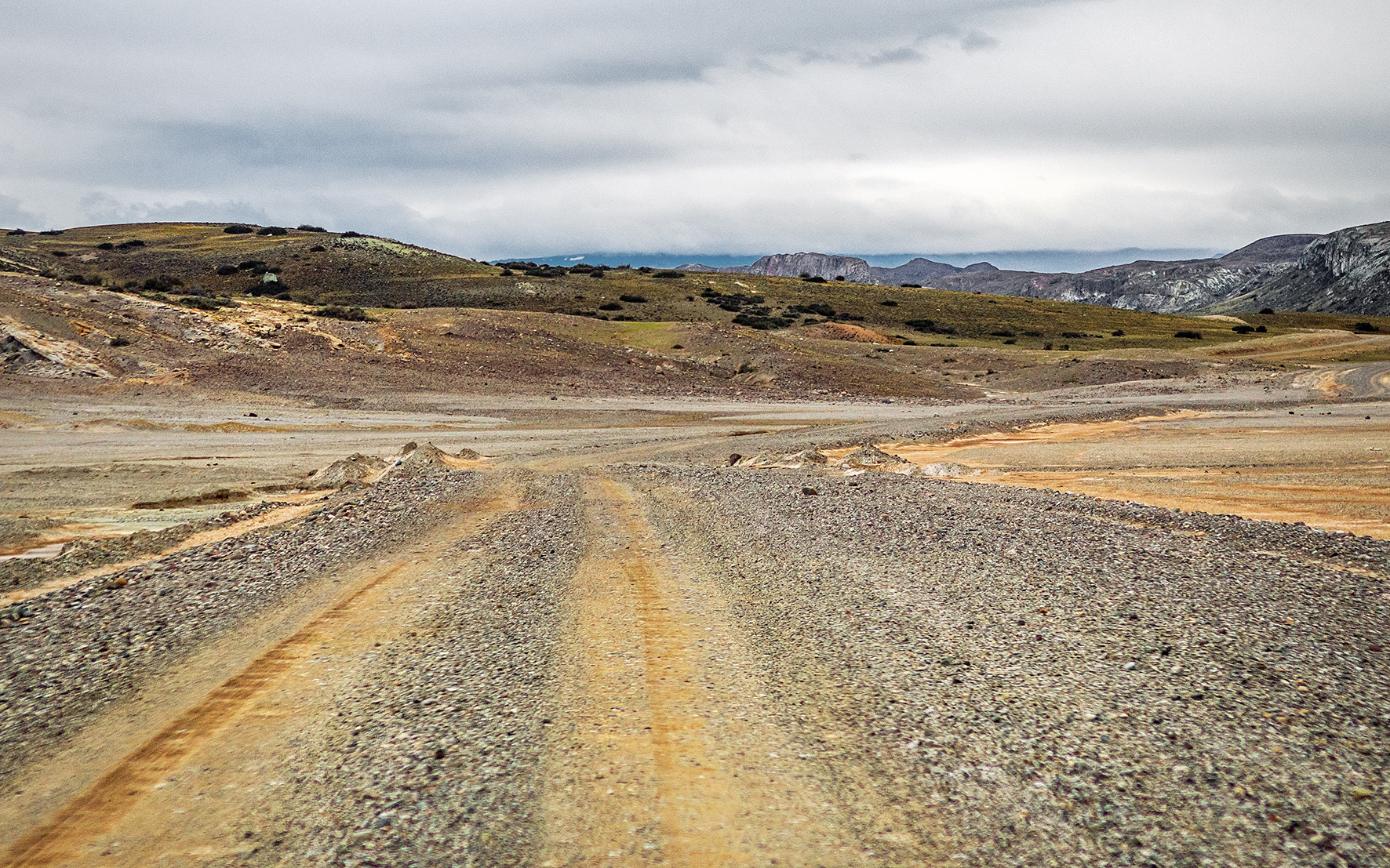
After taking care of all the paperwork, we drove about 13km in dry and windy no-man’s land.
Then we arrived at the Argentinian border. We thought the office on the Chilean side was small, but that was before we saw this one.
We entered a small wooden building and then it wasn’t even the 80’s anymore, it was the 50’s. The friendly border officer was wearing a military green uniform made of thick canvas fabric. A wooden chest of drawers in the back corner was bursting with notebooks and forms. He sat behind a small wooden desk right in the middle of the room, pulled out a pen from a pencil case and a large notebook with lined pages from a drawer, and then proceeded to write down our name and passport numbers into his register. There were more carbon-papered forms to sign but the whole process took less than 5 minutes.
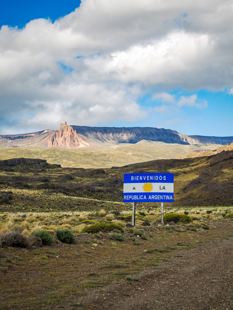
The officer asked if we were carrying any food and when we showed him the content of our food bag, he didn’t ask us to remove anything (we had a bit of cheese left, but no fruit or vegetable, mainly canned food). Seeing that we had some firewood in the trunk, he did give us a warning about making camp fires, and being very careful about preventing wild fires. In this dry and windy area of Patagonia, human-caused wild fires were one of the highest threats to the bio-diversity. With that he wished us a good trip and sent us on our way.
And then we were in Argentina.
From the border, the nearest towns were Lago Posadas, about 70km south or Bajo Caracoles, 100km East. Lago Posadas was a detour as we had to drive through Bajo Caracoles anyway to get to Ruta 40, the main North/South road in this part of Argentina (the Argentinian equivalent of the Carretera Austral). But it was getting a bit late so we decided to go to the closest one, even if it meant adding more distance to our trip the next day.
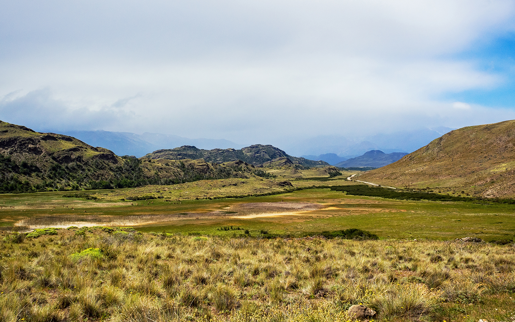
When planning for this trip, I had done some pretty extensive research about the Carretera Austral. I knew to expect the rough roads and the remoteness. Once we got there, we quickly realized that even if the towns were small, and nature was everywhere, there was always some trace of human presence, familiar and inviting…On the other hand, I had paid little to no attention to the Argentinian portion of our trip, other than noticing on the map that Ruta 40 was a long stretch of road that seemed to spread in the middle of nothing.
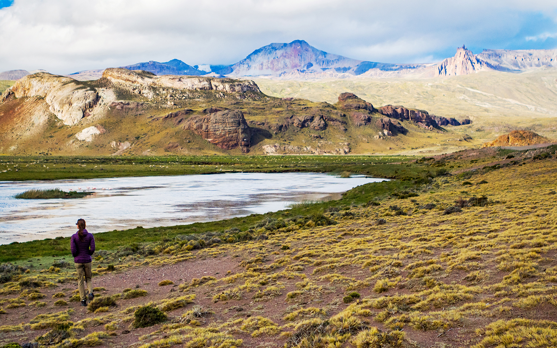
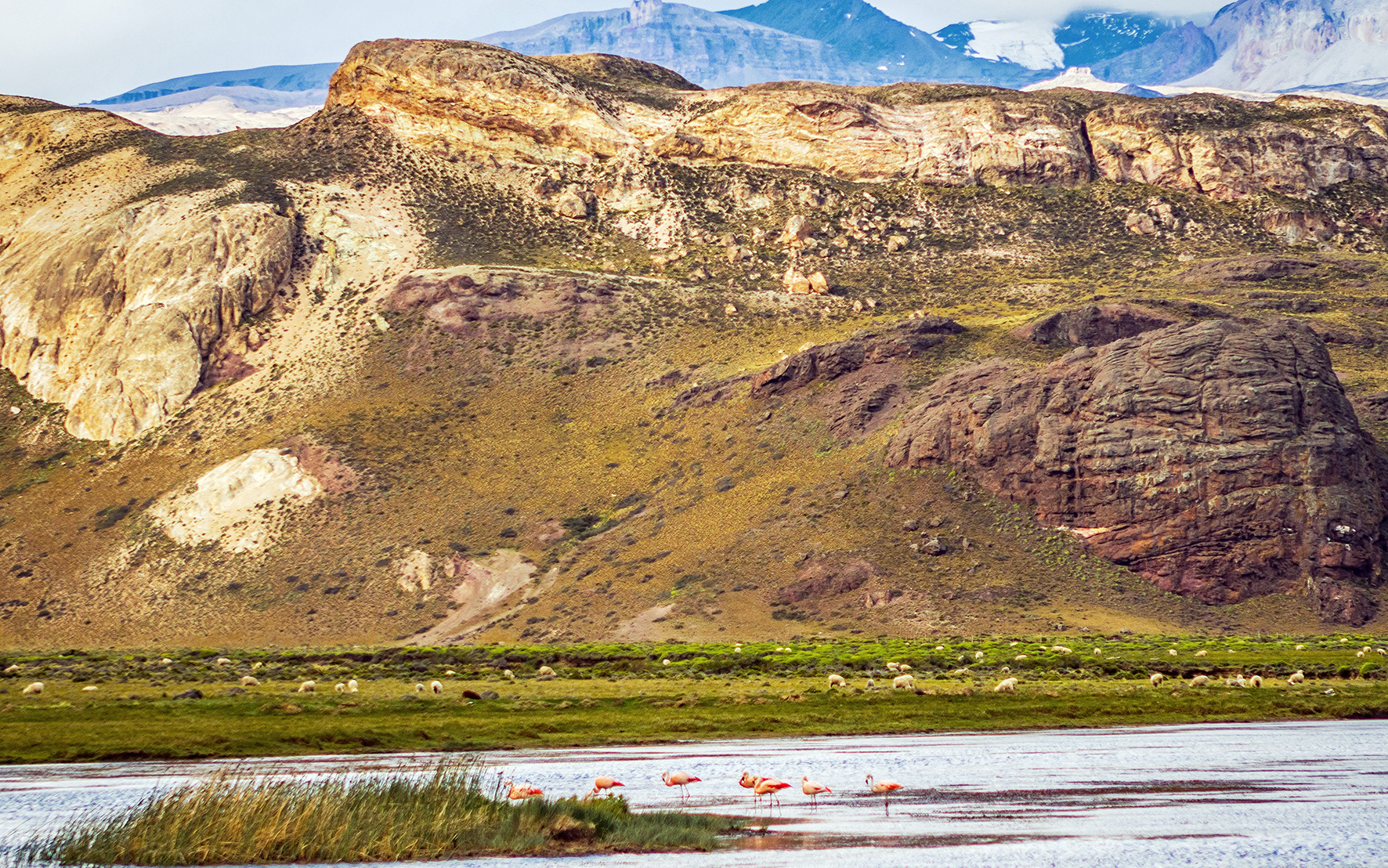
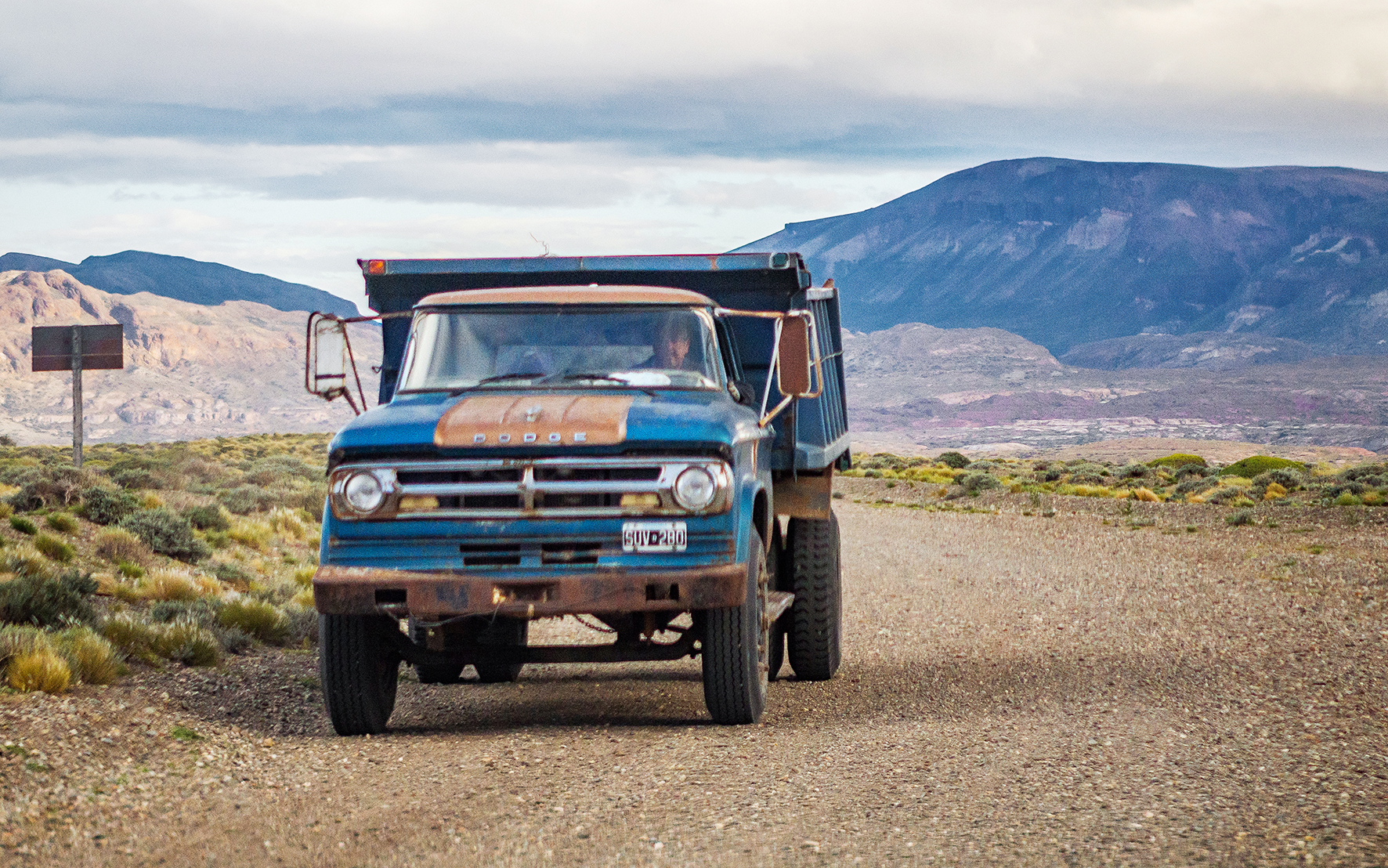
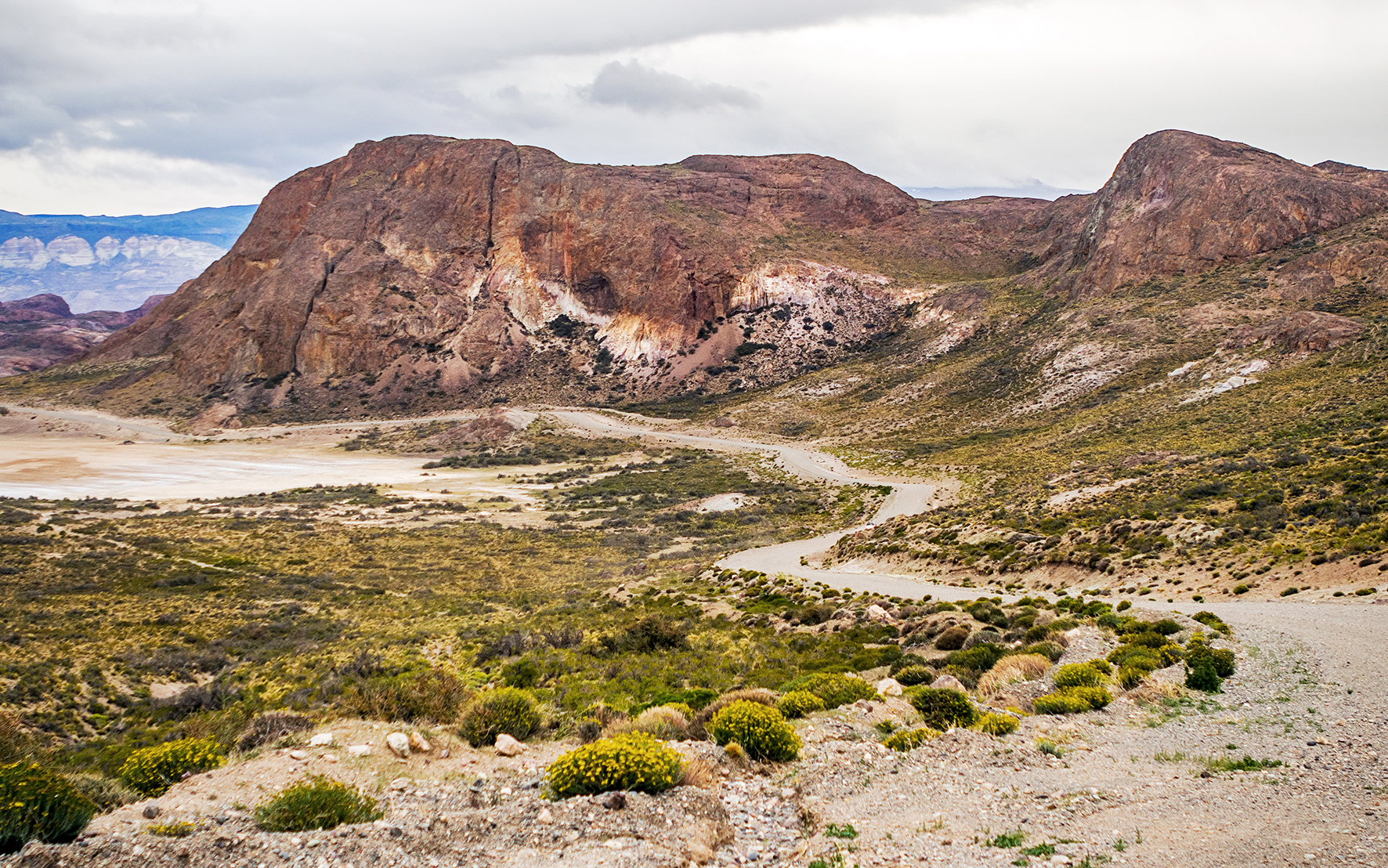
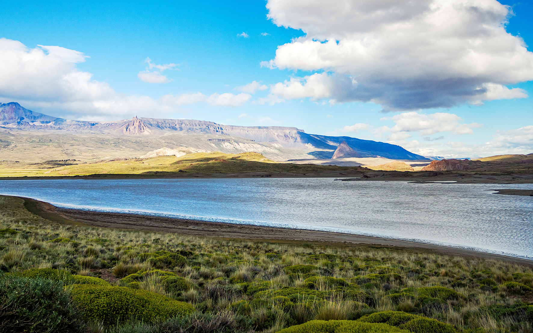
The first 20 km after the border felt like we were driving on Mars. After the greens and blues of Chile’s vegetation and lakes, we found ourselves in a dry and dusty canyon, landscapes in shades of red and brown as far as the eye could see. And isolation here was of a whole different scale. Along the 70km of road to Lago Posadas, we saw a total of three vehicles (2 cars and one guy on a motorbike). All of them actually stopped to ask where we were headed, making sure we knew where we were going and that we weren’t just lost in the desert. Although that environment felt all of a sudden much harsher and a lot less inviting, it was also a nice surprise to be experiencing remoteness at a whole new level…
30 min after the border we came to the first intersection in the road, facing an imposing mountain range in front of us. We turned right on route 39, heading to our destination for the night.
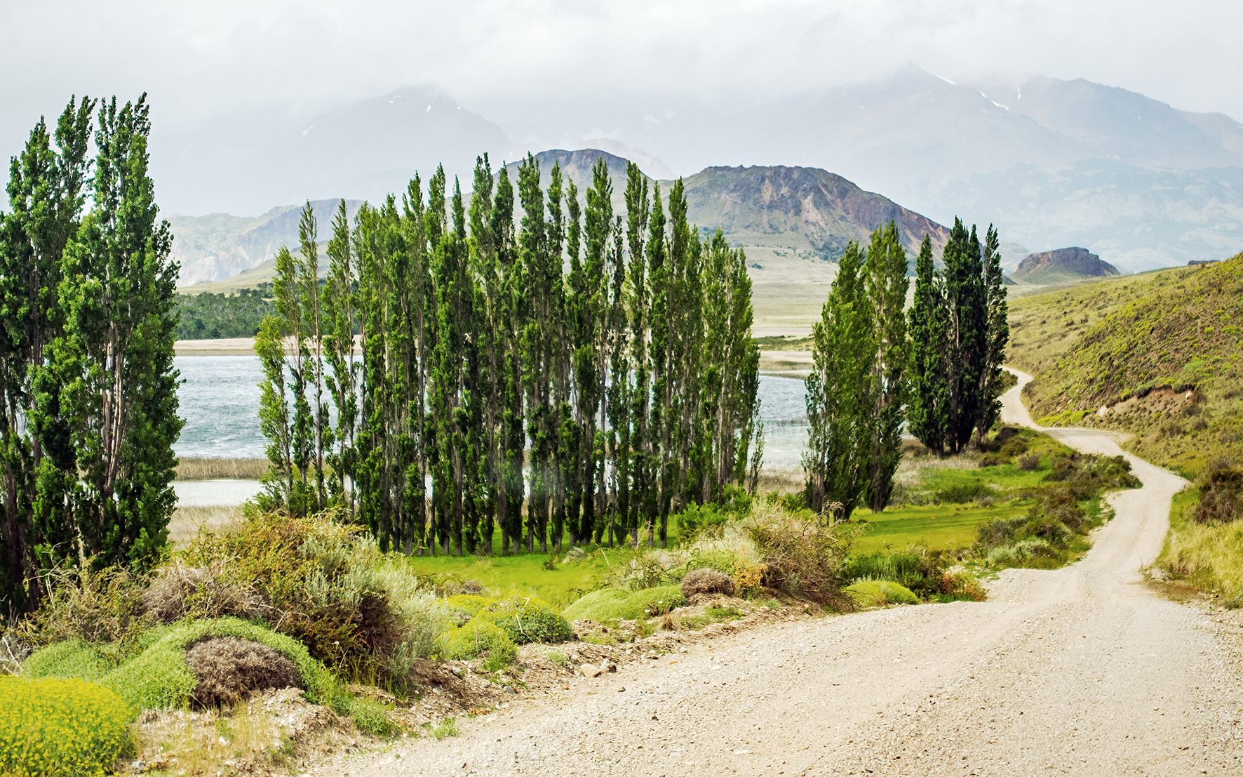
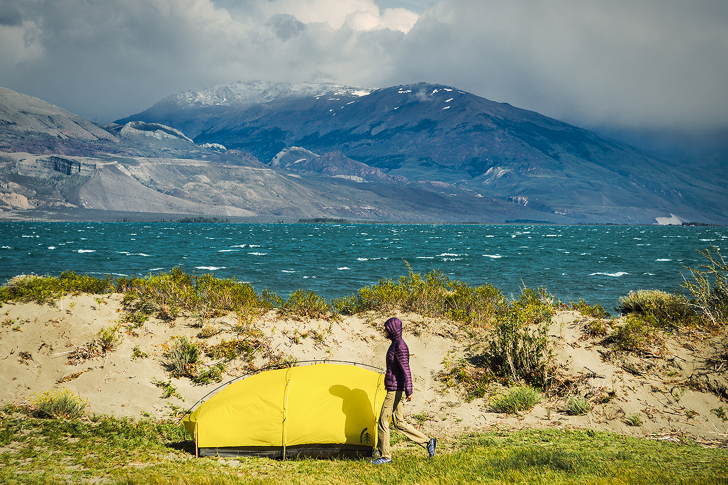
Planted in the middle of the windy desert and surrounded by low, brown mountains, the town of Lago Posadas felt like a little oasis. The road leading up to the arched entrance was lined with tall poplar-like trees, providing both a nice pop of green along with some wind protection. Once again, following the directions from iOverlander, we drove through the town and all the way to the lake, and found a spot to set up camp for the night.
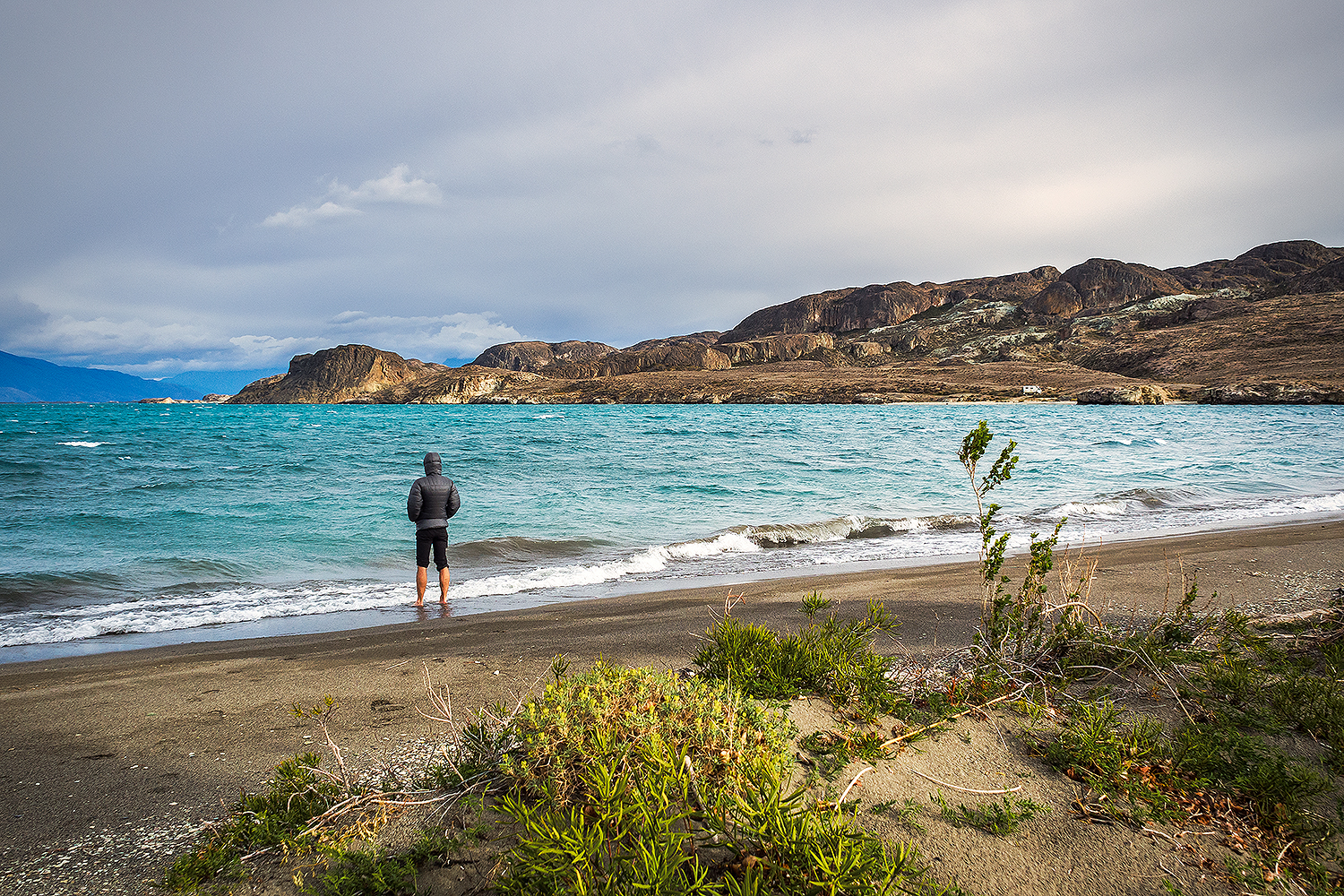
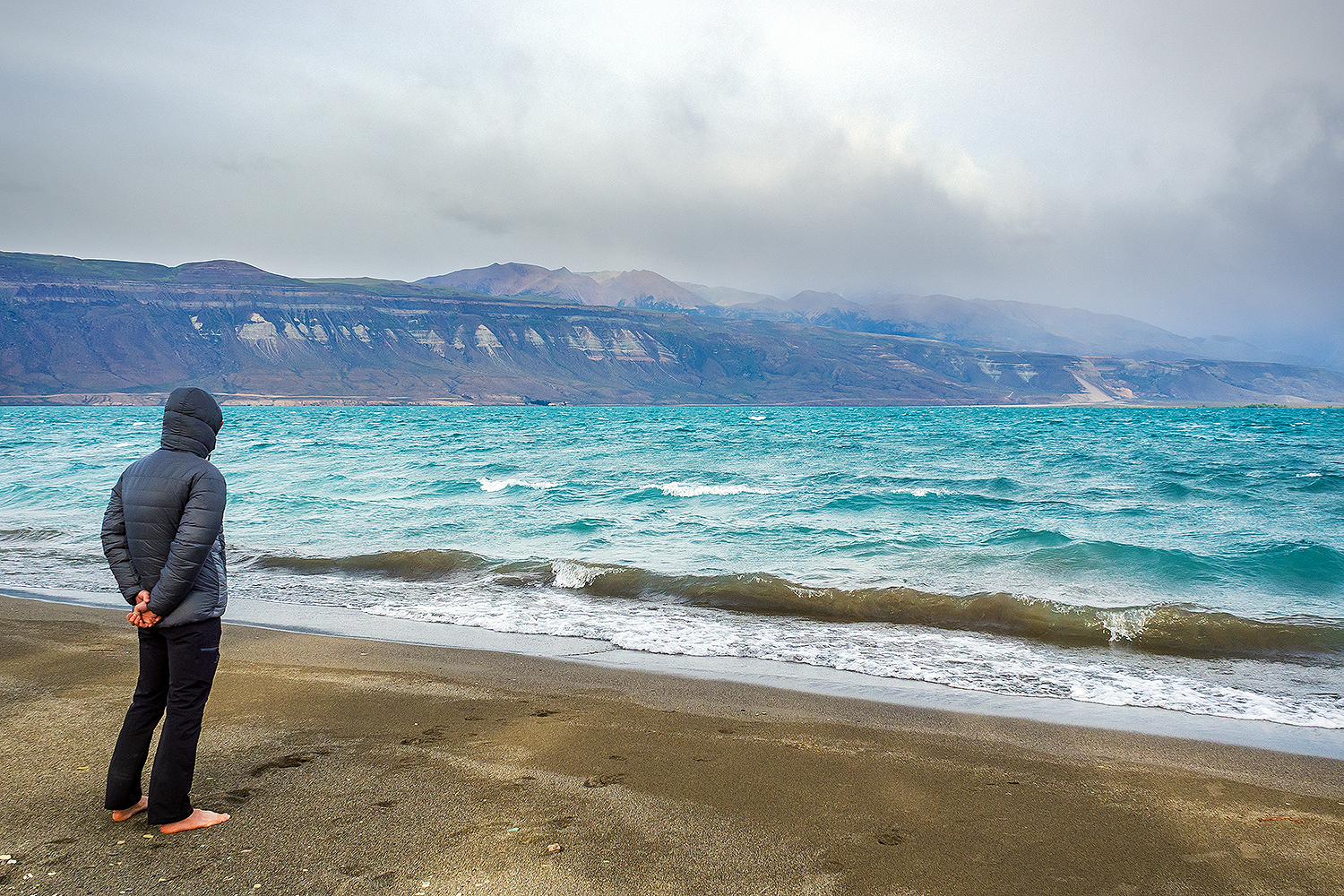
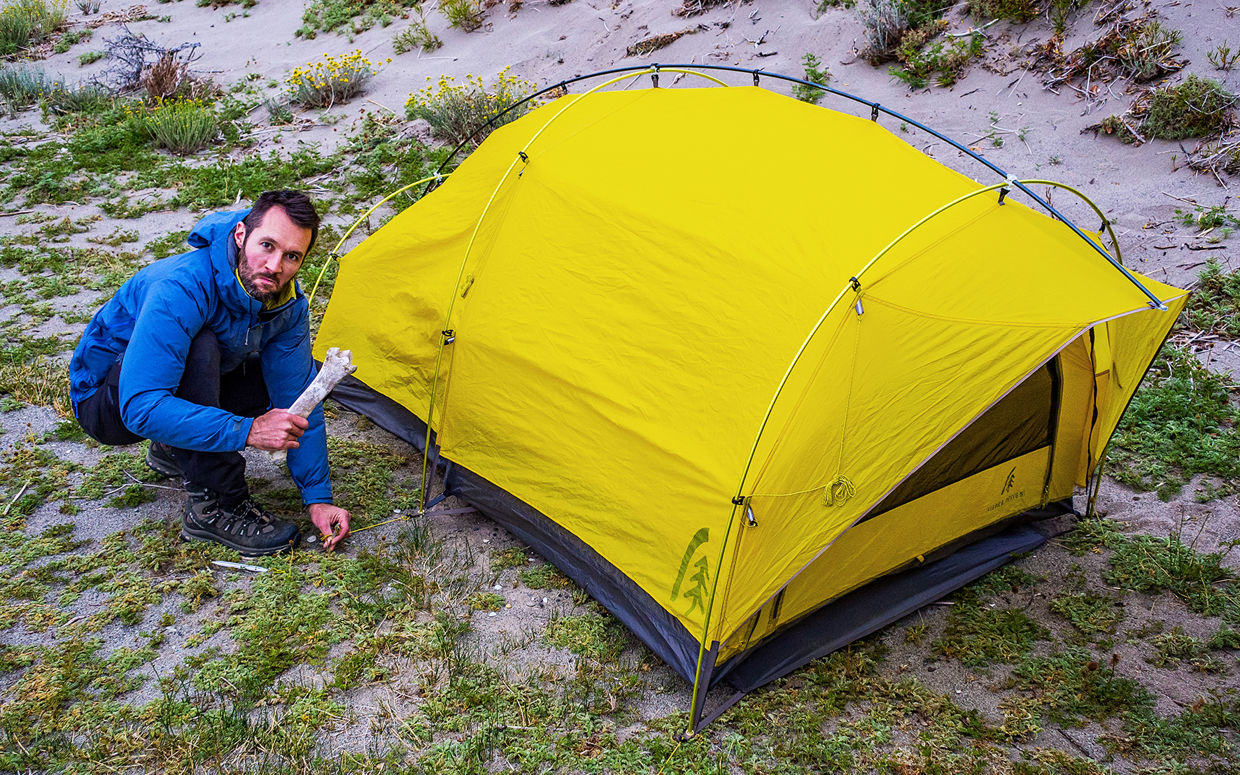
Battered by the wind, the lake felt almost out of place, with its incredible shades of blue popping out amongst sand dunes and grey mountains. We set our tent behind the cover of the sand dune. No fire for us tonight in those conditions, which we were fine with. At this point, it was 10pm before the sun showed any intention of hiding below the horizon. This was probably the most remote camping we had ever done – in Patagonia or anywhere else.
