Video Recap: Kluane National Park and Reserve – King’s Throne
Our adventures around the world…

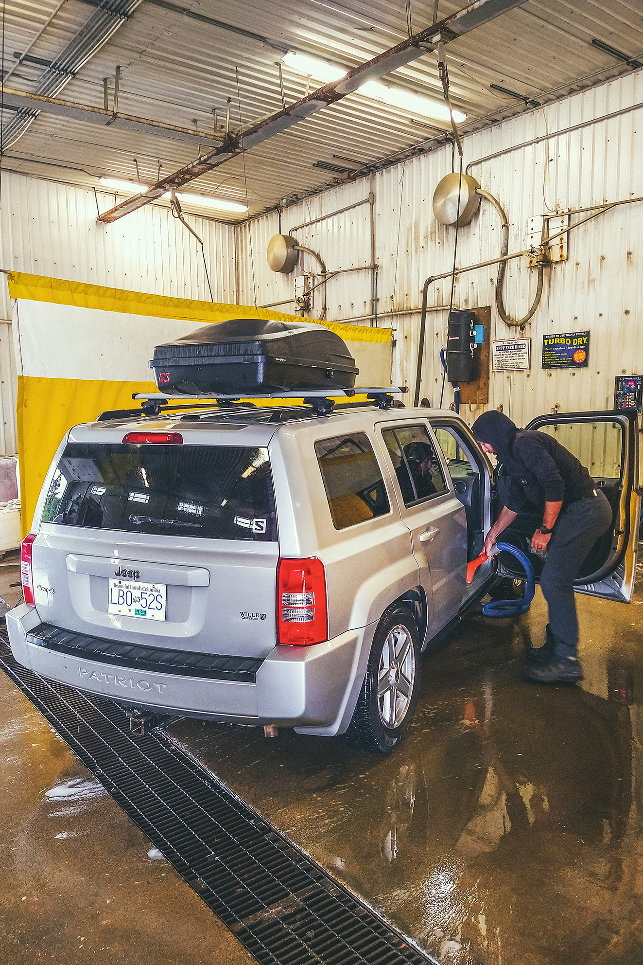
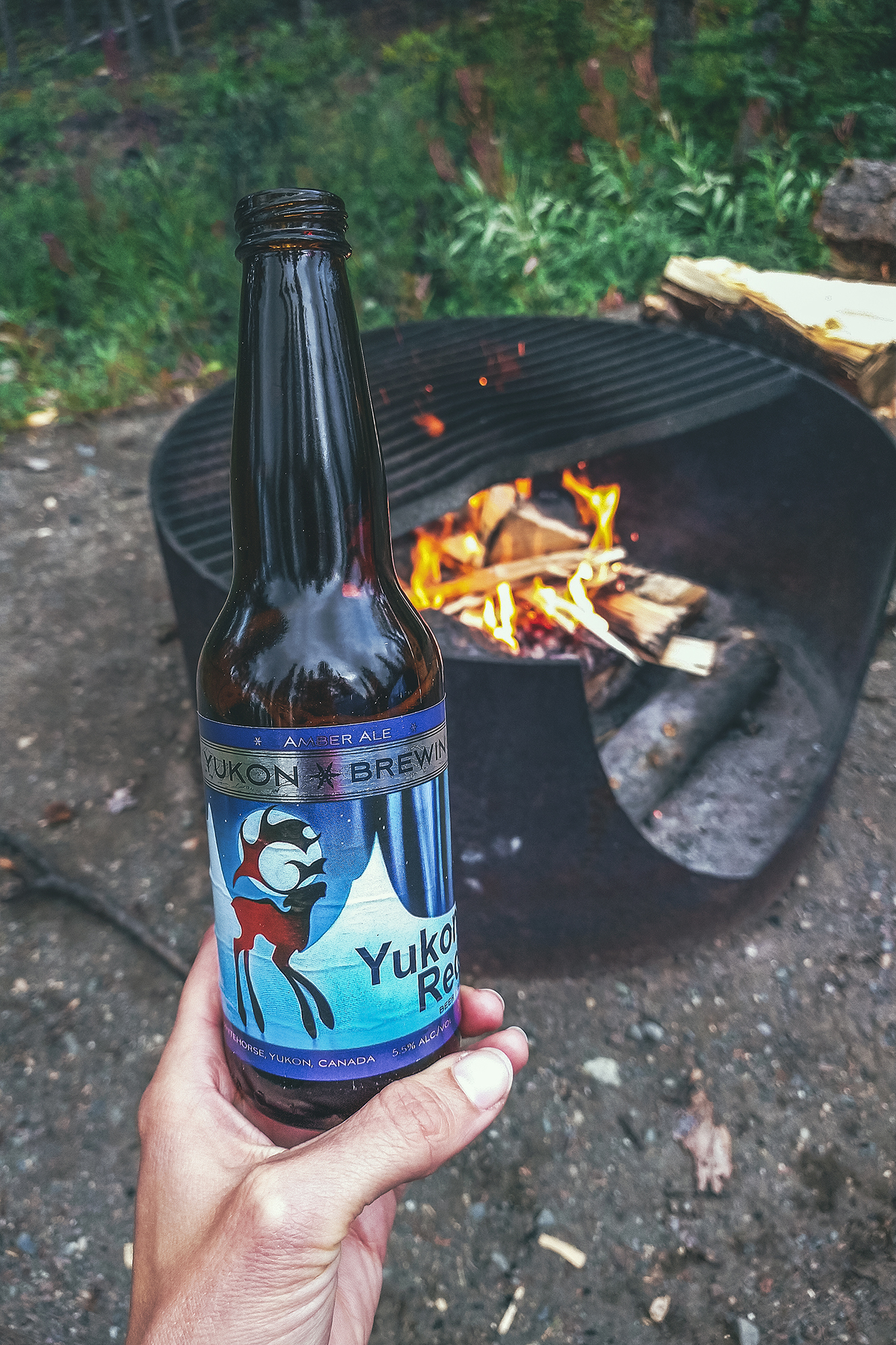
We got up and drove to Whitehorse, where we found a much-needed carwash and re-stocked our food supplies. On the way out, looking for a liquor store we stumbled upon the Yukon Beer store, so we bought a few to try out.
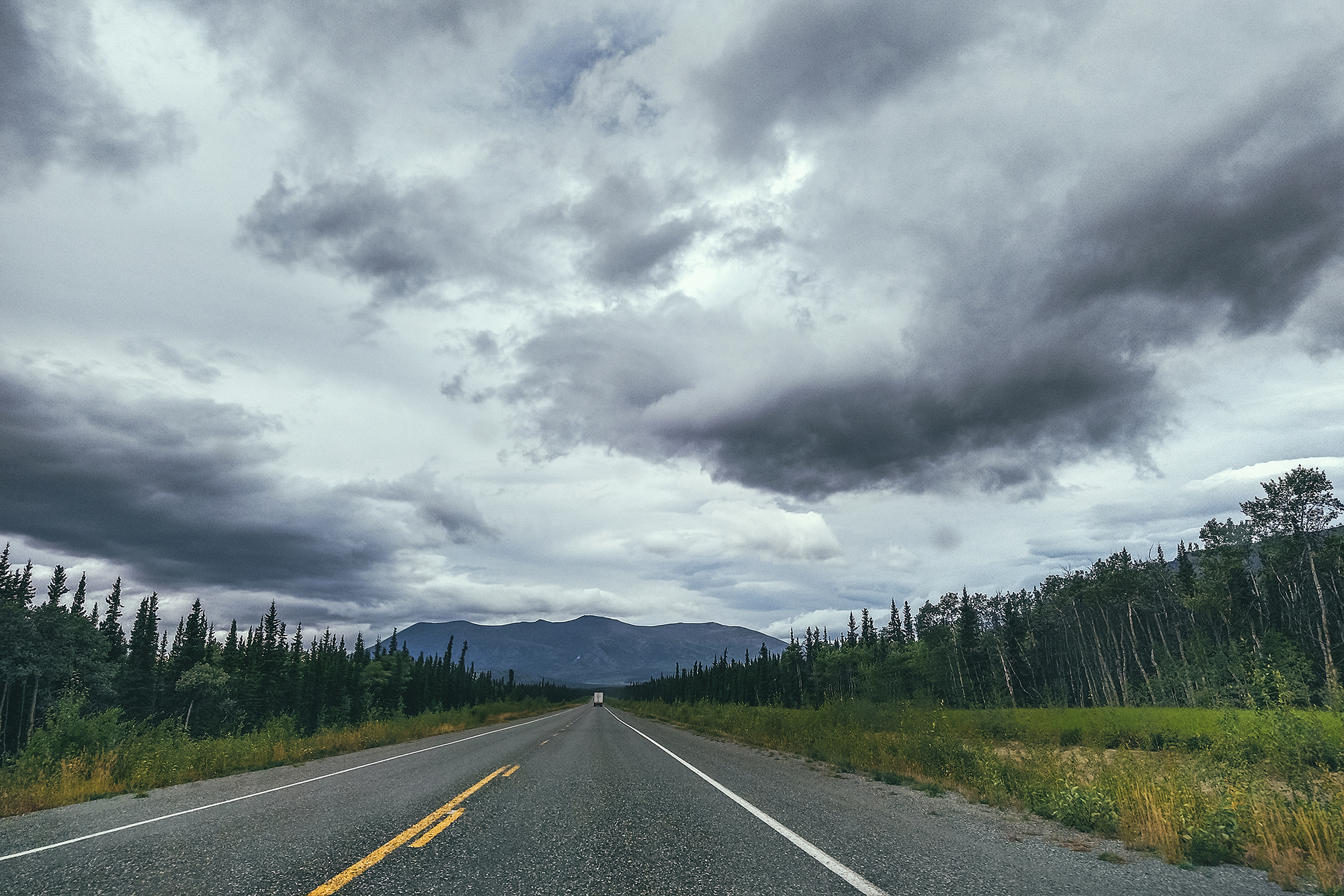
Then we headed towards Haines Junction, a couple of hours west on the Alaska Highway.
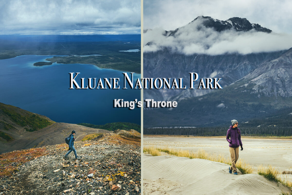
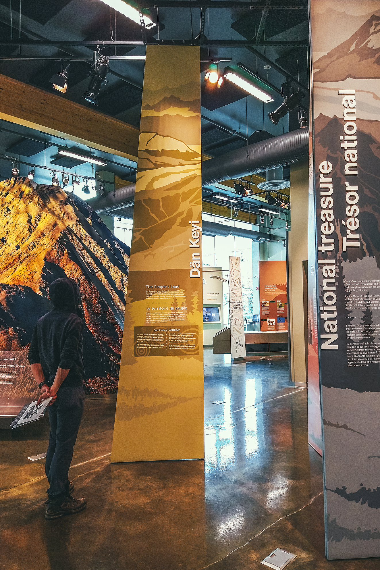
When we got there we stopped at the Visitor Center and went through the exhibit about the Kluane National Park and Reserve, which is a designated UNESCO World Heritage. The Park is home to 17 of the 20 highest mountains in Canada, including the tallest, Mount Logan, at 5959 meters. The park also features the largest non-polar icefield in the world.
We watched a short movie also covering the topic, the land diversity, fauna, and work being done in collaboration between the Kluane First Nation, Champagne and Aishihik First Nations and the Park Staff/Parks Canada administration.
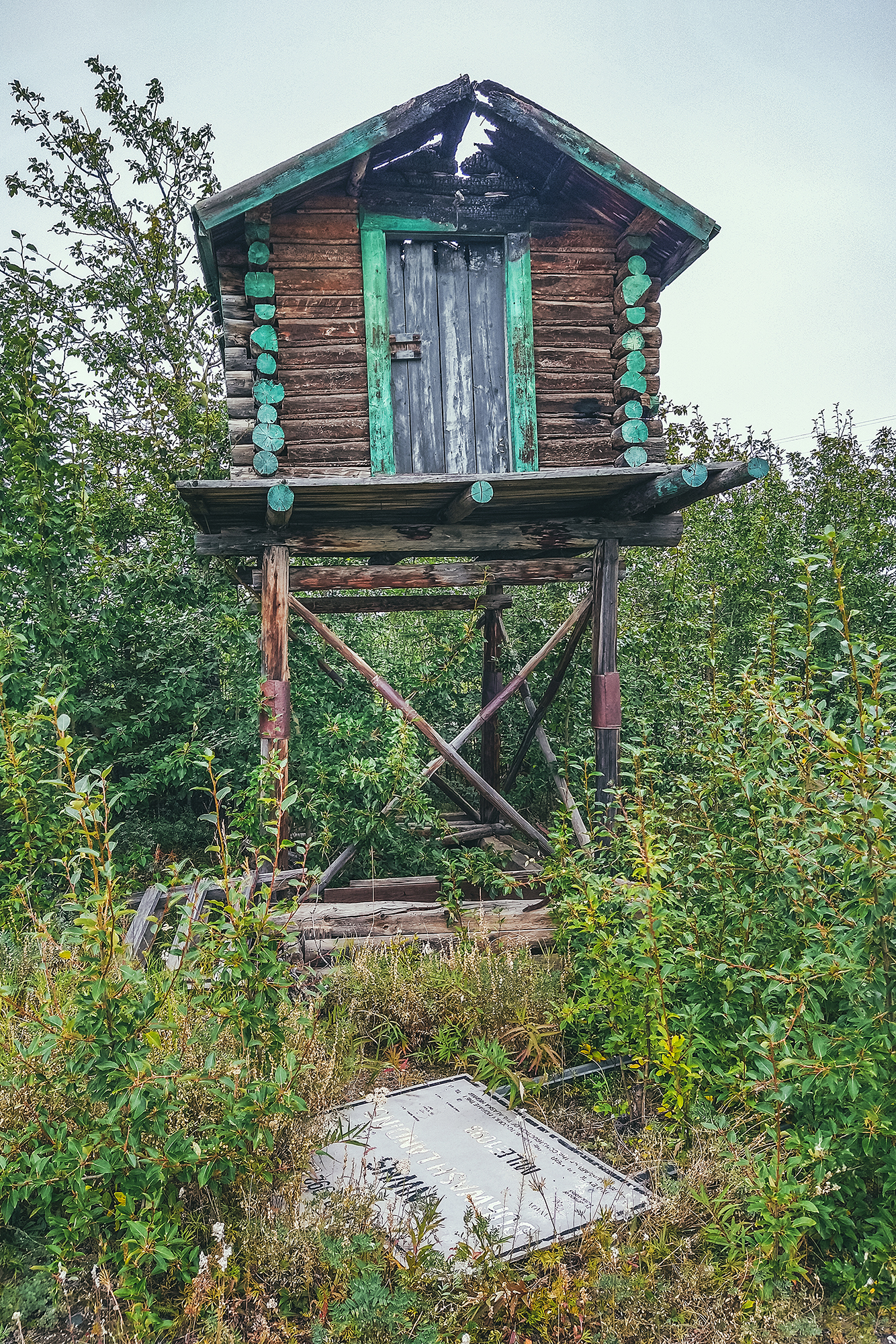
Next to the visitor Center is the Da Kų Cultural center which showcases First Nation Art and Culture, but it was closed due to Covid.
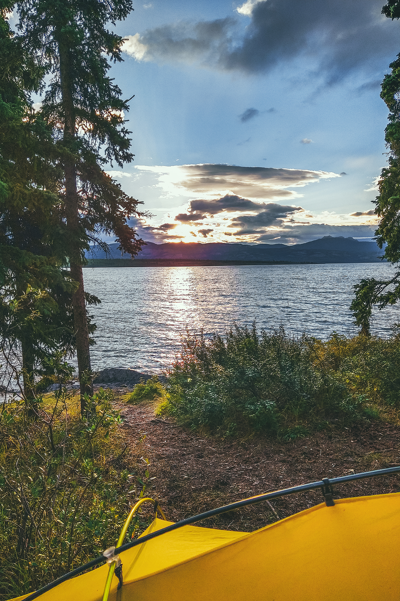
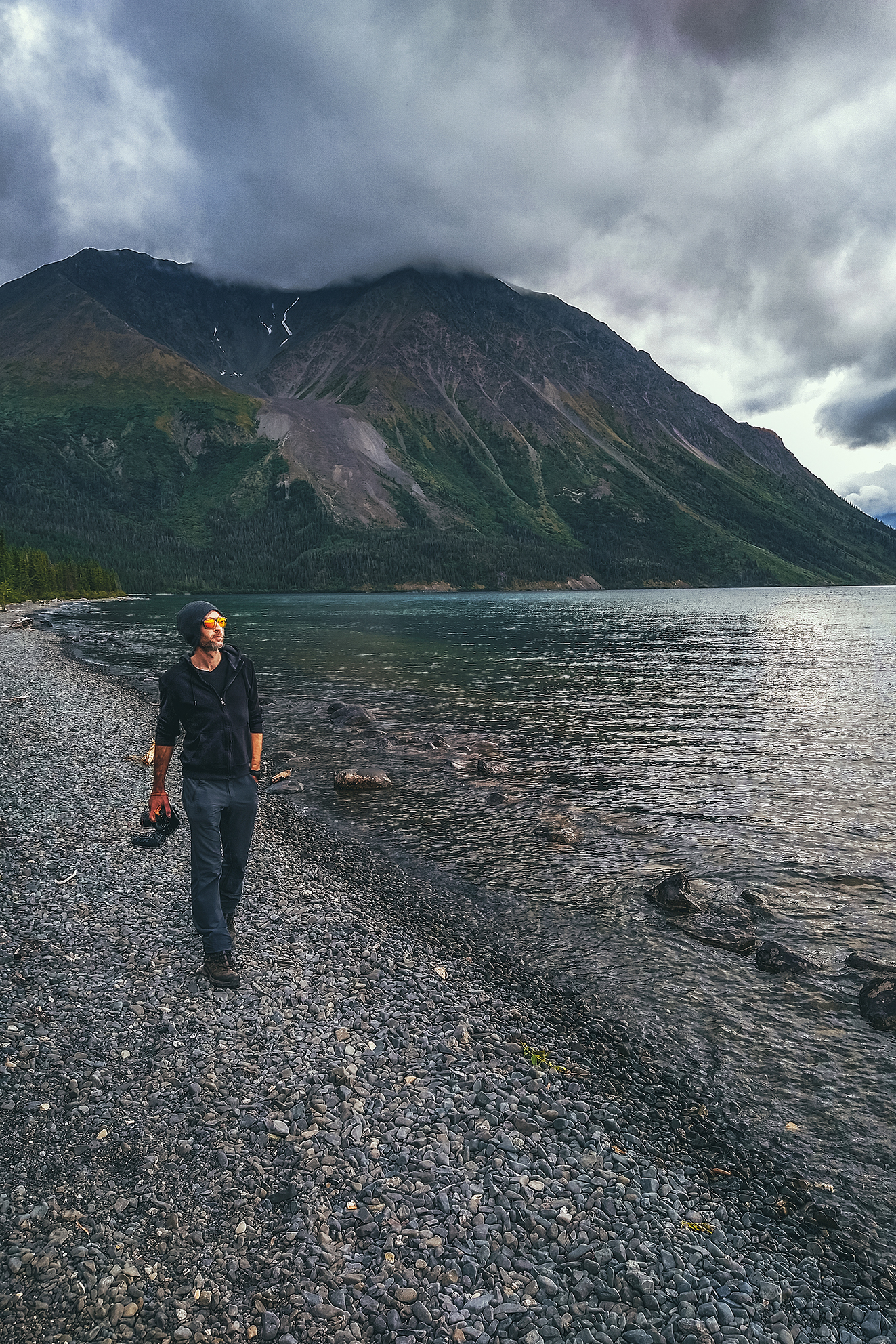
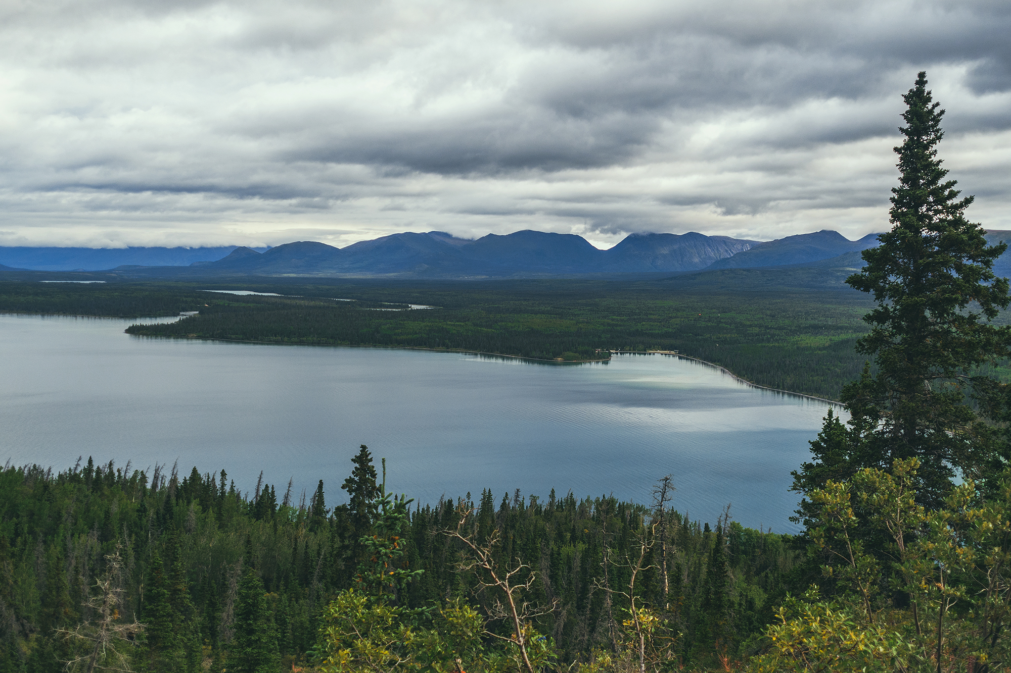
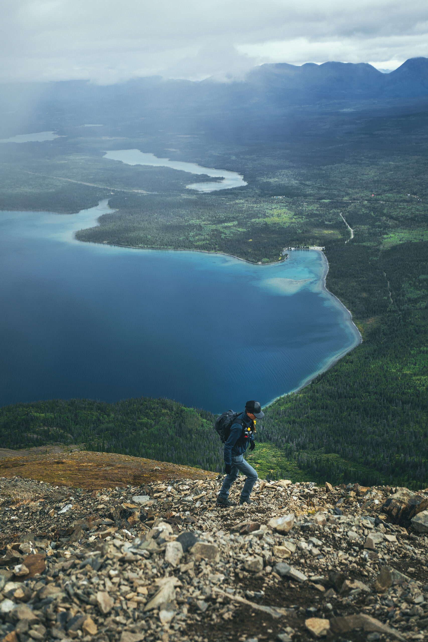
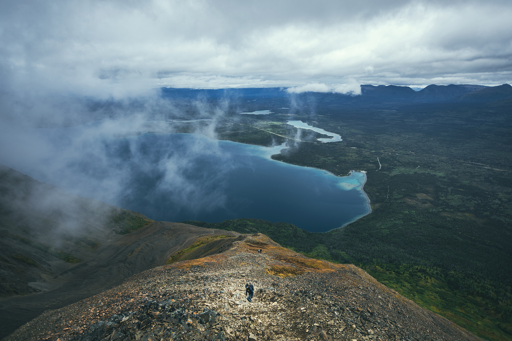
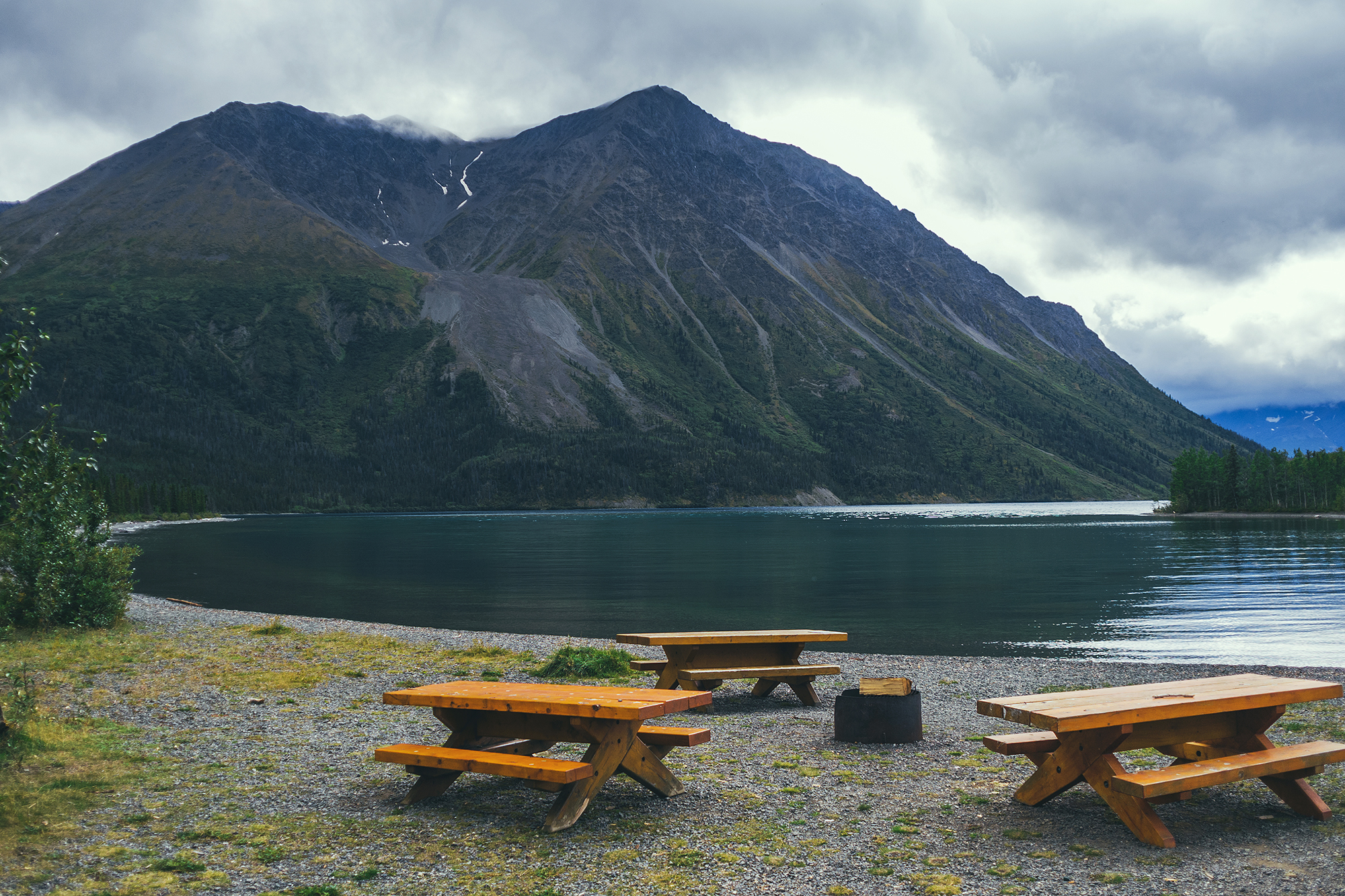
Next we drove to Kathleen lake, where we’d planned on spending the next few nights, while we explored the Kluane Area.
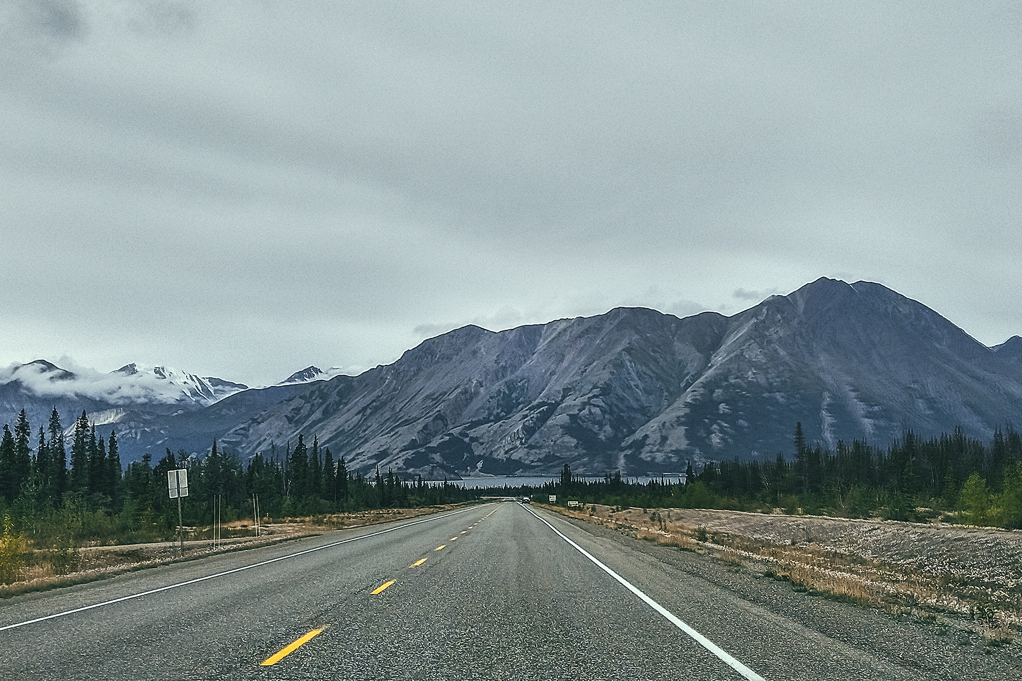
The forecast suggested rain that day, and nicer conditions the next, so we decided to take the drive to Burwash Landing and wait for the nice day to do a hike.
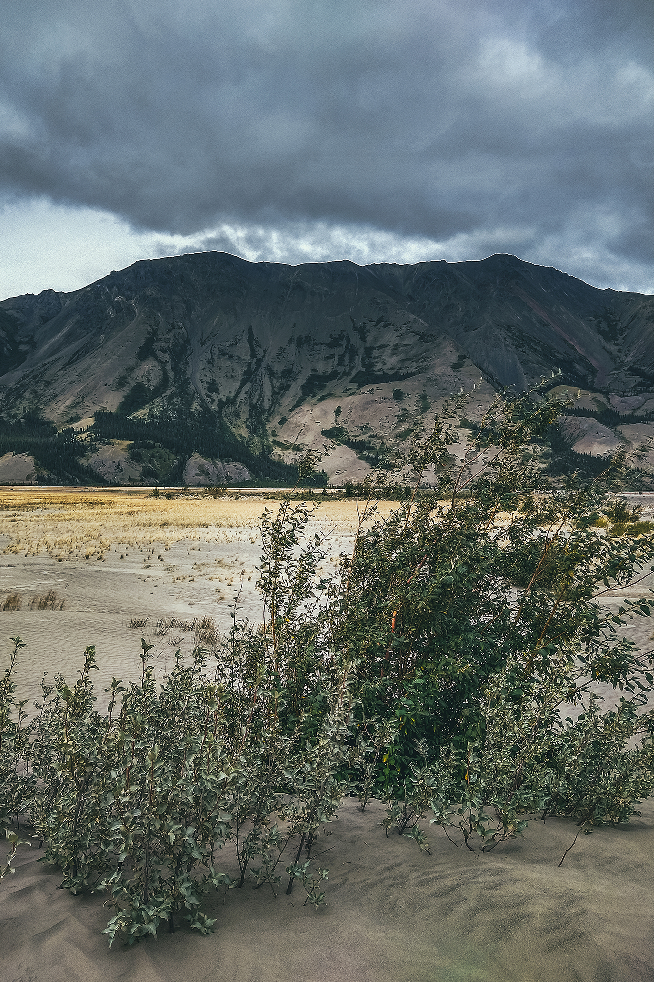
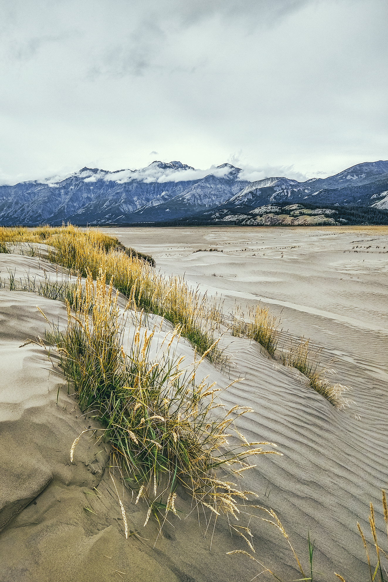
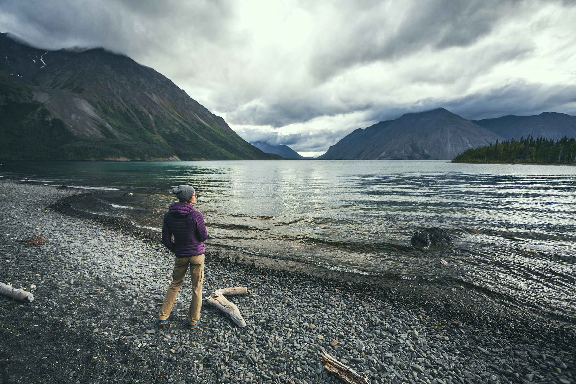
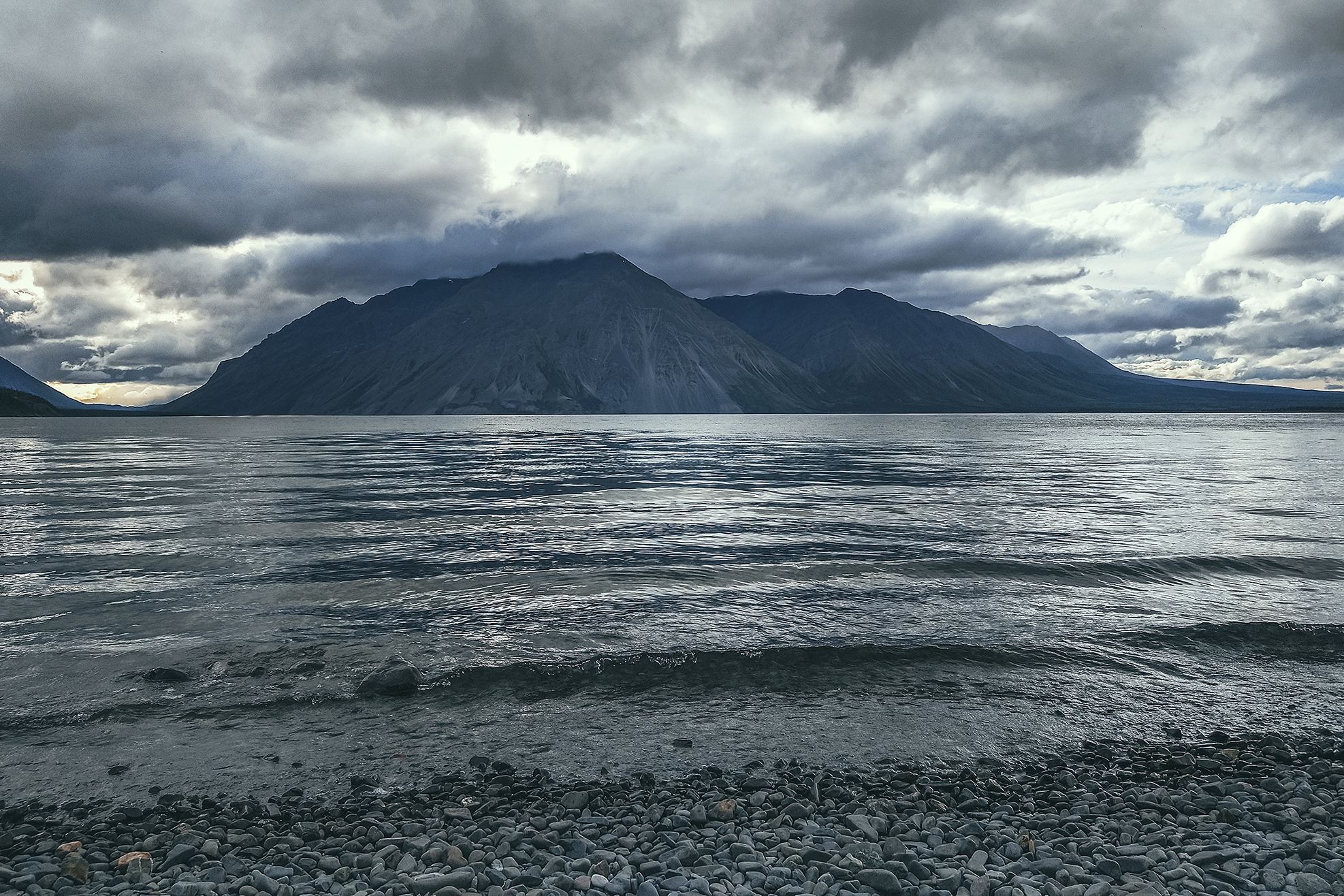
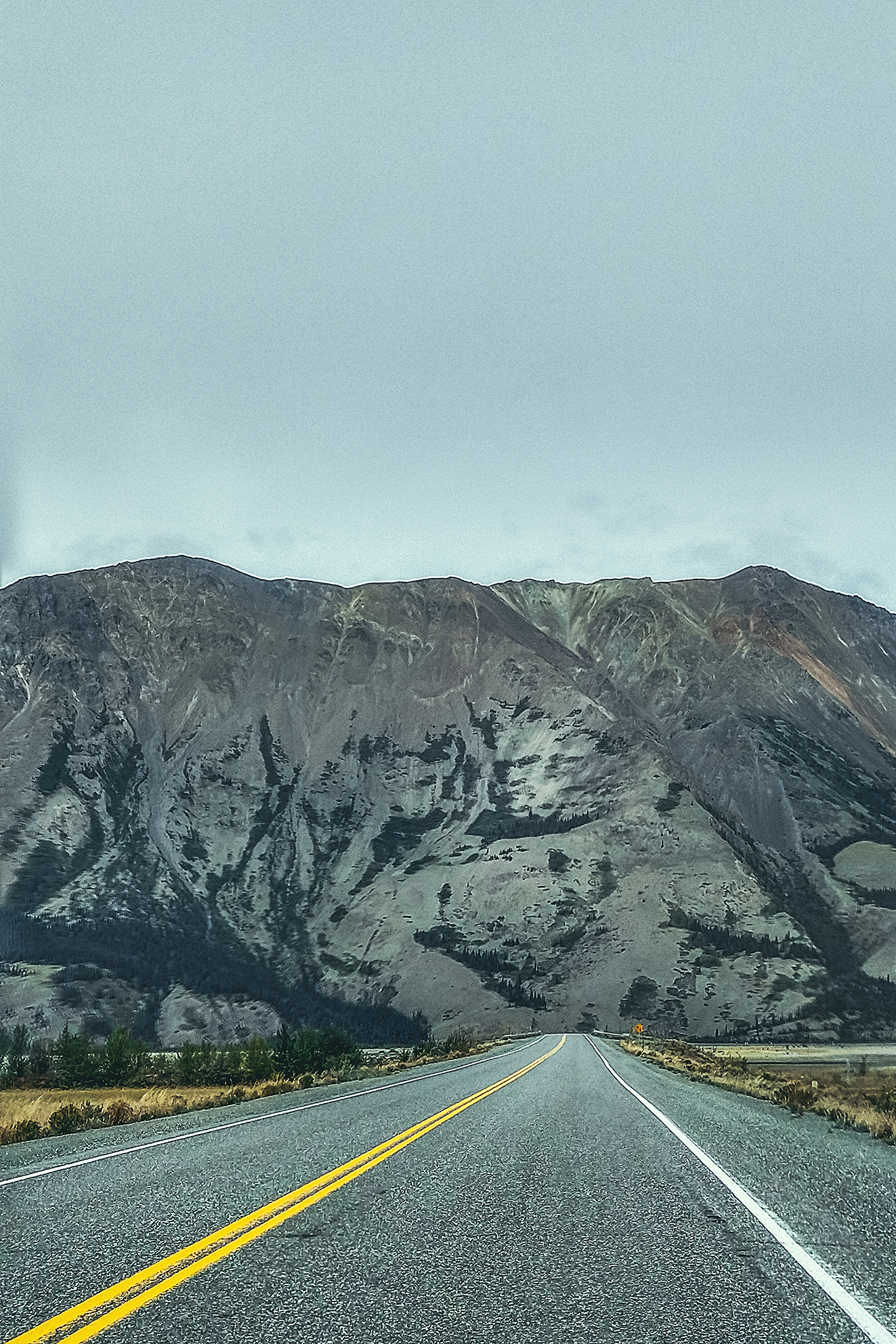
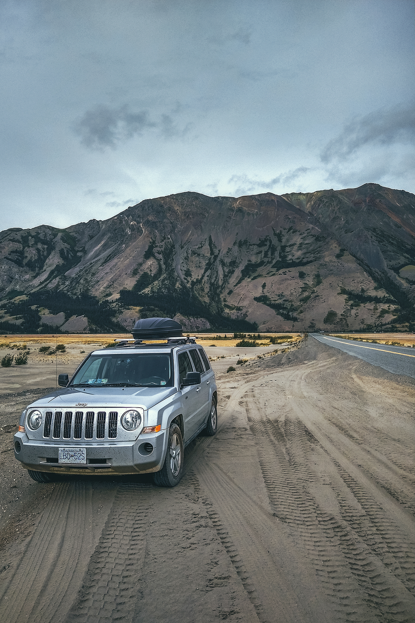
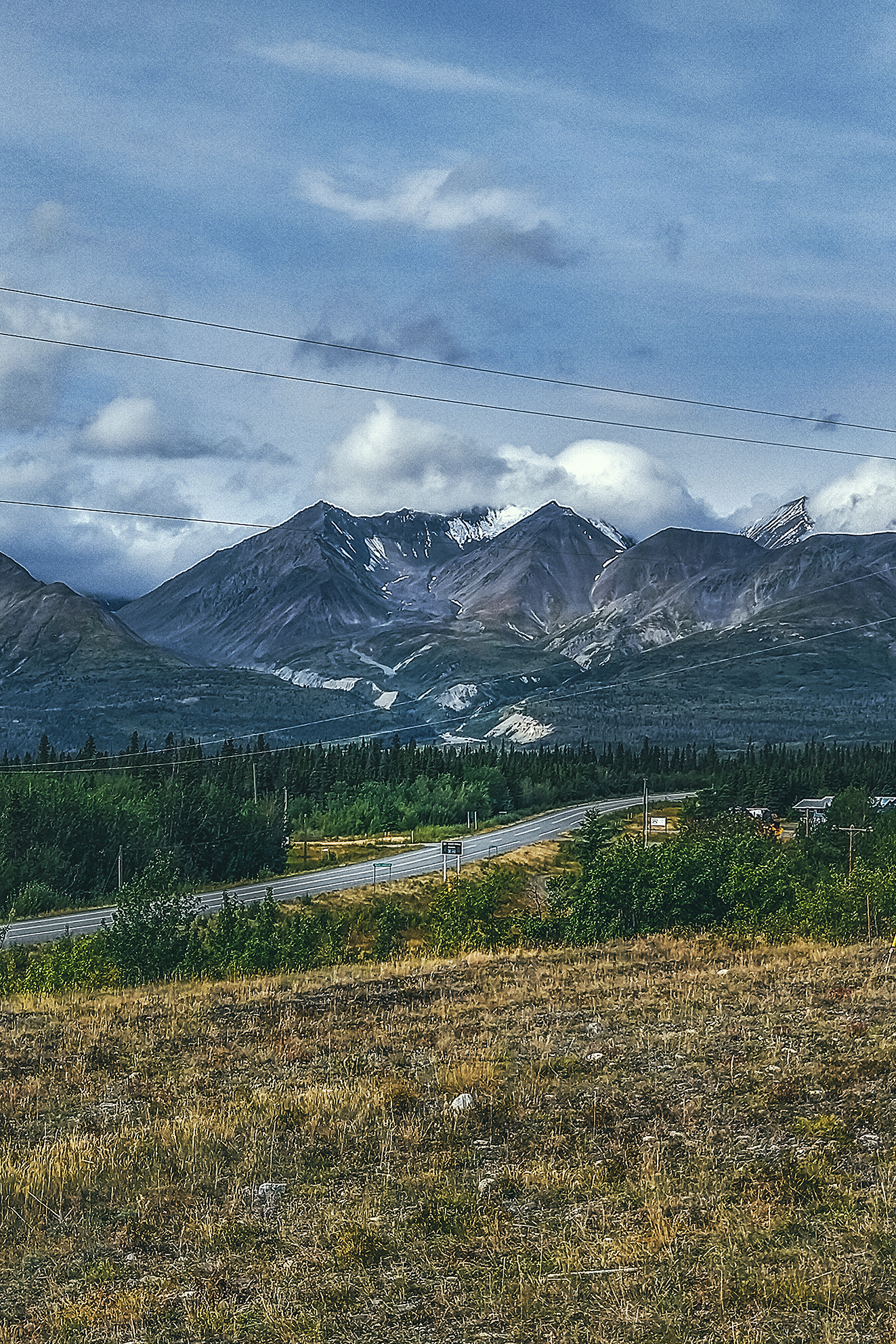
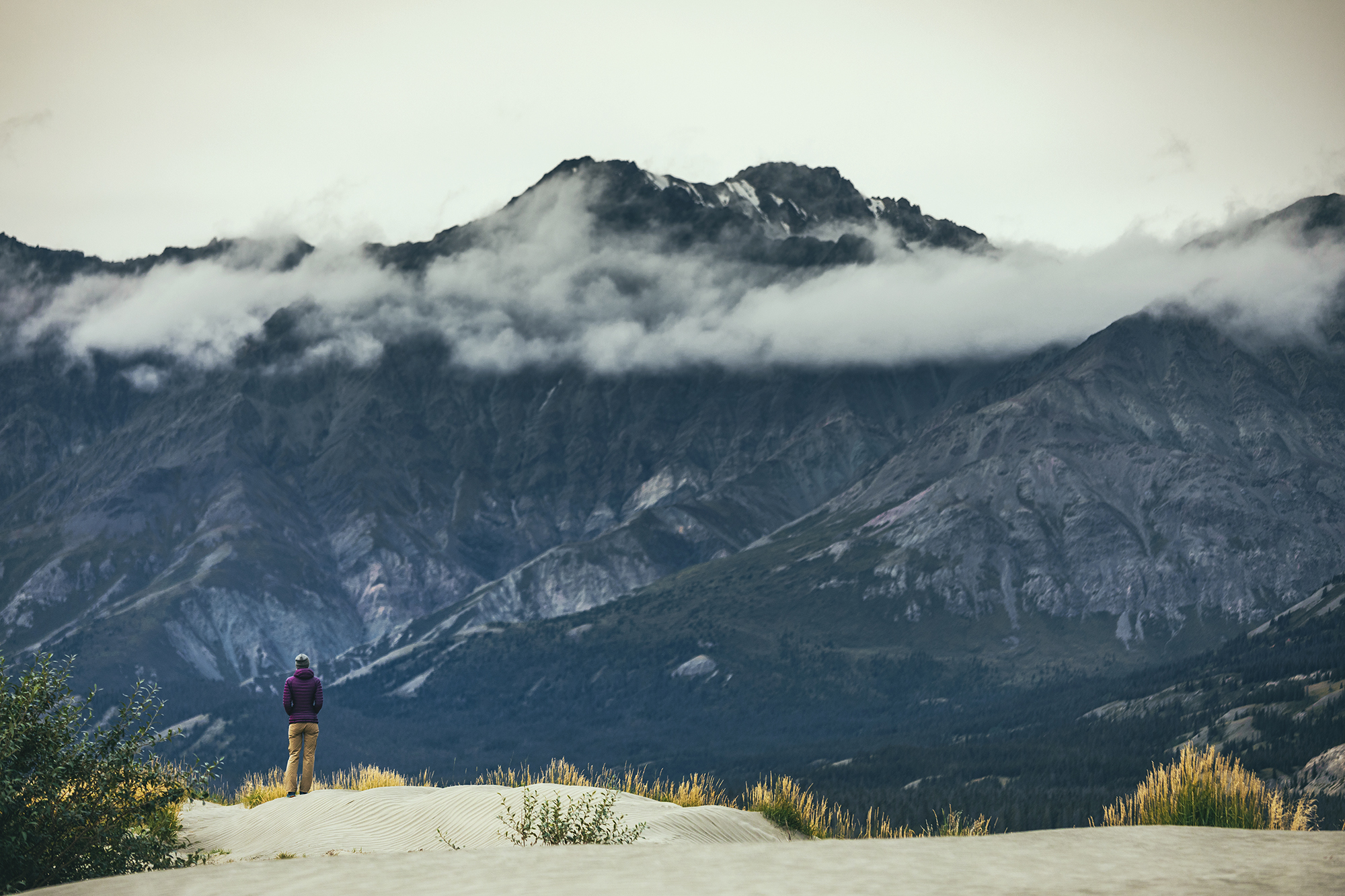
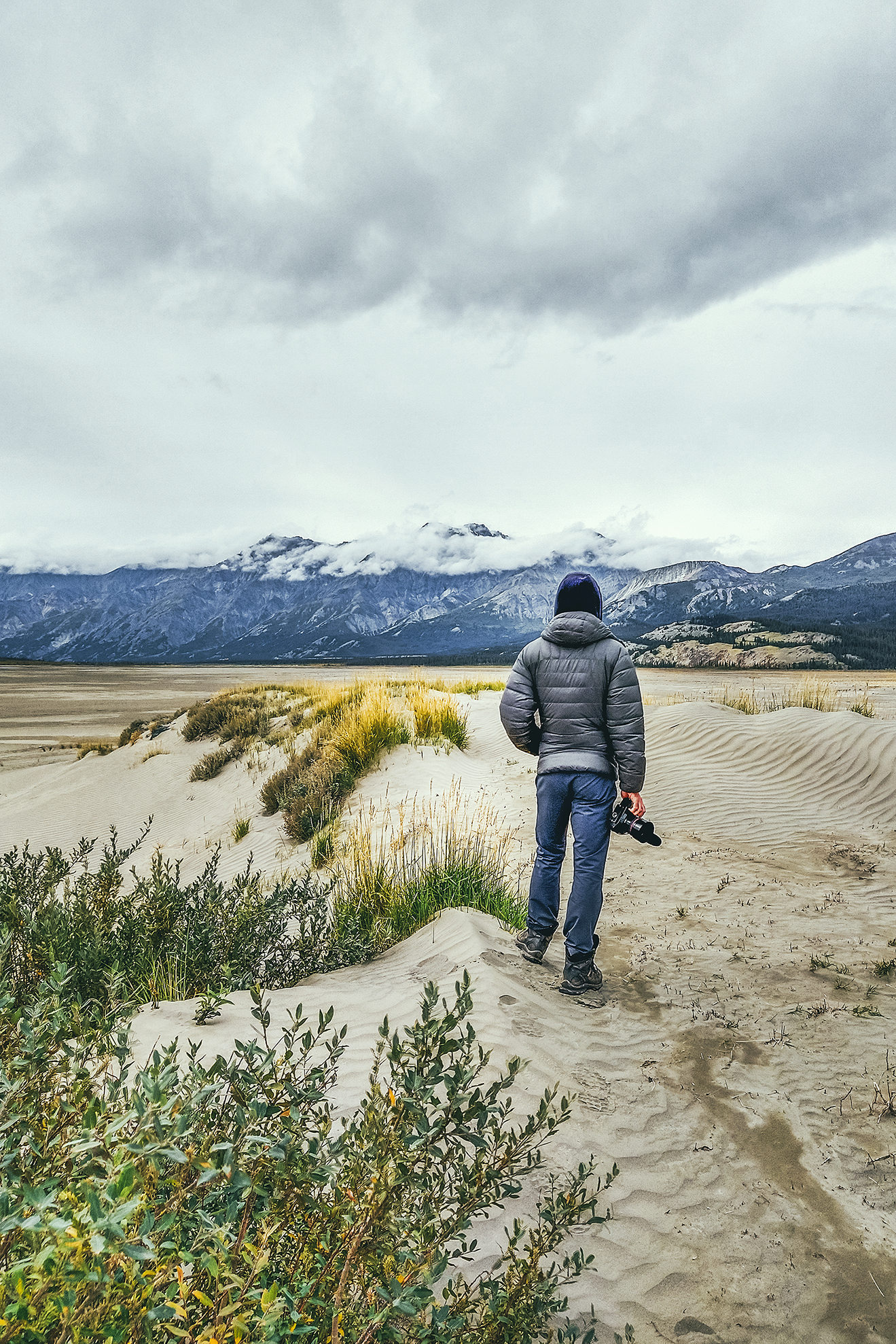
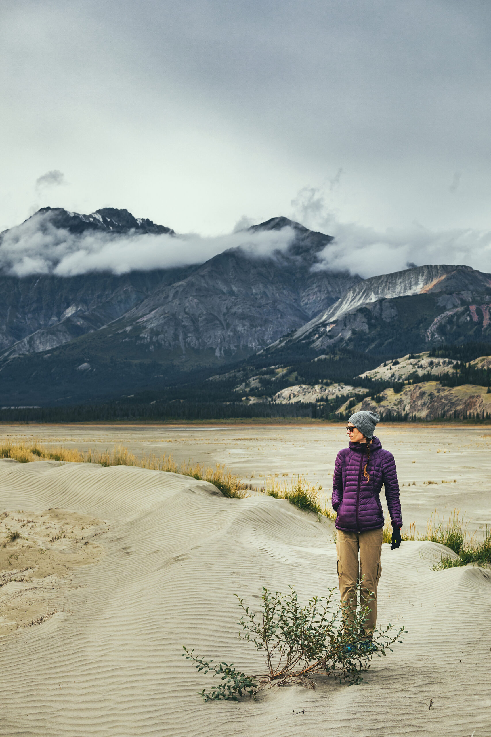
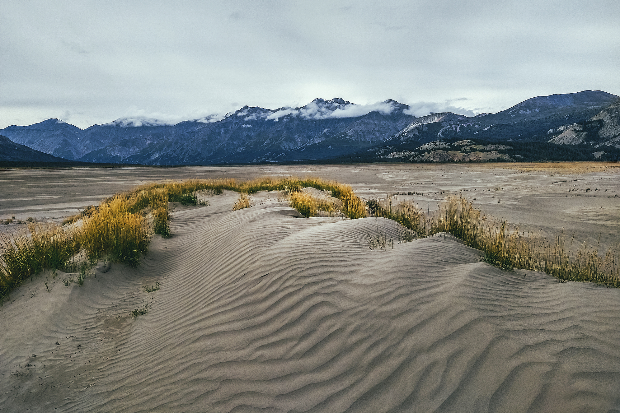
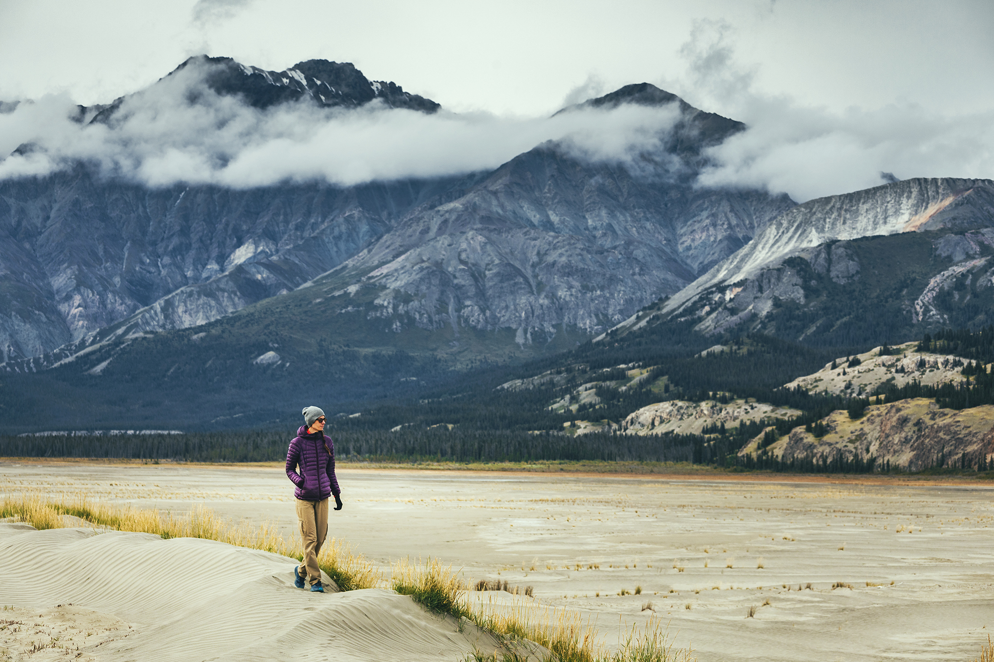
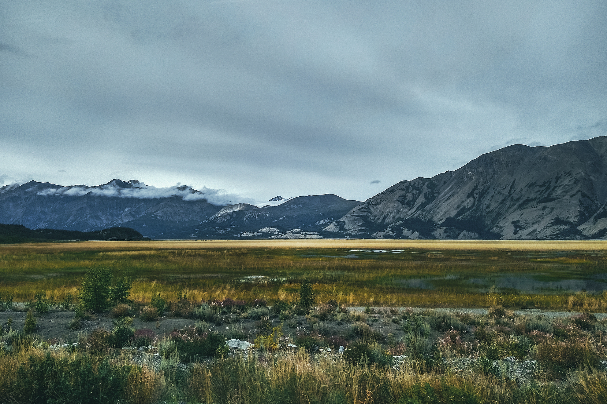
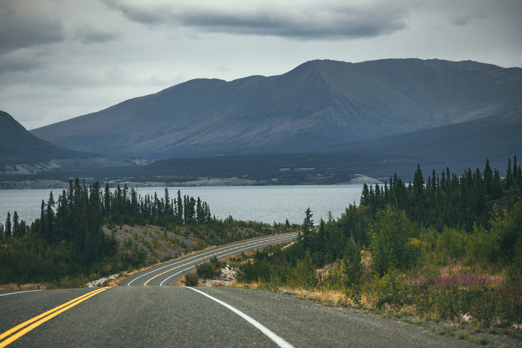
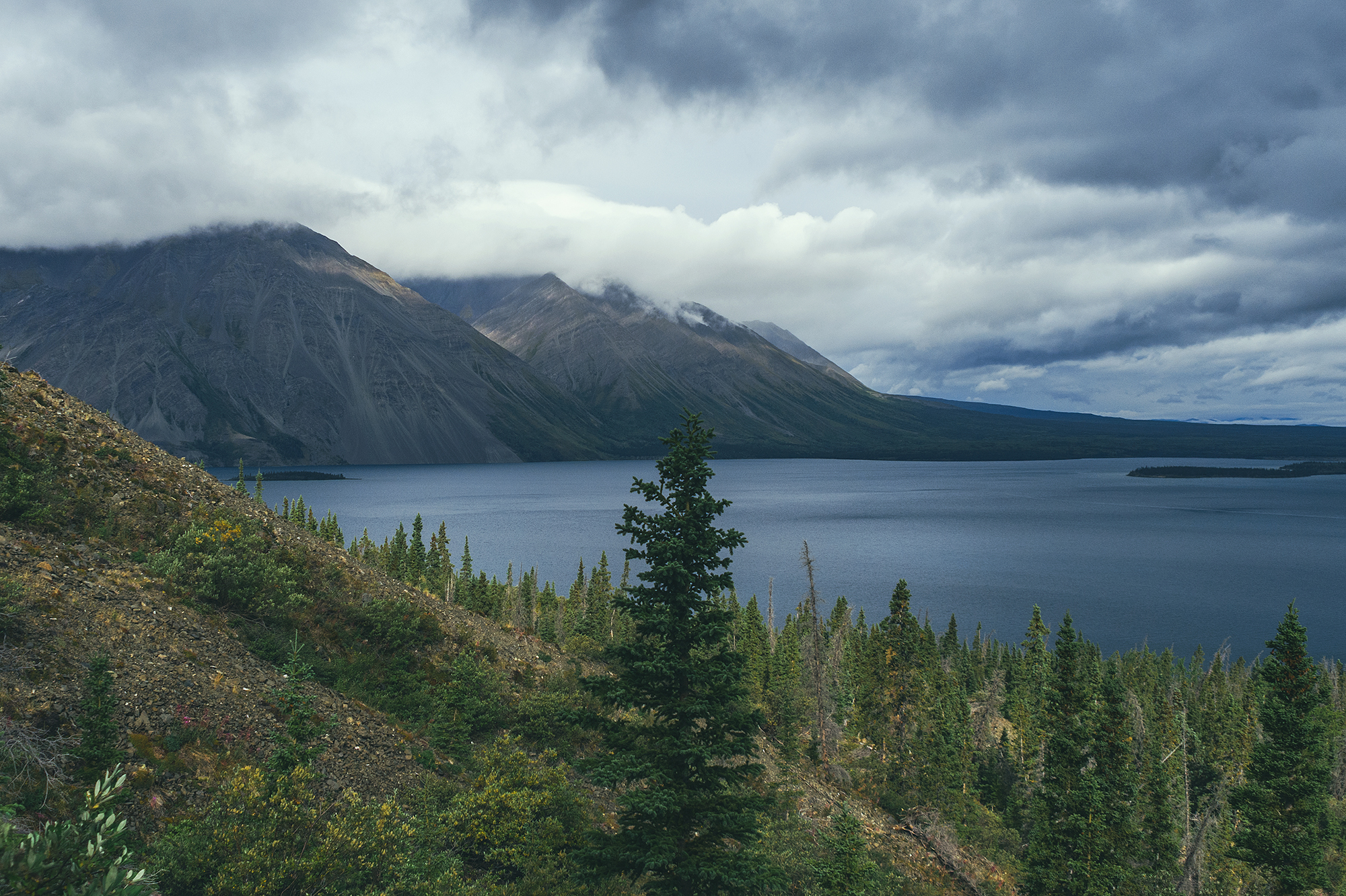
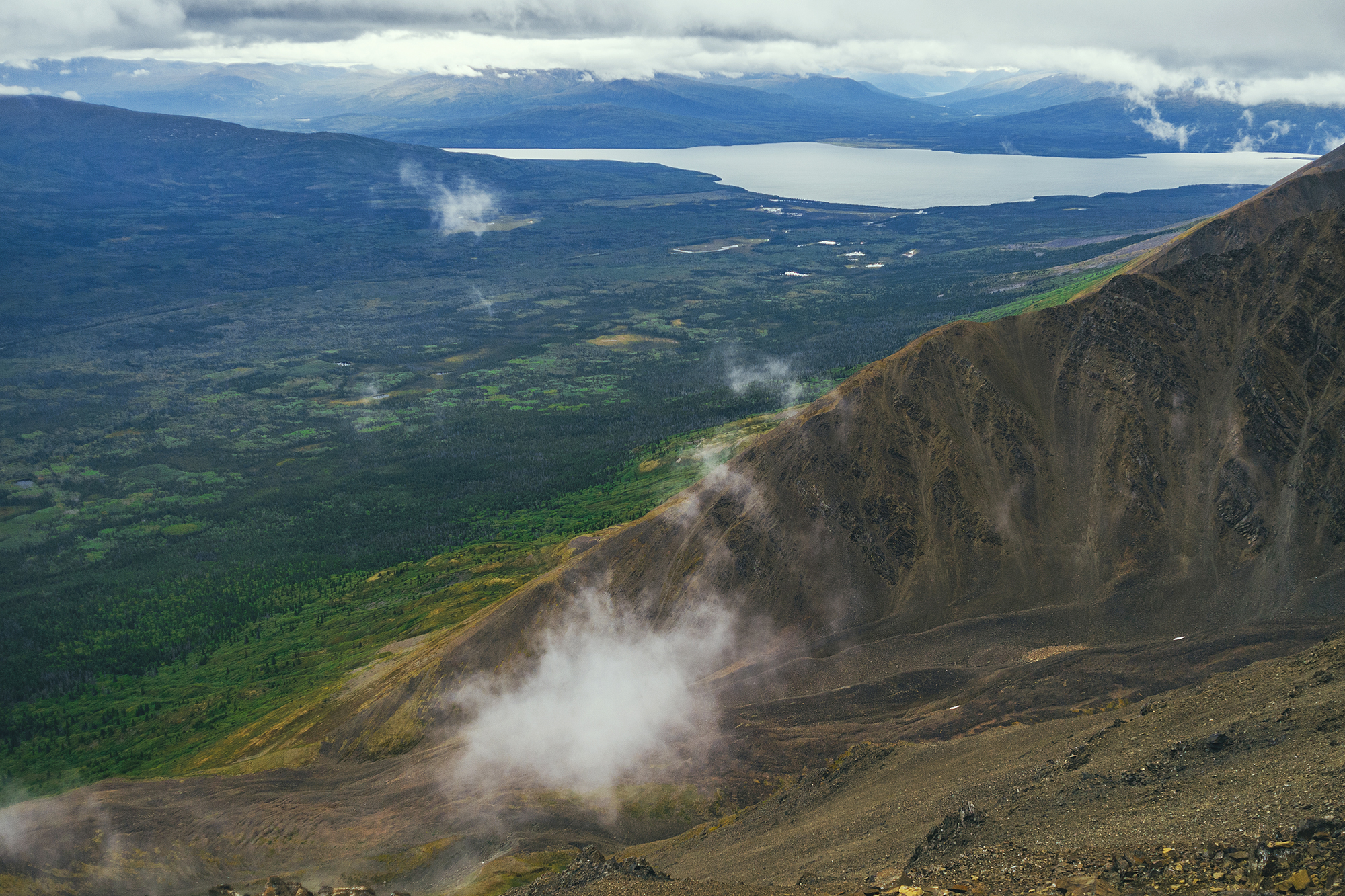
The drive along the Alaska Highway offers great view points on the Kluane mountains and Kluane lake. We stopped near the southern end of the lake, to take a stroll on a sandy area right off the road. The desert-like landscape is due to the retreat of the Kaskawulsh Glacier. As a result, its meltwater which previously fed two rivers, the Kaskawulsh River and ‘Ä’äy Chù’ (Slims River), now only flows into one. This phenomenon has apparently happened several times in the past, but current state of global warming suggest it is unlikely that the Glacier will re-advance, and that both rivers will run again. It was quite unexpected to see such a landscape surrounded by mountains.

We then stopped at the Thachäl Dhäl Visitor Centre and had lunch. The park ranger there was very friendly and pointed out to us a couple of herds of Dall Sheep that could be seen (through binoculars) on the slopes of the nearby mountain. They were pretty far, so even through binoculars they looked like tiny little white specs. Would this qualify as wildlife sighting?
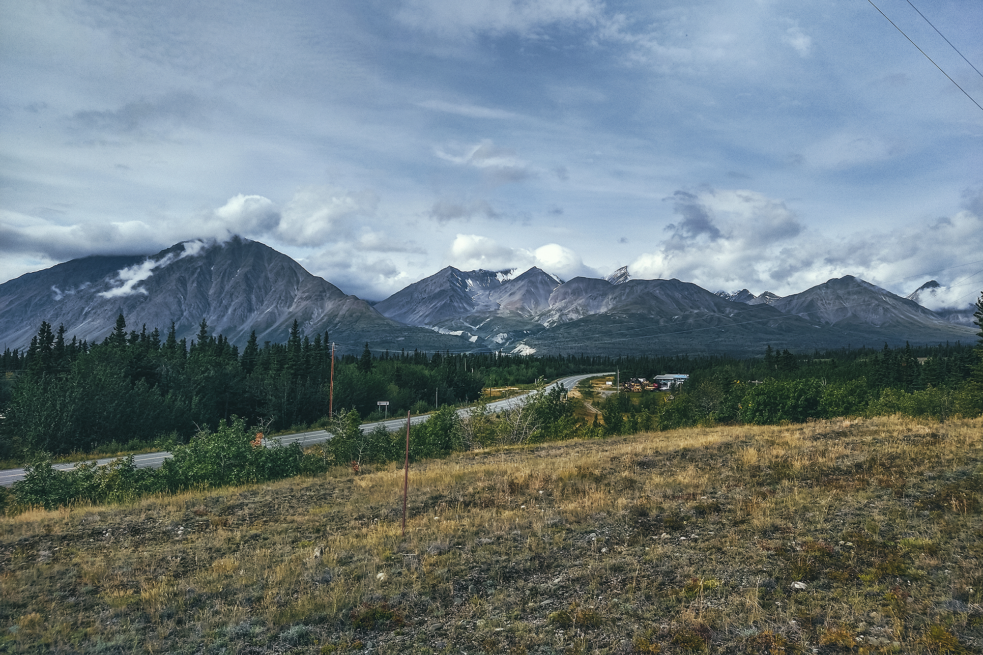
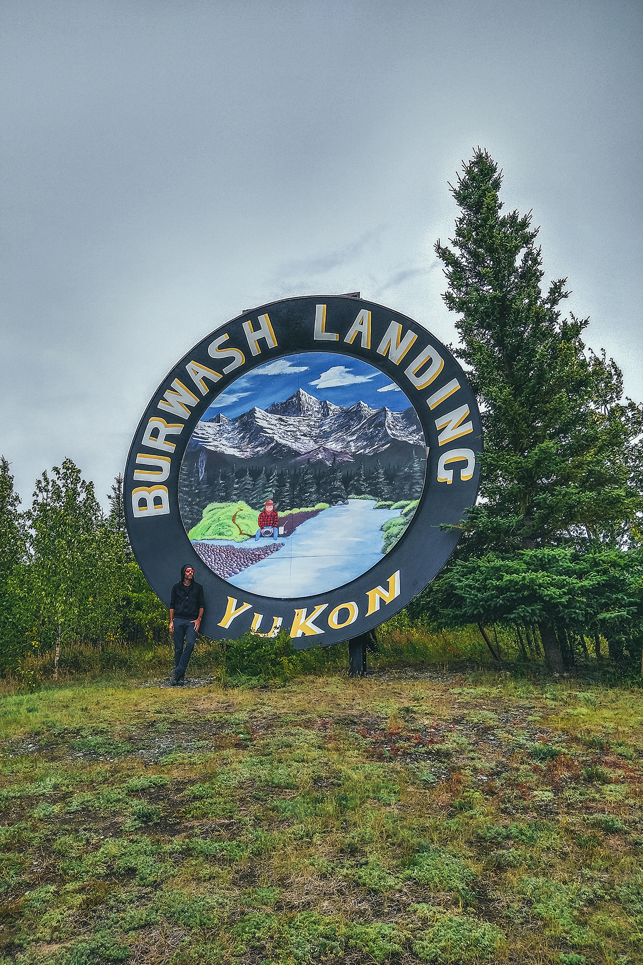
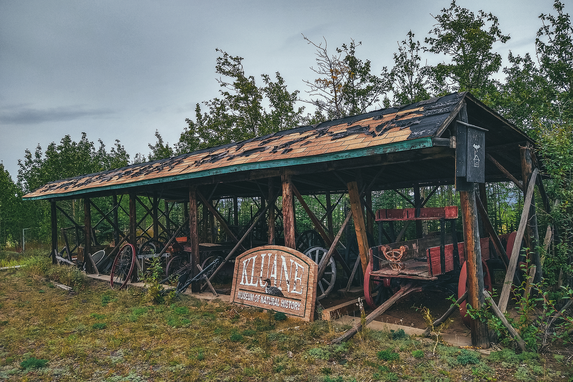
We continued on the drive to Destruction Bay and Burwash landing, where we once again, we found the museum closed due to Covid. The drive was still worth it though, for the scenery along Kluane Lake and the mountains around.
There are a number of hikes you can do into Kluane along that stretch of highway, some of them multi-day treks. I would definitely be interested in coming back for a multi-day adventure, as some of the trails reach the edge of the icefield, and promise a pretty spectacular sight.
There are also various guided adventures to be taken, from flying over the glaciers to white river rafting up close to them. Too much to do and see in just a couple of days! But it was great to get a glimpse at the area and know what to come back for.
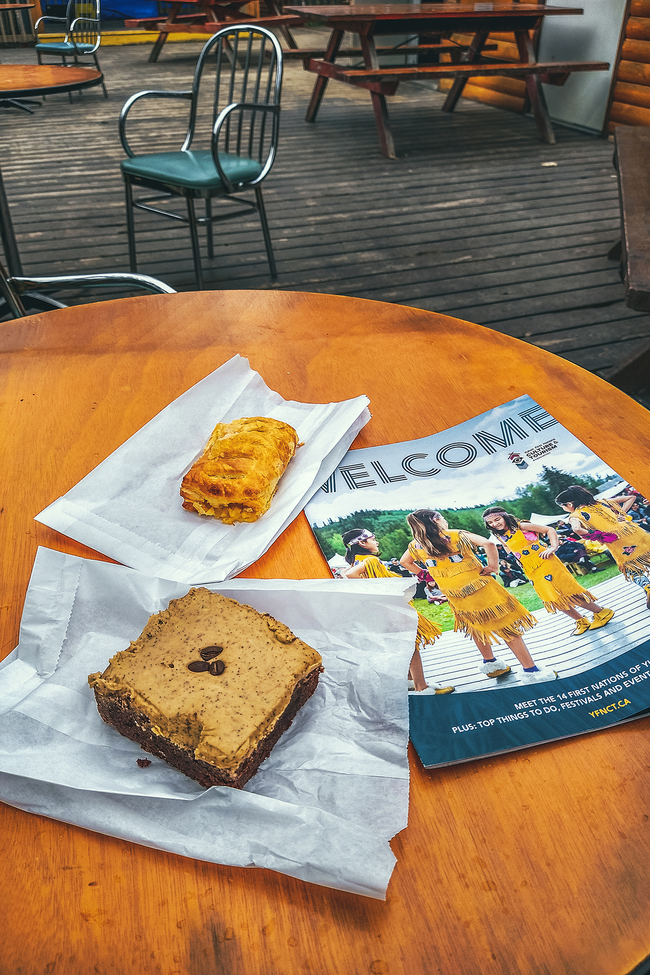
On the way back we stopped at Village Bakery in Haines Junction for some pastries and free wifi, then headed back to camp.
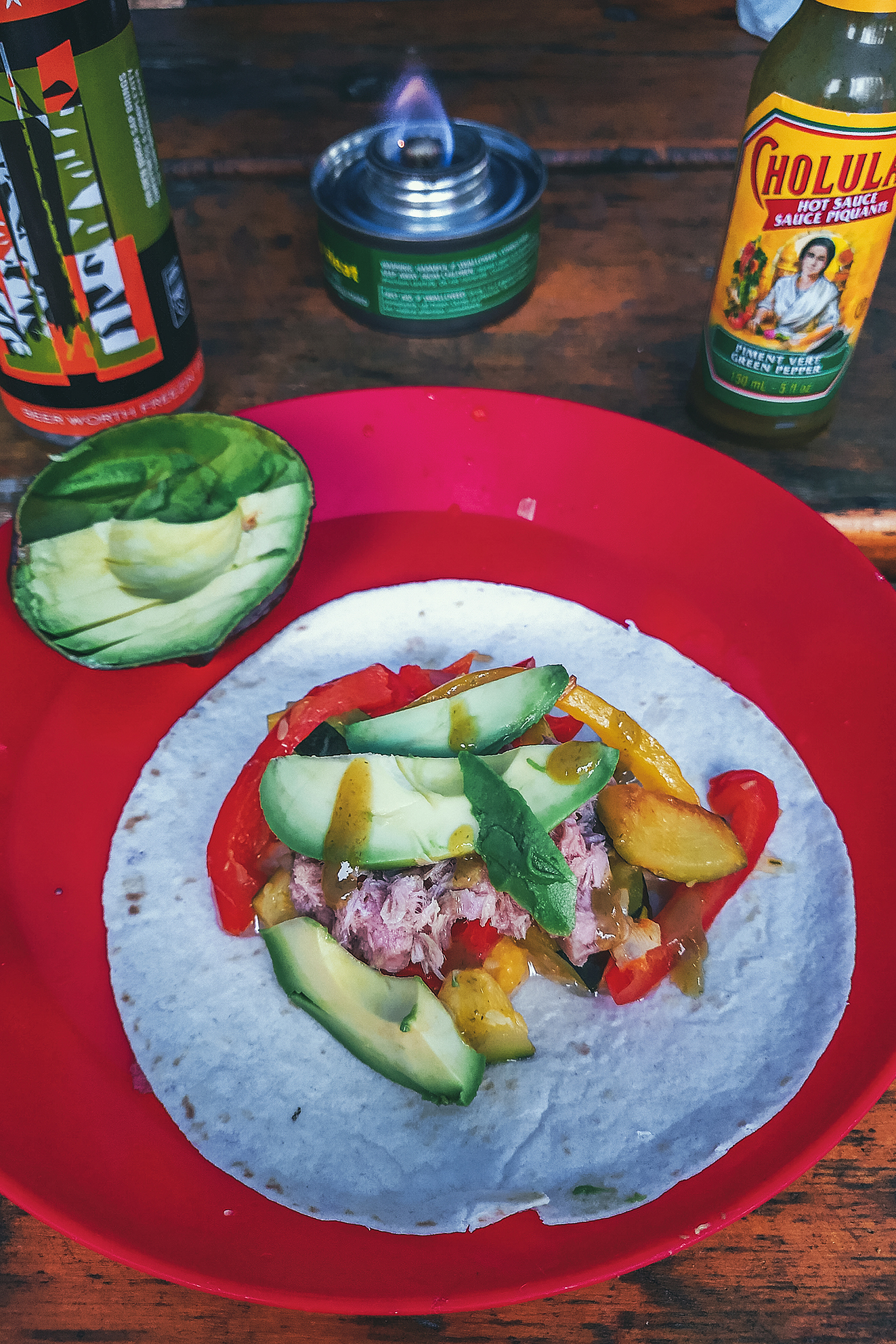
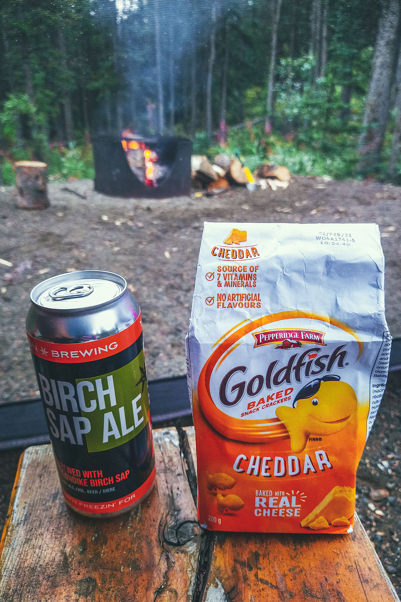
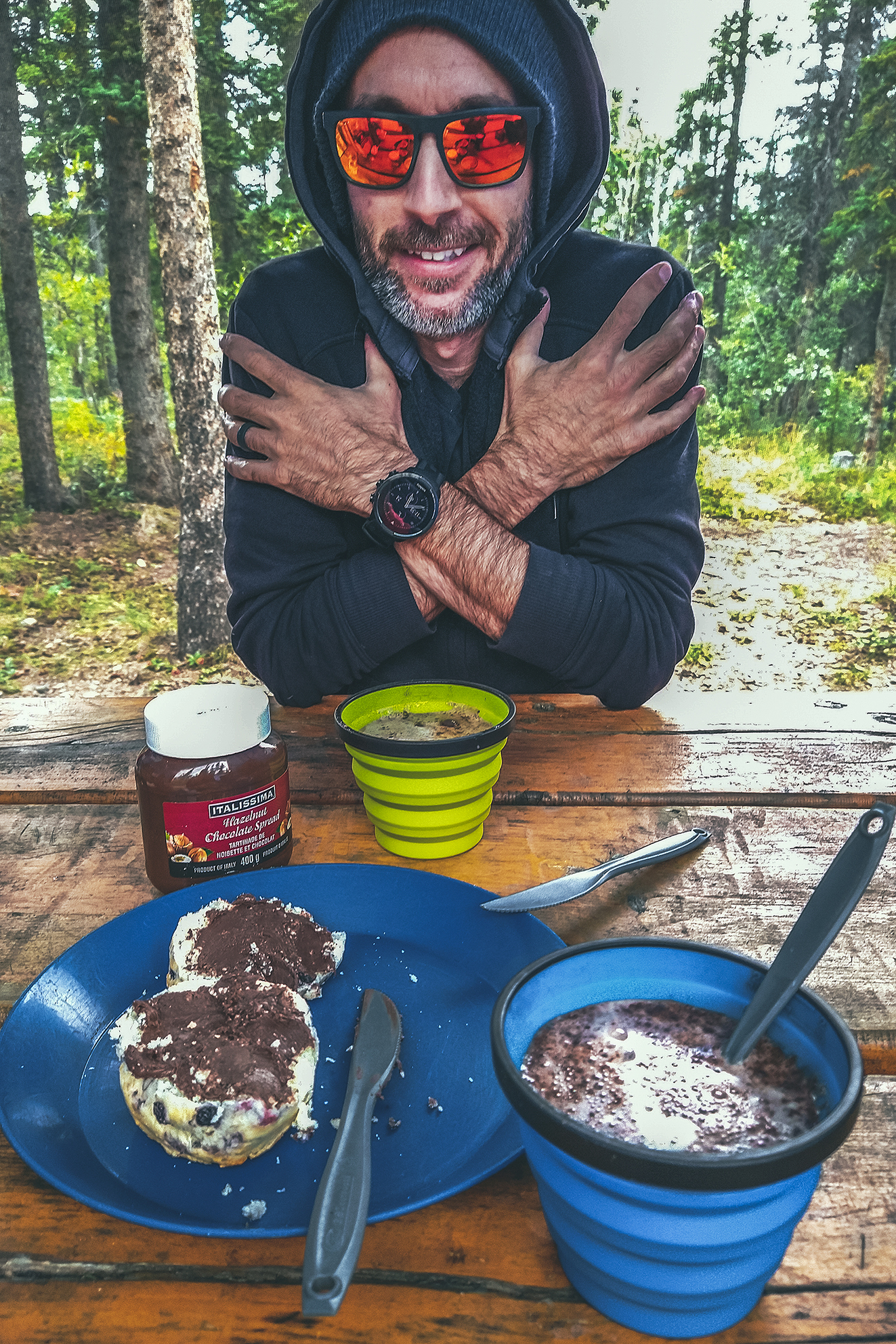
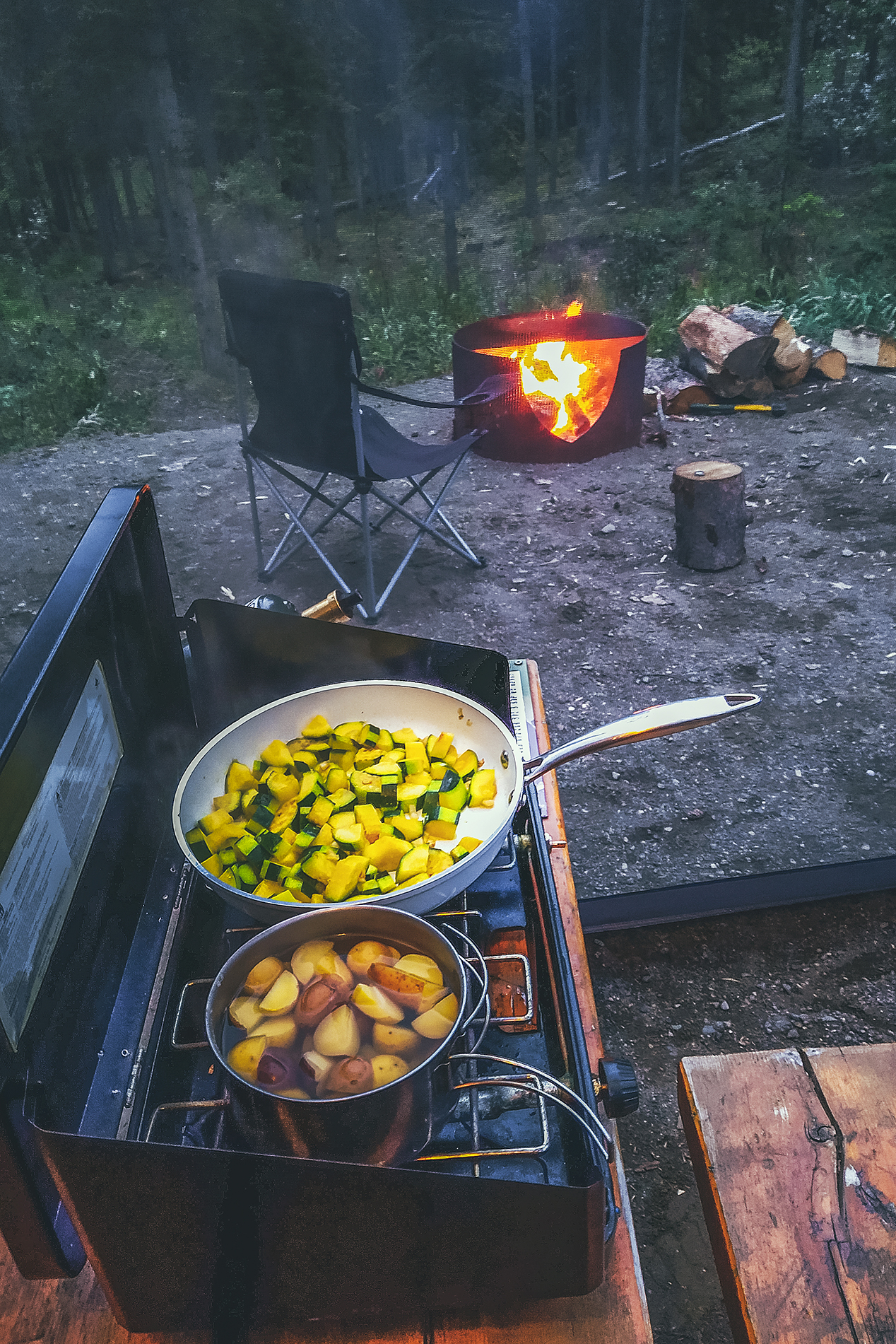
That night we changed things up a bit by making tacos – zucchini, bell peppers, avocado & tuna, with a dash of green pepper hot sauce. That was a nice variation from our other camping meals so far, and one we might even repeat at home.
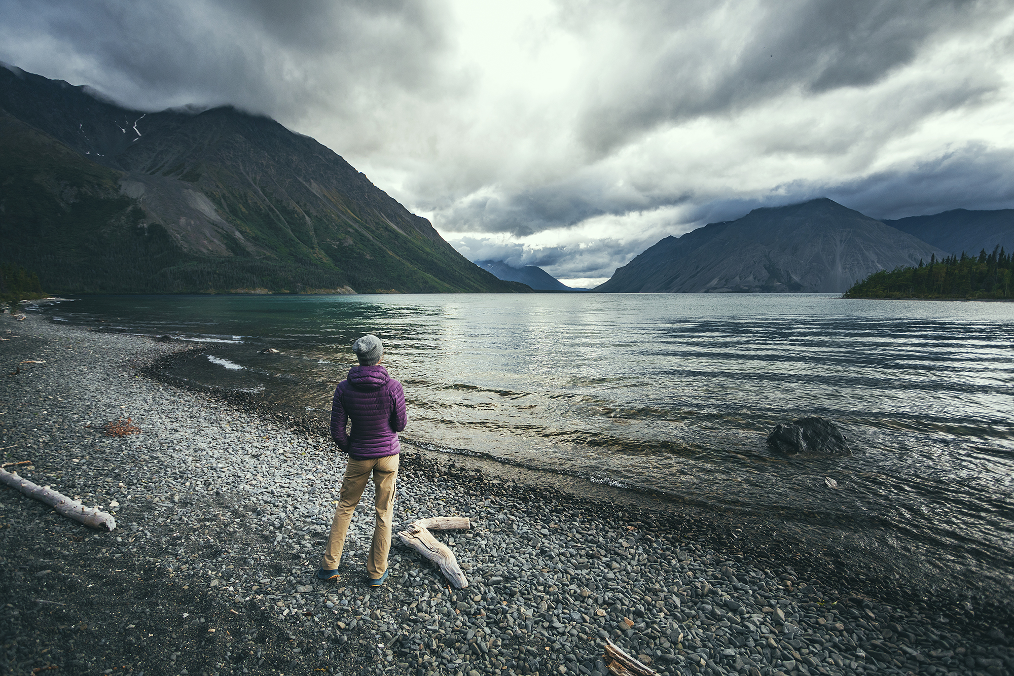
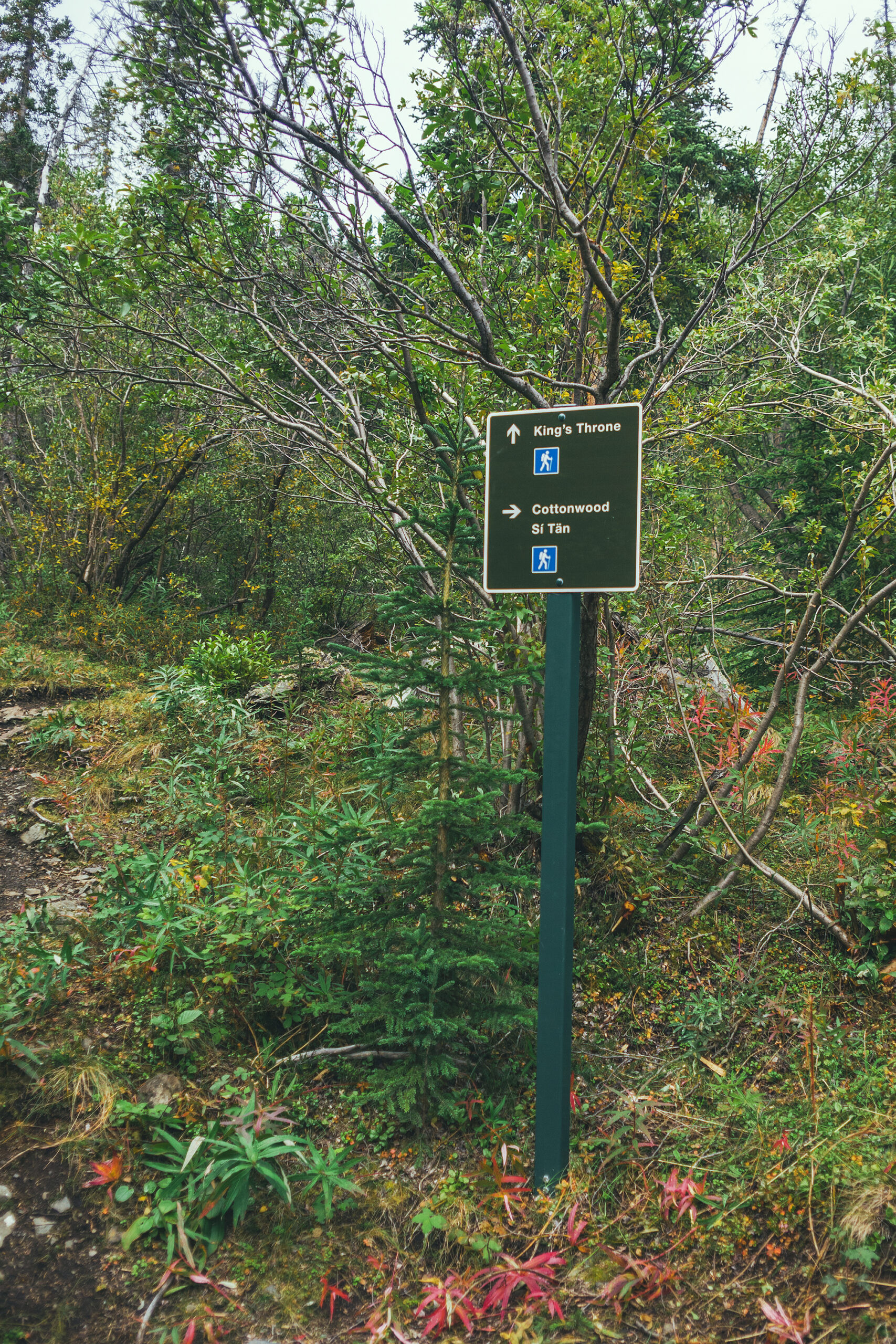
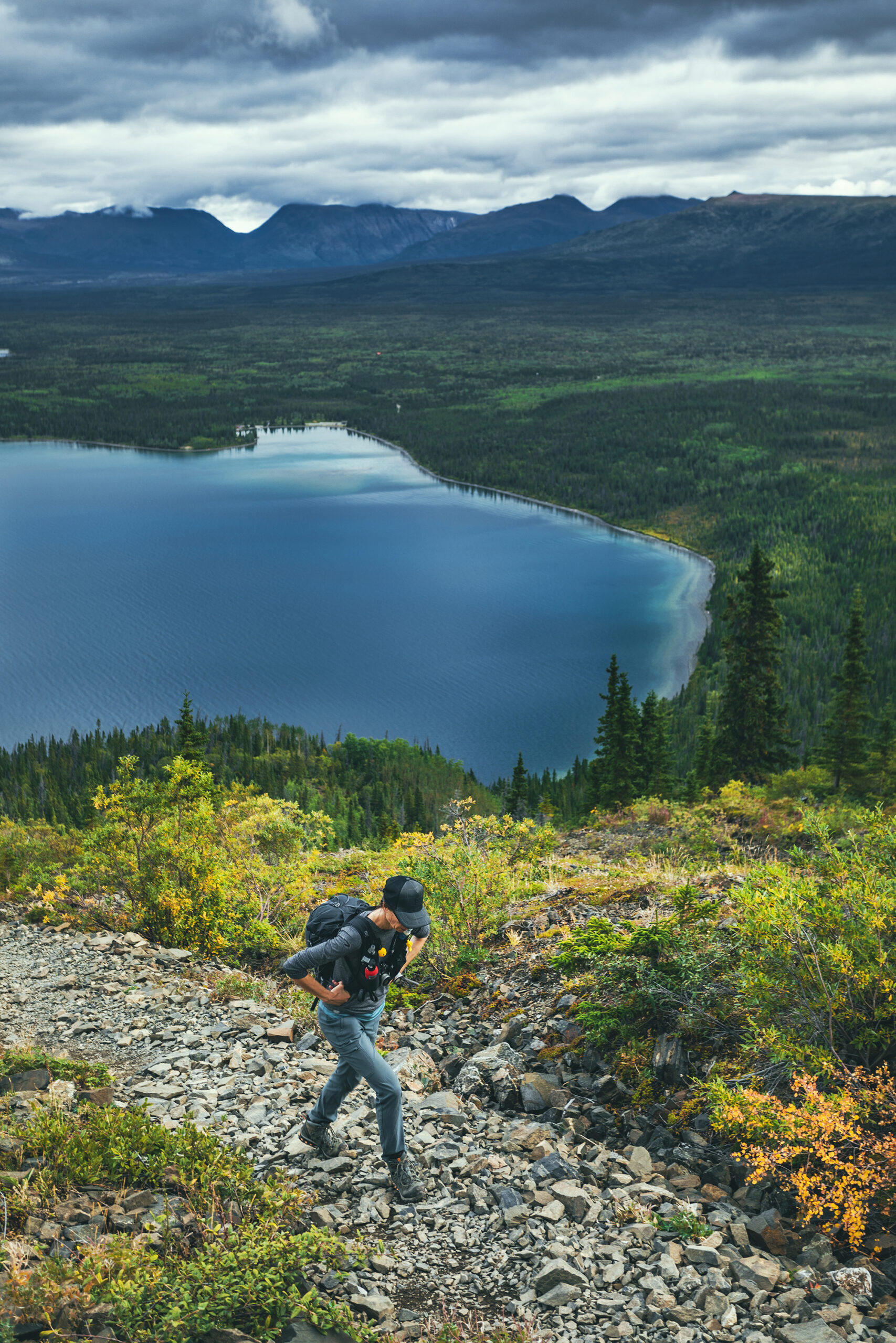
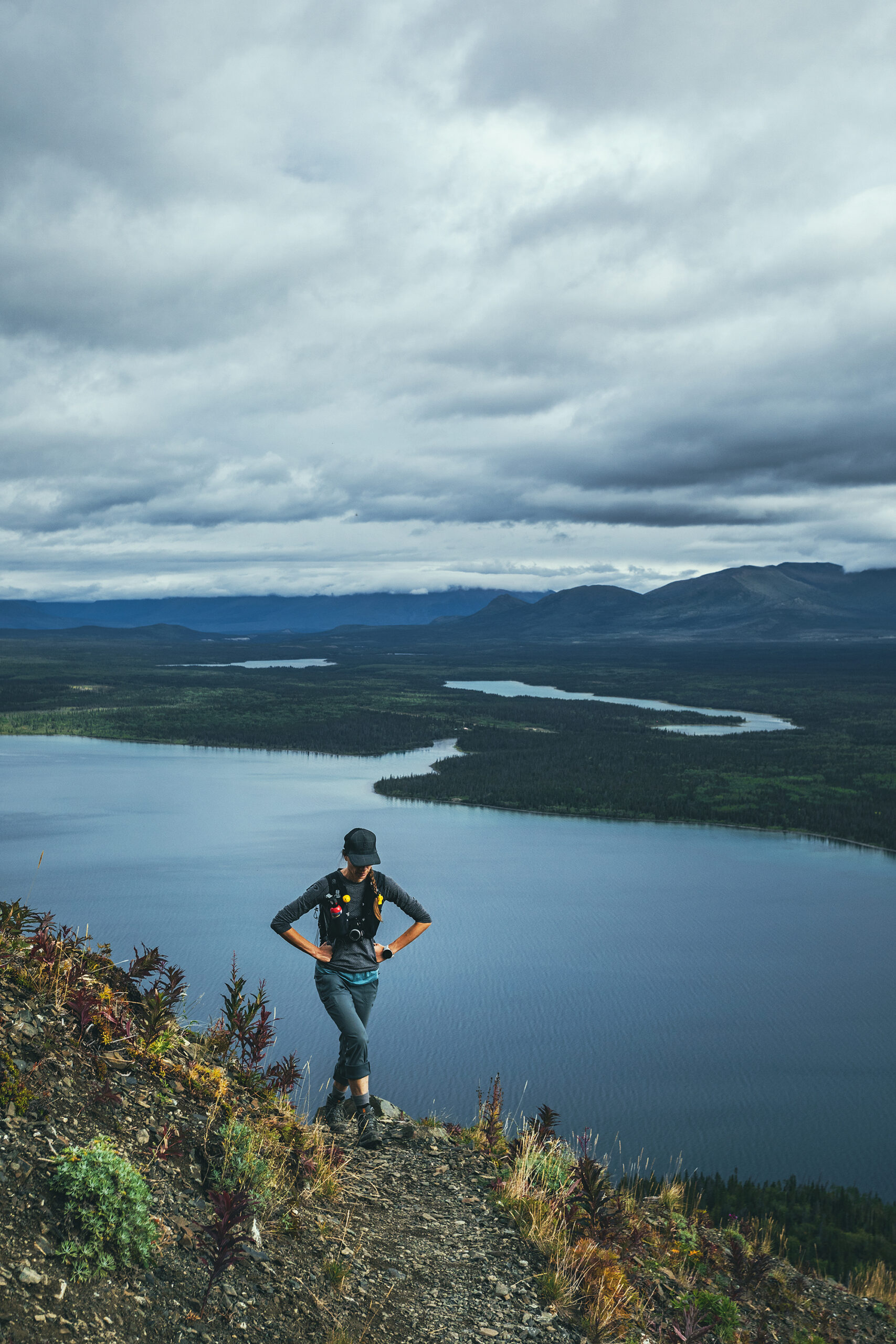
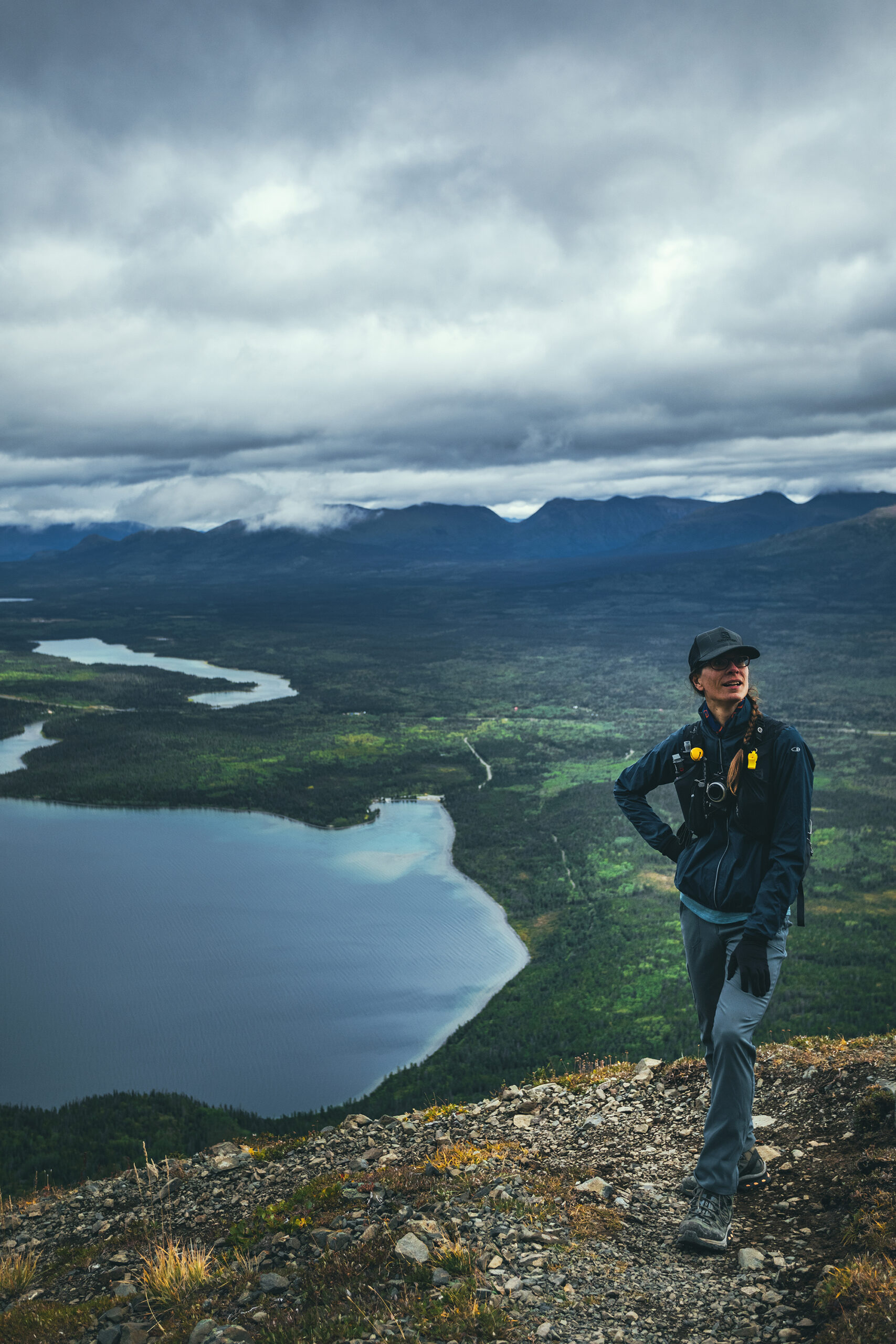
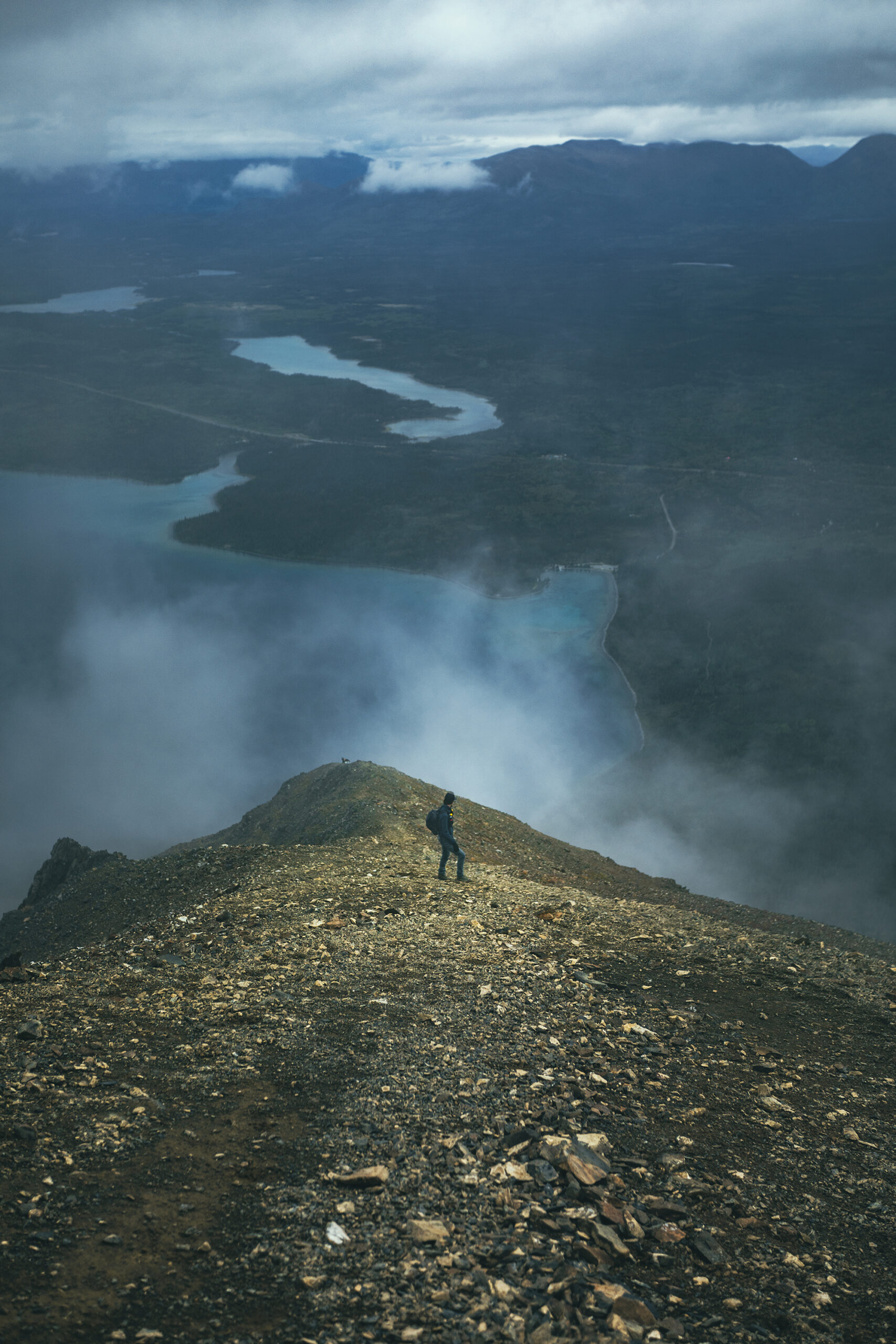
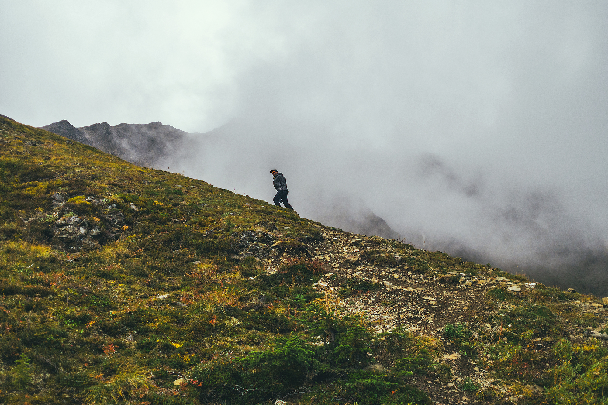
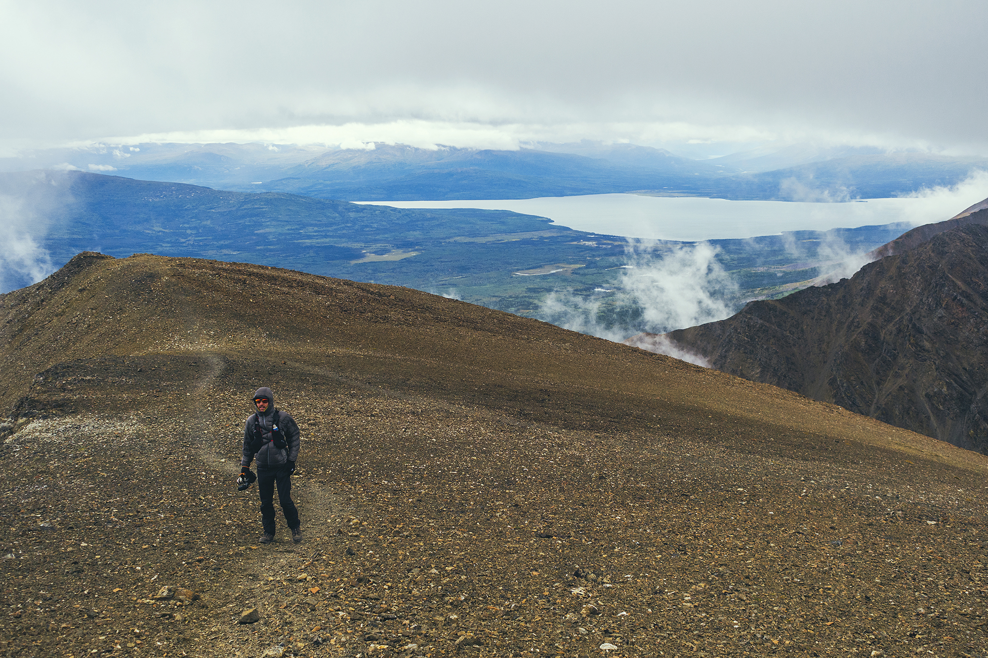
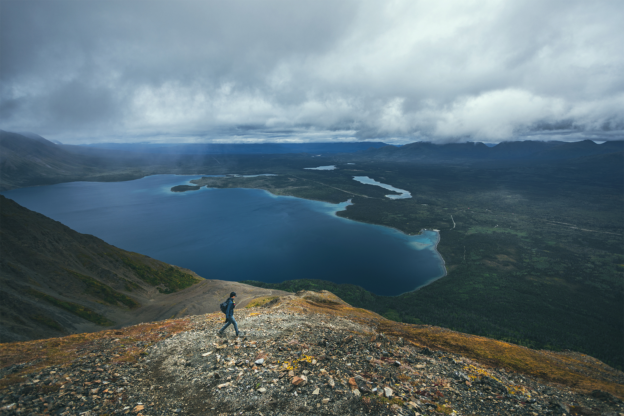
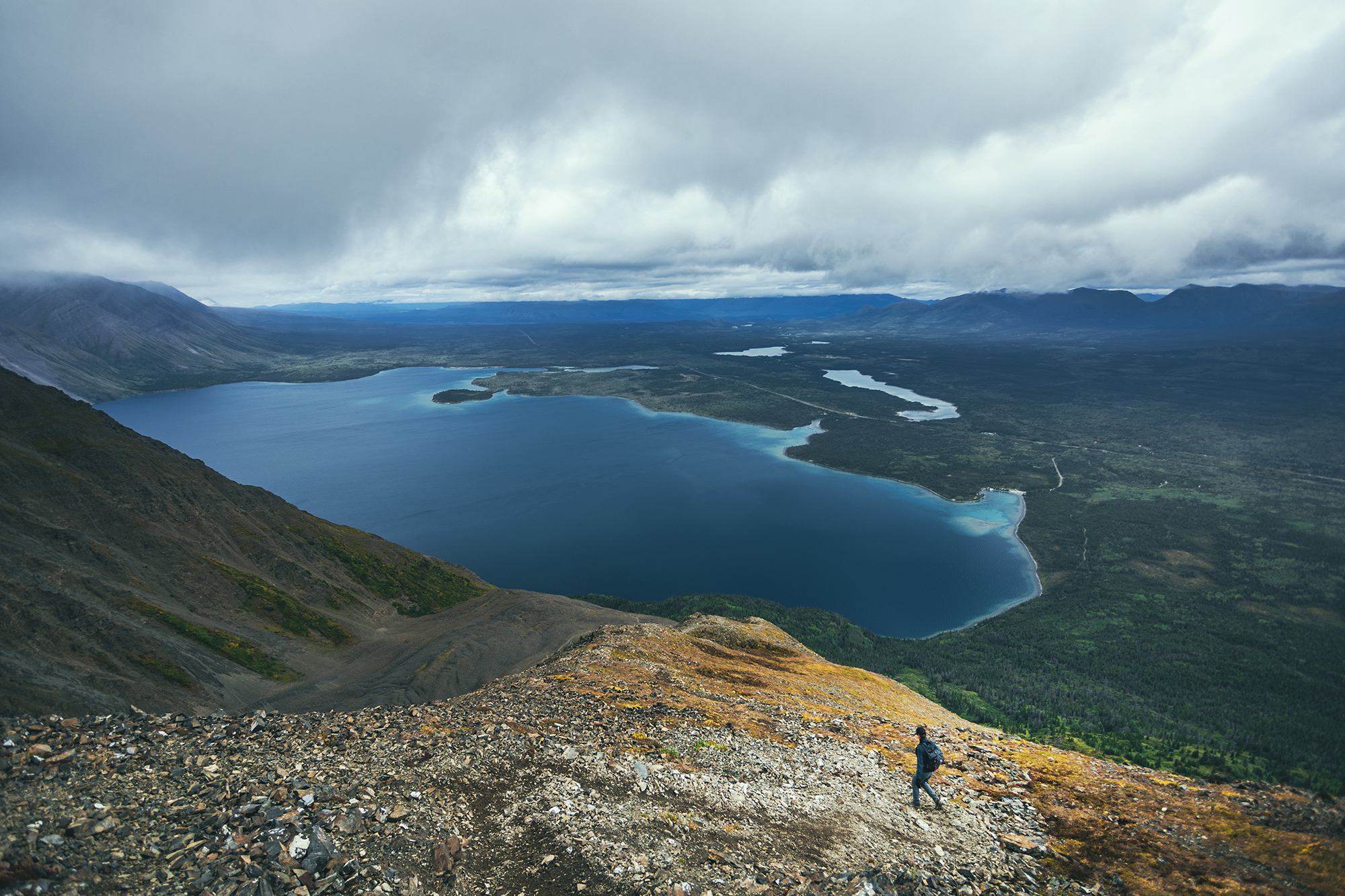
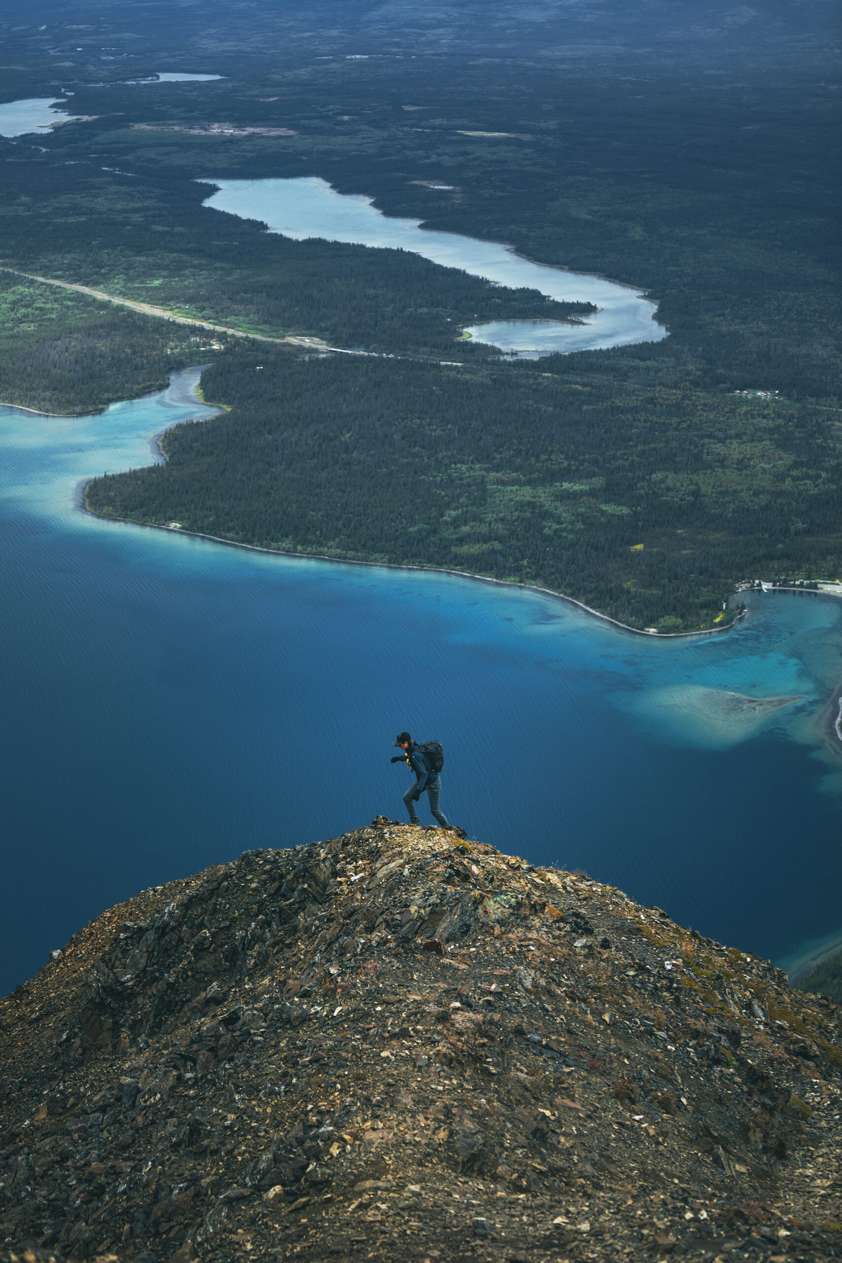
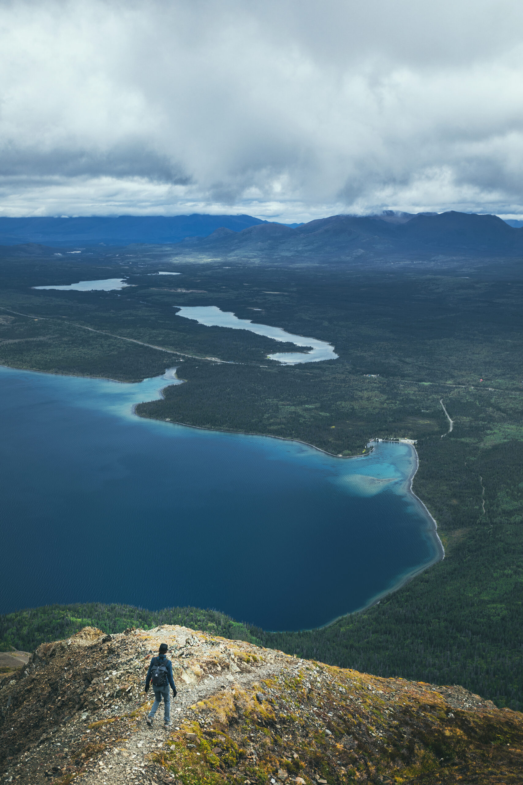
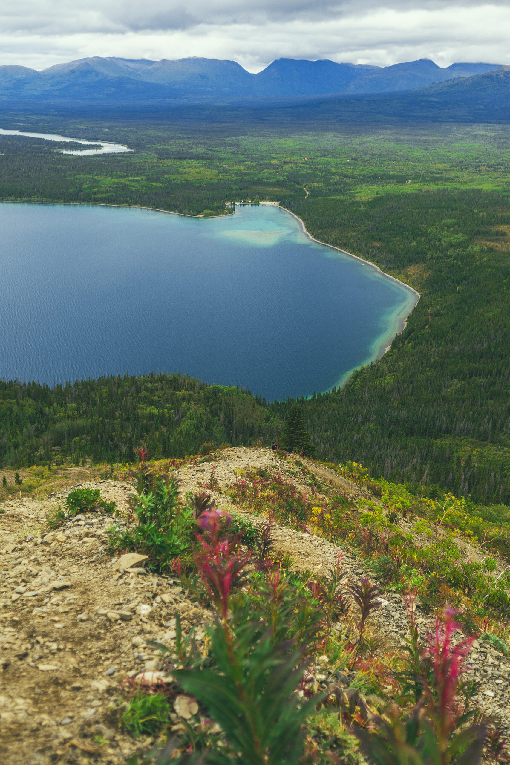
We set off for King’s Throne, a hike that was recommended to us by our friend Adele, as well as 2 or 3 other random people we saw on other hikes. The trailhead is actually at Kathleen Lake so it was conveniently near our campsite. Alltrails had it recorded at 12.7km, while I had seen it at 15km in some Yukon guide, with an estimated time of 8 hours.
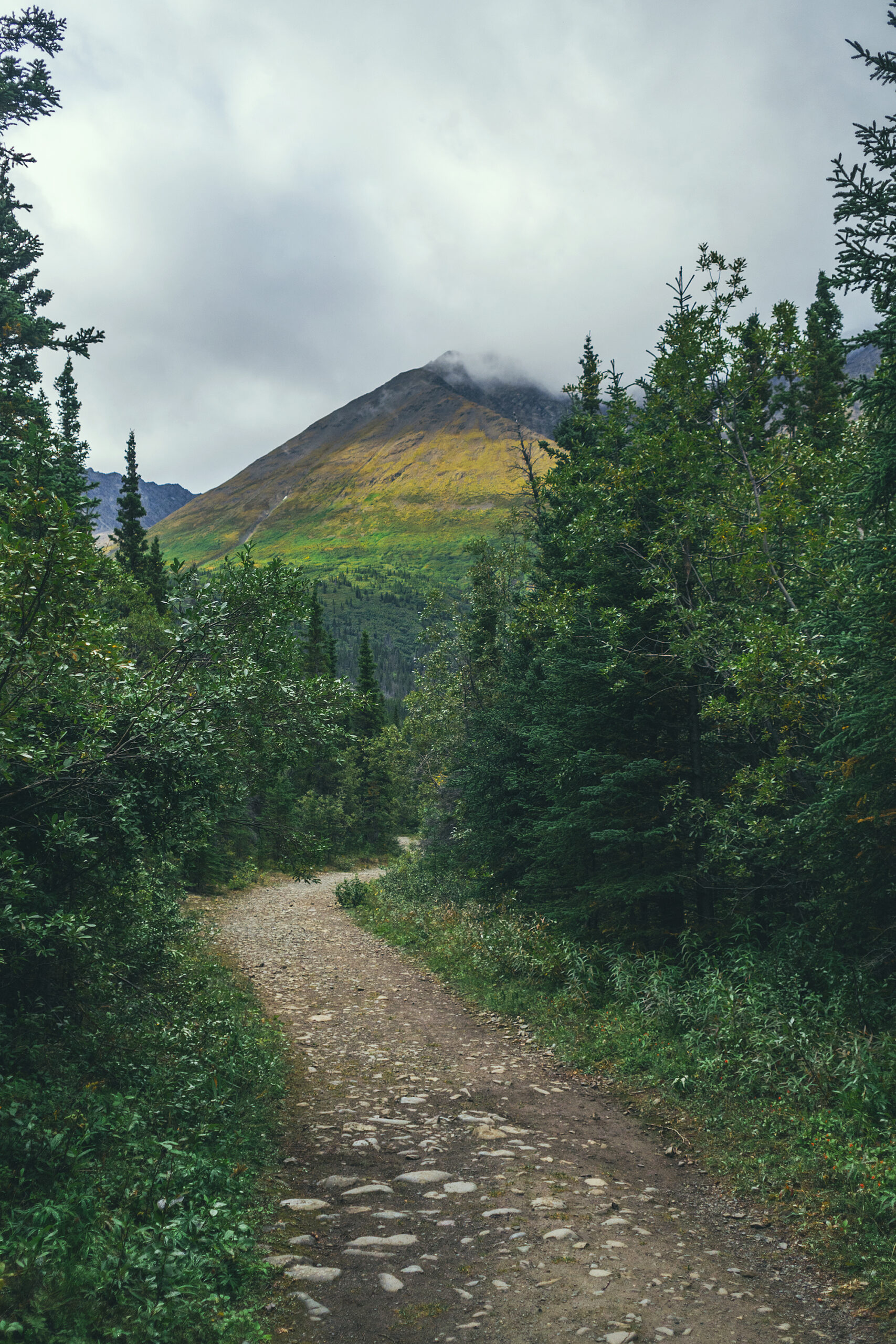
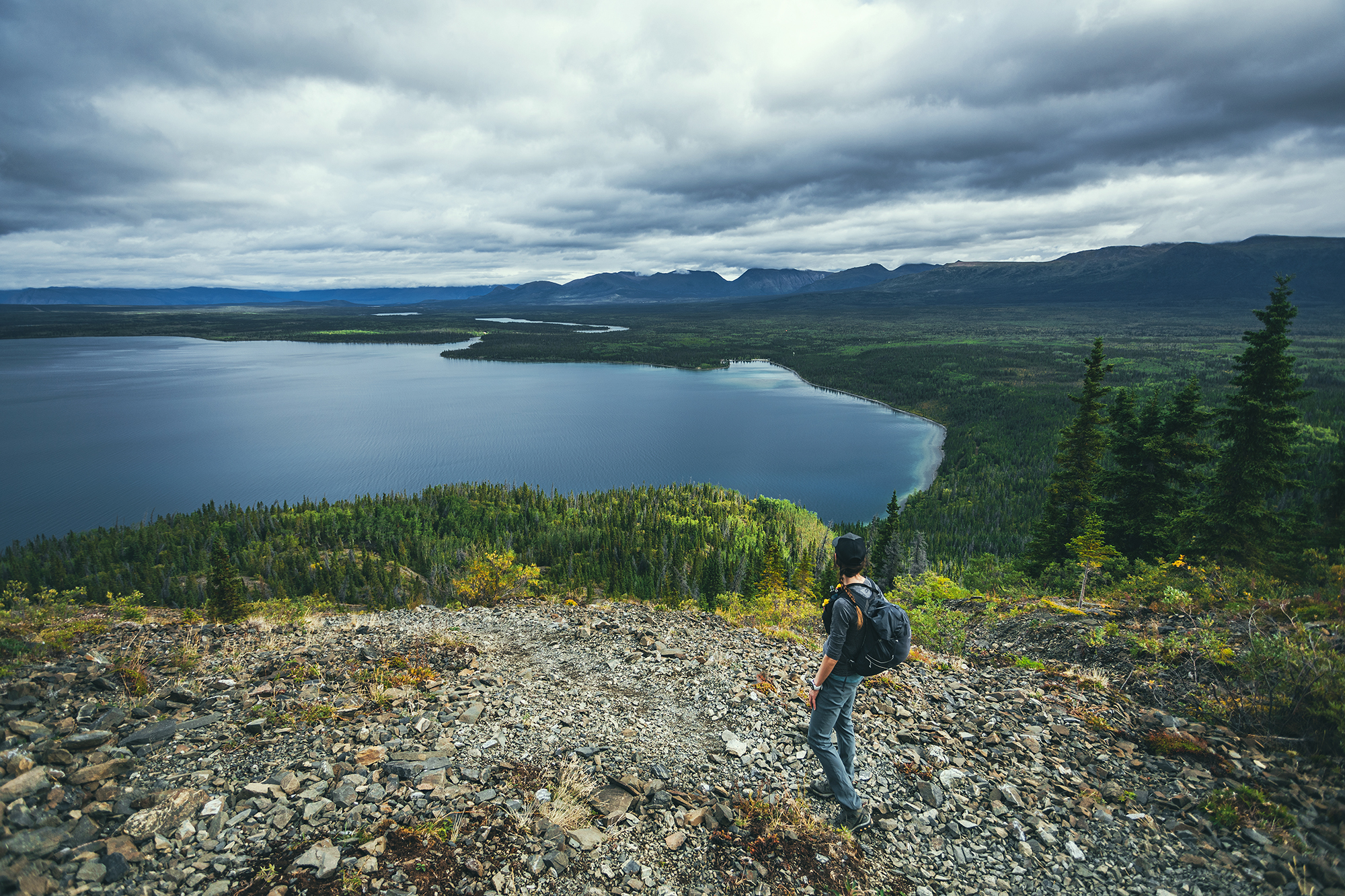
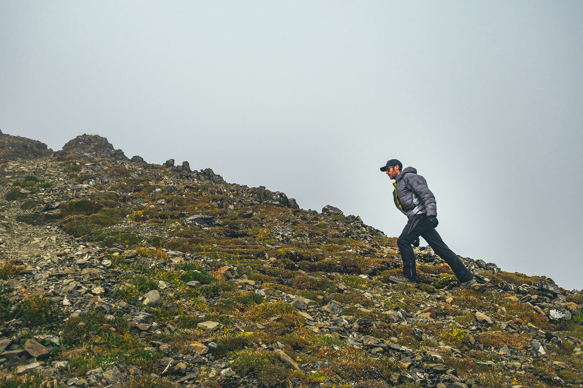
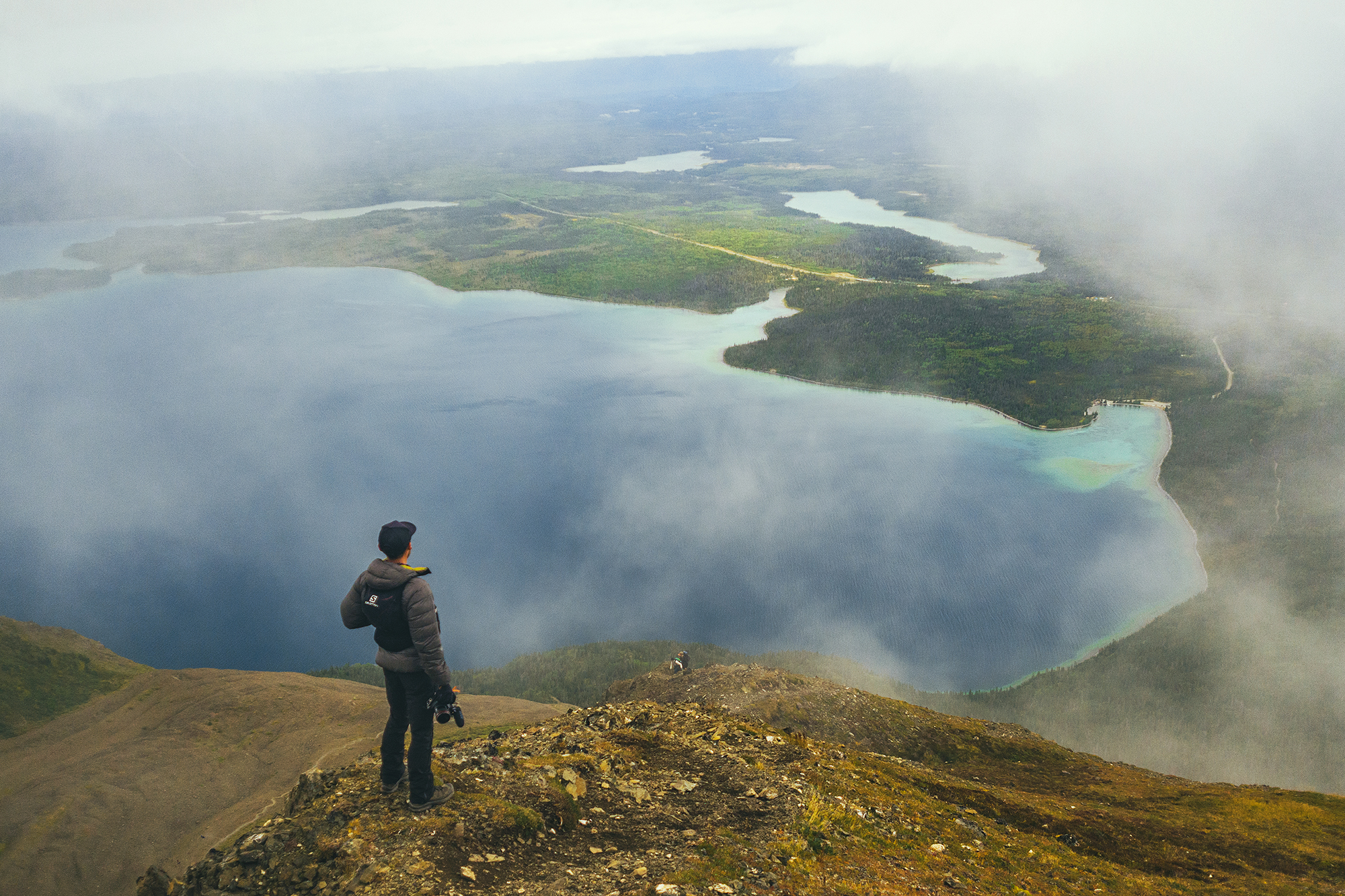
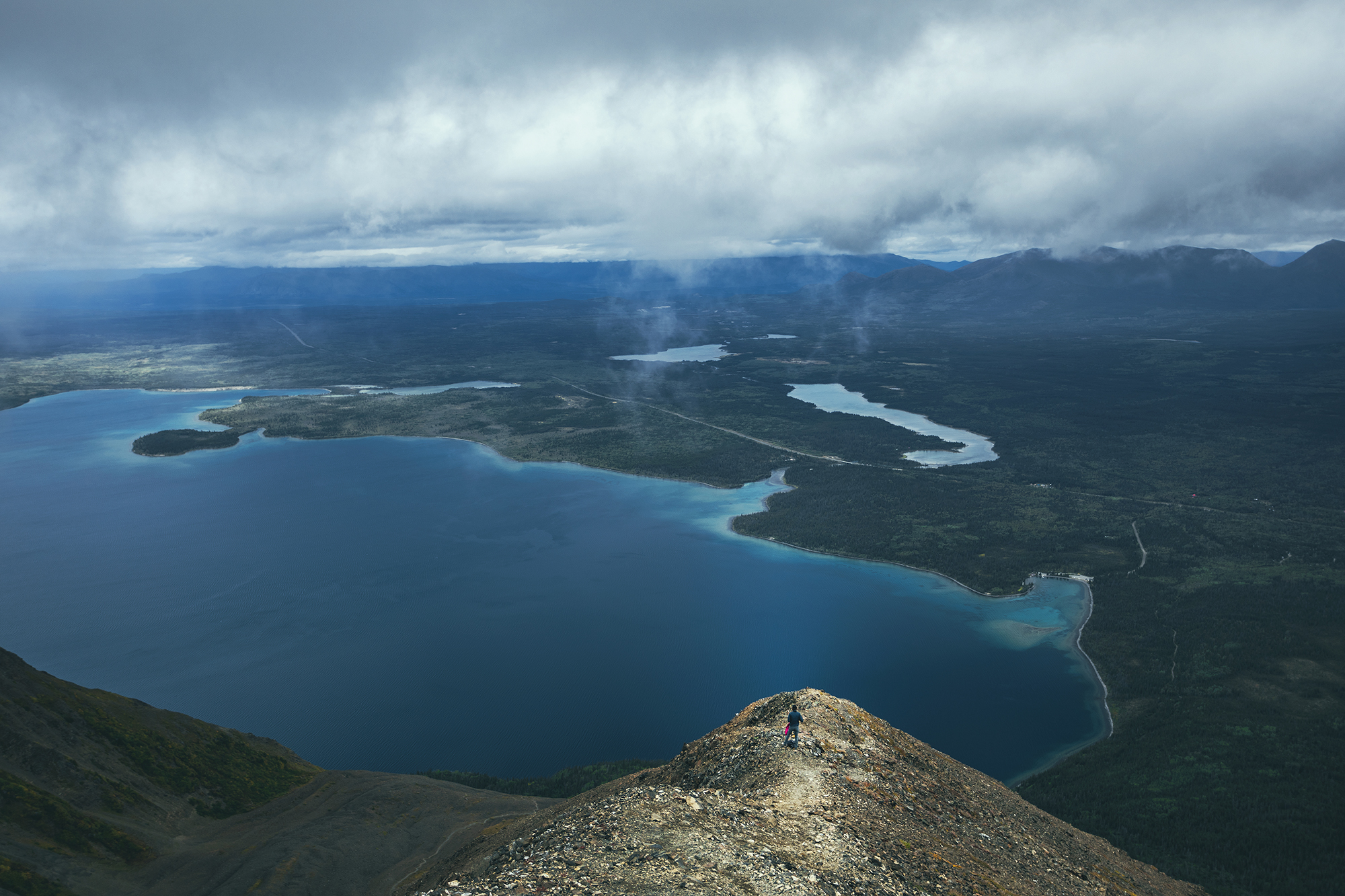
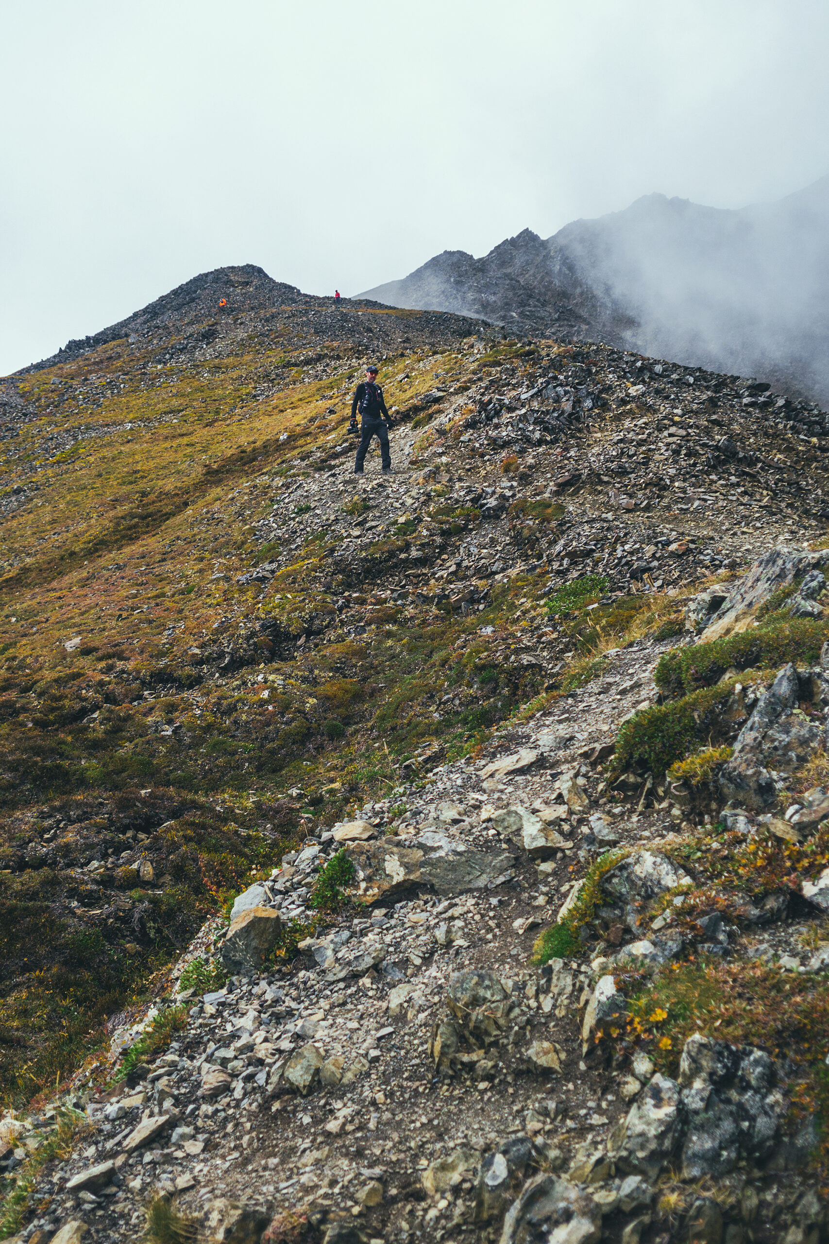
We started relatively late at 10am. The trail is pretty wide and flat for the first 2 kms in the trees, then it starts climbing steeply up the mountain side. We got to the alpine within 3km from the start and had great views of Kathleen lake from there on. One option I’d found was to hike 5km to King’s “seat”, basically the bottom of the cirque at the base of the ridge. My watch only read about 3.6k though when we got to that point after only about 1 hour of climbing (maybe a bit more), so we continued straight on to climb the ridge.
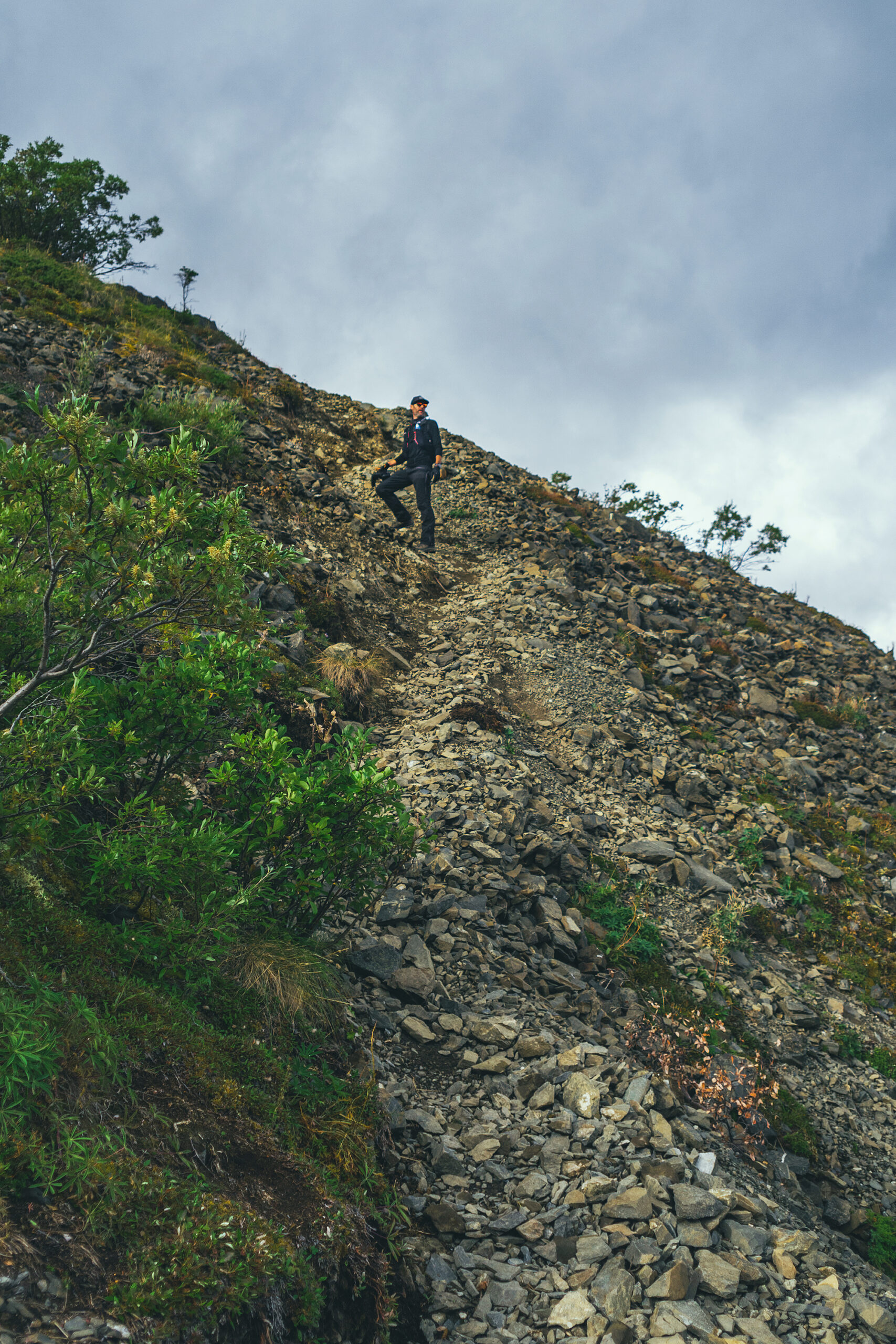
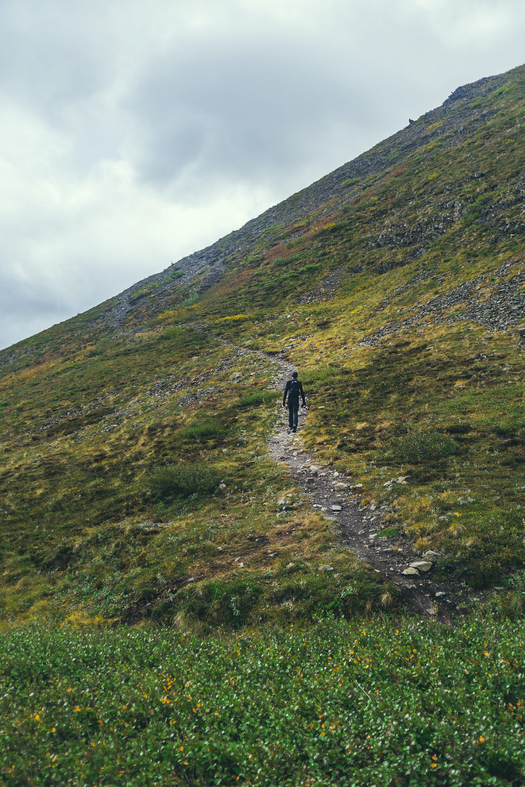

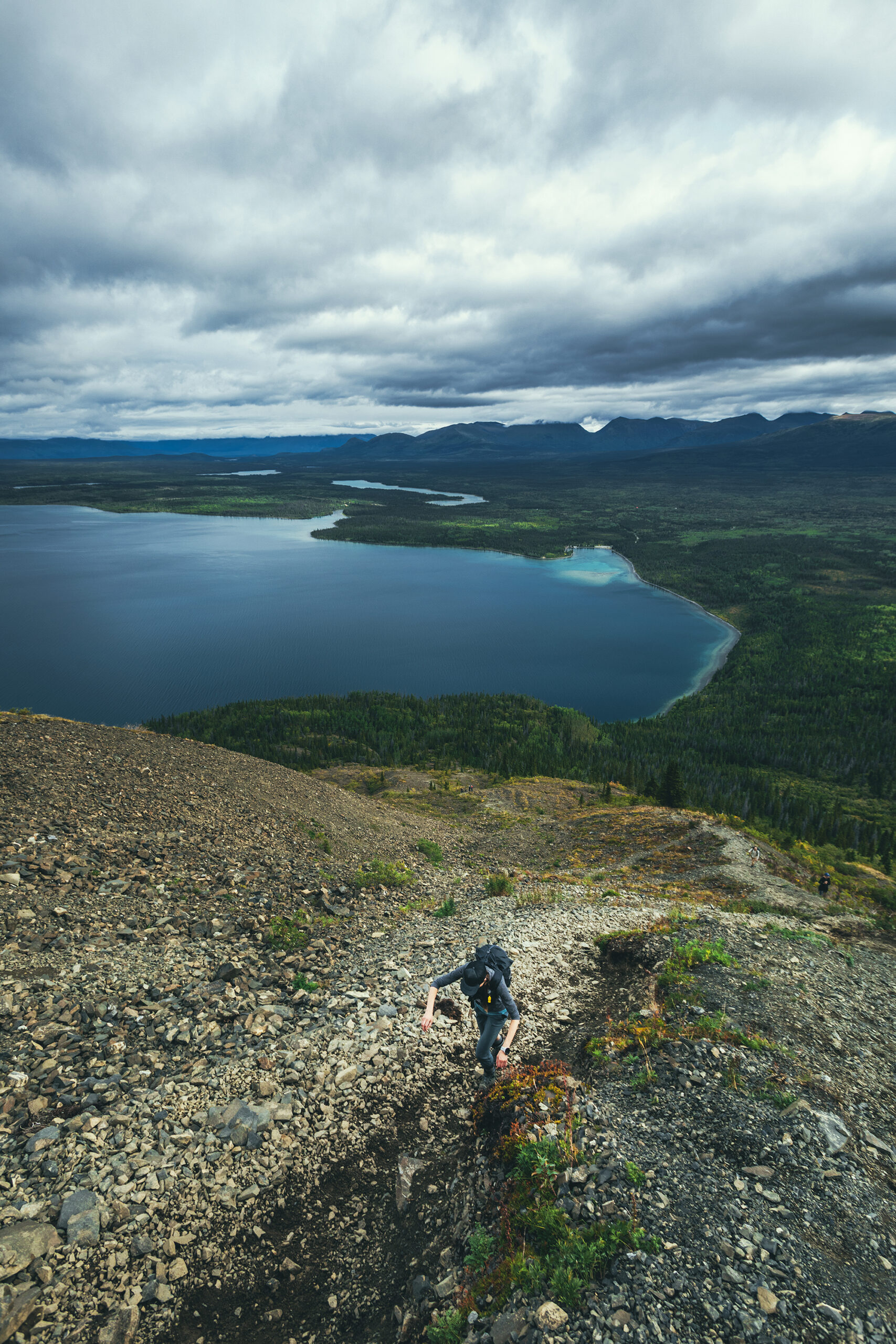

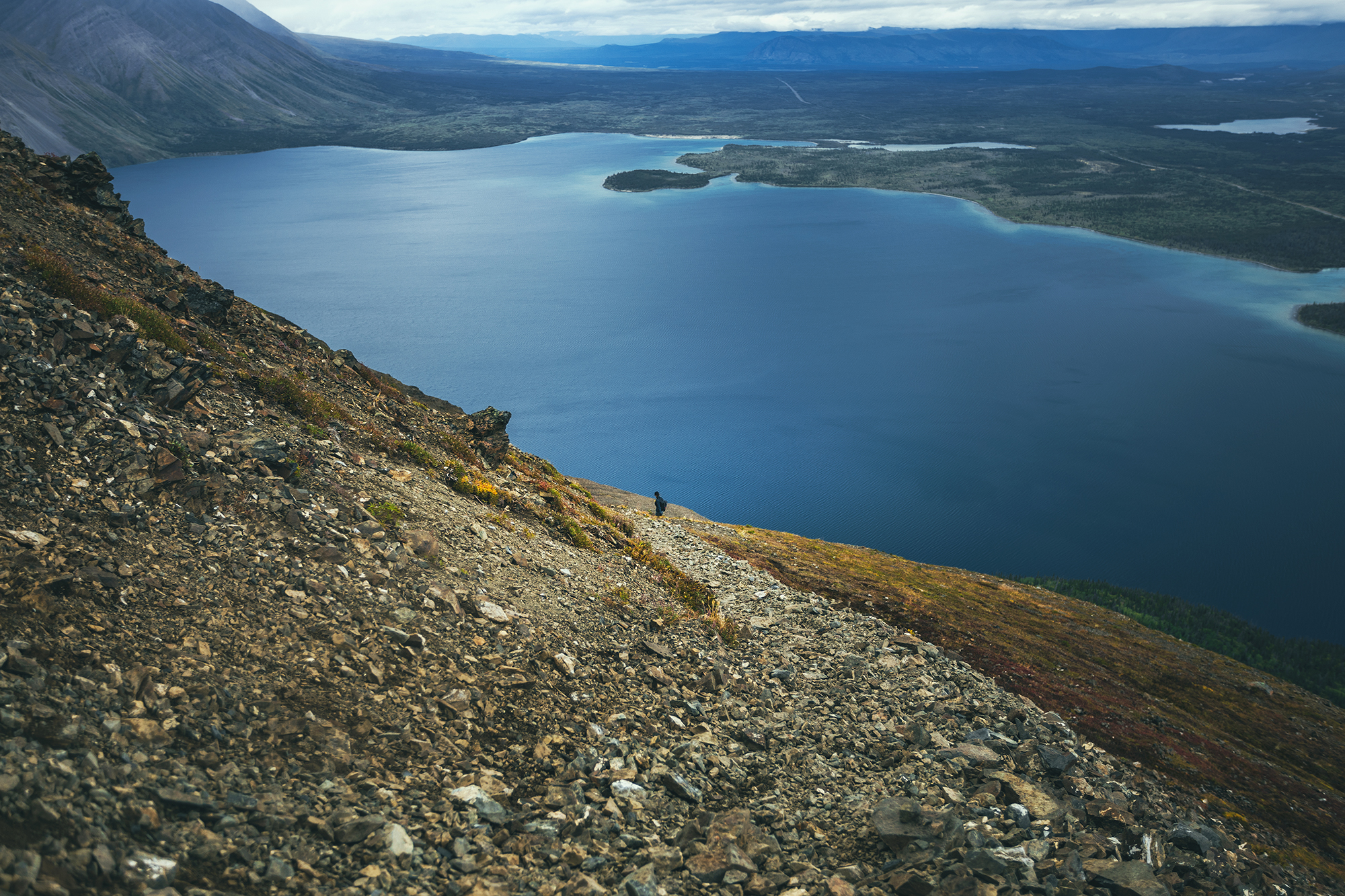
That portion was probably the most challenging (both up and down) as you climb very steeply on loose gravel. It was slow going up and a bit slippery on the down.
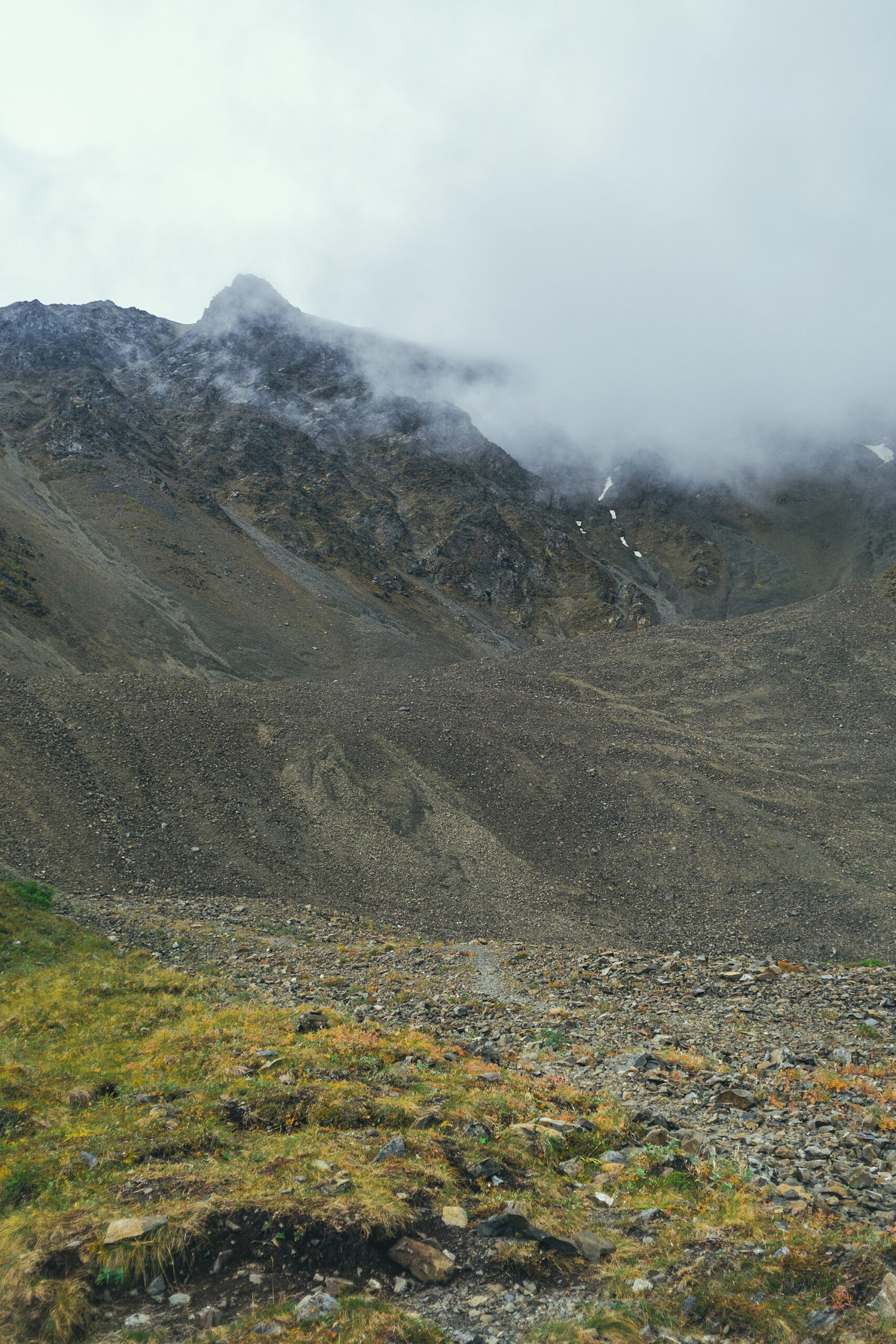
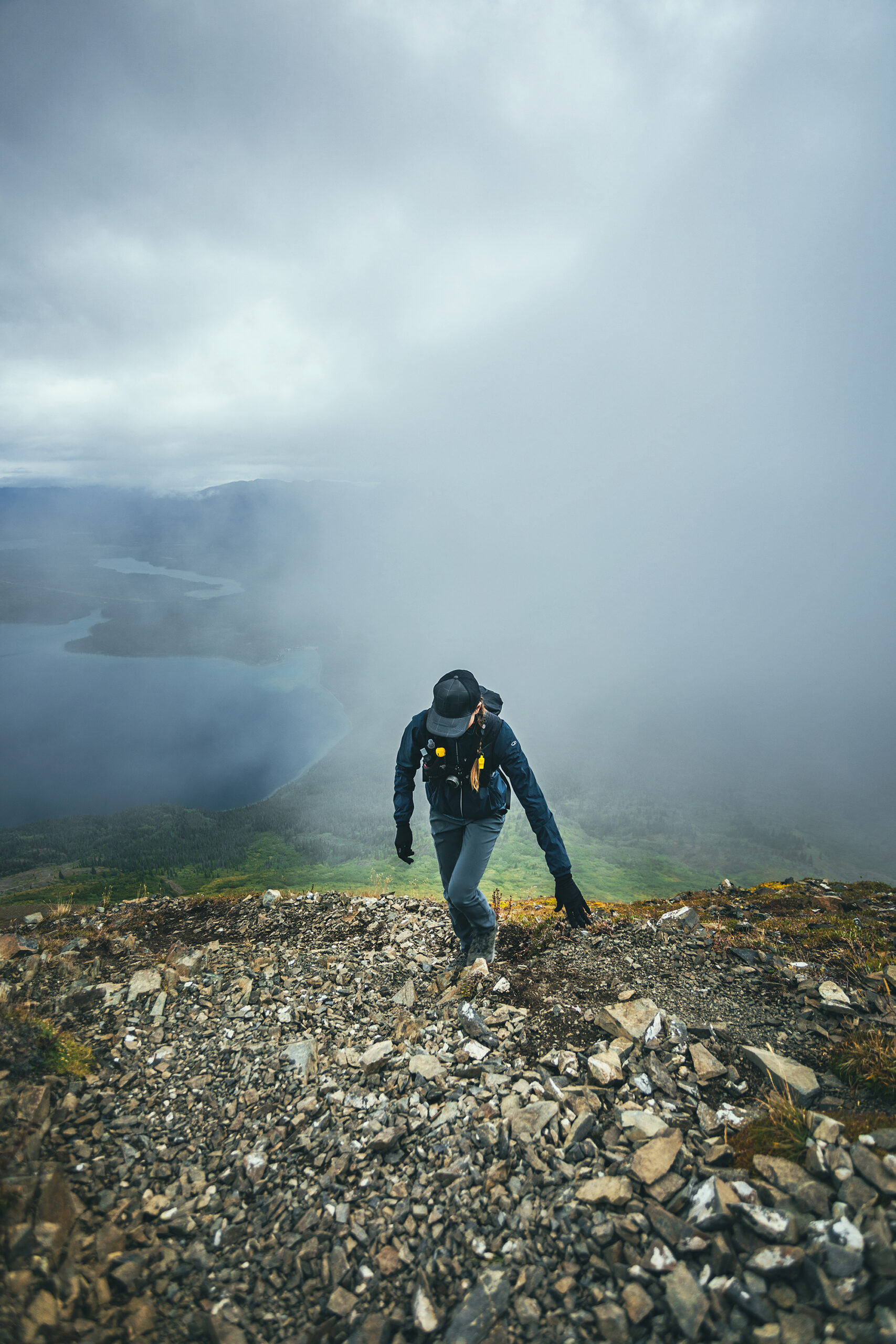
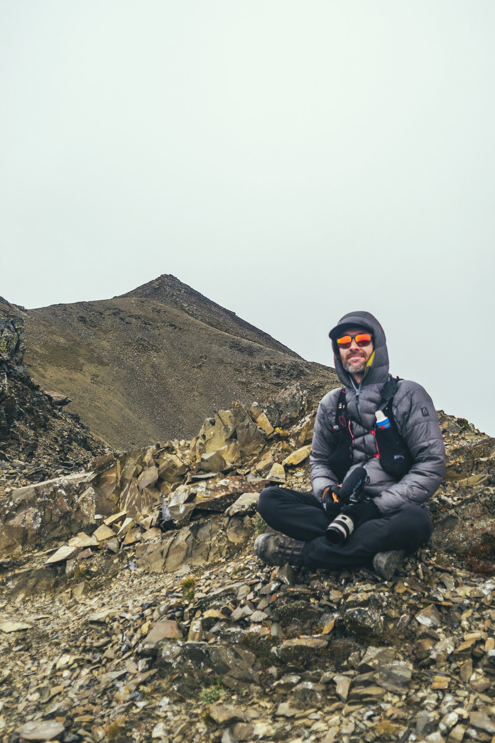
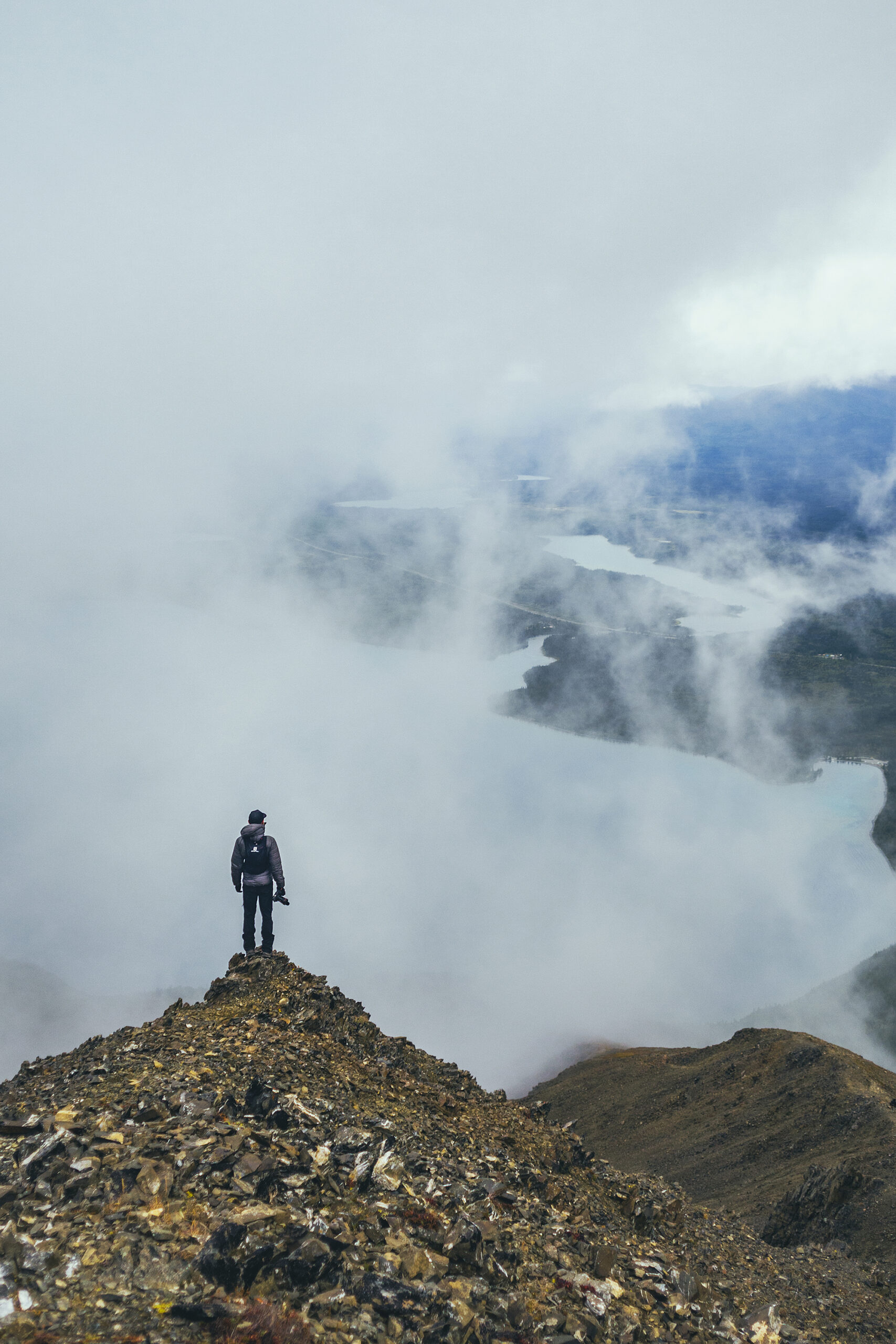
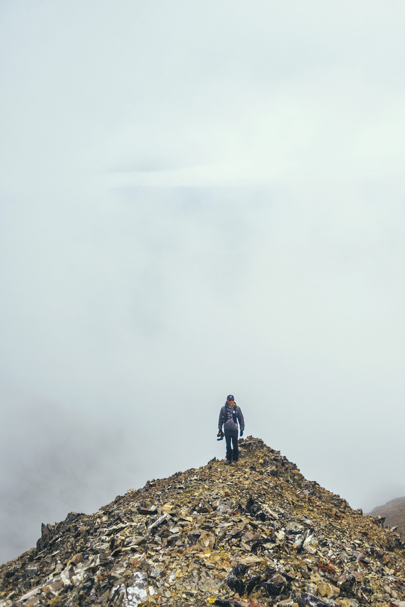
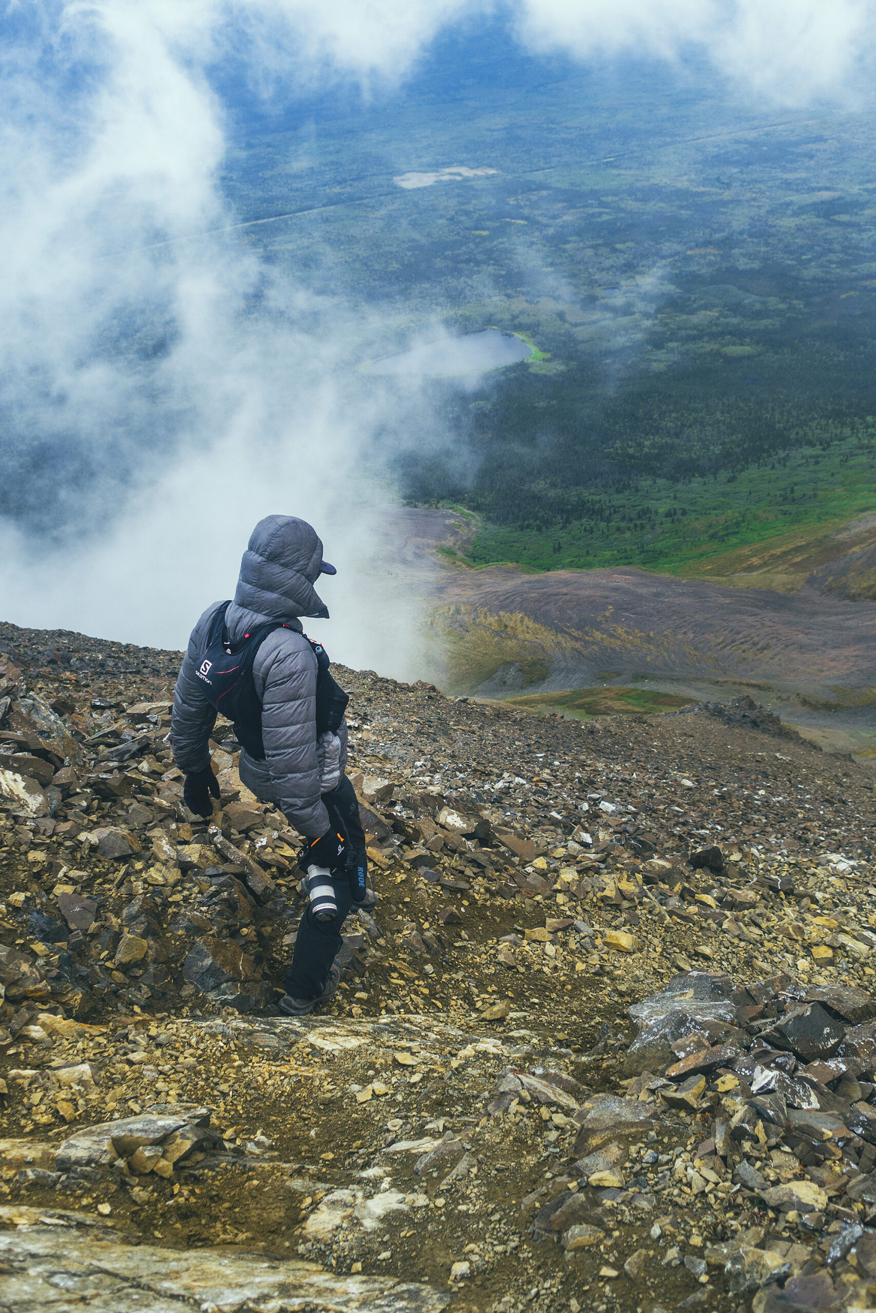
Looking up we could see that the higher section of the ridge was completely covered in clouds but we figured we’d keep going until we felt like it didn’t make sense anymore.
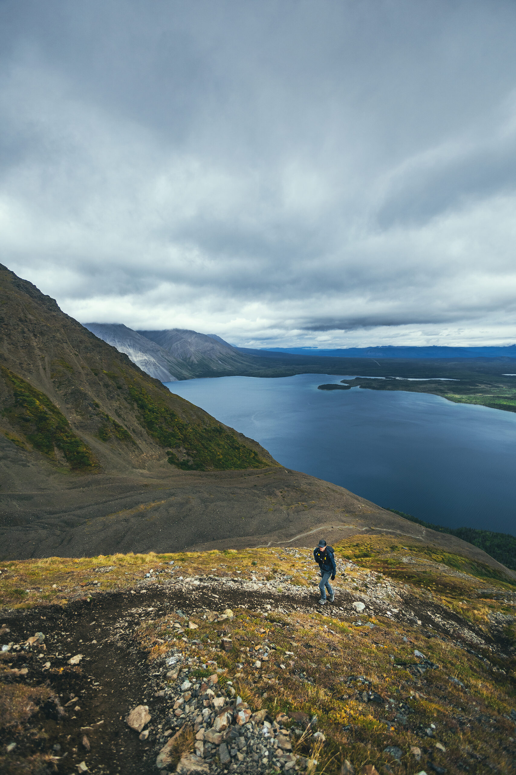
There were some pretty windy spots on the way but alternating with some sheltered ones. We had a snack part-way up and we were debating whether to continue.
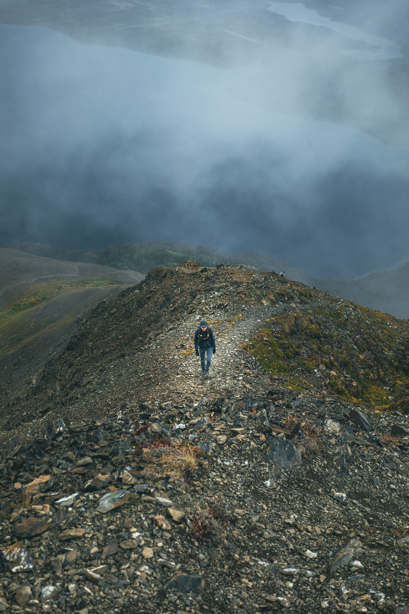
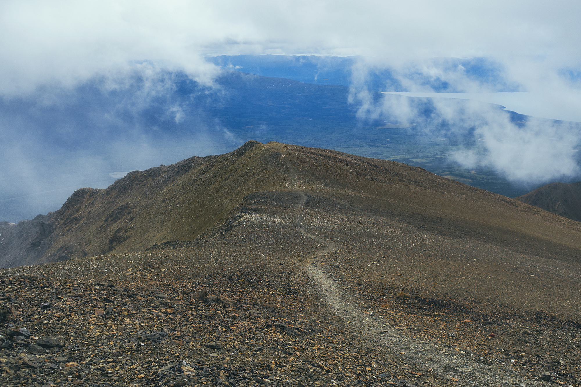
Another couple was following us from not far behind so we let them go by, to see if the next portion was strenuous or not, based on their progress. Turns out we were pretty much at the top of the steeper climb, and from there the trail followed the ridge relatively smoothly.
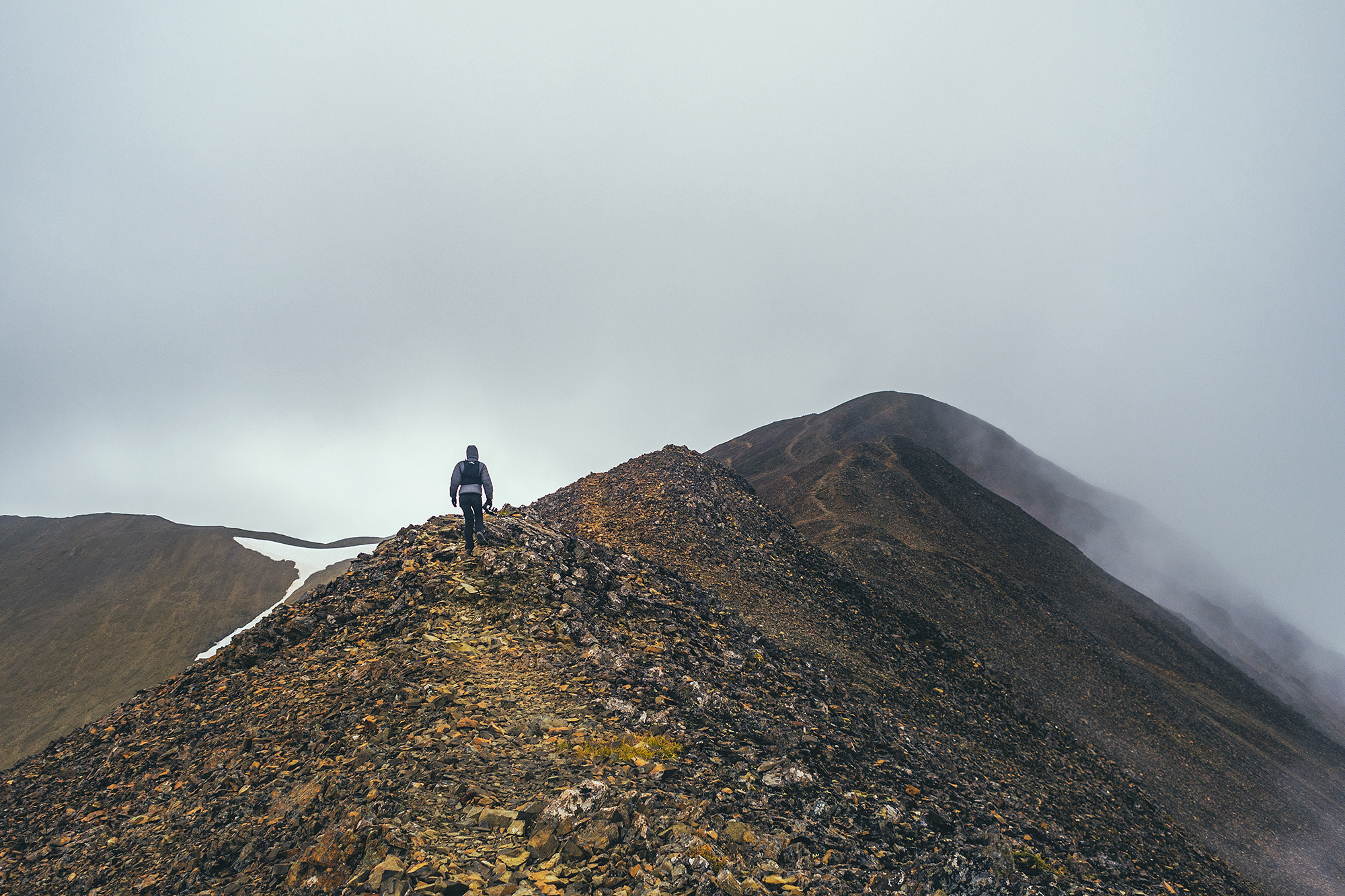
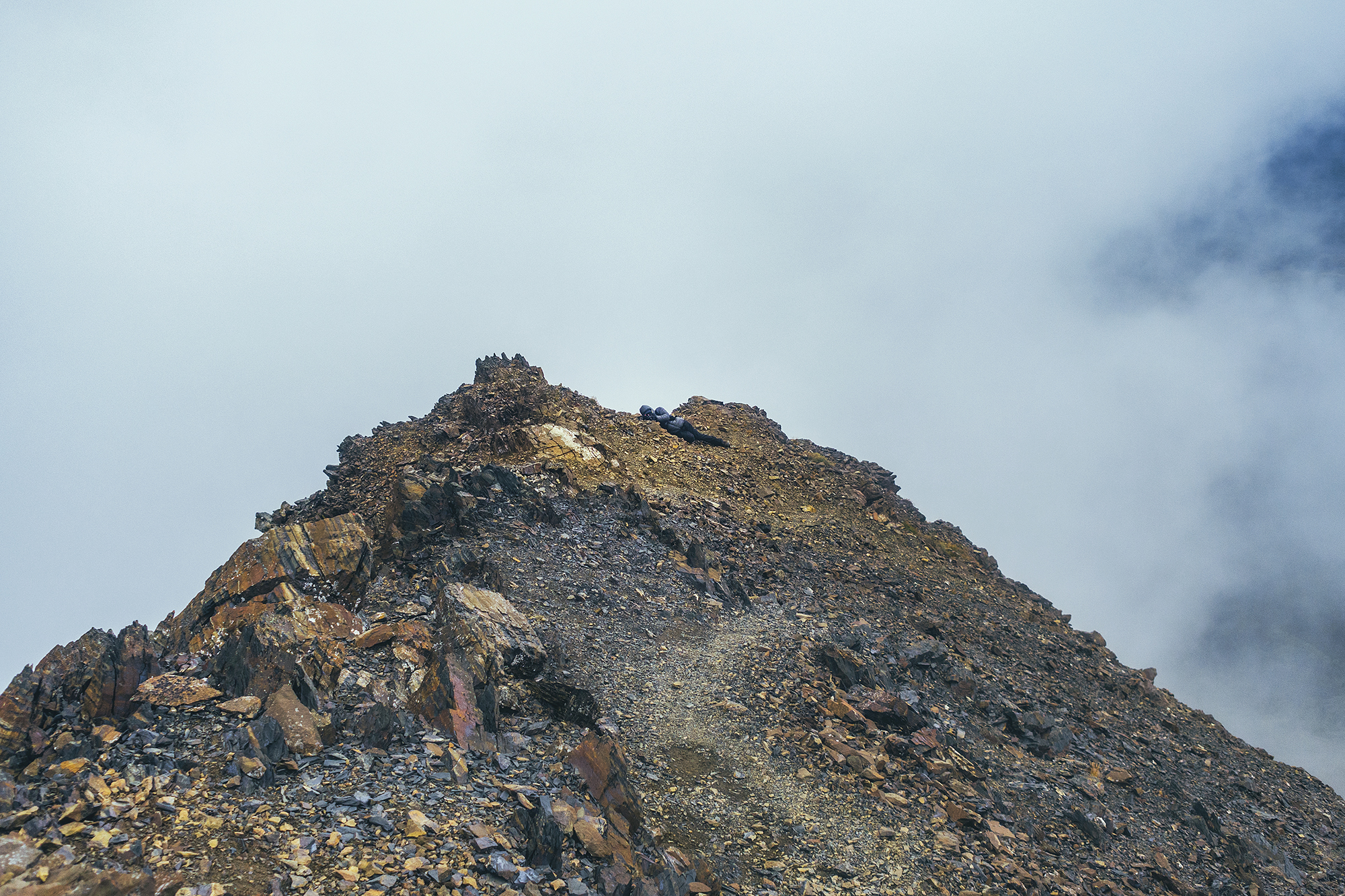
The trail split at each “bump” with option to go up or circumvent at the base. The ground was made up of larger rocks and traveling on that section was actually quick and easy. We went over 3 or 4 prominences, every time wondering if that was the summit, and every time it wasn’t, another bump showing up silhouetted further in the clouds.
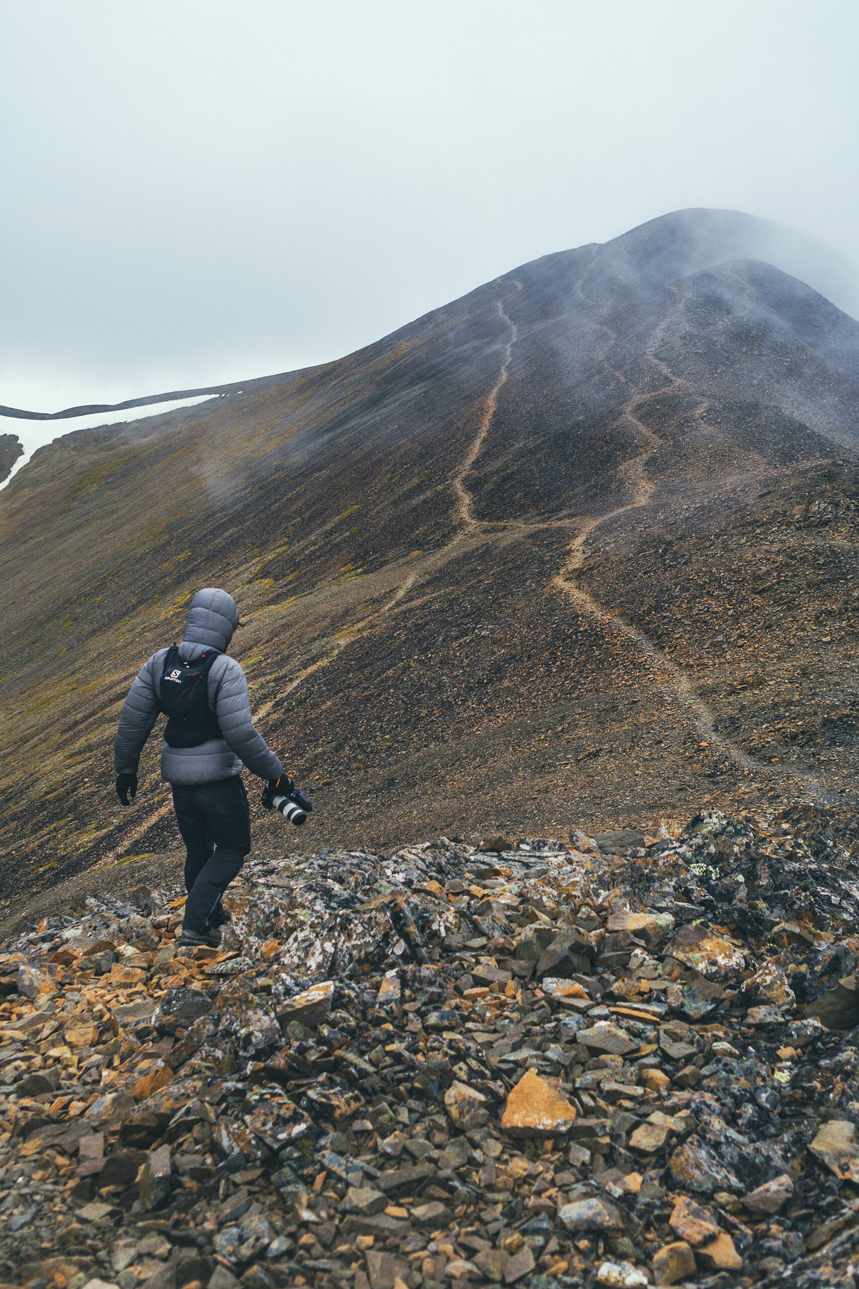
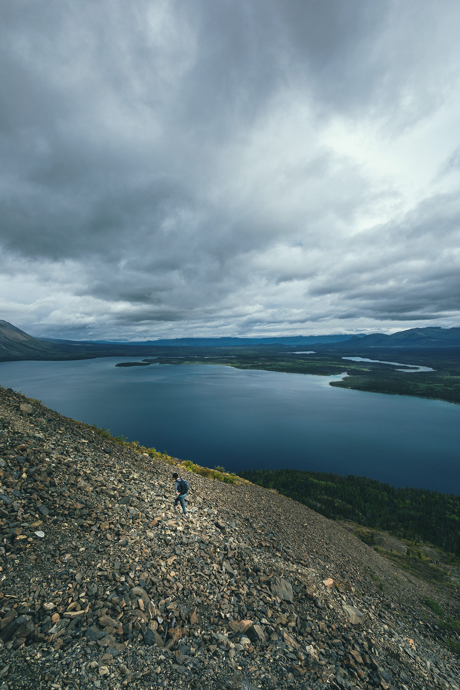
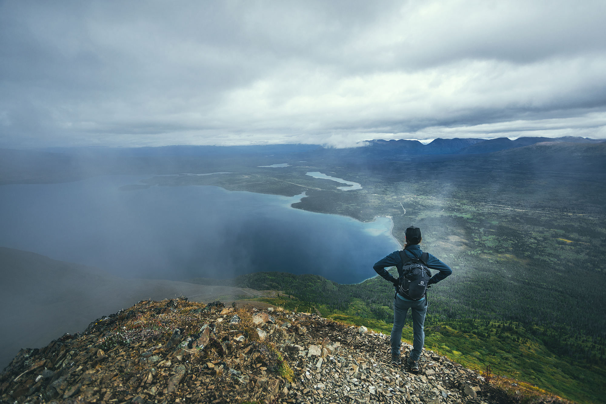
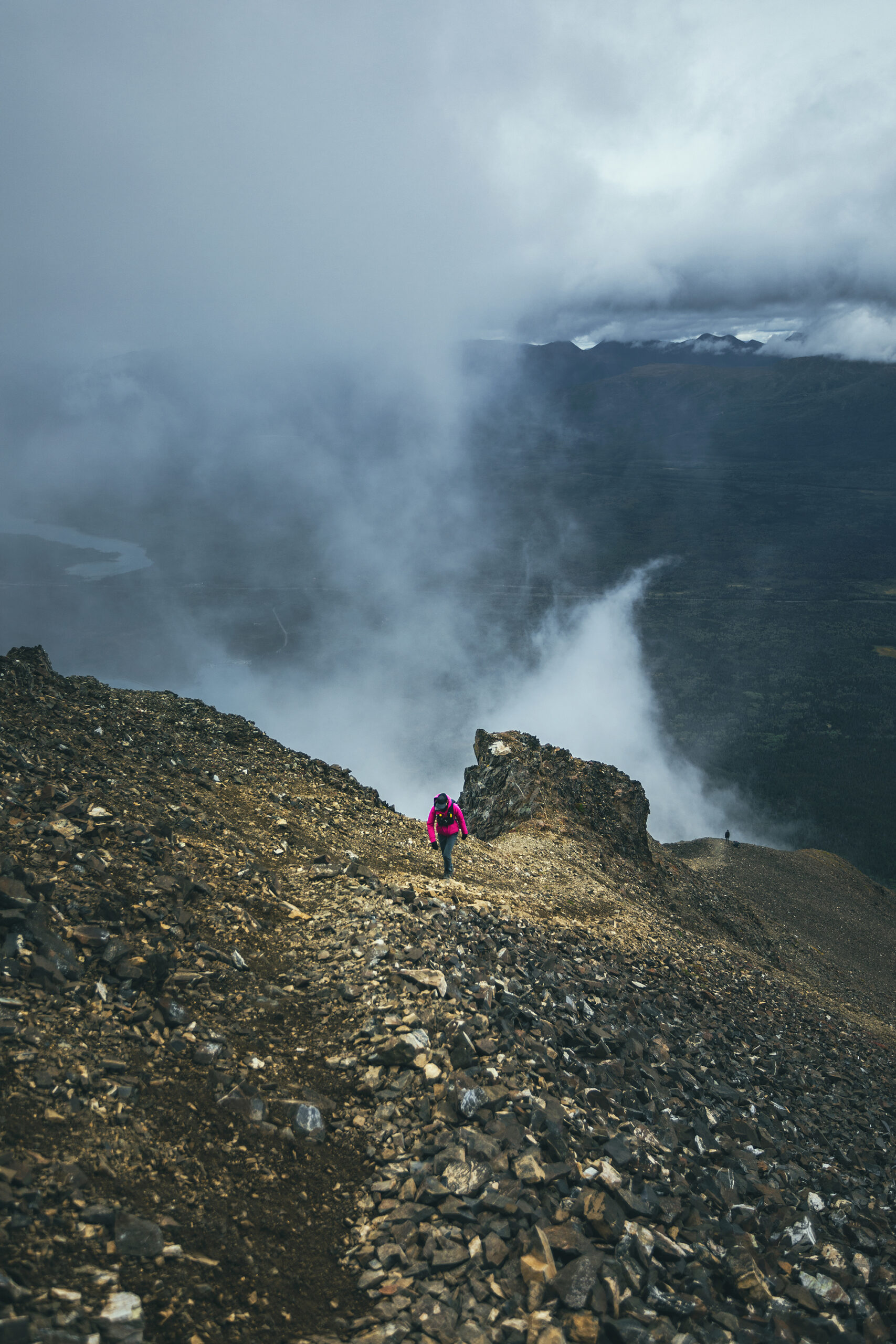
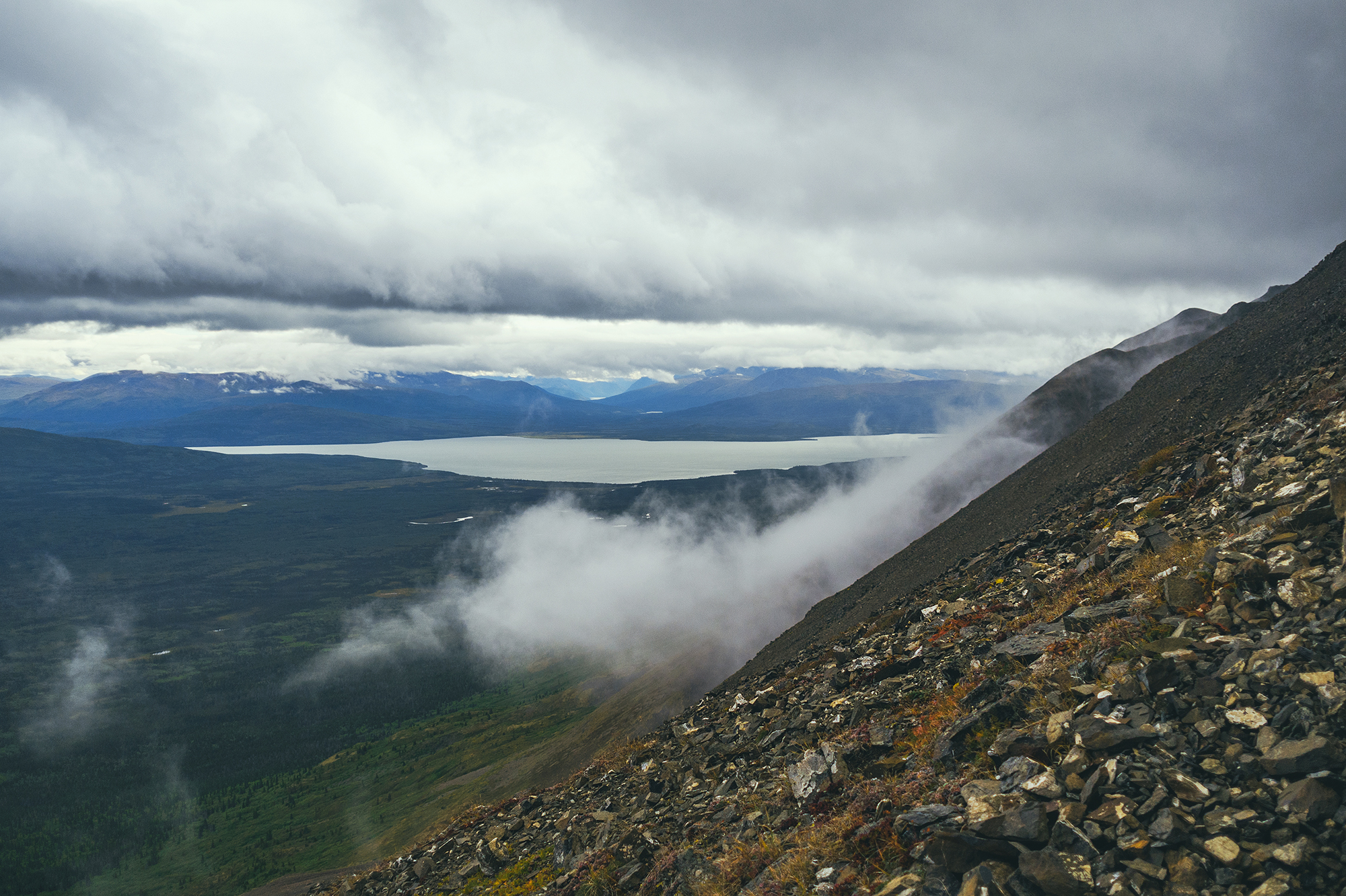
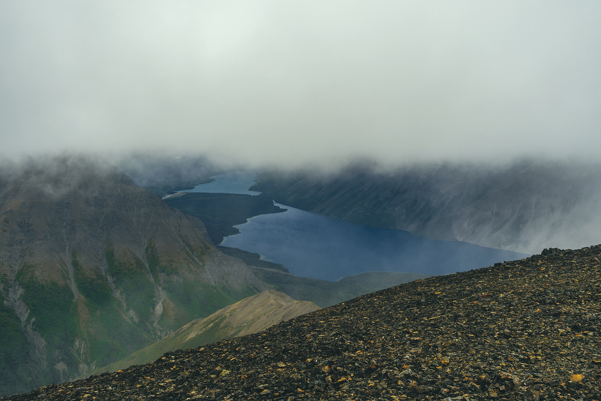
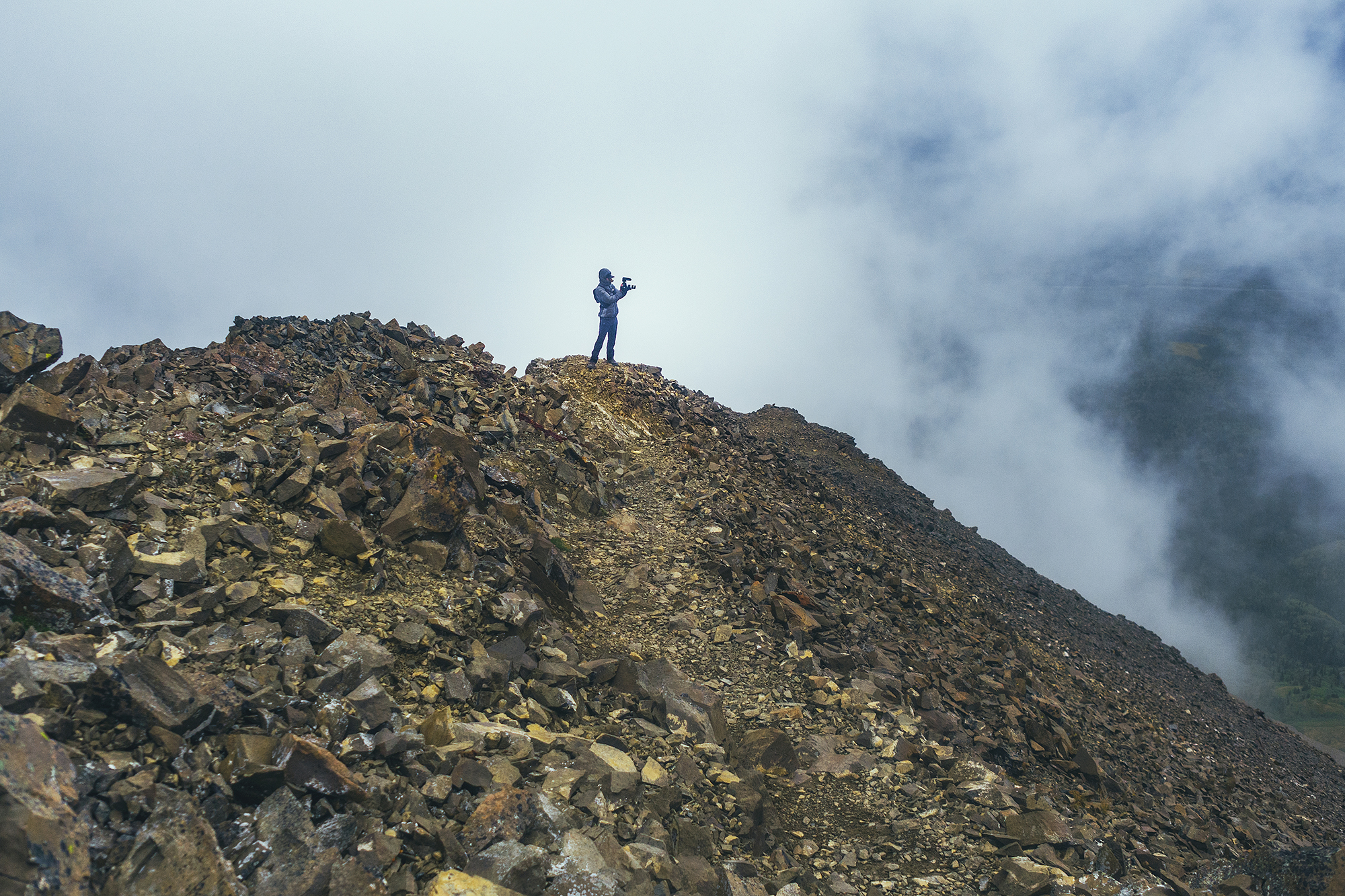
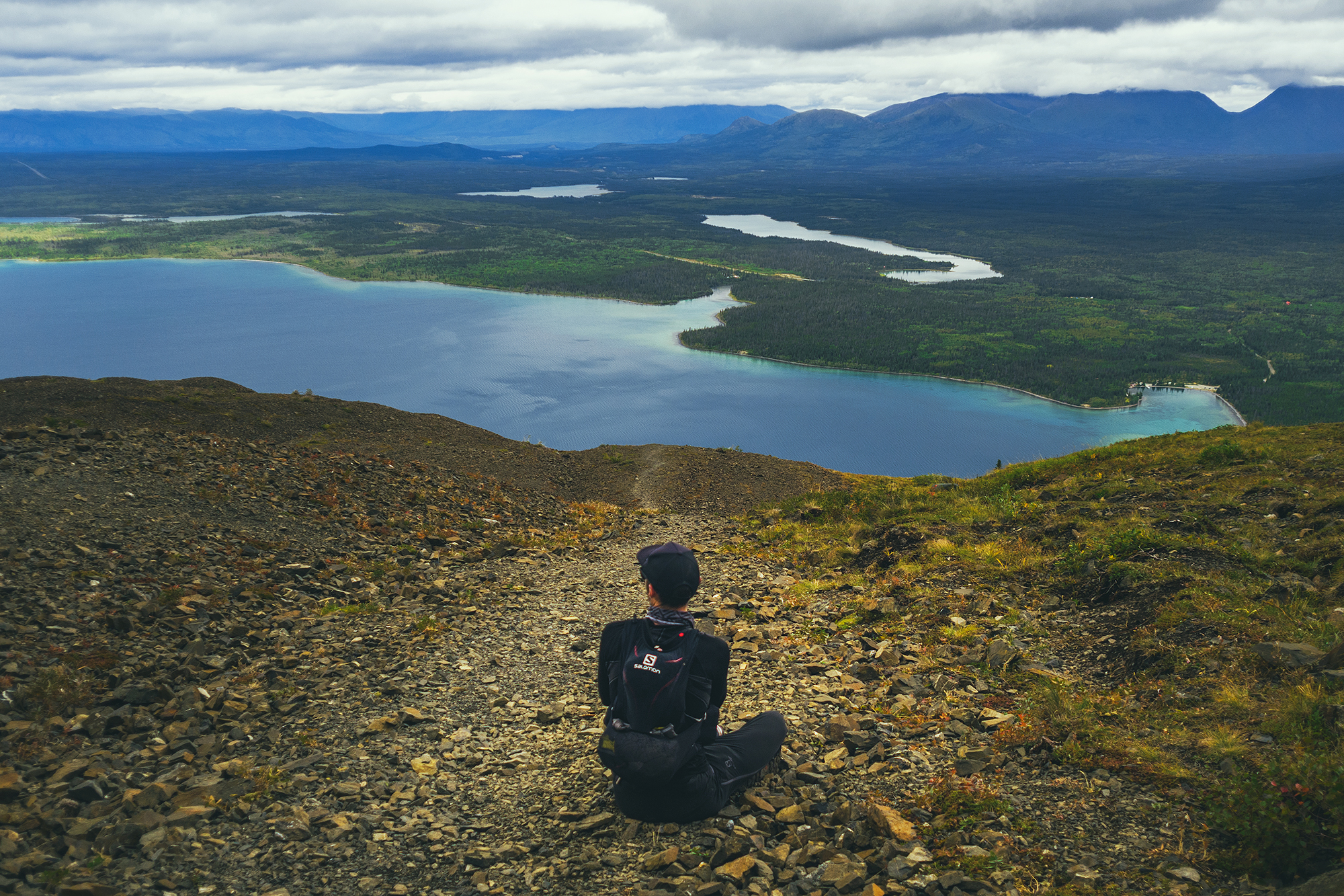
The official summit is technically the far end of the ridge, opposite to where we climbed, and we debated how far to keep going as we were basically traveling in a cloud, with little to no view. We did get a peek at the far section of Kathleen lake, as clouds parted on the other side of the ridge. Eventually we made it to a section where someone had built a small shelter out of stacked rocks.

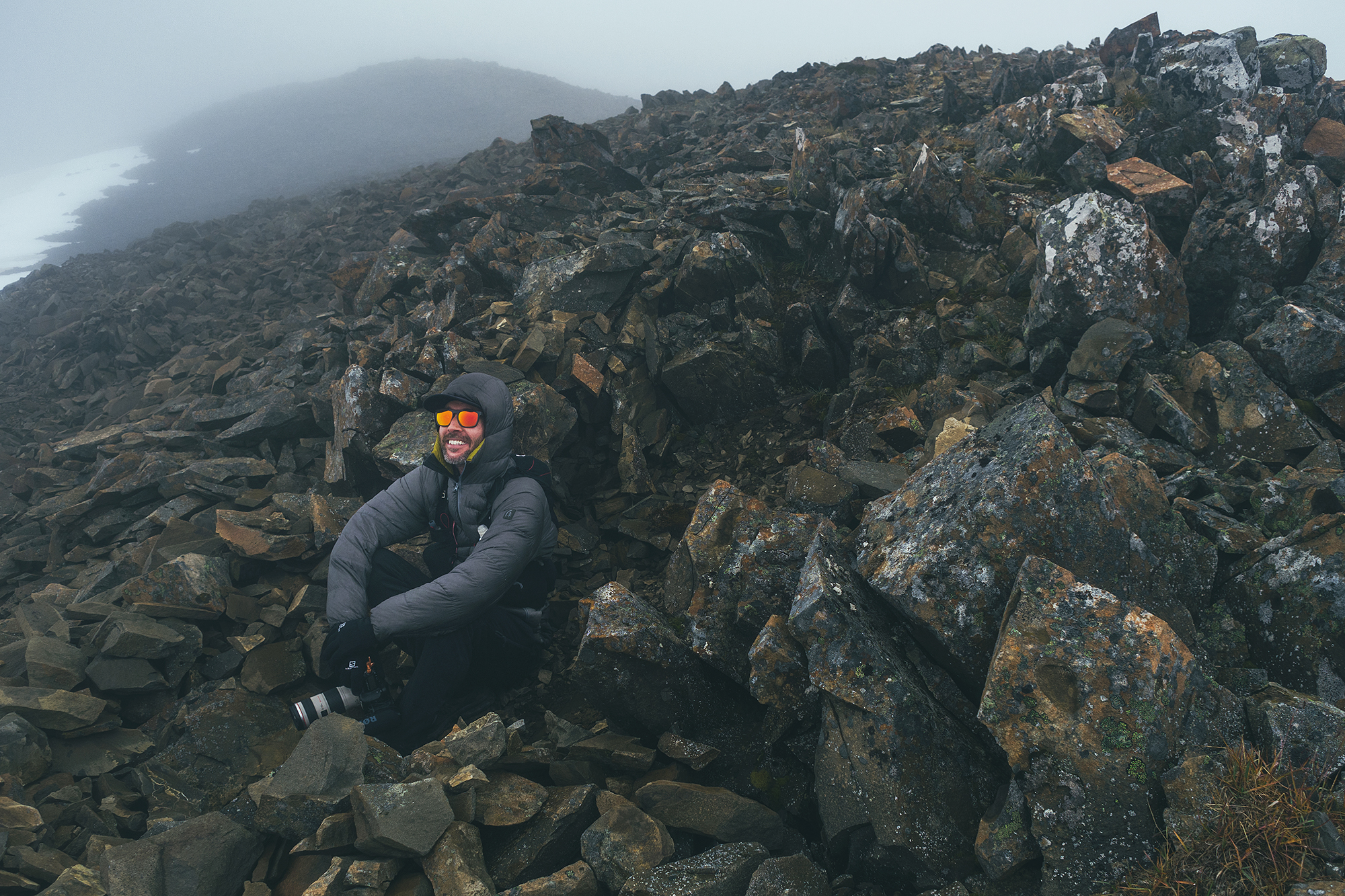
The wind was pretty brutal on the ridge but completely absent in the shelter. We decided this was a good point to turn around. Based on distance, we were at least 1km away from the official summit, maybe more. And at that point, the lack of views didn’t really make it seem worth continuing. A few people passed us, heads down, trudging to the summit, but we decided to turn around without any regrets.
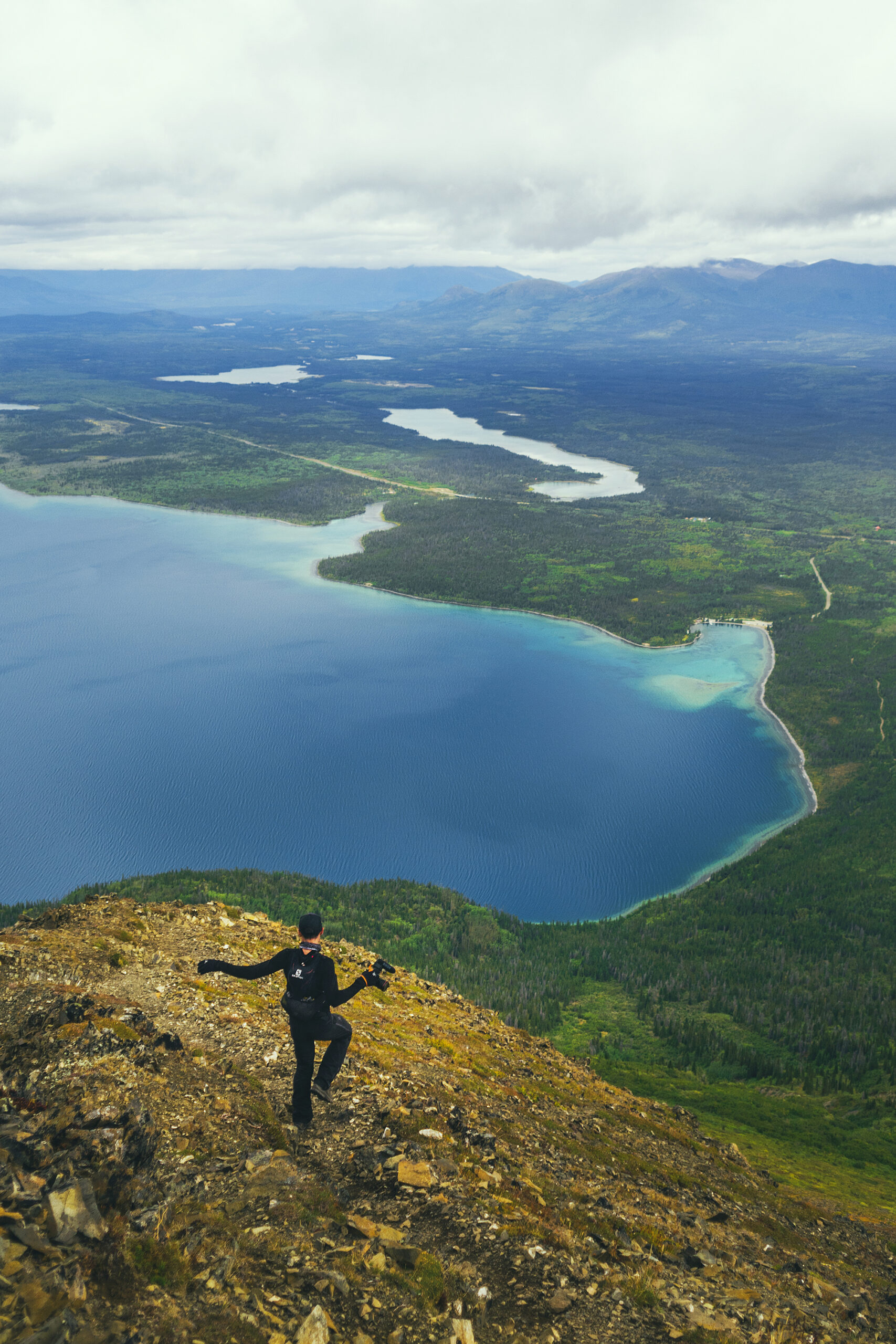
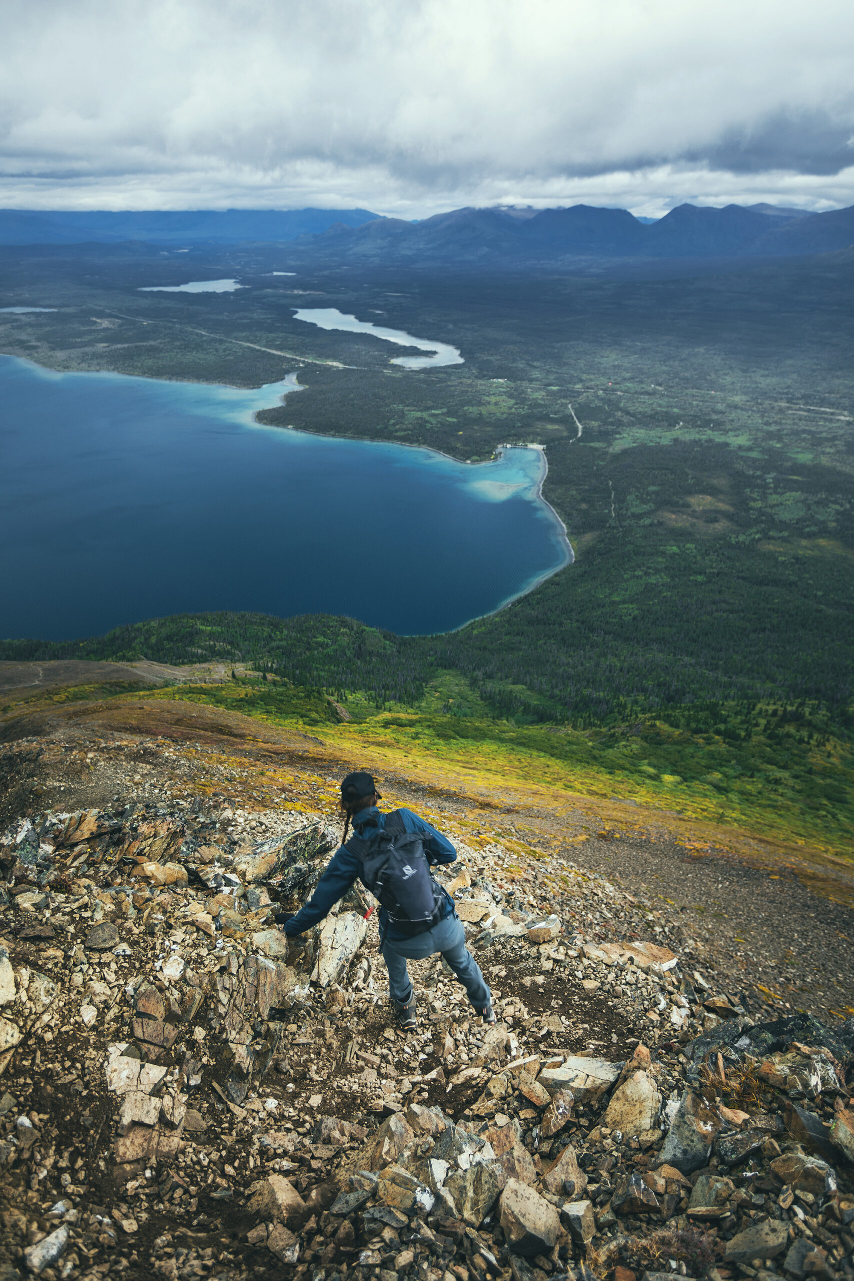
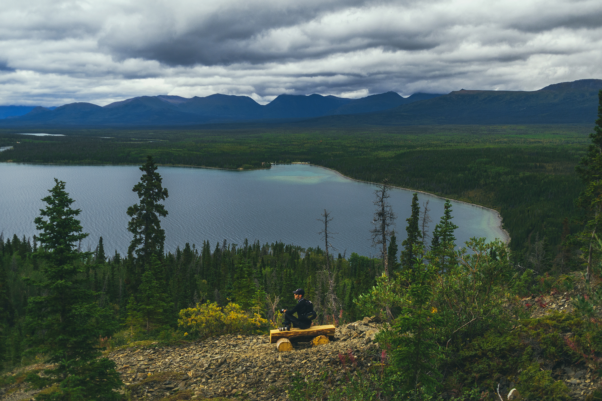
Two hours later when we were back down, sitting by the lake for a snack, and it looked like the summit had cleared but there were still dark menacing clouds above the whole ridge. In any case, we were pretty happy with the hike and the views we got over Kathleen Lake.
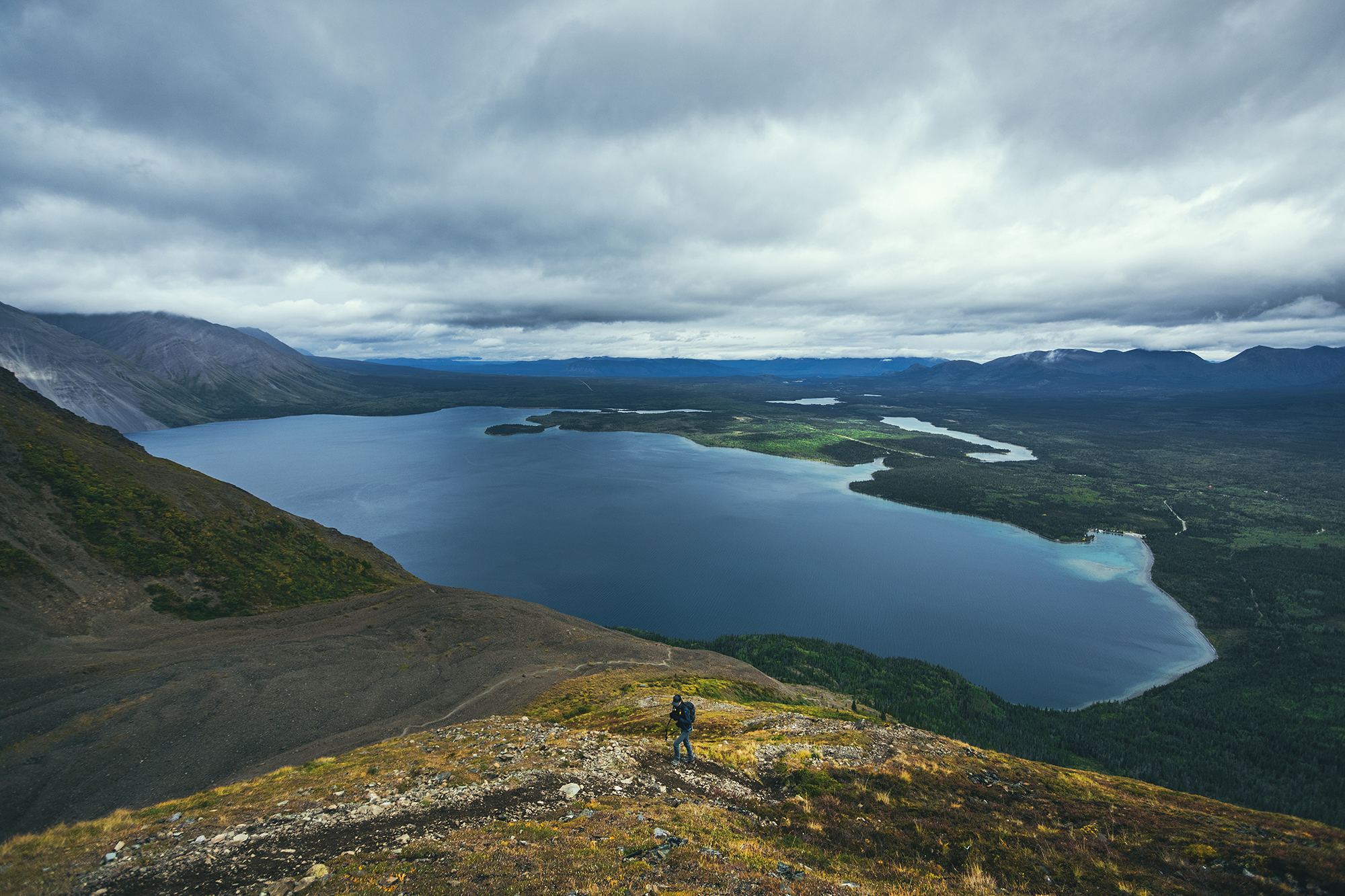
It took us 3h20min to go up, with a couple of breaks, and about 2h 20 to come down. I would assume continuing to the summit would have added 1-2 more hours to this. The way down was actually more challenging I found, due to the slippery terrain – And I swear the last 2kmm on flat were way longer than when we started ! (Brice thought so too!). In the end we clocked 13km with 1324m of elevation gain, so a decent day out!
We had snacks at the day use area by the lake, then headed back to camp for the evening.
We had been pretty fortunate with showers so far, finding accessible ones in a lot of campsites or nearby, but nothing of the sort at Kathleen Lake, so sponge bath it was, to rinse off the hike (the lake itself was way too cold and windy for me to go in).
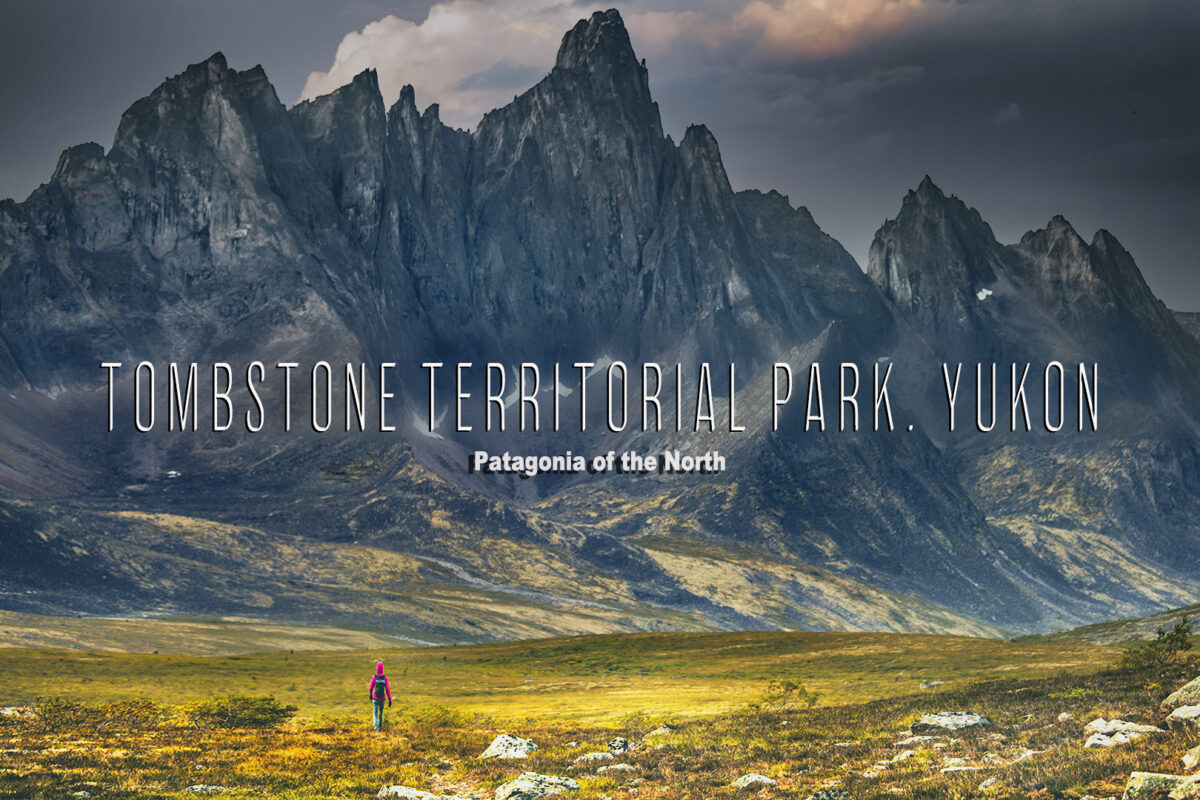
Here is a 25 minute video of our backcountry adventure around Tombstone Territorial Park, YT.
Thank you for watching!
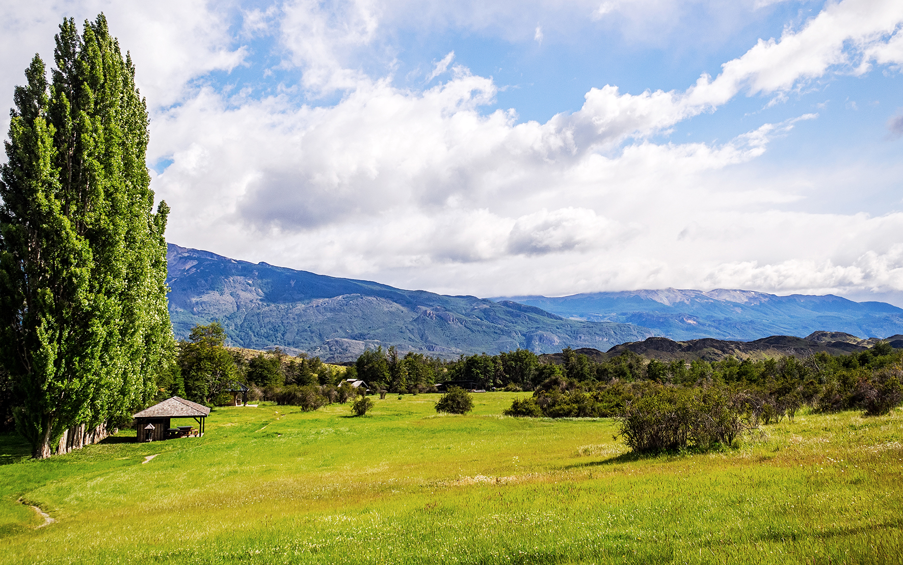
The wind blew really strong that night, and then from steady light rain, it started to pour buckets. It was still pouring when we got up the next morning, which meant that most likely no boats were going out to the marble caves today, which Ricardo confirmed at breakfast. So we decided to forgo the caves. Instead we stayed at the campsite a bit longer in the morning, chilling by the fireplace and enjoying the company of the other travelers. It was nice to take a moment to just pause and hang out, after being on a constant move for the last 5 days. We drove down the road a bit further past Nutria, taking in the wet and foggy nature, then headed back towards Puerto Rio Tranquilo. After getting some more food, we hit the road to continue our journey.
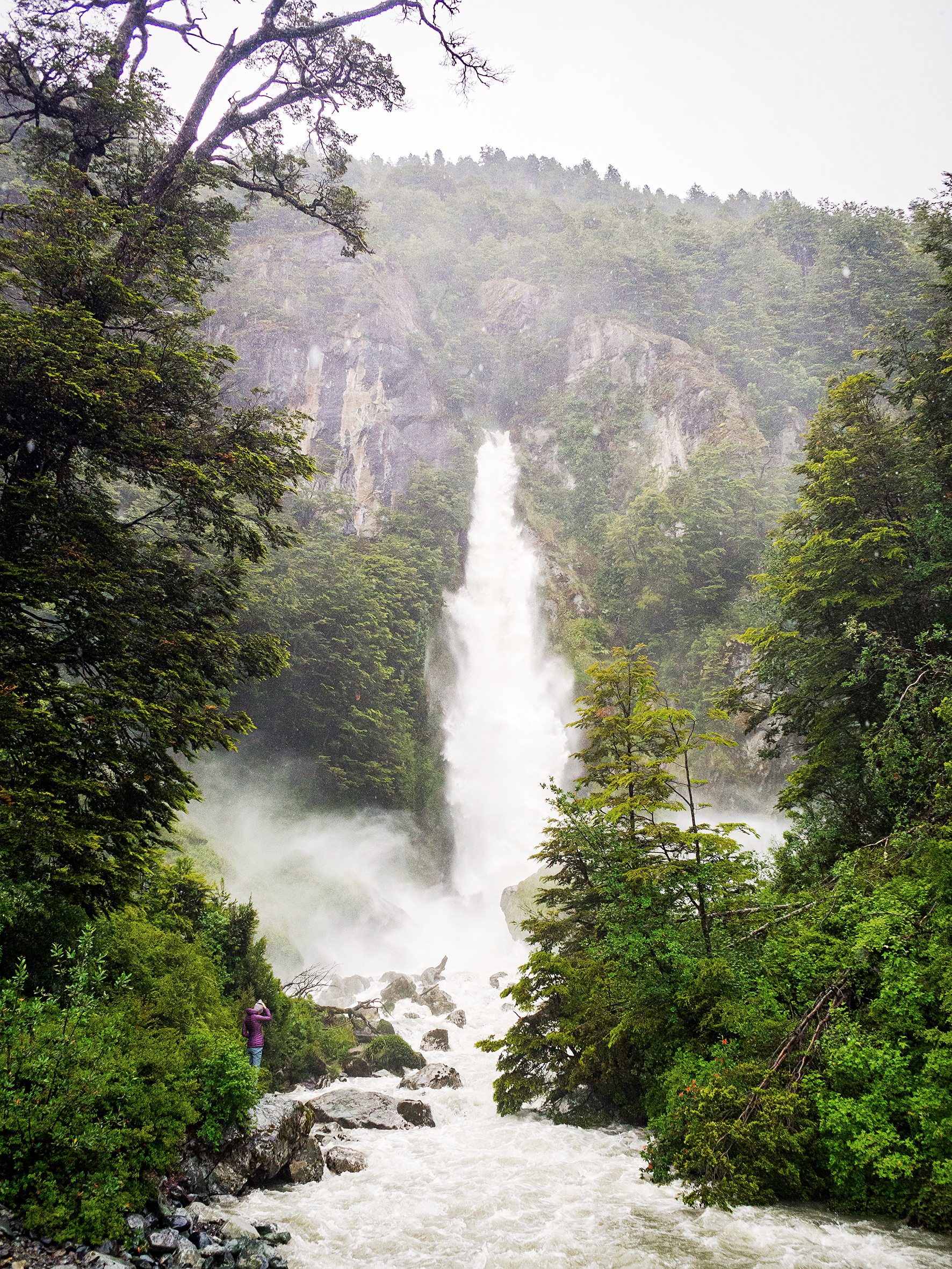
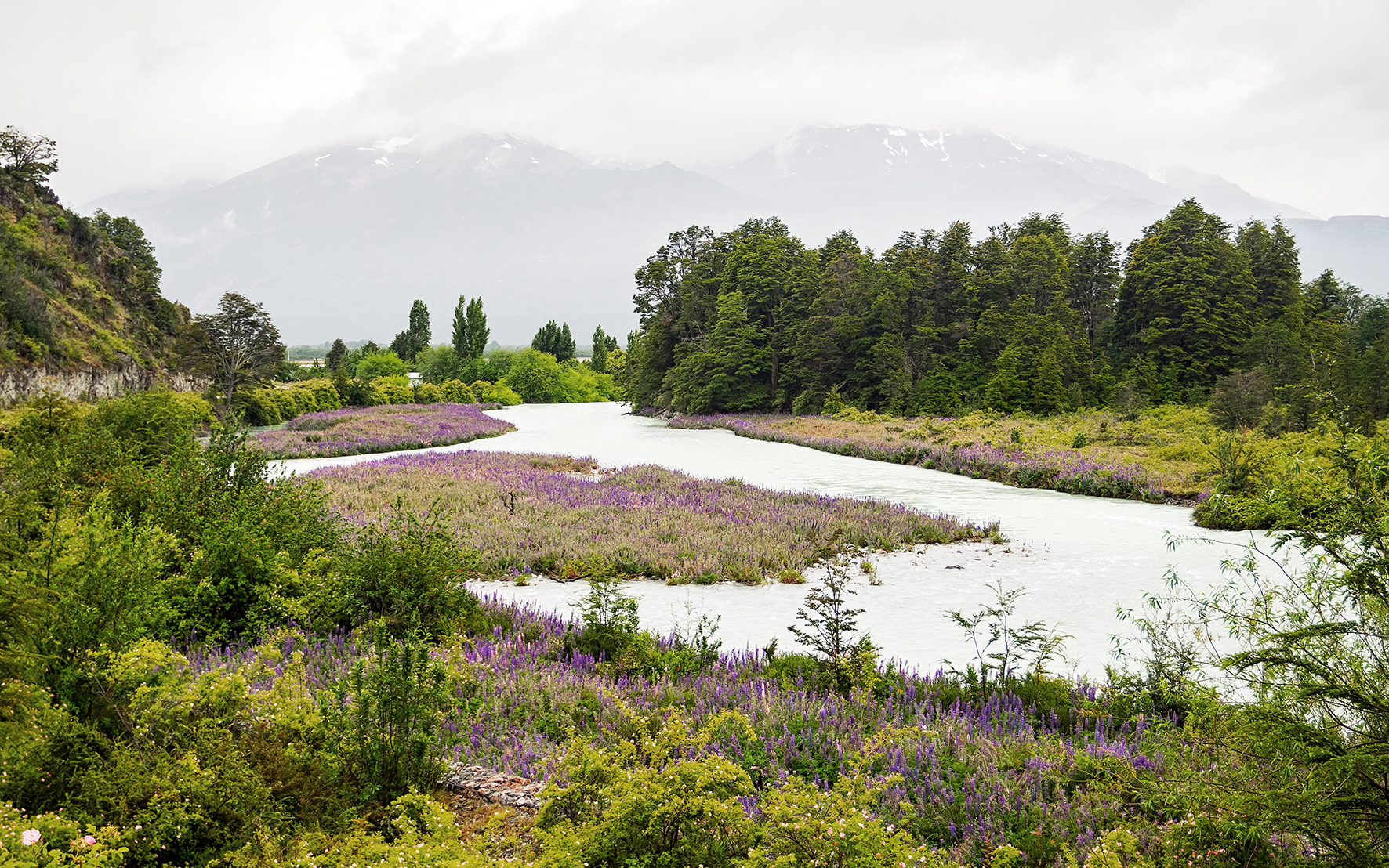
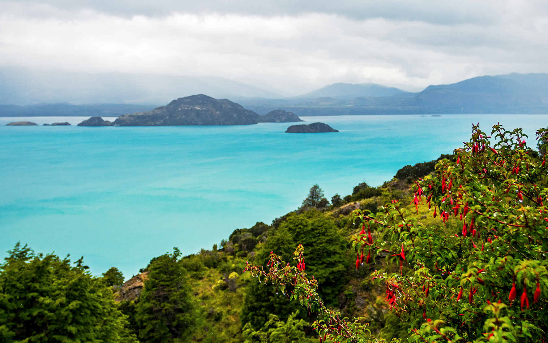
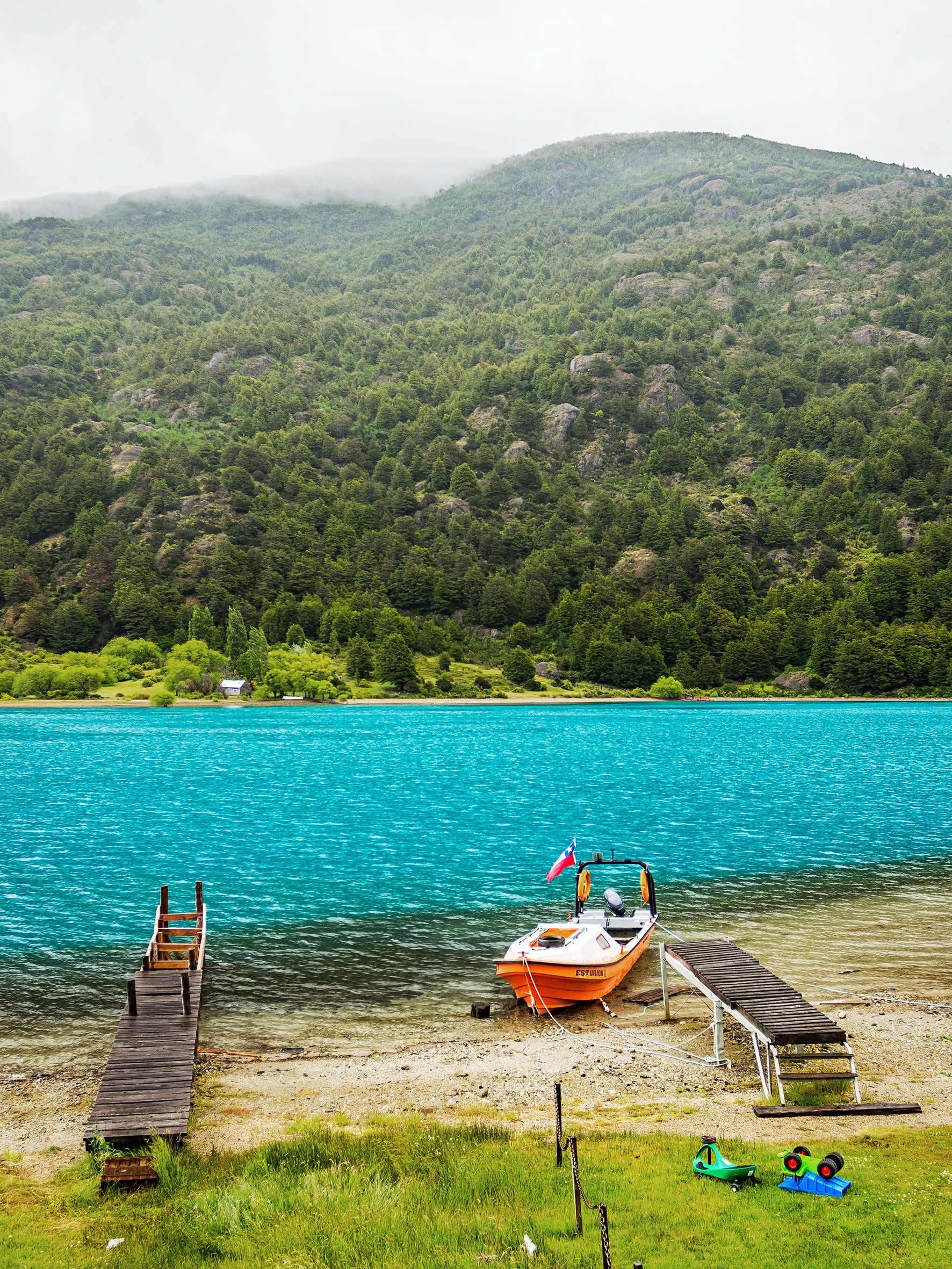
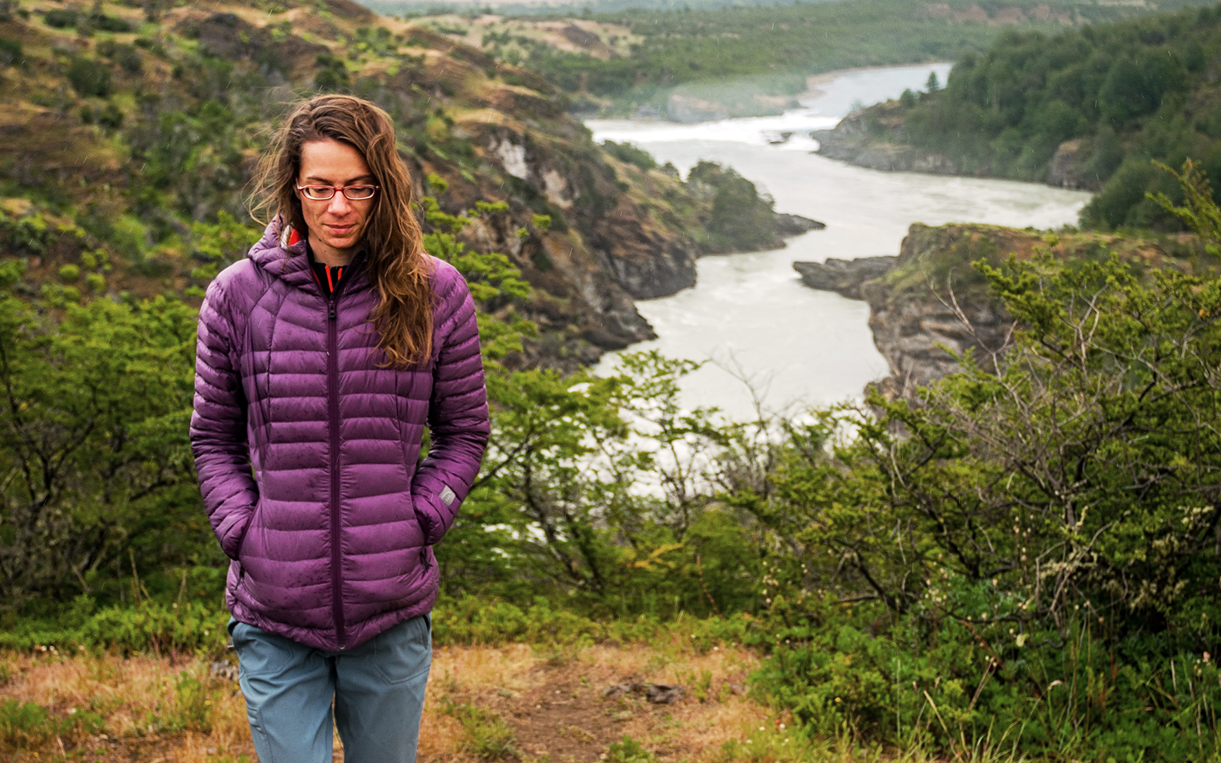
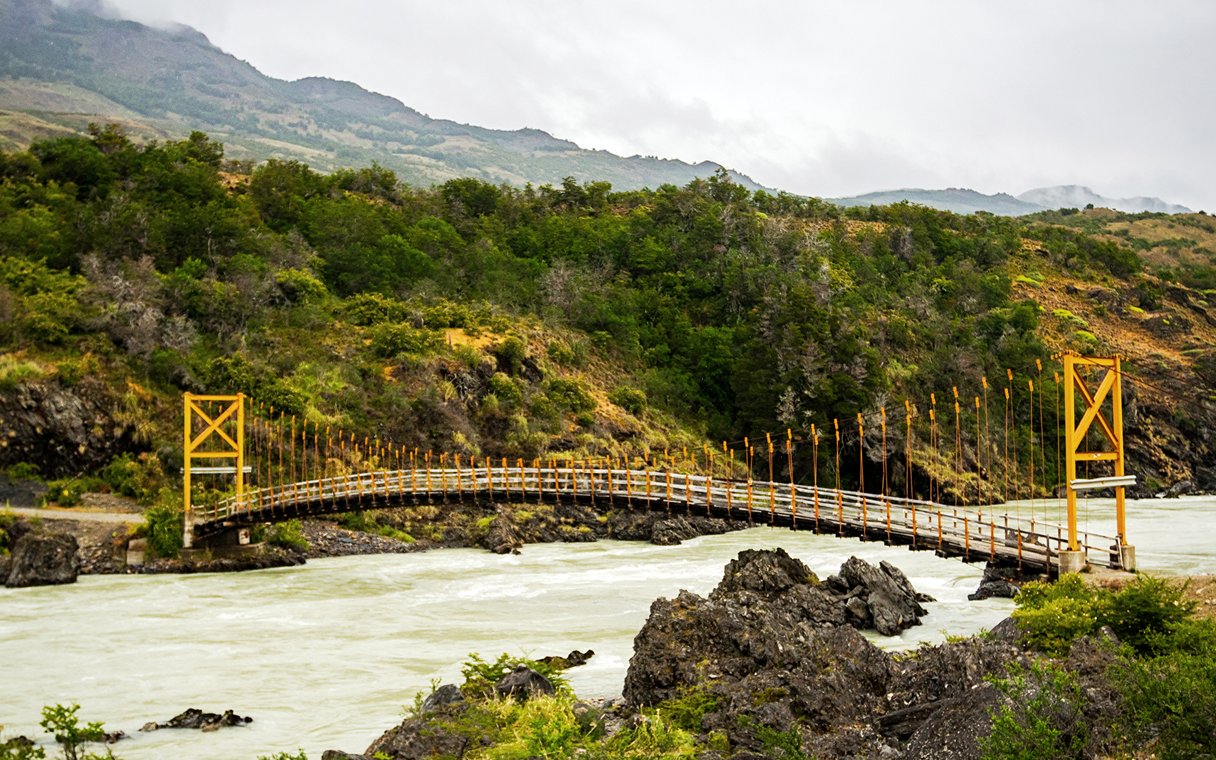
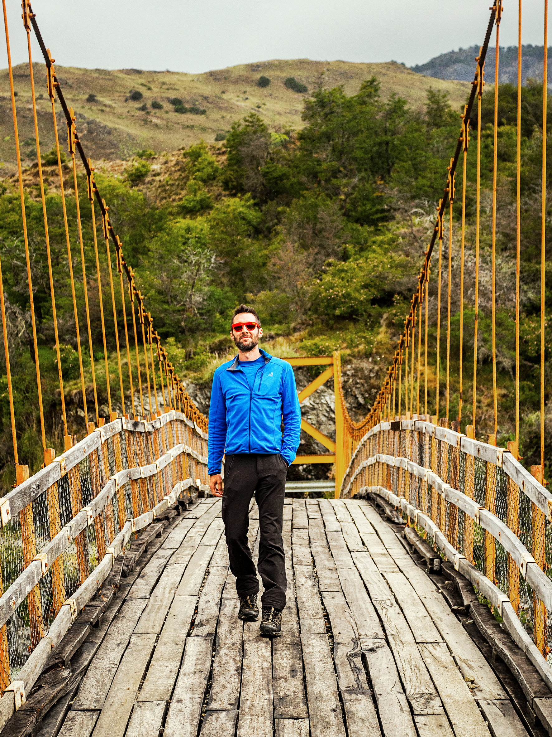
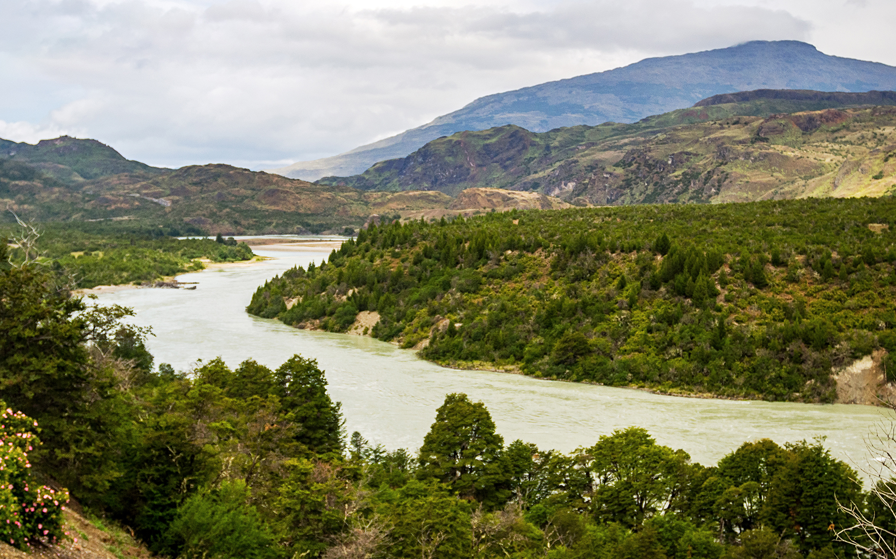
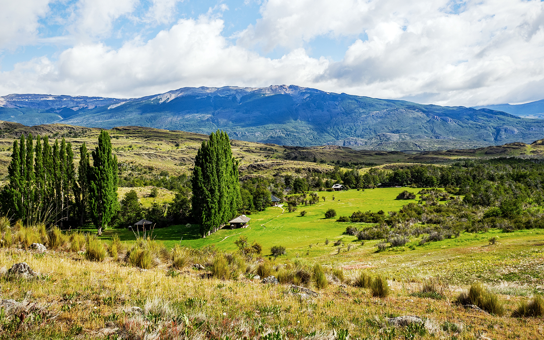
The plan was to drive to Parque Patagonia to camp, then do a hike in the morning before crossing the border to Argentina. The road to Parque Patagonia was every bit as scenic as the previous days. We made many stops on the way to admire the stunning views of Lago Bertrand and its teal blue water, and the confluence of Rio Baker, and took a small detour to check out the cool pasarela crossing over Rio Cochrane at the bottom of La Peninsula.

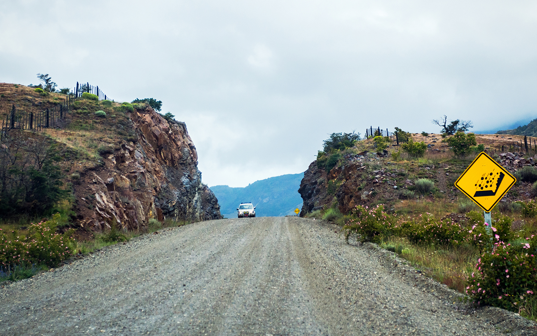
The car we rented (a Nissan Tilda), was the most affordable option available but definitely not the most ideal choice for the type of road we were on, and it took quite a beating on the dusty, pot-holed, corrugated Patagonia road. But in the end it took us from point A to point B without failing and we came to really like our slightly awkward and inadequate little ride….

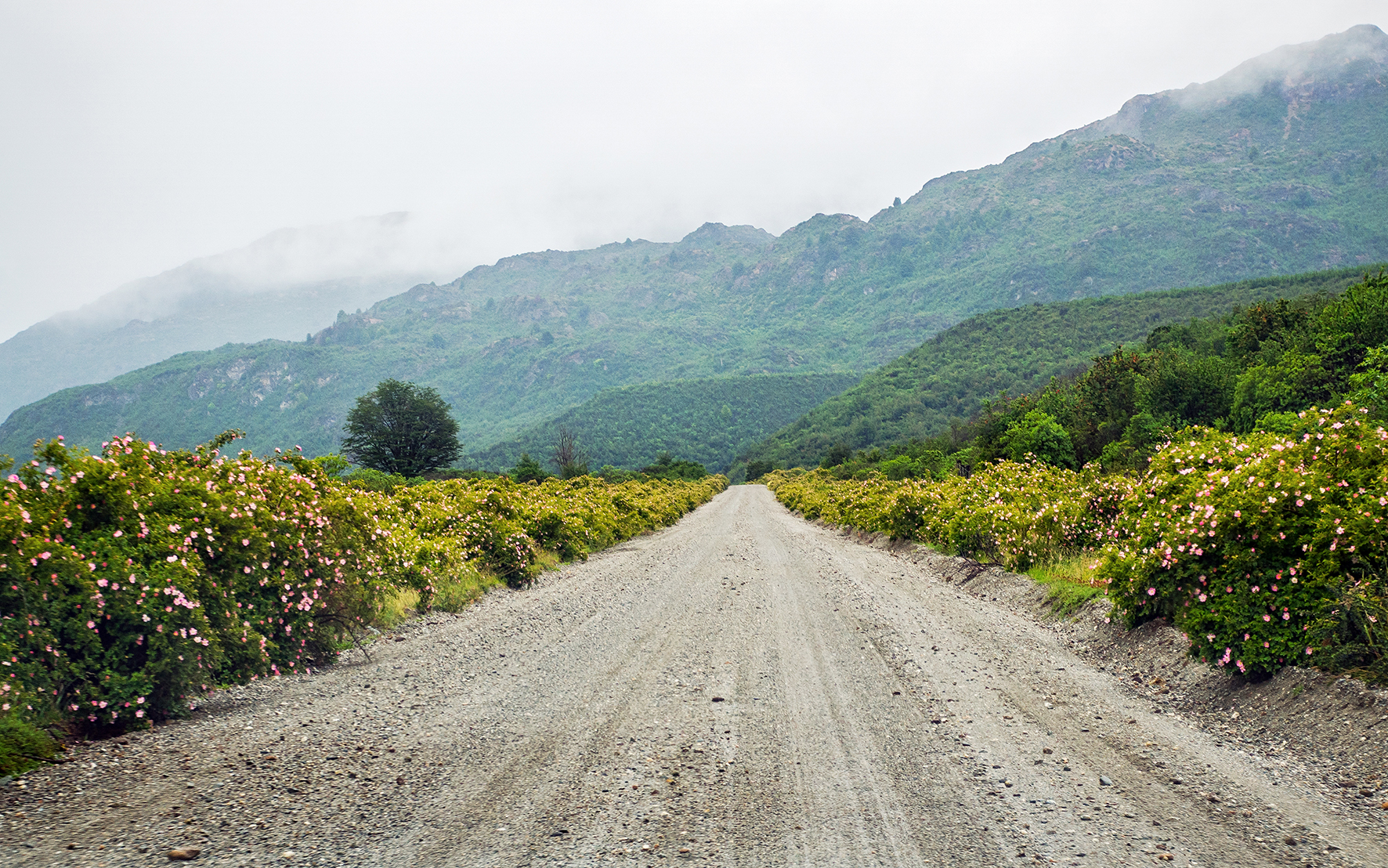
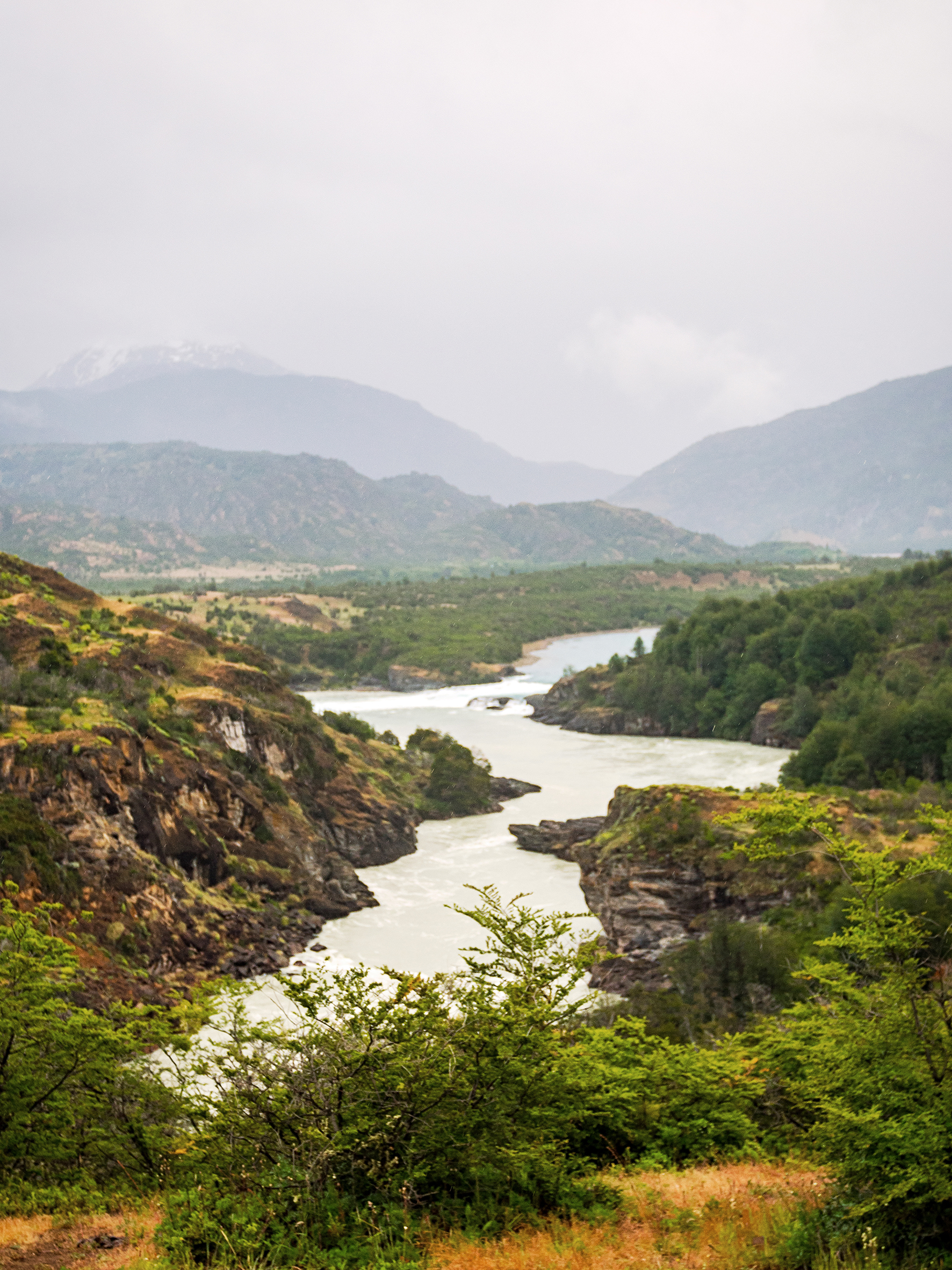
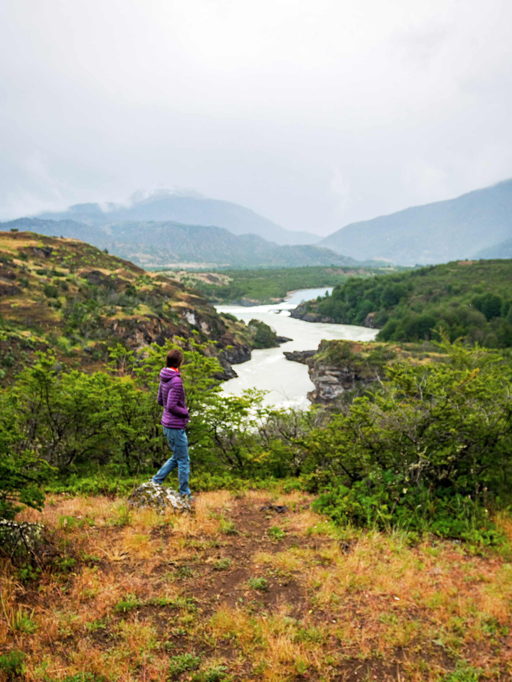
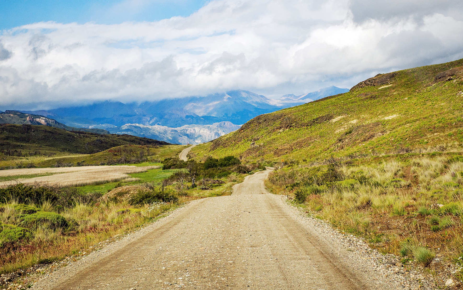
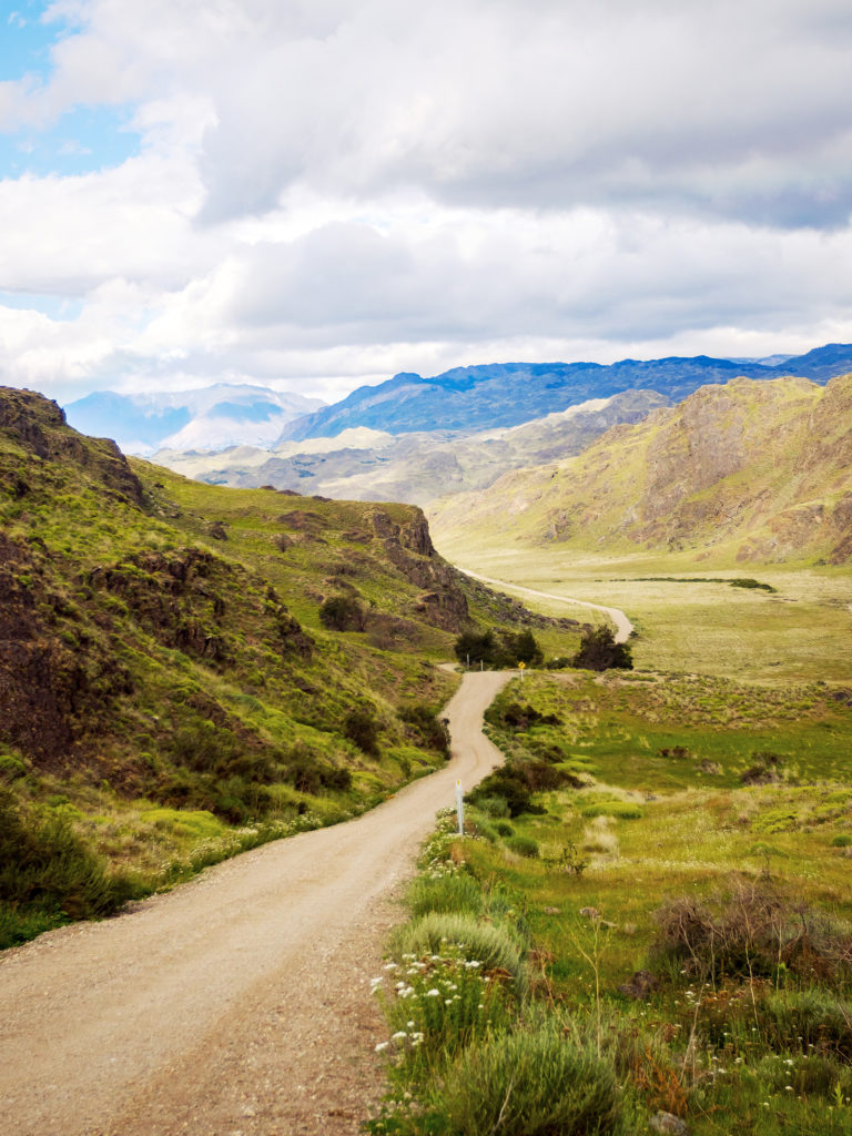
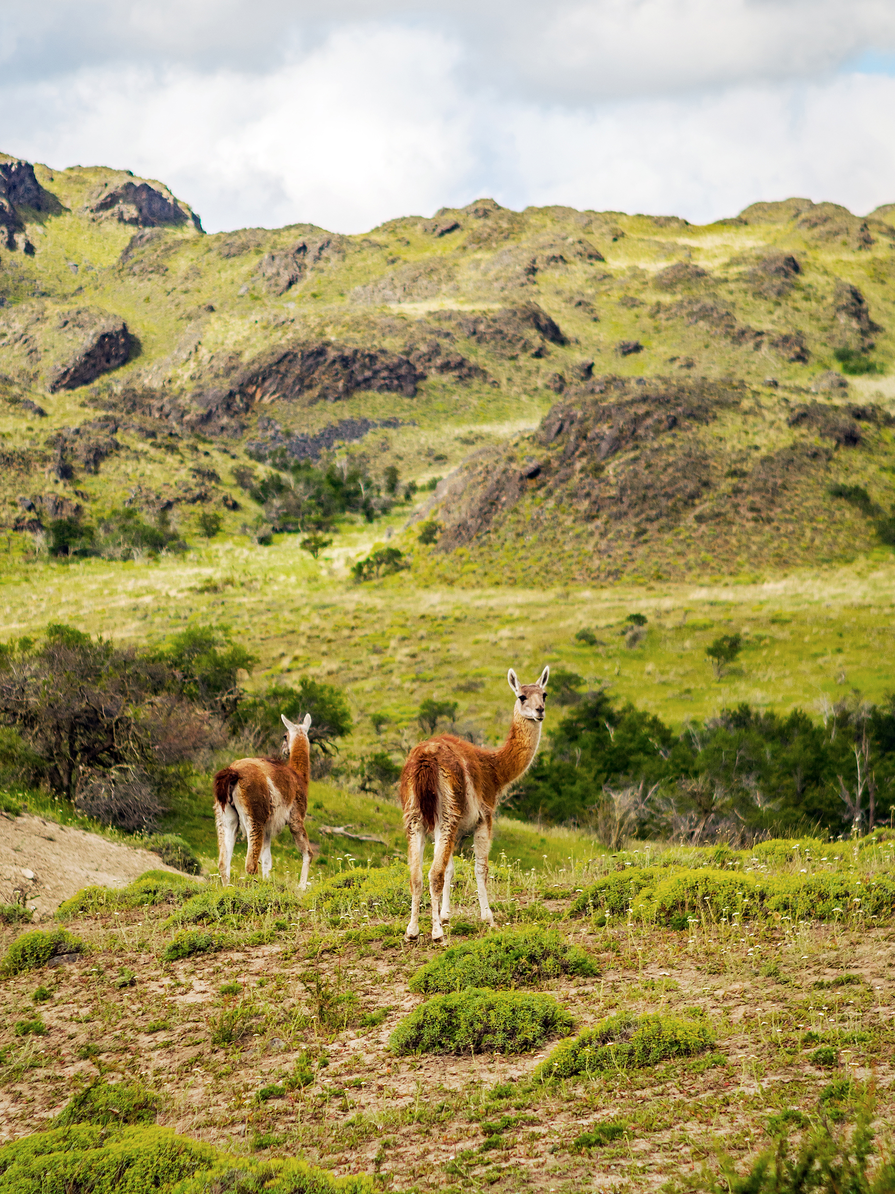
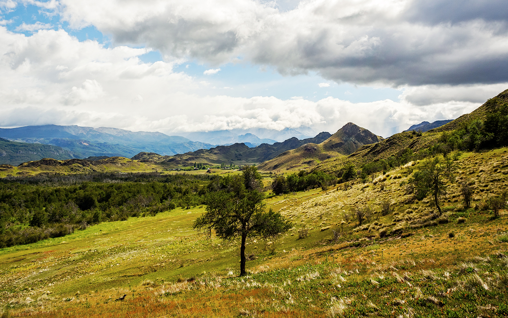
The landscape started to change as we left the Carretera to turn off onto X-83 road, taking us into Valle Chacabuco. Changes in the vegetation became more apparent as well, lush greens and colorful flowers disappeared off the hillsides, now instead speckled by tall wild grass and short round bushes in shades of yellows and browns. In this incredibly vast, more arid landscape, we no longer had to stop for cows on the road, but instead we made the acquaintance of guanacos. With herds grazing all around. they seemed rather indifferent to cars driving up to them.
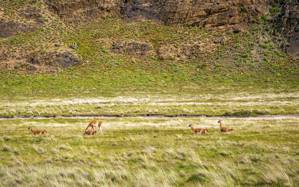
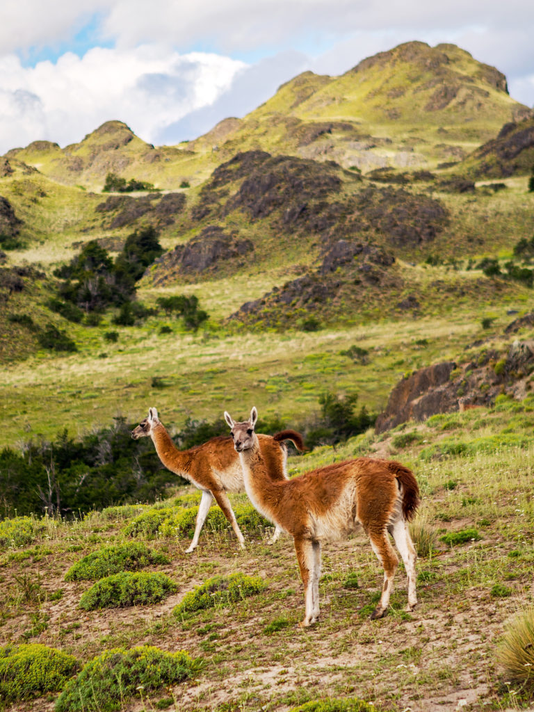
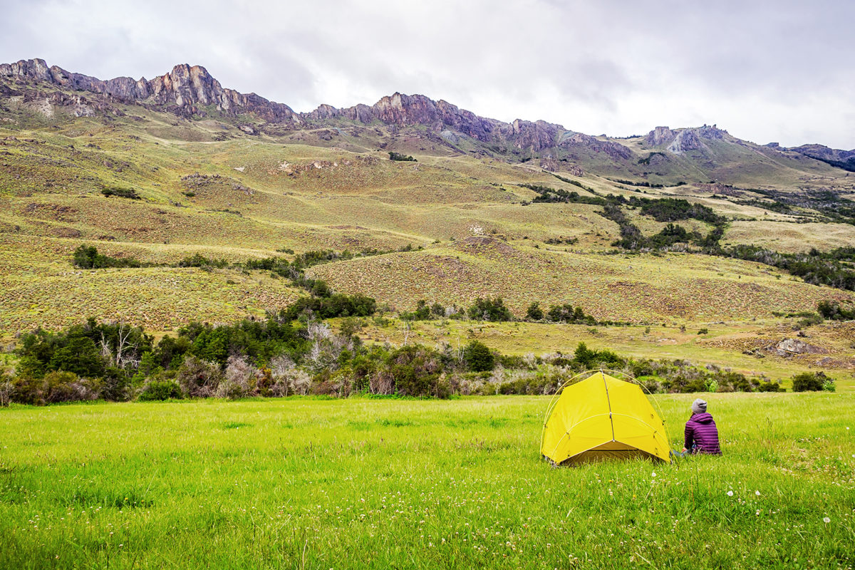
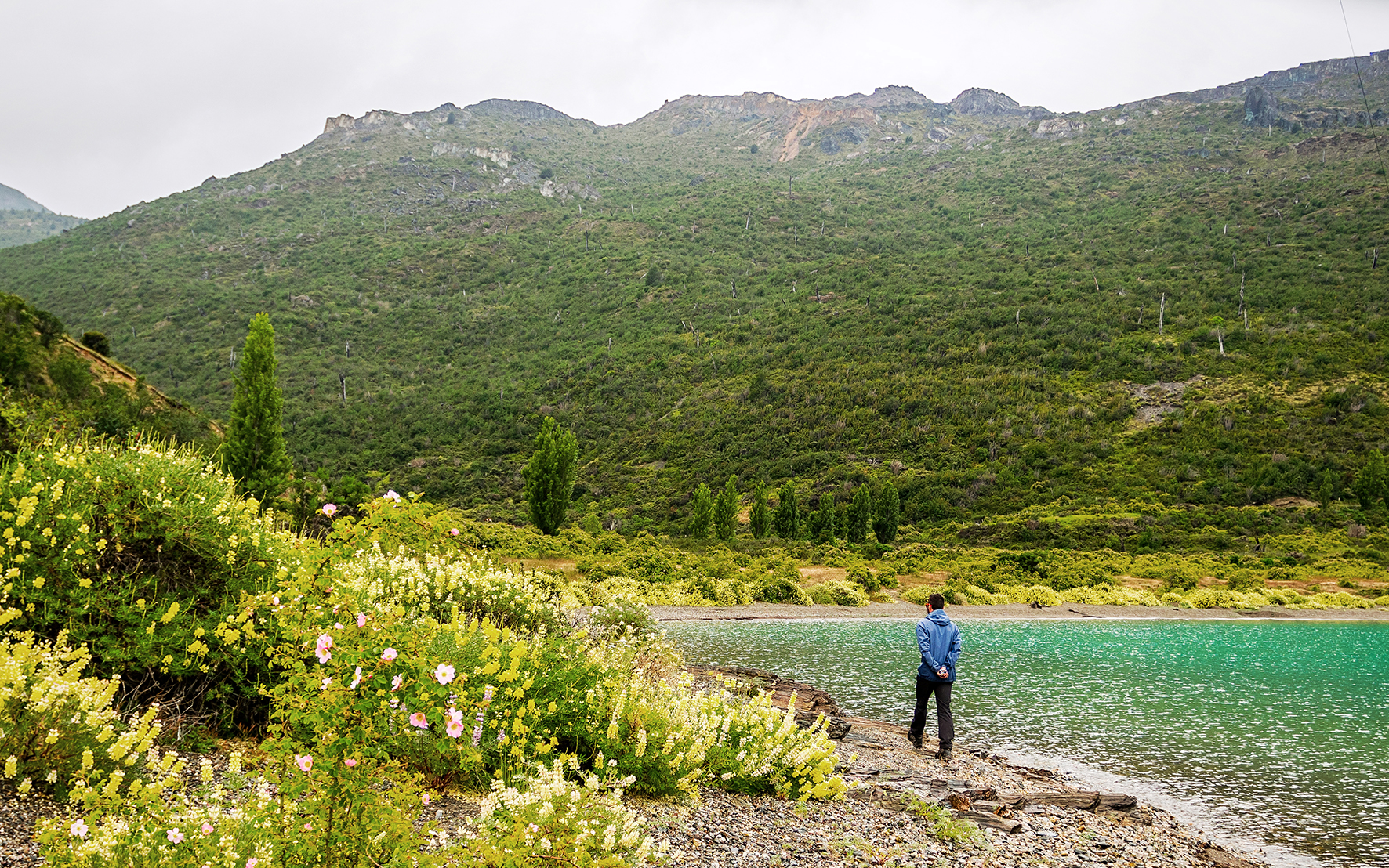
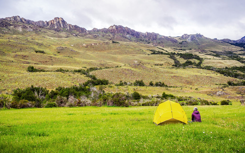
There was only one campsite in Valle Chacabuco, on the road before the Paso Roballos border crossing (supposedly there is another one that was built more recently, but we didn’t know where it was located). We reached it at around 7pm. The price for the night (10,000 CLP per person) almost had us turn around and look for another option, but there was nothing within less than an hour of driving, and wild camping in the park is strictly forbidden, so we decided to stay. The campground came with bathrooms and showers, which were advertised as hot but were most definitely not. Still, the setting was pretty scenic, and the campsites once again very well laid out. We found a spot furthest to the entrance with a large 3-wall hut sheltering a large table and shelves. We had no wind or rain that night and woke up the next day to guanacos grazing around in the field.