Video Recap: Kluane National Park and Reserve – King’s Throne
Our adventures around the world…

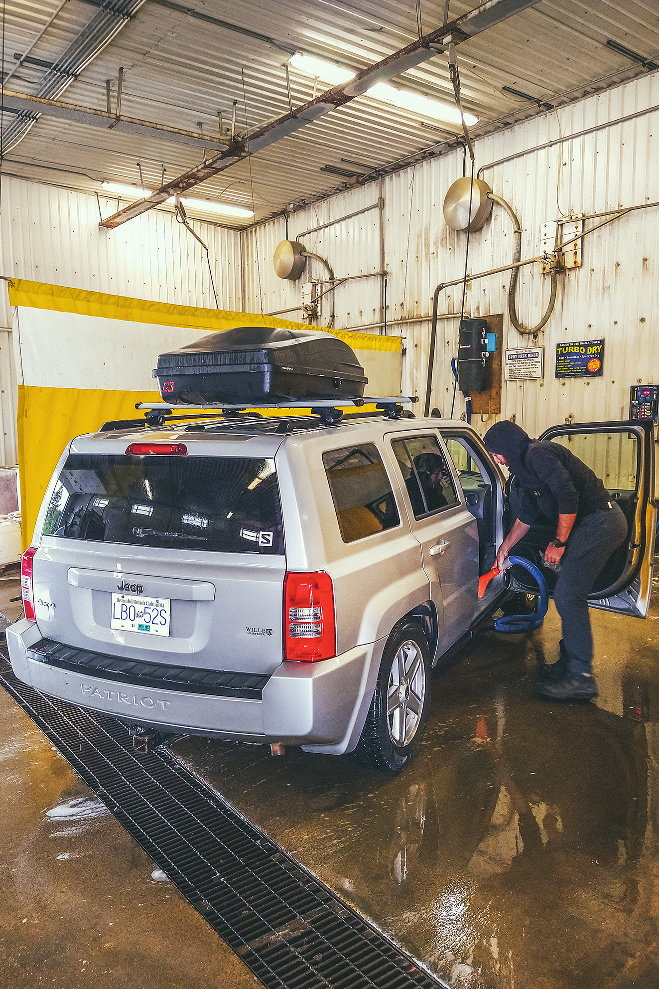
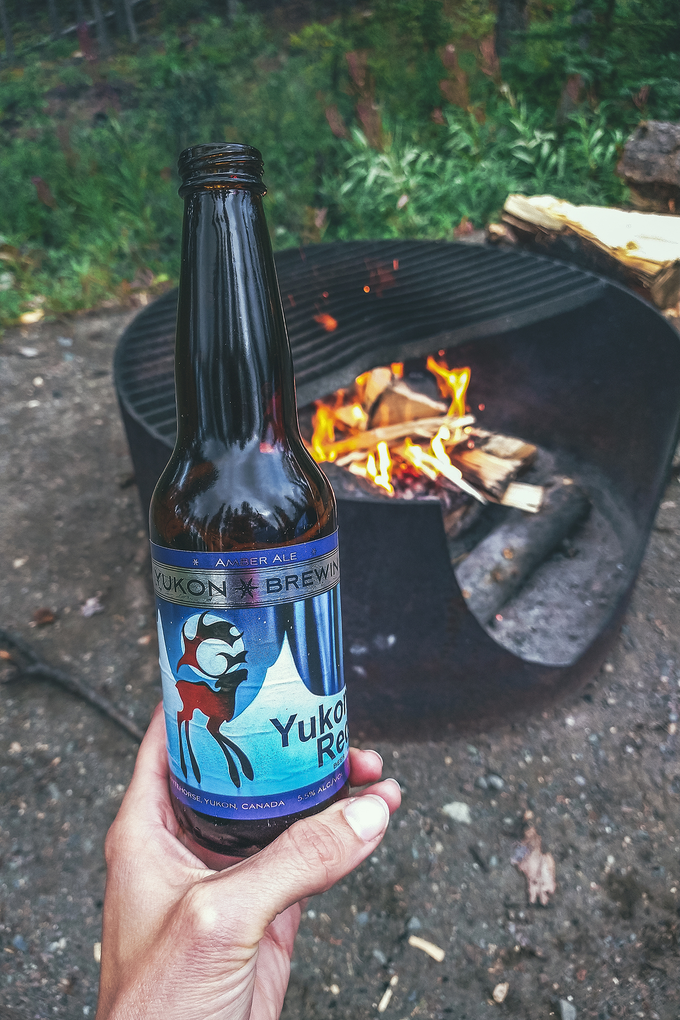
We got up and drove to Whitehorse, where we found a much-needed carwash and re-stocked our food supplies. On the way out, looking for a liquor store we stumbled upon the Yukon Beer store, so we bought a few to try out.
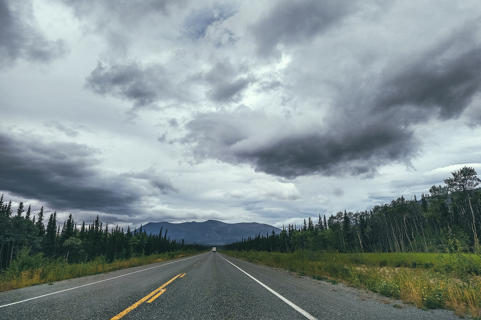
Then we headed towards Haines Junction, a couple of hours west on the Alaska Highway.
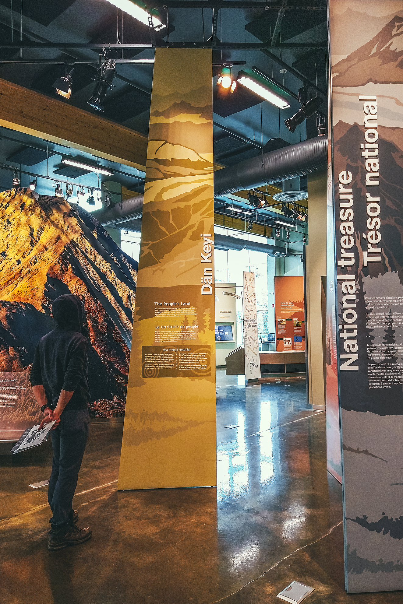
When we got there we stopped at the Visitor Center and went through the exhibit about the Kluane National Park and Reserve, which is a designated UNESCO World Heritage. The Park is home to 17 of the 20 highest mountains in Canada, including the tallest, Mount Logan, at 5959 meters. The park also features the largest non-polar icefield in the world.
We watched a short movie also covering the topic, the land diversity, fauna, and work being done in collaboration between the Kluane First Nation, Champagne and Aishihik First Nations and the Park Staff/Parks Canada administration.
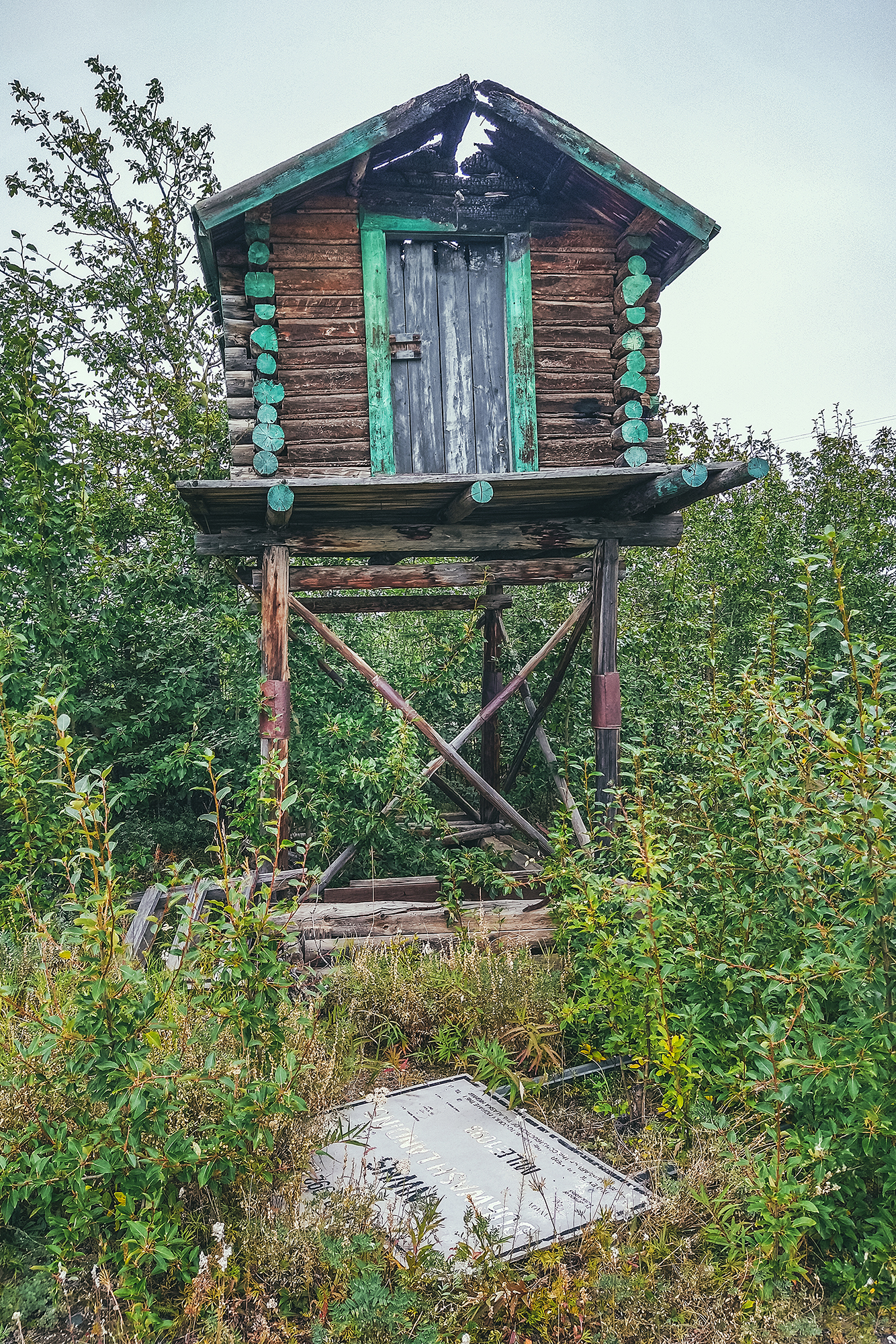
Next to the visitor Center is the Da Kų Cultural center which showcases First Nation Art and Culture, but it was closed due to Covid.
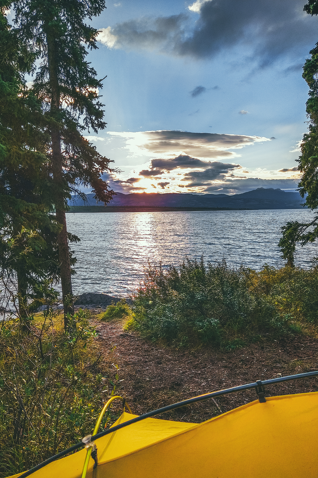
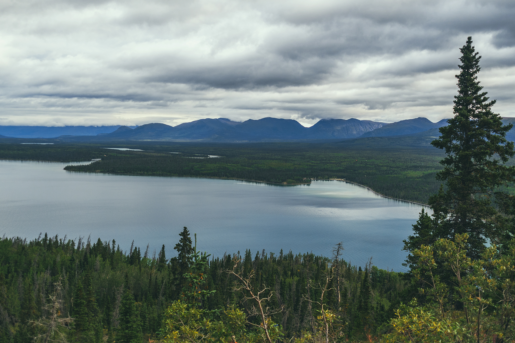
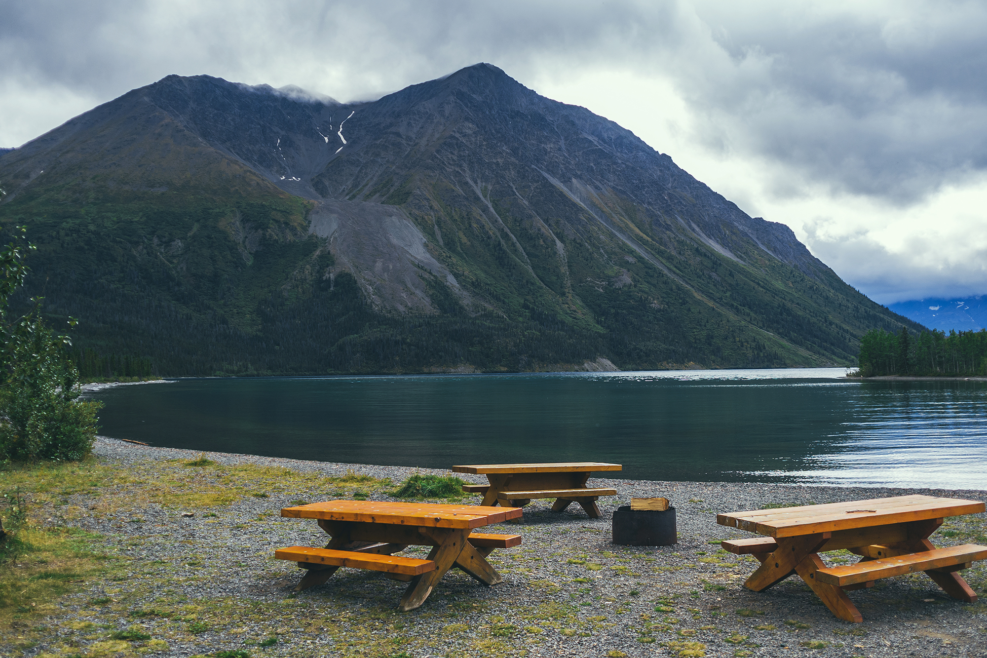
Next we drove to Kathleen lake, where we’d planned on spending the next few nights, while we explored the Kluane Area.
The forecast suggested rain that day, and nicer conditions the next, so we decided to take the drive to Burwash Landing and wait for the nice day to do a hike.
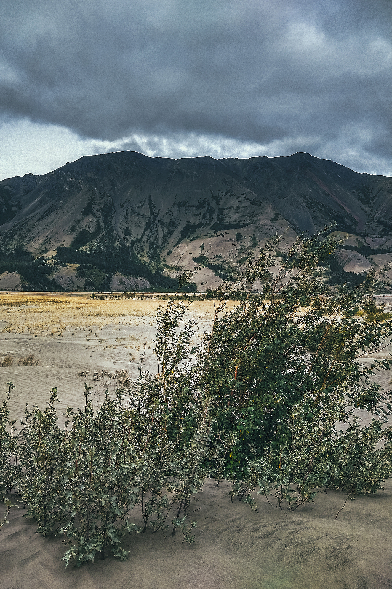
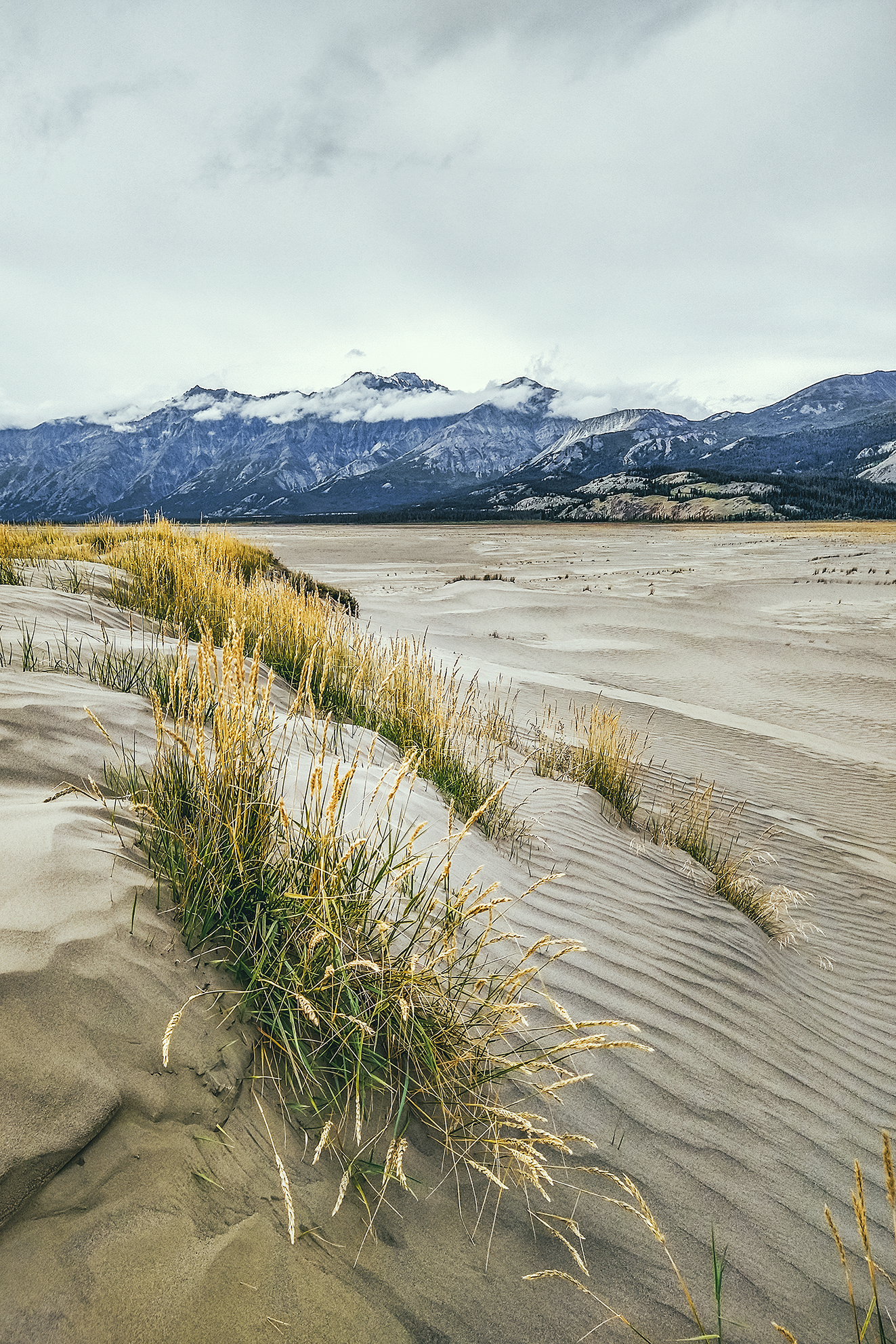
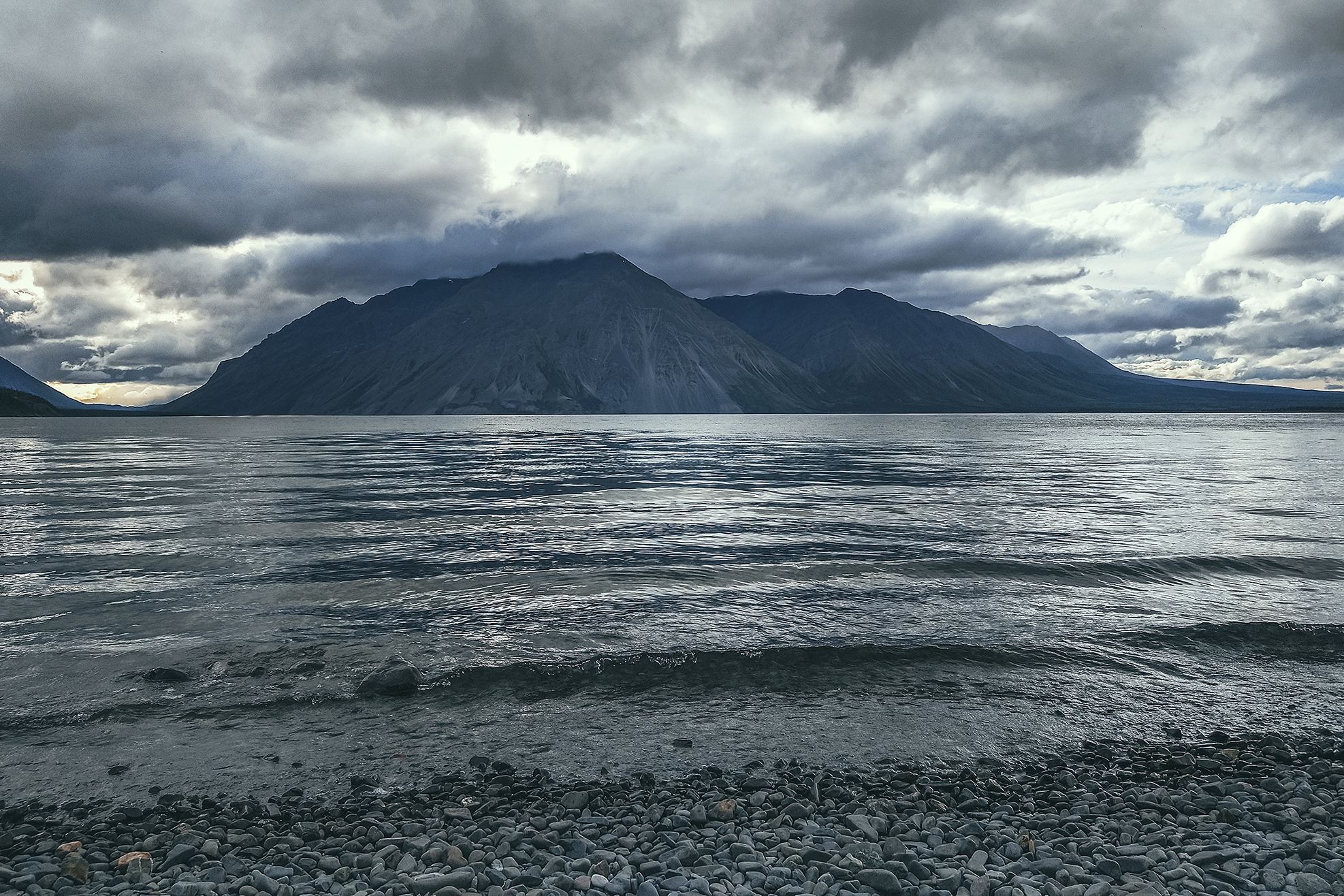
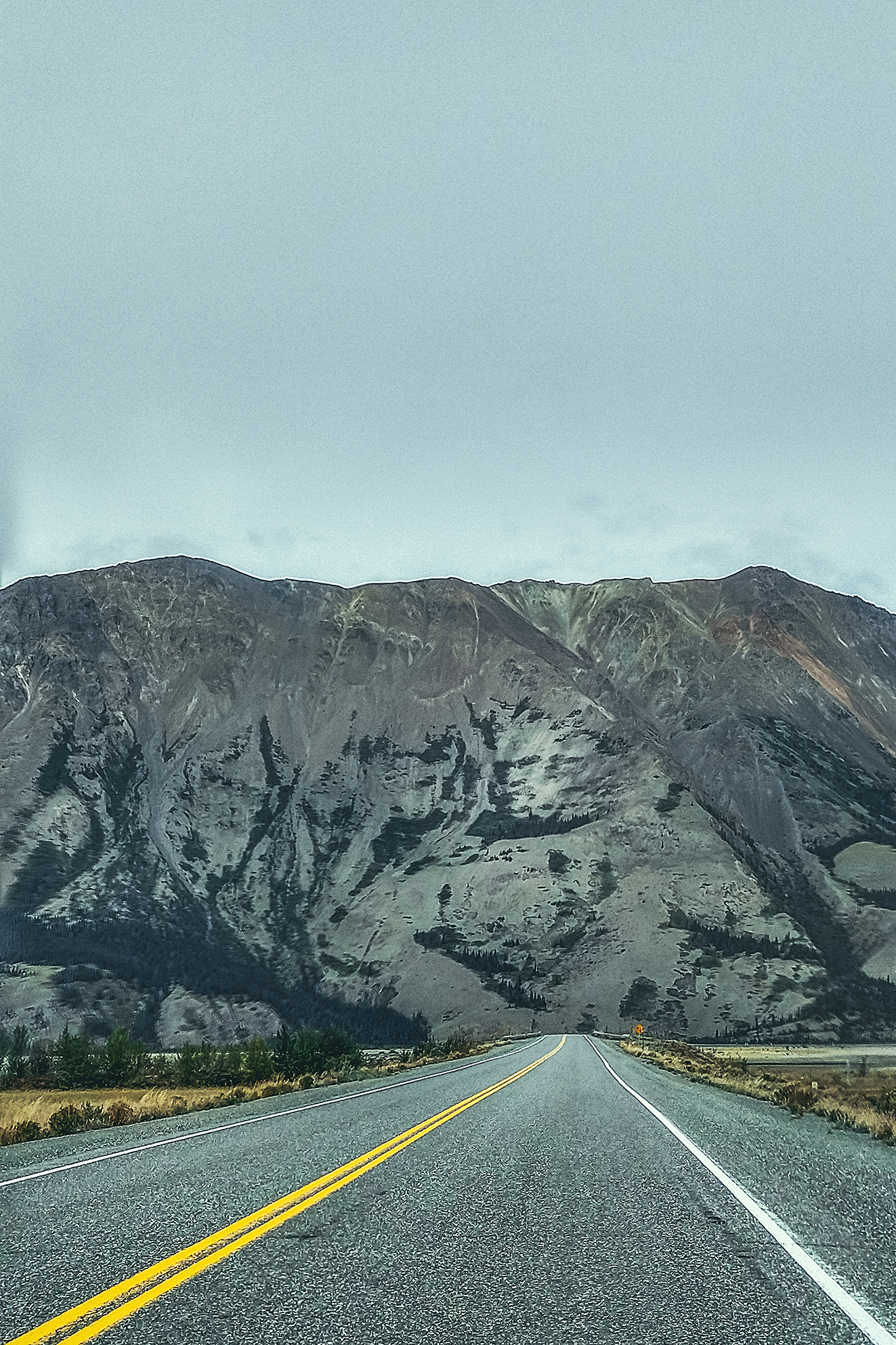
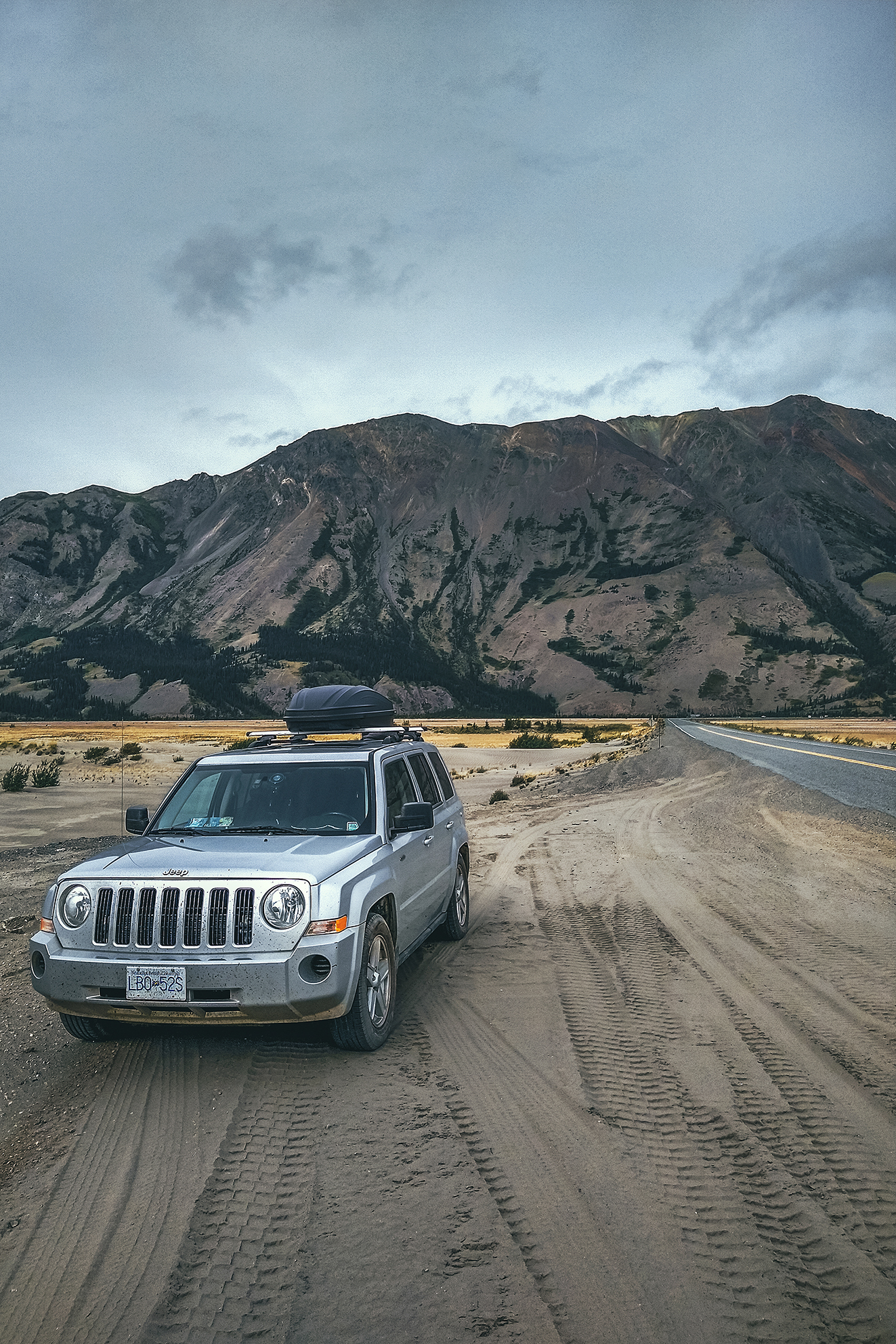
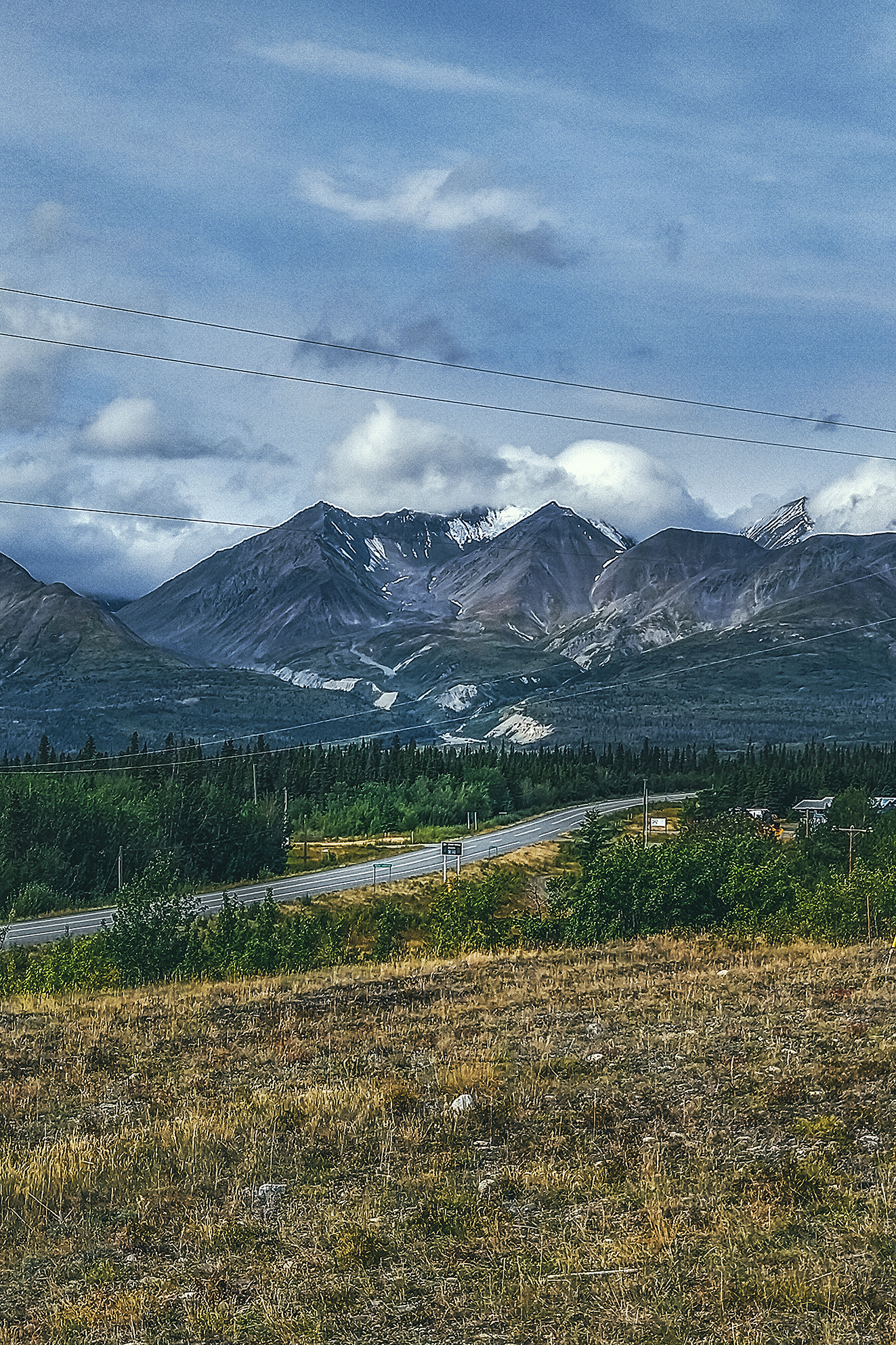
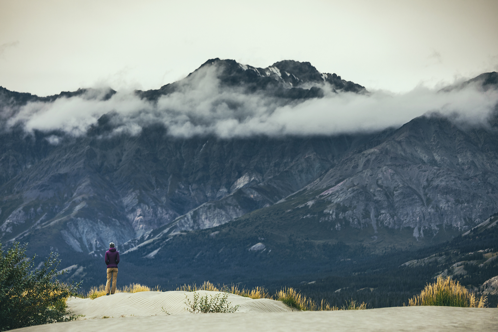
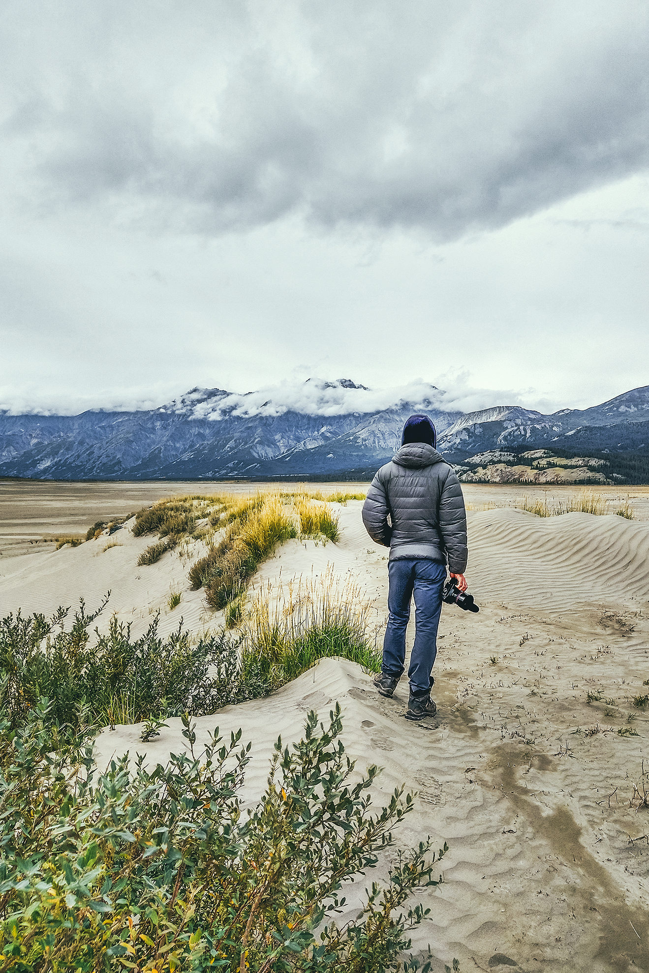
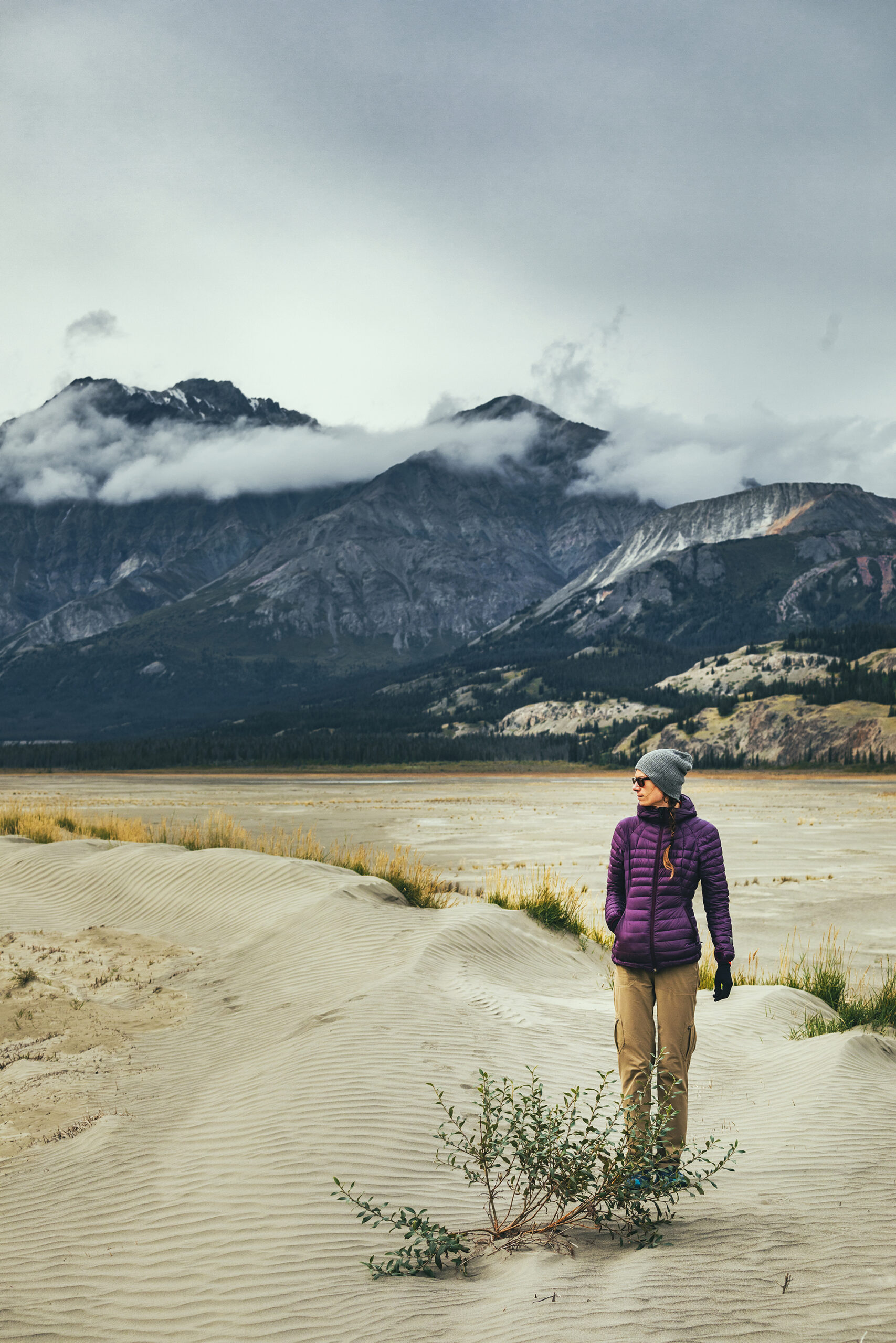
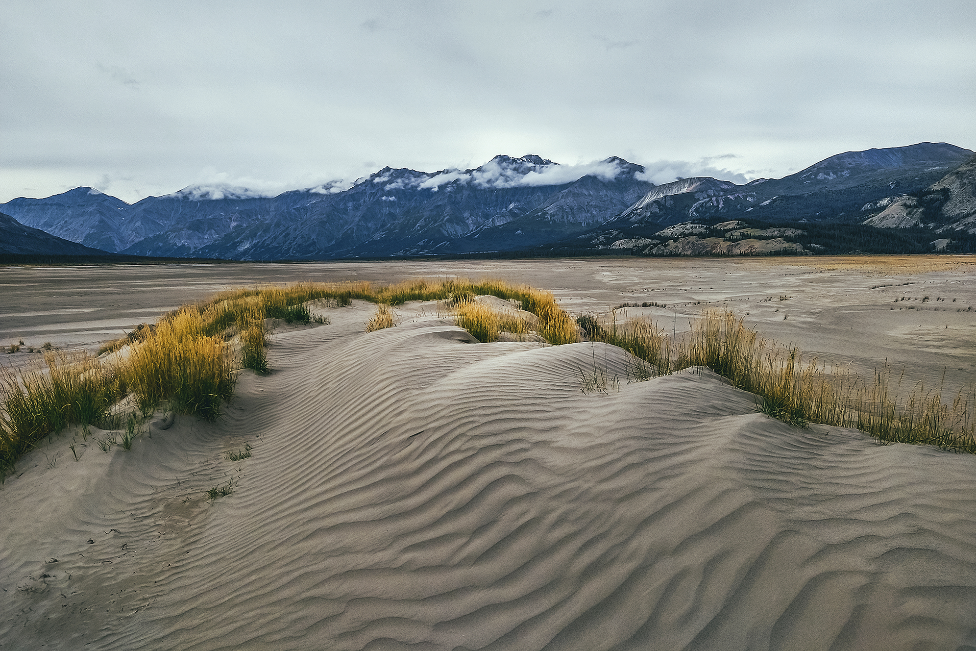
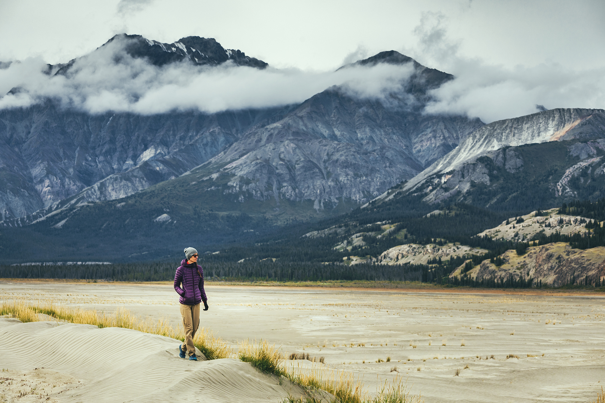
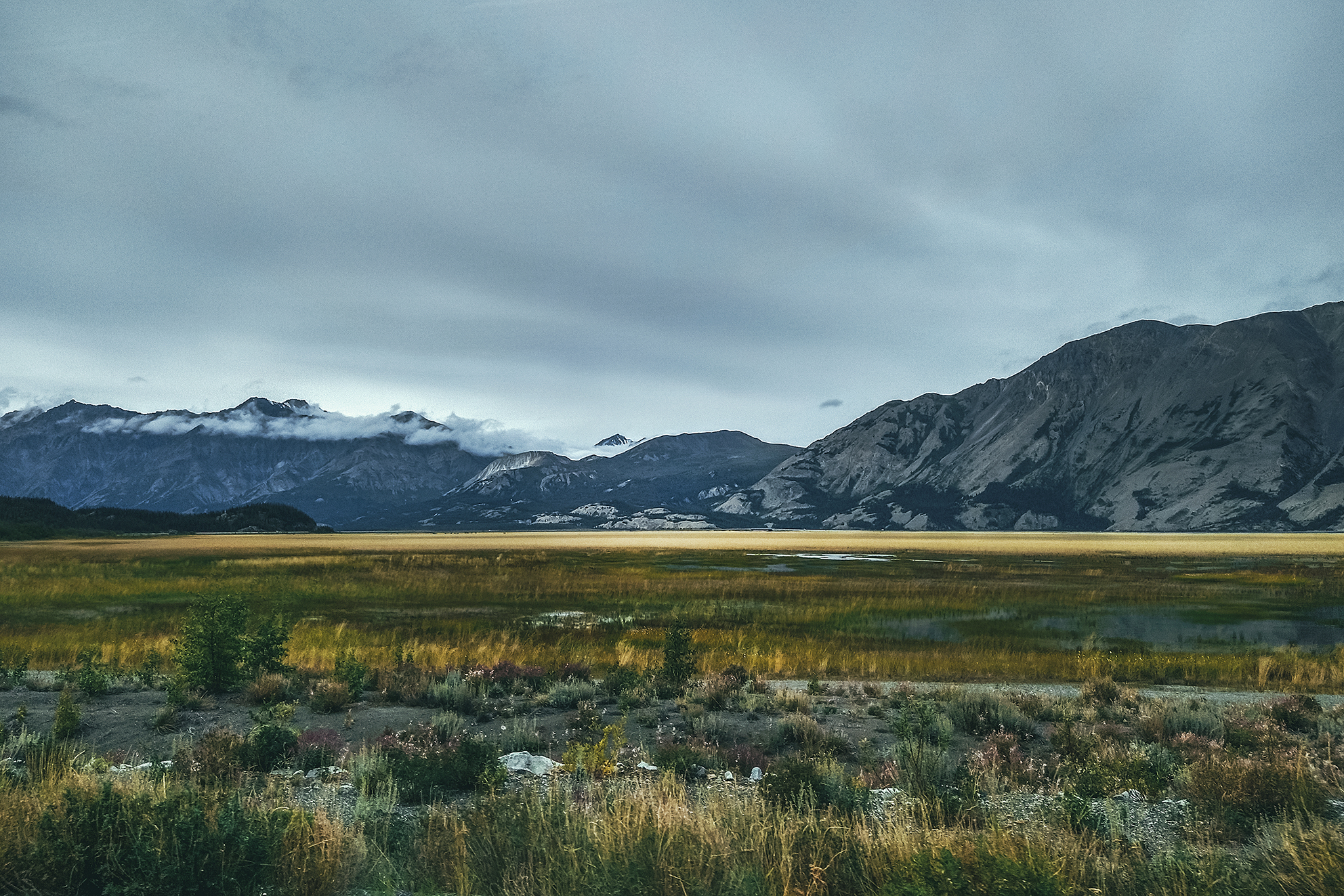
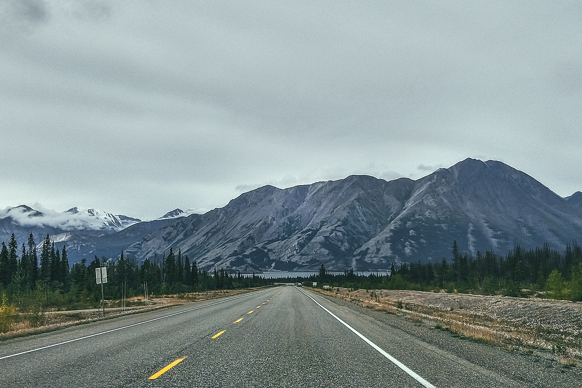
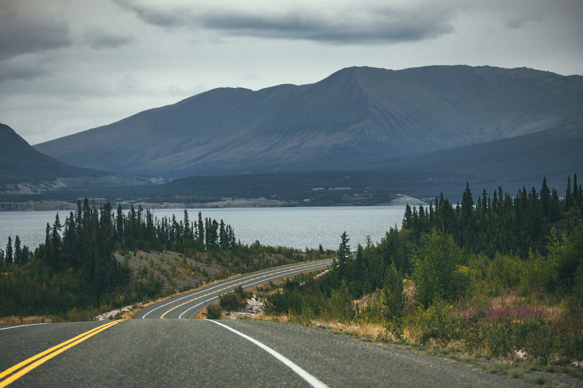
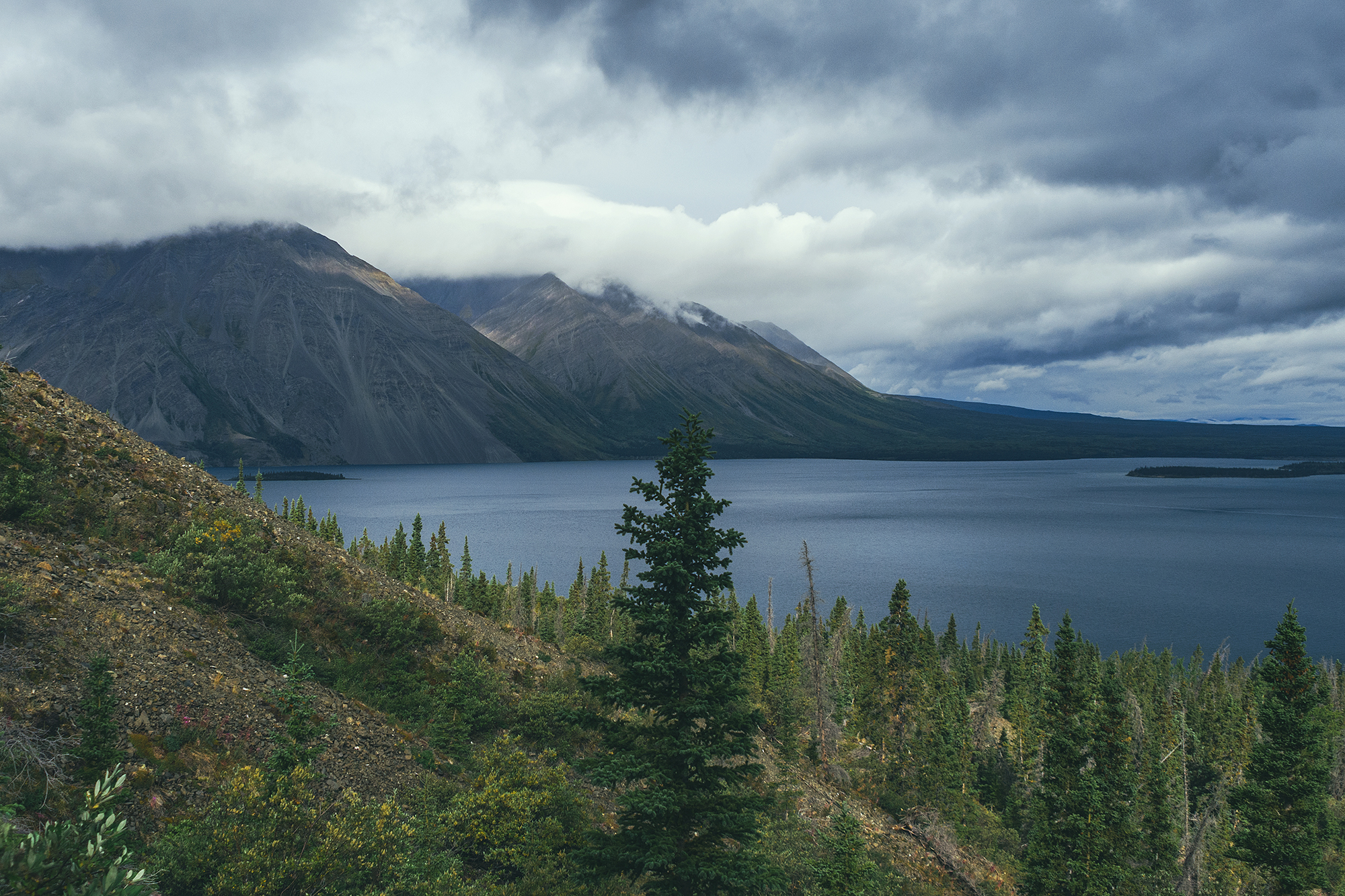
The drive along the Alaska Highway offers great view points on the Kluane mountains and Kluane lake. We stopped near the southern end of the lake, to take a stroll on a sandy area right off the road. The desert-like landscape is due to the retreat of the Kaskawulsh Glacier. As a result, its meltwater which previously fed two rivers, the Kaskawulsh River and ‘Ä’äy Chù’ (Slims River), now only flows into one. This phenomenon has apparently happened several times in the past, but current state of global warming suggest it is unlikely that the Glacier will re-advance, and that both rivers will run again. It was quite unexpected to see such a landscape surrounded by mountains.

We then stopped at the Thachäl Dhäl Visitor Centre and had lunch. The park ranger there was very friendly and pointed out to us a couple of herds of Dall Sheep that could be seen (through binoculars) on the slopes of the nearby mountain. They were pretty far, so even through binoculars they looked like tiny little white specs. Would this qualify as wildlife sighting?
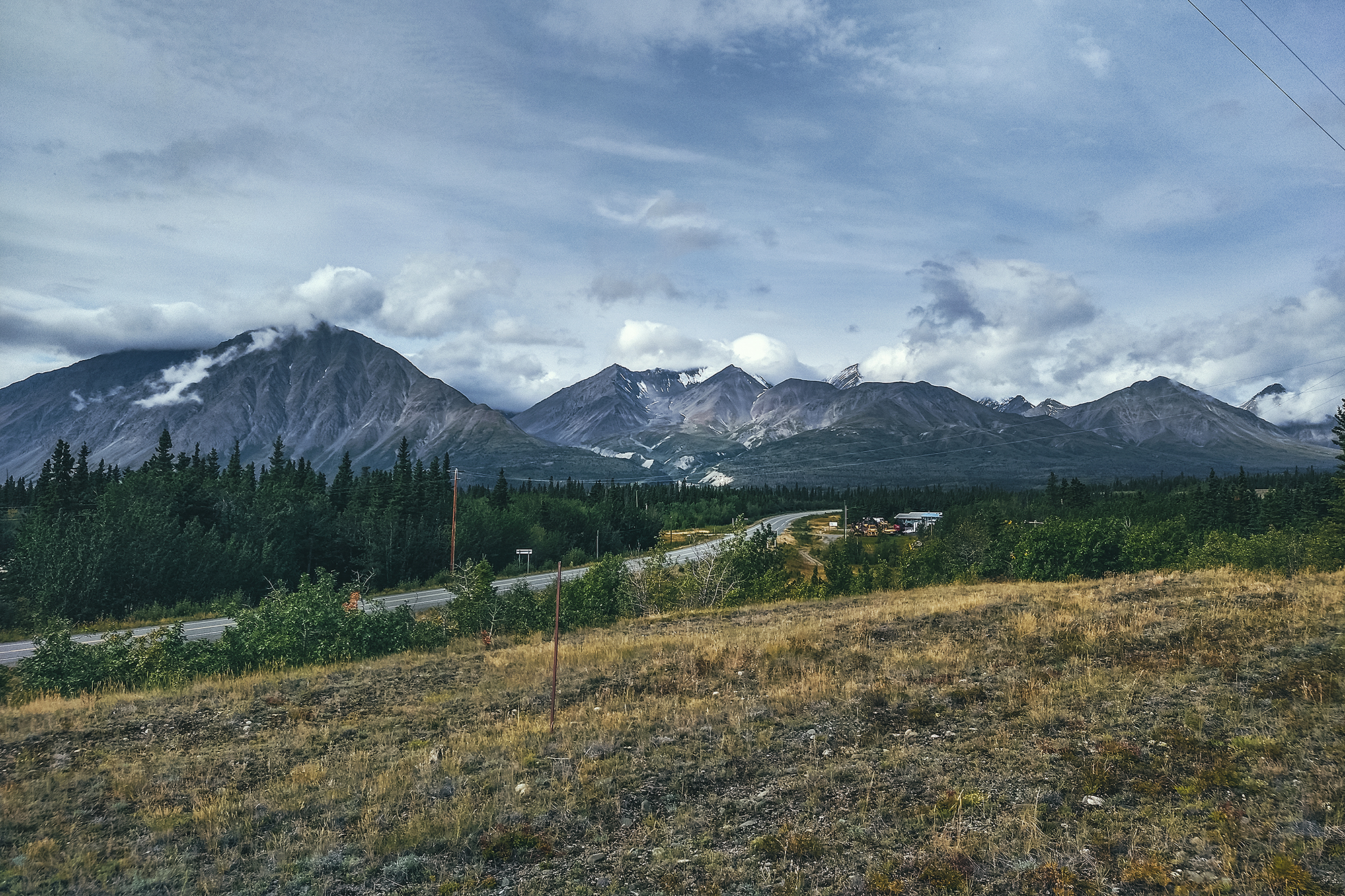
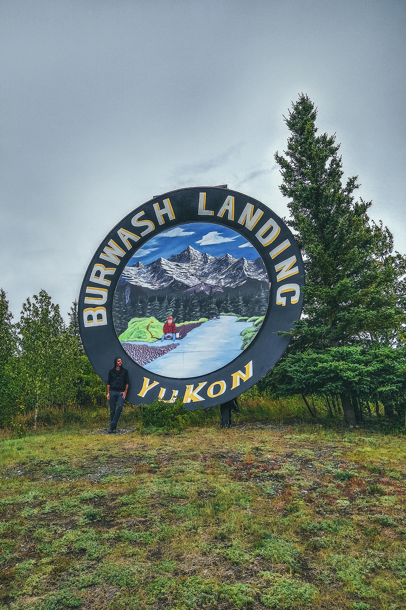
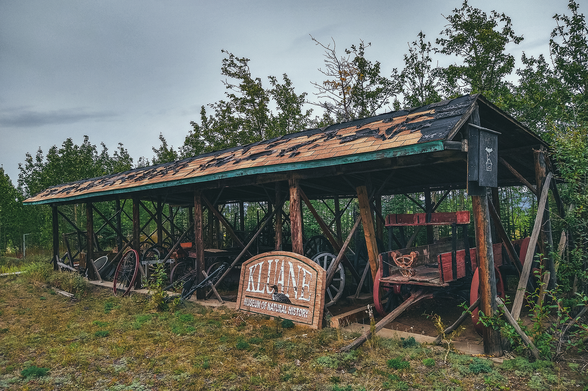
We continued on the drive to Destruction Bay and Burwash landing, where we once again, we found the museum closed due to Covid. The drive was still worth it though, for the scenery along Kluane Lake and the mountains around.
There are a number of hikes you can do into Kluane along that stretch of highway, some of them multi-day treks. I would definitely be interested in coming back for a multi-day adventure, as some of the trails reach the edge of the icefield, and promise a pretty spectacular sight.
There are also various guided adventures to be taken, from flying over the glaciers to white river rafting up close to them. Too much to do and see in just a couple of days! But it was great to get a glimpse at the area and know what to come back for.
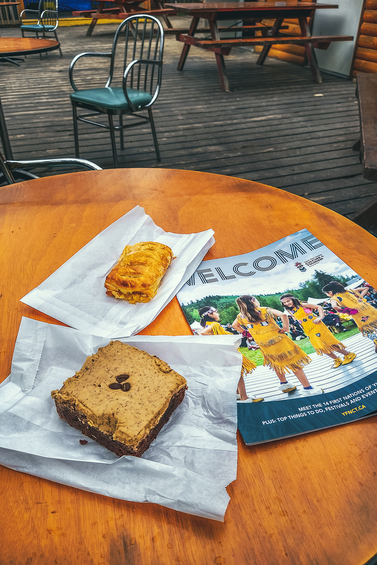
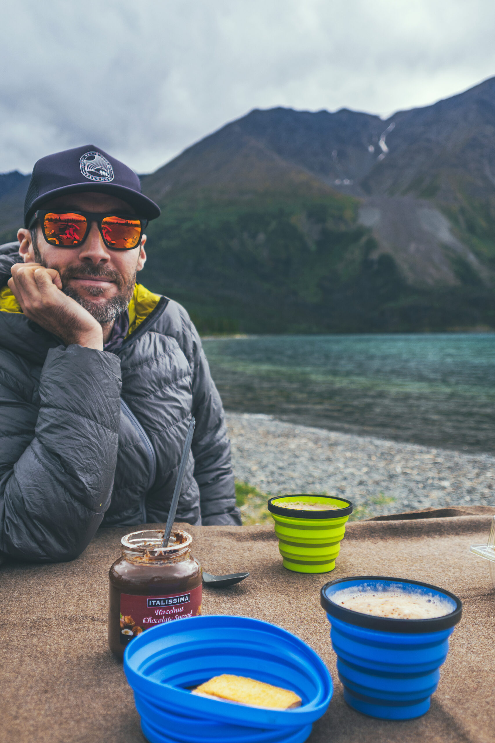
On the way back we stopped at Village Bakery in Haines Junction for some pastries and free wifi, then headed back to camp.
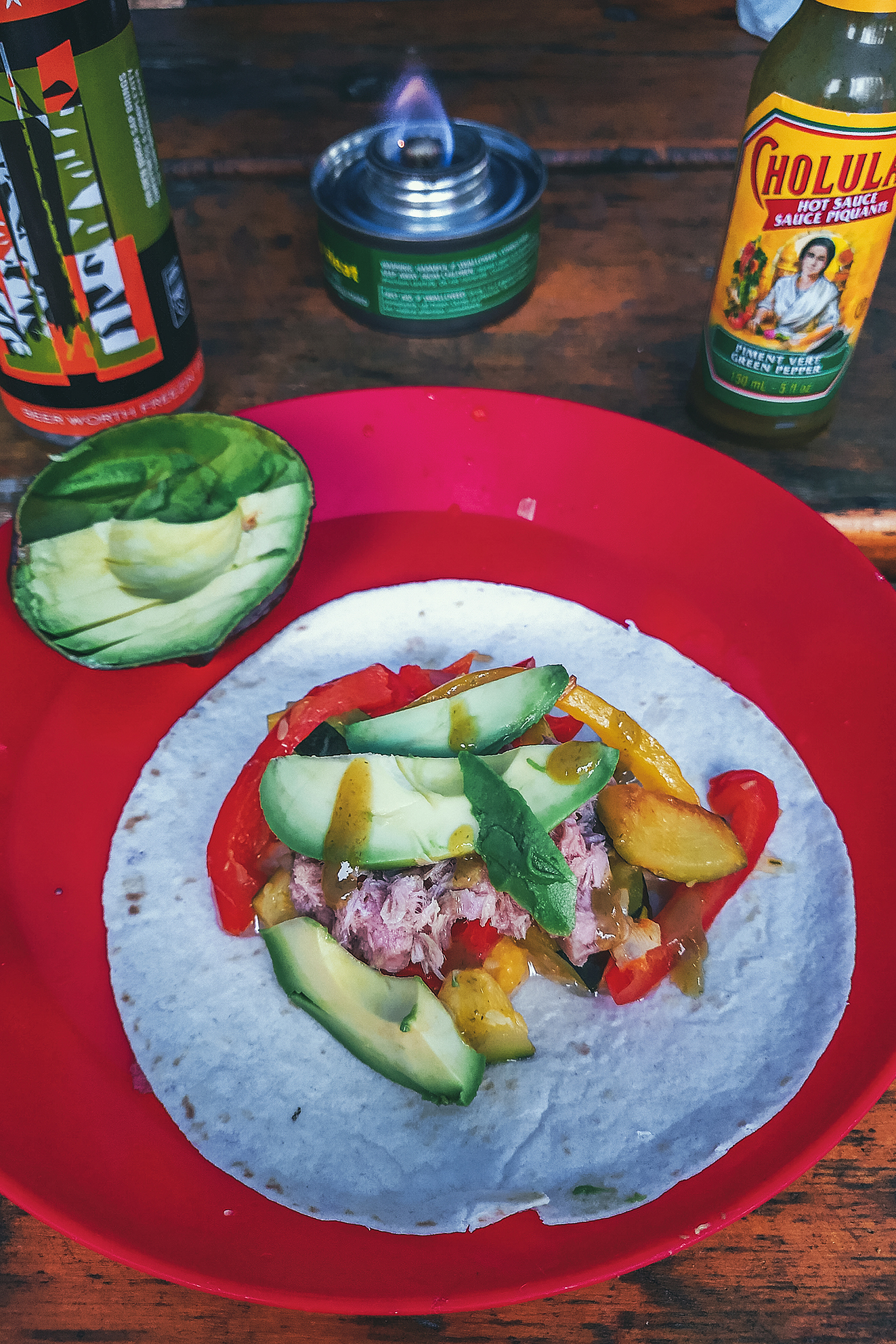
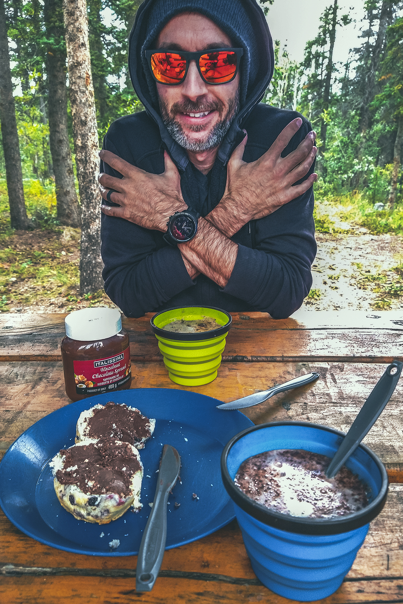
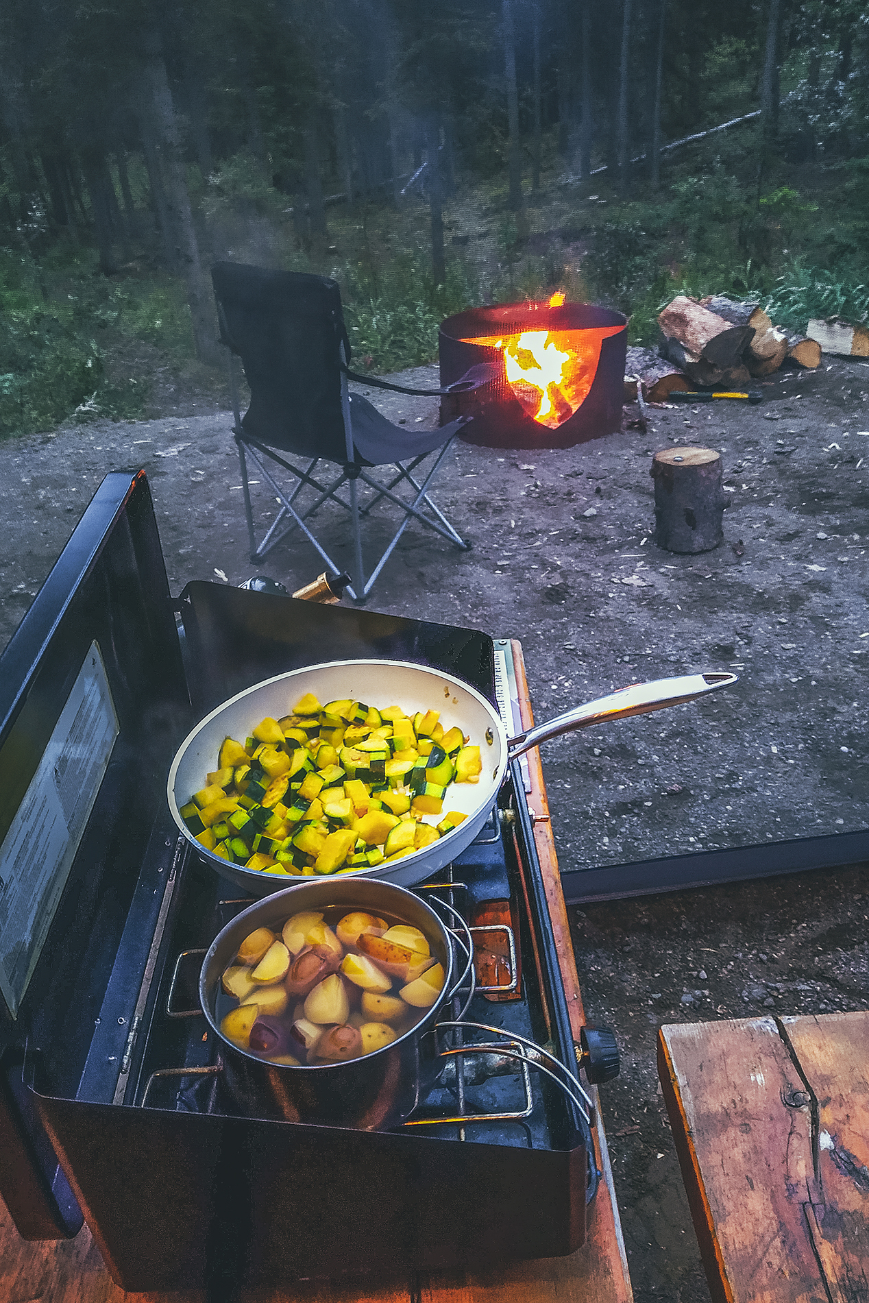
That night we changed things up a bit by making tacos – zucchini, bell peppers, avocado & tuna, with a dash of green pepper hot sauce. That was a nice variation from our other camping meals so far, and one we might even repeat at home.
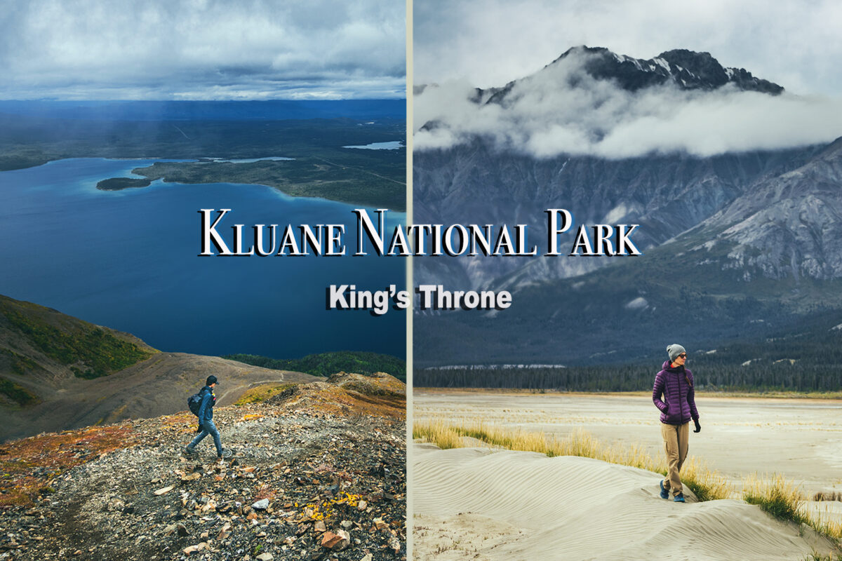
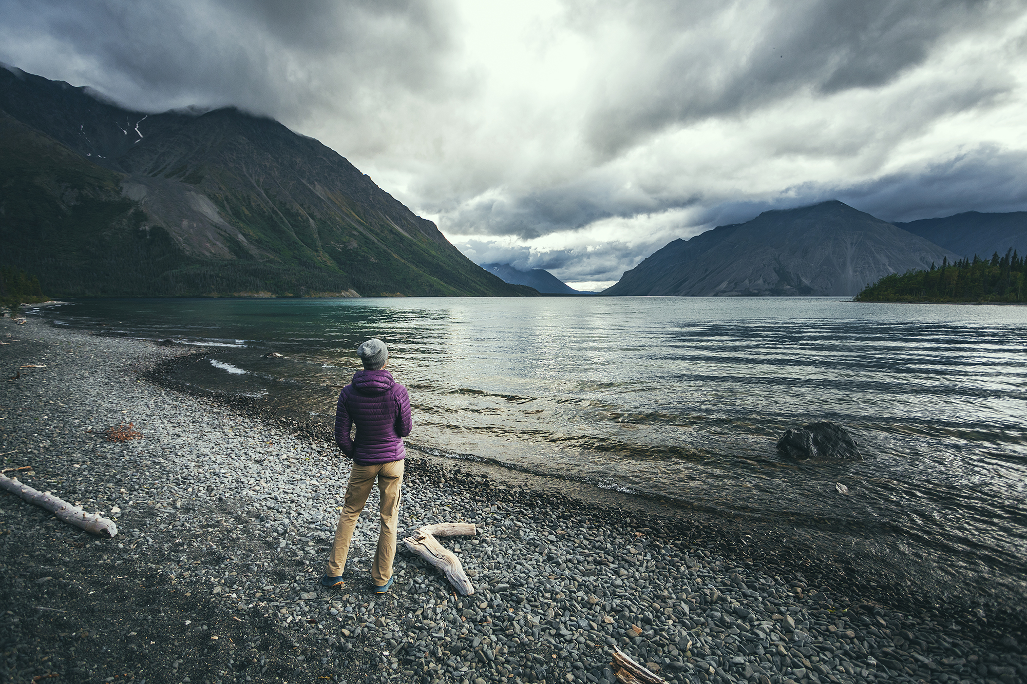
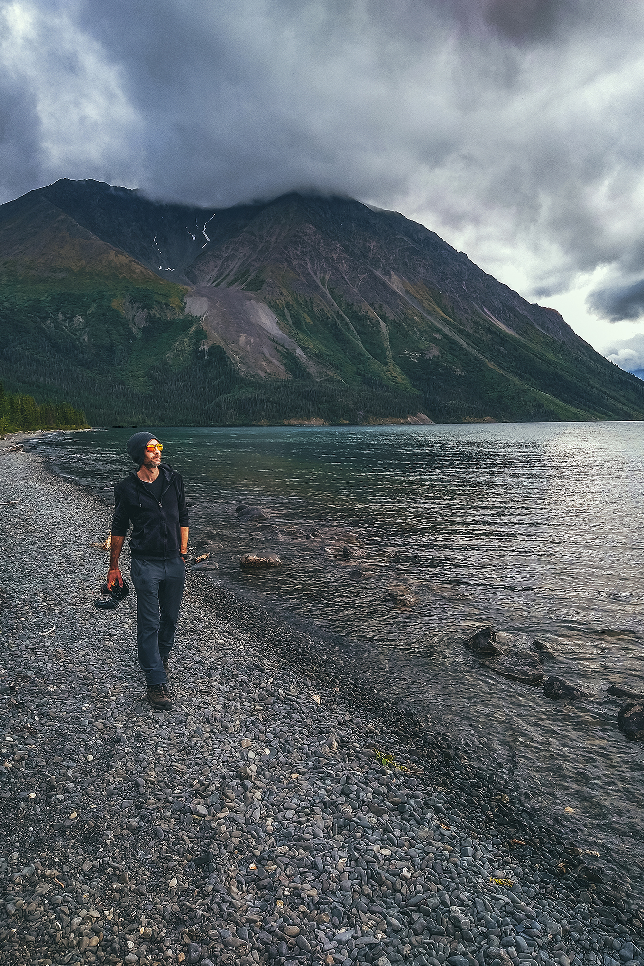
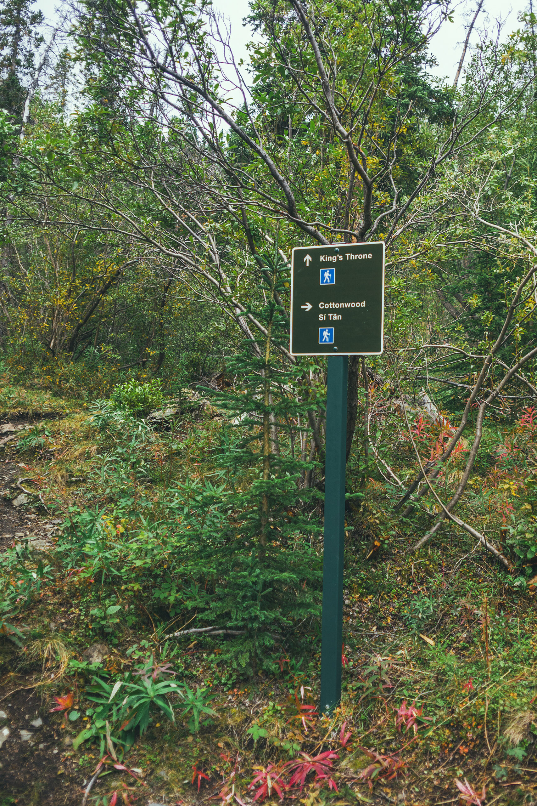
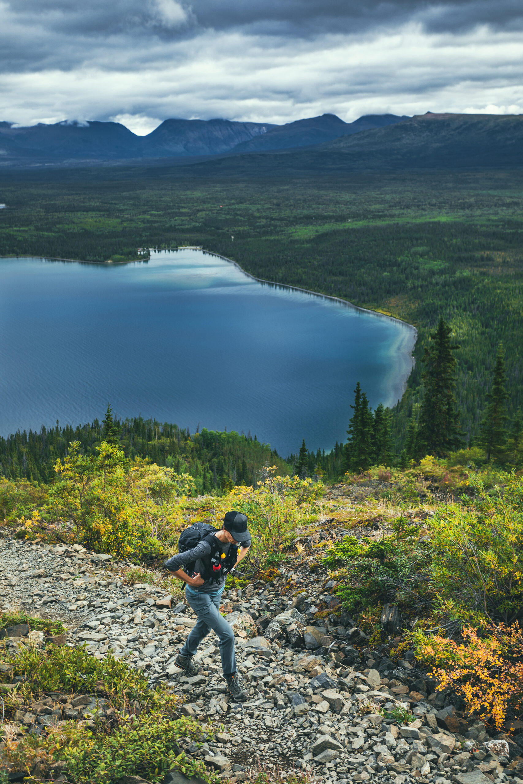
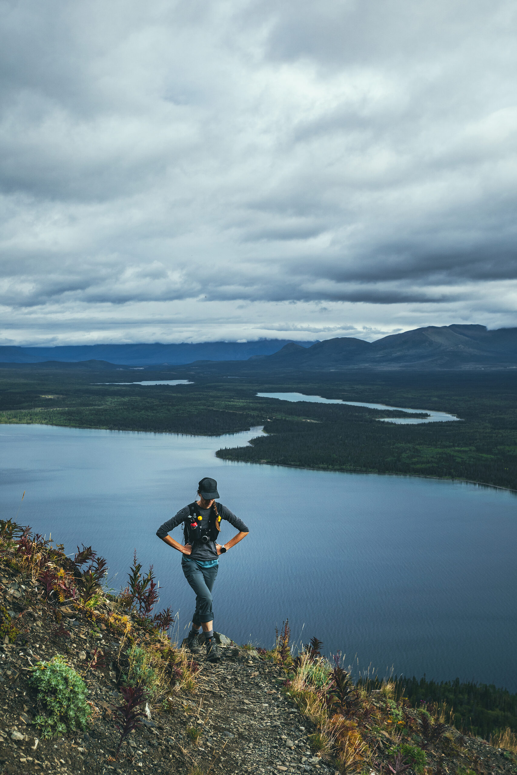
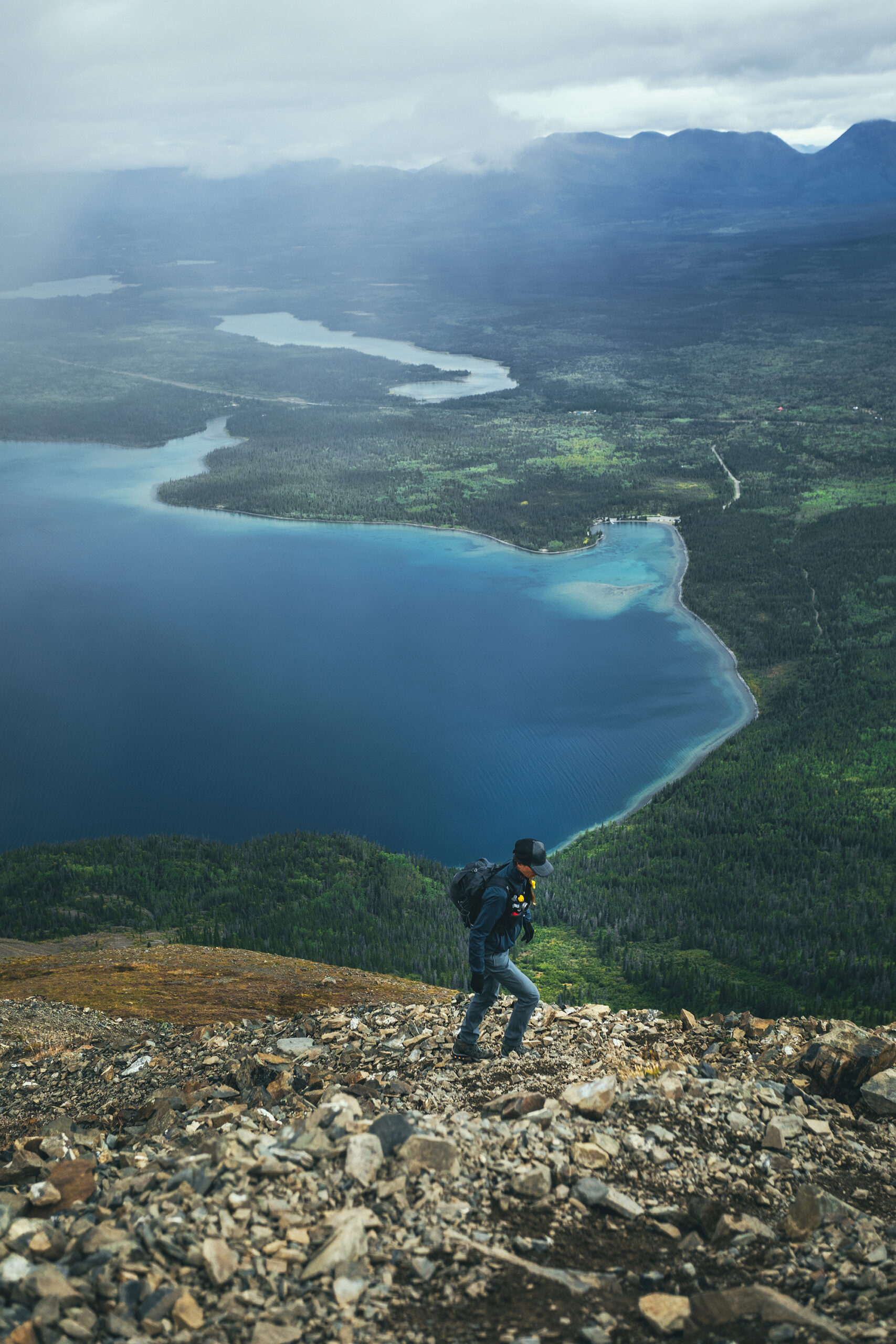
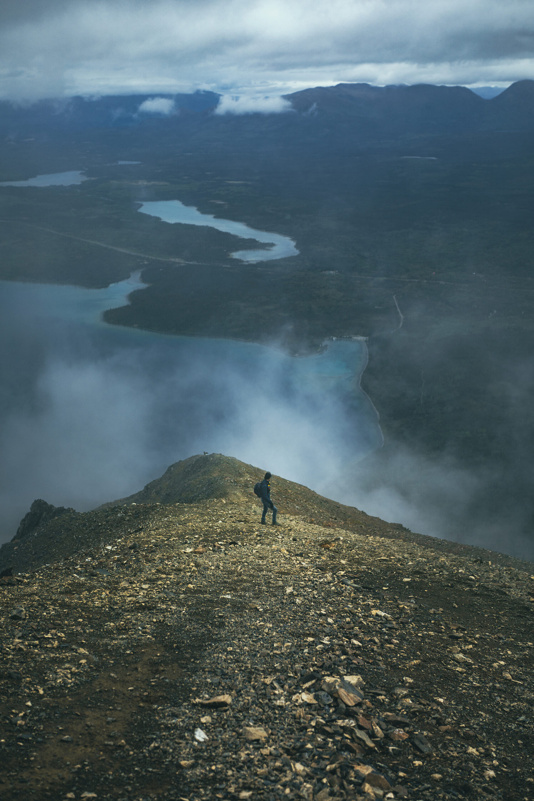
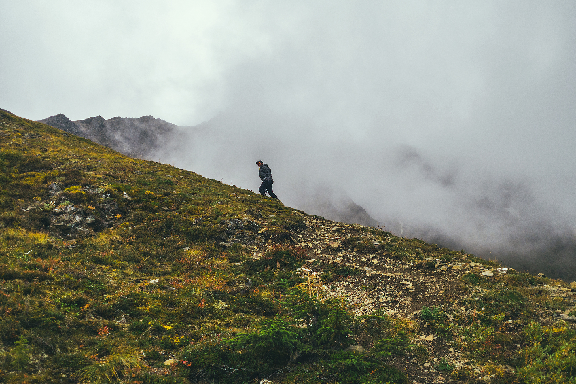
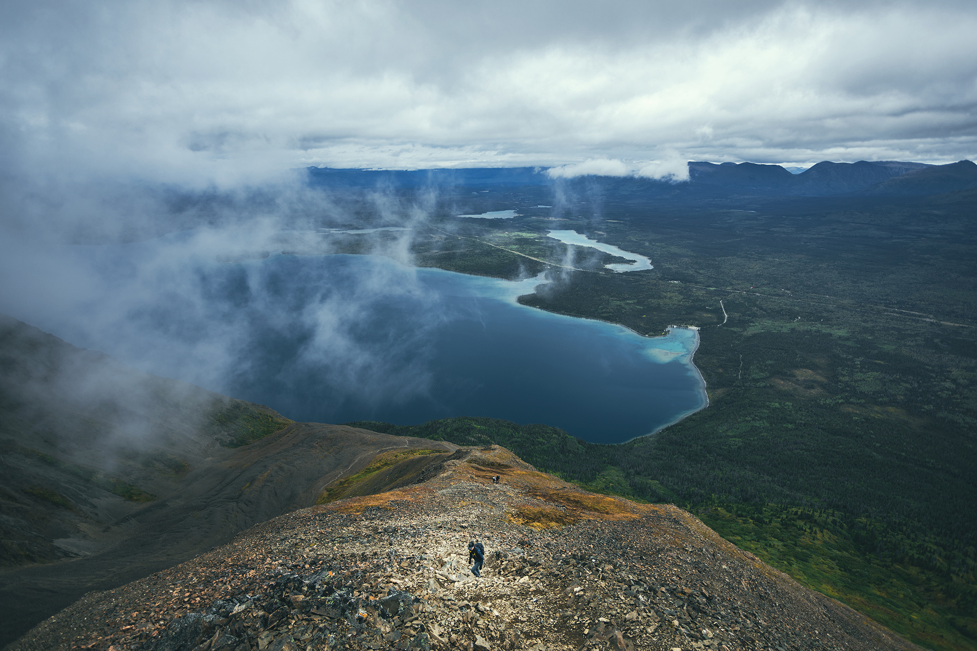
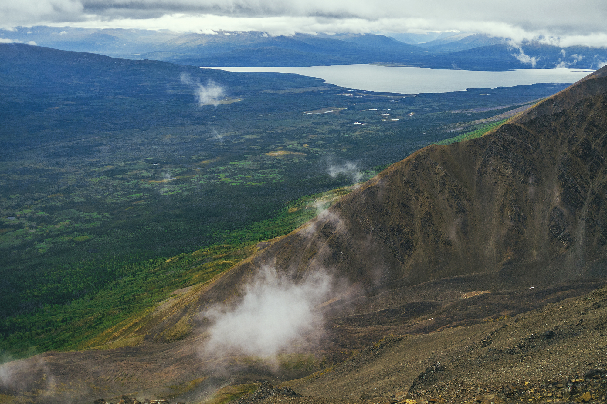
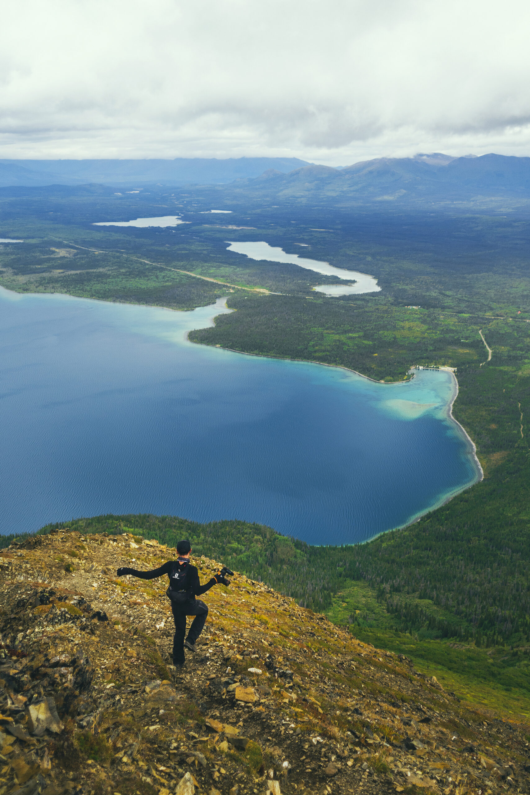
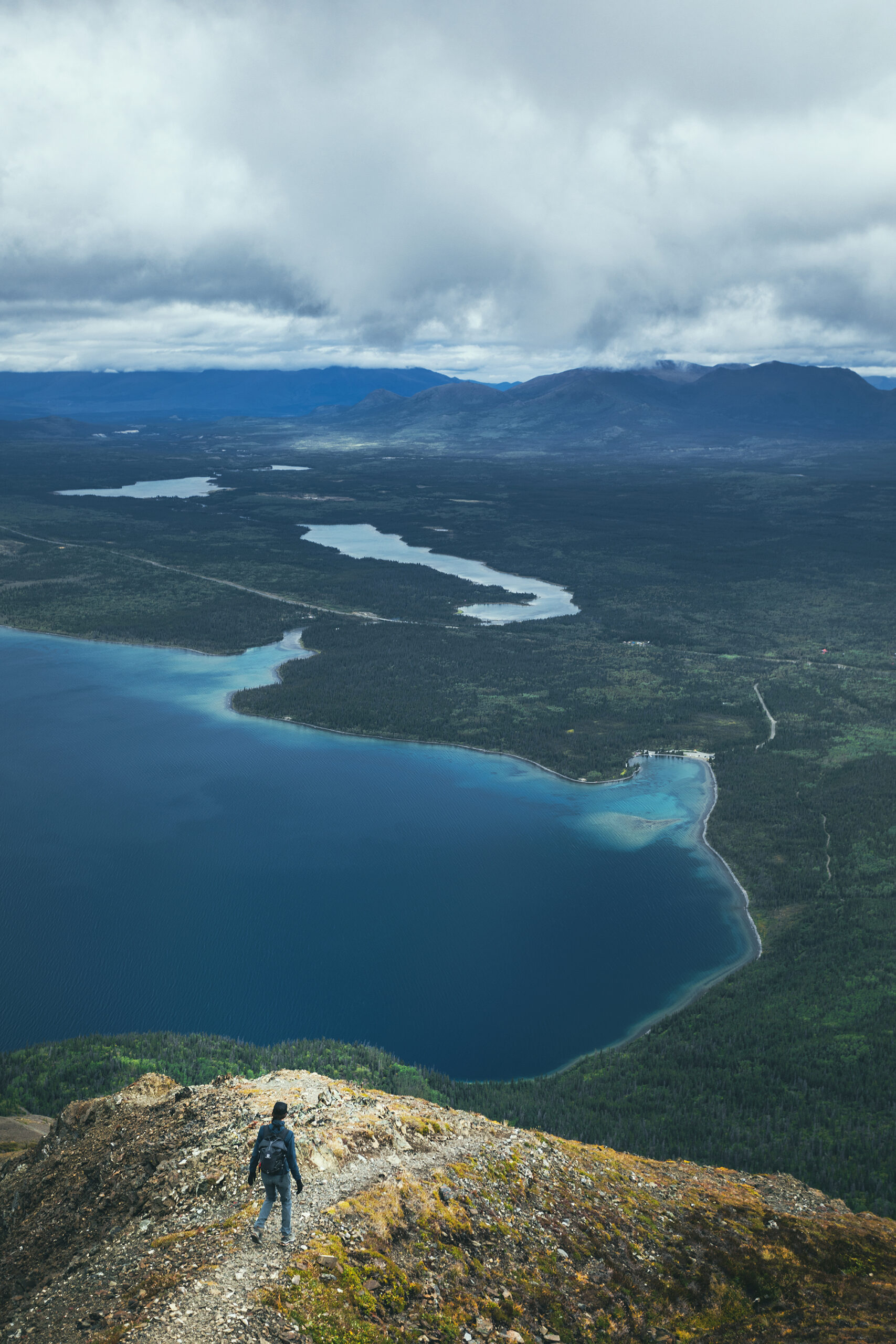
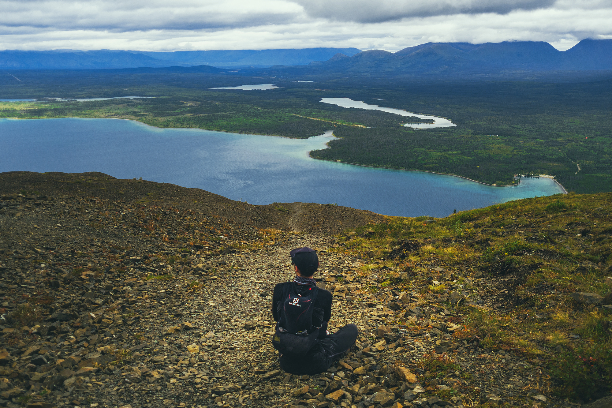
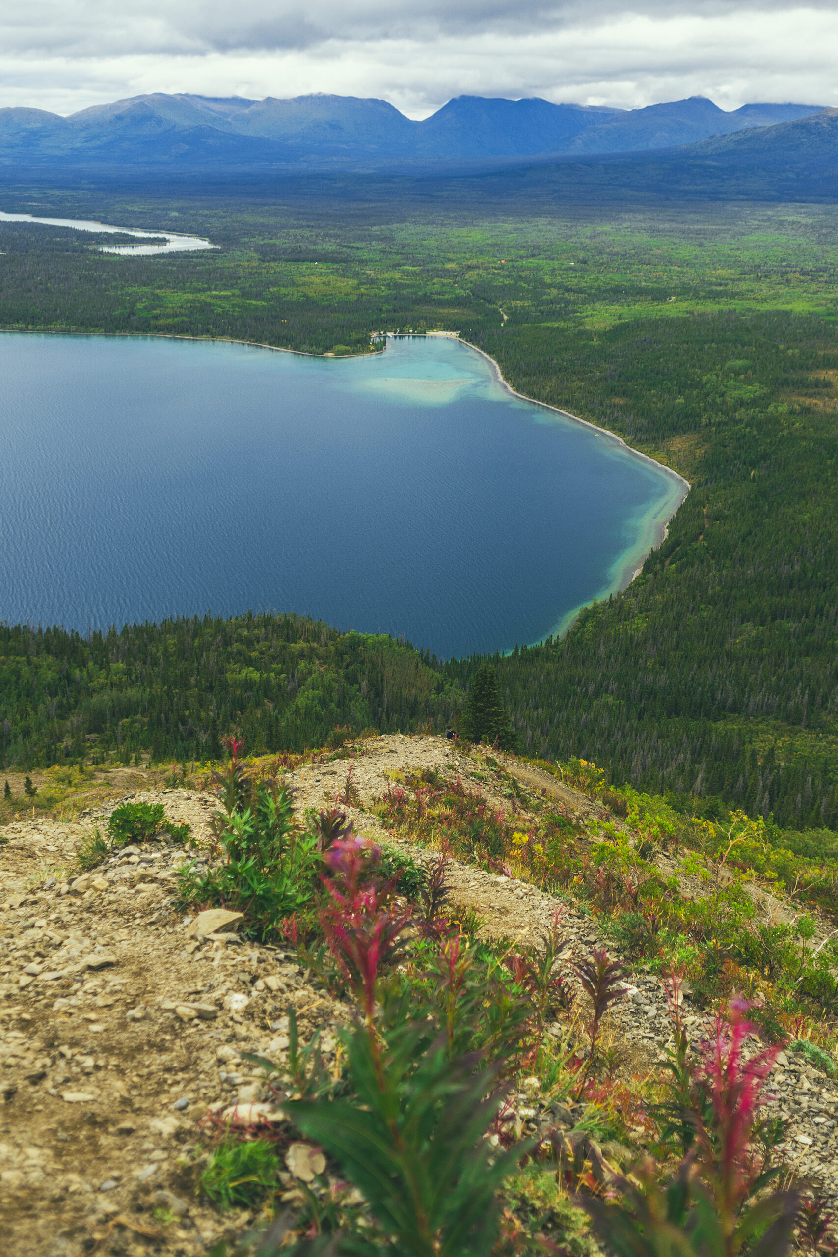
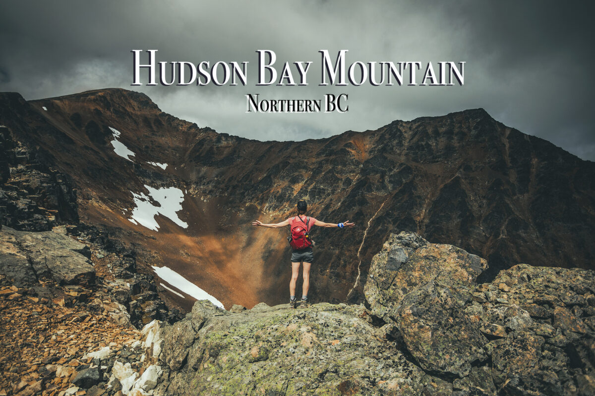
We set off for King’s Throne, a hike that was recommended to us by our friend Adele, as well as 2 or 3 other random people we saw on other hikes. The trailhead is actually at Kathleen Lake so it was conveniently near our campsite. Alltrails had it recorded at 12.7km, while I had seen it at 15km in some Yukon guide, with an estimated time of 8 hours.
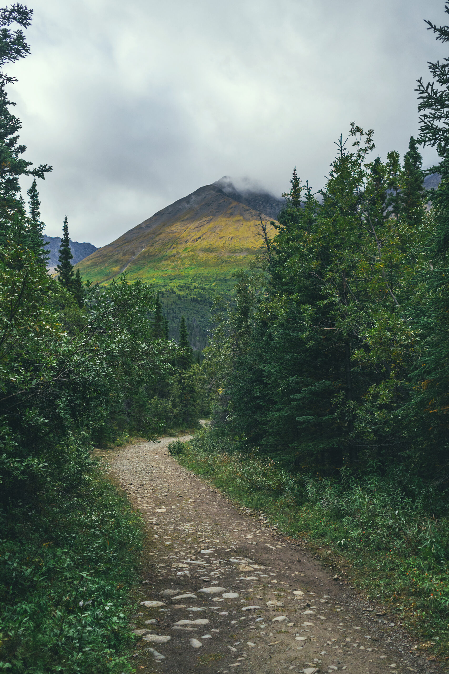
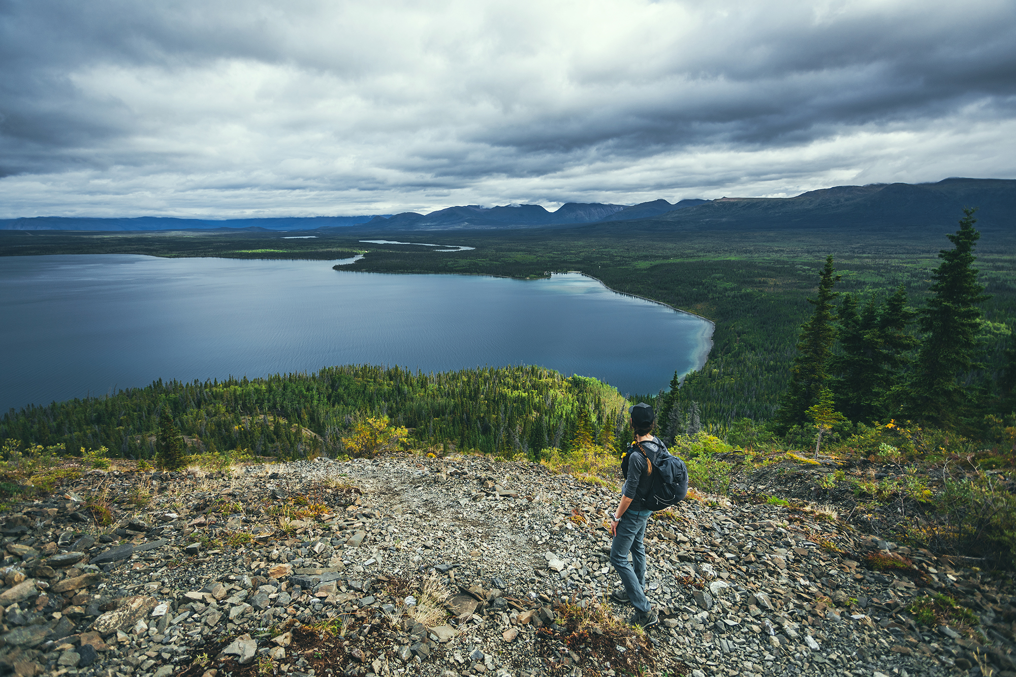
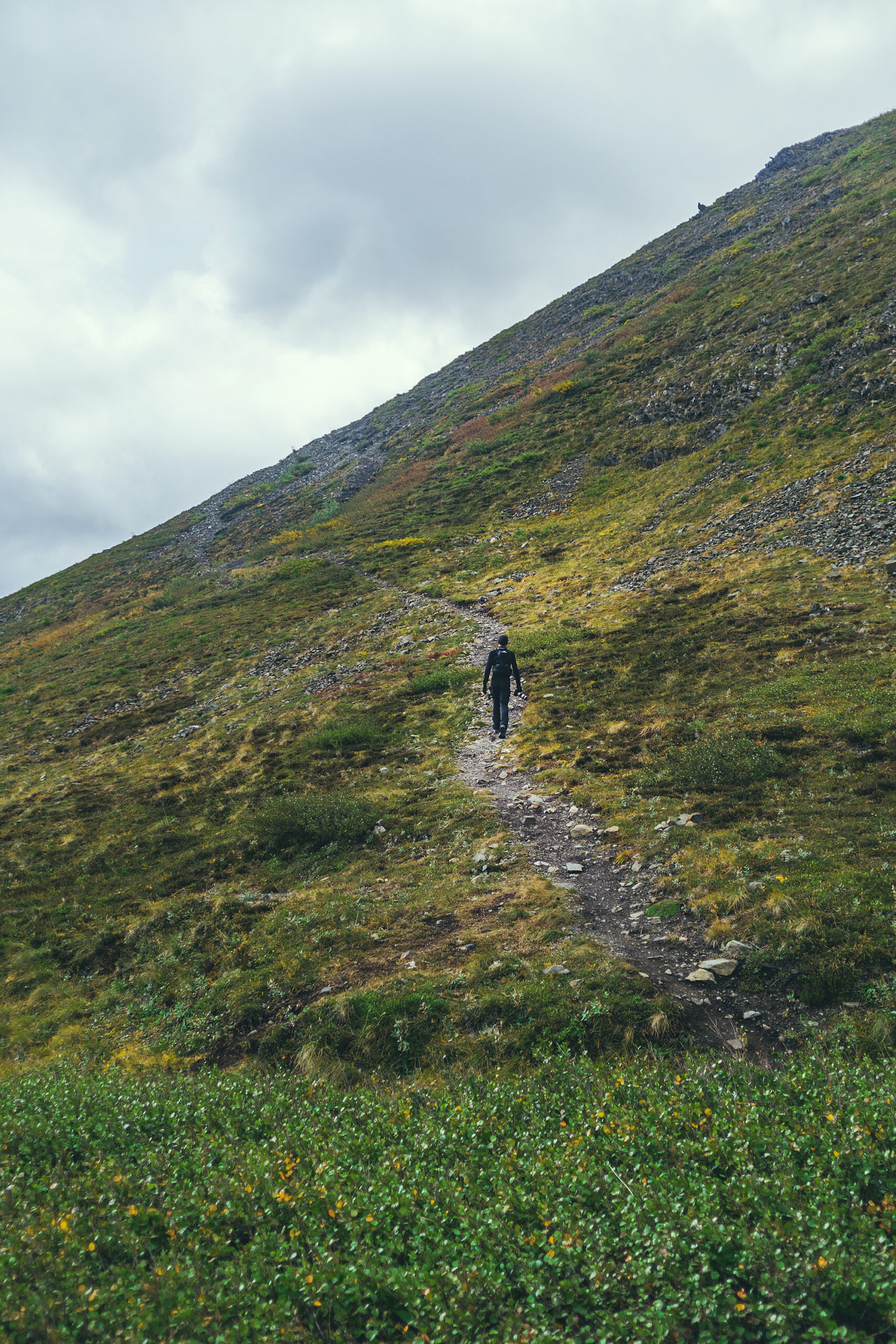
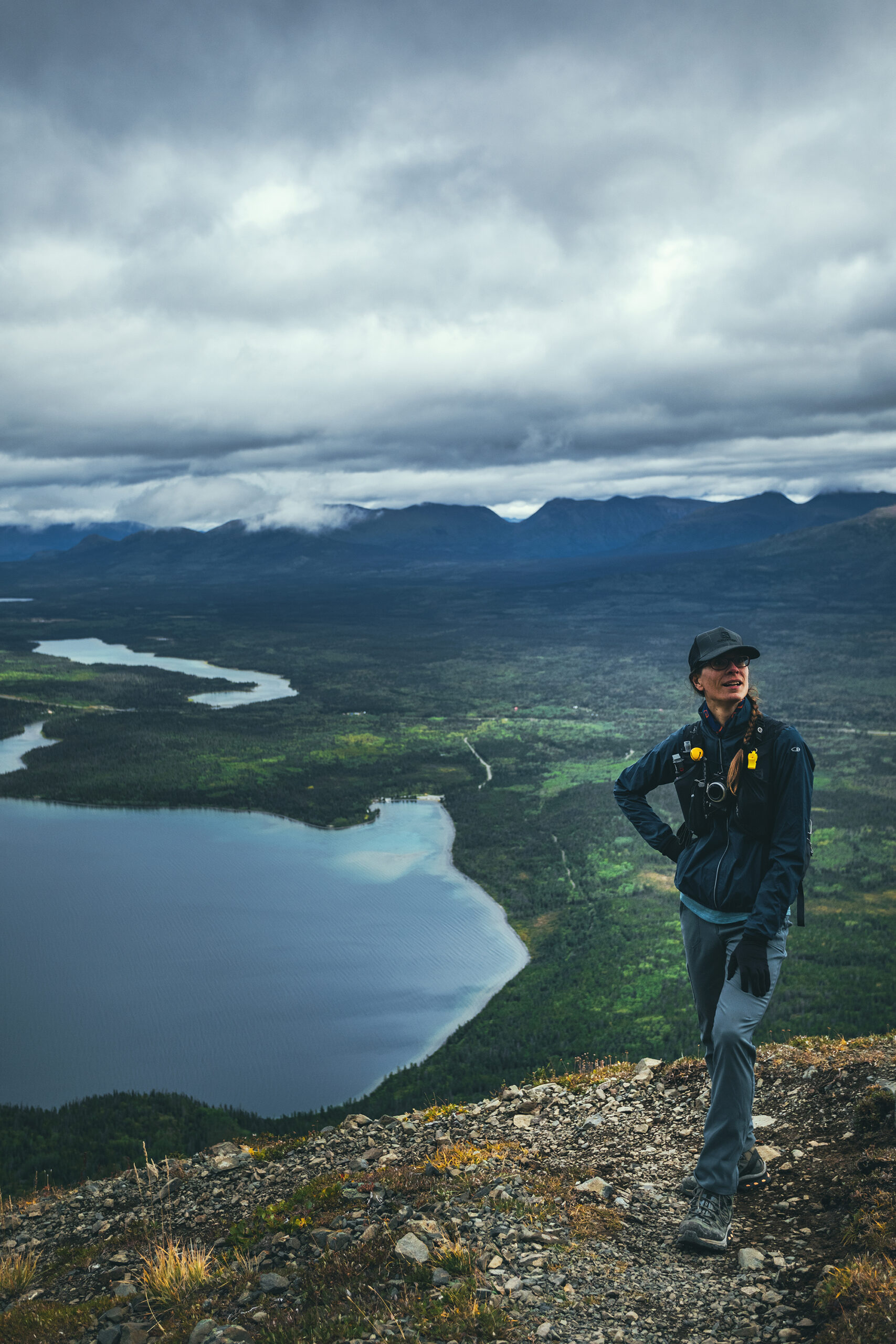
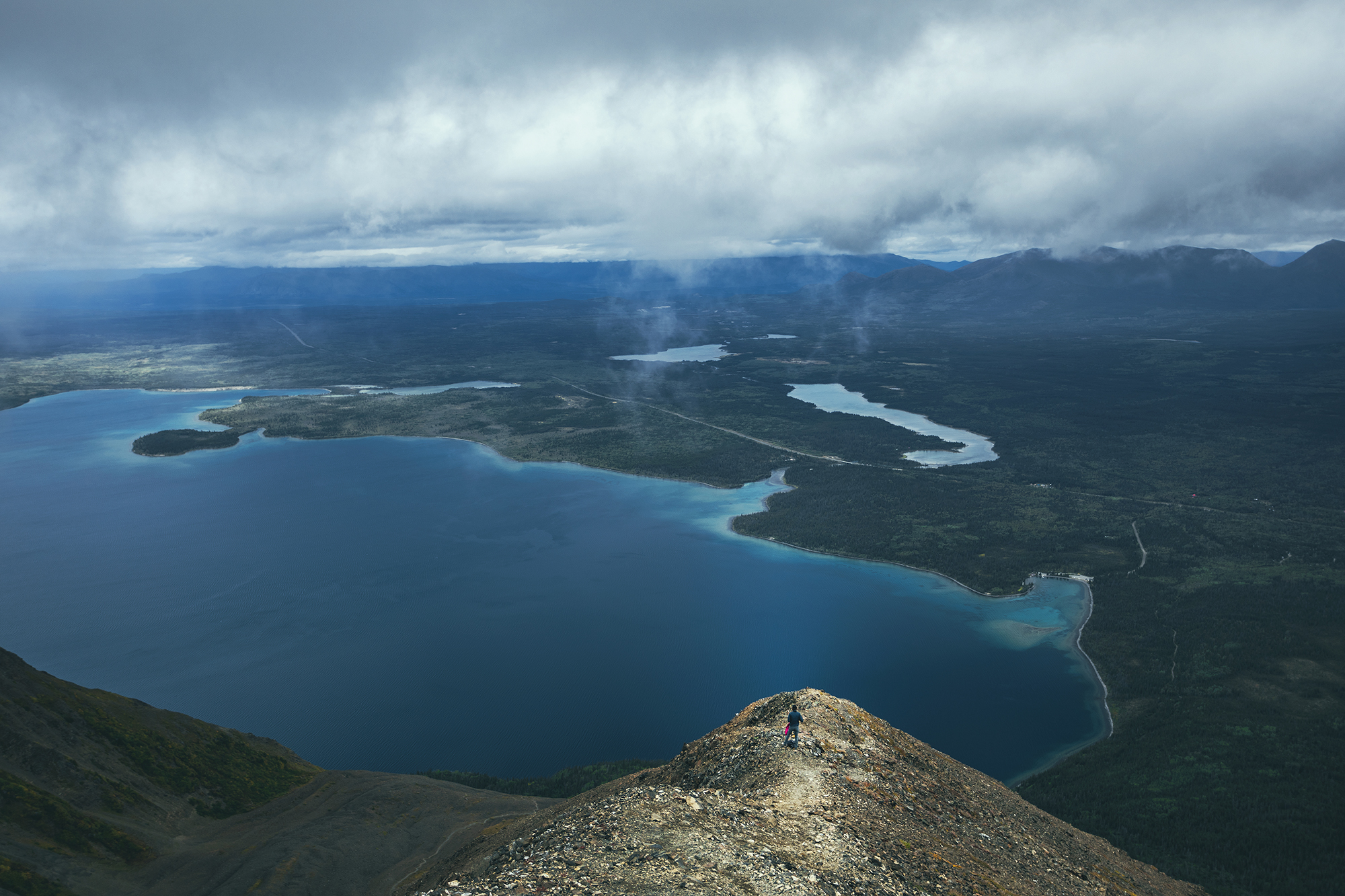
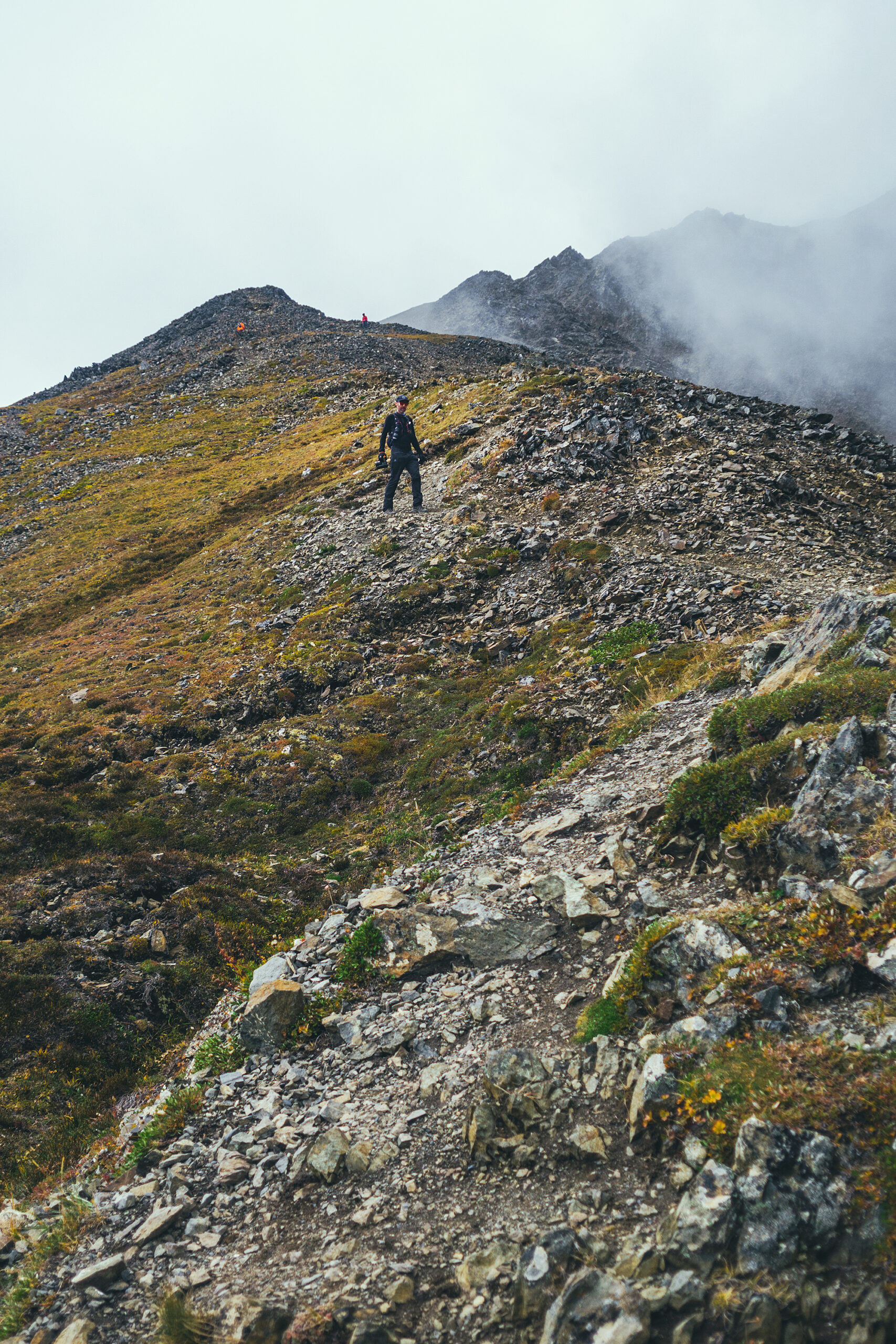
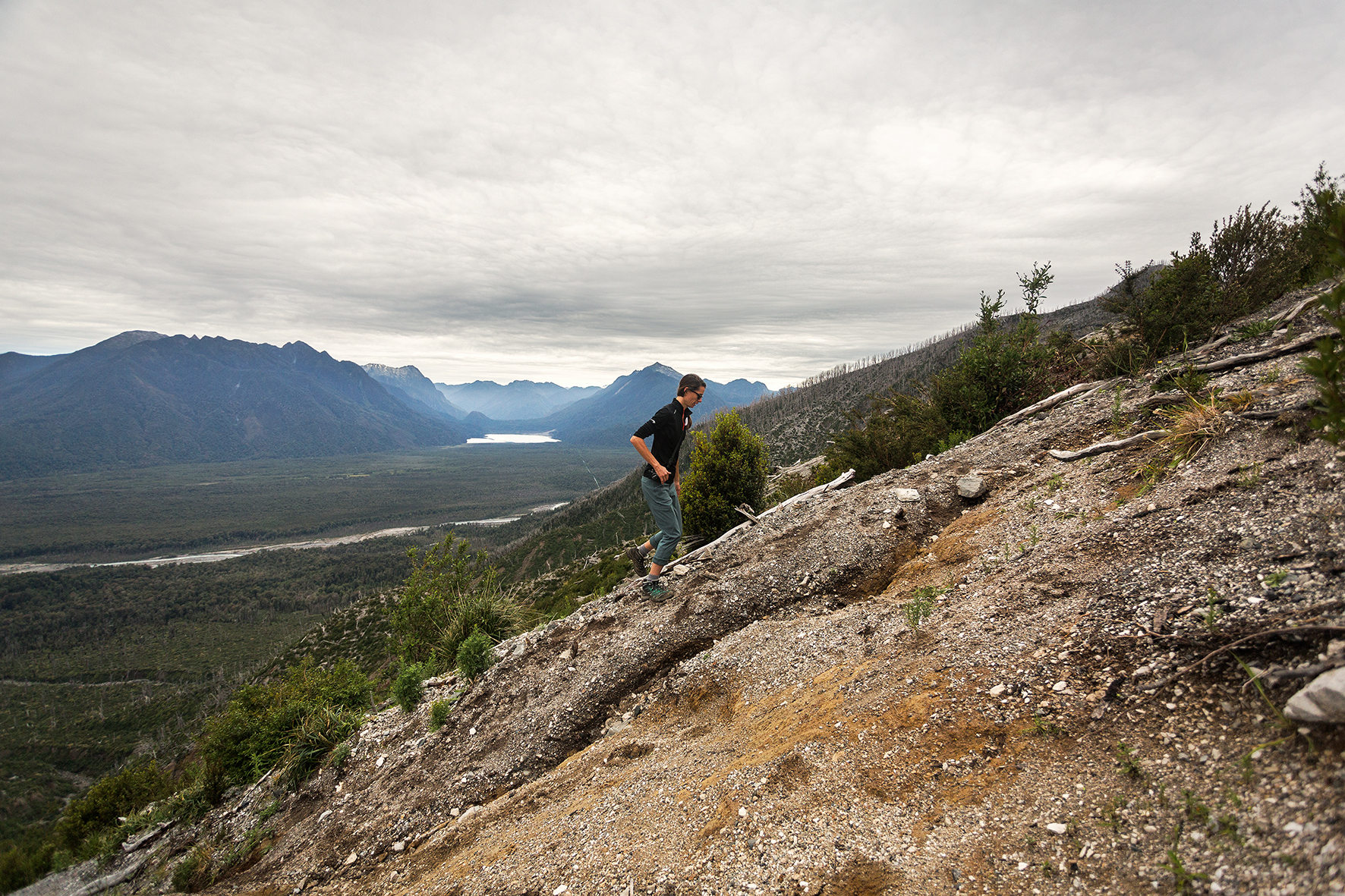
We started relatively late at 10am. The trail is pretty wide and flat for the first 2 kms in the trees, then it starts climbing steeply up the mountain side. We got to the alpine within 3km from the start and had great views of Kathleen lake from there on. One option I’d found was to hike 5km to King’s “seat”, basically the bottom of the cirque at the base of the ridge. My watch only read about 3.6k though when we got to that point after only about 1 hour of climbing (maybe a bit more), so we continued straight on to climb the ridge.
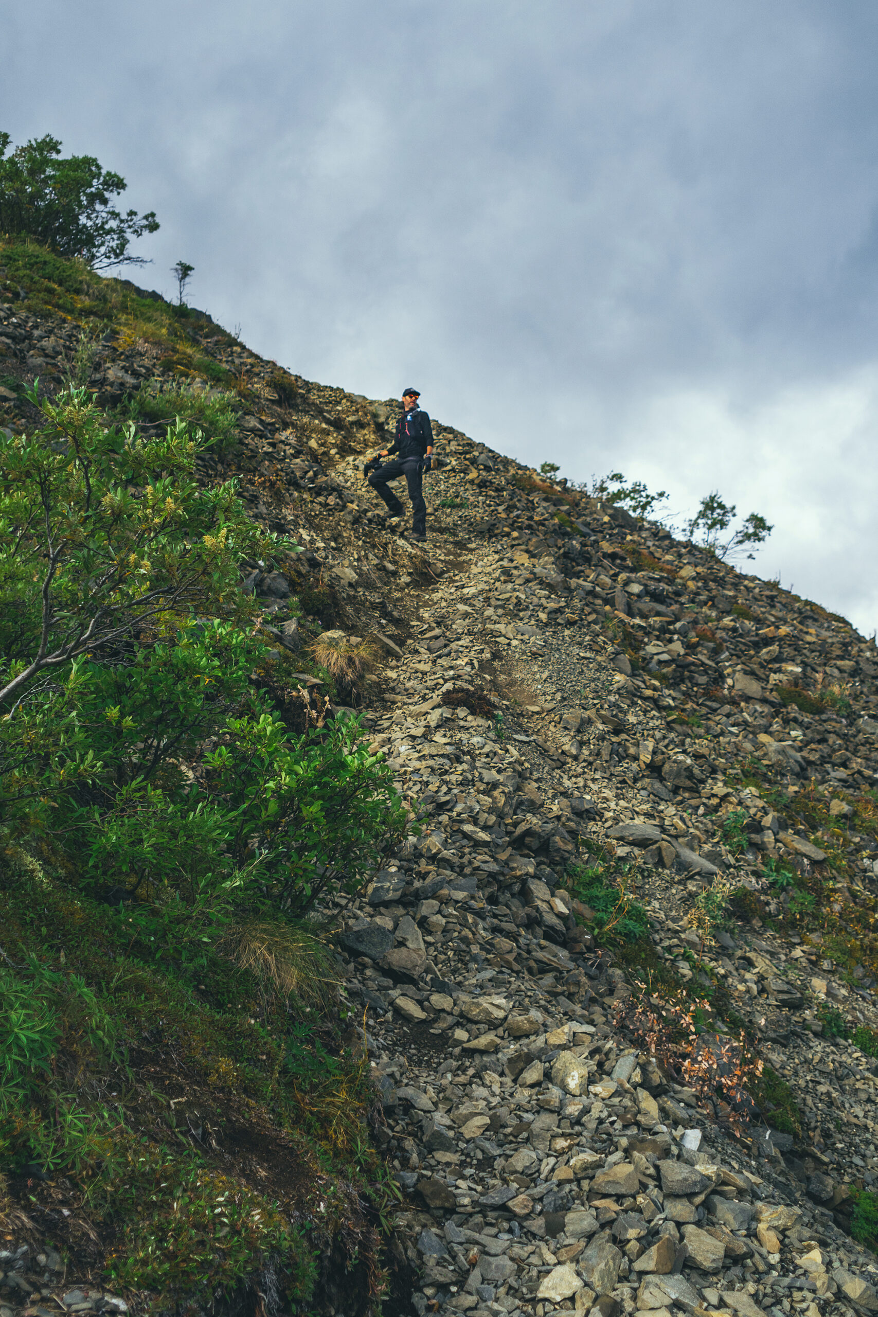

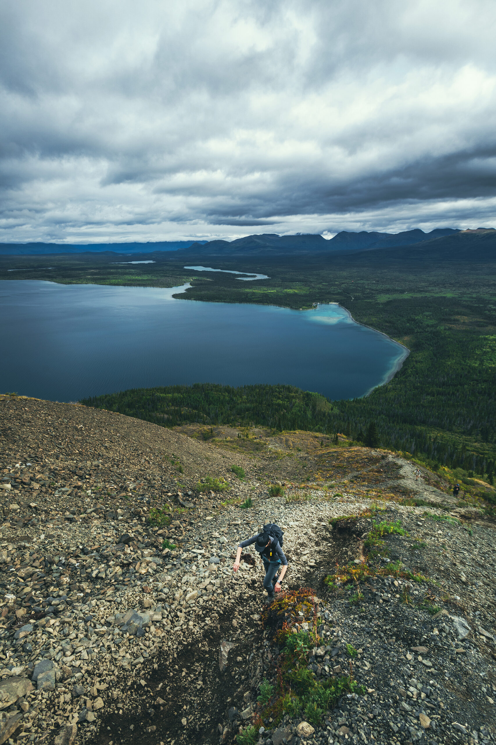

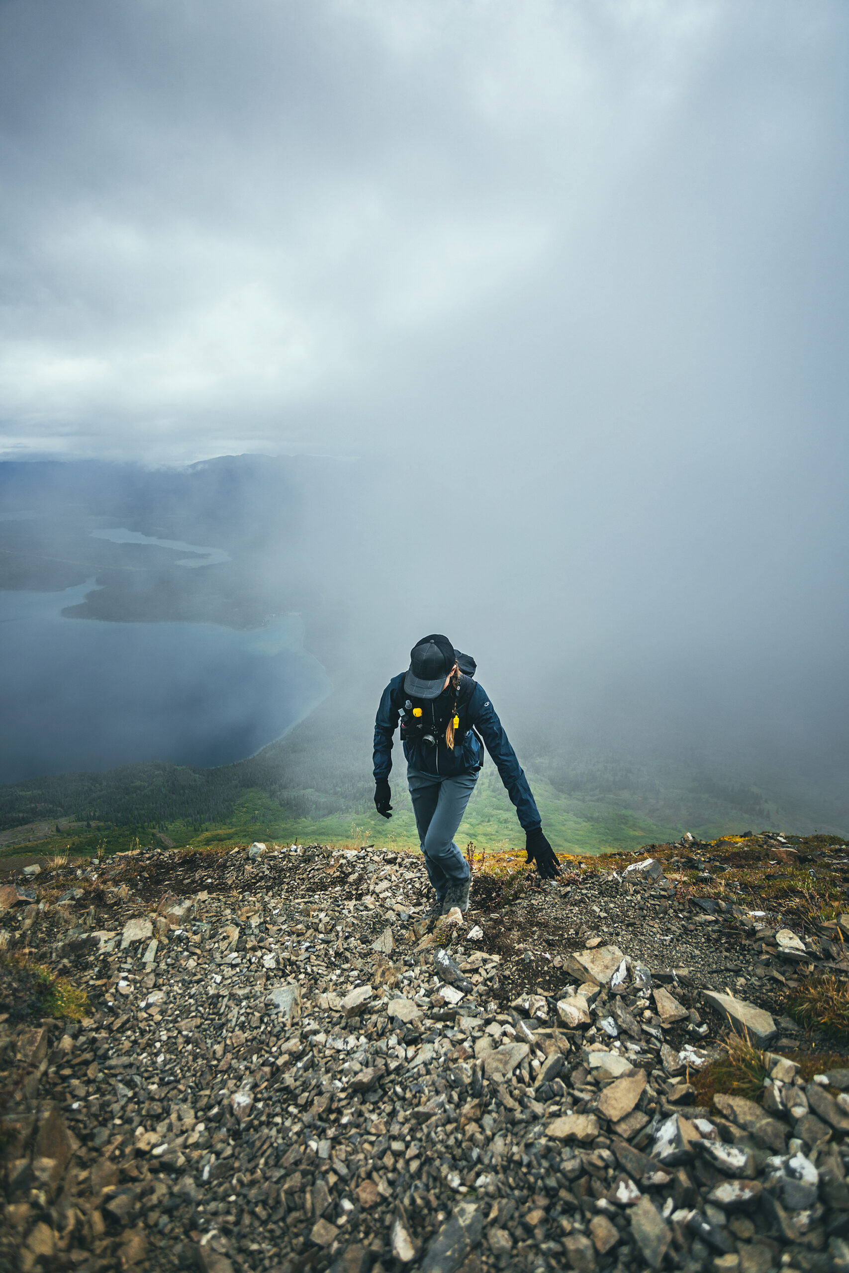
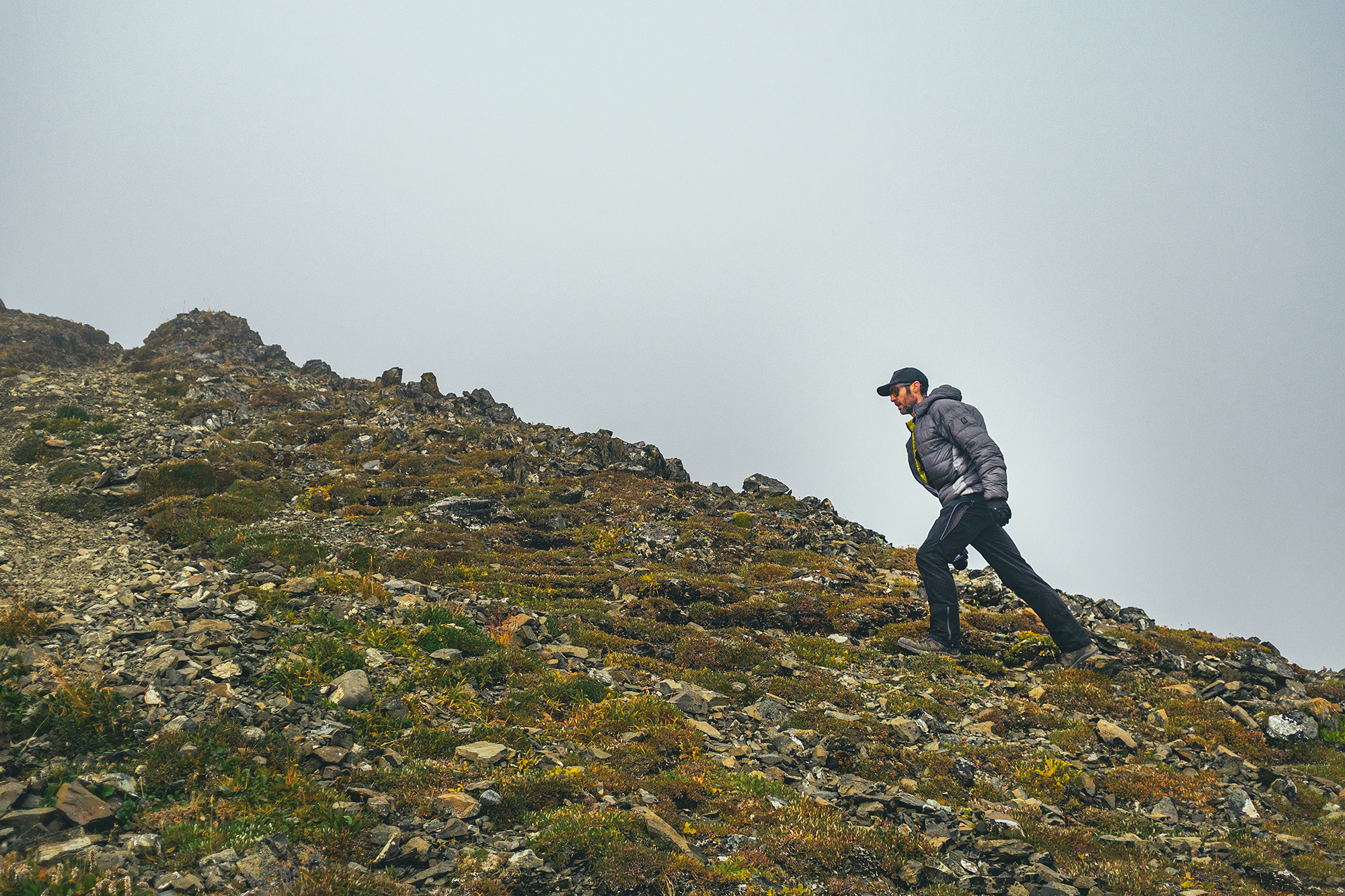
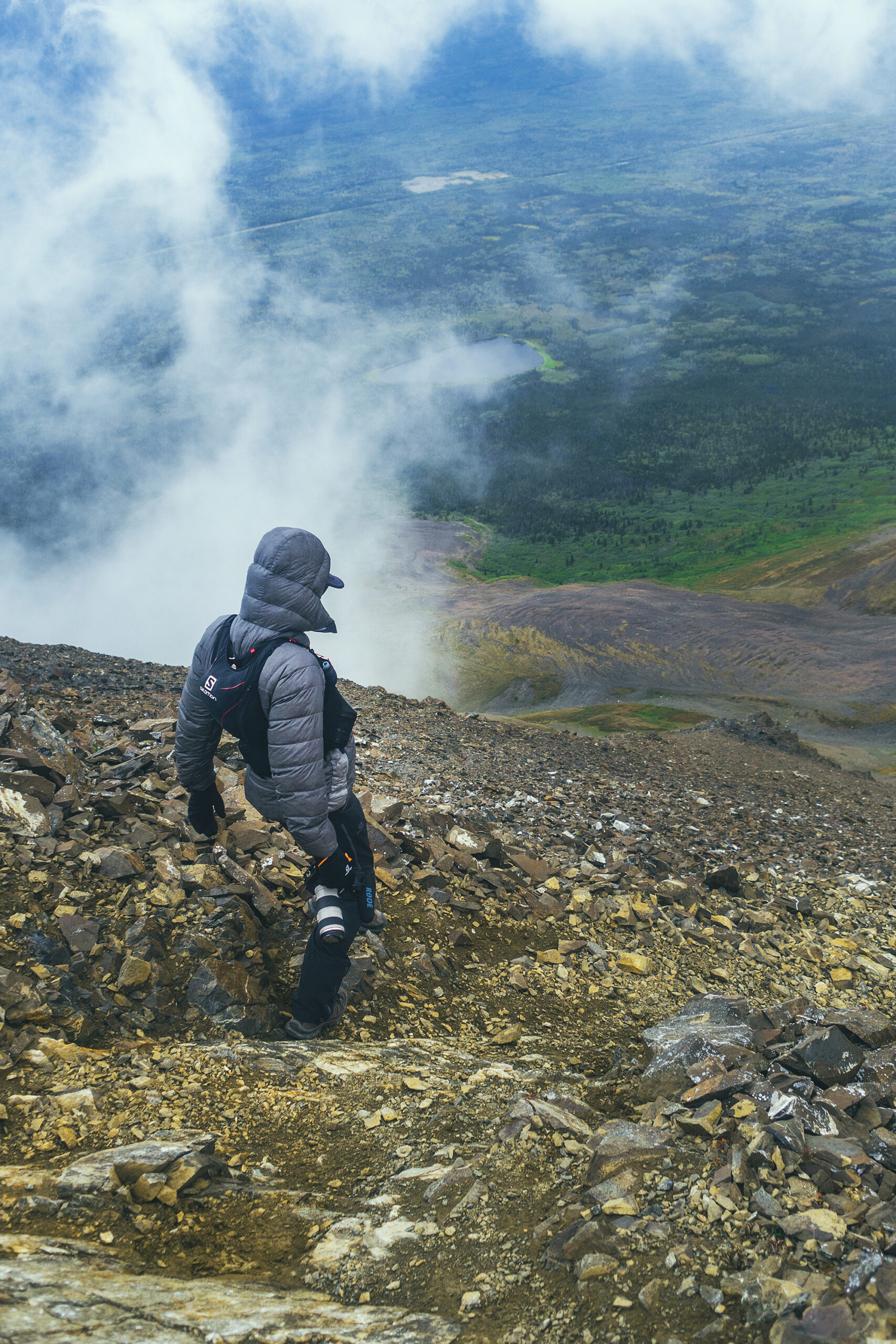
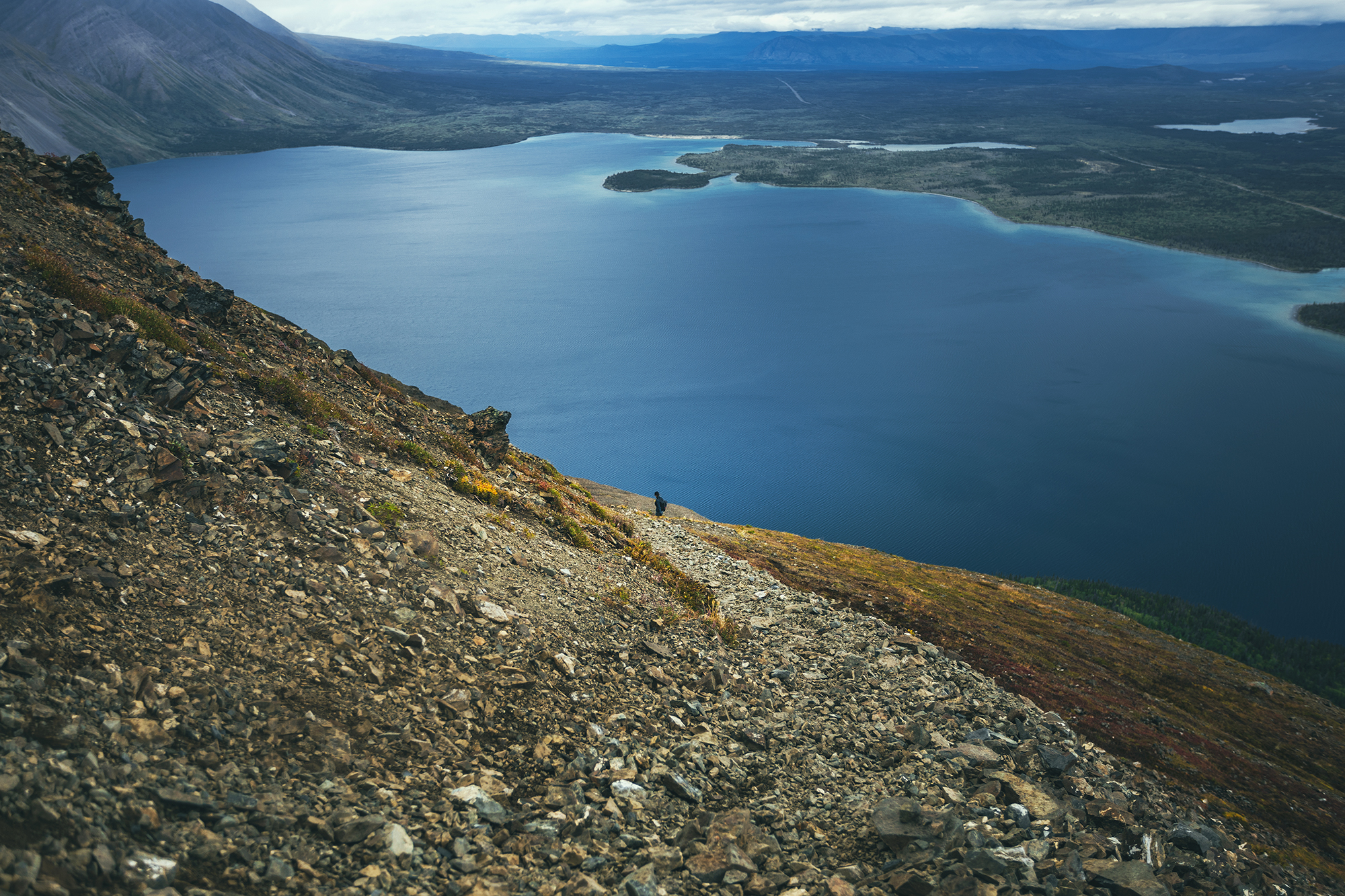
That portion was probably the most challenging (both up and down) as you climb very steeply on loose gravel. It was slow going up and a bit slippery on the down.
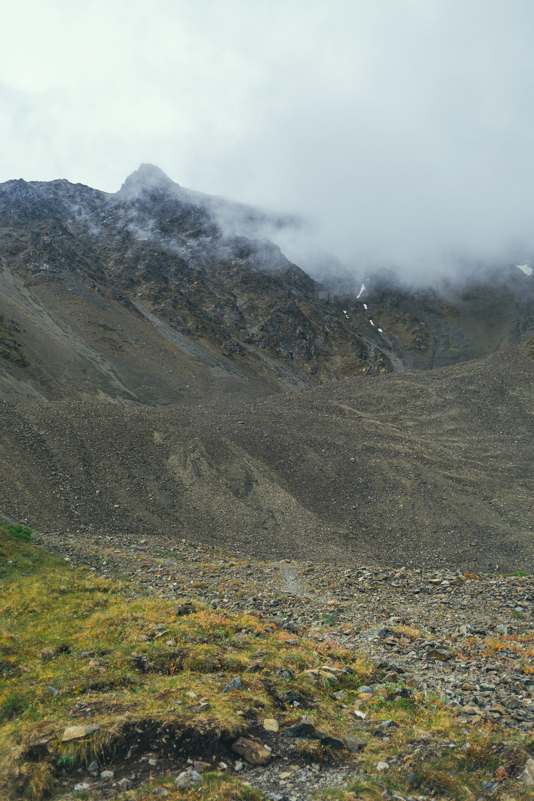
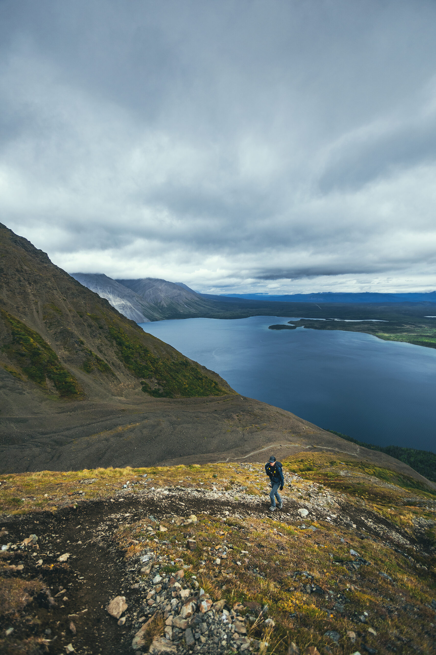
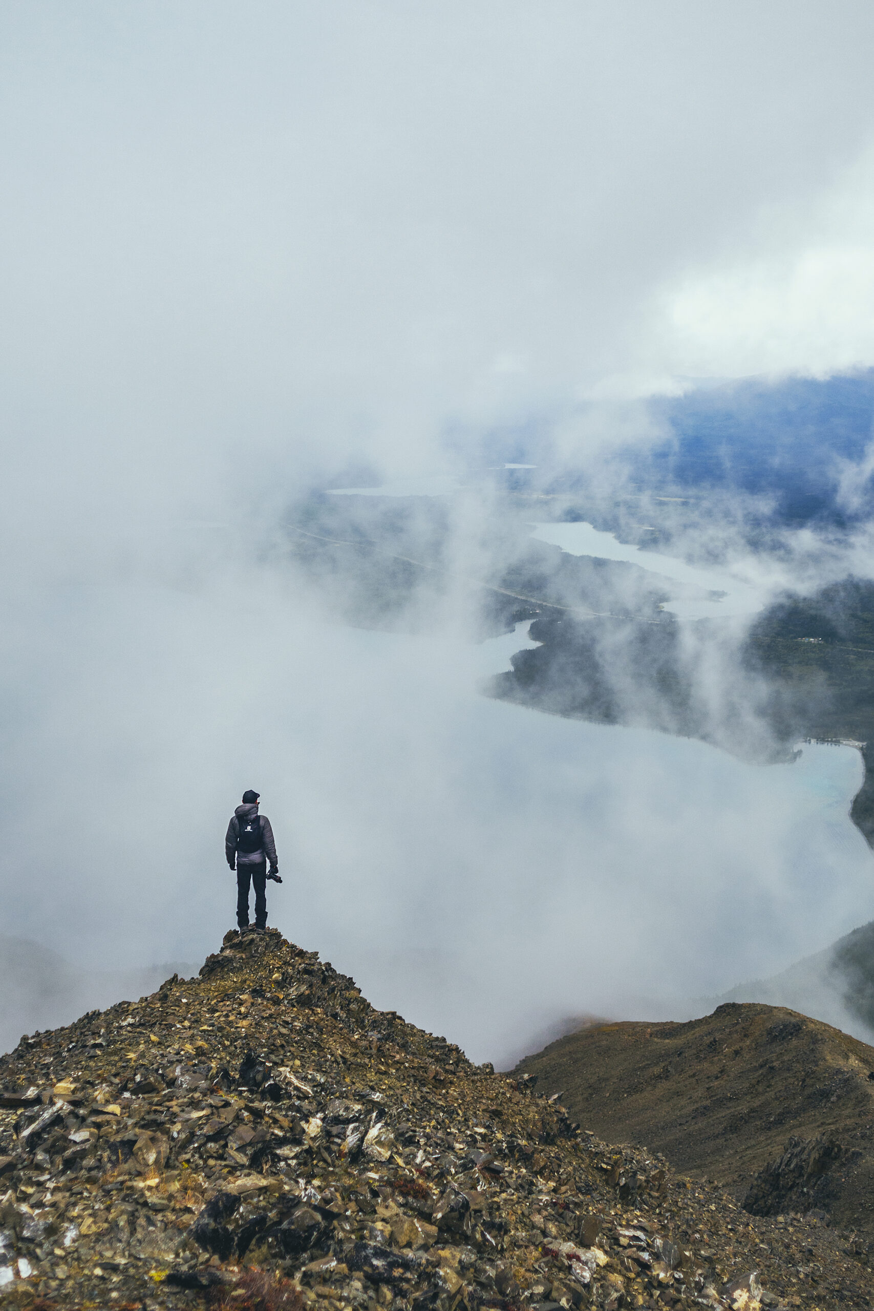
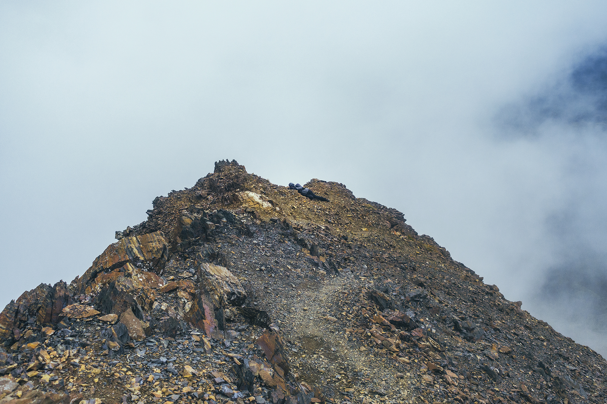
Looking up we could see that the higher section of the ridge was completely covered in clouds but we figured we’d keep going until we felt like it didn’t make sense anymore.
There were some pretty windy spots on the way but alternating with some sheltered ones. We had a snack part-way up and we were debating whether to continue.
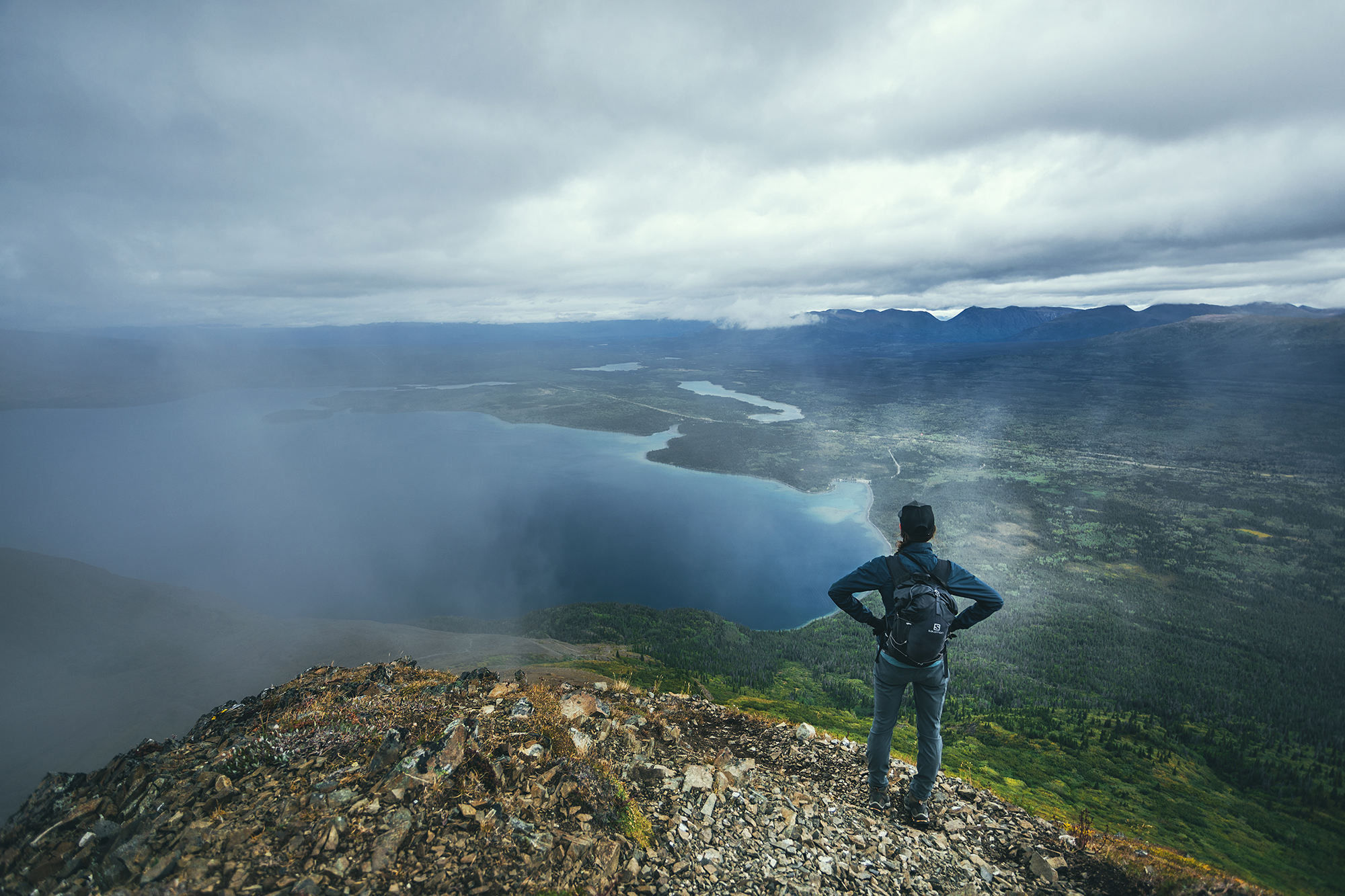
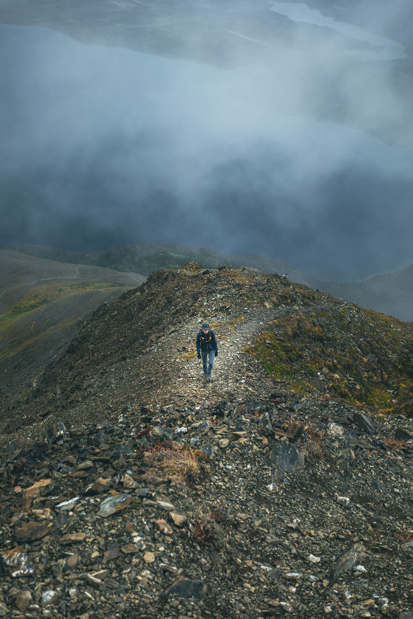
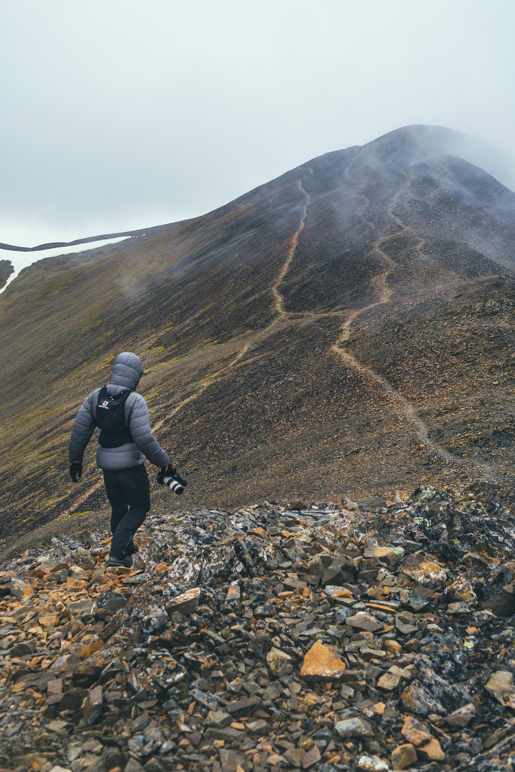
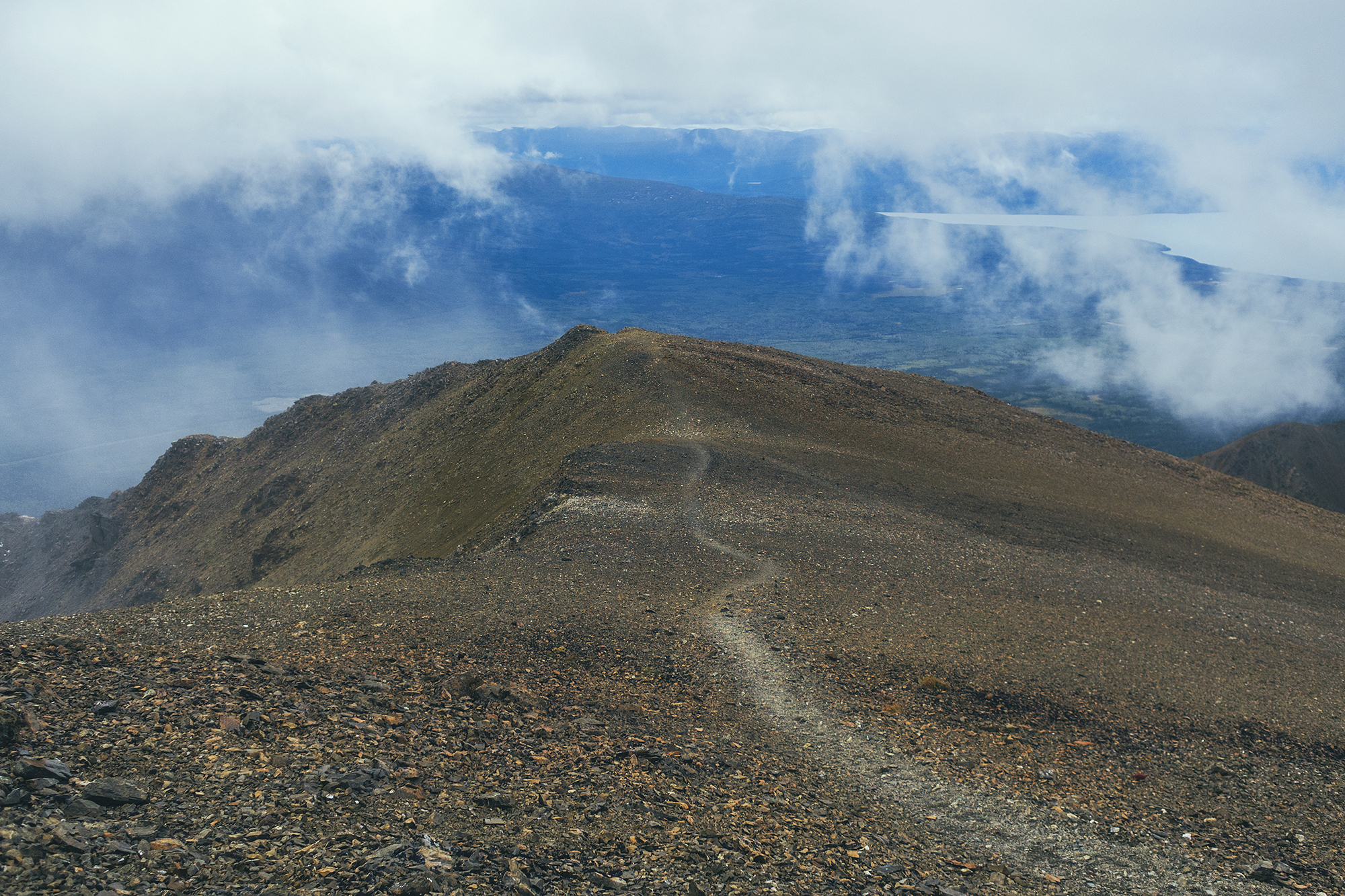
Another couple was following us from not far behind so we let them go by, to see if the next portion was strenuous or not, based on their progress. Turns out we were pretty much at the top of the steeper climb, and from there the trail followed the ridge relatively smoothly.
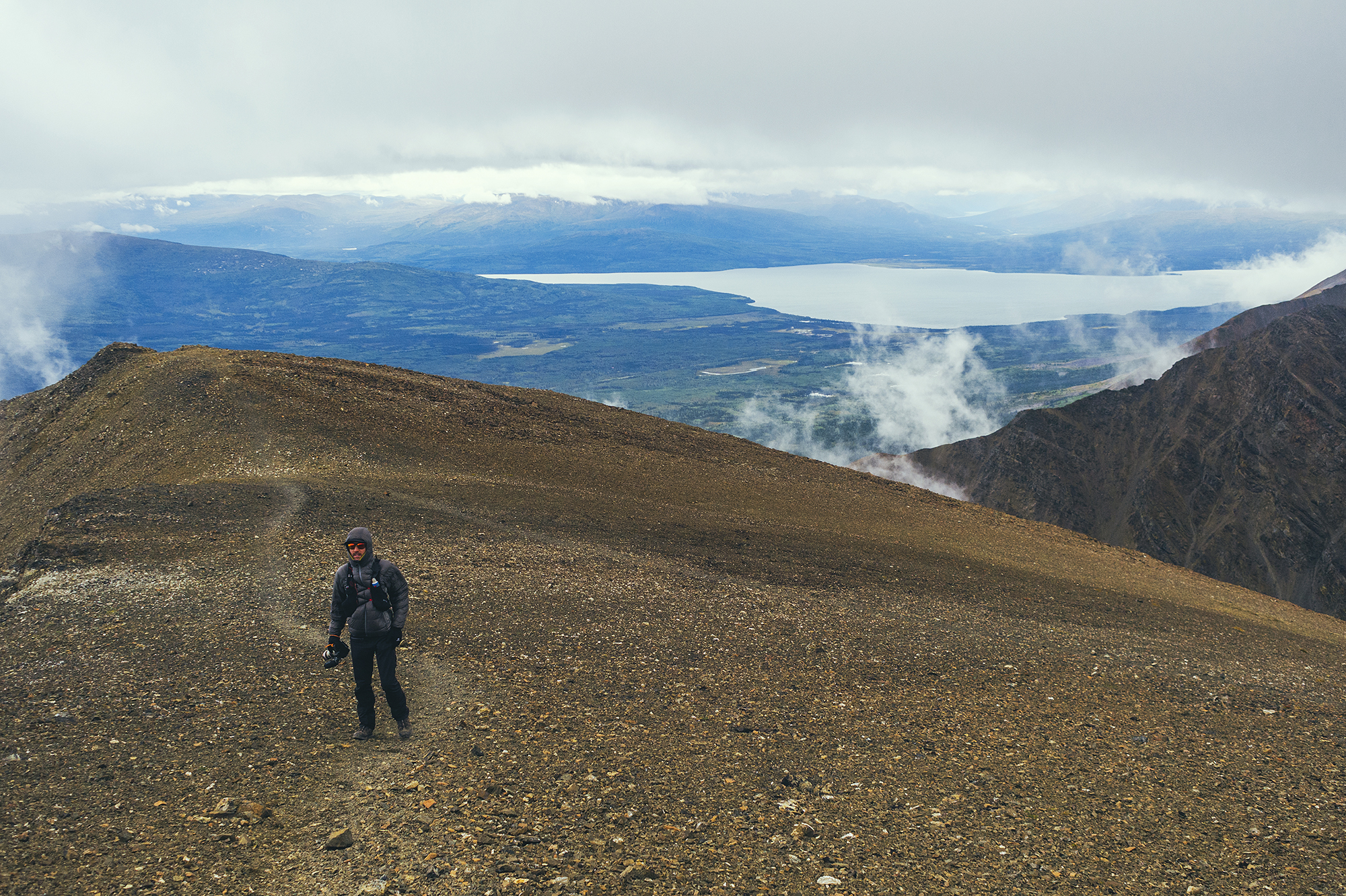
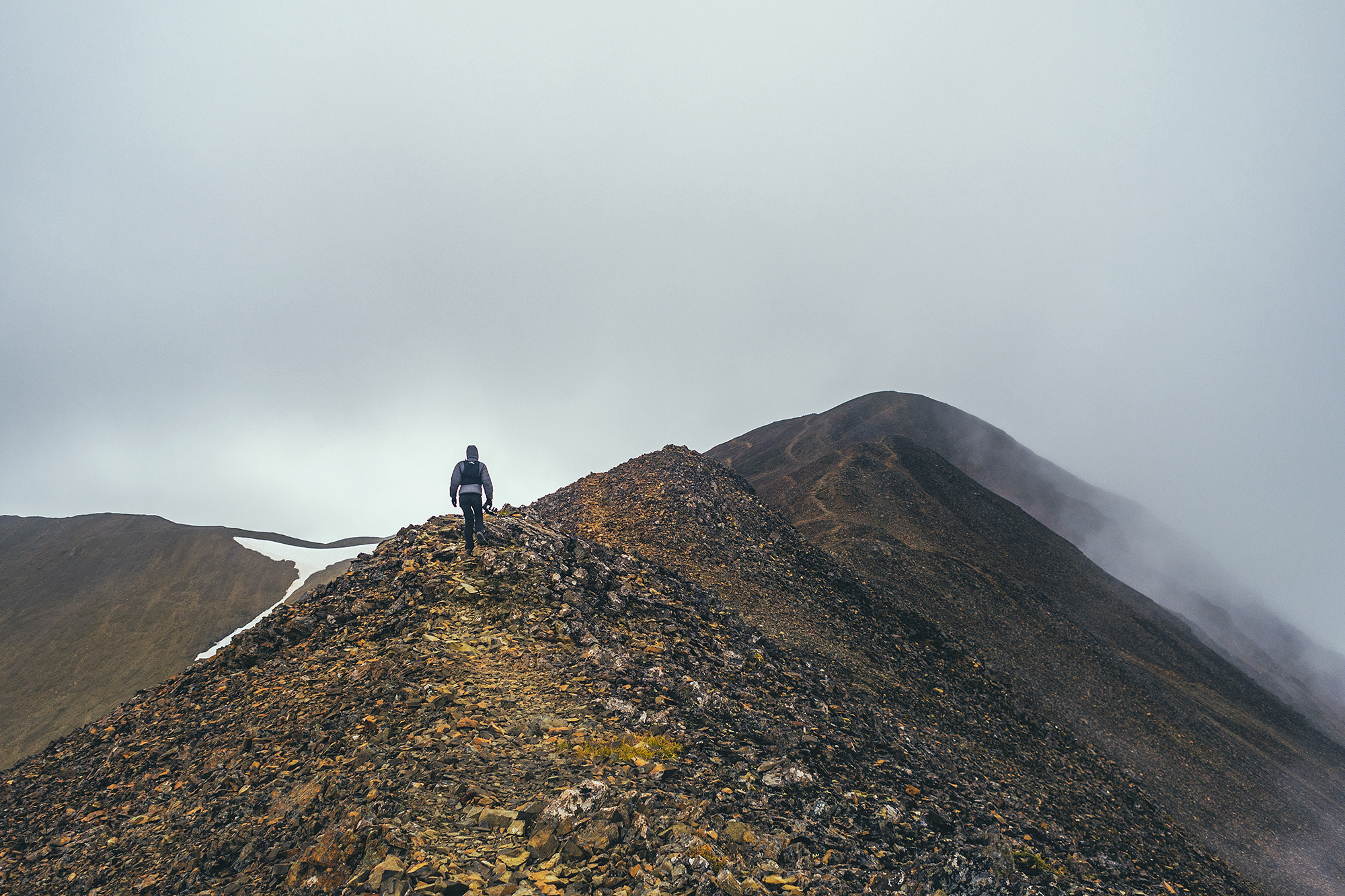
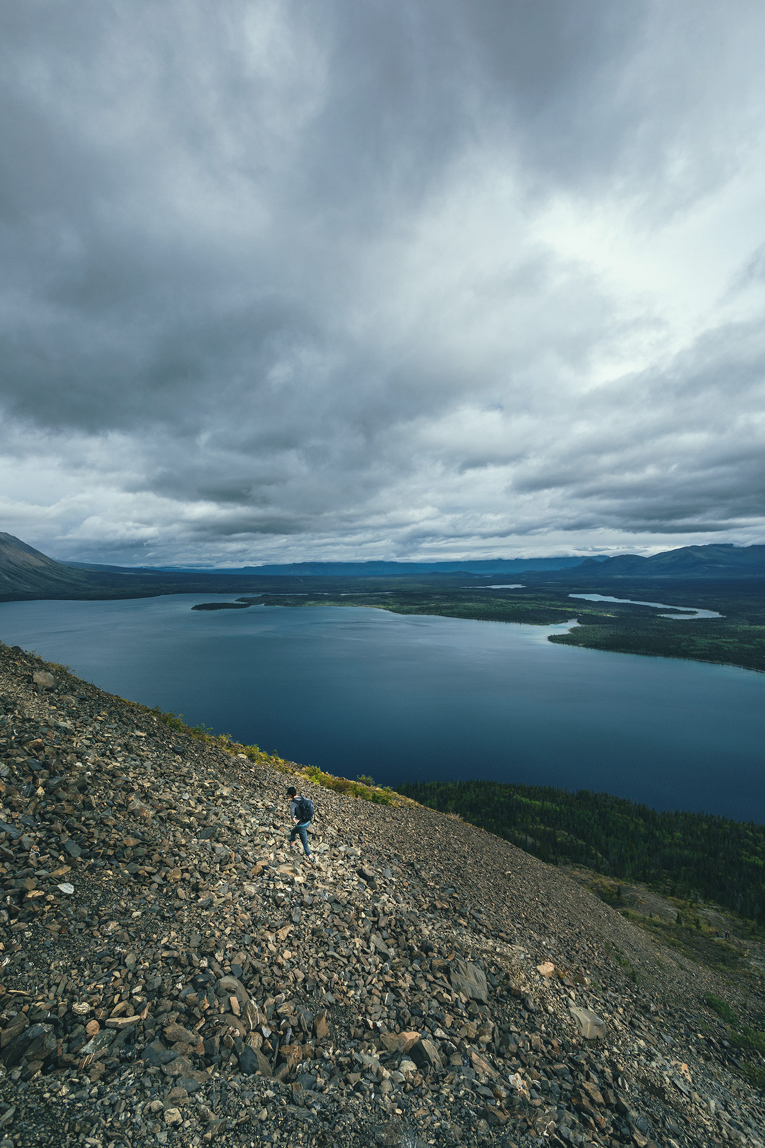
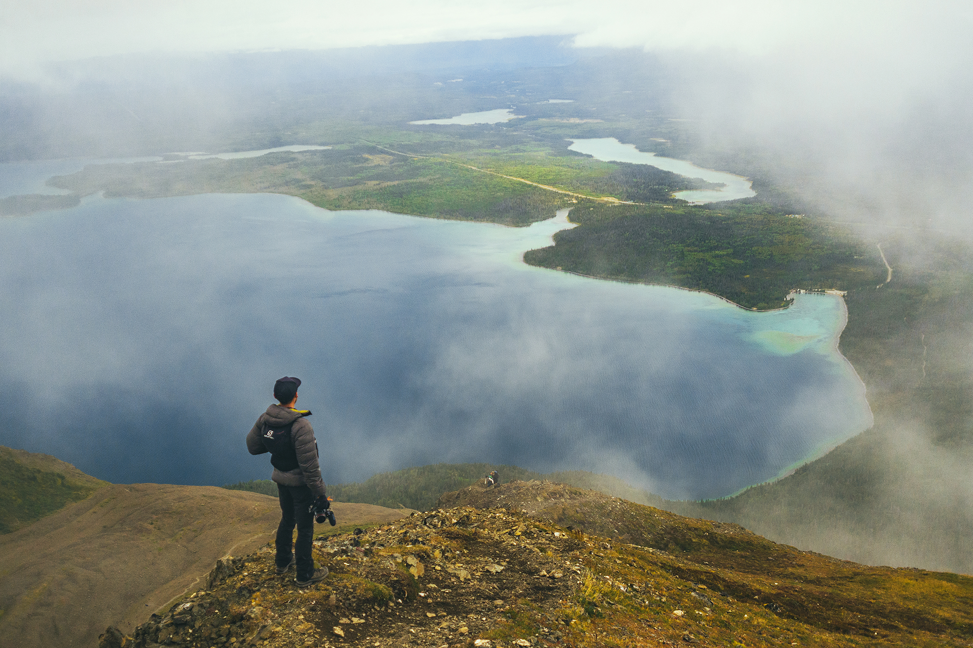
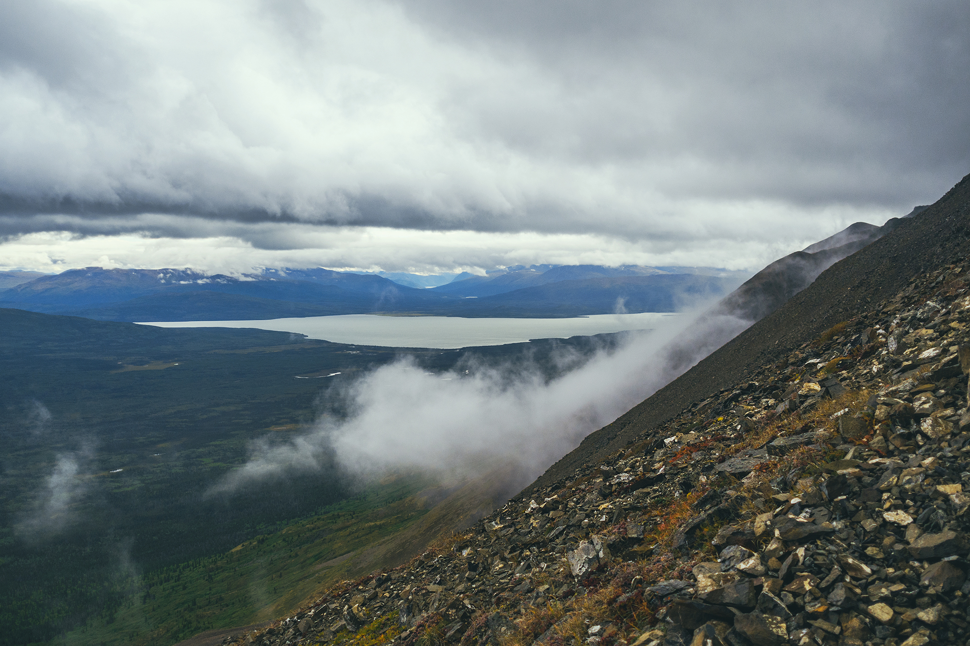
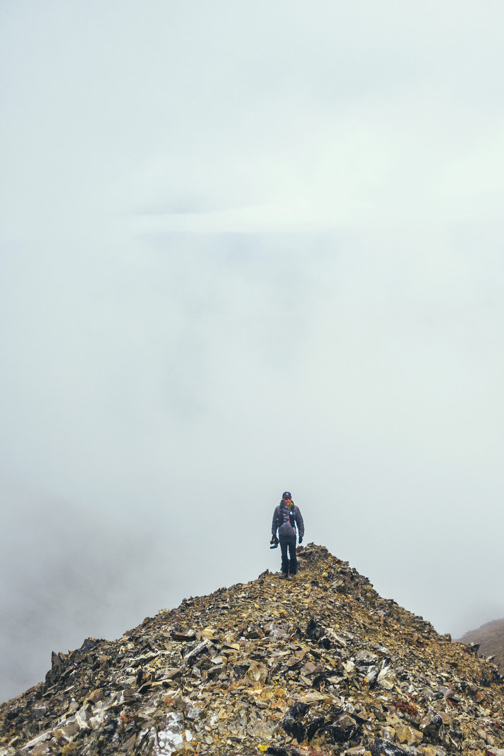
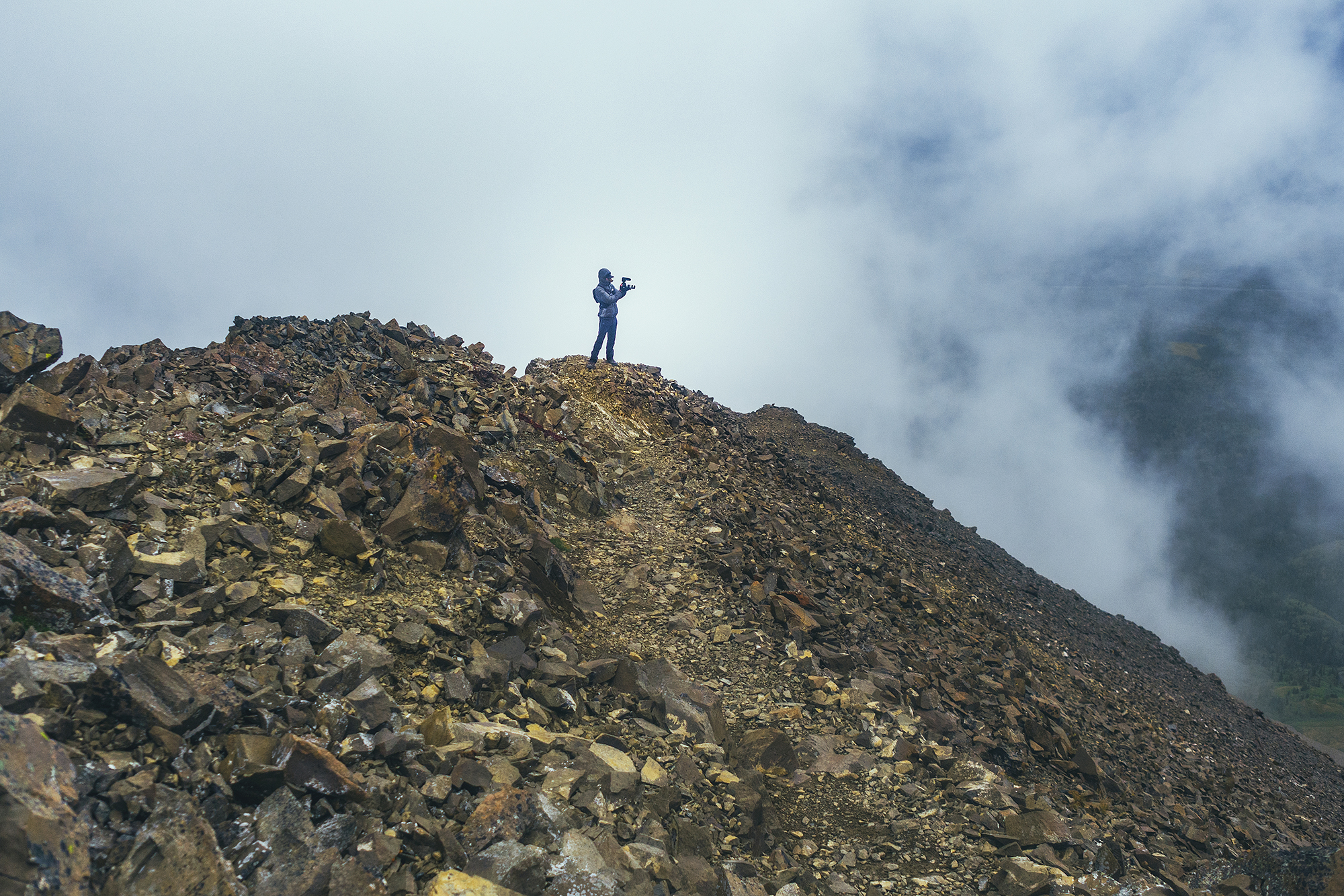
The trail split at each “bump” with option to go up or circumvent at the base. The ground was made up of larger rocks and traveling on that section was actually quick and easy. We went over 3 or 4 prominences, every time wondering if that was the summit, and every time it wasn’t, another bump showing up silhouetted further in the clouds.
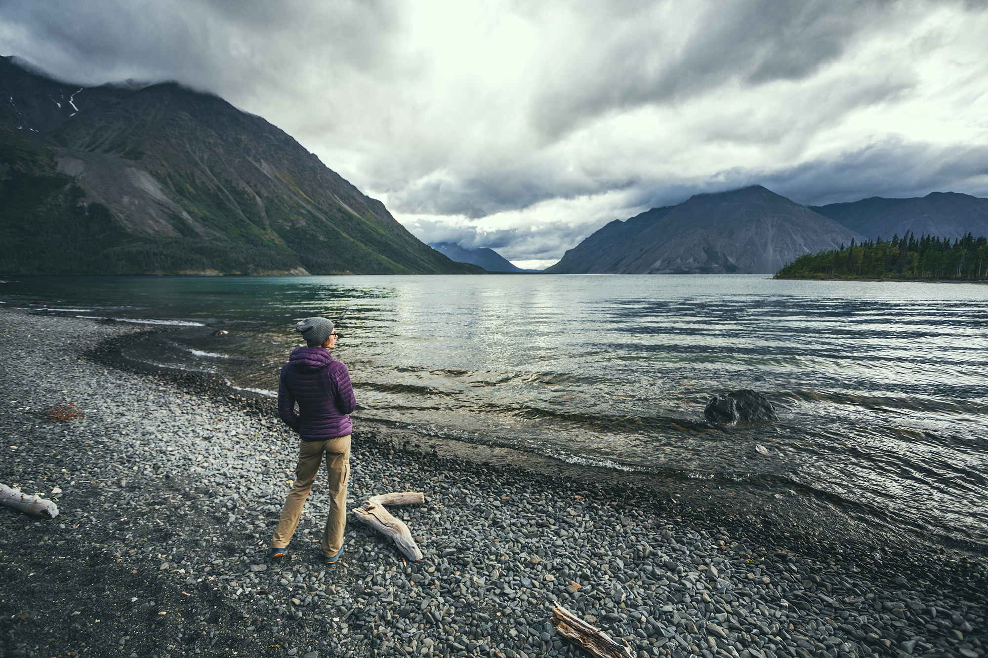
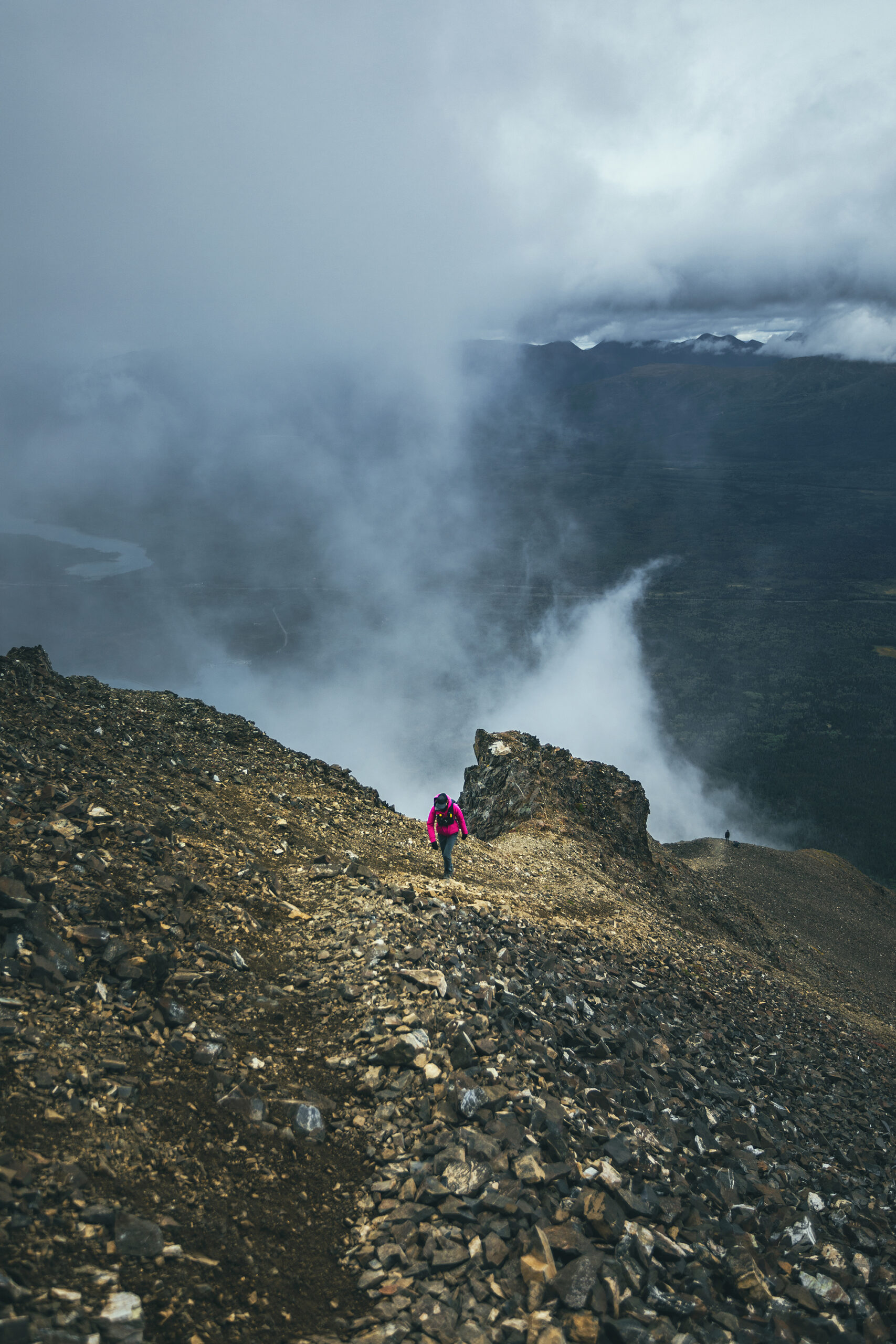
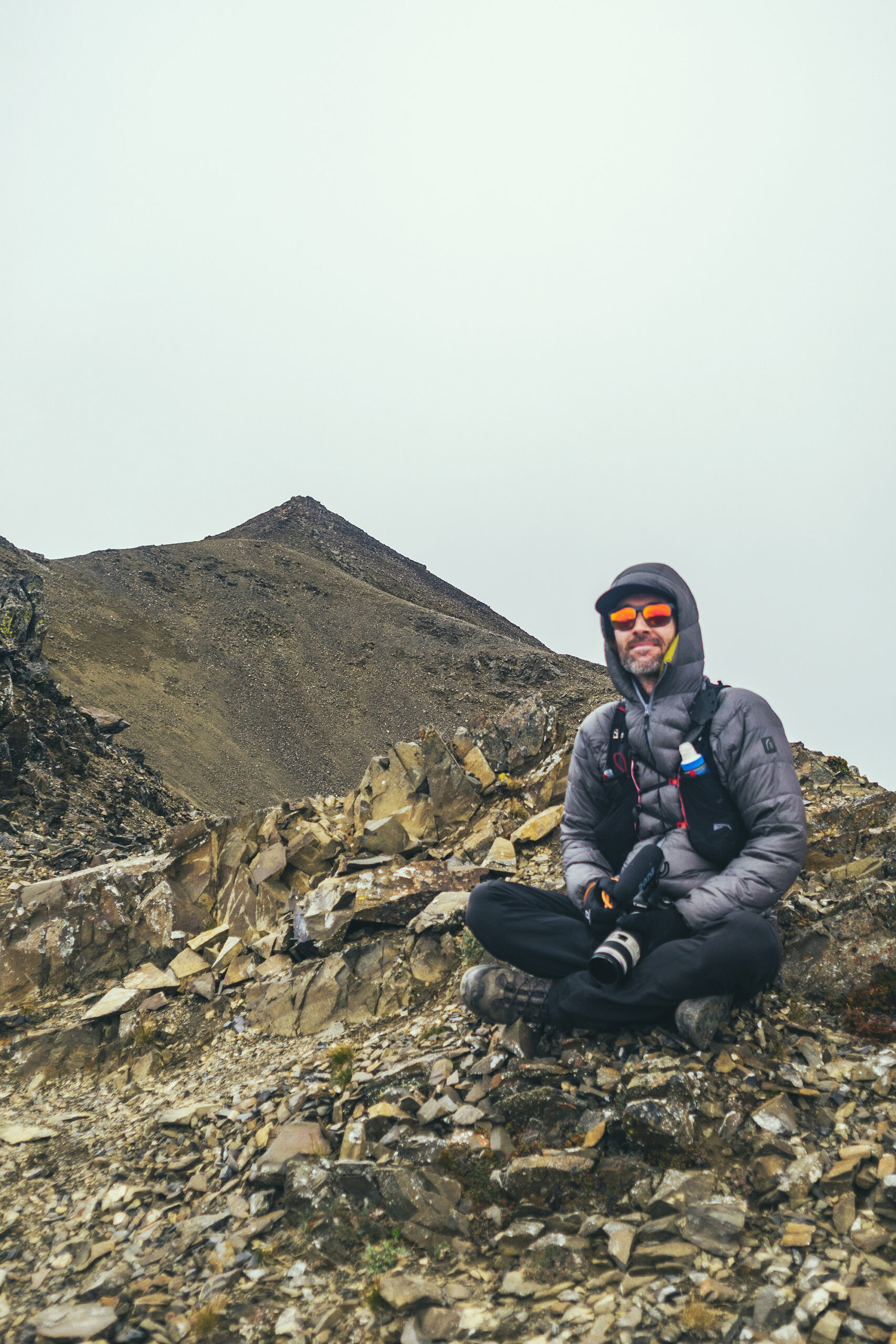
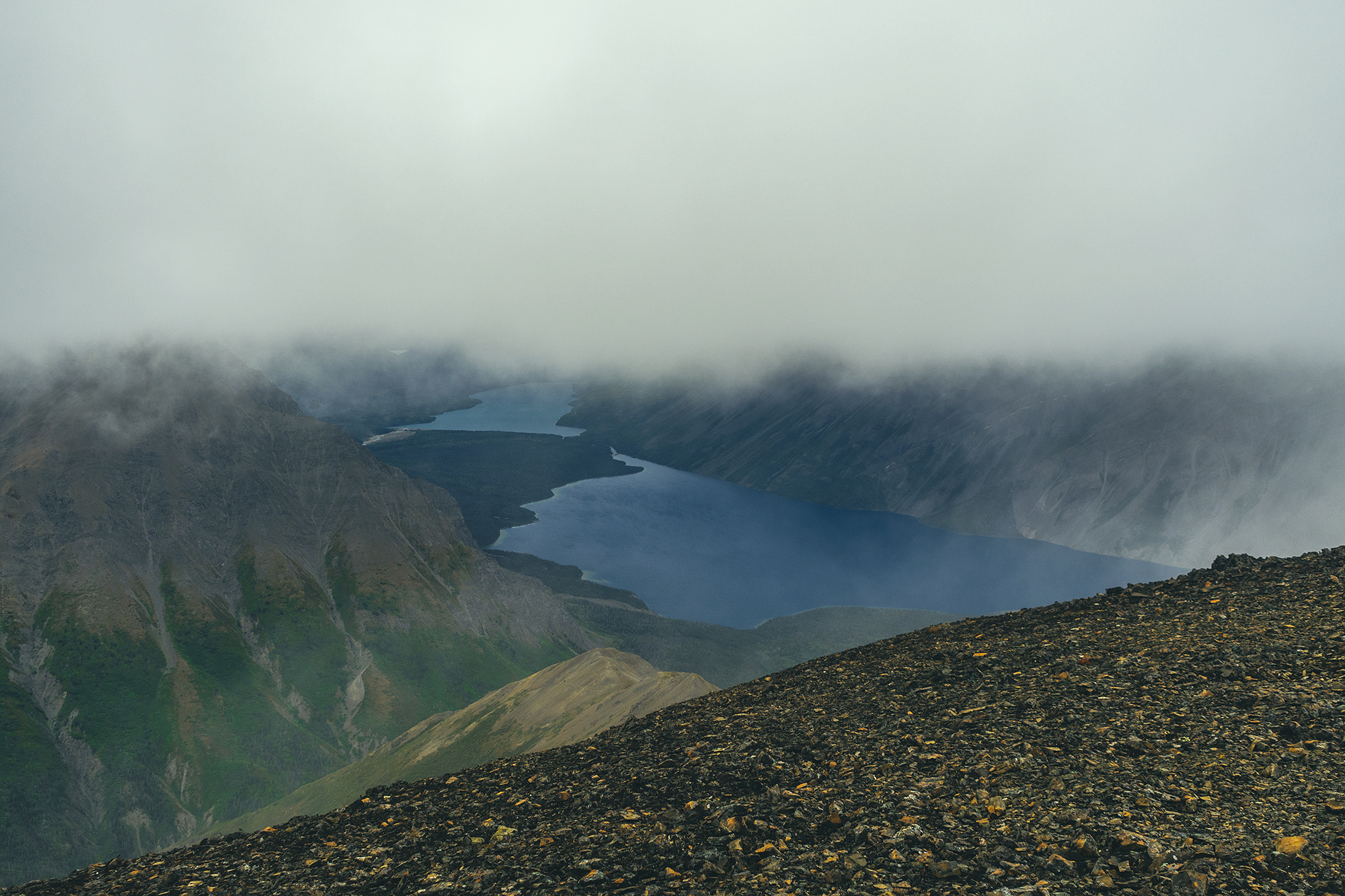
The official summit is technically the far end of the ridge, opposite to where we climbed, and we debated how far to keep going as we were basically traveling in a cloud, with little to no view. We did get a peek at the far section of Kathleen lake, as clouds parted on the other side of the ridge. Eventually we made it to a section where someone had built a small shelter out of stacked rocks.

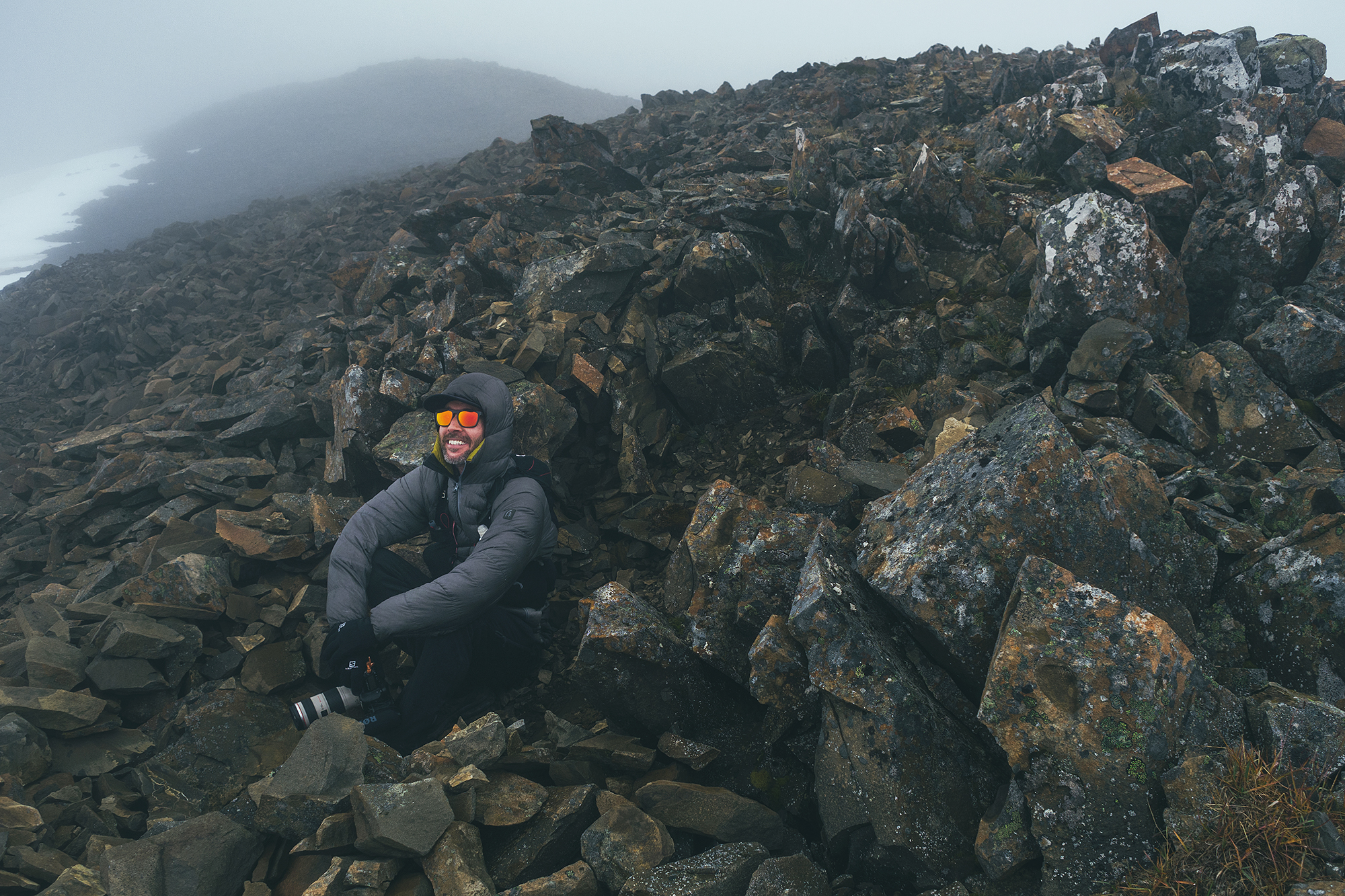
The wind was pretty brutal on the ridge but completely absent in the shelter. We decided this was a good point to turn around. Based on distance, we were at least 1km away from the official summit, maybe more. And at that point, the lack of views didn’t really make it seem worth continuing. A few people passed us, heads down, trudging to the summit, but we decided to turn around without any regrets.
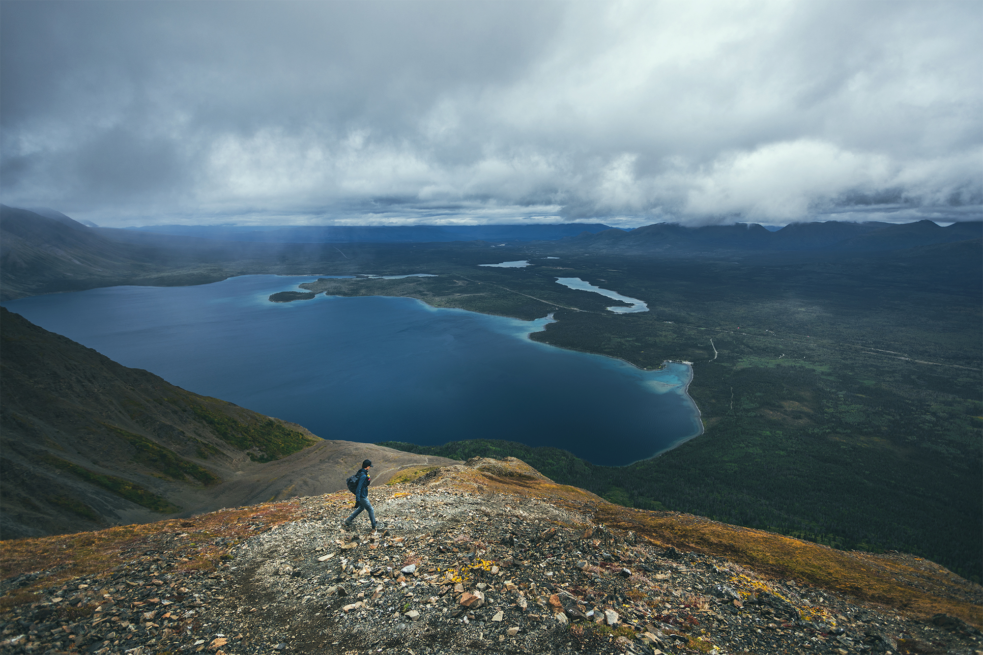
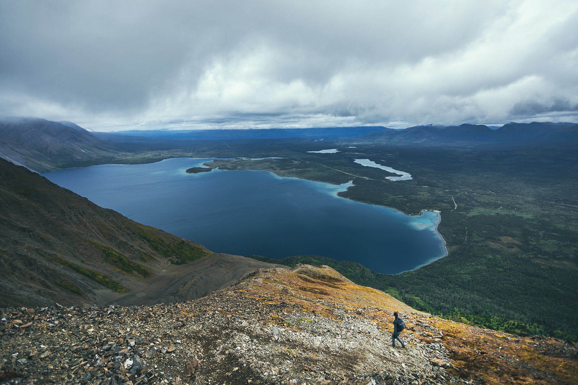
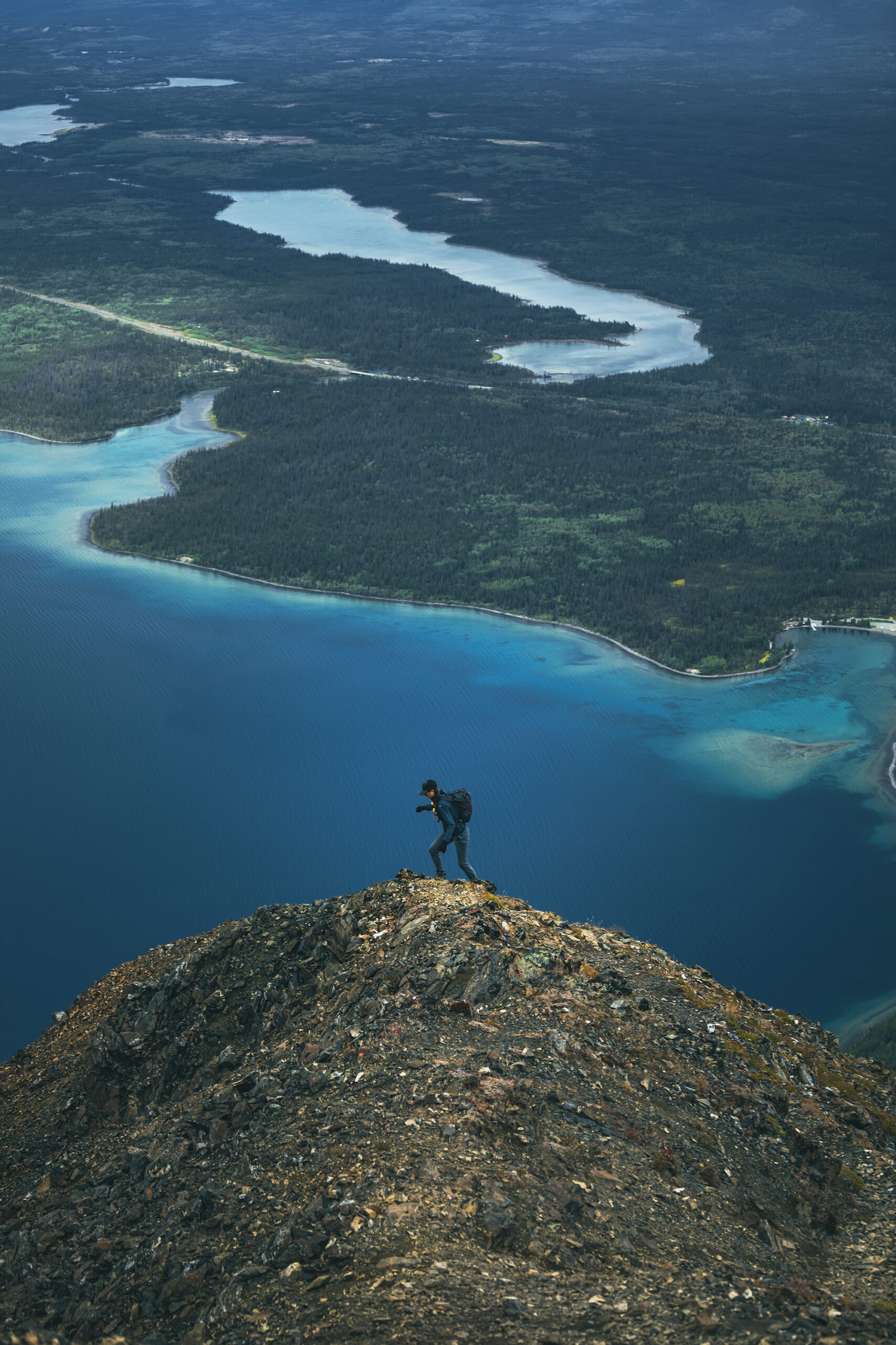
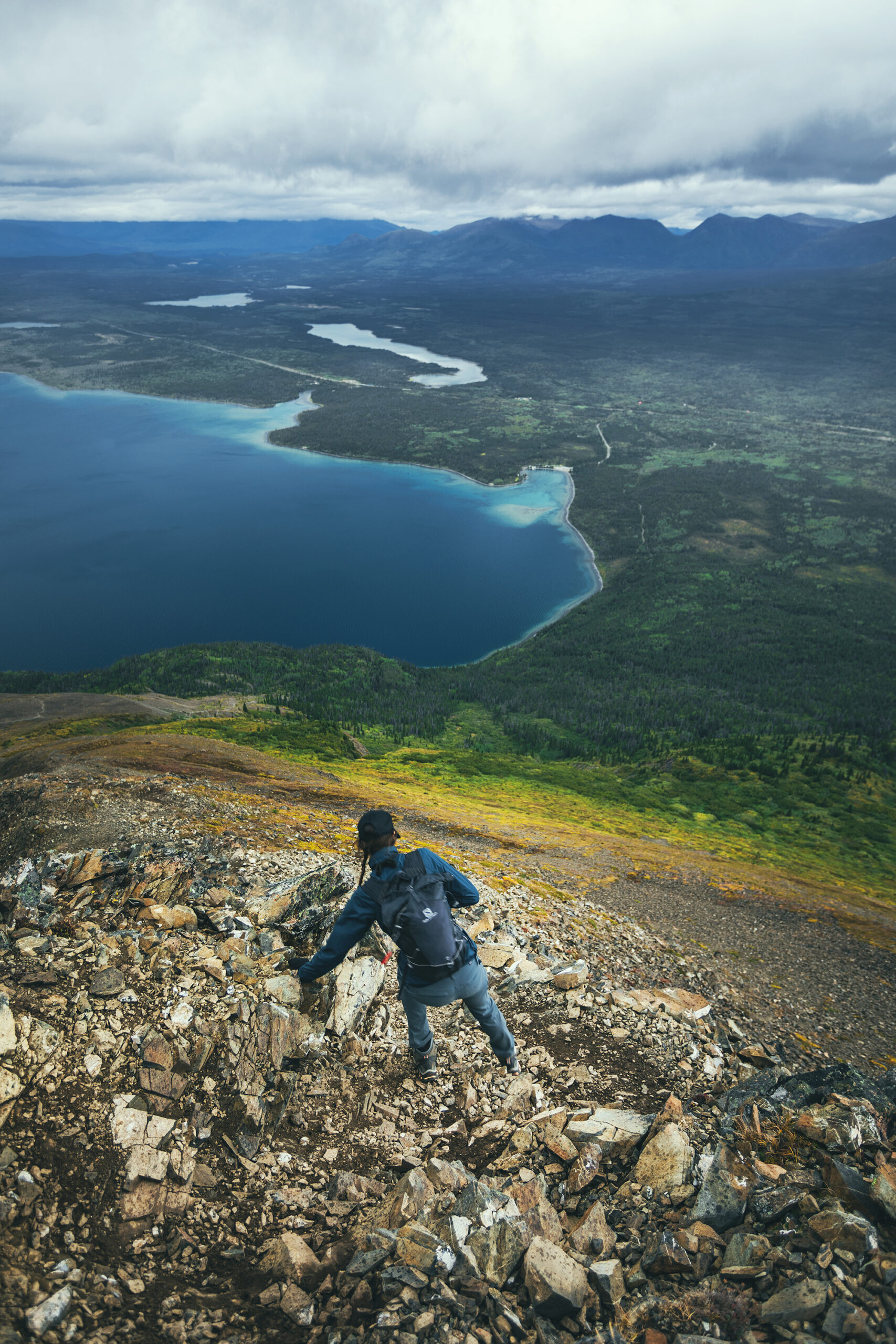
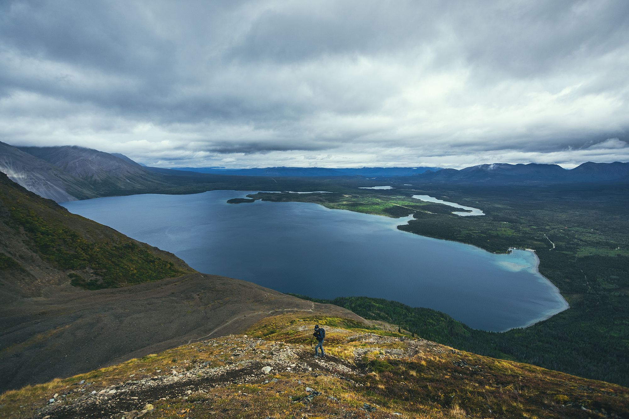
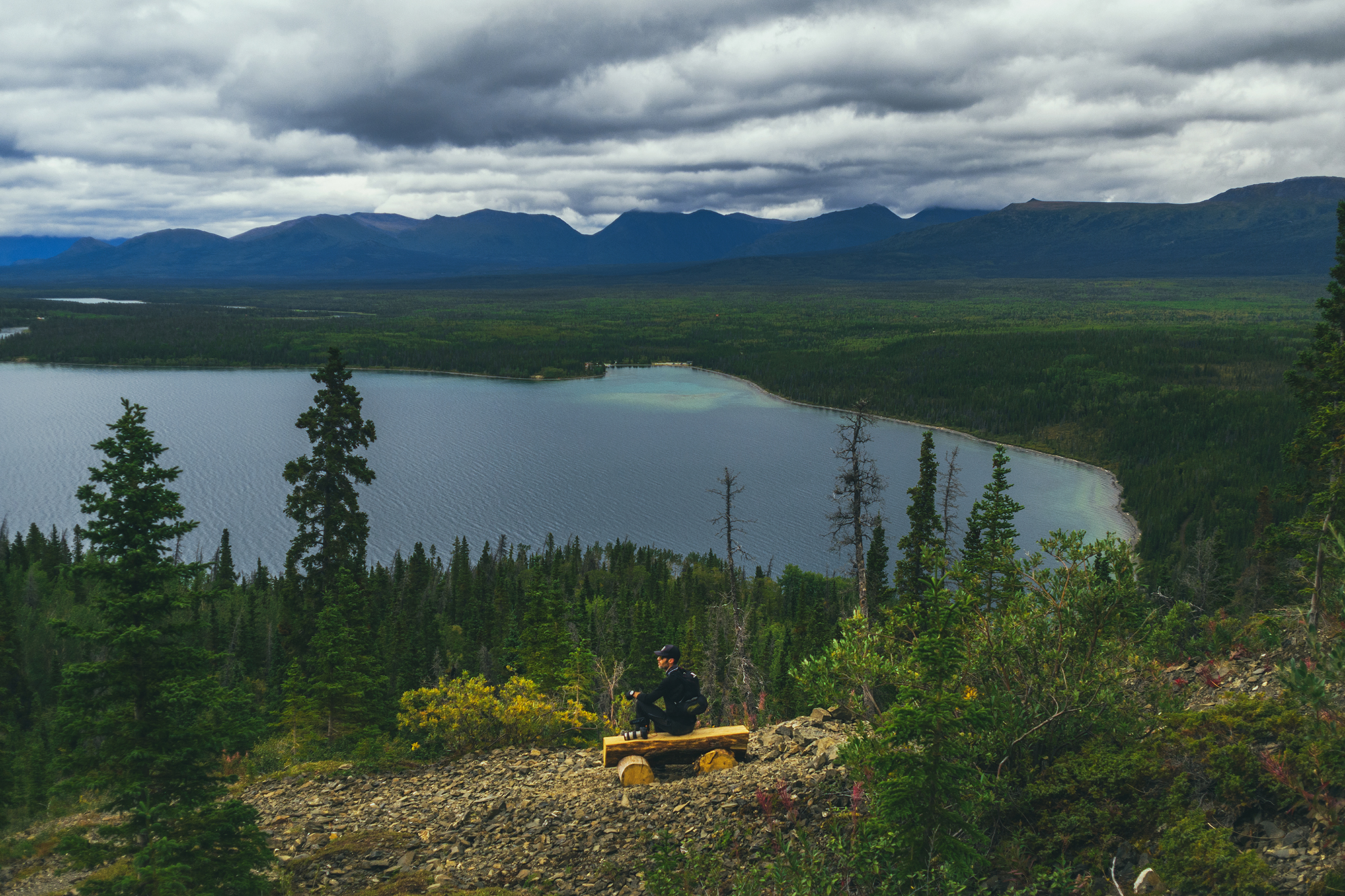
Two hours later when we were back down, sitting by the lake for a snack, and it looked like the summit had cleared but there were still dark menacing clouds above the whole ridge. In any case, we were pretty happy with the hike and the views we got over Kathleen Lake.
It took us 3h20min to go up, with a couple of breaks, and about 2h 20 to come down. I would assume continuing to the summit would have added 1-2 more hours to this. The way down was actually more challenging I found, due to the slippery terrain – And I swear the last 2kmm on flat were way longer than when we started ! (Brice thought so too!). In the end we clocked 13km with 1324m of elevation gain, so a decent day out!
We had snacks at the day use area by the lake, then headed back to camp for the evening.
We had been pretty fortunate with showers so far, finding accessible ones in a lot of campsites or nearby, but nothing of the sort at Kathleen Lake, so sponge bath it was, to rinse off the hike (the lake itself was way too cold and windy for me to go in).
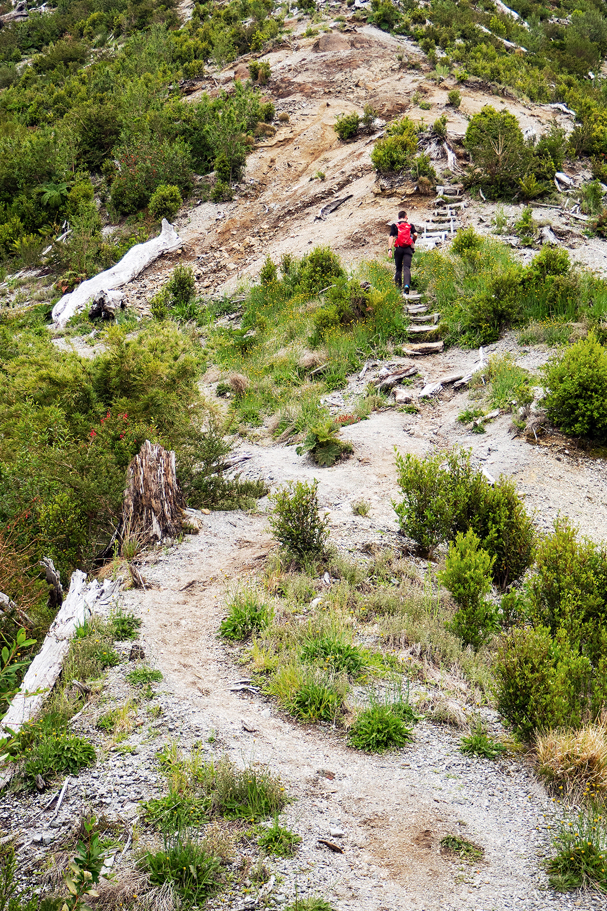
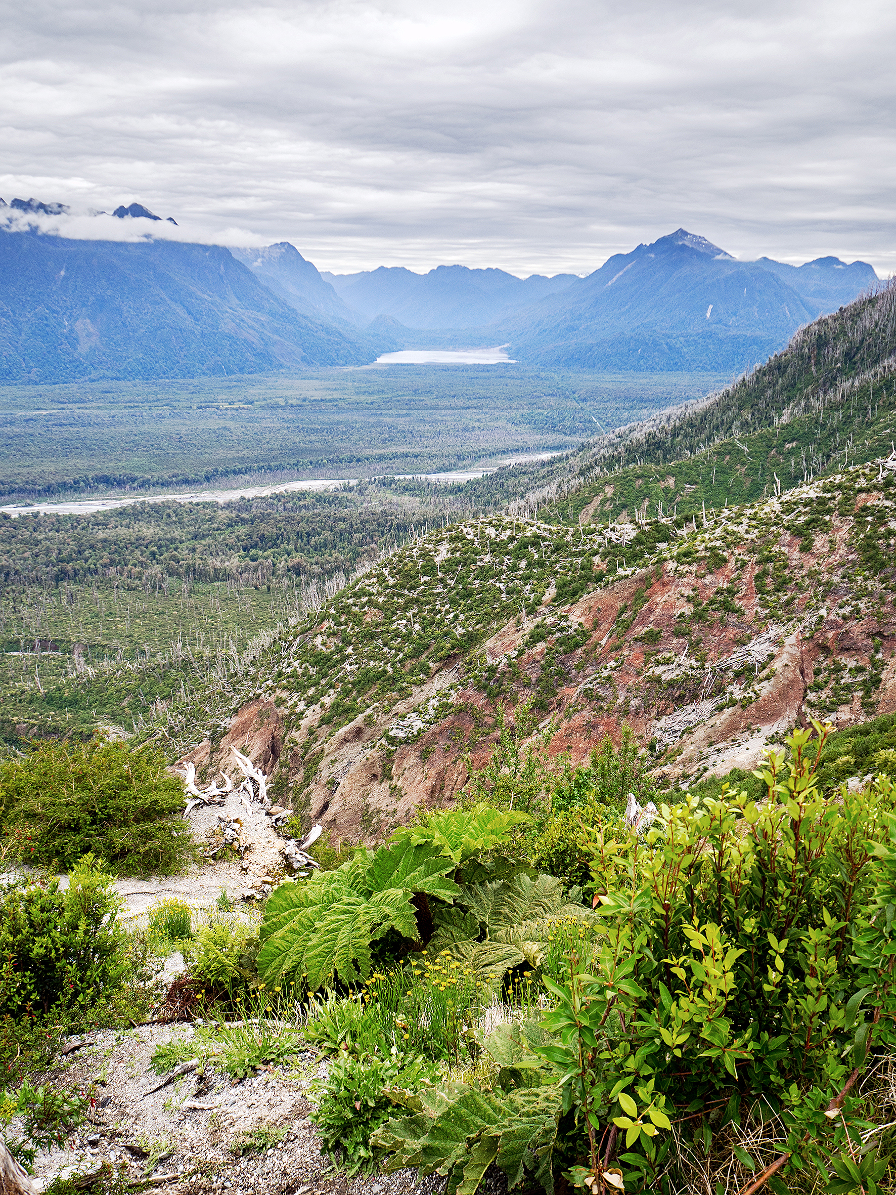
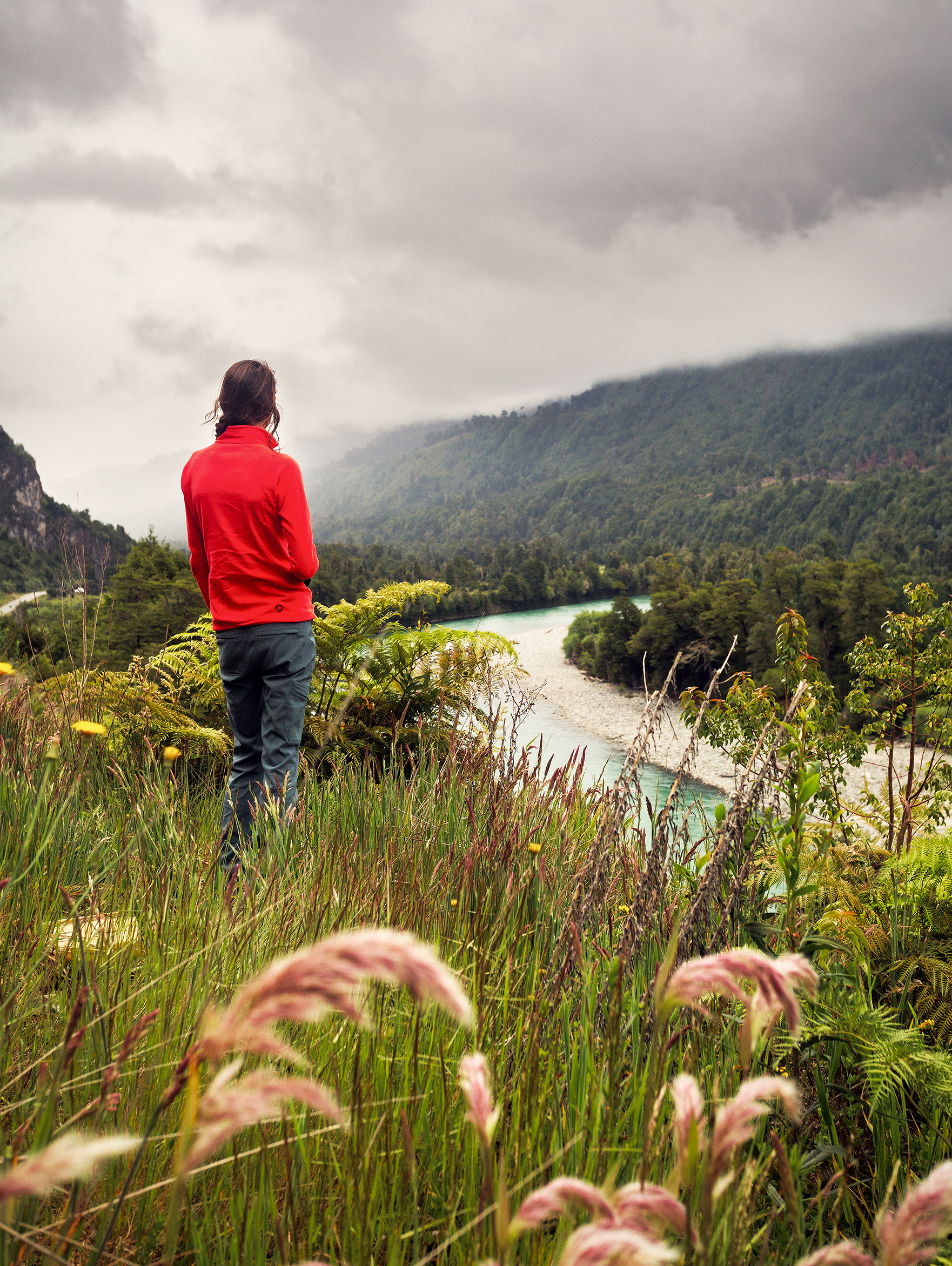
It was pretty chilly still on day 2 of our Patagonia trip, and not being able to make coffee was a bit of a bummer. But we were hopeful we could buy propane once we reached Chaiten, so for the time being we forgot about coffee and headed out for a hike up the Volcano. The short 4,4km (round trip) hike lead us about 700m up to the crater of the volcano in about 1,5 hours. The trail was pretty steep, with a fair amount of stairs carved into the ground.

I won’t lie, it kicked our butt. Mainly because when thinking back to when we had our last full substantial meal, we came up with “3 days ago, on our last day in Dominical. Costa Rica!!!”. Since then we had mostly had snacks on the road and sandwiches, and had skipped a couple of dinners due to arriving late in places. So, even though we’re generally in pretty fit conditions, this one felt like we were trying to run up the Grouse Grind on an empty stomach.
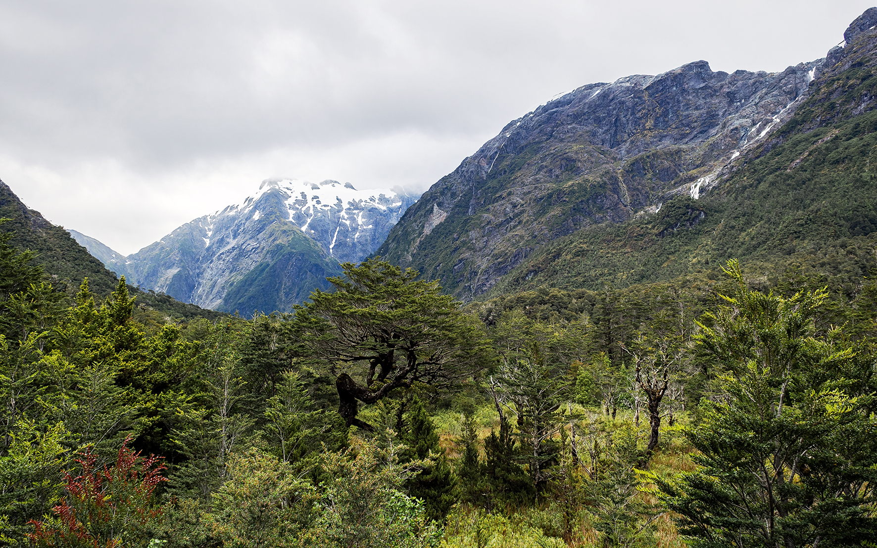
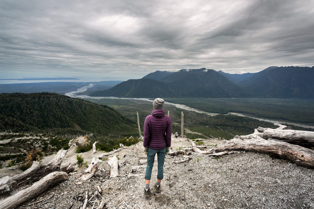
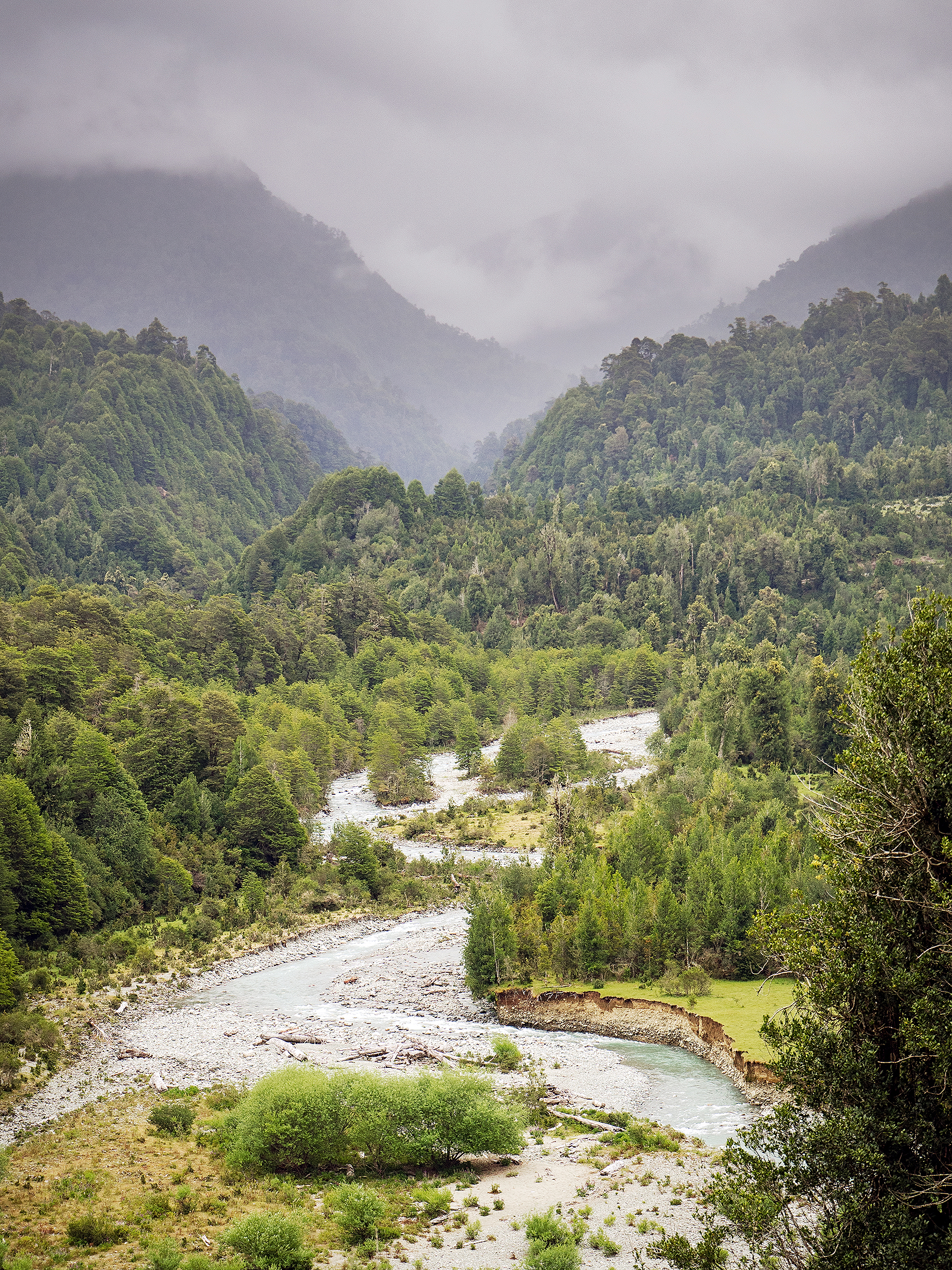
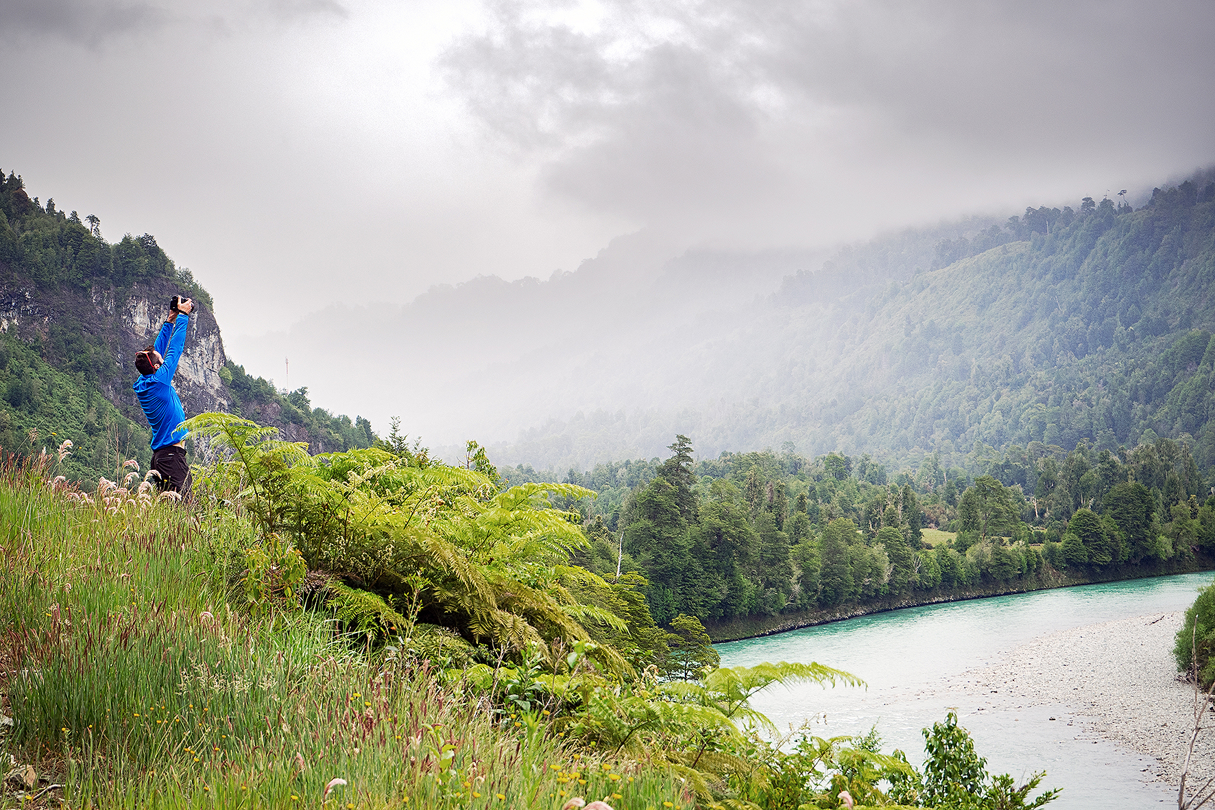
The hike was beautiful. The view was mainly open all the way through, providing really nice vistas of the valley bellow and surrounding mountains. Eventually, we reached an even steeper ridge, and although the trail started to fade, the direction remained pretty clear: straight up. At that point it became more or less a scramble up to the crater.
At the very top, we were able to walk alongside the ridge of the crater, with plunging views into the crater on the one side, and out into the valley on the other. The perfect reward after our (embarrassingly) difficult ascent – we still made is up before the three 20-something kids who started a bit before us, so not all pride was lost.
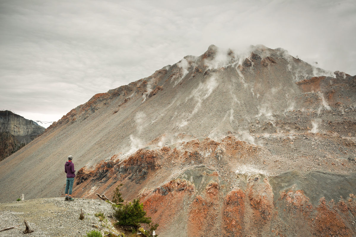
The other side of the crater continued to rise higher up and we could see skinny plumes of steam escaping from the surface of the cone.

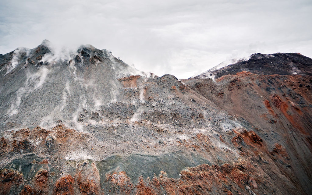
Down below, the once molten lava had now solidified in an earthy, wavy surface.

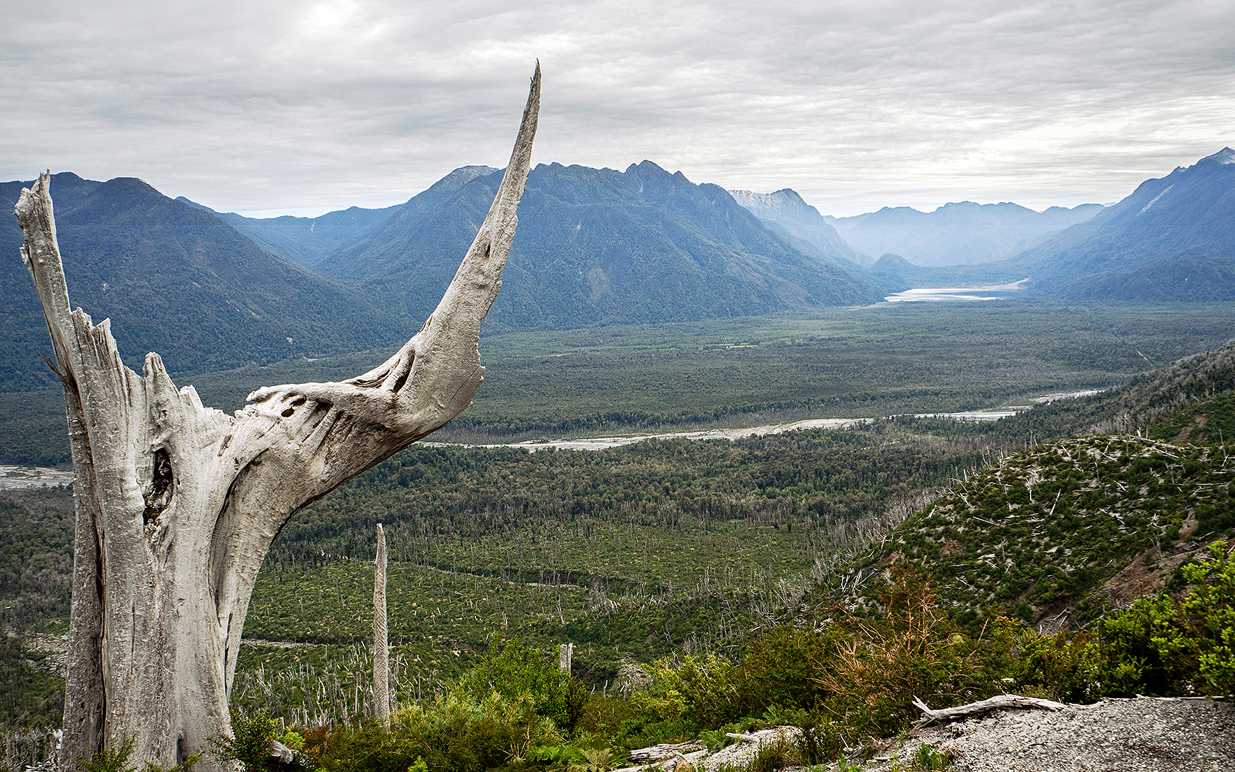
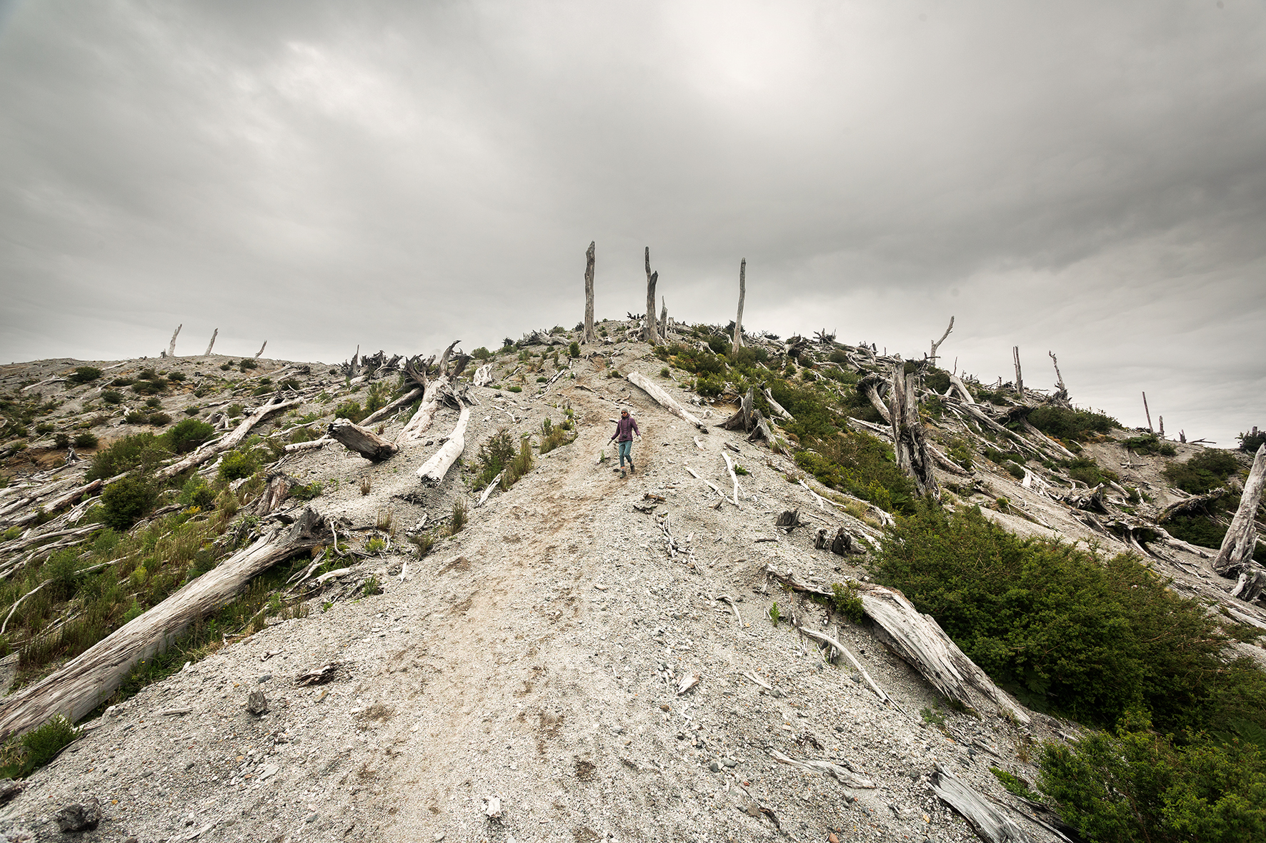
The last time the volcano erupted was in 2008, after a dormant phase of about 9500 years. It was completely unexpected and although no life was lost, a thick layer of ashes spread for hundreds of kilometers around, and created significant damage especially in the nearby town of Chaiten. The results of the eruptions remain visible today, in the bare tree trunks and stumps covering the slope of the Volcano. I loved looking at all the different shapes those tree took along the trail, and entertained myself by giving them names.
The “Rino”:
the “Gate”, marking the end of the climb:
and the “Three Sisters”, perched at the very top and overlooking the area.

This one tree below was a pretty good testament to strength and determination, still stubbornly rooted at the base of the last uphill ridge despite the damages caused by the eruption, as if saying “I’m here, I’m still standing”.

We had snacks and took some photos then headed back down. It took us about 1h20min to climb, and roughly 45 minutes to come down.

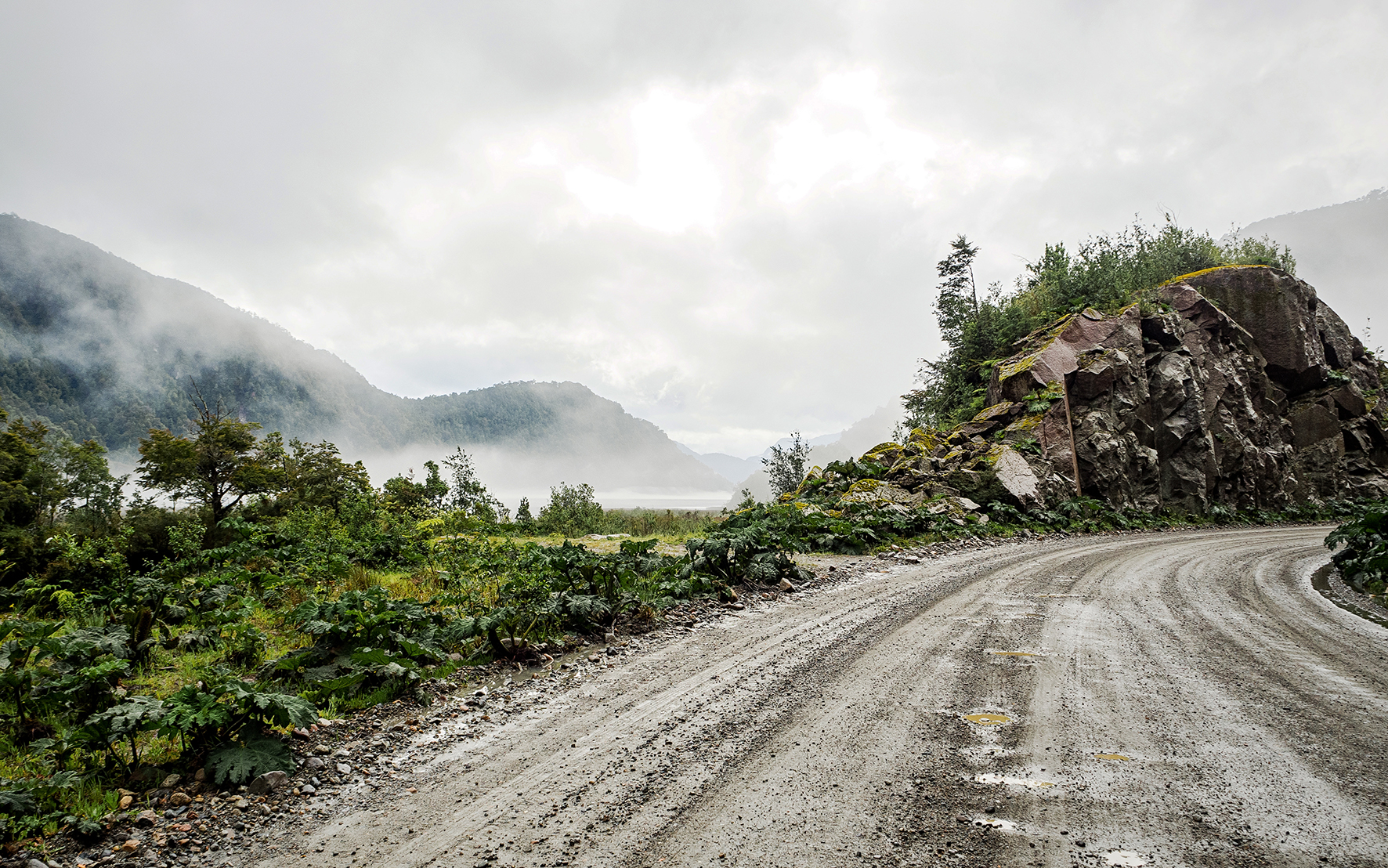
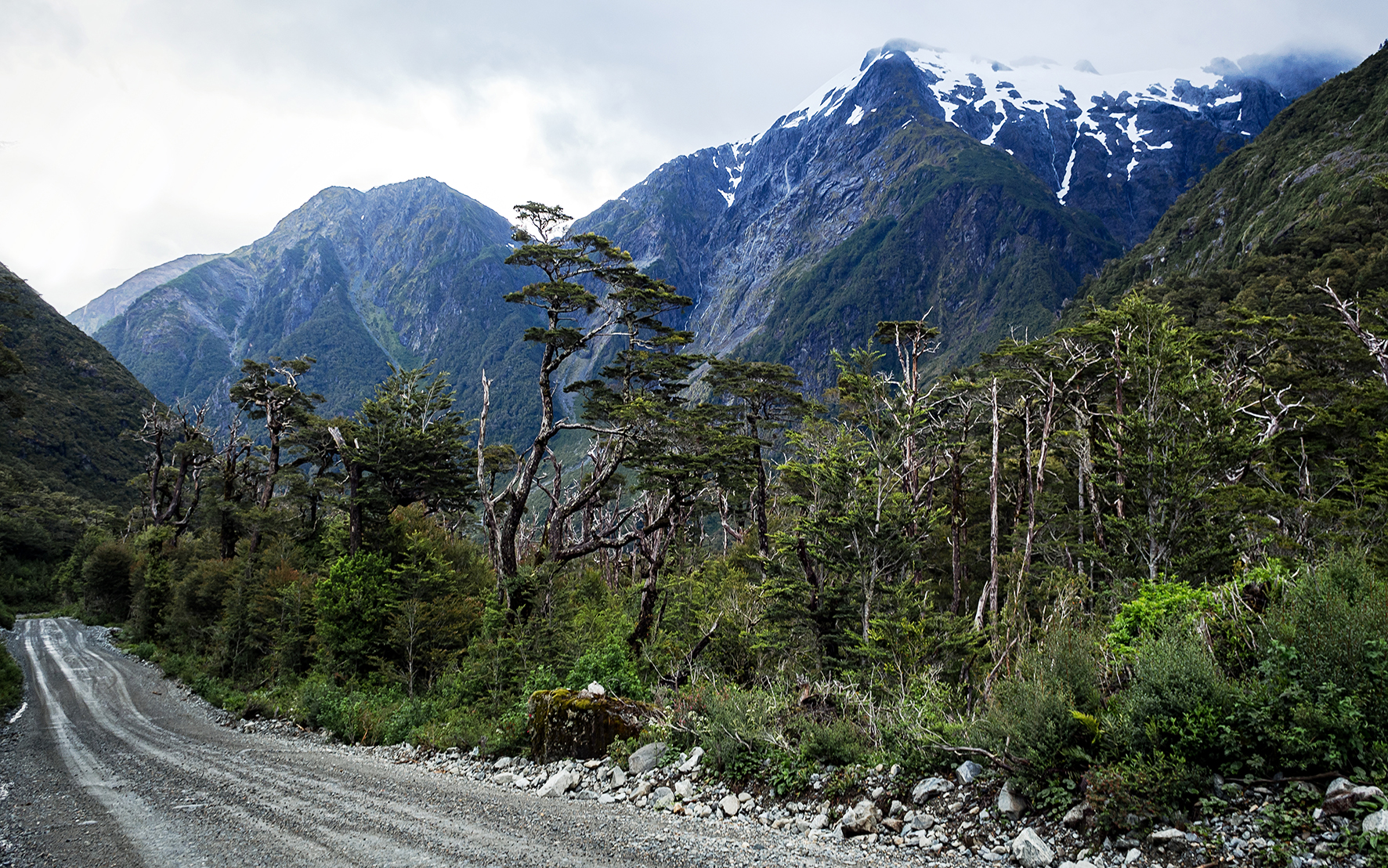
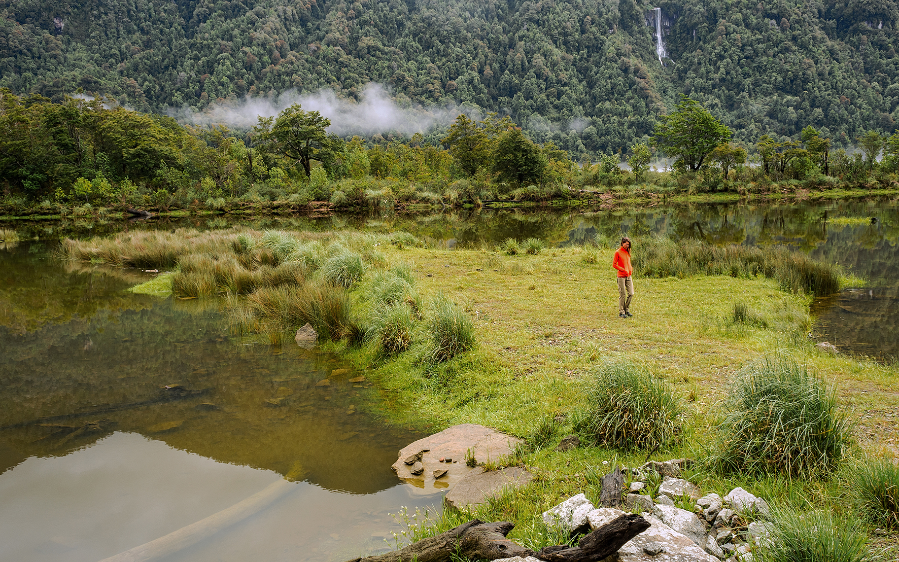
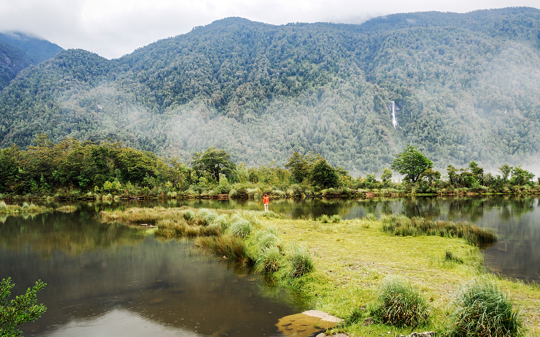
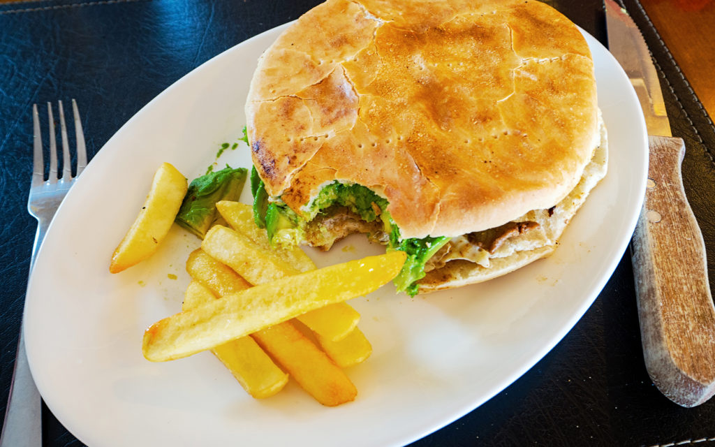
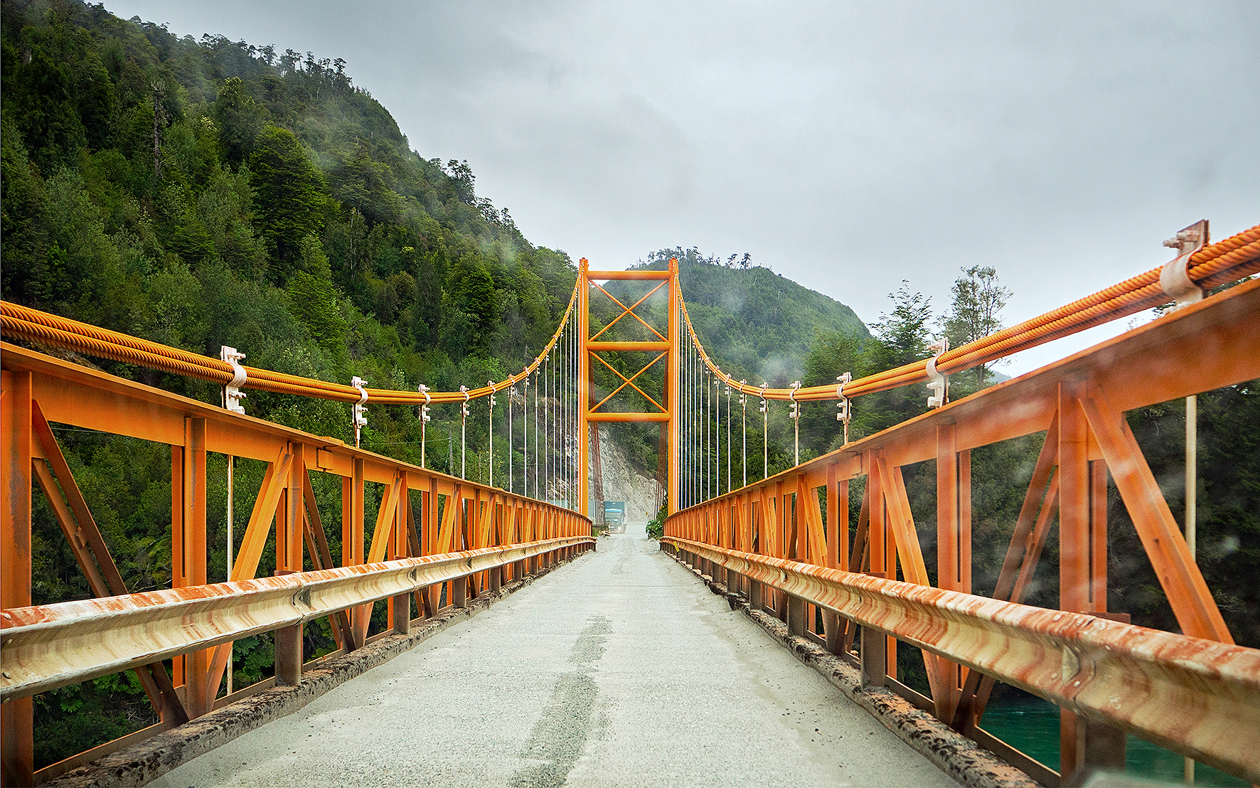
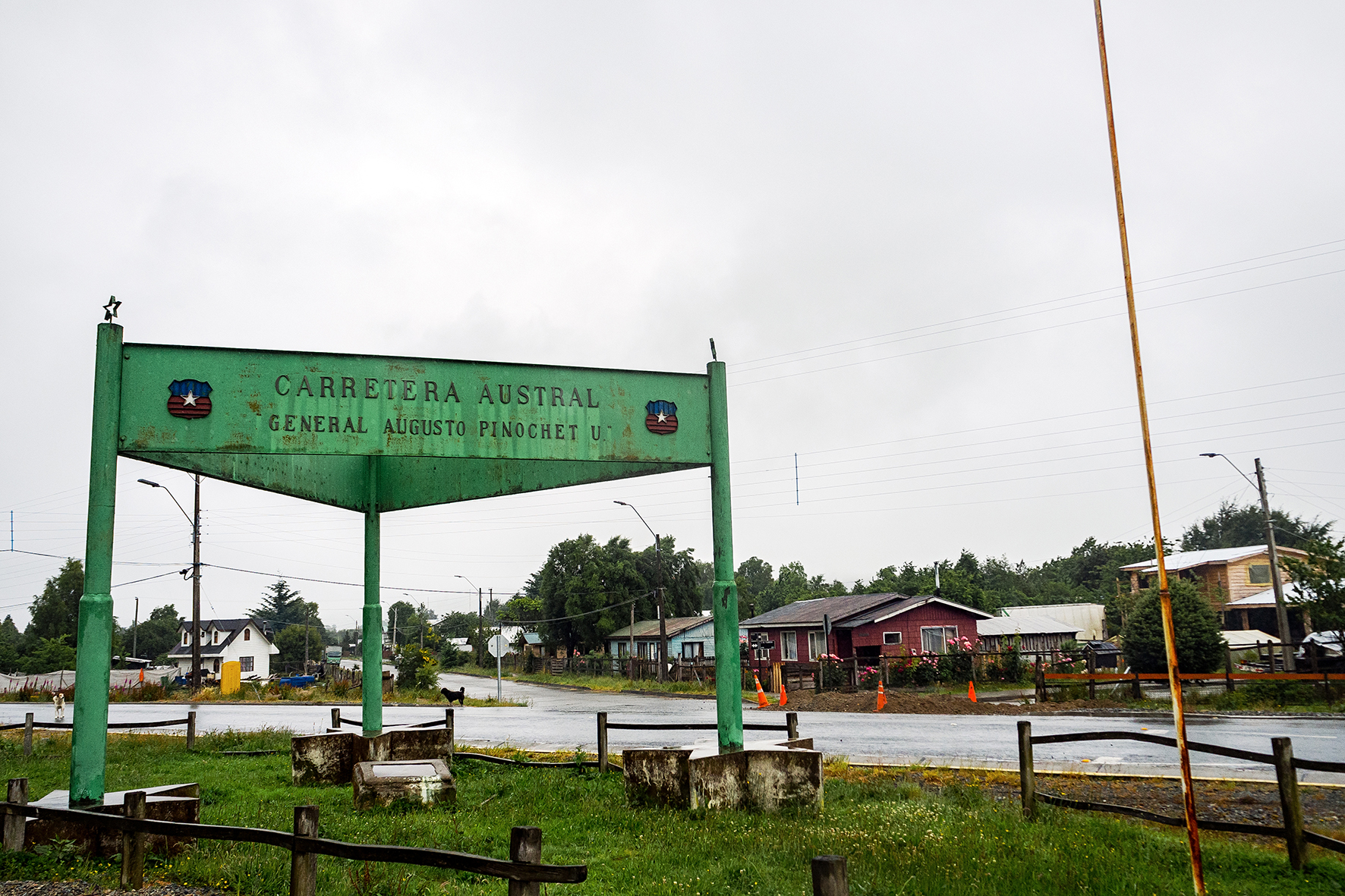
Then we headed south to the town of Chaiten, about 35km away. The road was pretty good, mainly gravel while we were still in the park, but it turned into a newly paved section in the last 10km or so. In Chaiten, we walked into the first grocery store we could find, to buy more food as well as propane. Eager to break our streak of light-weight meals, and replenish our hiking fuel, we then looked for a place to eat, and settled on Flamengo, which served huge steak sandwiches.
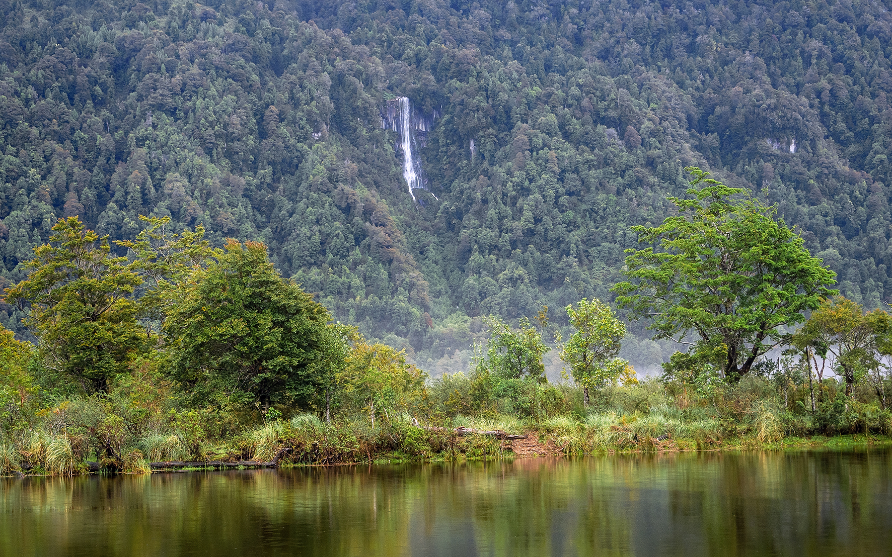
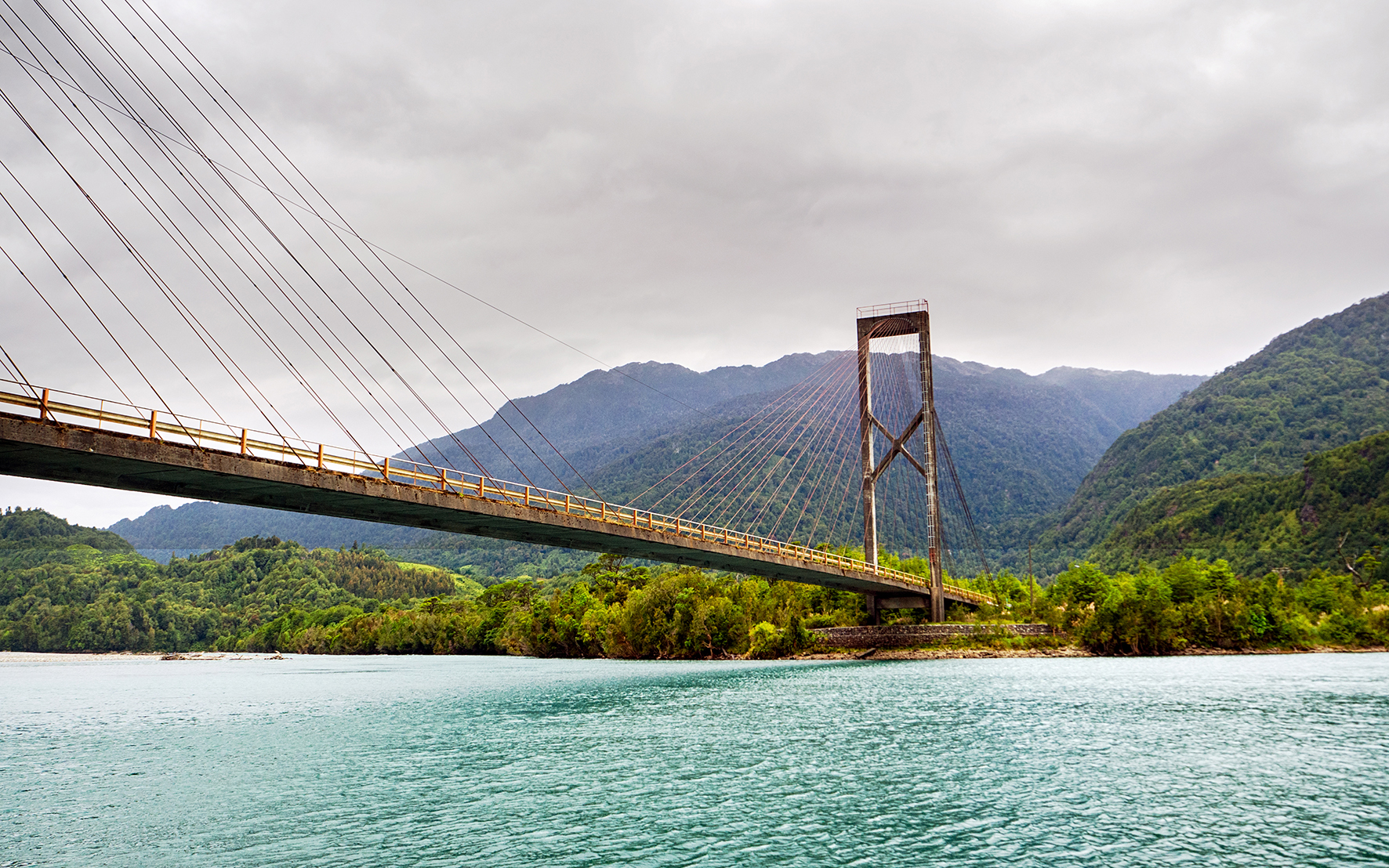
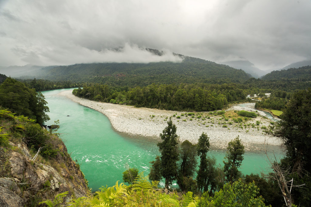
The plan was to spend the night near La Junta, about 2 hours away. The road was really scenic, with constant rivers and streams flowing by the side of the road, and low mountains all around. We stopped here and there for photos but mainly drove through, taking in the scenery and scenes that felt of a different era. Cows on the road especially reminded me of my childhood, and the winding country roads we drove on to go to school, every so often getting stuck behind a herd of cows. This place felt like we were back in the 80’s, before the rise of technology and when things seemed just a bit simpler.
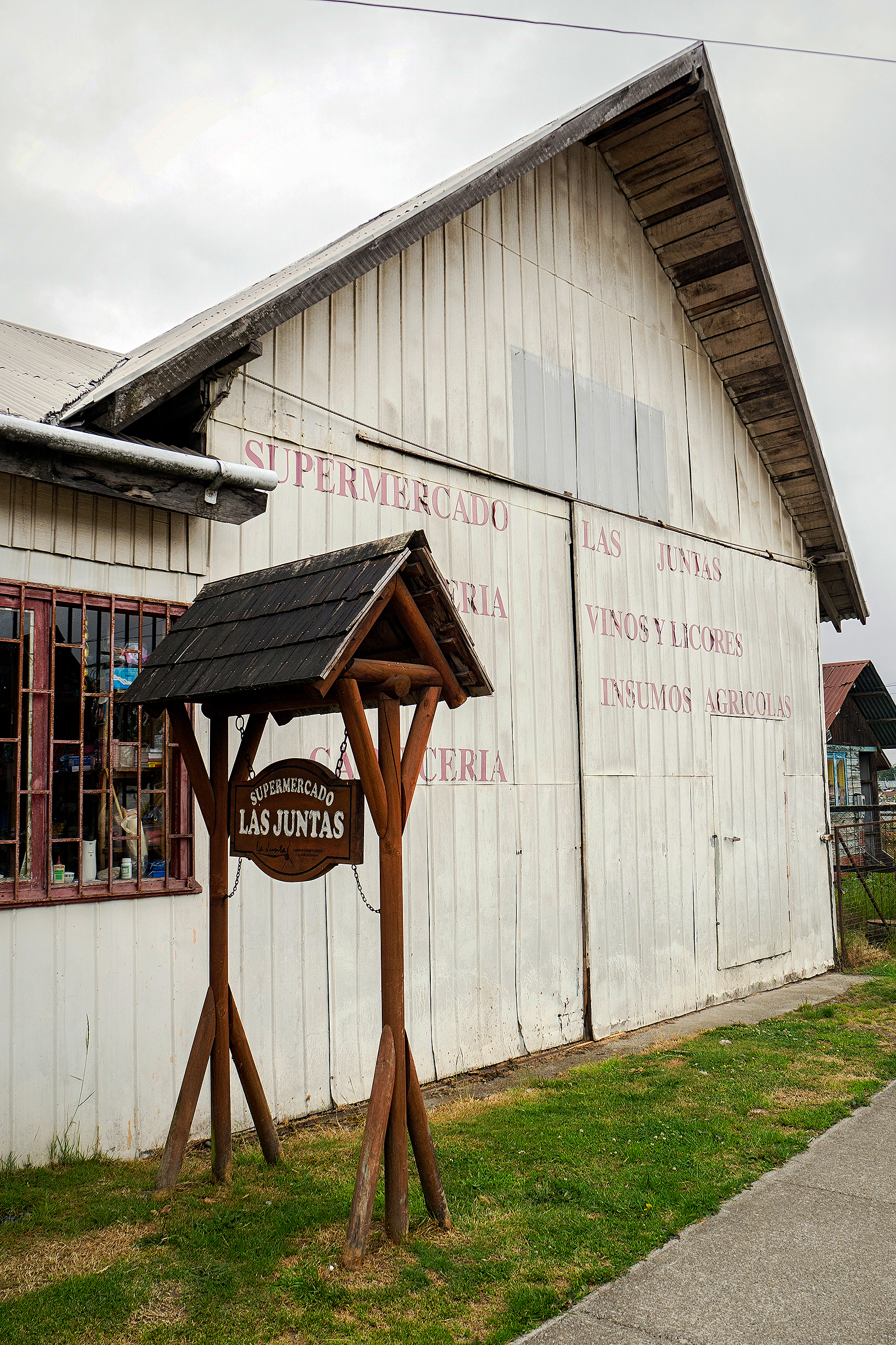
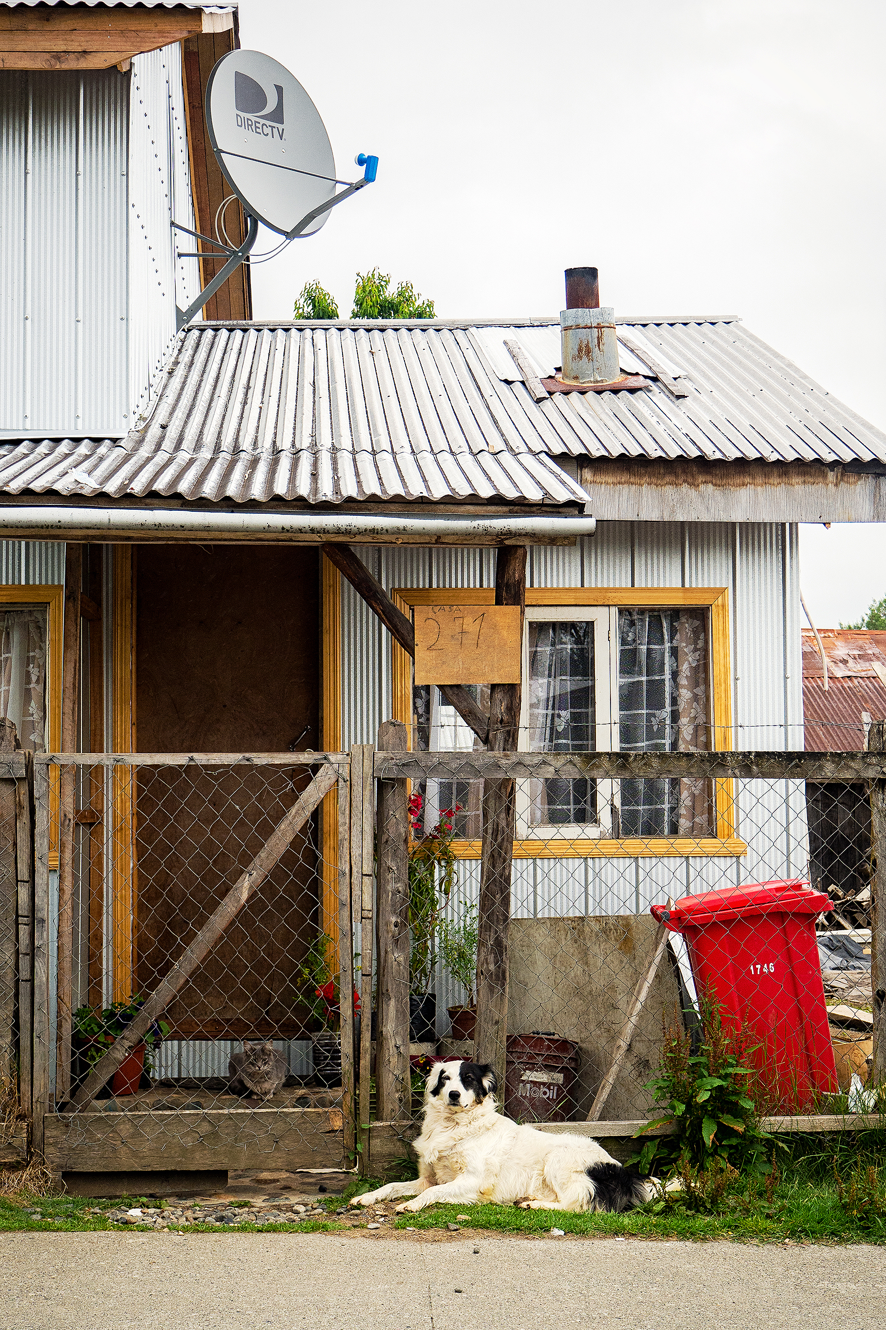
We arrived in La Junta and drove around the town a bit, and again it add the feel of our grandparents hometowns some 30 years ago, although harsher, more rugged than our European country towns – less stone houses, and more wood and metal.
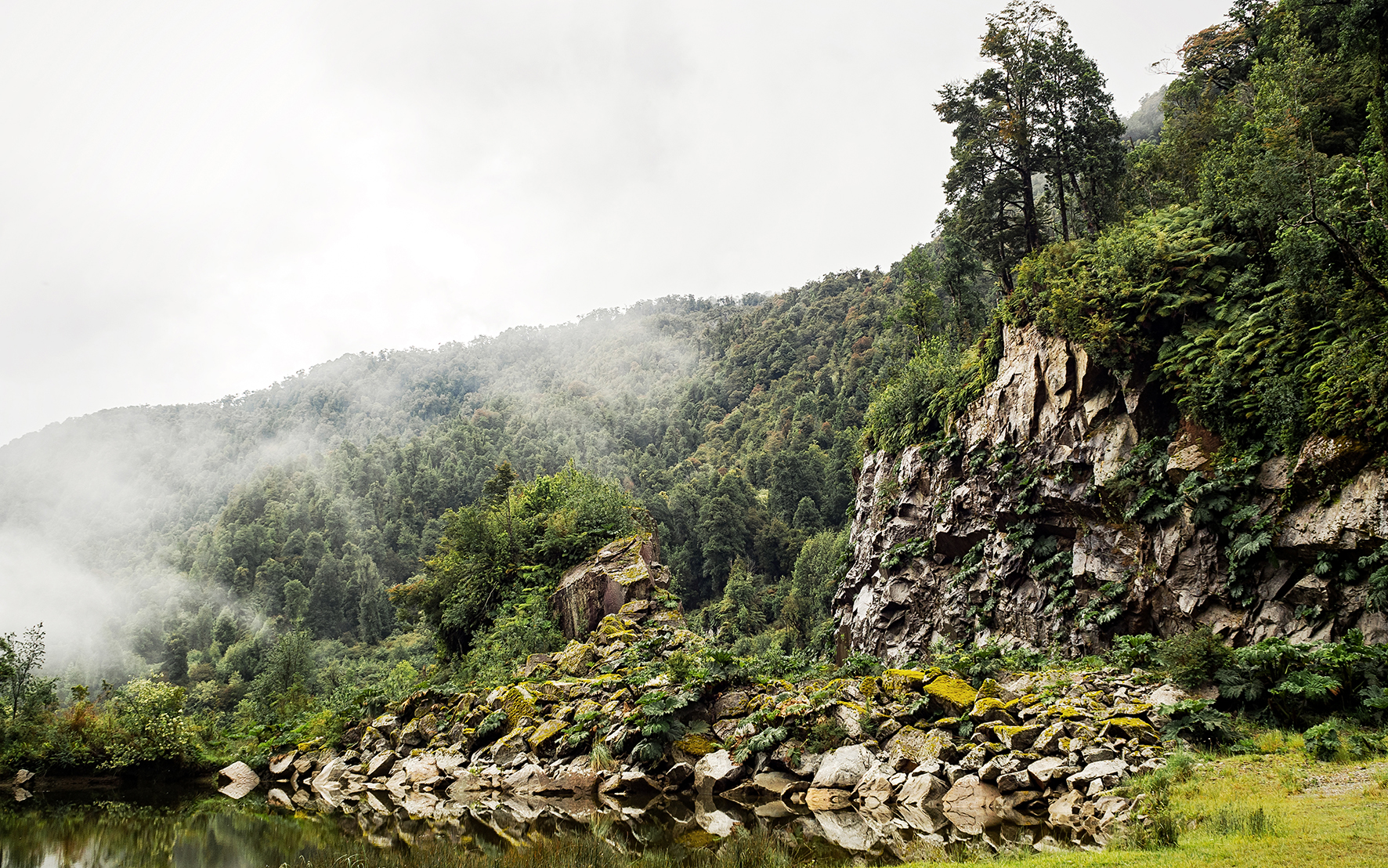
The guide book mentioned a campground about 17km west of town, which was built around a hot spring. It was overcast and the rain had been chasing us all afternoon, so the idea of a hot soak sounded pretty perfect. We drove down a gravel road for a bit, then turned onto another even rougher dirt road. Eventually we came across a pick-up truck going the opposite way. Turns out it was the owner of the campground who was leaving for the day as he had, until then, seen no costumers. He backed up a couple hundred meters to the campground gate and let us in.
The site was built around a large open grassy area. To the right was a fairly large hut (described as a “Quincho” in spanish), with a few tables, and more importantly, a wood-burning stove. Since we were the only ones there, Claudio said that instead of pitching our tent outside in the rain, we could sleep inside. He even suggested we set up the tent by the stove, in order to trap the heat.

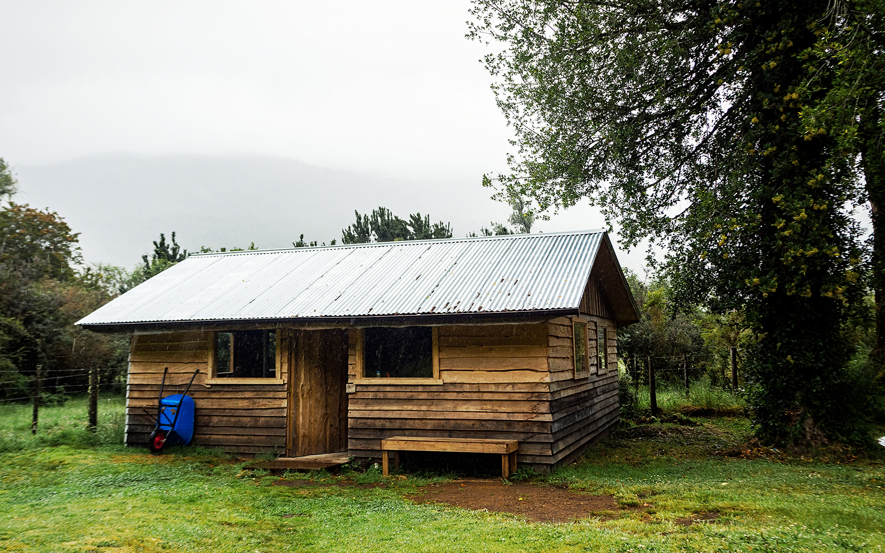

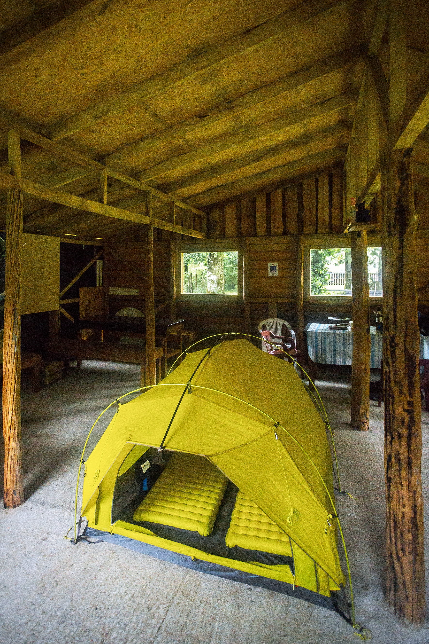
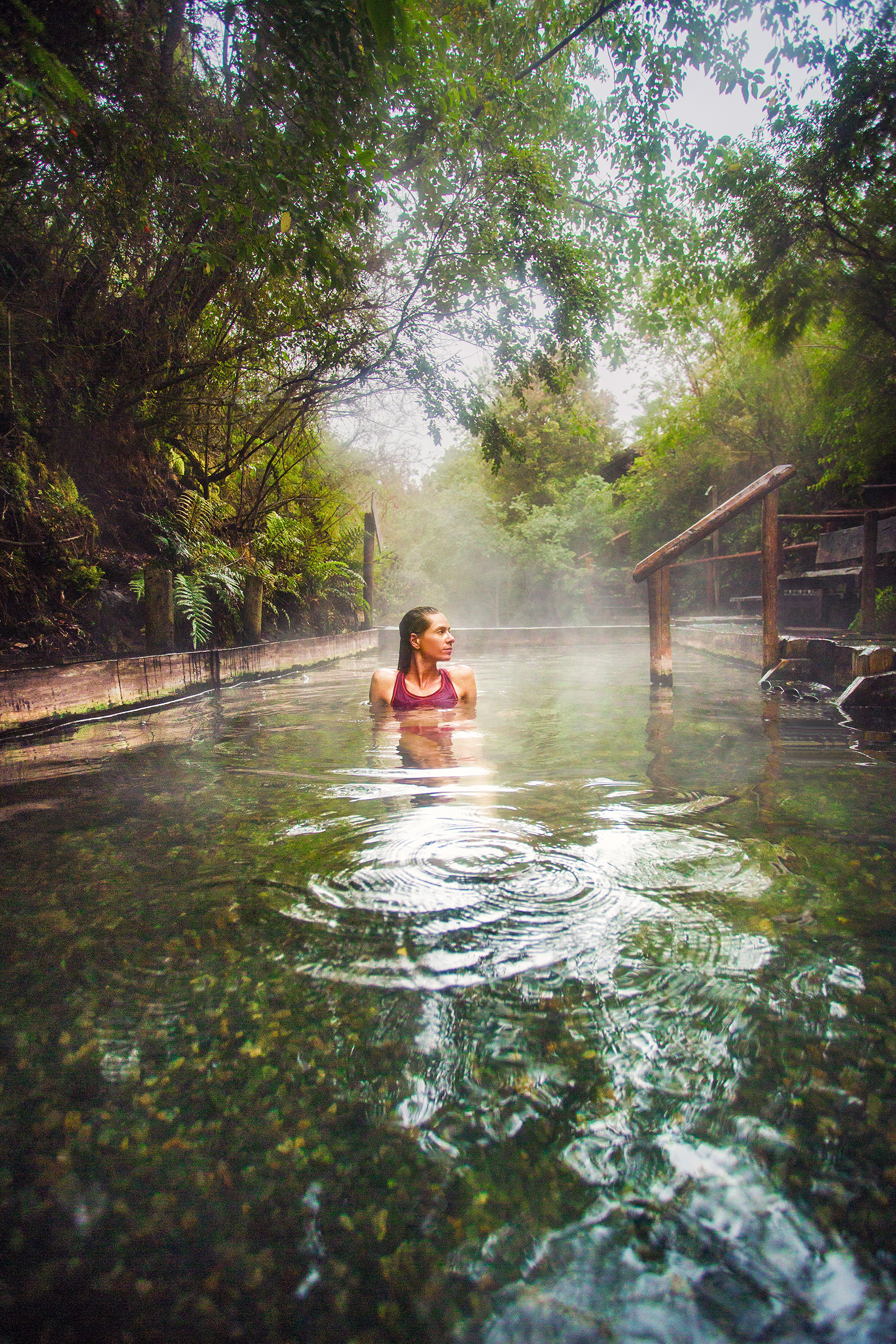
On the other side of the grassy field were a couple of buildings with toilets and cold showers, an a few more meters past them, an opening in the bushes led to the hot spring. The pool on the left was filled with really hot steamy water coming from the ground and naturally heated to about 80 degrees. The one on the right was cold stream water. A hose between the two brought cold water into the hot pool to cool it down to a more comfortable temperature of about 45 degrees. Lush trees and bushes all around made for a nice private setting. It was pretty perfect. It cost us 10,000 pesos per person (about 20CAD each), so a bit of a splurge compared to other campgrounds, but ultimately for a private hot spring with a private fireplace and hut, it was totally worth it. We set up our tent inside, got the fire going and then enjoyed a nice hot soak.
Later, Claudio’s dad arrived with a friend. We shared the hut for dinner and then they went back to his truck to spend the night. They were pretty amused when they saw our tent in the middle of the quincho. It poured all night so we were pretty happy with our setup.
The next morning after breakfast, we took another dip in the hot springs before heading out.
Click through the gallery below for more photos of the road