Road Trip to to the Yukon – Part 11 – Dawson Creek and Bootski Lake

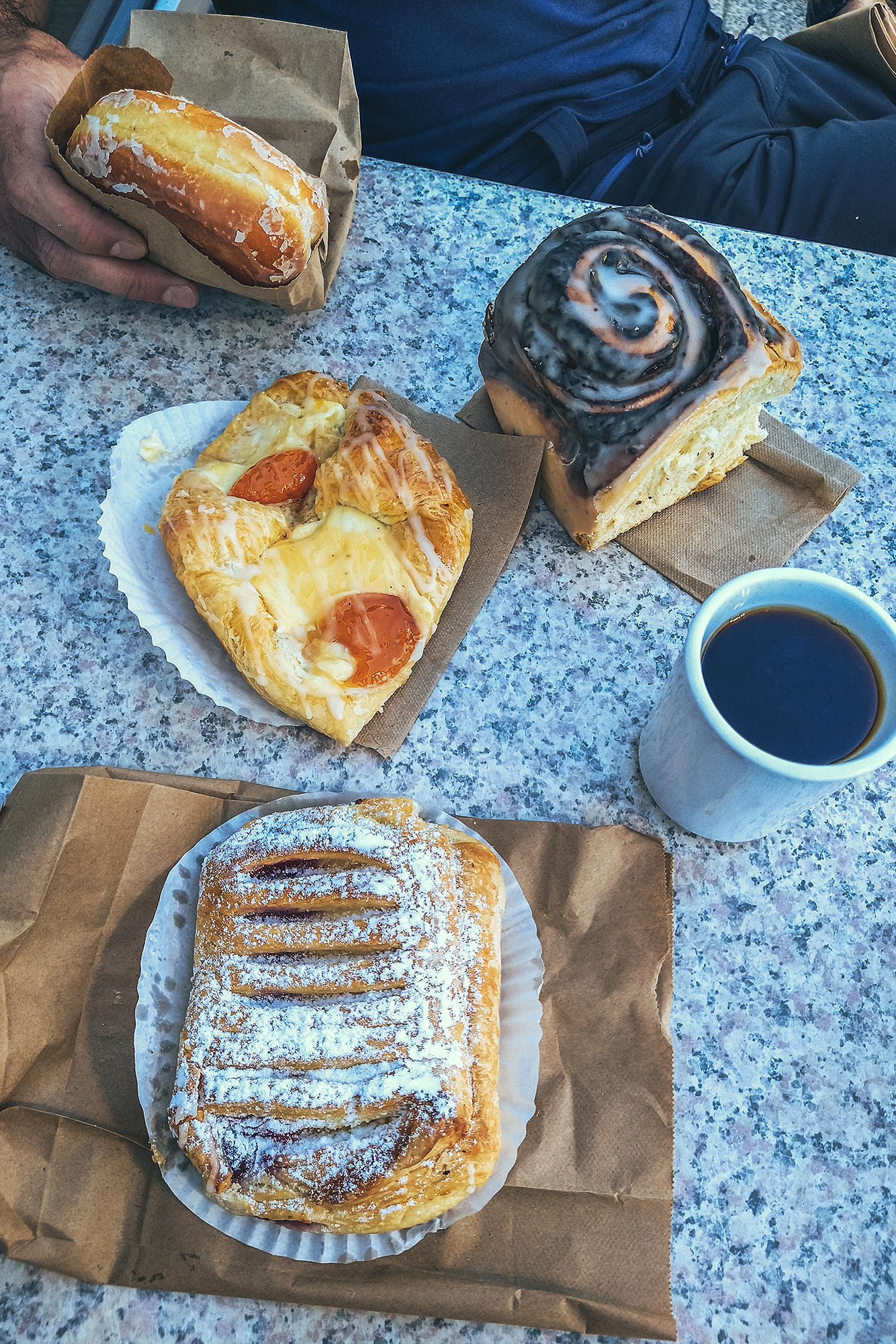
September 2nd – Driving to Dawson Creek

We took care of a few things in the morning while still at the house (namely, book some plane tickets to fly to Montreal literally 2 days after we’re back in Vancouver), then we headed to the Visitor center to grab a couple booklets on Dawson Creek and Tumbler Ridge. These two stops weren’t on the original itinerary, but we decided to add them as we had a bit of buffer with our return-home date.

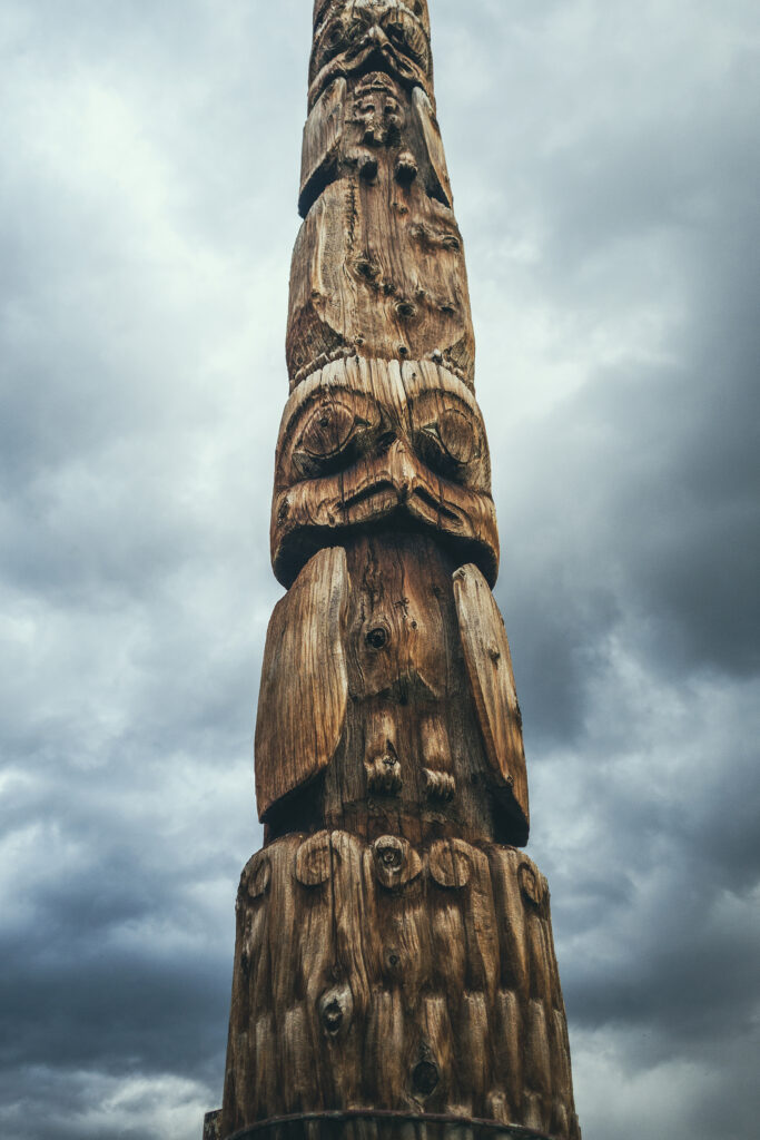
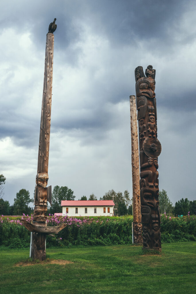
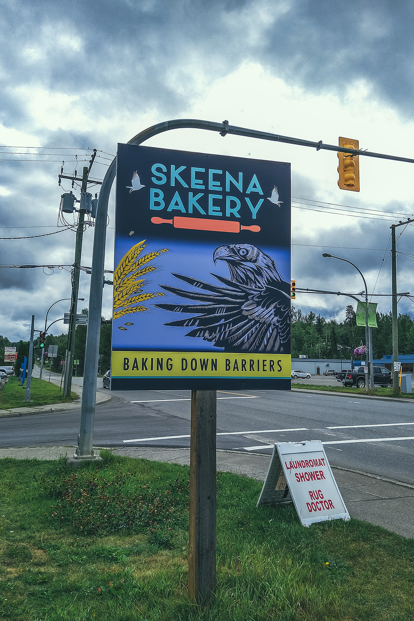
Before leaving Fort St John, we also stopped at the indigenous Artist Market, a small shop that sells handmade crafts from local artists. They had soaps, salves, shoes, artwork, jewelry etc… I didn’t see anything that I wanted to bring back but it was a nice selection of locally-made items.

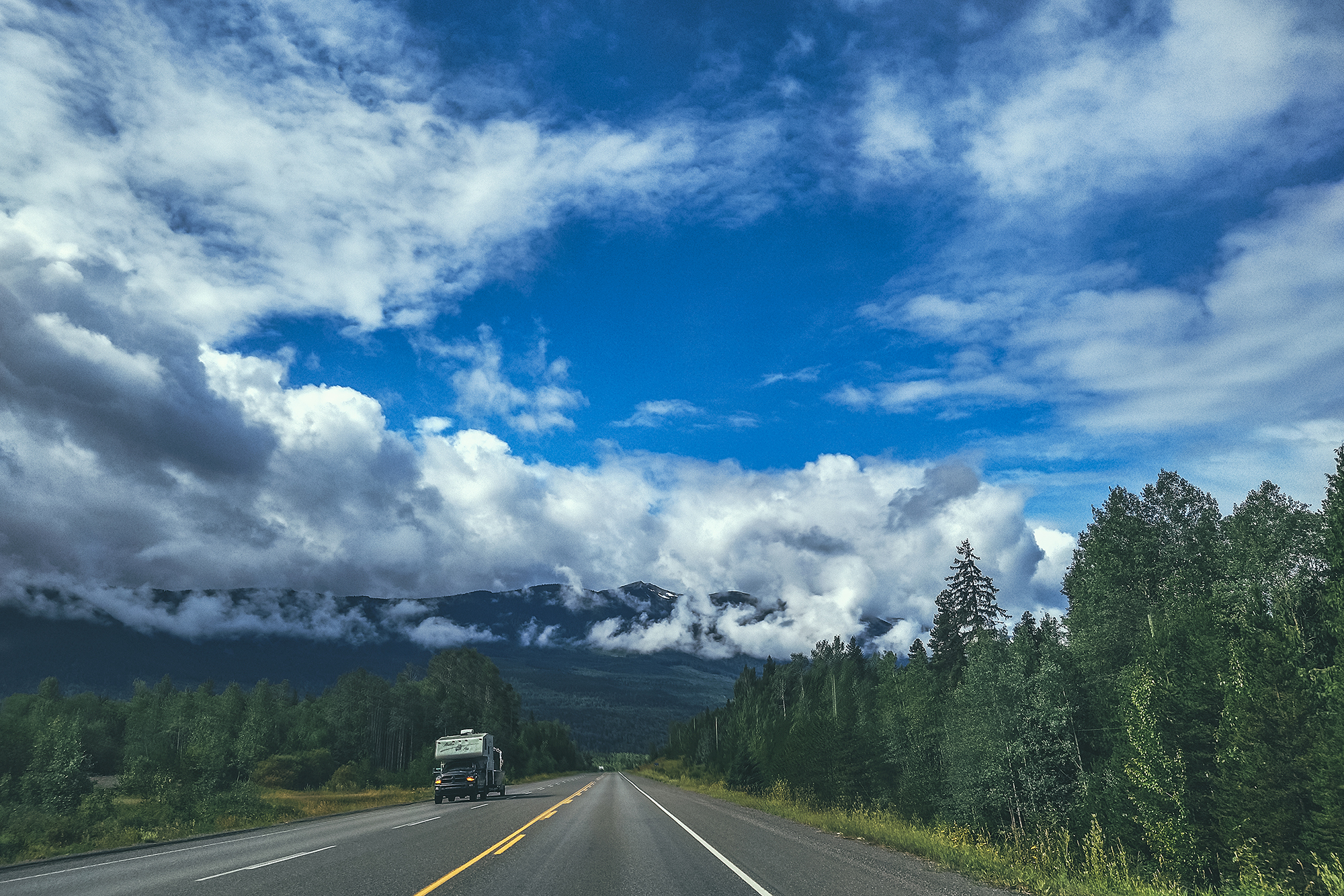
Then we left Fort St John and headed to Dawson Creek, about 1 hour away.

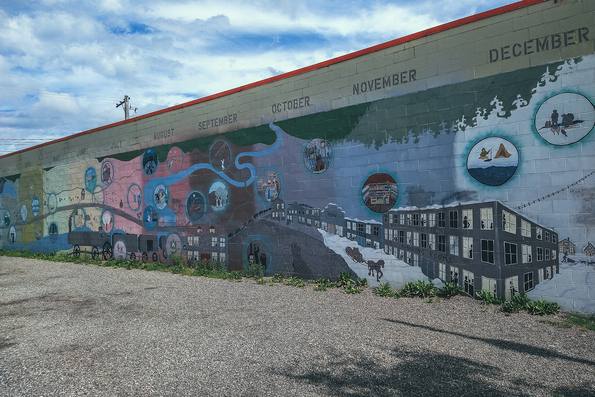
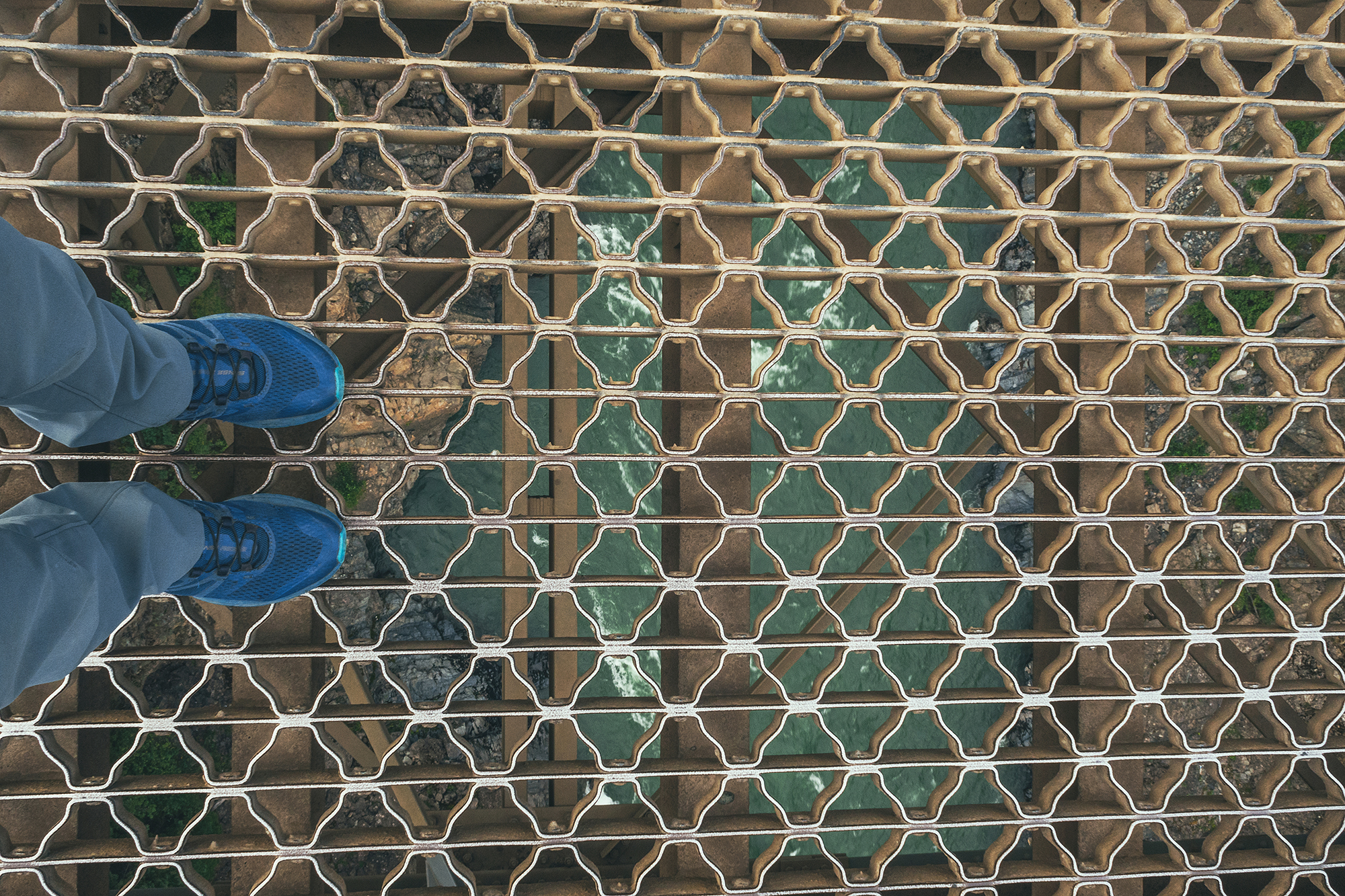
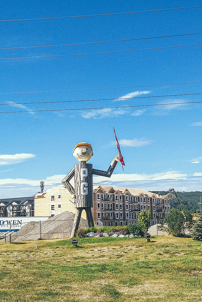
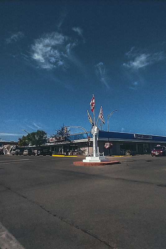
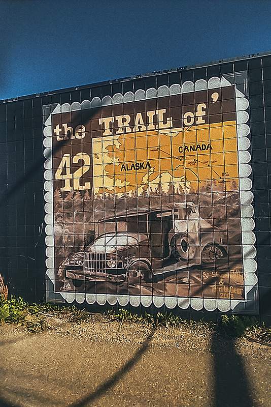
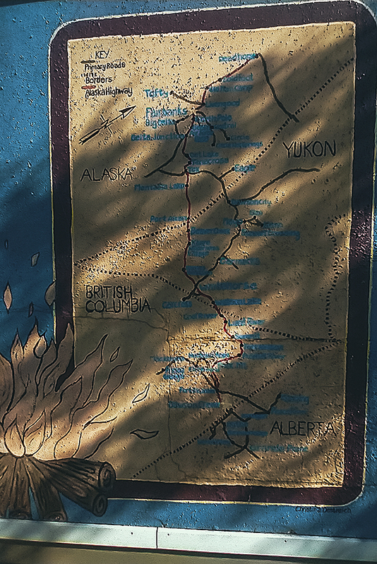
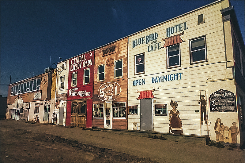
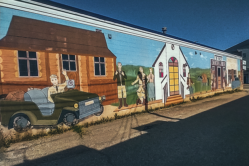
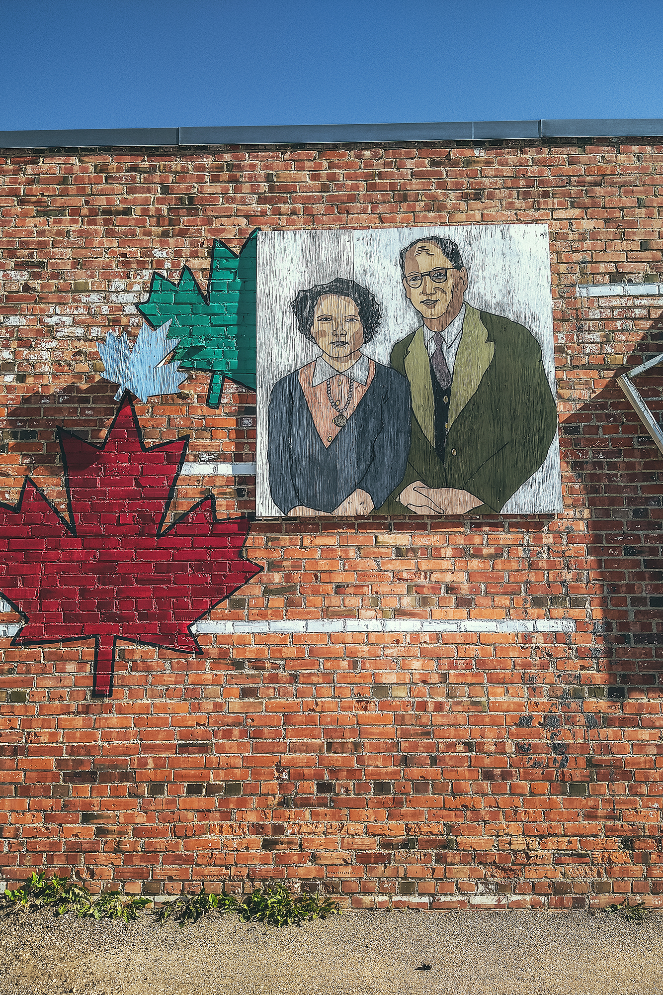
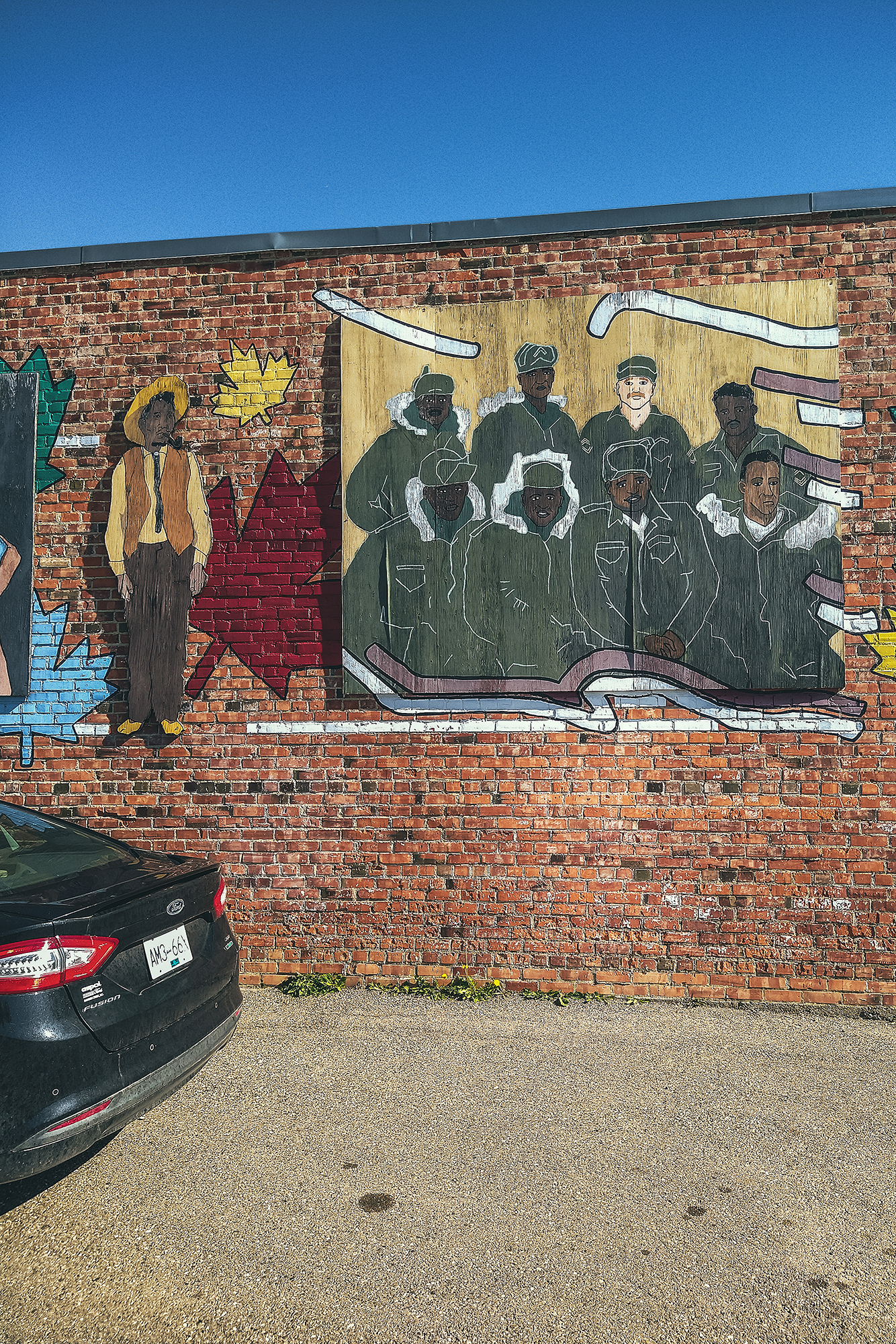
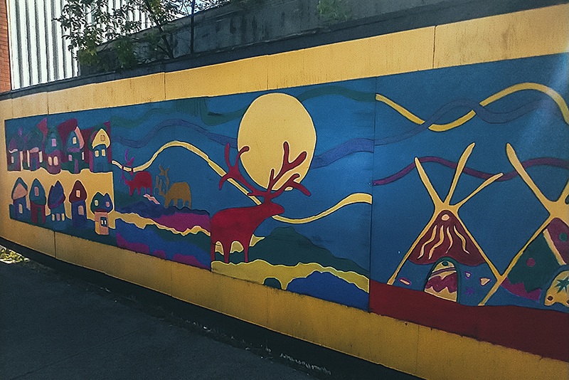
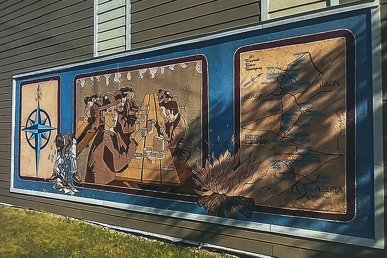
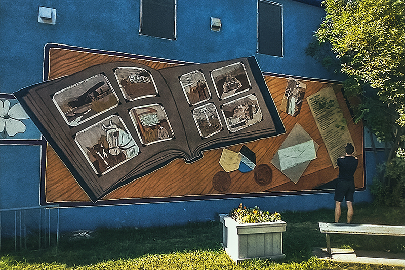
Dawson Creek is the historical place of the “Mile 0″, which is where the Alaska Highway officially starts. Not surprisingly, most of the town’s historical sites have to do with the highway construction in the early 1940’s. It was a beautiful sunny day, so we didn’t feel like going into the museum. Instead we took the small walking tour around the town center, which passes by a number of murals depicting some of the town’s history.

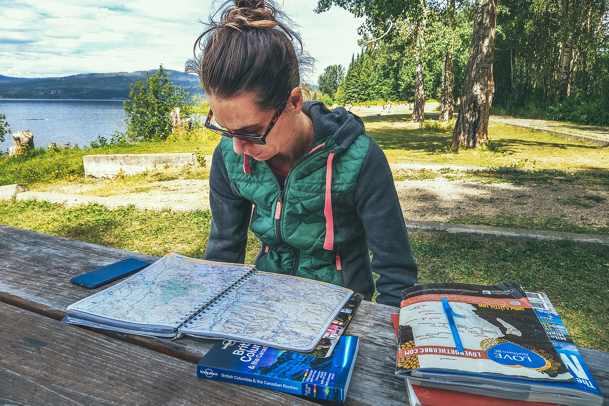
It was 4 o’clock when we headed out and we got to the Tumbler Ridge visitor Center at 5pm, right as it closed.
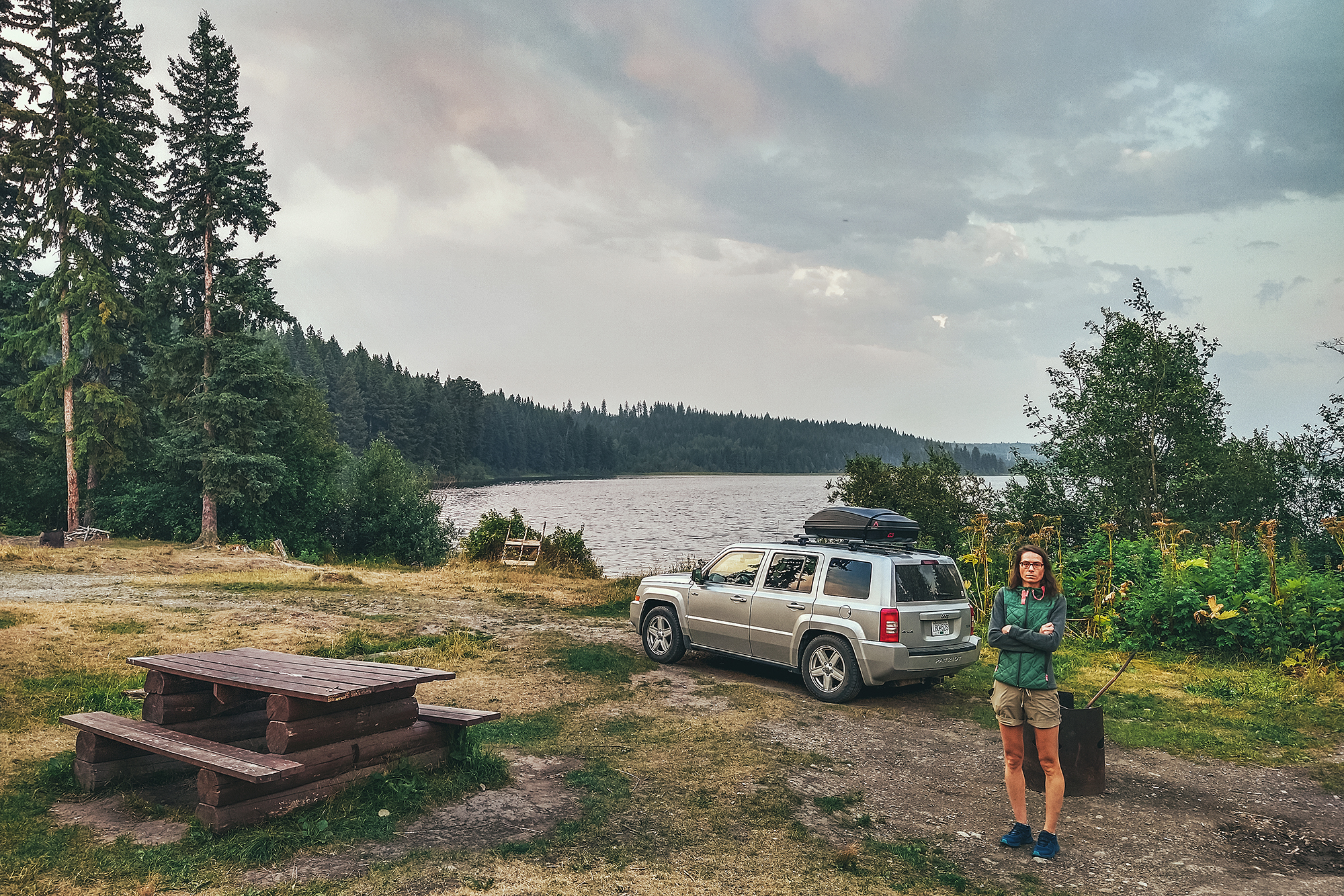
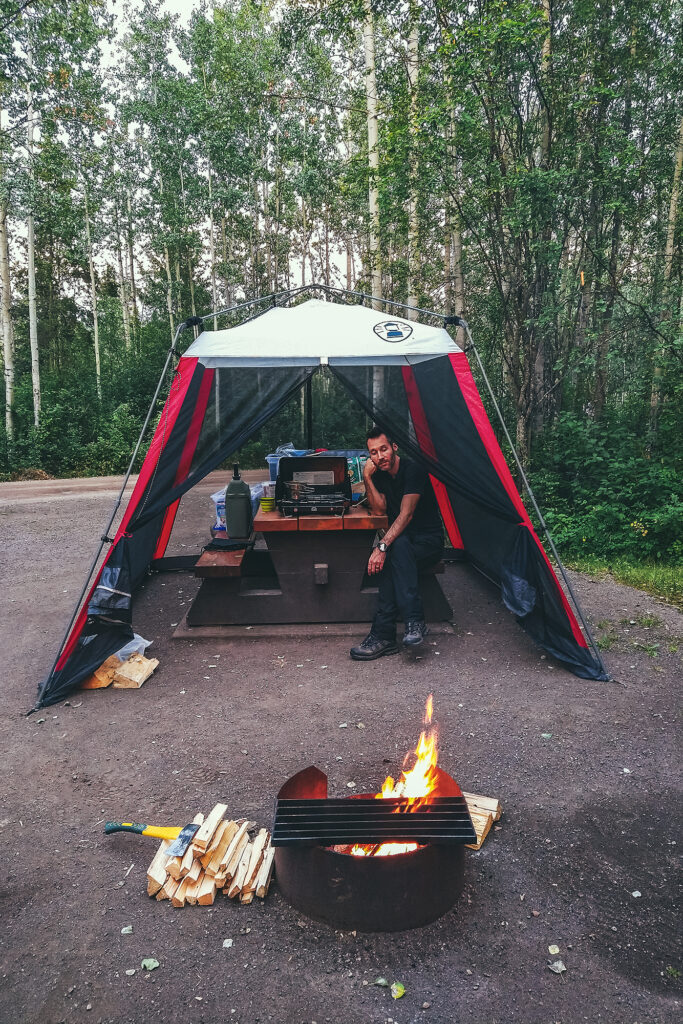
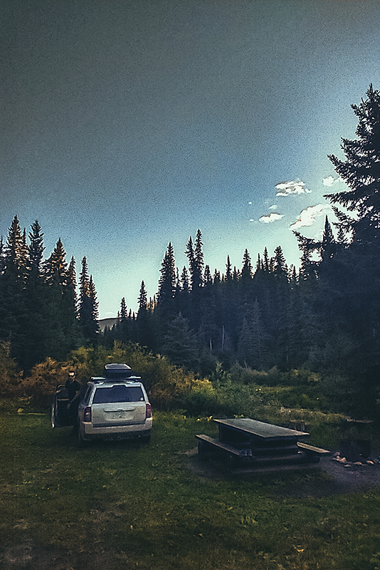
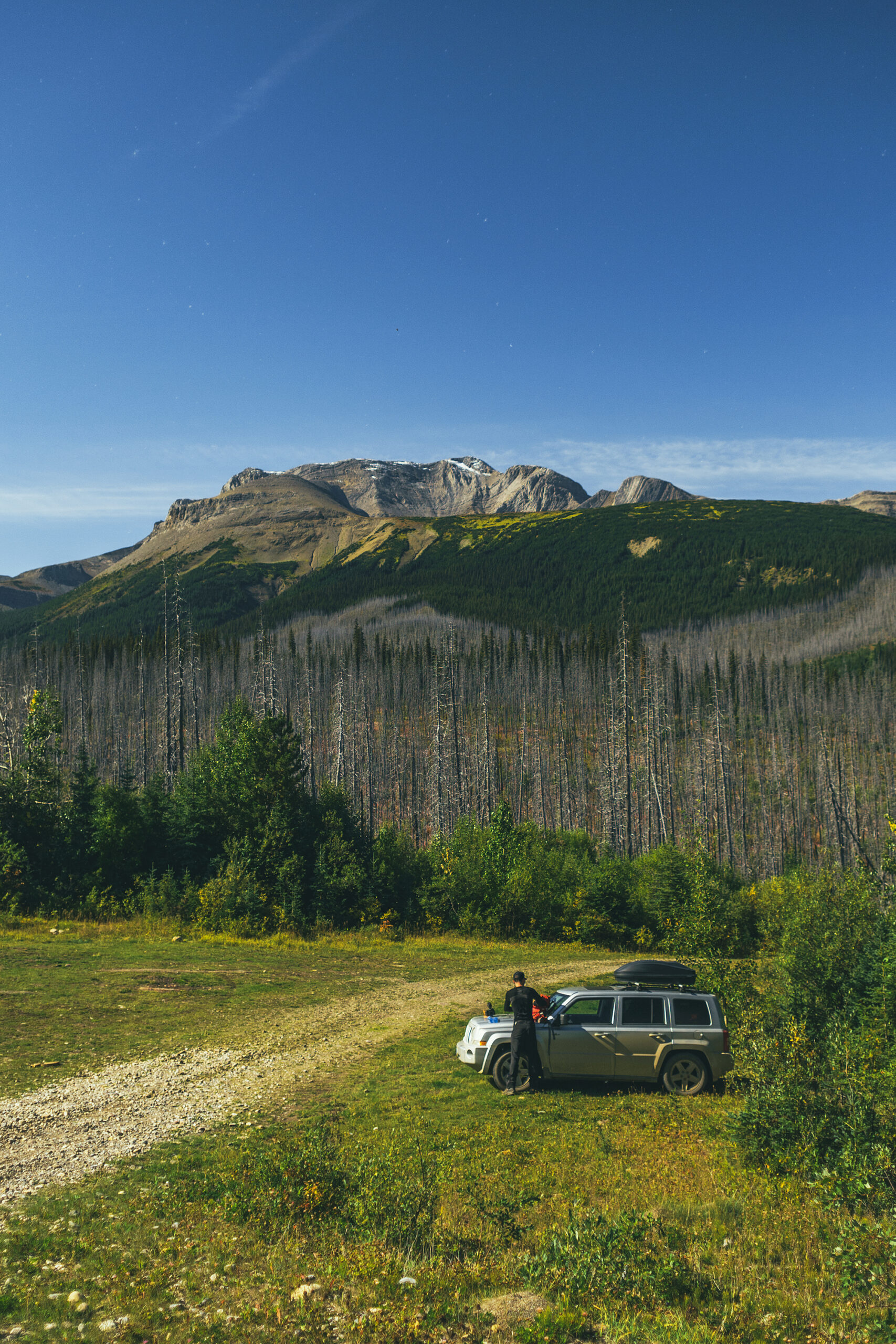
Thankfully, I’d picked up a full booklet about the area in Fort St John, so we were able to easily pick a hike to do the next day. We drove about 25 km out of town towards the trail head and set up camp at the Flatbed Creek Rec Site – a small site off the side of the road but right near a small creek, a pretty nice spot once again.

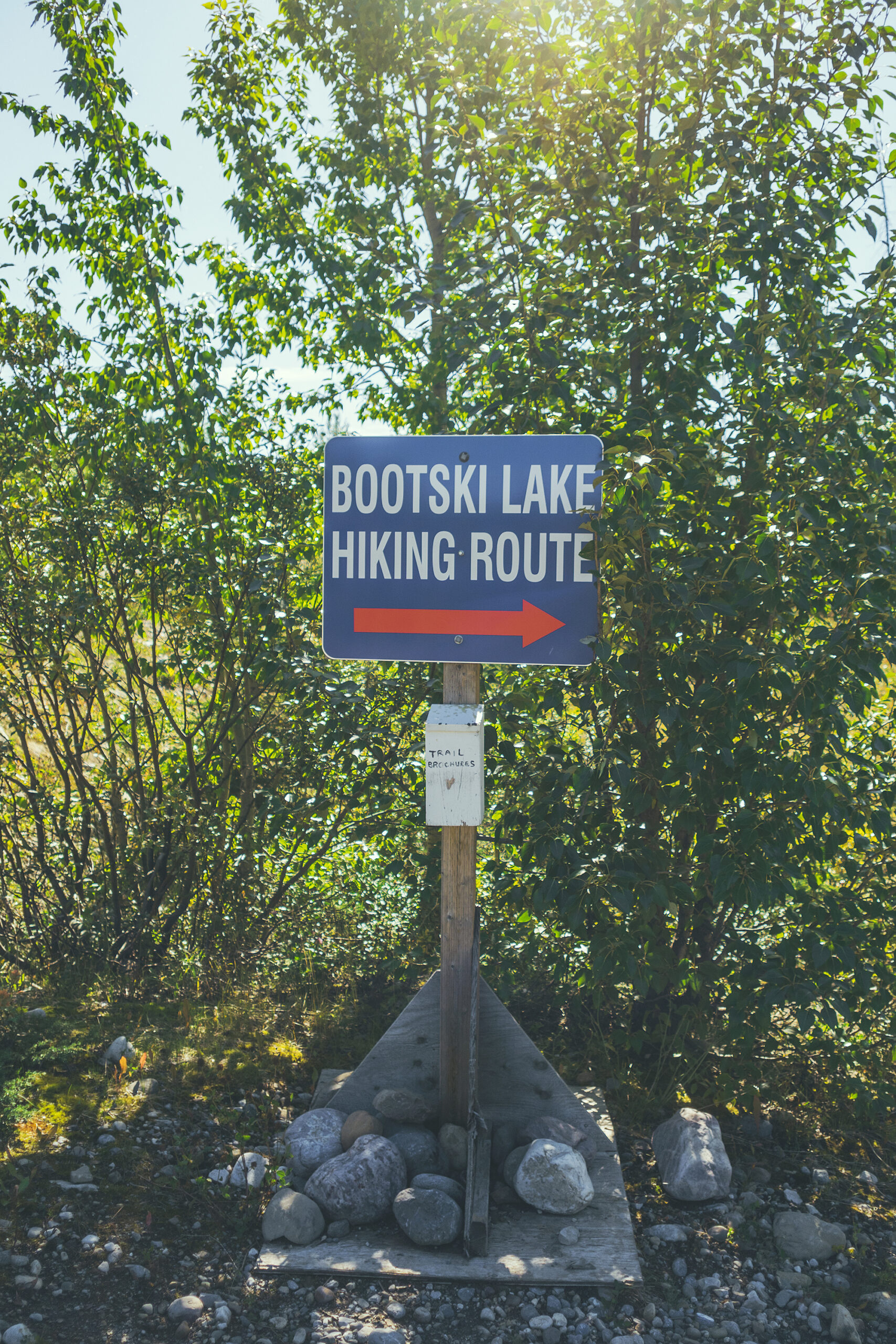
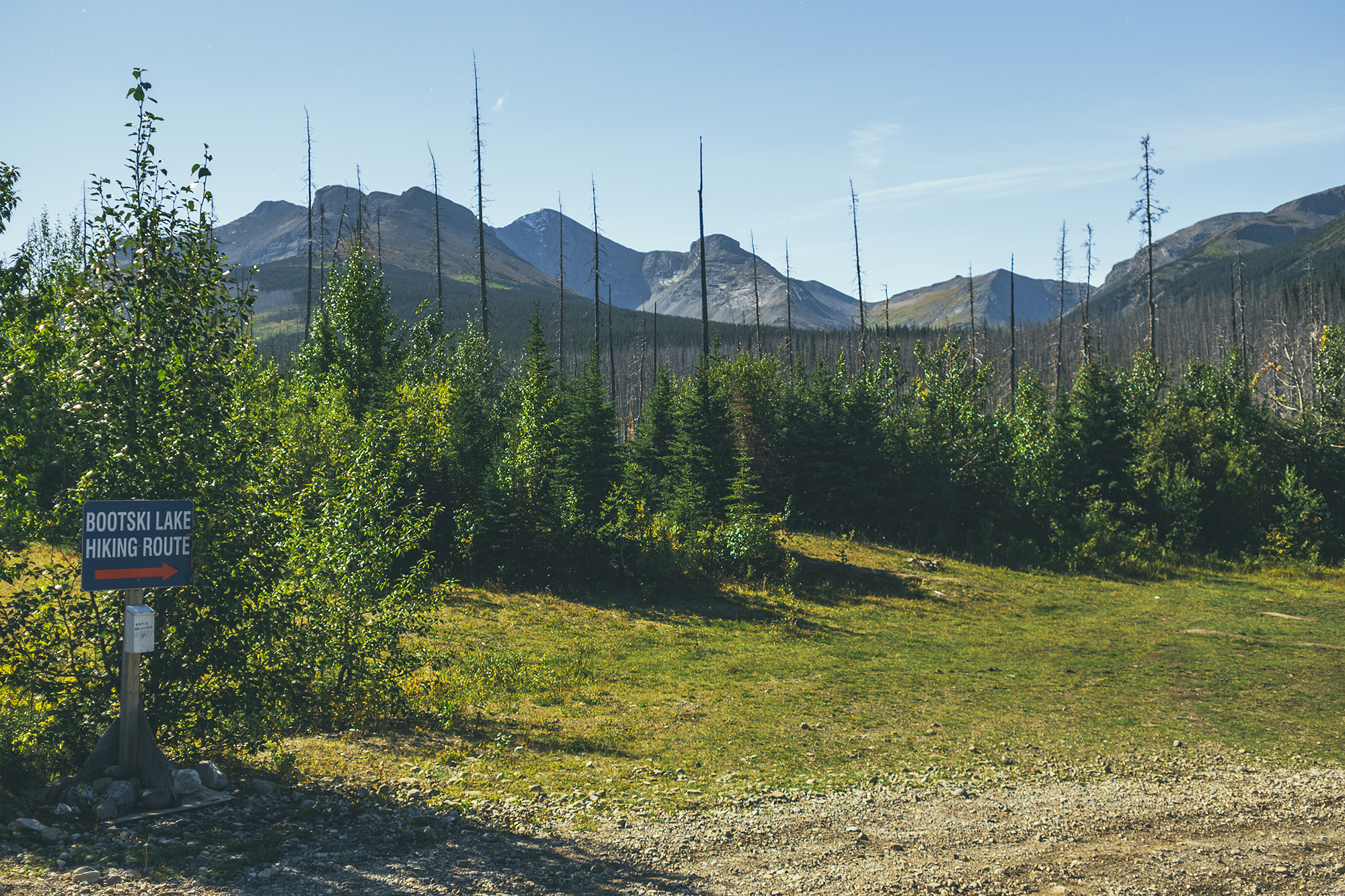
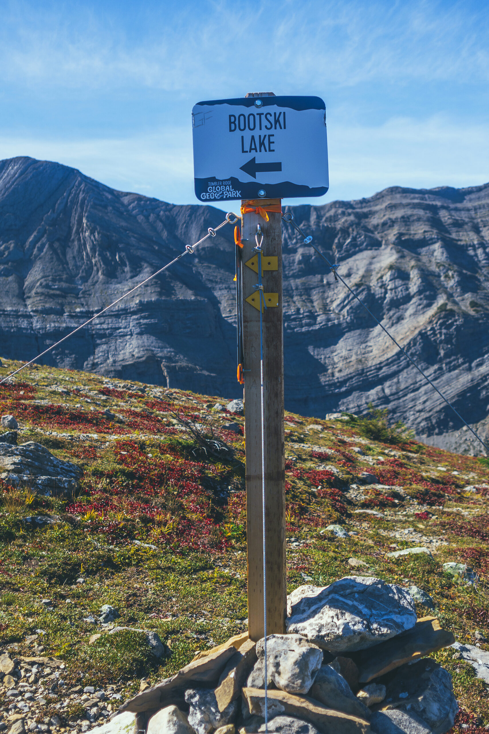
The next day we were planning on doing a hike called Bootski lake down a rough forest road at the edge of the park boundaries, then we thought we’d come back to this spot to camp another night.

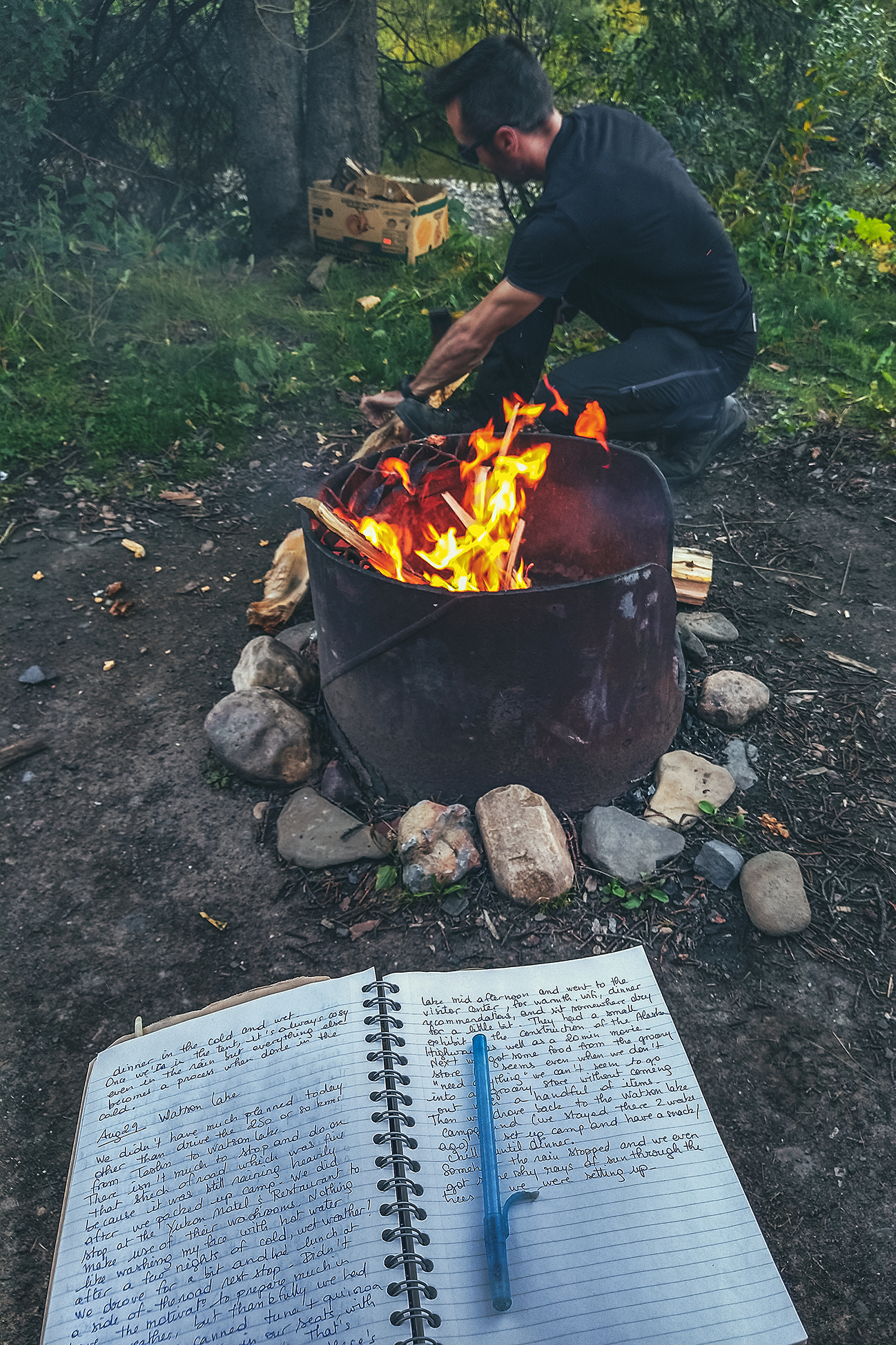
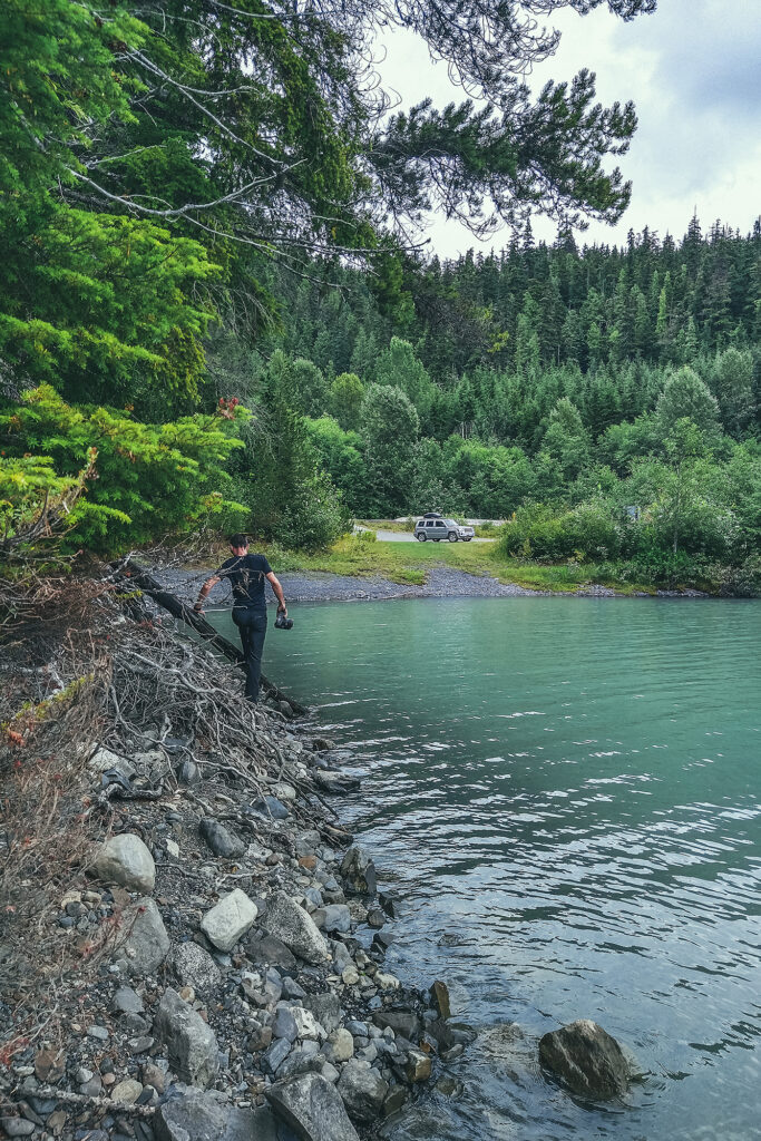
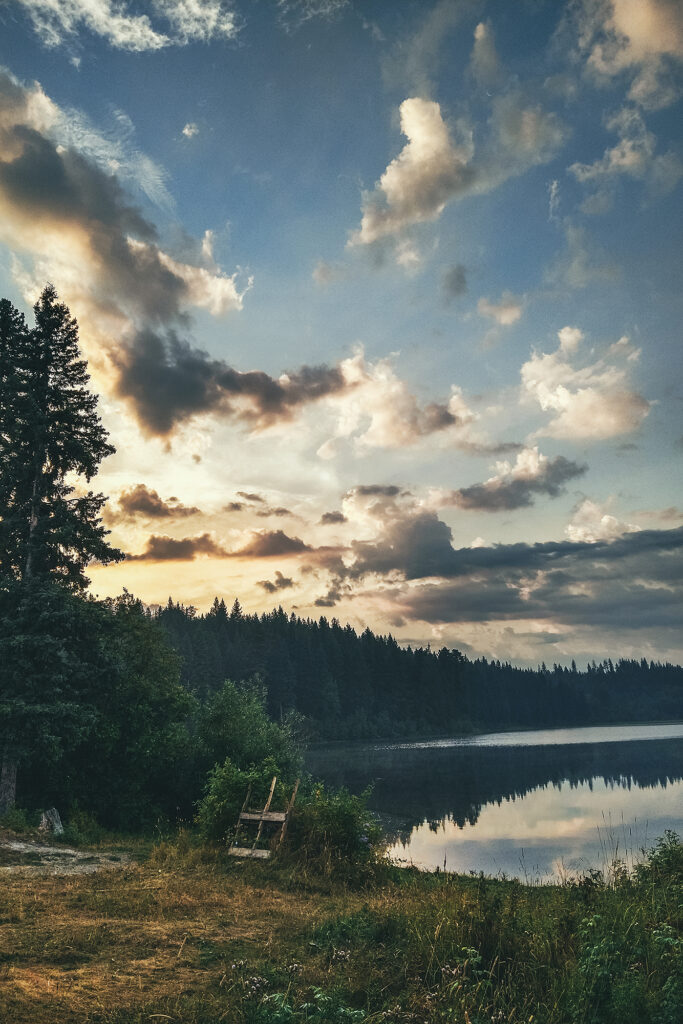
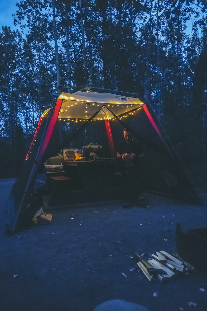
This was the only time of this trip when we spent the night with absolutely no one around, in a fairly remote spot. If wildlife was ever going to come out, that would be it. I did a bit of a check to see if there were any traces of animals (like bear scats). We didn’t know when the last people that camped there were there, and whether they were responsible, leave-no-trace campers, or the type to leave remnants of food out after they’ve gone, attracting wildlife to the spot. Thankfully we didn’t see any traces of such behavior, or recent animal activity. We did get a visitor at night, probably a small-ish rodent type, although it sounded a bit bigger as it ran around on the tarp we’d placed underneath our tent.

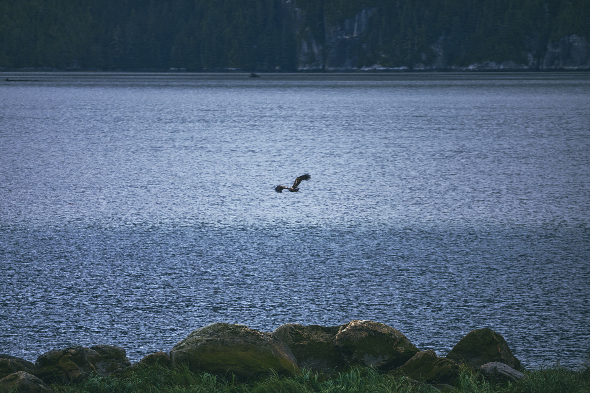
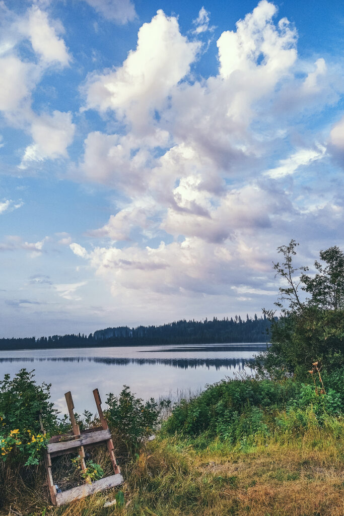
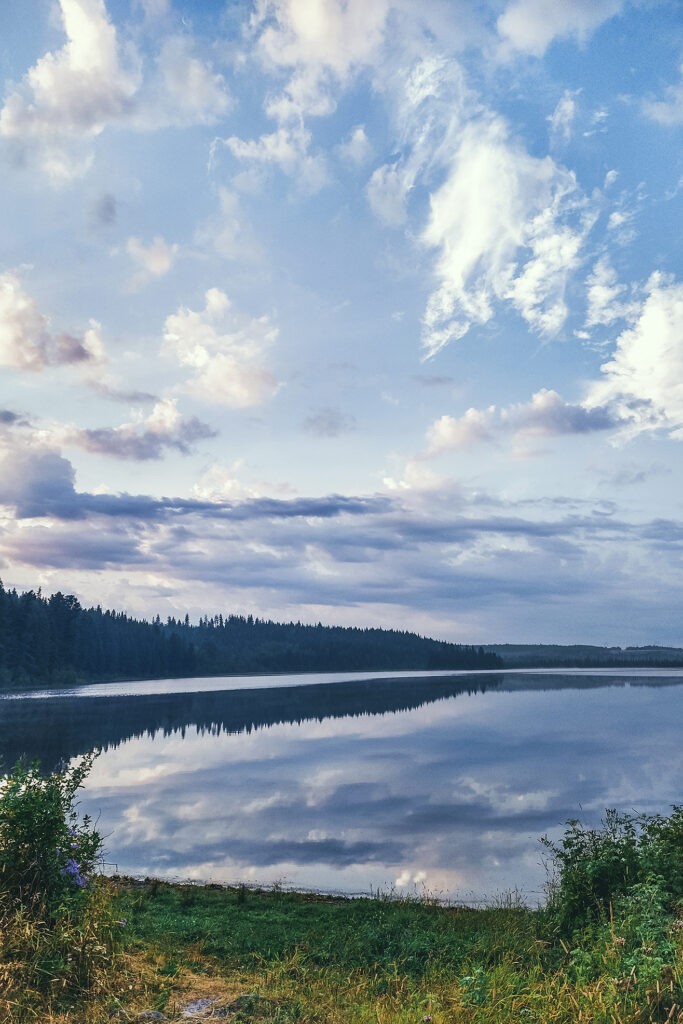
The rest of the night was quiet and uneventful but we got a really nice starry sky, being pretty far from any light pollution. We hadn’t seen many stars at all throughout our trips, partly due to weather but also to the fact that the days were still quite long up in the Yukon and we rarely got a full dark night when we were there. Going back down south we could feel the days getting shorter as we got closer to Vancouver.

September 3 – Hiking to Bootski lake

It took us a bit of time in the morning to get ready (if you haven’t clued in by now, it usually does, we’re not really the get-up-and-go type). Contrary to what we first had thought, we decided to pack everything up and spend the following night at a campsite back in Tumbler Ridge, partly because we didn’t want to leave our gear for any random party to find, as people would likely come to this spot to spend the week-end, and also because an in-town campsite came with the promise of showers, which we were sure to appreciate after our hike.
We drove about 13km south on highway 52.E, then 37 km down Okay Main Service Road to the trail head. There was phone service right at the FSR turn off so we made sure to let a friend know where we where going and when to expect us back, a precaution we always take when hiking in remote locations.

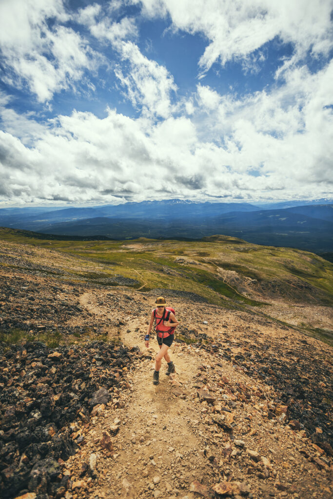
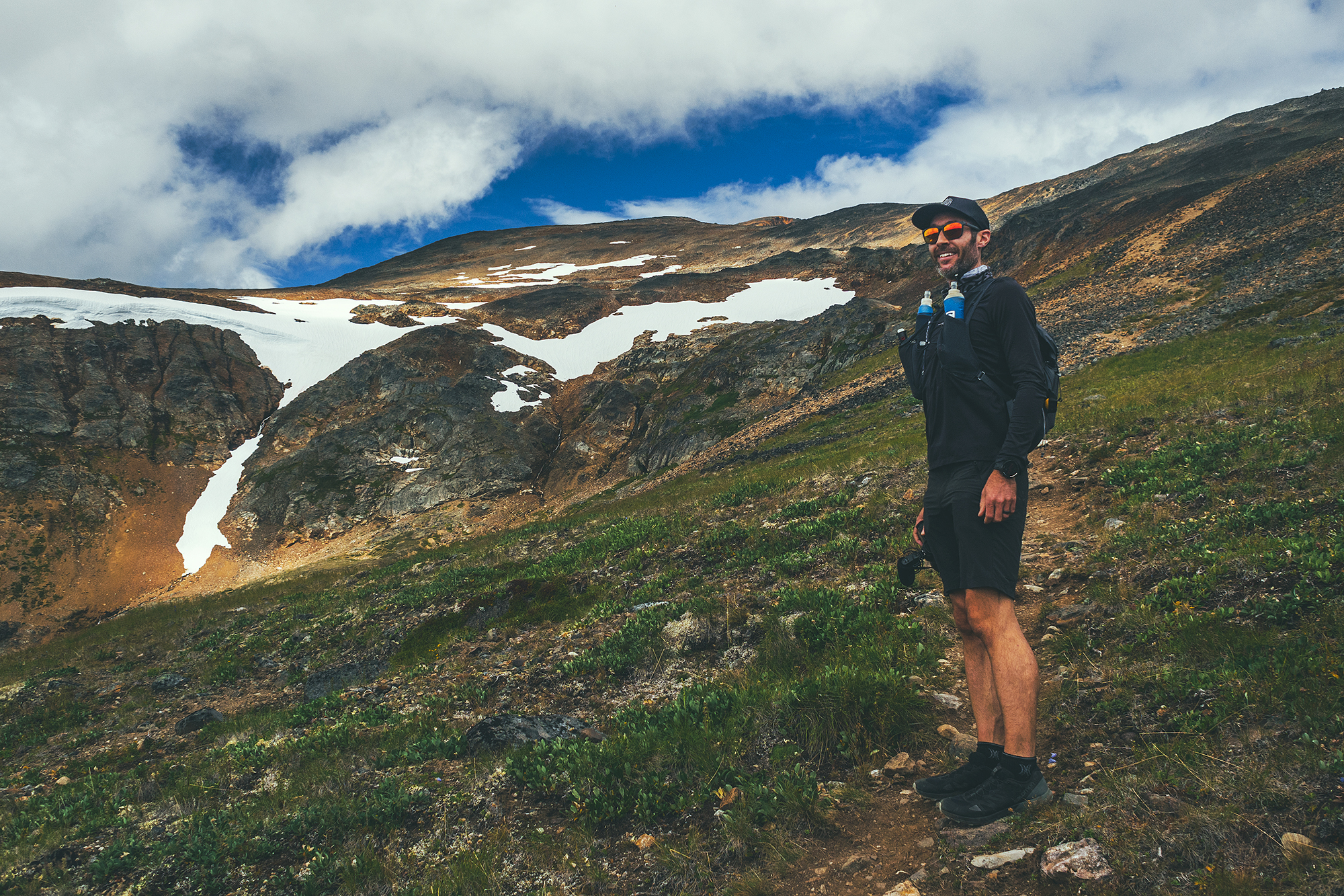
It was pretty sunny that day, but weary of changing conditions, and after spending the last few weeks bundled up against the elements, I still wore leggings and long sleeves – a choice I regretted as soon as we warmed up on the trail. Brice wore all black pants and long sleeve, also a questionable choice for him who generally runs hot.

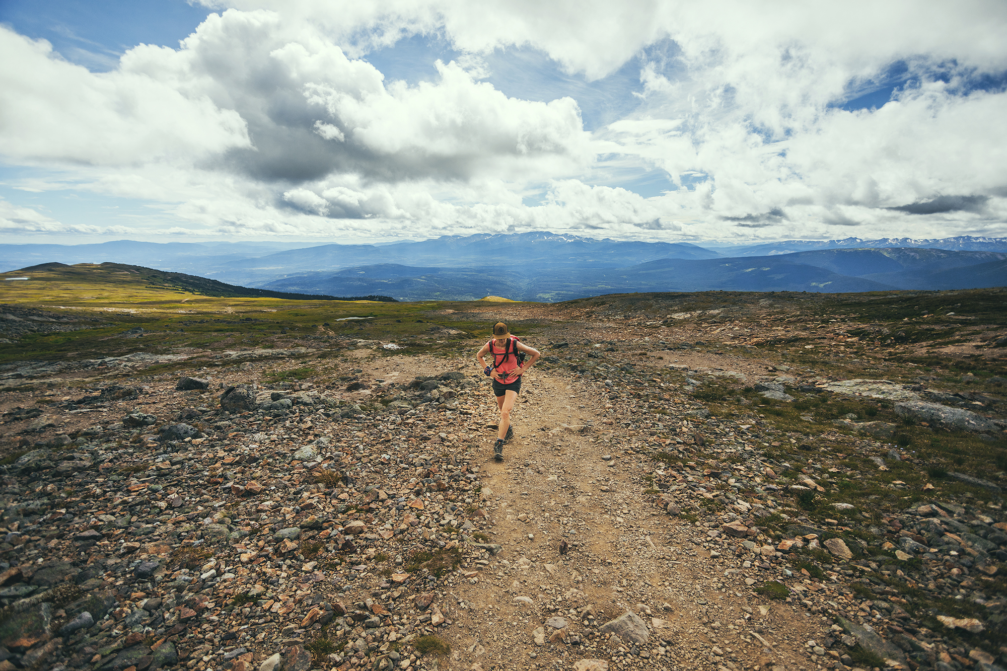
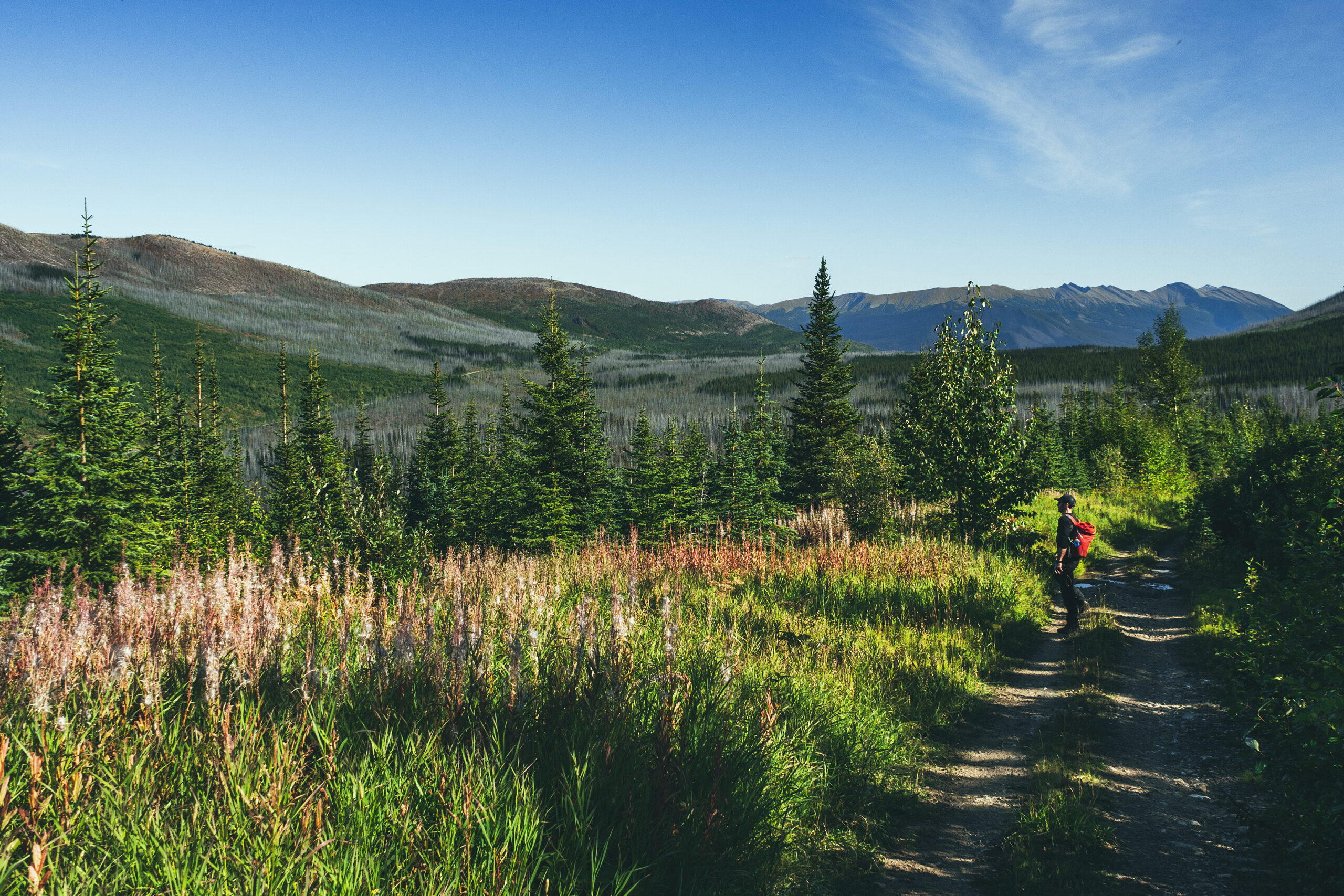
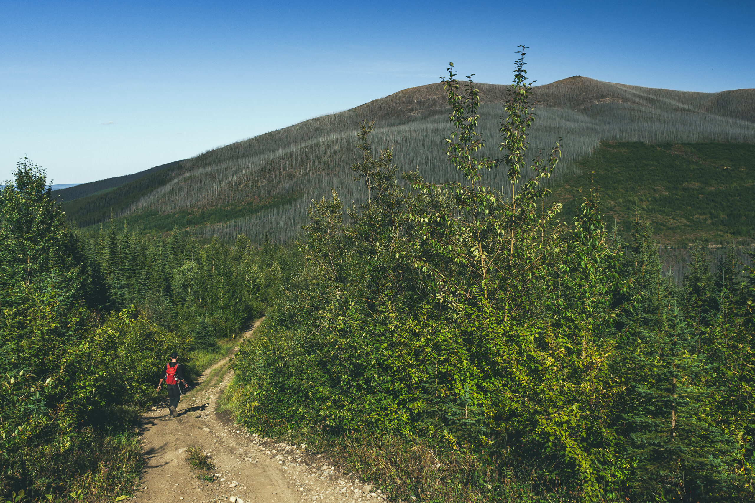
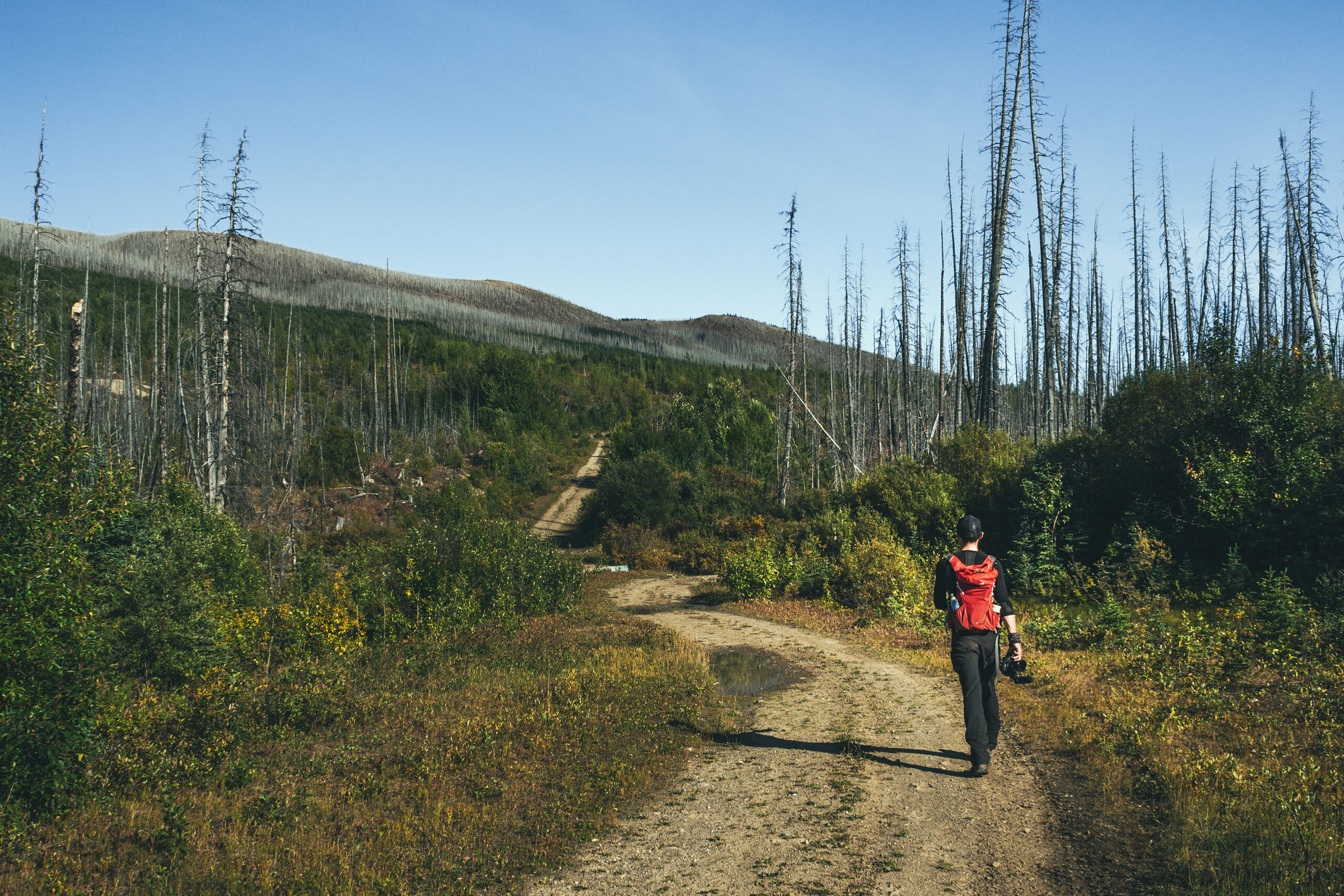
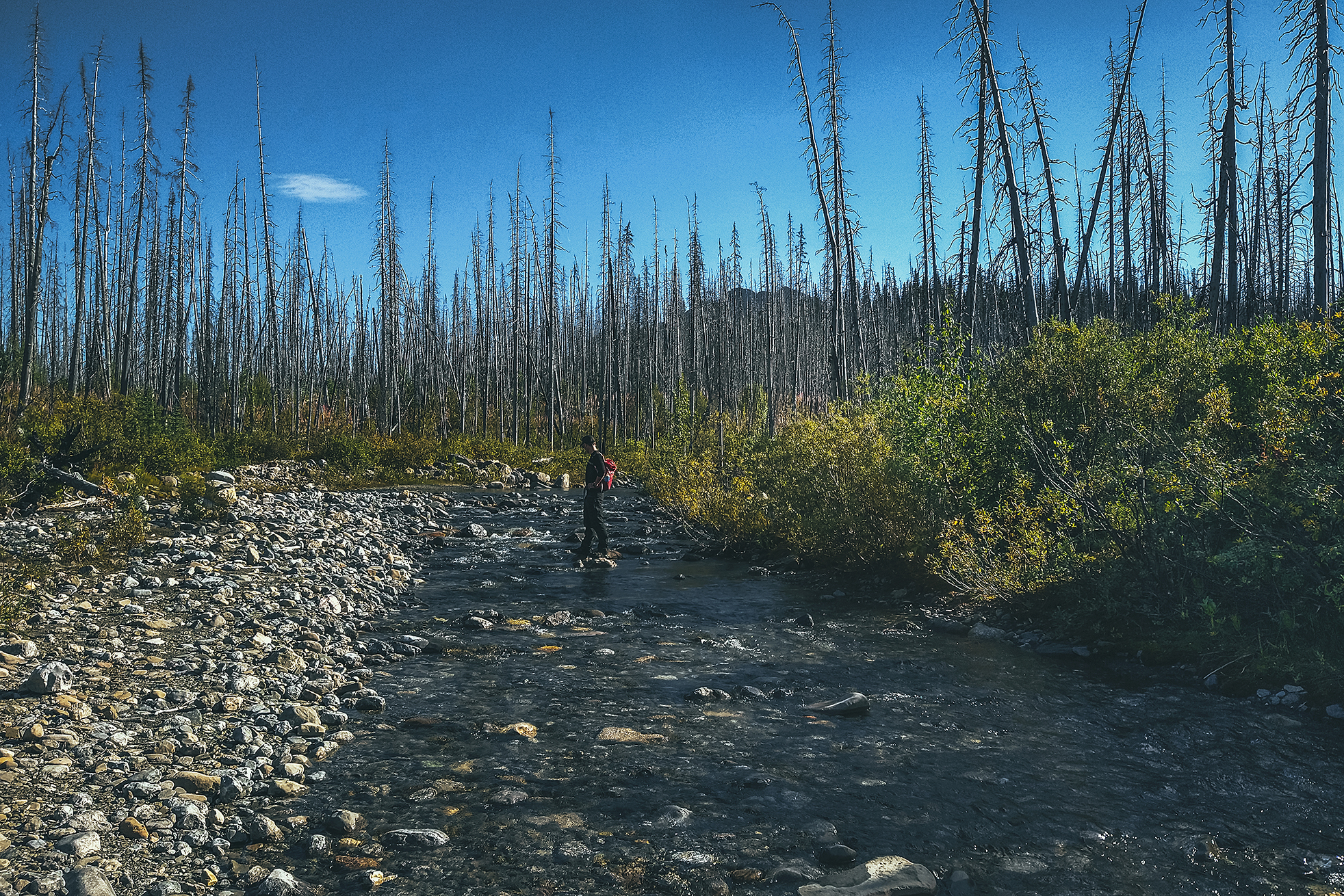
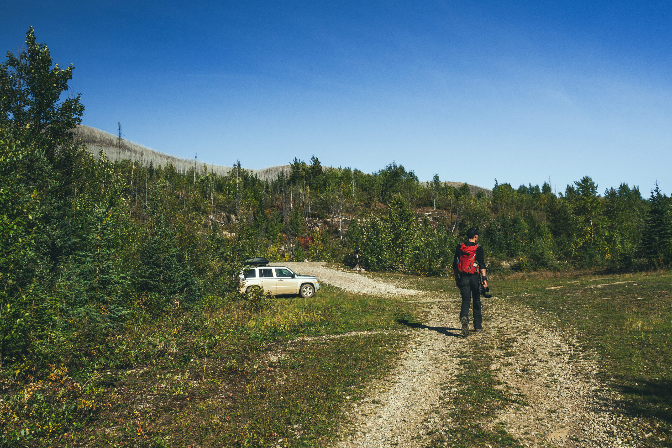
The hike starts with 3.5km along an ATV track. At first we thought we could have driven some of it but it got pretty rough, probably more so than our jeep could handle. There was one creek crossing where I thought it wiser to go through barefoot, rather than risk another leg dunking. Brice as per usual skipped over those slippery rocks like it was nothing.

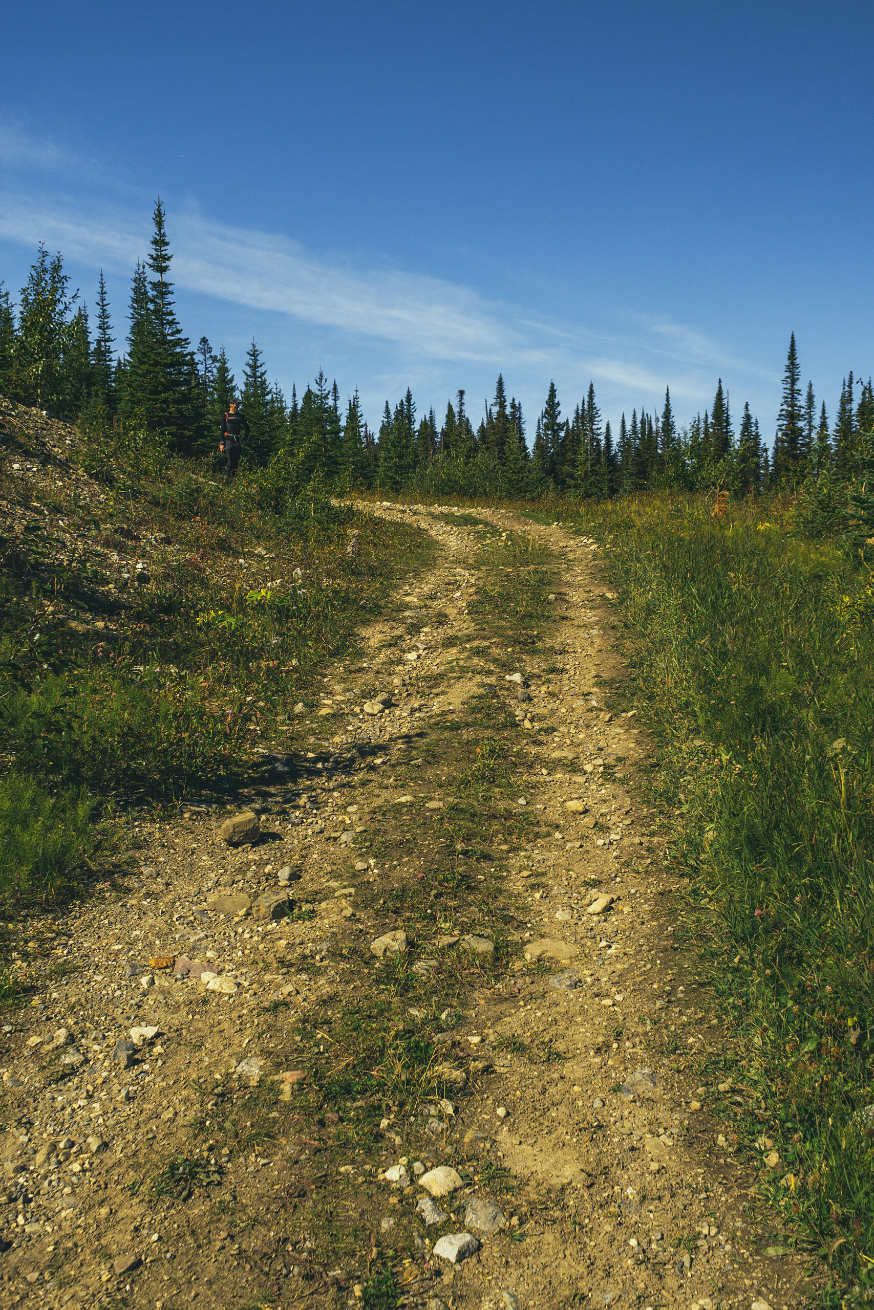
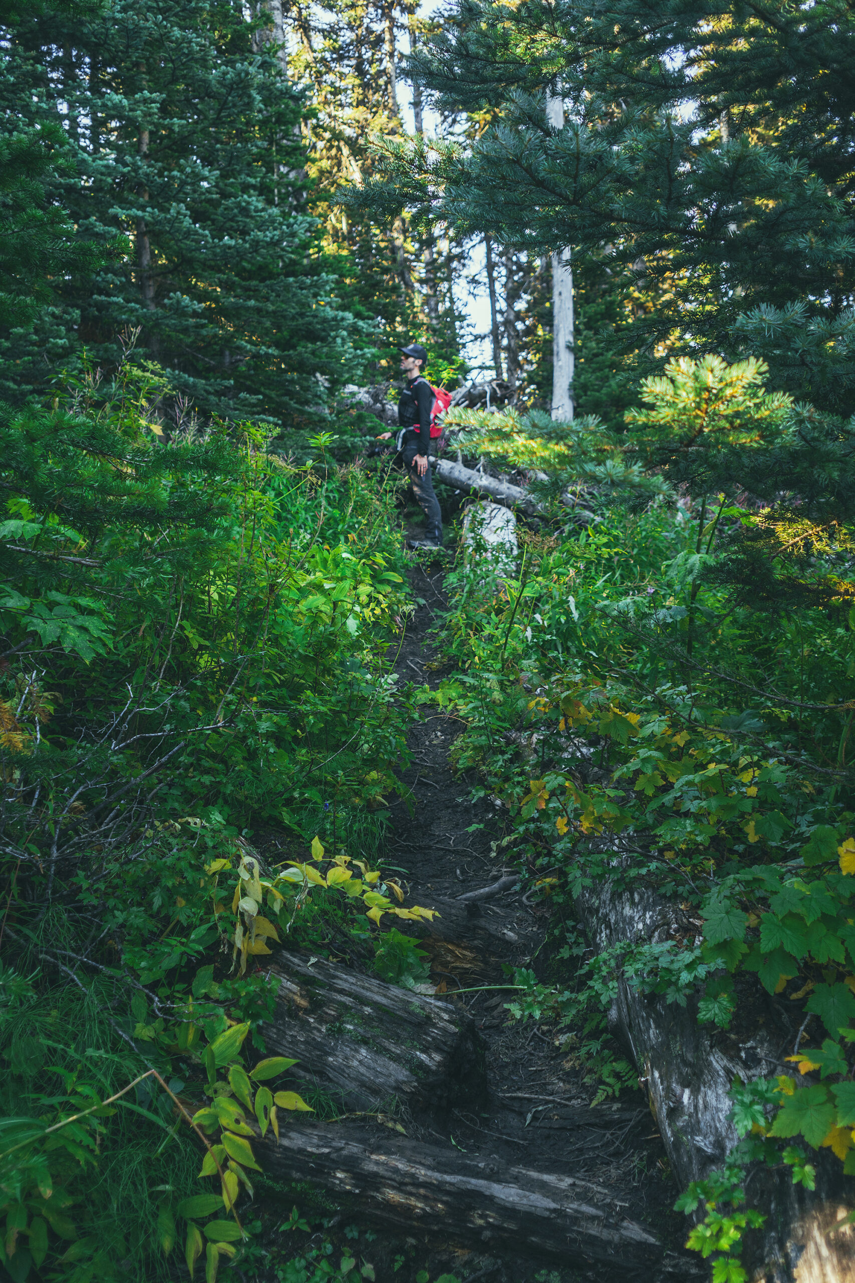
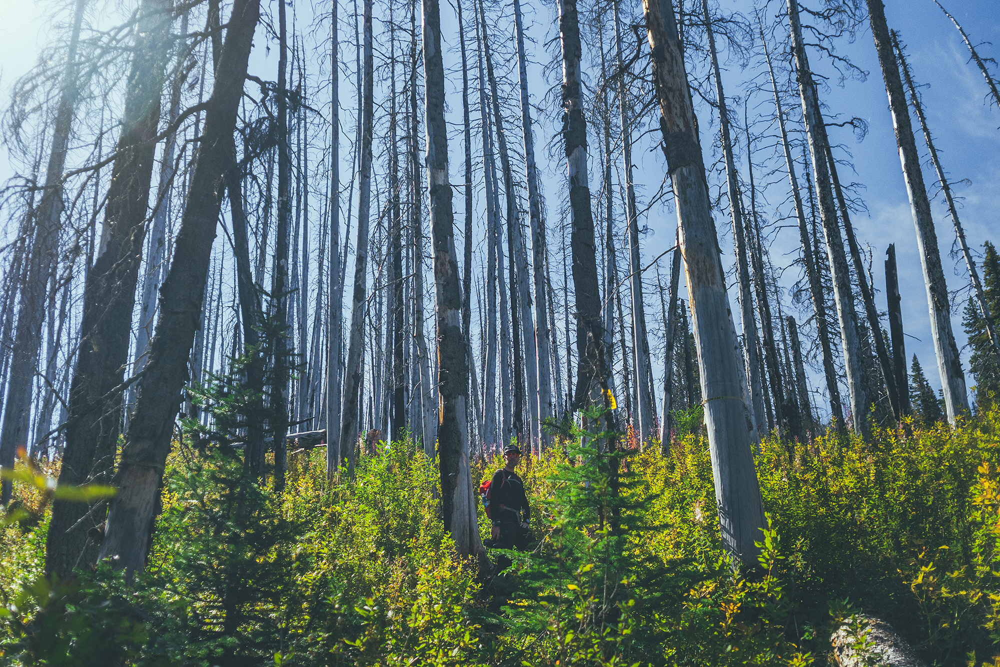
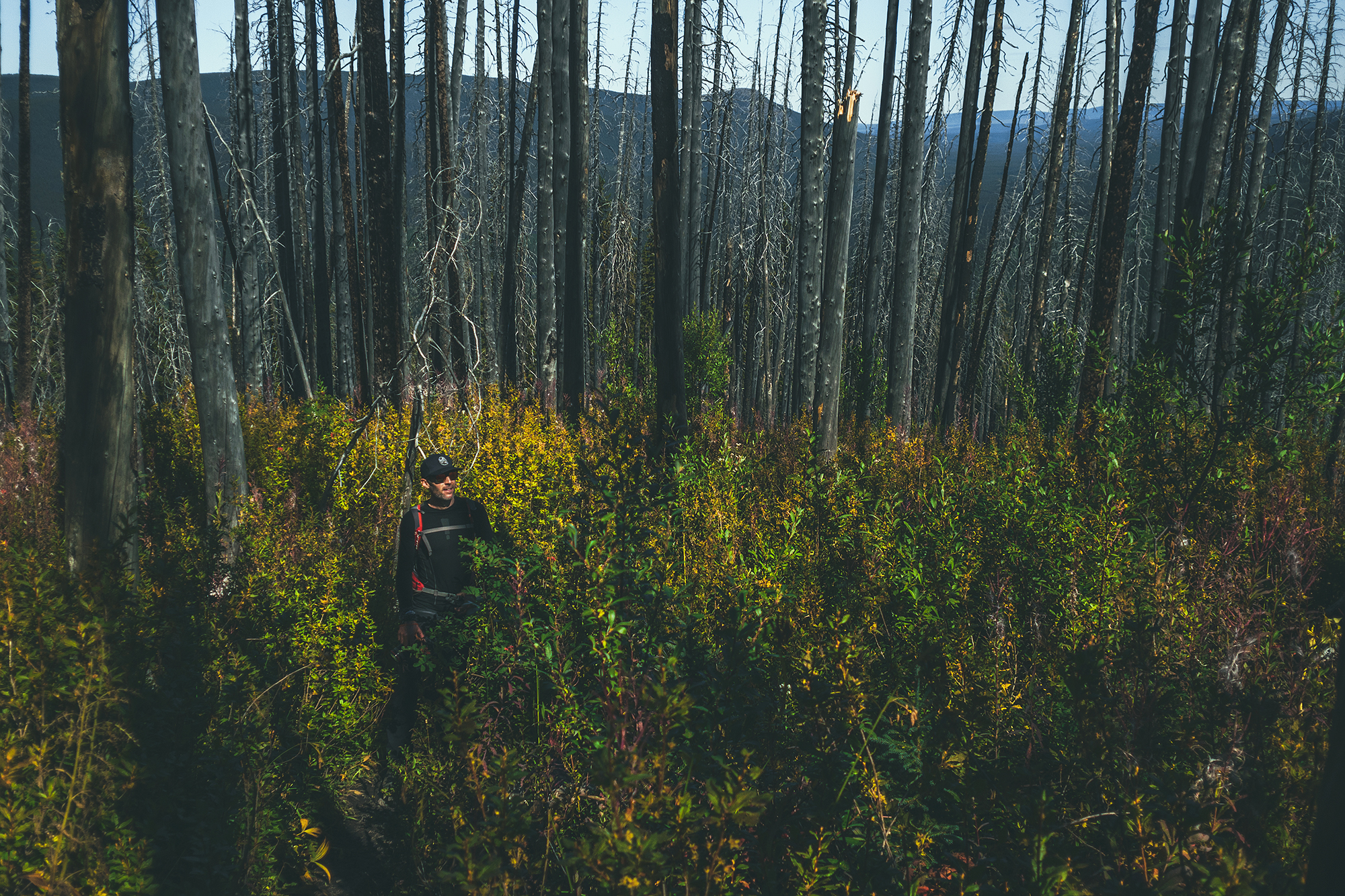
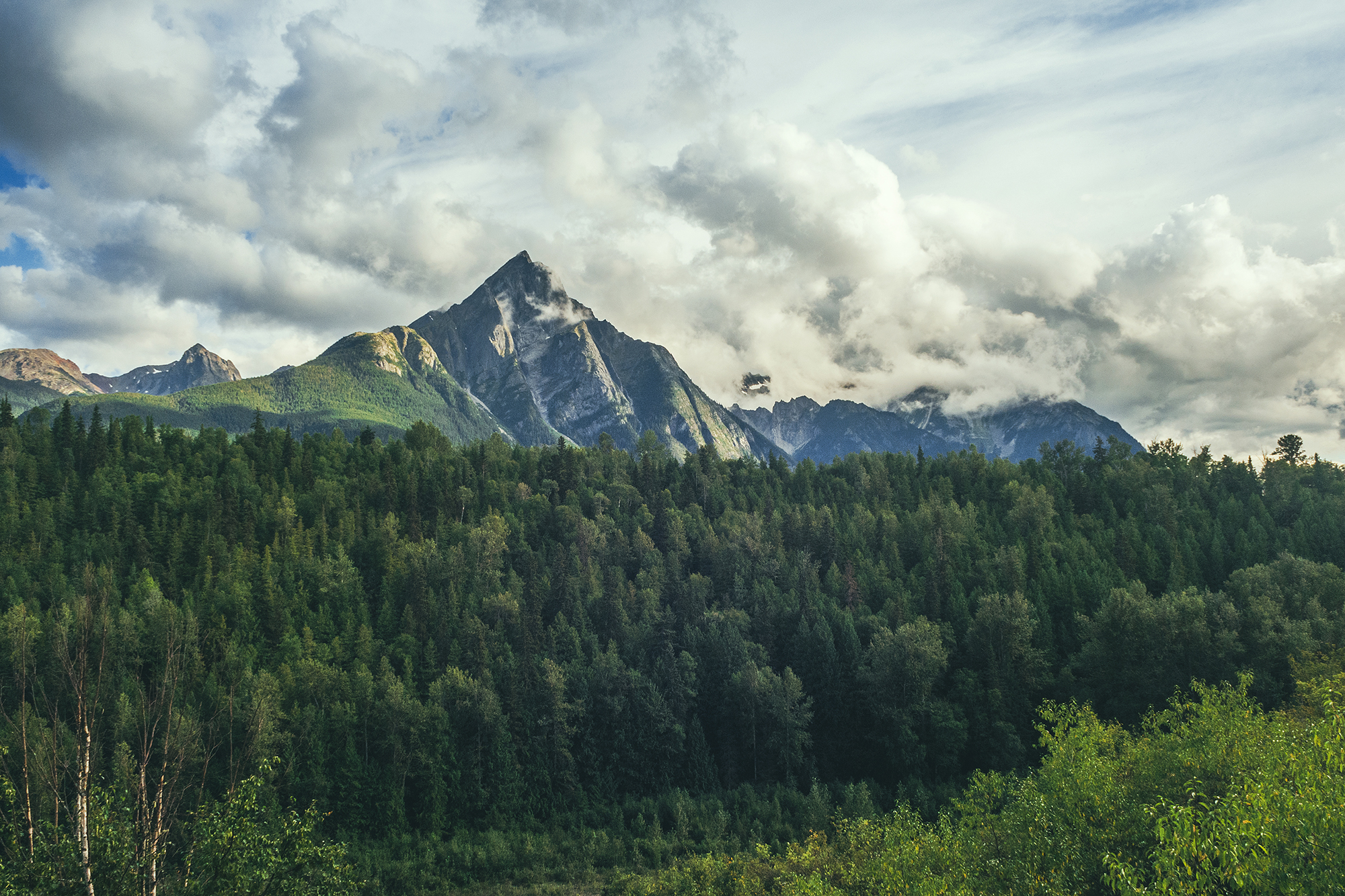
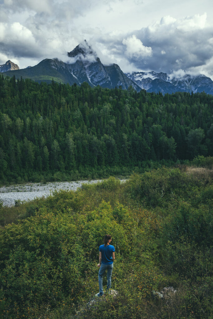
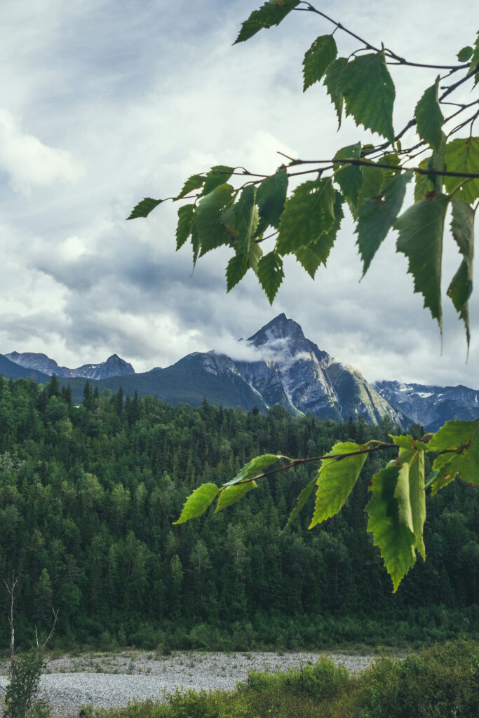
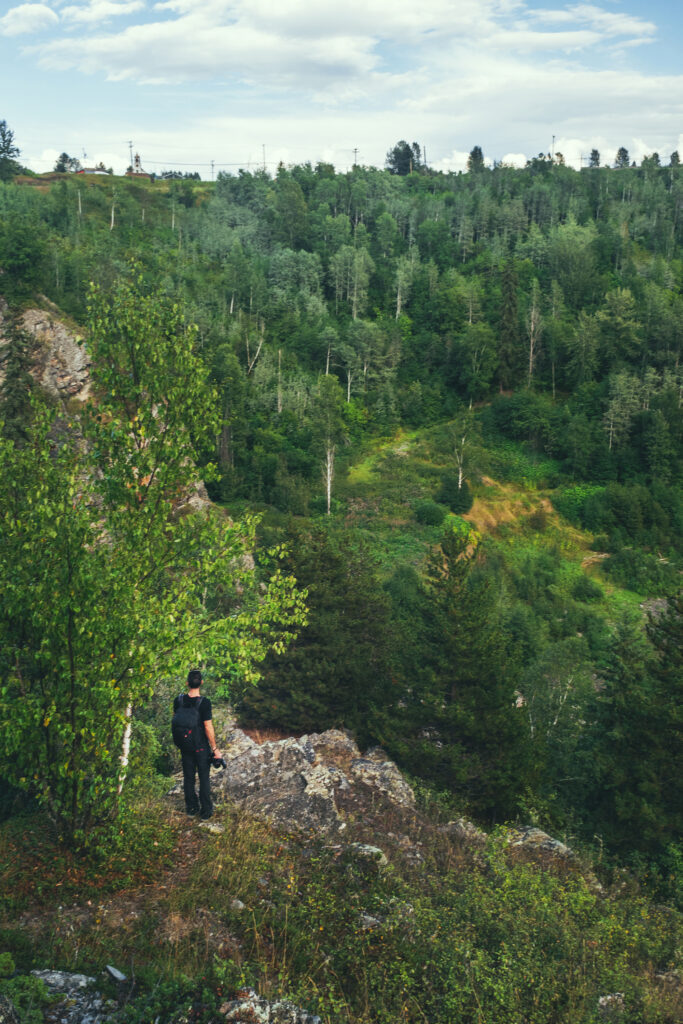
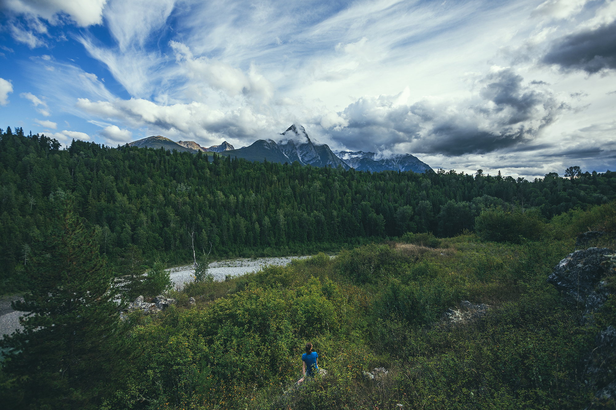
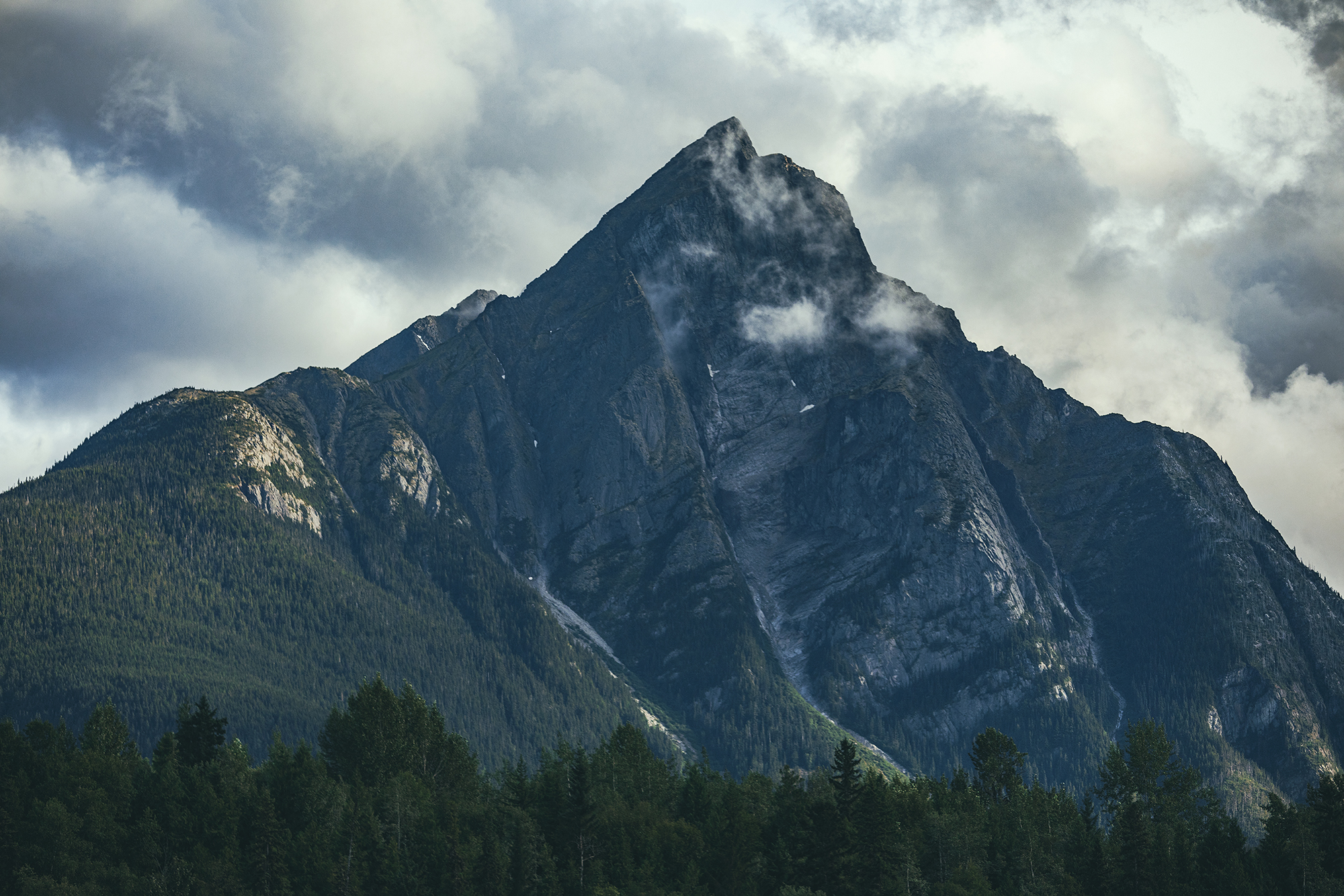
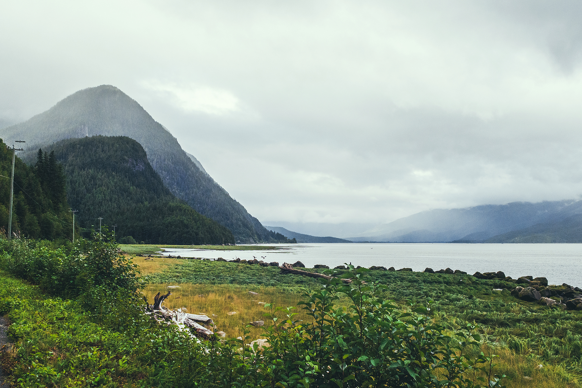
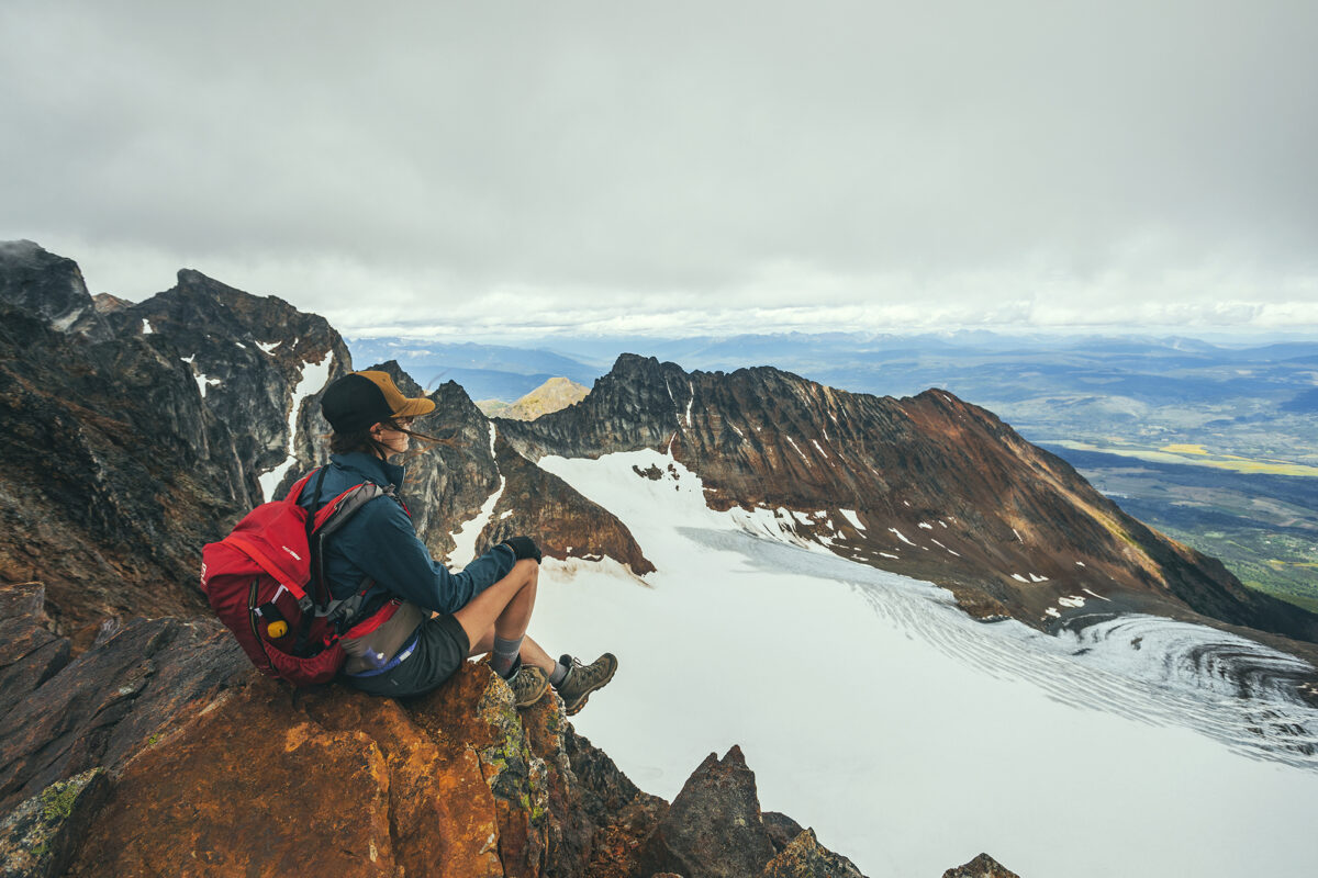
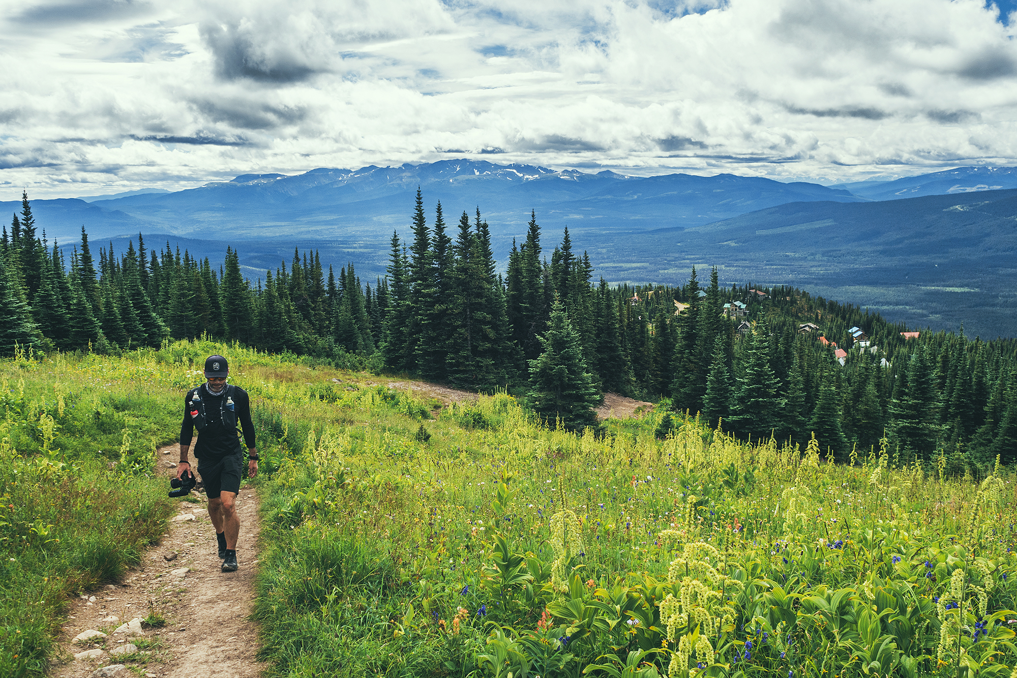
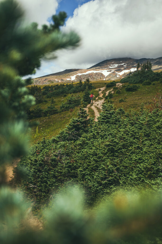
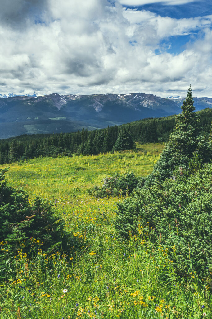
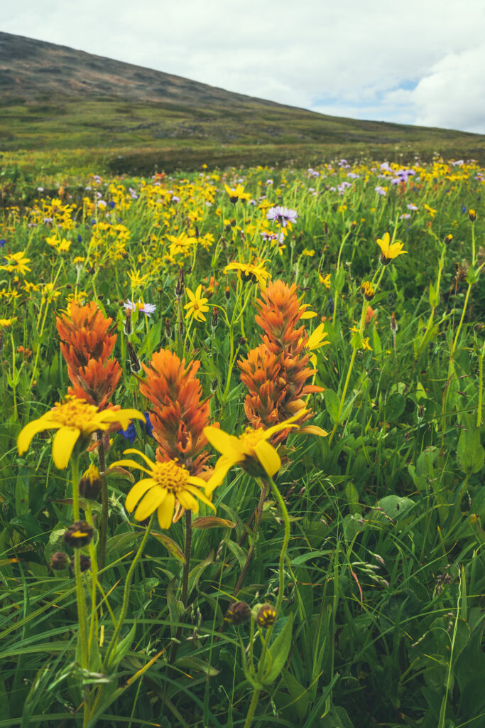
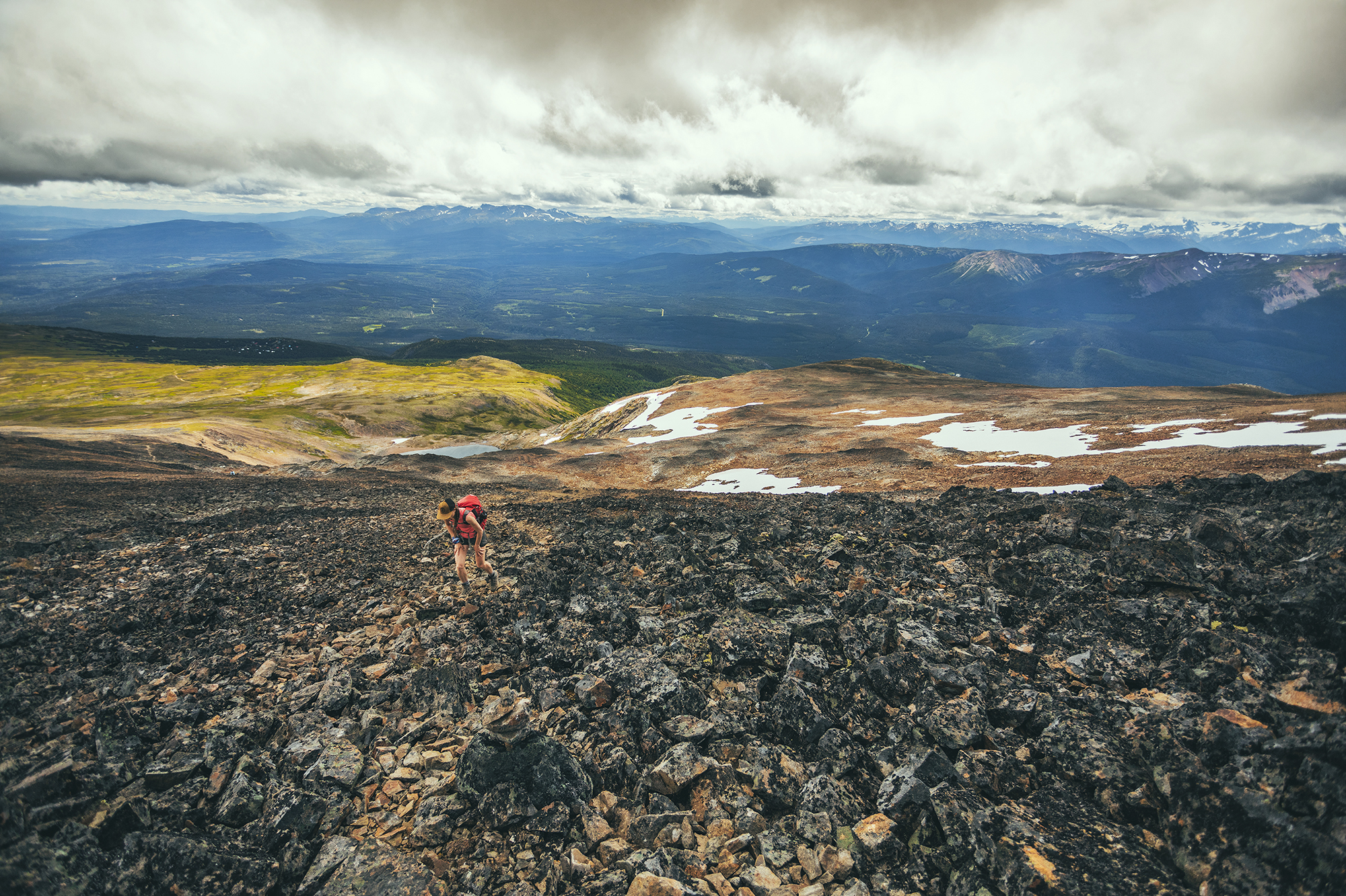
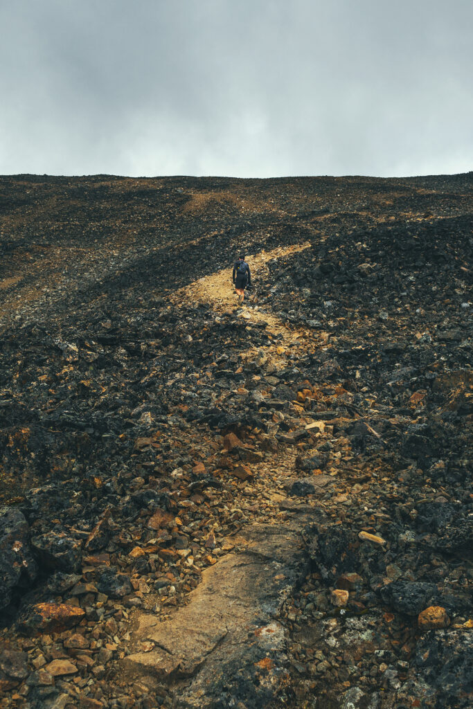
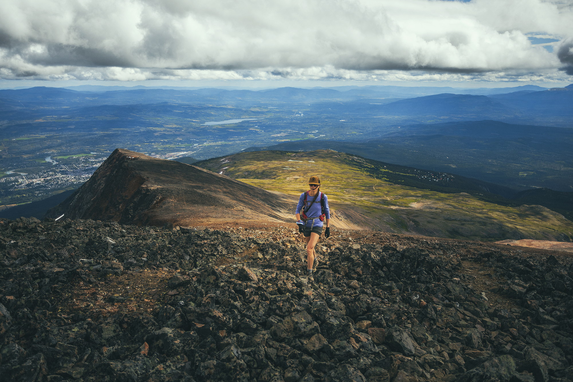
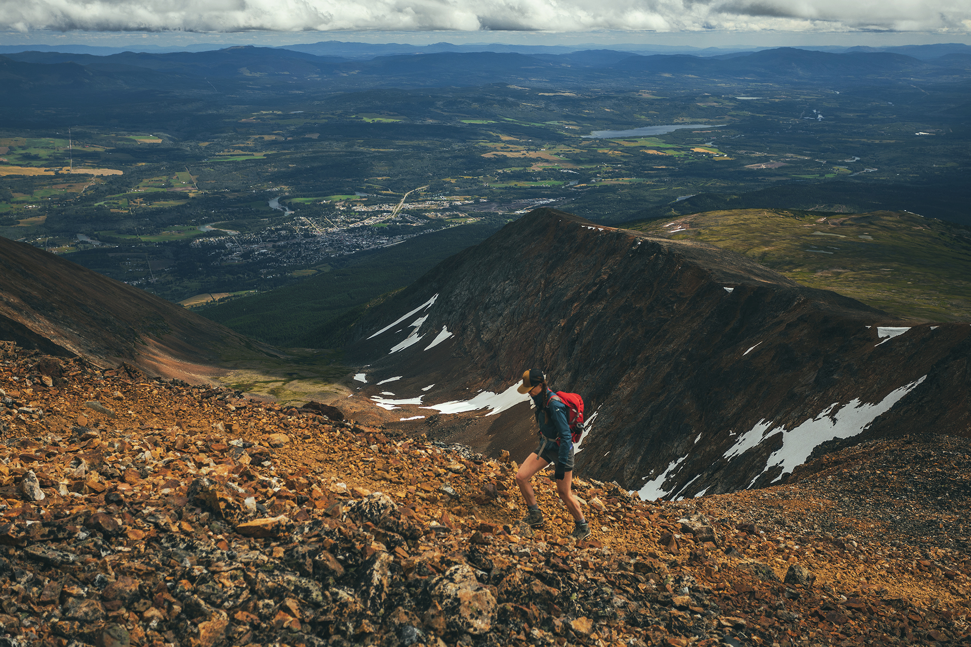
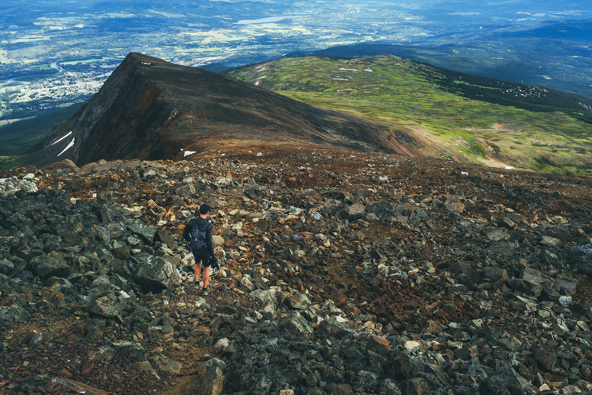
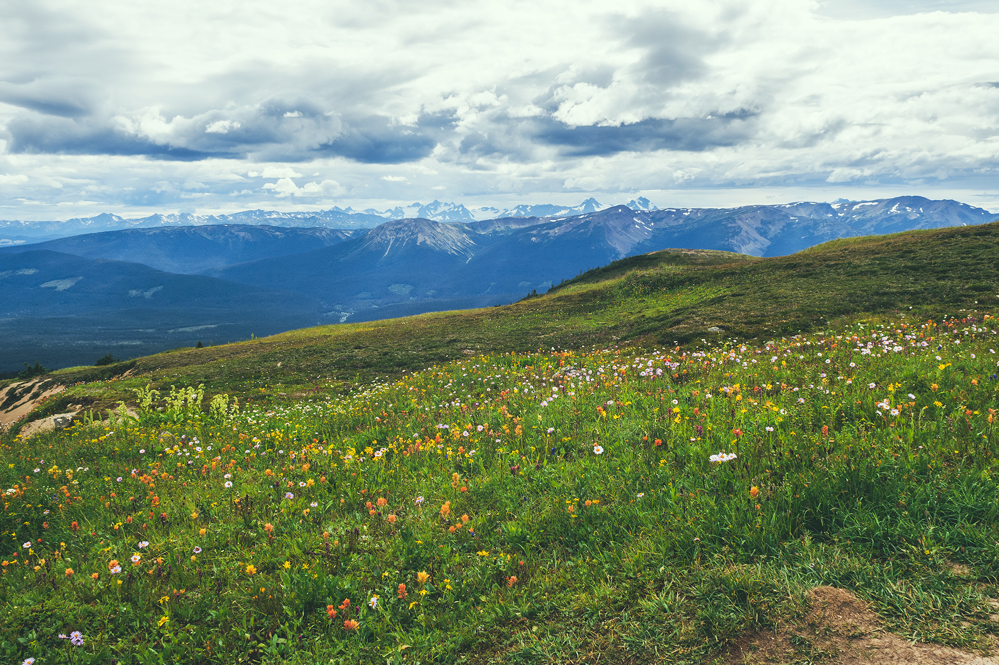
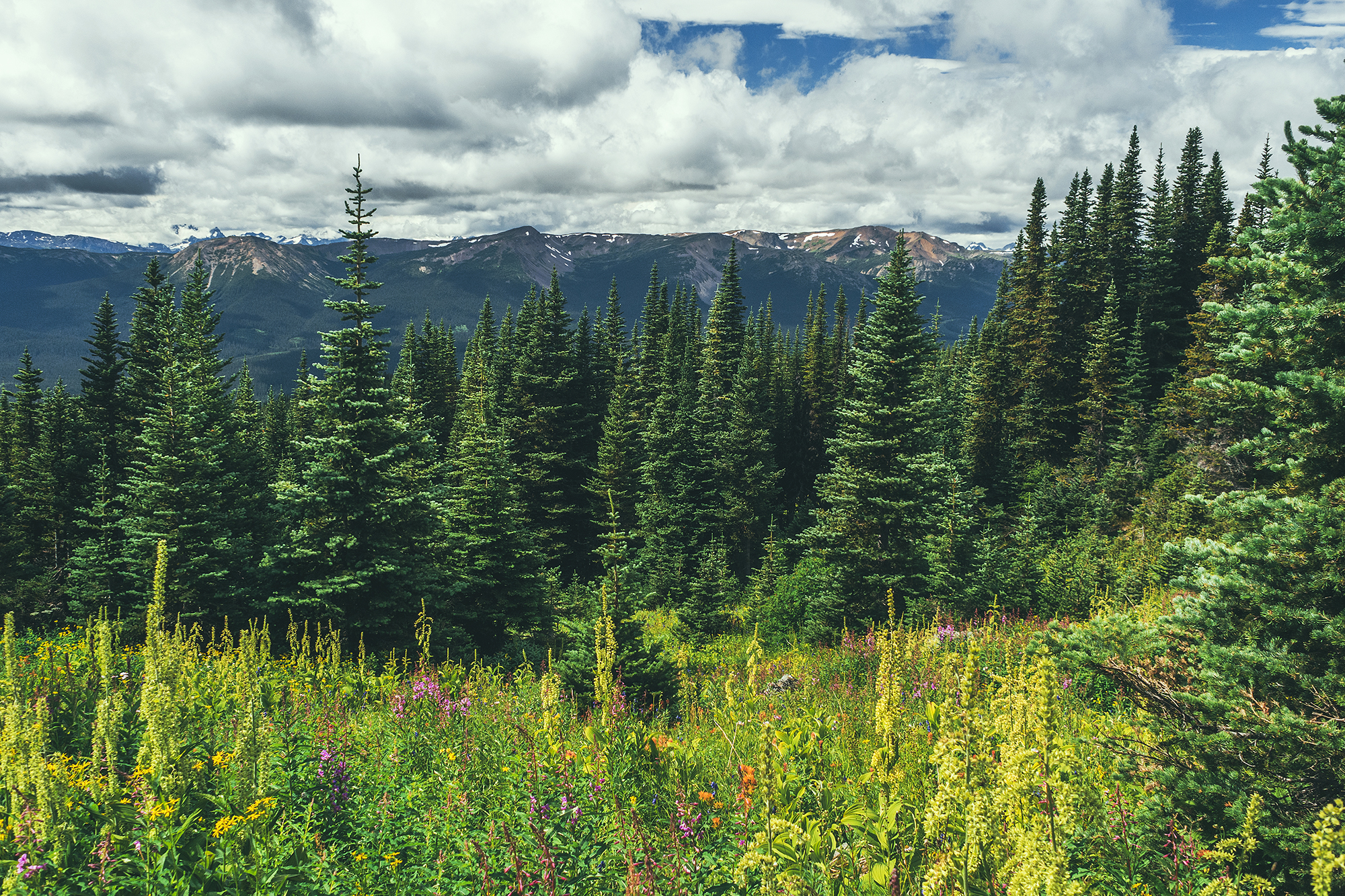
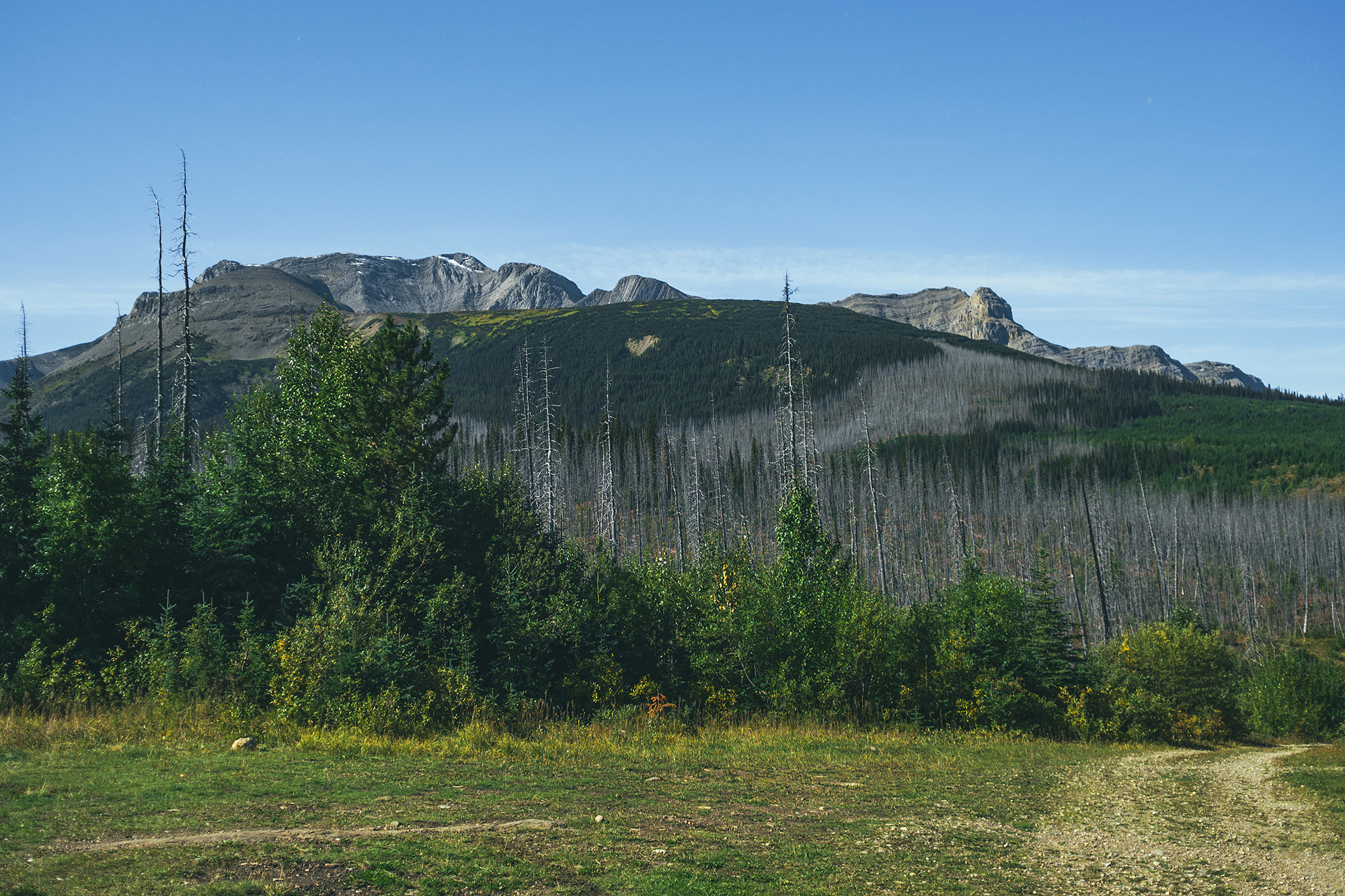
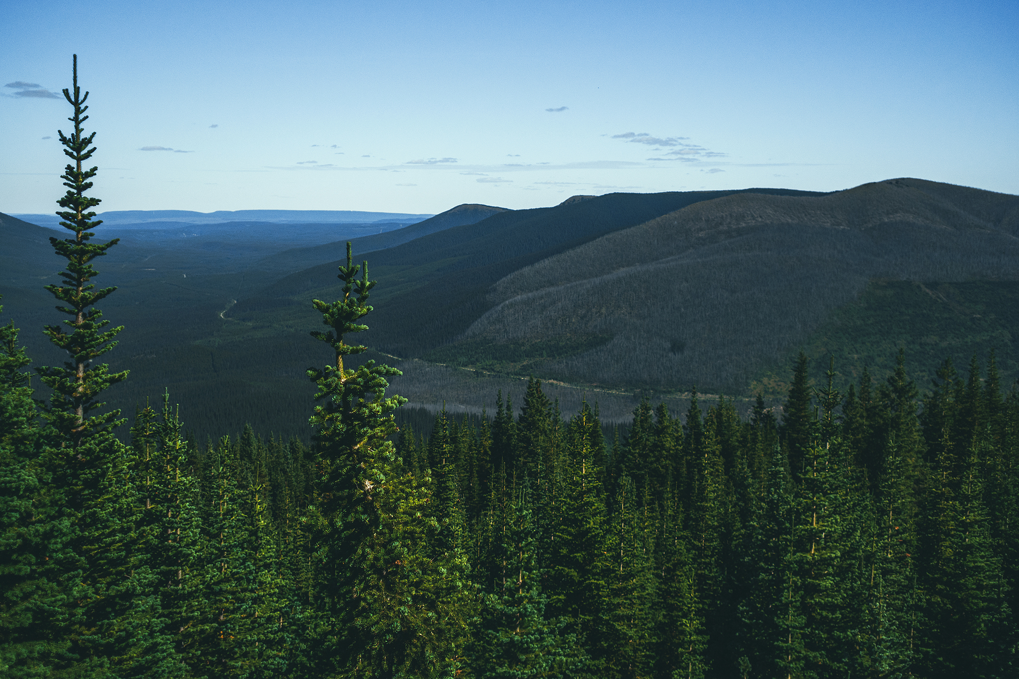
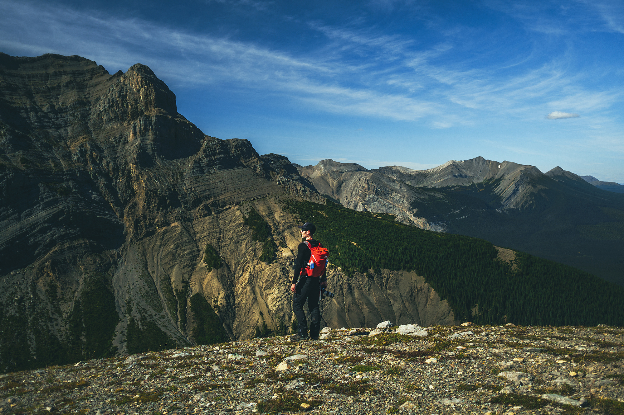
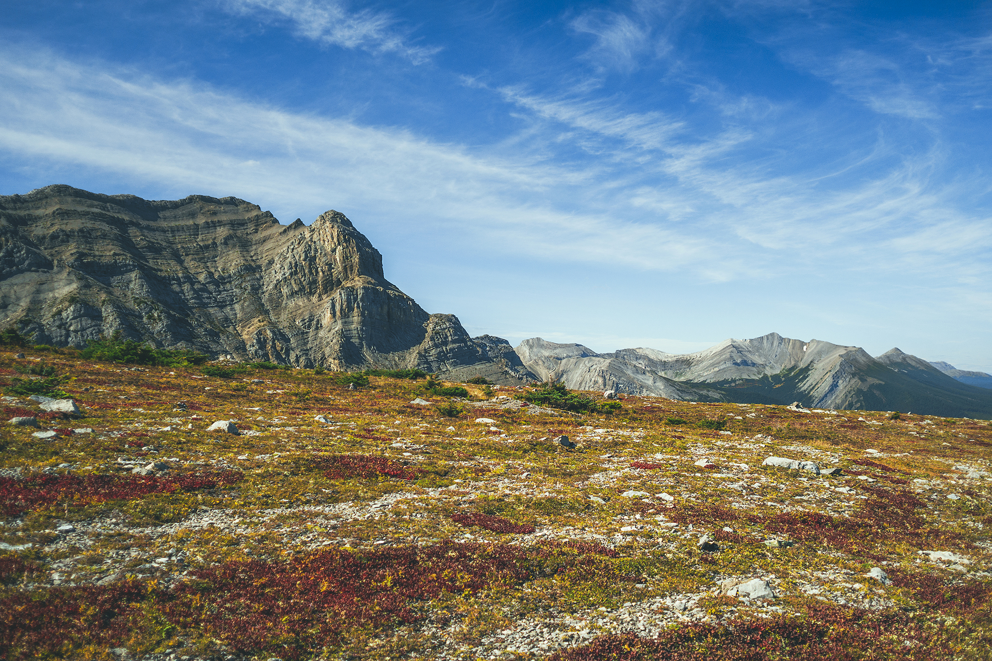
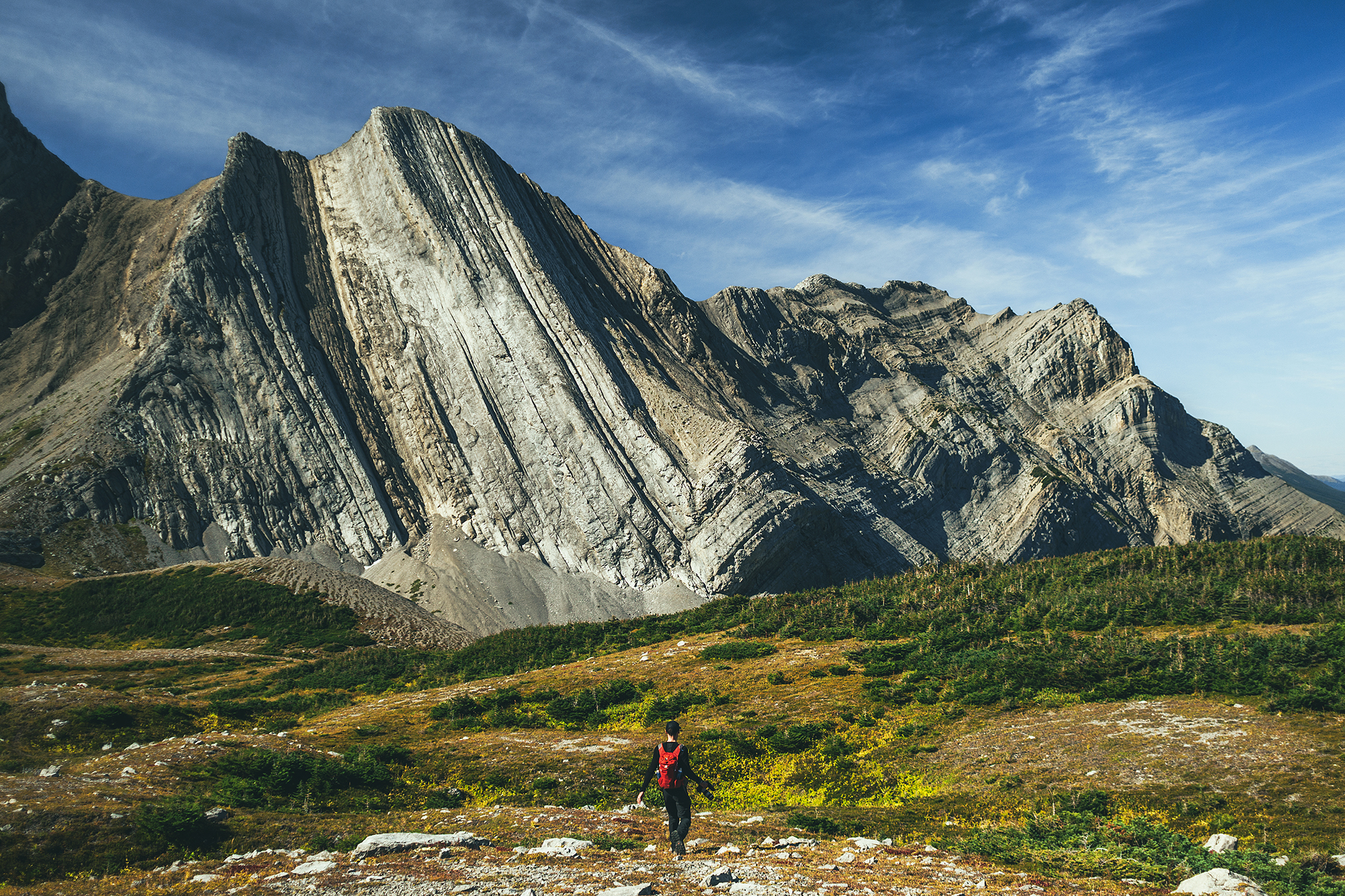
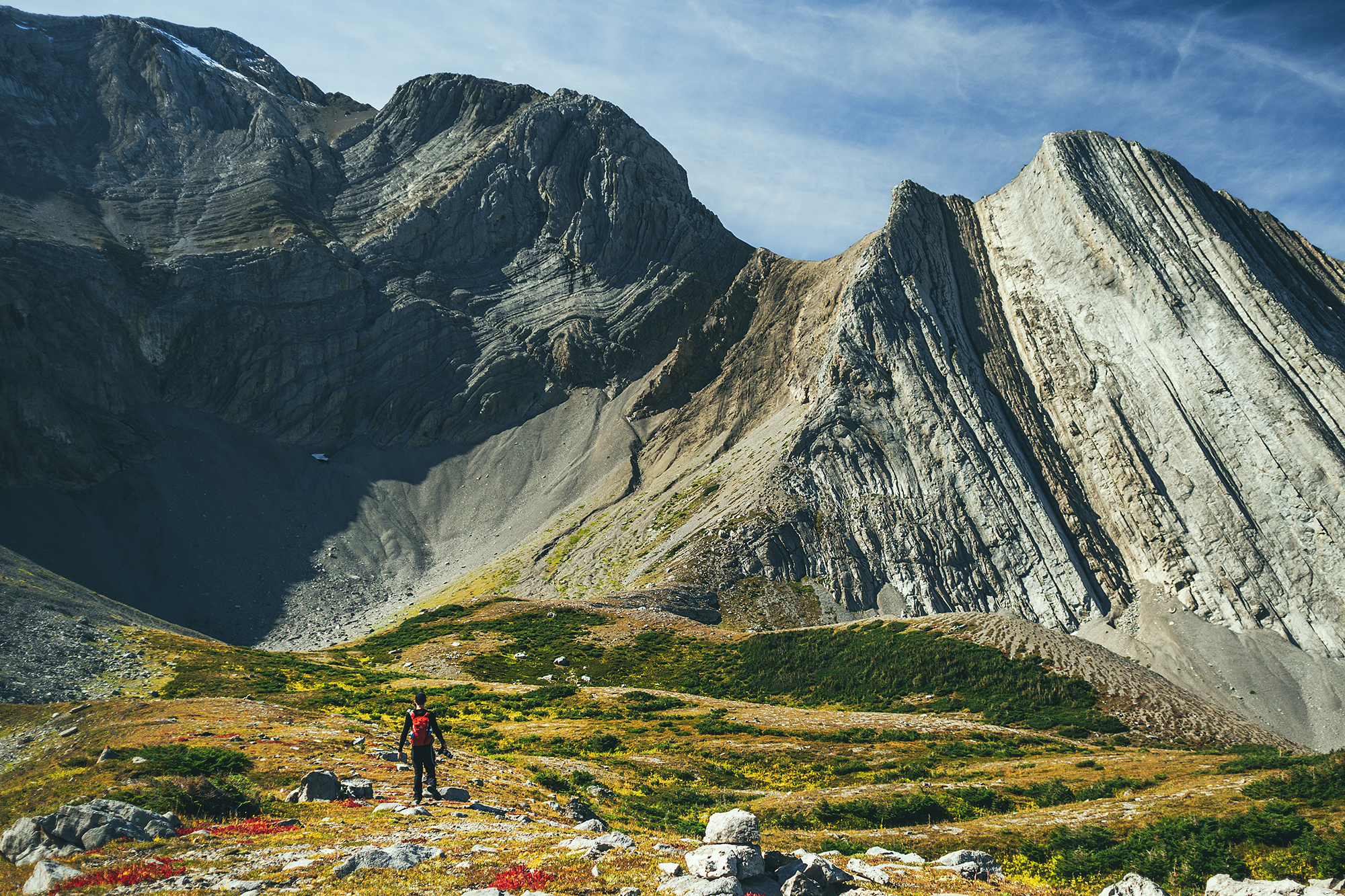
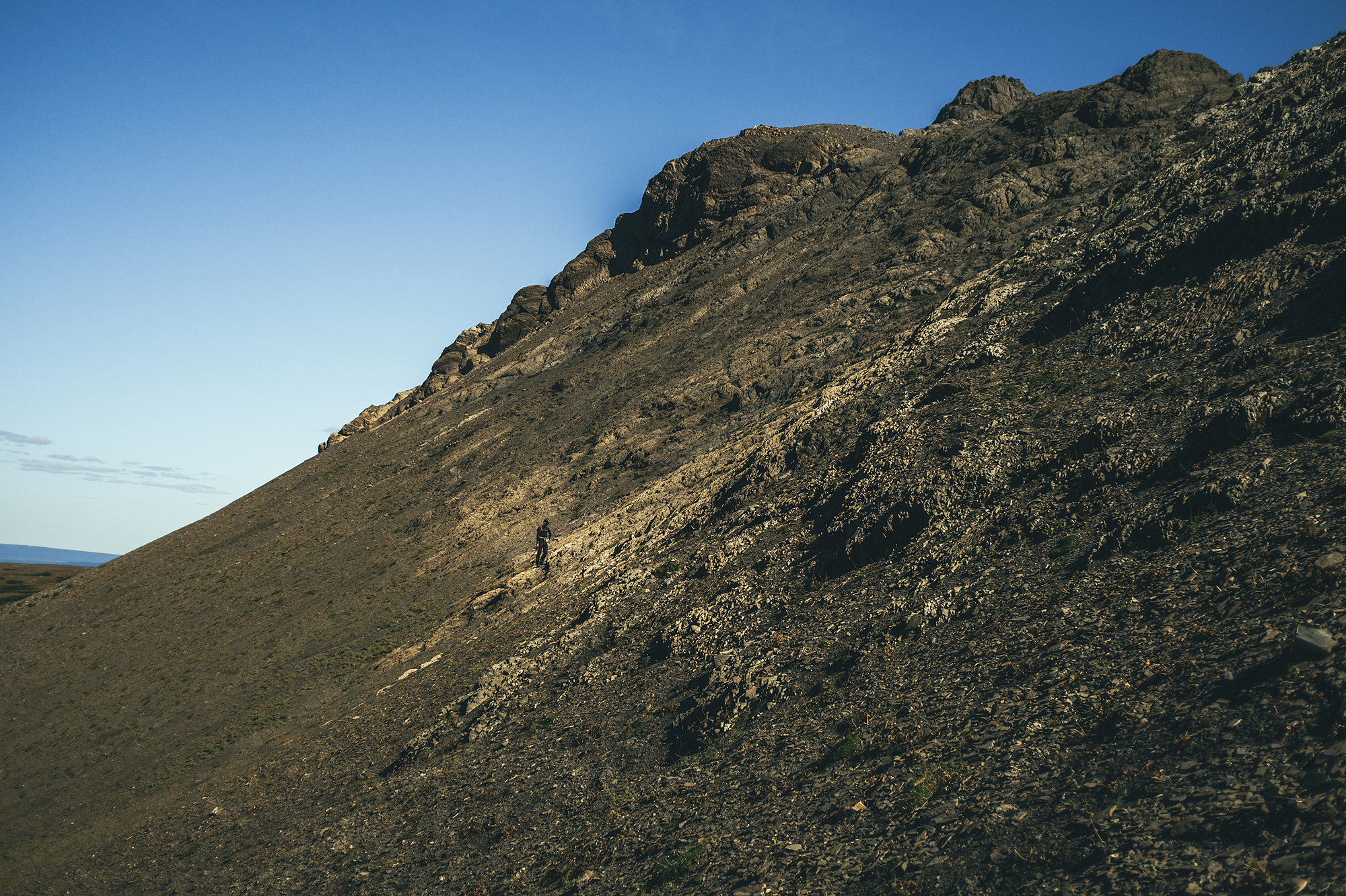
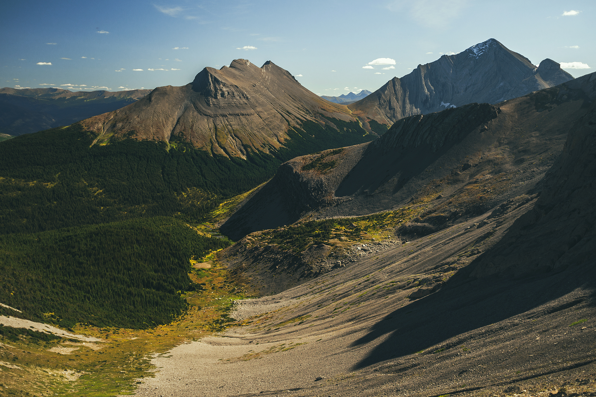
After 3.5km, the trail veers off into the trees and becomes a steep single track, similar to a lot of those we have around Vancouver. It was only about 1 km, but quite steep. Shortly after the start of the climb, the trail goes through a burn area, still dense with tall, charred trees. Then it’s back into intact forest again, until it reaches an open meadow with 360 views of the mountains and valley around. That view alone was quite stunning, and although some distance back, the impressive wall of Mount Waptki in the backdrop was an imposing sight.

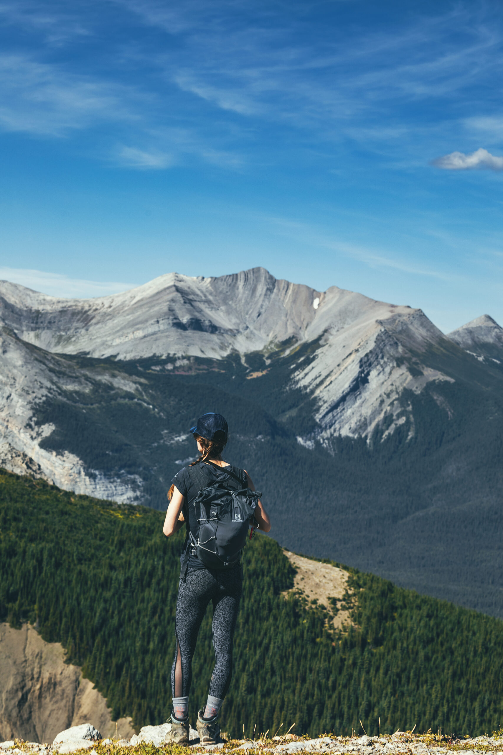
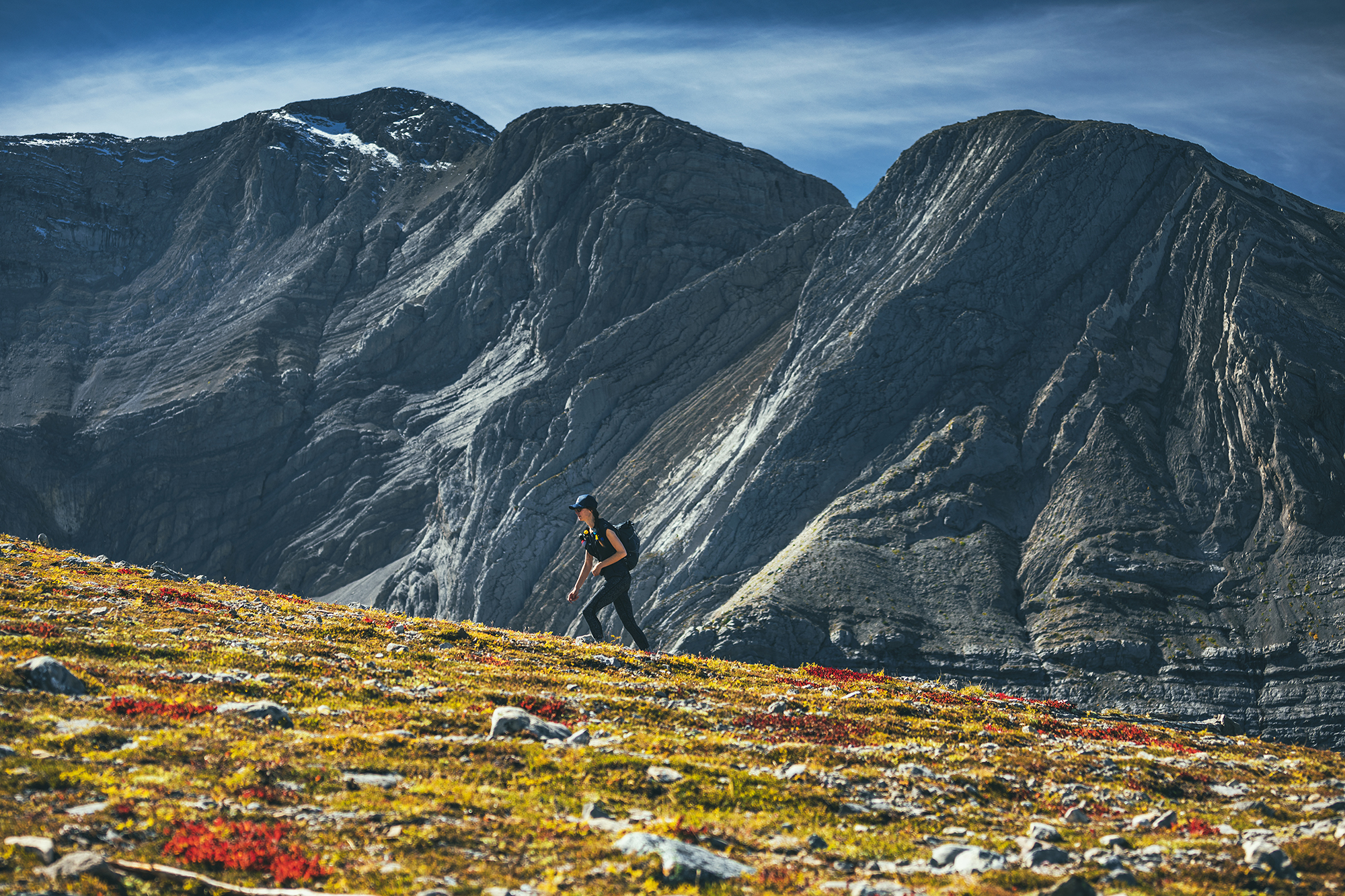
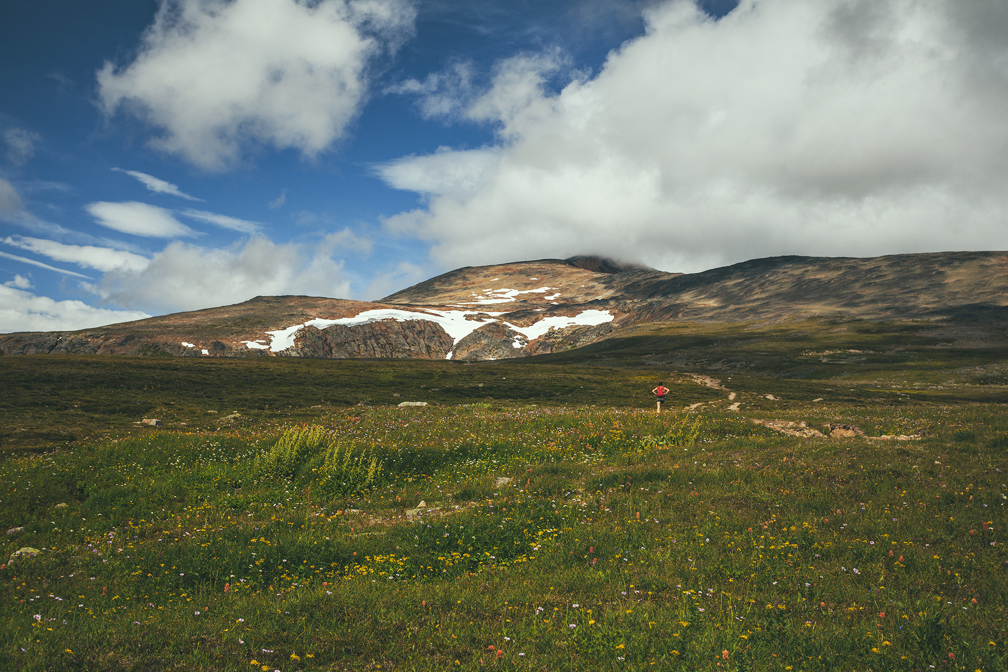
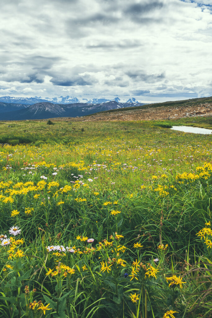
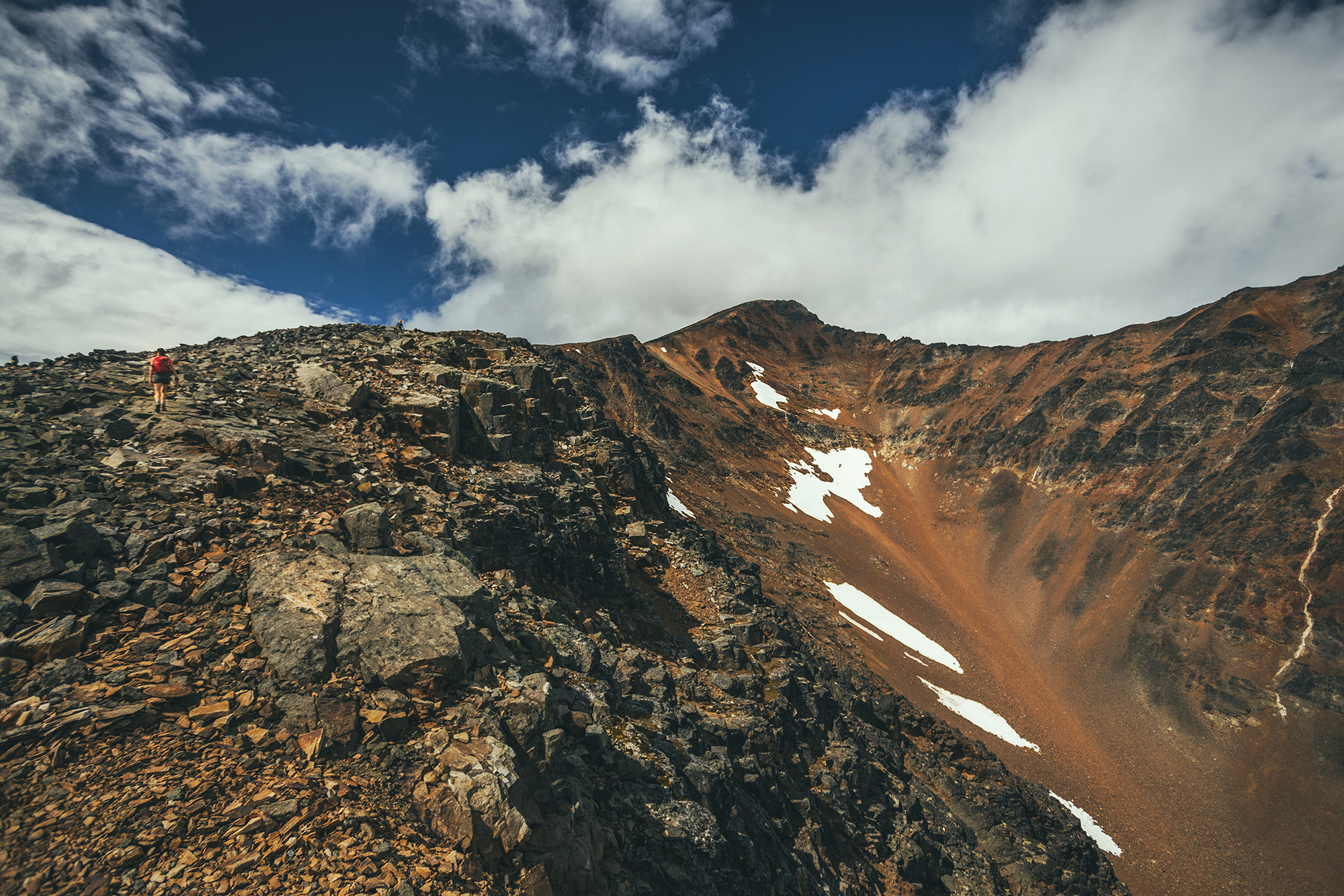
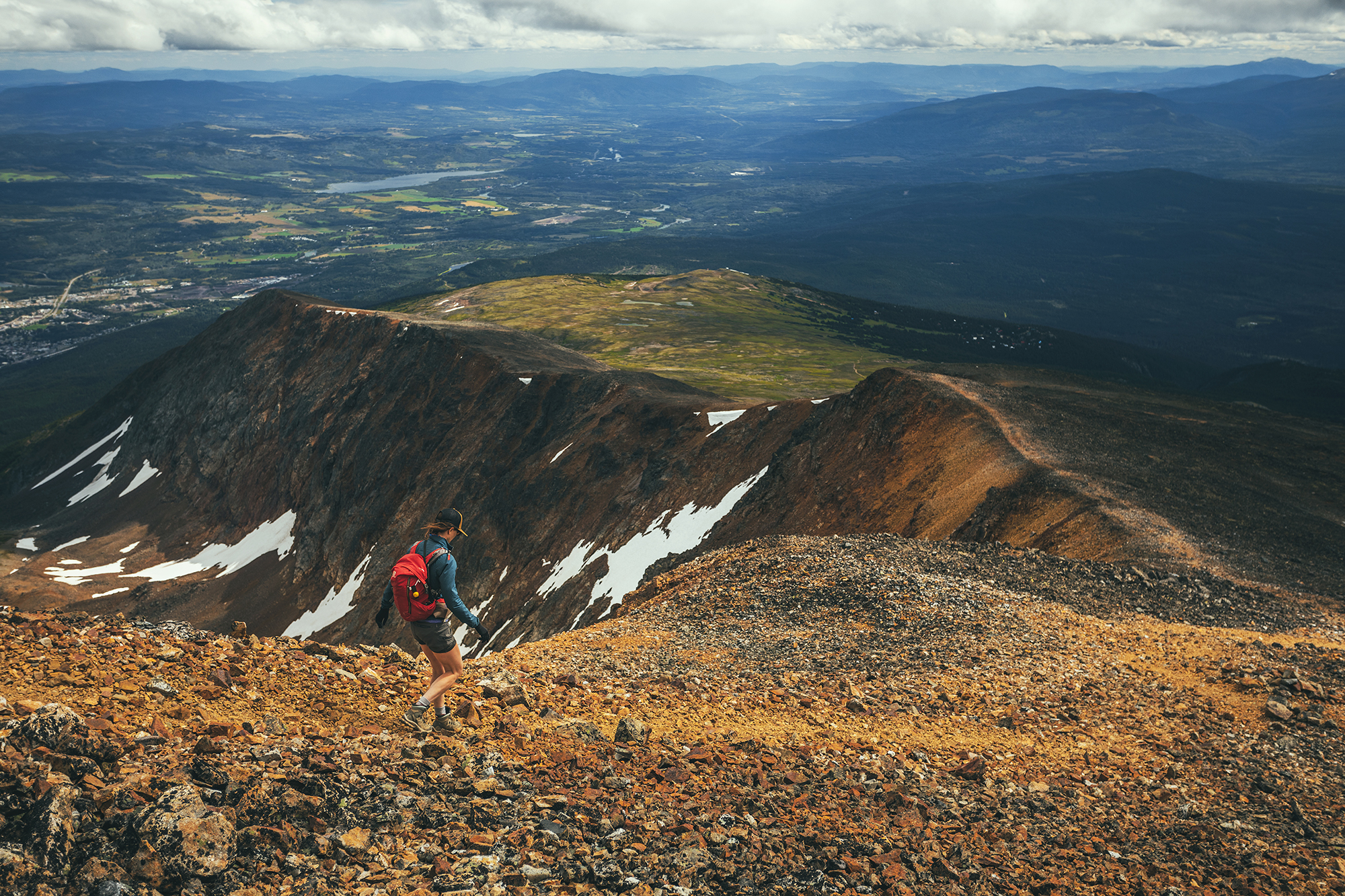
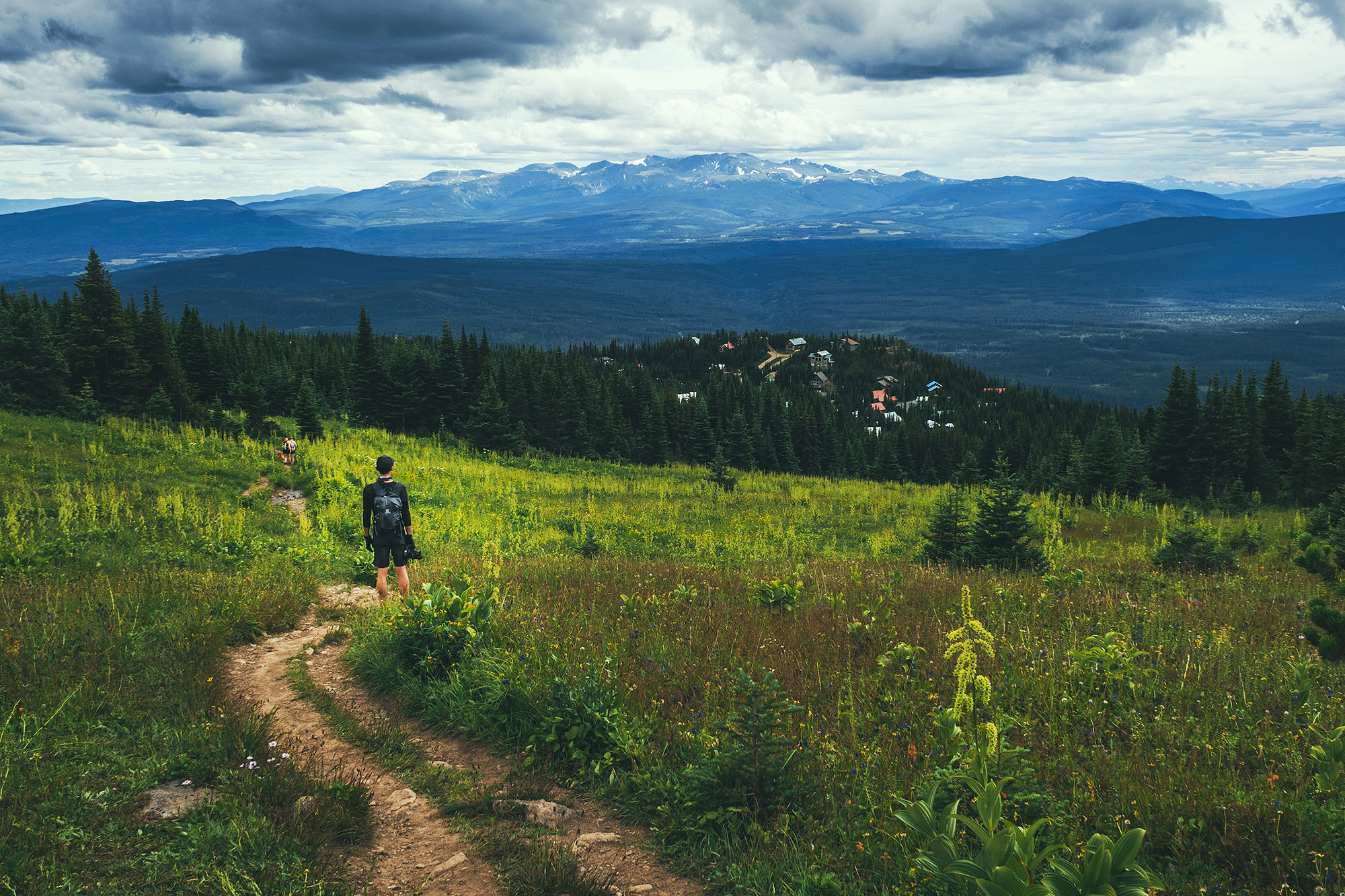
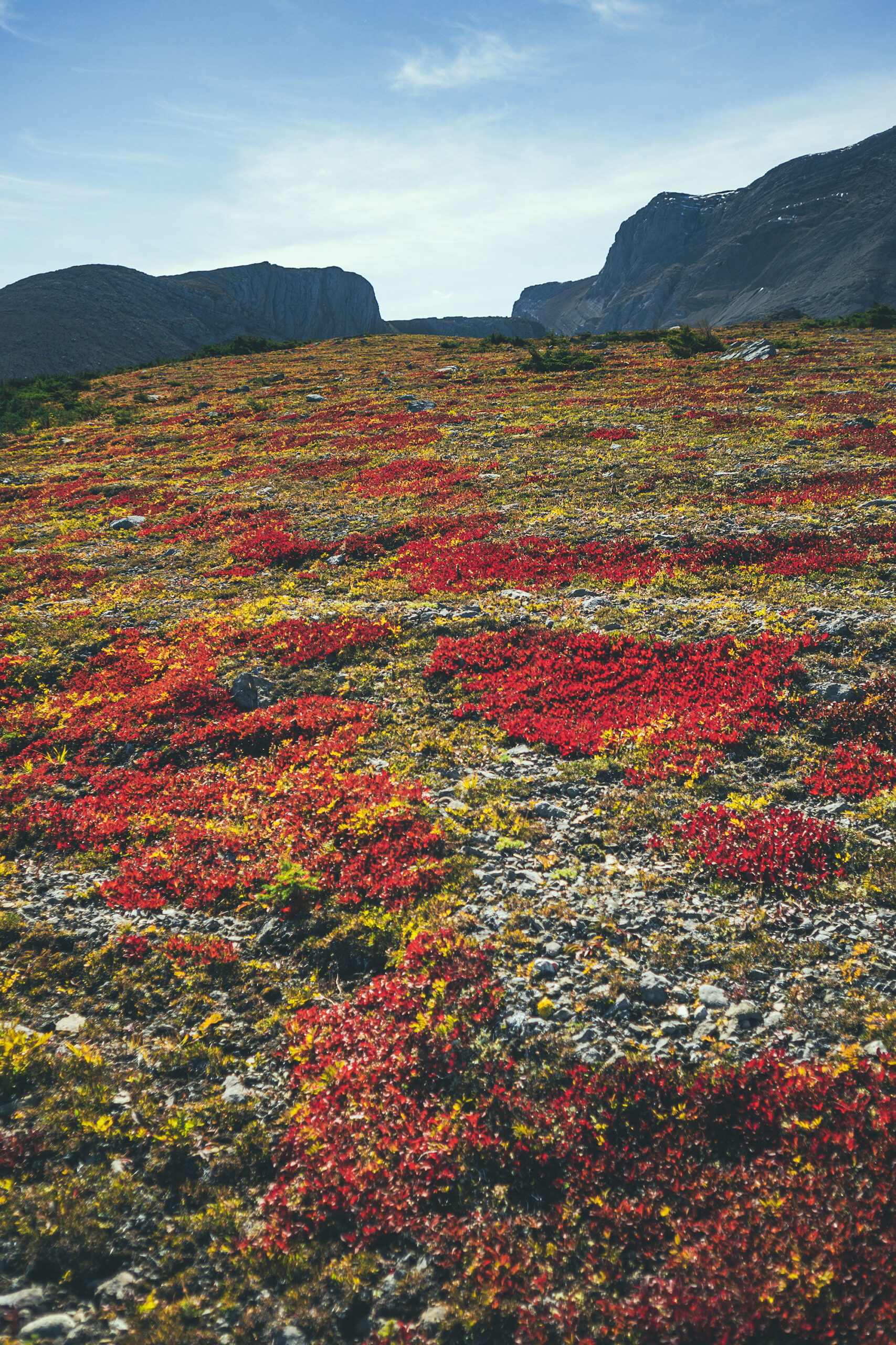
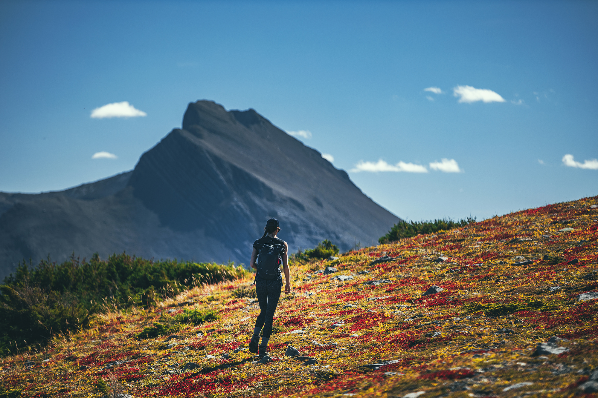
Once we were on the meadow, the trail disappeared and we were a bit taken back, conditioned as we were to always stick to marked trails and avoid stomping on vegetation.
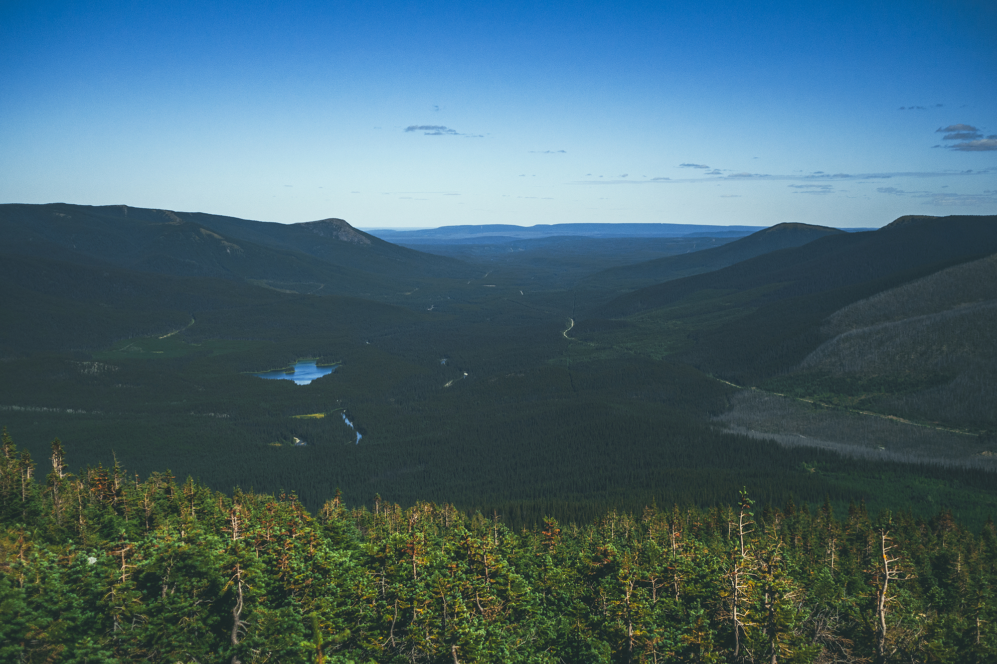
So we went in the general direction of the main summit and bowl (where we assumed the lake was) trying to stay mainly on rocky surface where possible.

We passed a couple with a puppy returning from the lake. They had driven their car all the way up the ATV track to the start of the single track trail, but theirs had higher clearance and a metal plate to absorb shock on the bottom, ours would definitely not have made it that far……

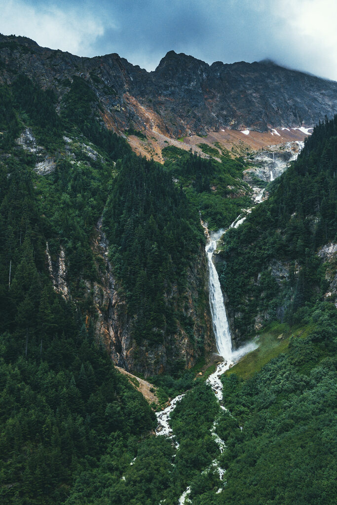
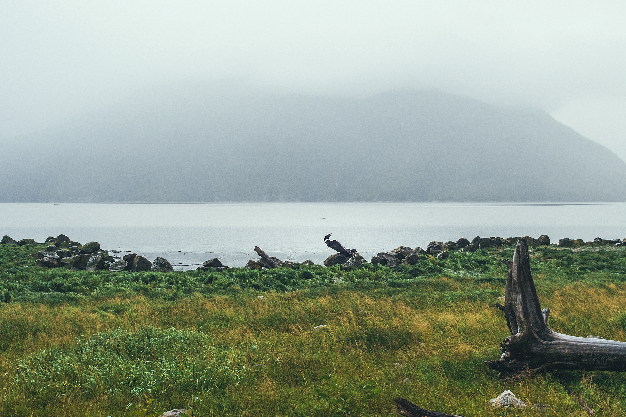
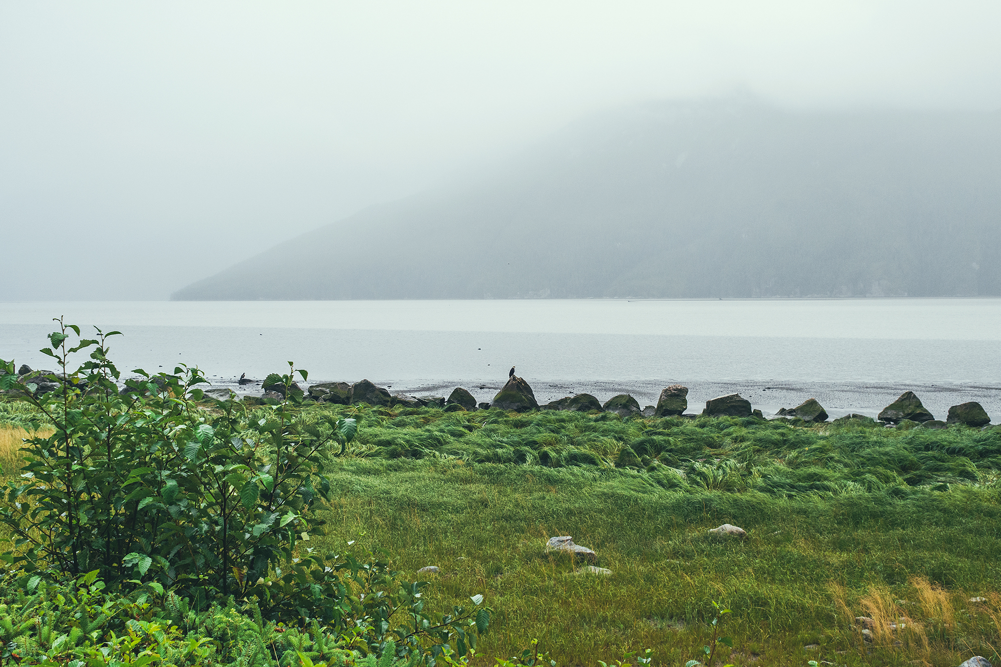
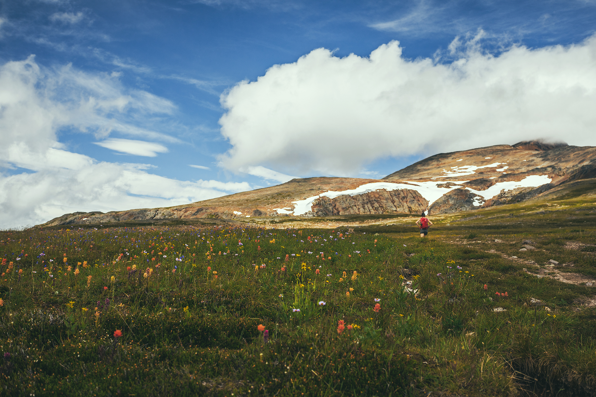
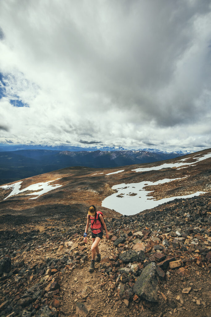
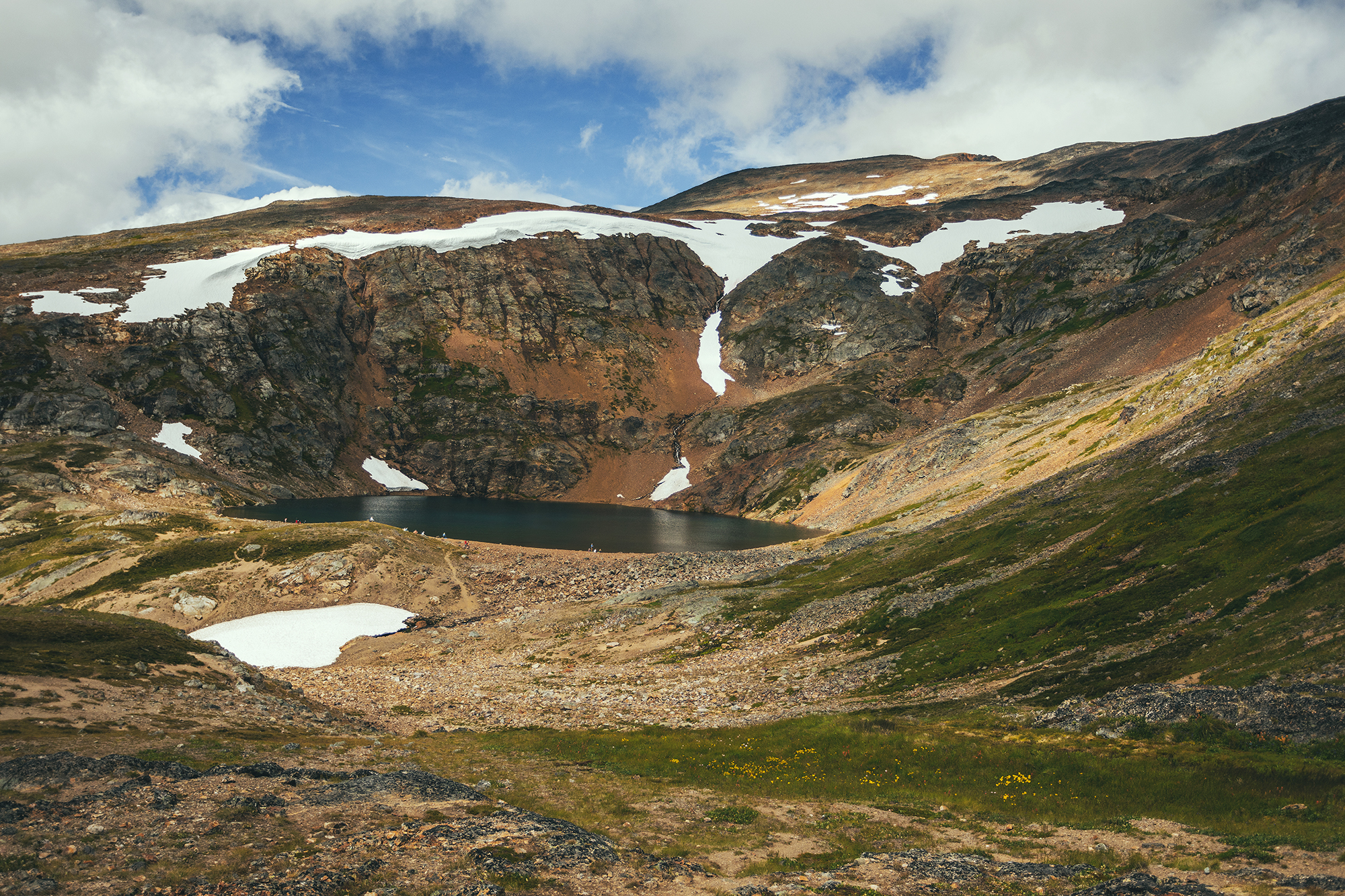
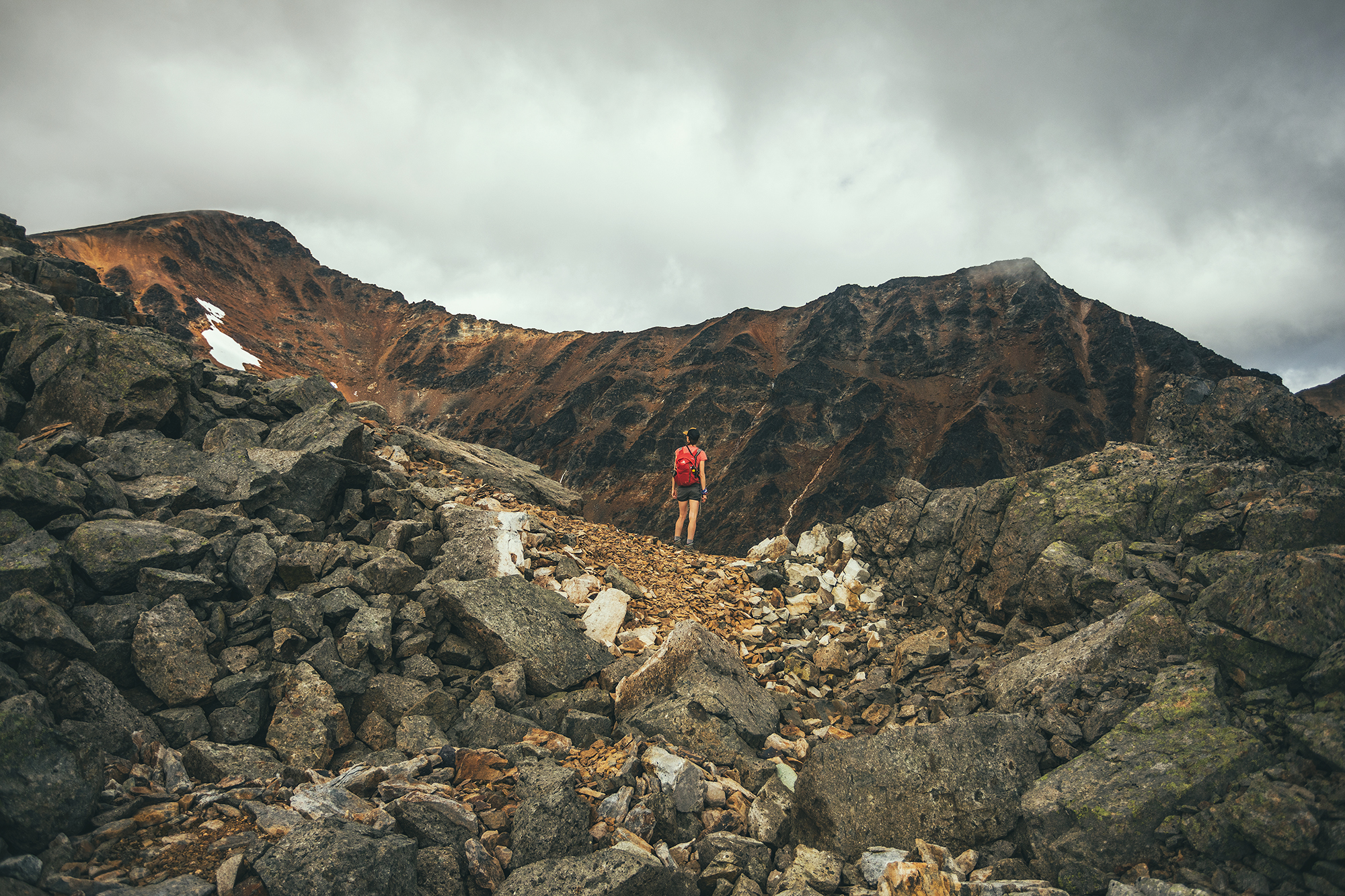
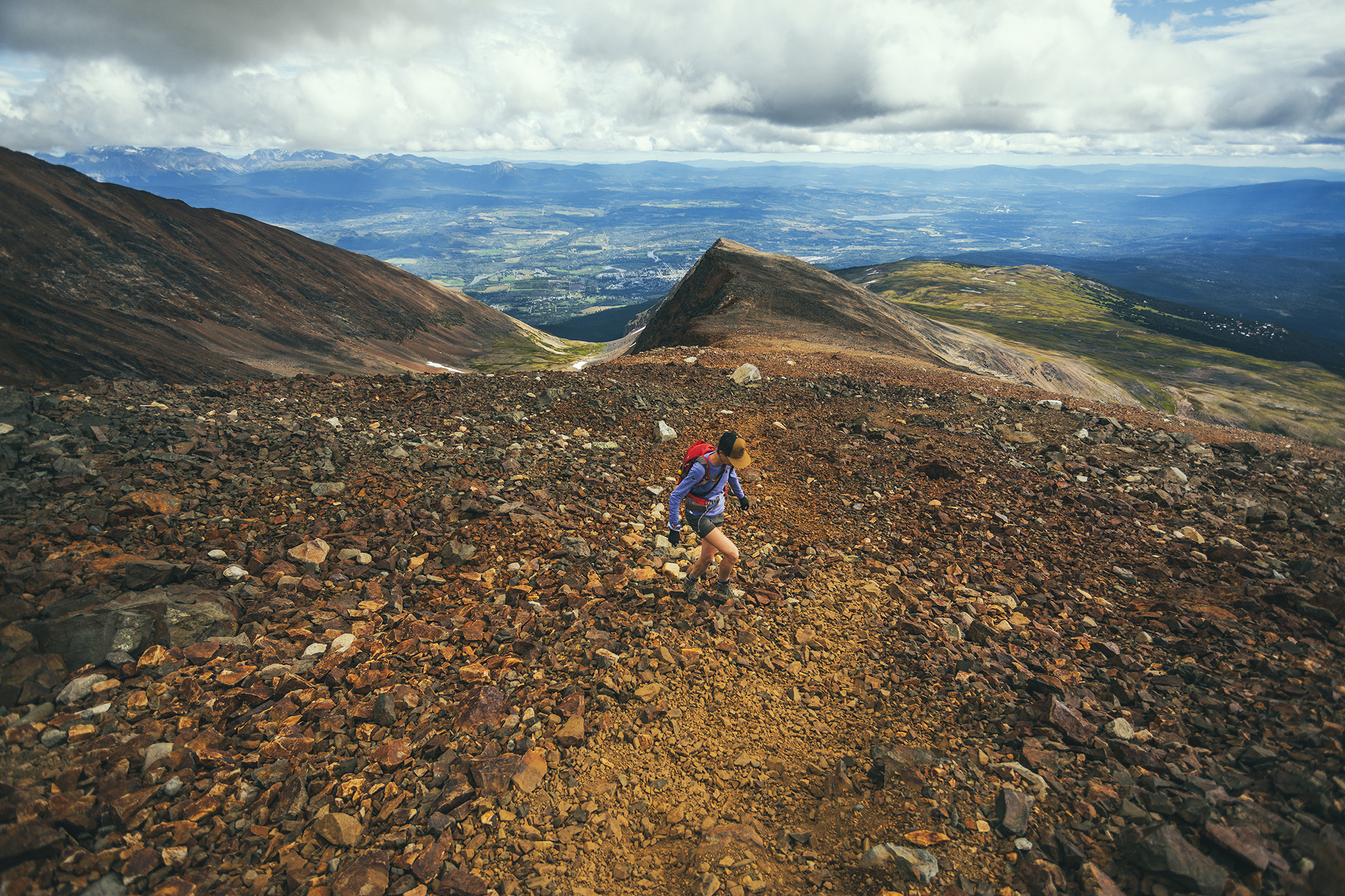
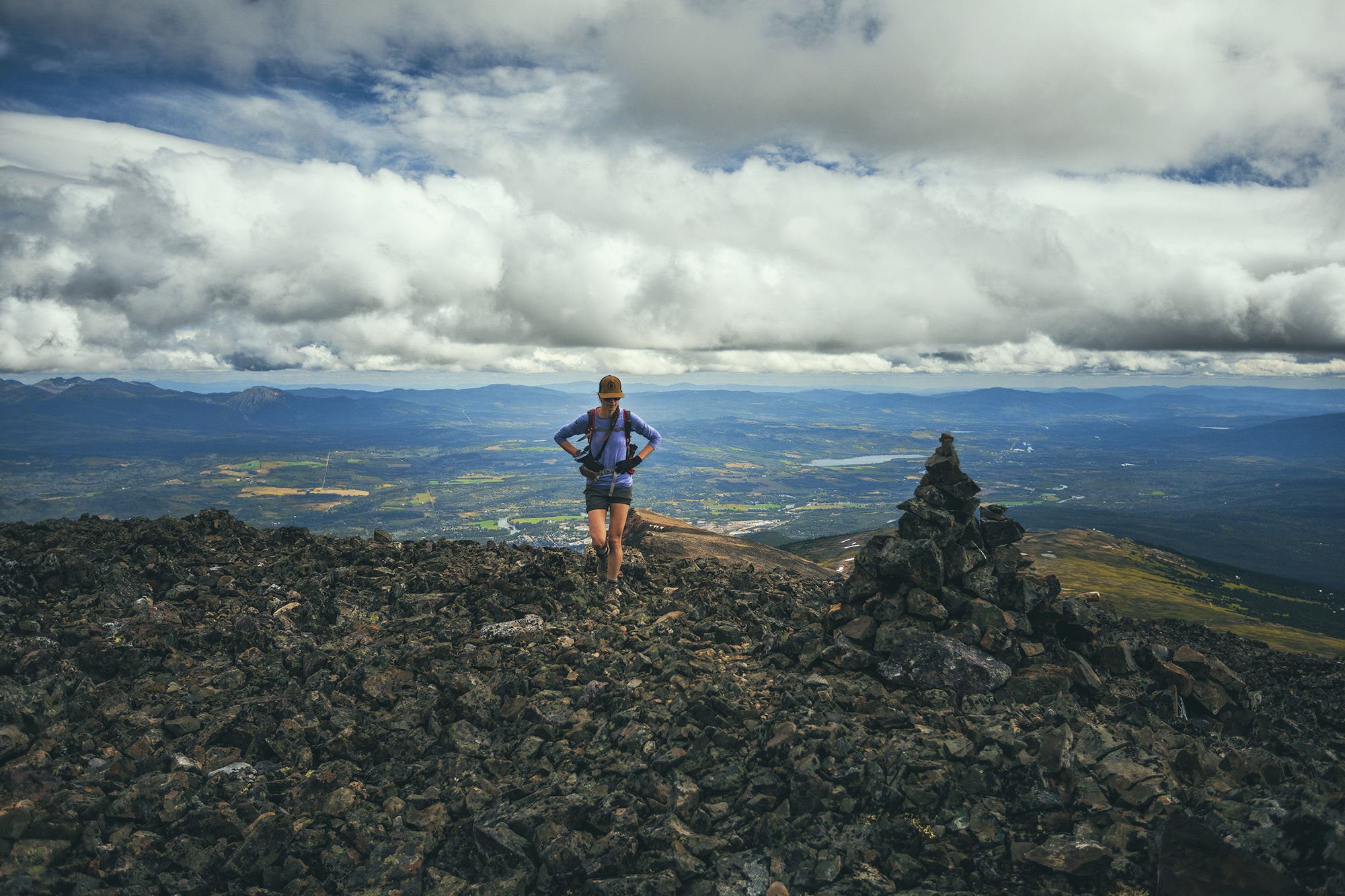
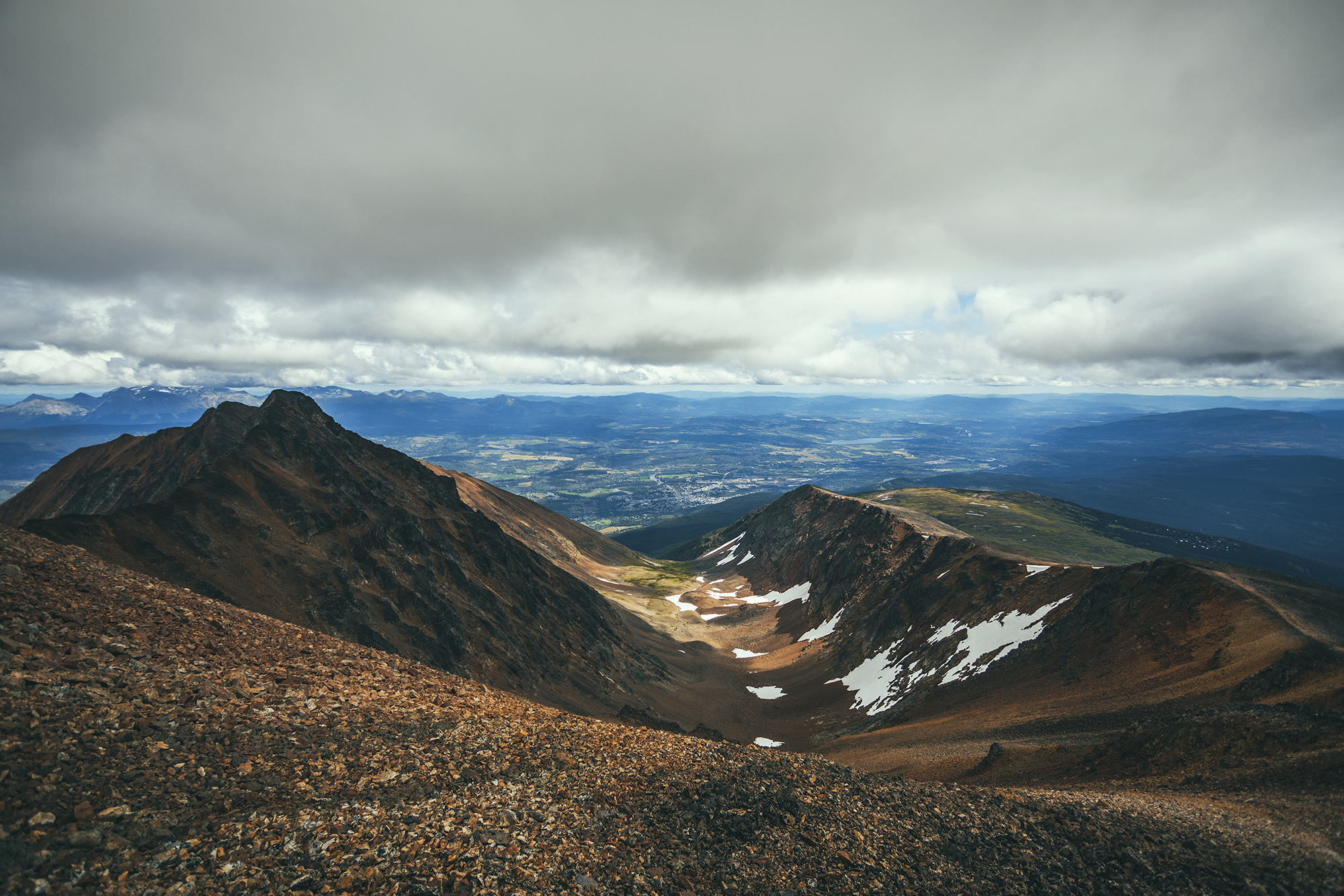
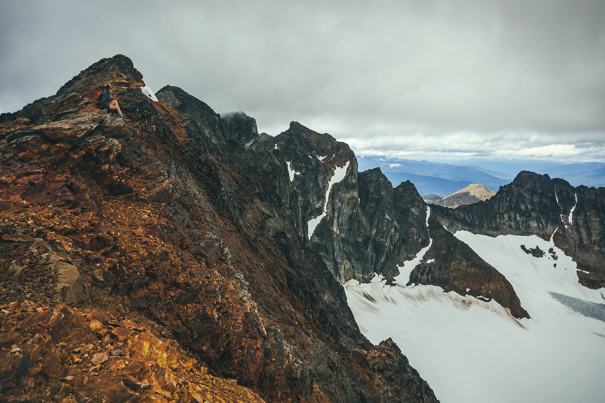
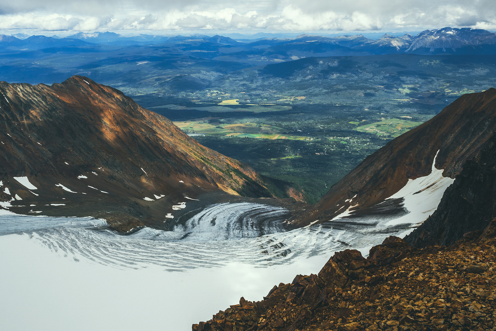
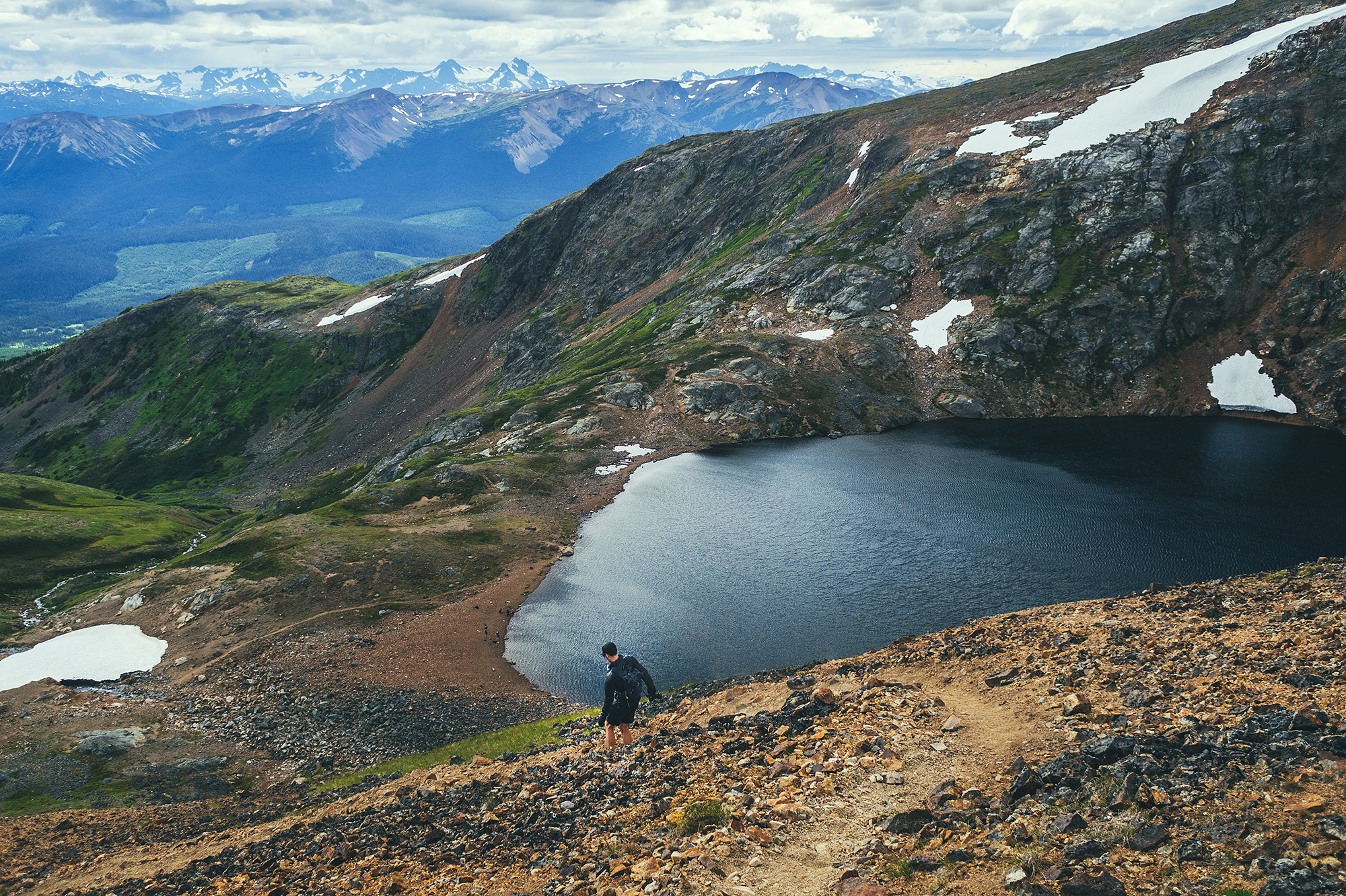
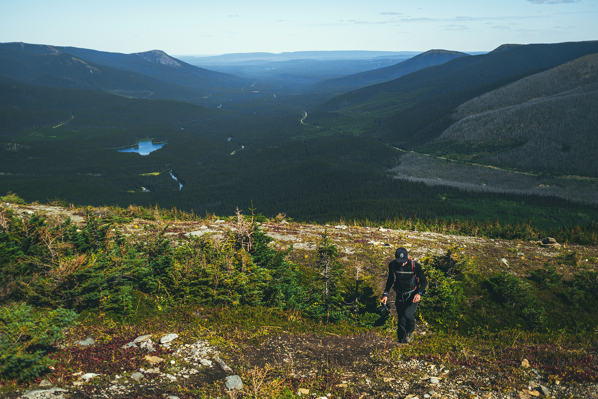
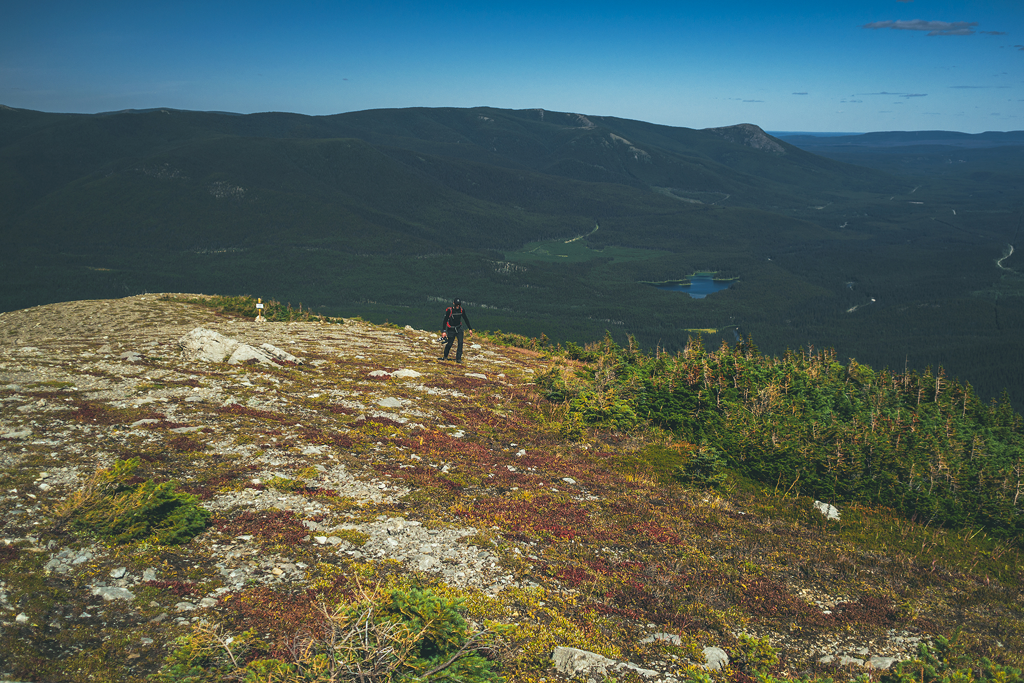
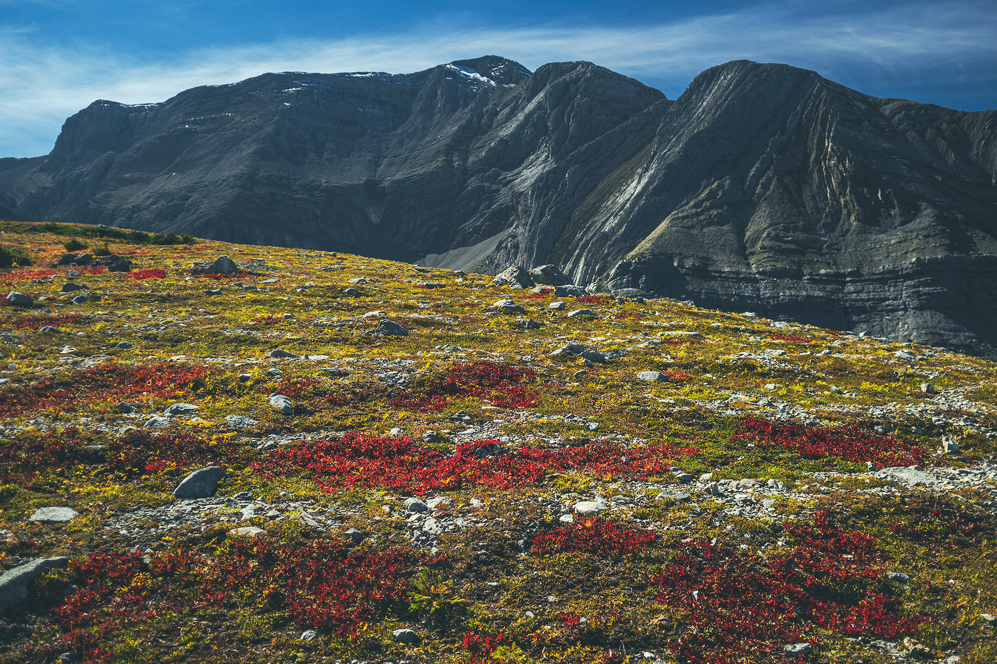
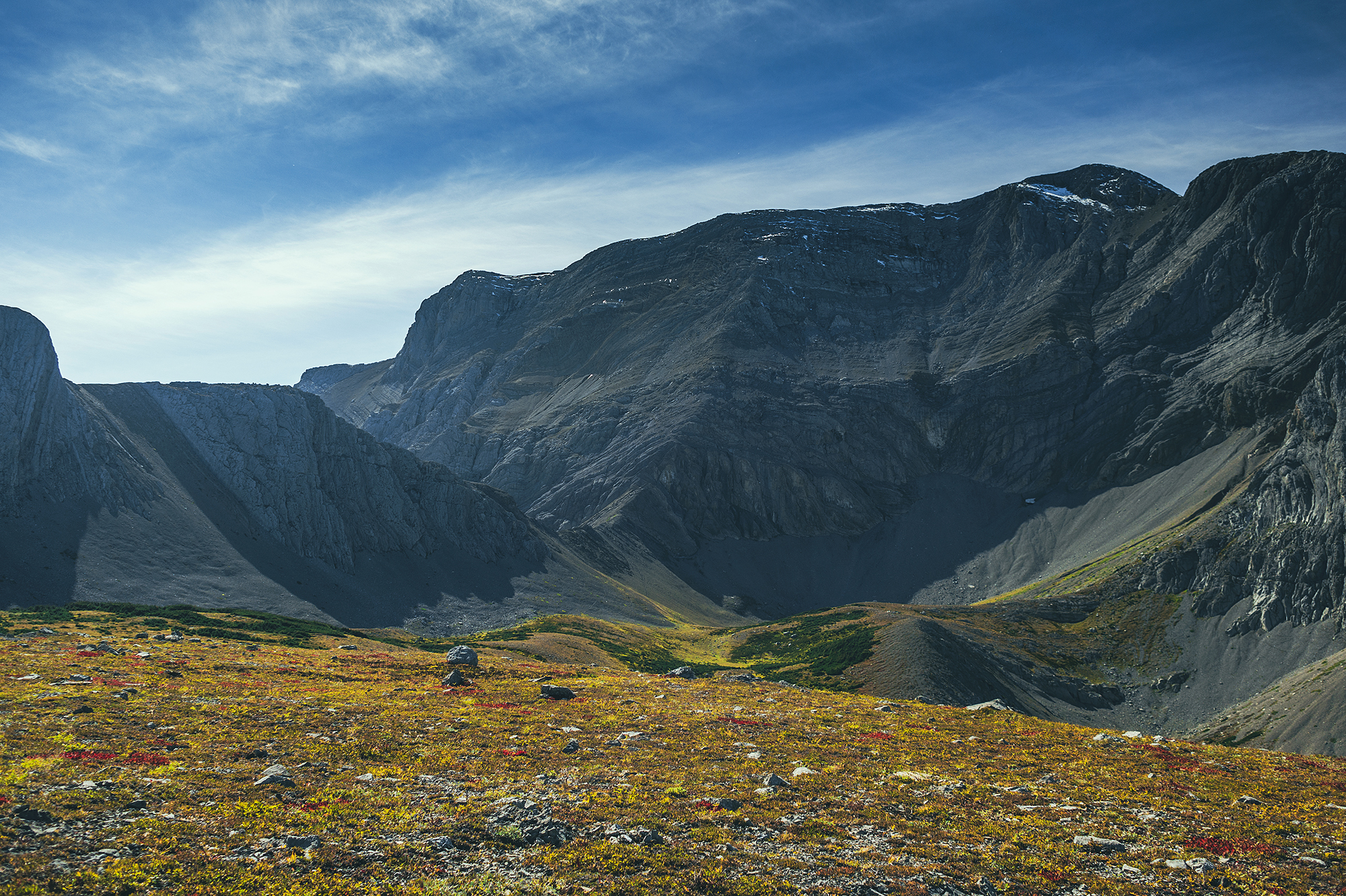
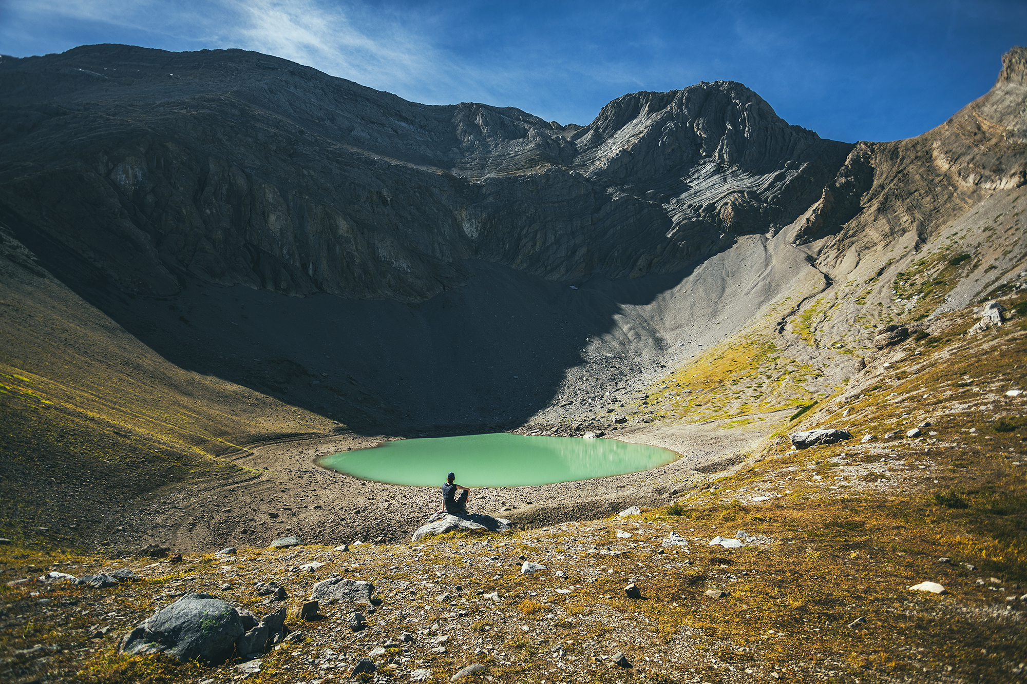
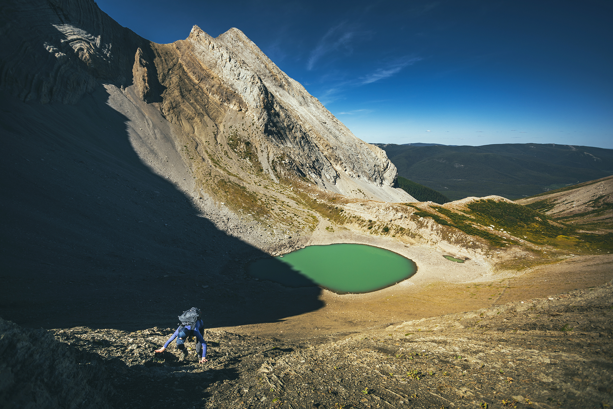
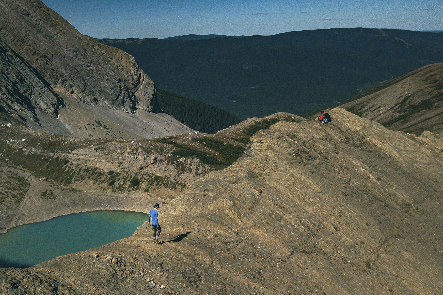
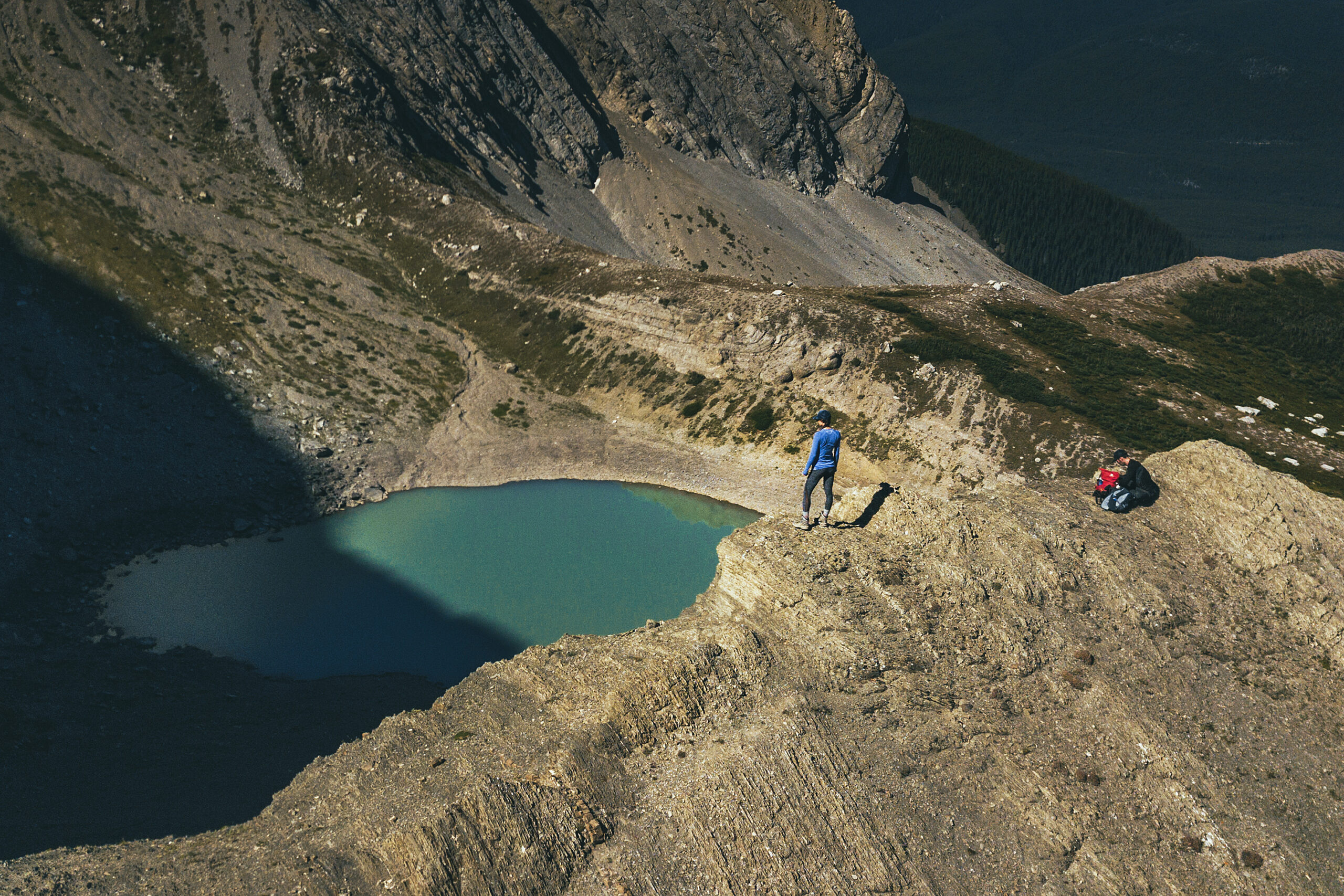
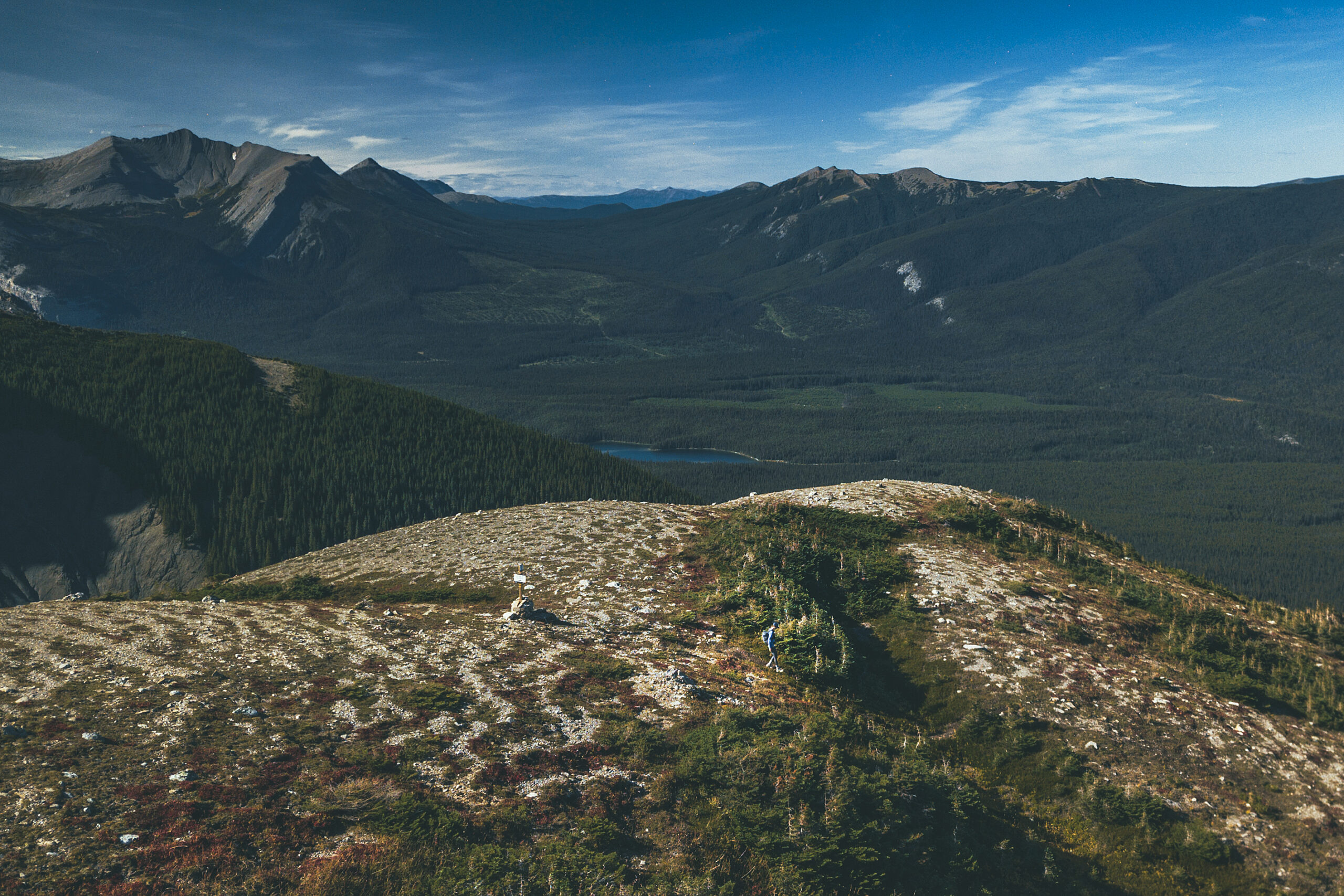
Eventually we reached the bowl and the view of the lake, which was really a small tarn resulting from snow melt, and visibly at its lowest after a summer of evaporating.

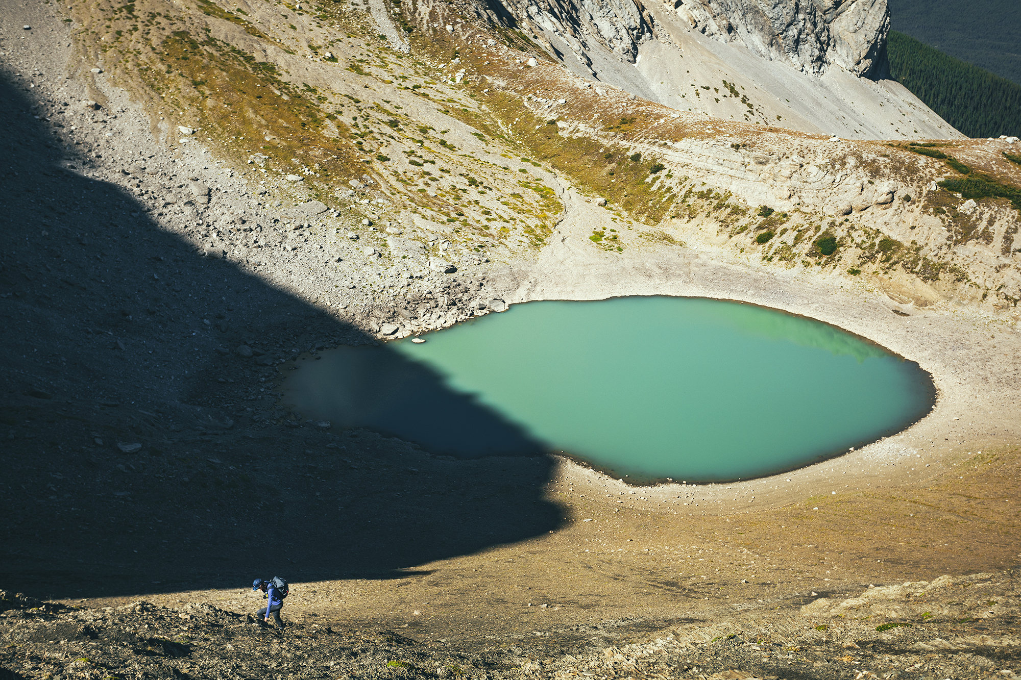
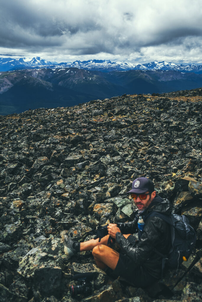
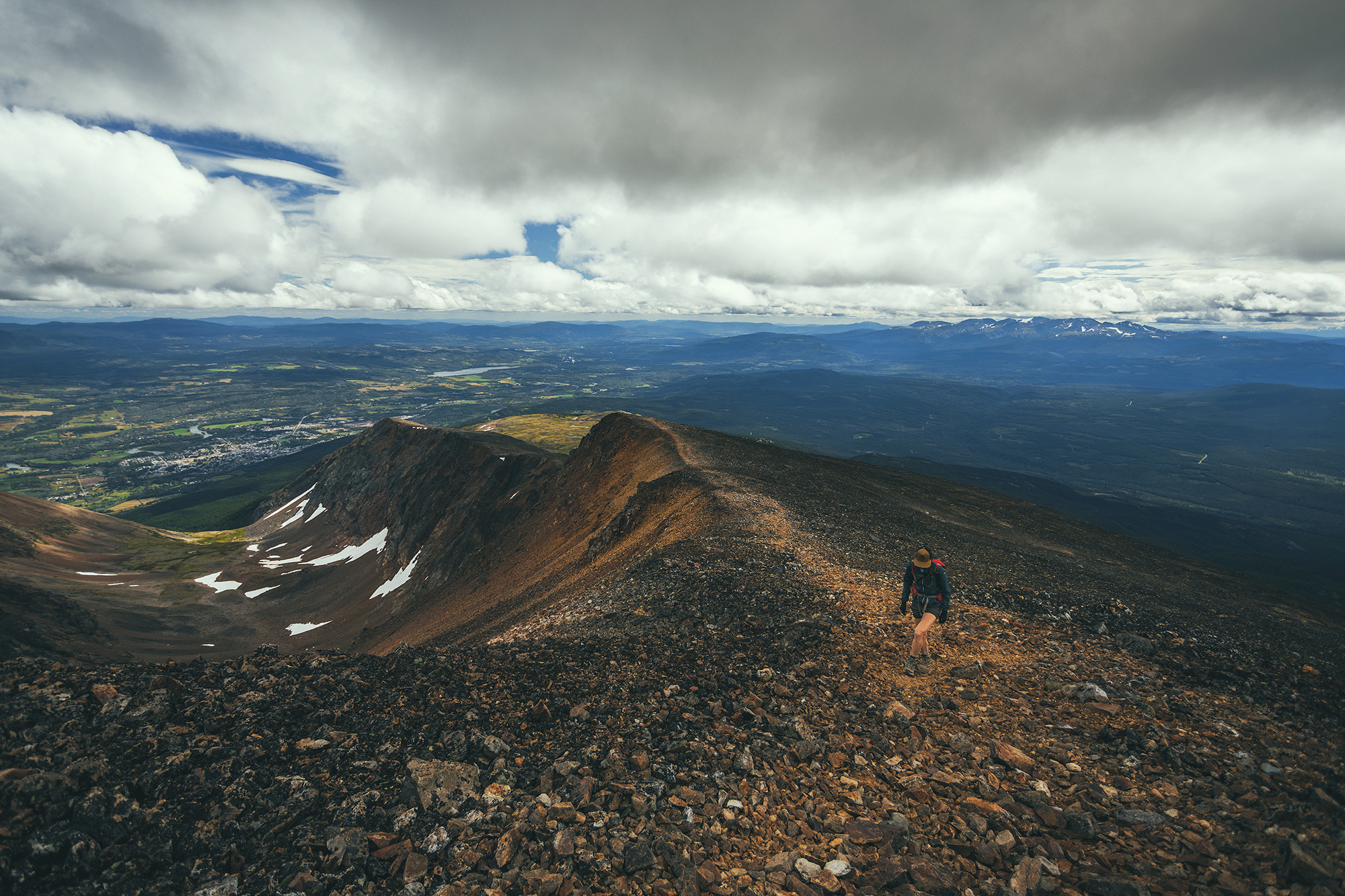
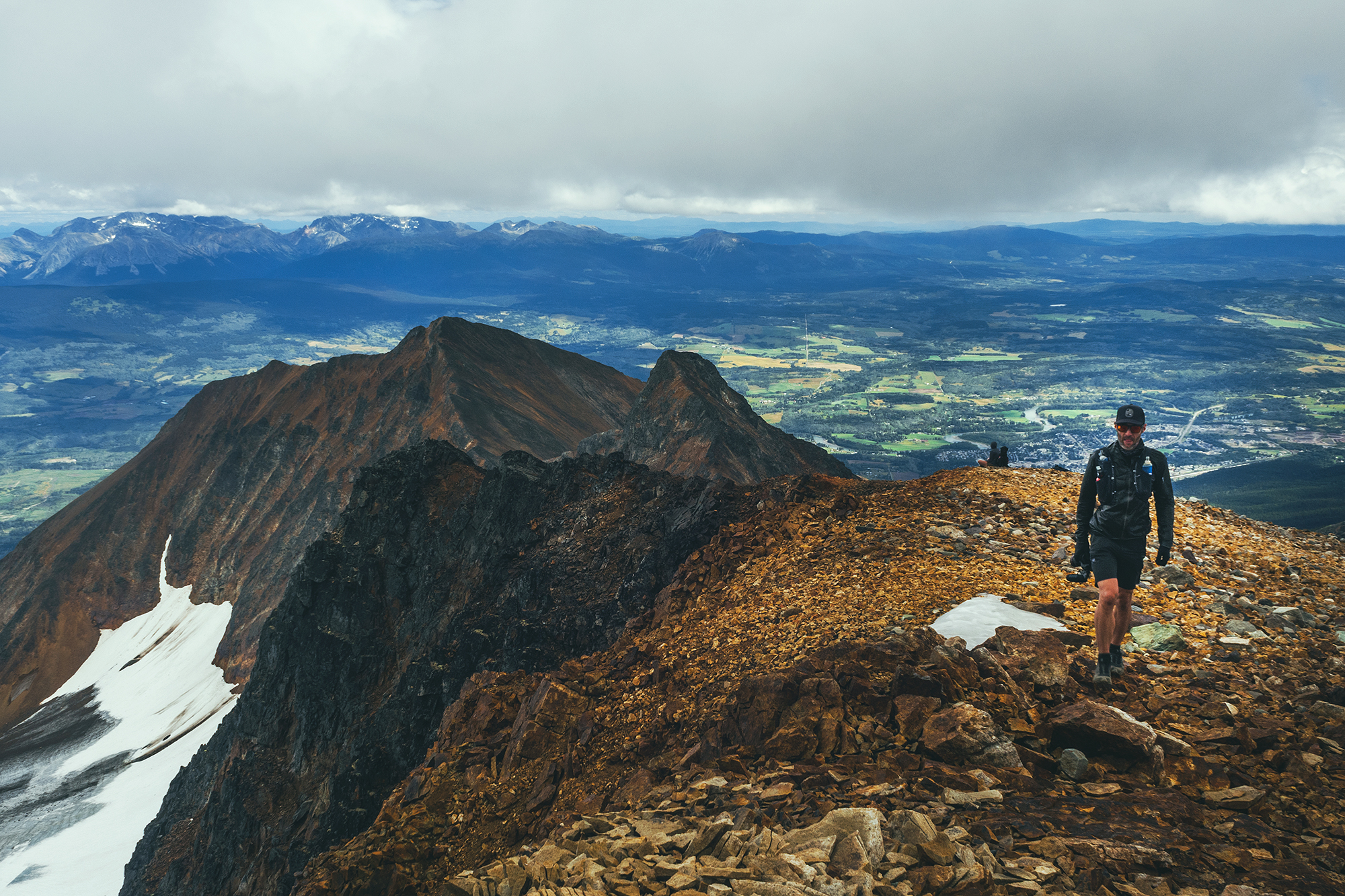
From there, we followed a trail going up to the lowest part of the ridge, overlooking the lake. The slope we climbed was quite steep, and all lose gravel, which I didn’t love, but i still managed to make it to the saddle.
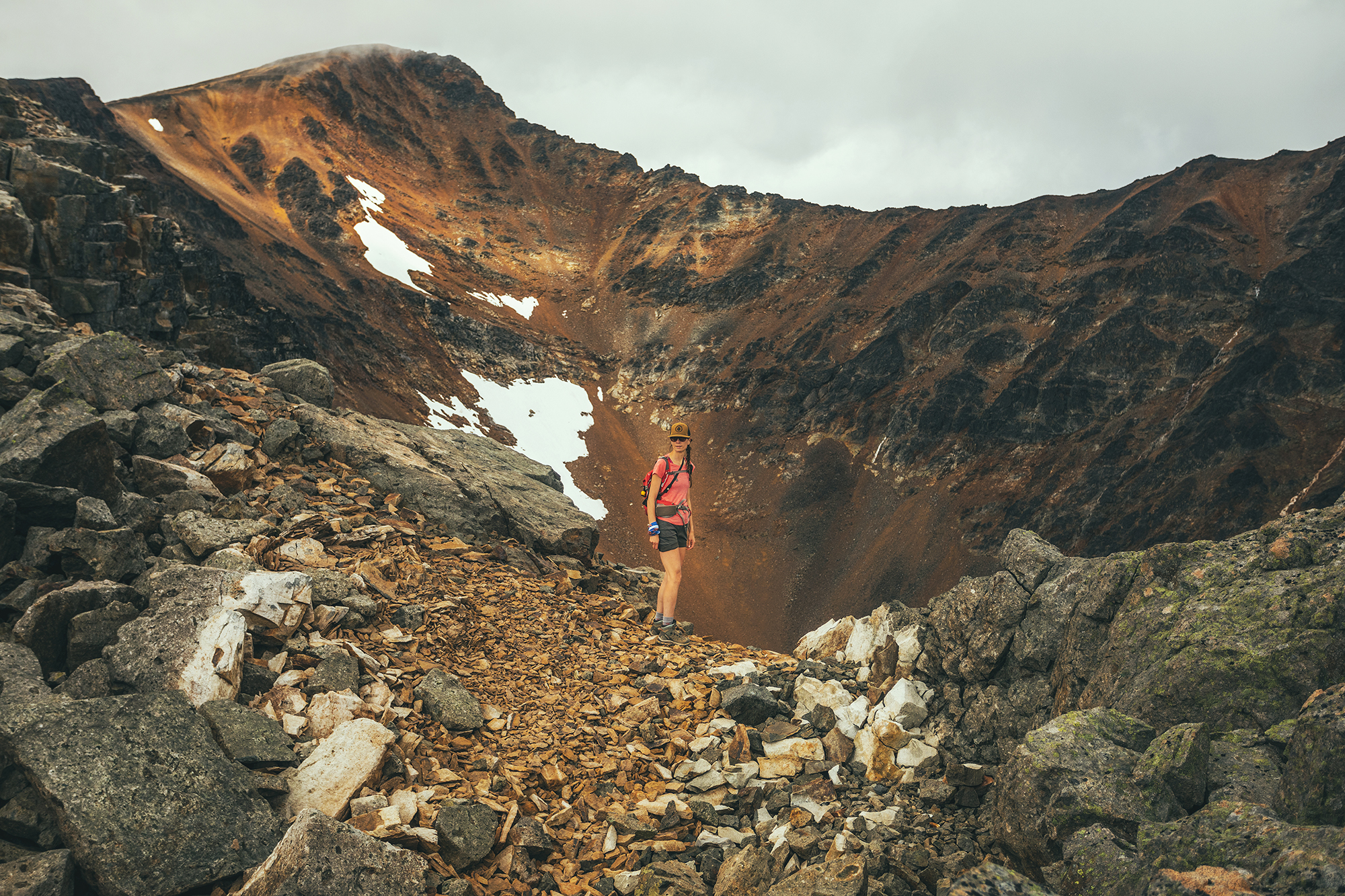
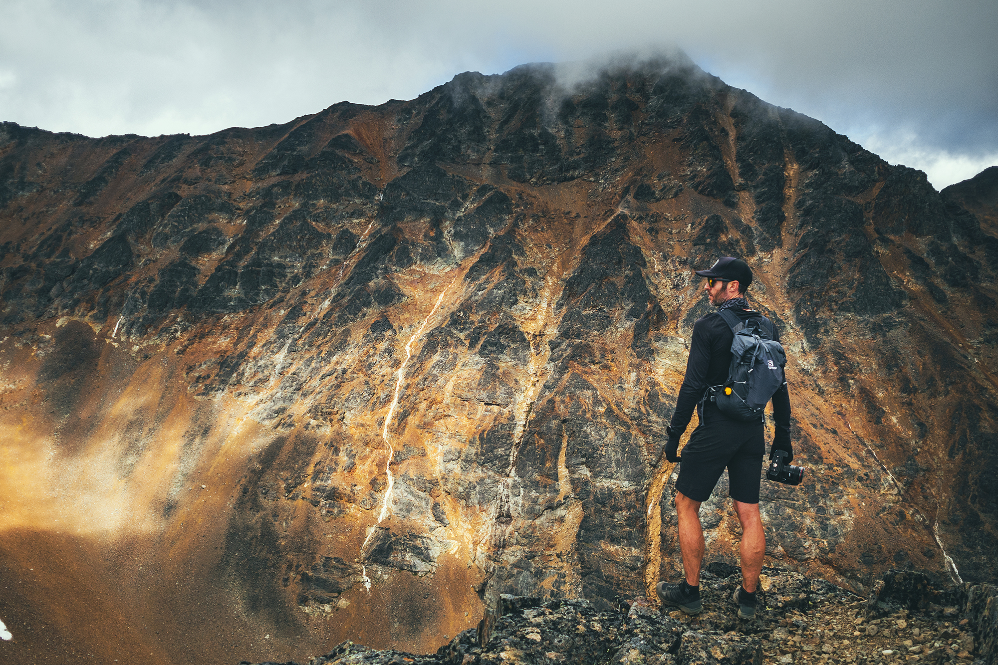
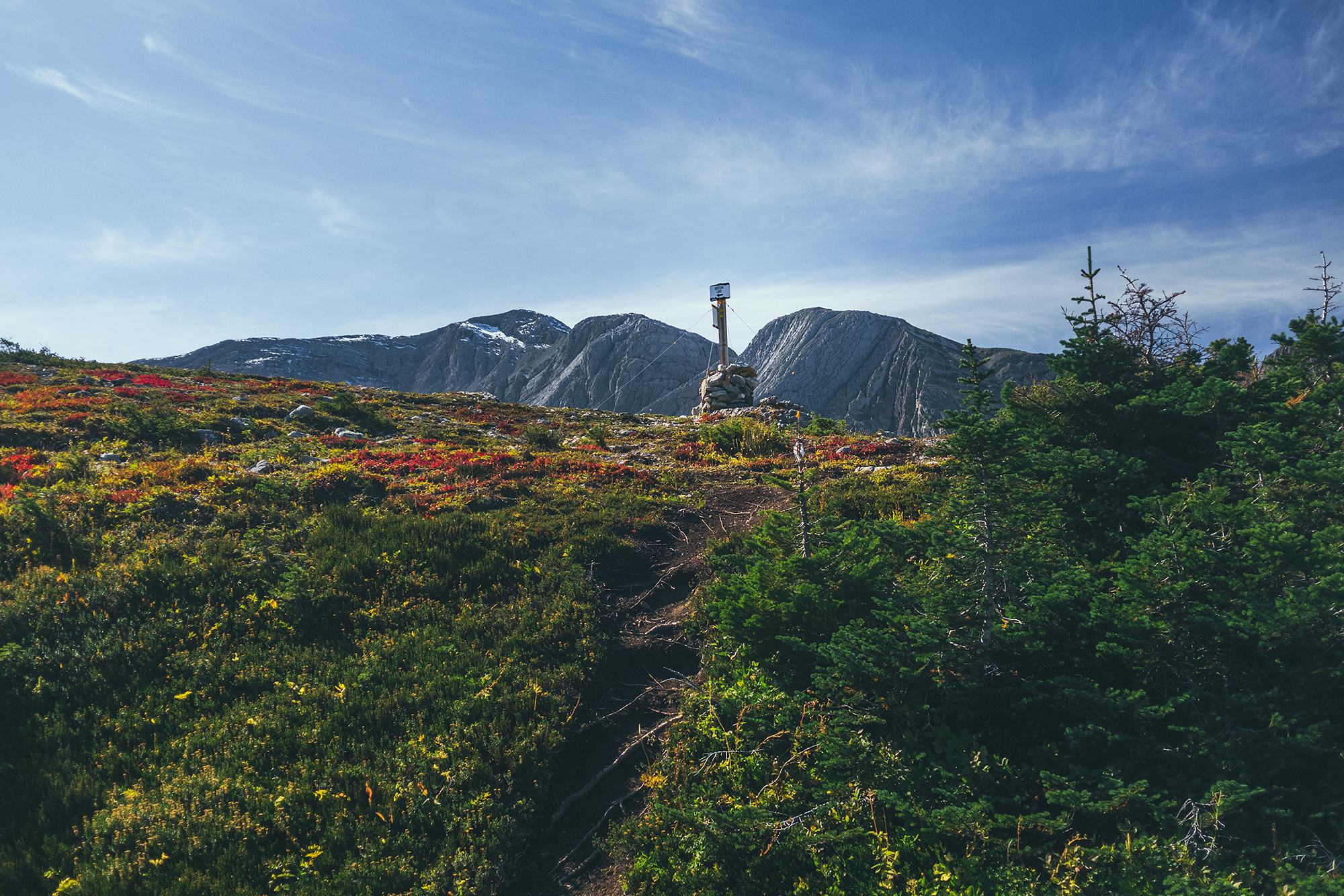
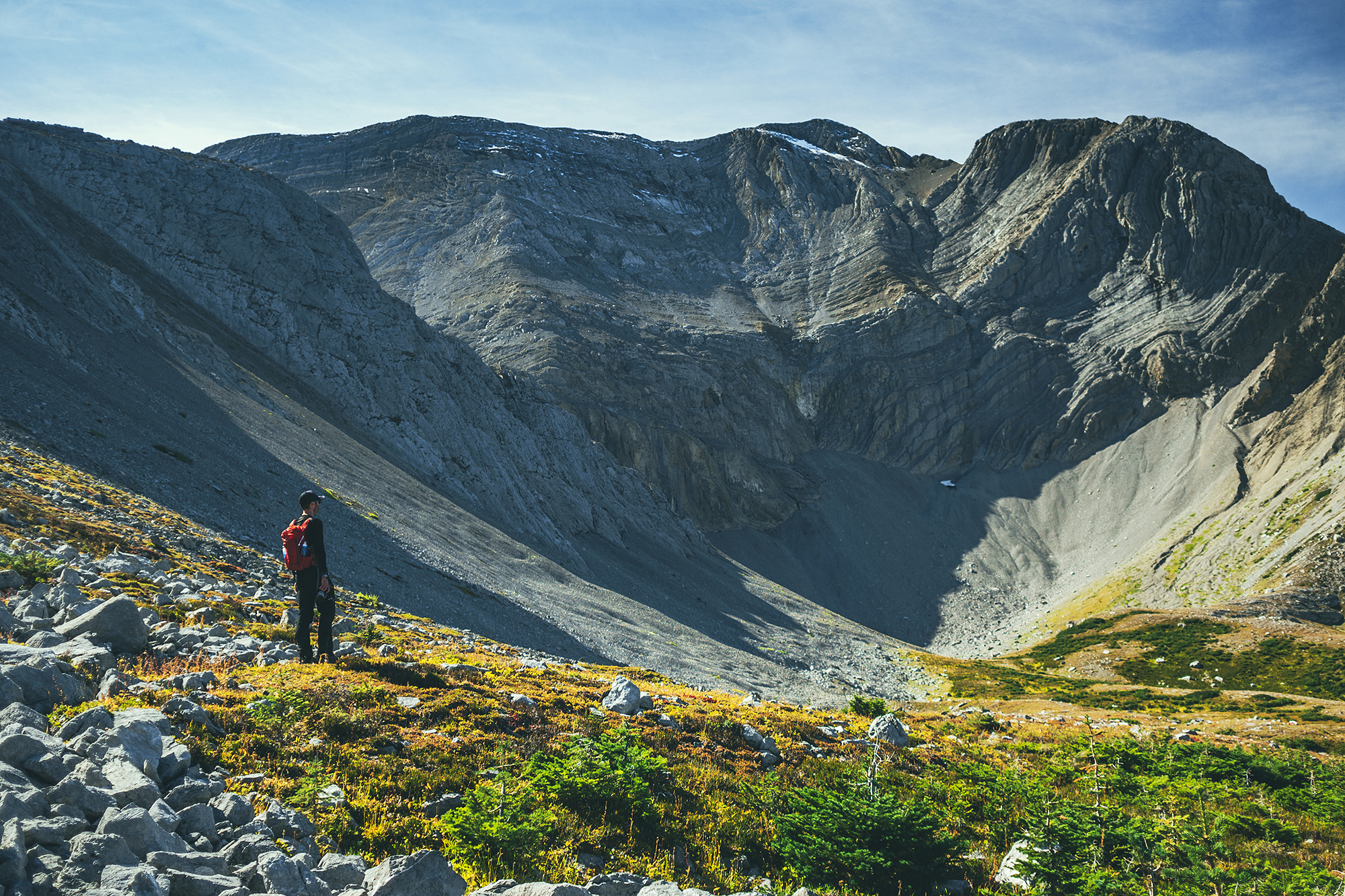
While at the top, I marveled at the fact that this mountain was basically made of layers and layers of slate, compacted together nearly vertically, and somewhat loose as I could pull out pieces without much effort. Geology is quite something, and I know nothing about any of it, but still it makes my head spin to think about how these mountains came to be millions of years ago, and the fact that we’re ultimately sitting on a pile of rocks held together by gravity-defying friction….

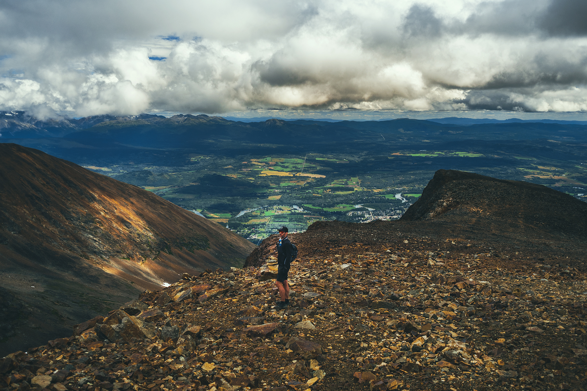
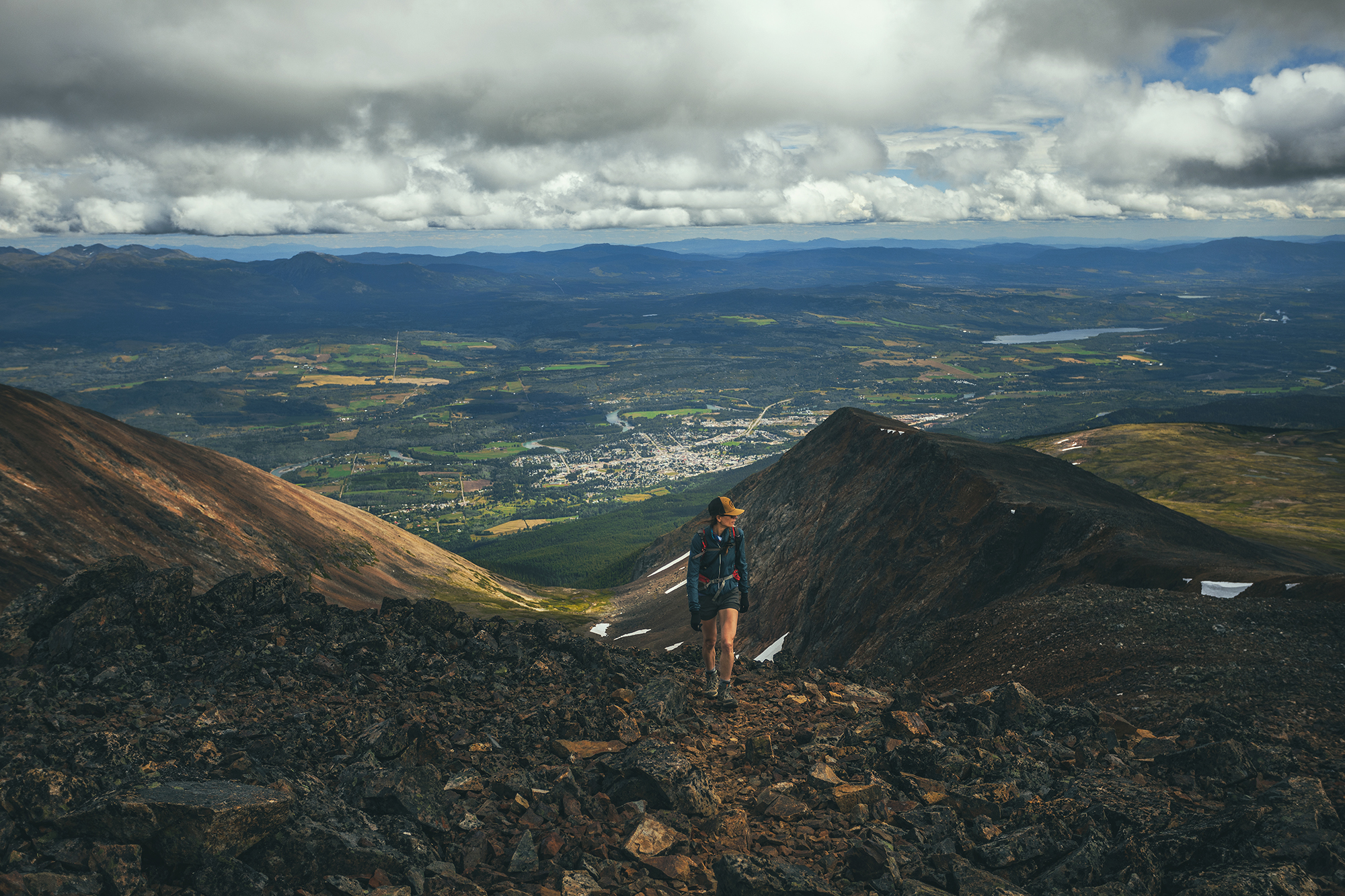
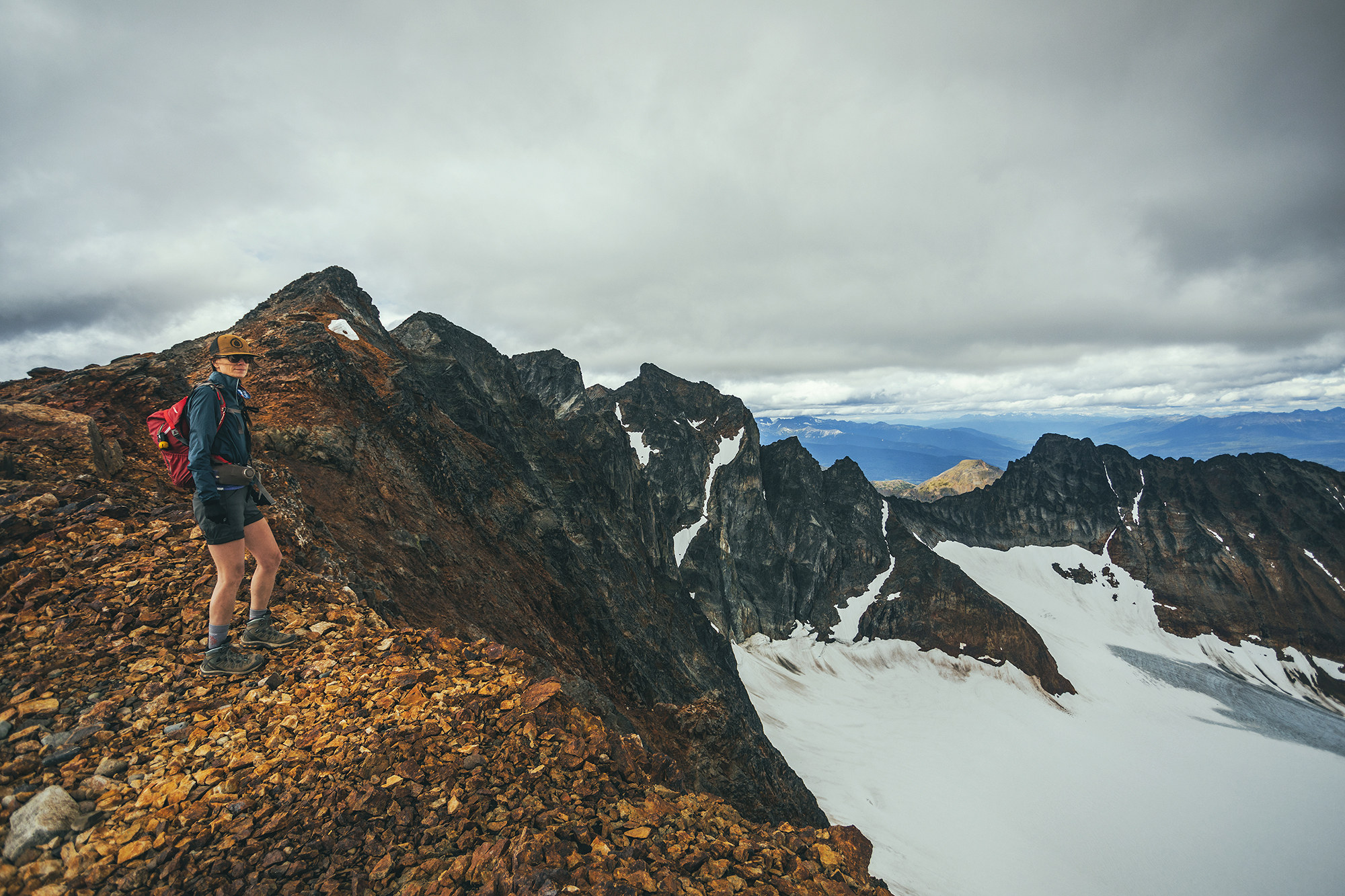
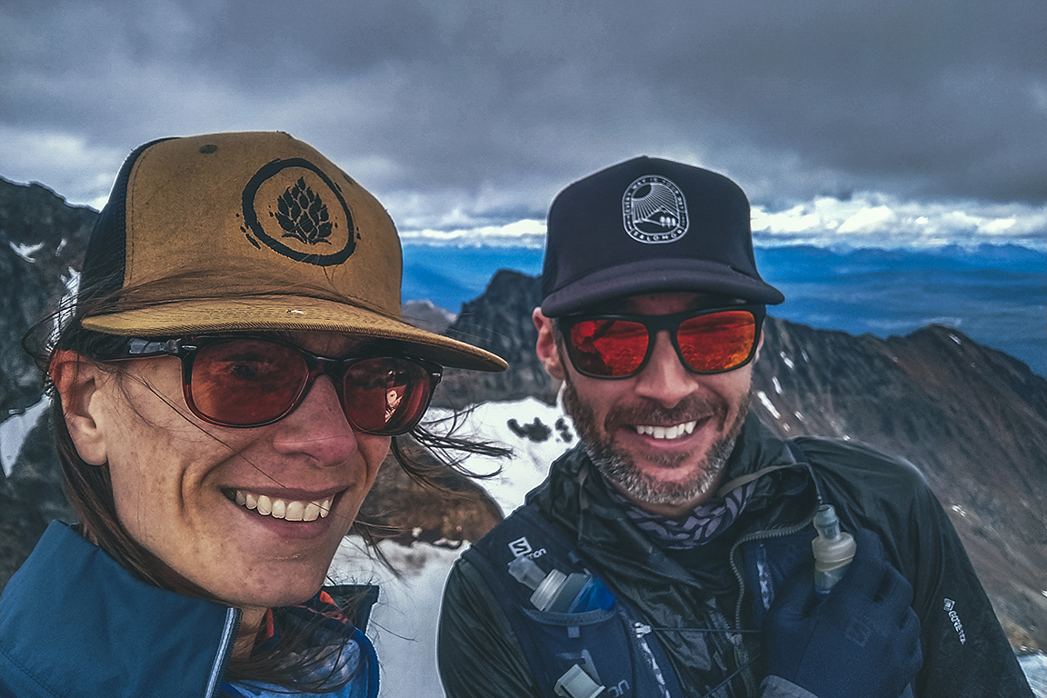
After some photos and drone-flying, we made our way down in a different spot, along a “spine” of bigger rocks jutting out from the gravel and which we could grab on to while bum-sliding down.

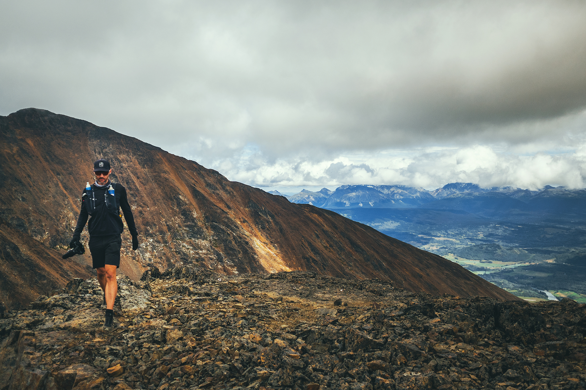
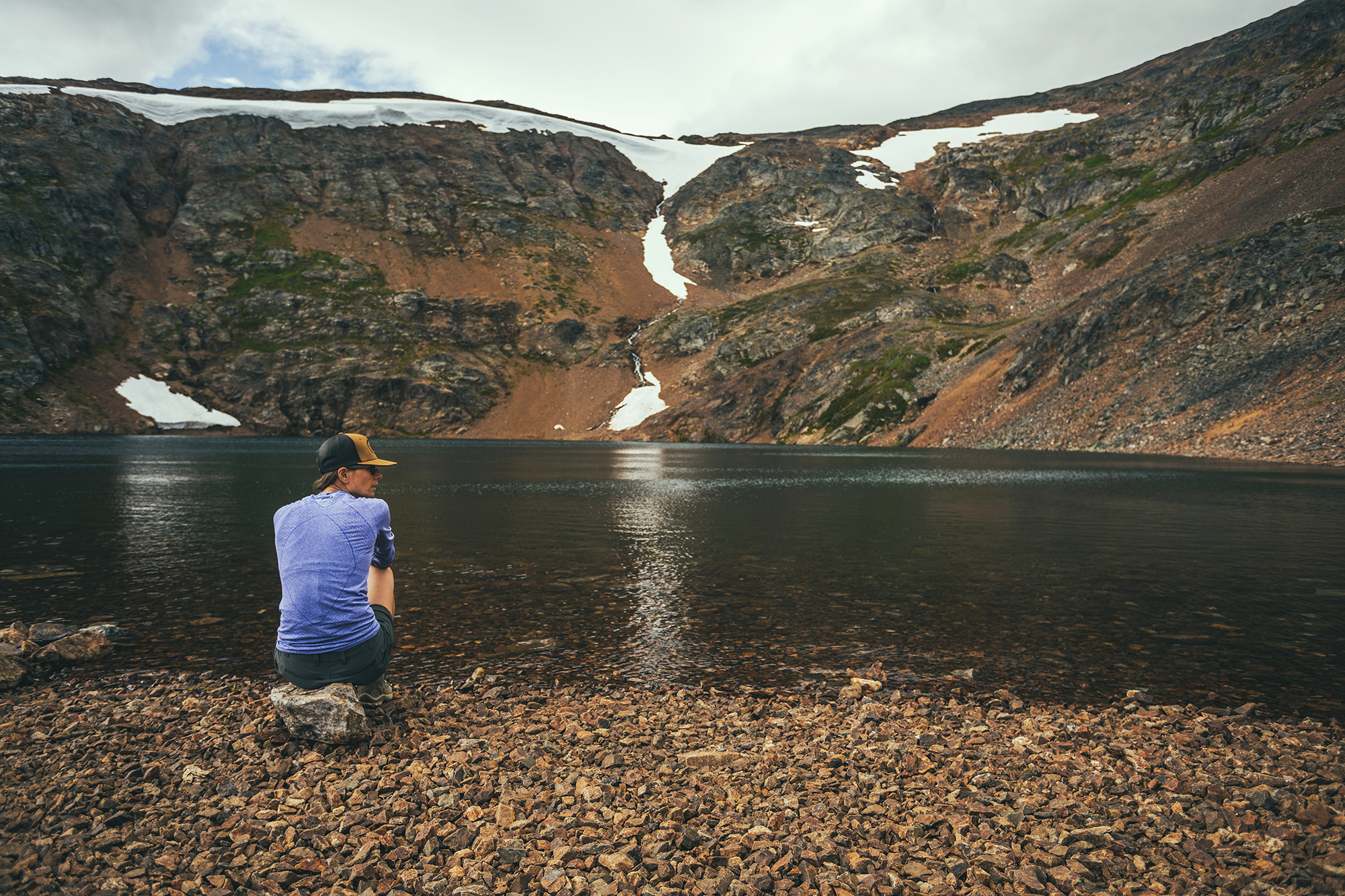
We went down to the tarn and Brice considered going for a dip for a hot second, but to sun was rapidly disappearing behind the top of the ridge and the water was soon completely in shade, so he decided against it. We started heading back across the meadow. It took us a bit less time as we managed to connect the faint sections of trail more directly. The way down was quick and I looked forward to that barefoot creek crossing. My feet got quite hot in my hiking boot and merino socks. Looking back this would have been a great trail to do in running gear, but having never done it before, we erred on the side of steadier footwear – and more layers than we eventually needed, but that’s always what I do anyway. Even if I end up carrying four jackets in my bag, I’d rather that then get caught in the cold and have a very unpleasant experience.

We got back to the car pretty much 5 hours after we left, having spent the exact time suggested on All trails. The drive from the main road took us about 45 min each way, mainly because the 13k nearest the trailhead were very pot-hole-y and slow, whereas the first 24 kms where very smooth.

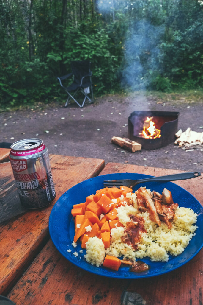
Then we drove the 35km or so back to town. According to the brochure there are 3 campgrounds in Tumbler Ridge. We went to the Lions Campground, but soon realized all the sites were reserved – it was the start of Labor day long week-end and I hadn’t thought about people going for one last camping trip before back to school. We eventually came across one site that didn’t have a reserved sign and snatched it up. Turns out it was technically reserved as we found out from the campground manager, but he admitted to having a couple of spots saved up for this exact case, so we were able to stay. It was a totally opposite experience from the night before, when we camped in complete isolation, whereas we were now surrounded by big RVs and campers, kids running everywhere and big groups of people sharing they campfire. It wasn’t unpleasant though – especially the part about not having to worry about running into wildlife at night (even though we actually never did), and the sites were pretty quiet from 9pm on, until 7.30 am the next morning.

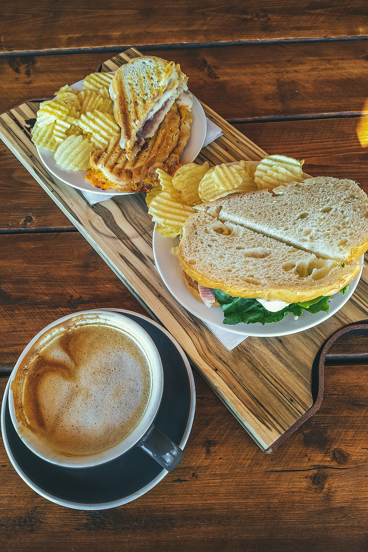
We thoroughly enjoyed the showers, and had a lovely sleep at the campground.

Video Recap: Hiking to Crater Lake and Hudson Mountain, near Smithers, BC

Road Trip to the Yukon – Part 2 – From Smithers to the Nisga’a Nation

August 5 – Smithers and the Hazeltons

We got up and packed up camp, then headed to Smithers for breakfast and a stroll – We grabbed pastries at Paul’s Bakery and enjoyed them, along with a coffee at the outdoor space behind the Bugwood Coffee stand. Then we took a walk down the three or four blocks along Main St.

Smithers is located on the traditional land of the Wet’suwet’en Yintikh Nation, who live along the Buckley river and Burns Lake.

Smithers has a classic small town vibe of old vs. new: Second-hand bookstore and family-owned butcher shop and bakery, meet new “hipster” stores selling everything clay and linen, a buzzing brewery and an outdoor coffee stand with public piano. It’s a bit of a mixed feeling to witness another old timey town evolving into the same format of “modernity” that has spread in many places. When you’re in one of these newer shops, you could really be in any town in North America, it gets harder to pin-point a town’s identity or original cultural make-up. I guess it’s a good thing that small towns stay alive but it doesn’t feel like the change involves much of the indigenous peoples of the area, who remain on the fringe of the evolution.

Leaving Smithers, we headed out for a quick visit of Twin Falls, two waterfalls that originate from the Kathlyn and Toboggan placiers – one of which we saw from above the day before. The falls are very accessible, with a viewing platform 5 min down the trail, and another viewpoint almost at the base, another 3 minutes further. After a quick picnic, we continued North to the Hazeltons.

The Hazeltons refers to two small towns, on either side of the Hagwilget Canyon. Old Hazelton is located in the Gitanmaxx Band territory. The Old Town is more or less 2 blocks of of pioneer-era Buildings, most of which have been repurposed for modern use but preserved in their former state. Our Airbnb actually happened to be a small laneway house at the back of one such old town building, now a residence & guest house.

Before settling down for the day, we headed to the ‘Ksan historical Village & Mureum. The site is a replica of a traditional Gitxsan village. Gitxsan people have lived at the confluences of Buckley & Skeena river for over 8000 years and the museum is a great showcase of their ancient but still observed traditions.

We visited 3 longhouses, the building where members of one clan, or family, gather to celebrate special occasions and organize potlatches.
Each house displayed items of every day life, including Bentwood boxes, made by folding Cedar sheets after steaming them to make them pliable. Traditionally, most common items where made of cedar, including some clothing. Other material used included copper, which made the shield of the chief, a well as was used for helmets and decorating or dyeing garments. Copper isn’t native to the area but was a abundant resource of the Nass Valley, home of the Nisga’a people, with which the Gitxsan people traded often.

The village also displayed many totem poles and we had the opportunity to listen to a resident Carver, who explained his process in carving a pole, from inspiration, to design to the actual carving.

After the Museum, we headed to our airbnb to unpack and have a snack. It was probably one of the coziest, most well set-up place we’ve stayed at!

There was still lots of dailight time ahead of us so we drove to the Hagwilget Canyon & Bridge to check out what the Northern BC guide referred to as “one of the most photographed places in Canada” and also one of the highest suspension bridge in the country, hanging 262 feet above the river. It is surprisingly “un-secure” as the railing is barely waist-high and it wouldn’t take much to jump or fall over. I’m not usually afraid of heights but I felt much more comfortable walking down the center of the bridge (on the road) rather than the side.

We managed to find a trail descending halfway into the Canyon for a different view of the bridge and the river below.

Stegyawden, a Tsimshian name meaning, ‘painted goat’, is also known as Hagwilget Peak or the Roche de Boule mountain range. It’s a prominent mountain in the area and its peak can be seen from many locations.

As we walked back to the car, a man who we had seen walking along the river bank earlier, approached us and gave us an eagle feather from several he had collected at the bottom of the canyon. He offered it as he wished us welcome to his village and an enjoyable stay.

We made one more stop before calling it a day, by driving to Kispiox, 10km north of Hazelton, to see the totem poles displayed in the town. They stand where there was once the site of a Telegraph building post. At some point, settlers were trying to build a telegraph line to Asia, but the project was stopped before it was completed and the site abandoned. The miles of wires left behind became a source of supply for the indigenous peoples nearby.

We had a lovely evening at the airbnb, making use of the well equipped kitchen weirdly though I didn’t sleep very well. I got up at ن 3am and as I went to the bathroom, realized the toilet seat was up, which was weird as I was the last one to use the bathroom and I knew i hadn’t left it that way.
I kinda rattled me as I couldn’t make sense of how it ended up that way my two explanations, after all plausible ones were exhausted:
an animal spirit who entered the bathroom in the form of a beetle, which I found on the floor and probably came tangled in our tent when we hang it in the shower to dry – OR – a ghost from old-timey old town. Either way, some cheeky immaterial being clearly played a prank on me and I couldn’t fall back asleep for 1.5 hour after that.

August 6 – Along the Nisga’a Highway and into the Nass Valley

We left Hazelton and headed south west towards Terrace. The drive was pretty uneventful but scenic in places, as we drove along the Skeena River. We made a quick stop in Usk, to see the small ferry crossing, built in 1913.

Terrace is a bigger town with strip malls, we didn’t stop and kept going, this time aiming North on Highway 113, aka the Nisga’a highway. After a few kilometres of road lined with houses, trees took over and it was more or less nothing but dense forest on either side, for the rest of the way.

We made a stop at Kitsumkalum lake for lunch. The lake is indicated as a provincial park on BRMB, but there wasn’t any sign pointing to the entrance. We saw an unmarked road going down near where the entrance was indicated on the map, so we drove down it and sure enough it took us to the lakeside. The site is labeled as a “user-maintained” so it was pretty rudimentary. The road was very pot-holed and for once, I didn’t even want to take a look at the outhouse.

We kept driving until we started seeing signs for the Nisga’a Nation auto-tour, which indicates various points of interest in and around the Nisga’a Lava flow.

We first stopped at the drowned forest, where the stream of the Treax river rushes through the trees, covering the ground around them (hence the name “drowned”).
We stopped at Lava lake, then at a couple of scenic water falls along the way. Eventually the trees disappeared, instead replaced by the dramatic landscapes of the lava flow.

Less than 300 years ago, a volcano in the Nass mountain range, the Treax Cone, erupted violently and the lava from the eruption covered a large area of the valley, destroying several villages and taking the life of an estimated 2000 indigenous people..
The solidified lava that remains today has high cultural significance for the people of the Nisga’a nation, and only a few marked trails allow venturing around the rock features.

Due to Covid, all tourist services and attractions were closed, including the museum, the hot springs, and any cultural event that would normally be held and open to visitors.

I had planned for us to spend the next day driving out to Gingolx, the furthest village at the end of the Nass valley, and making stops along the way. But without access to any of the afore-mentioned activities, it was ultimately only a 2-hour drive and back.
It was 4:30pm when we got to the small visitor center, so we decided to take the drive out to Gingolx, if only for the scenery along the way, and come back to spend the night at the Nisgala Memorial Lava Bed Park Campground which was still open for use.

There are four main villages of the Nisga’a Nation along Nass Road, which travels paralell to the Nass River. Gitlaxt’aamiks is the eastern most, more or less located at the intersection of the Nisga’a Highway and Nass Road. Next is Gitwinksihlkw, with its scenic suspension bridge, Lax̱g̱altsʼap is home to the Nisga’a Museum. Ging̱olx is the last village, at the mouth of the Nass River.

We stopped at the Gitwinksihlkw suspension bridge then later down the road saw a bunch of eagles perched on rocks and stumps by the river. They looked young, as not all of them had white heads and their feathers looked pretty shaggy (we had binoculars to look at them).

Eventually we made it to Gingolx, which sits at the very end of the road and on the scenic shores the river mouth. We had a snack then made our way back to the campground for the night.

Road Trip to the Yukon – Part 1 – From Vancouver to Crater Lake

In the summer of 2021, after 2 years of working through a very challenging project, not to mention a world-wide pandemic, I was able to take 2 months off work. Yukon had been on our list of places to travel to for a bit, and with flying and travel restrictions still in place, it seemed like the right opportunity to take this trip.

I kept a journal as we drove through Western Northern BC, into the Yukon, up to Tombstone Territorial Park, back down to Kluane National Park, then down through Eastern Northern BC before returning to Vancouver. The next few posts are a transcript of that journal, complemented by the 1000s pictures we took along the way…

August 2 – Leaving Vancouver

That summer, BC experienced a gnarly heatwave (due to a meteorological “heat dome”), followed by dramatic wildfires spreading in all areas around the lower mainland. When we left Vancouver around 10am on Aug 2nd, I was a bit worried about the wildfires in the Okanagan, and what that would look like for our itinerary. Looking at the Emergency BC App and the BC Wildfire Map, I could see that the shortest route, through the Fraser Canyon, would take us right through the main evacuation alert/order zones. Not Ideal.

So instead we took a slight detour, following highway 5 through Merritt, Kamloops, and then rejoining Highway 97 via route 24. We also decided to drive further on that first day than originally planned, as the air quality at Lac La Hache, where we initially planned to stop, was not the greatest.
We drove an extra 2,5 hours past Lac La hache and landed at Chubb Lake, a small Recreation Site off the highway past Quesnel, with campsites on the water. It was a perfect spot for our first night on the road!

Although it hadn’t rained in Vancouver for weeks, the weather forecast was calling for a thunderstorm. We did get some brief, heavy rain falls on the road between Williams lake and Quernel, but no rain at the lake, only a bit of distant lightning & thunder.

That first night gave us a taste of the bug situation for a good portion of the trip. Mosquitos at the lake where quite intense, especially with being right on the water. Thankfully, one of the main pieces of gear that we purchased for this trip was a net shelter, big enough to fit over most of the picnic tables at campgrounds and keep the mosquitoes away. It turned out to be a game changer for our camping experience, acting as both a bug shield and rain cover (with the added help of a big tarp), and ultimately creating that homey feeling every night, after we’d set up everything on the picnic table.

We’re not used to packing this much for a trip, generally limited in weight when flying somewhere, or if we’re going backcountry camping. But since we were driving, we were able to bring a lot more along, including the extra comfort items such as a table (we ended up not using it since all campgrounds had a picnic table) chairs, shelter and extra tarps, boxes of food, two-burner cooking stove, etc…. We even brought an extra tent (didn’t end up using it) as well as a back up sleeping mat (which we did use when my mat got punctured).

August 3  – Prince George to Smithers

After packing up camp, we drove to Prince George and stopped at our first (of many) local bakery for pastries, at a place called Pastry Chef Bakery. Then we got back on the road for another day of driving. We stopped at Beaumont Provincial Park for lunch, and enjoyed a picnic in the shade with view of Fraser Lake.

After a few more hours of driving, we arrived near Smithers, and set up camp at the Tyhee lake Campground 10 min south of town. Since we were one day ahead of schedule, we decided to stay two nights.

Thanks to recent rain, the fire ban had been lifted for the area, so we were able to enjoy a nice campfire that night, always a big part of the camping ambiance.

August 4  – Crater lake / Hudson Bay Mountain

Since we set up camp for 2 nights at Tyhee Lake, we were able to take a day off driving and go out for a hike. Our friend Adele had mentioned Crater lake as a good hike, so we decided to go for it.

The trail starts from the Hudson Bay Mountain resort, and thanks to the road taking us a good way up in elevation, we reached alpine meadows within just a few minutes of starting the hike.

From there, we had views all the way to the top. In only took us about 40 min to reach the lake, so we kept going right away, along the ridge.

From the top of that first section, we found ourselves overlooking a steep chute and couloir – probably be a great ski objective for more adventurous backcountry skiers.

After that, the trail was a bit more faint, traveling over rocks and scree, but it was easy to aim for the next summit. This time we looked over the edge to an impressive glacier.

We saw that there was one more climb possible to the top of a prominence that from afar, looked like a dorsal fin, but clouds were coming in and the wind was strong so we decided to head back down. We stopped at the lake for a quick break before heading down through the meadow, back to the car.

On the way back to camp we stopped in Smithers to grab some beers at the local brewery and give the small “downtown” strip a first look.

There were hot showers at the campground, which we much appreciated after after having a good day out. It rained pretty strong that night but it had stopped by morning so it wasn’t too much of a pain to pack everything up, even with both tents being wet.