Grand Canyon National Park, AZ – October 25, 2023
3:50am – The alarm goes off. I feel like I haven’t slept at all. I tried to go to sleep at 10pm last night, but I’ve barely dozed off, coming in and out of consciousness throughout the night. My watch says I’ve gotten 30 min of deep sleep over 4 hours. I got this new watch specifically for this trip. My old watch had a battery life of about 7 hours, which obviously wasn’t going to be enough. This watch is much fancier than my old watch. It’s got all these bells and whistles and data tracking and sleep pattern. For the last few days I’ve been doing HRV tests in the morning, comforted by the fact that my watch has been telling me that I’m “ready for peak performance”. This morning I don’t do the test. I feel nauseous and out of it. I don’t need my watch to tell me I should stay in bed.
Instead I think back on times when I’ve had to deal with jet lag. Eating and drinking water usually helps my body stay alert. So that’s what I do. I eat dry granola straight out of the pack. I drink a big glass of water. That seems to do the trick.
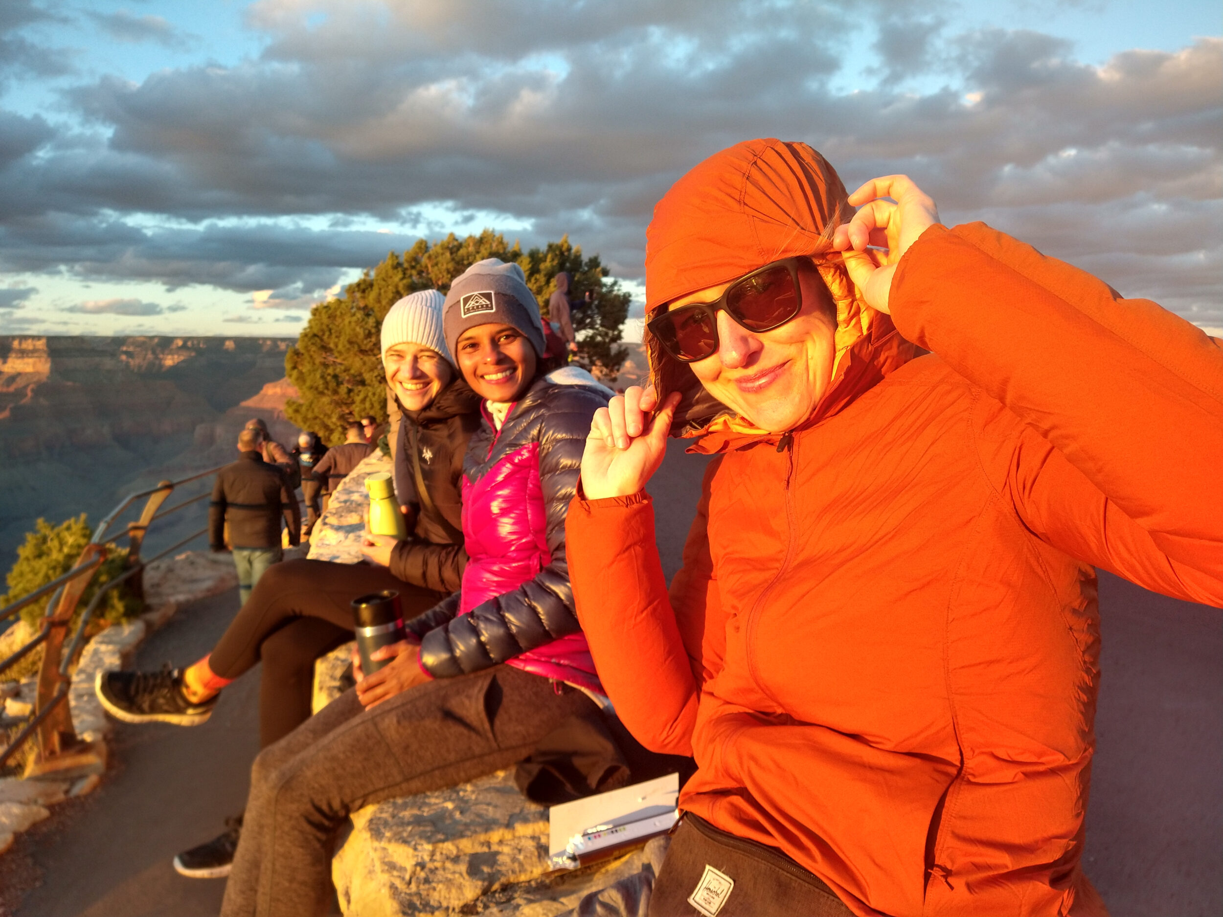
4:30am – Deanne, Dasha, Wiebke and I are all dressed, running packs on, and pretty much ready to go. The earliest Park shuttle this time of year starts at 5am from the Visitor Center. We want to be at the trailhead by 5, so we call a cab. You can’t book one ahead of time as we found out last night, but apparently, this early in the morning it’s easy enough to get a ride.
4:37am – Cab is here to pick us up. The excitement is growing. Radio in the car is playing “We will rock you”, seems like an appropriate song to start this day.
4:50am – We’re at the trailhead. Last bathroom break before we start going down. I don’t really feel nervous anymore, I’m ready to go.
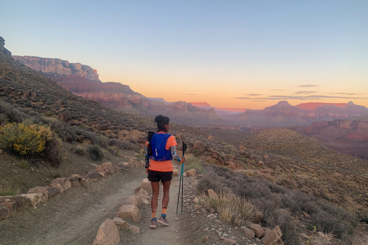
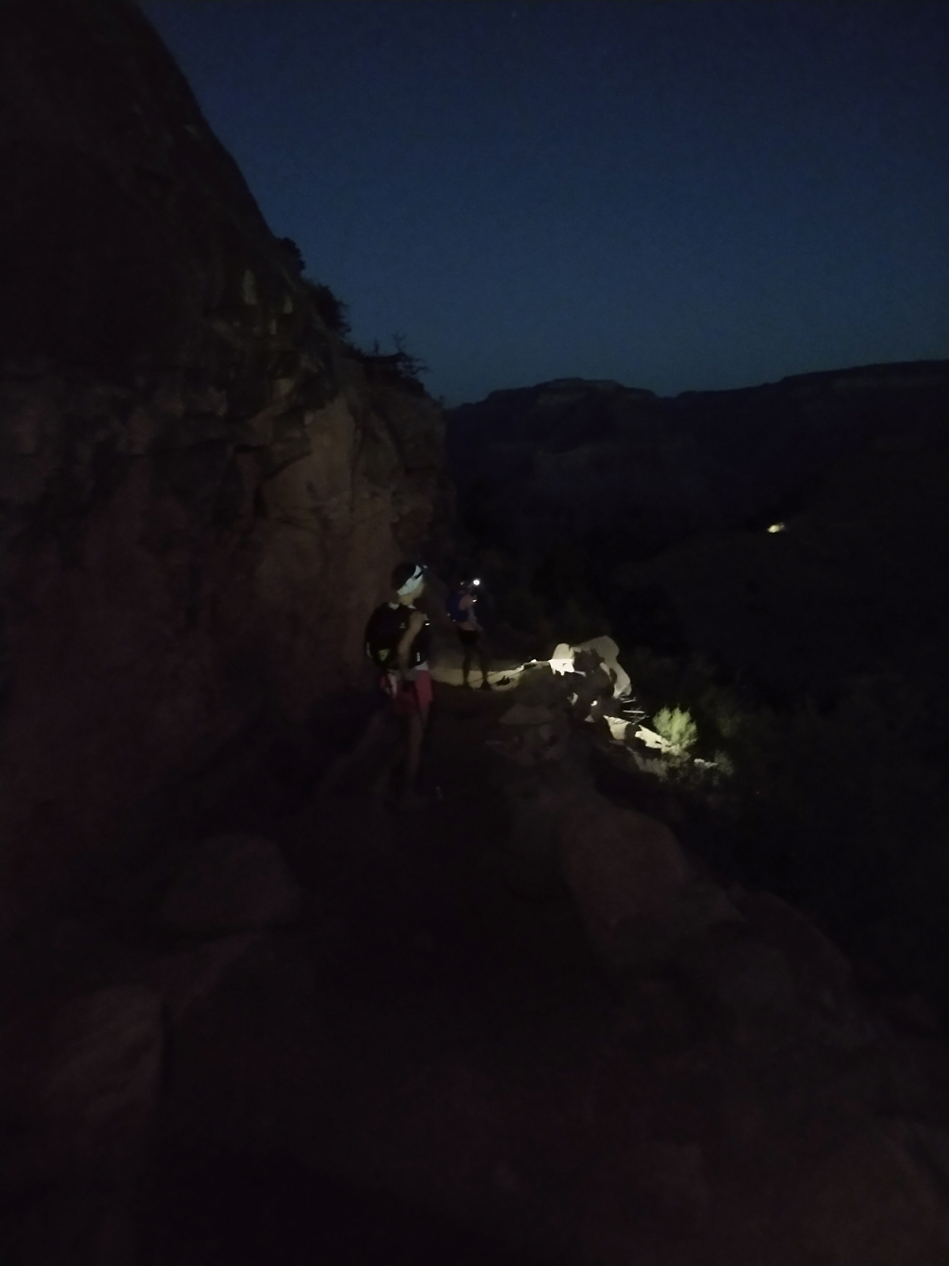
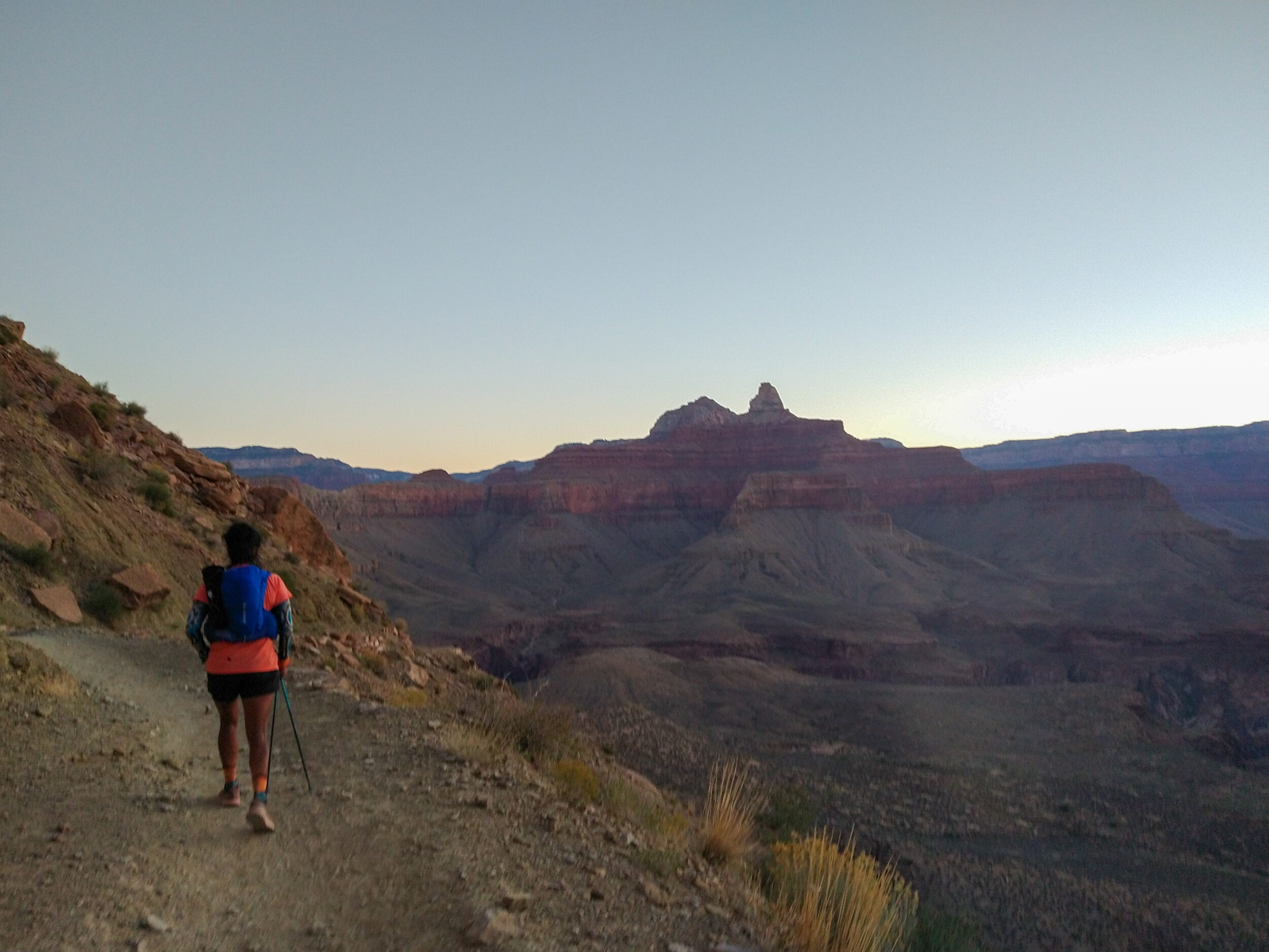
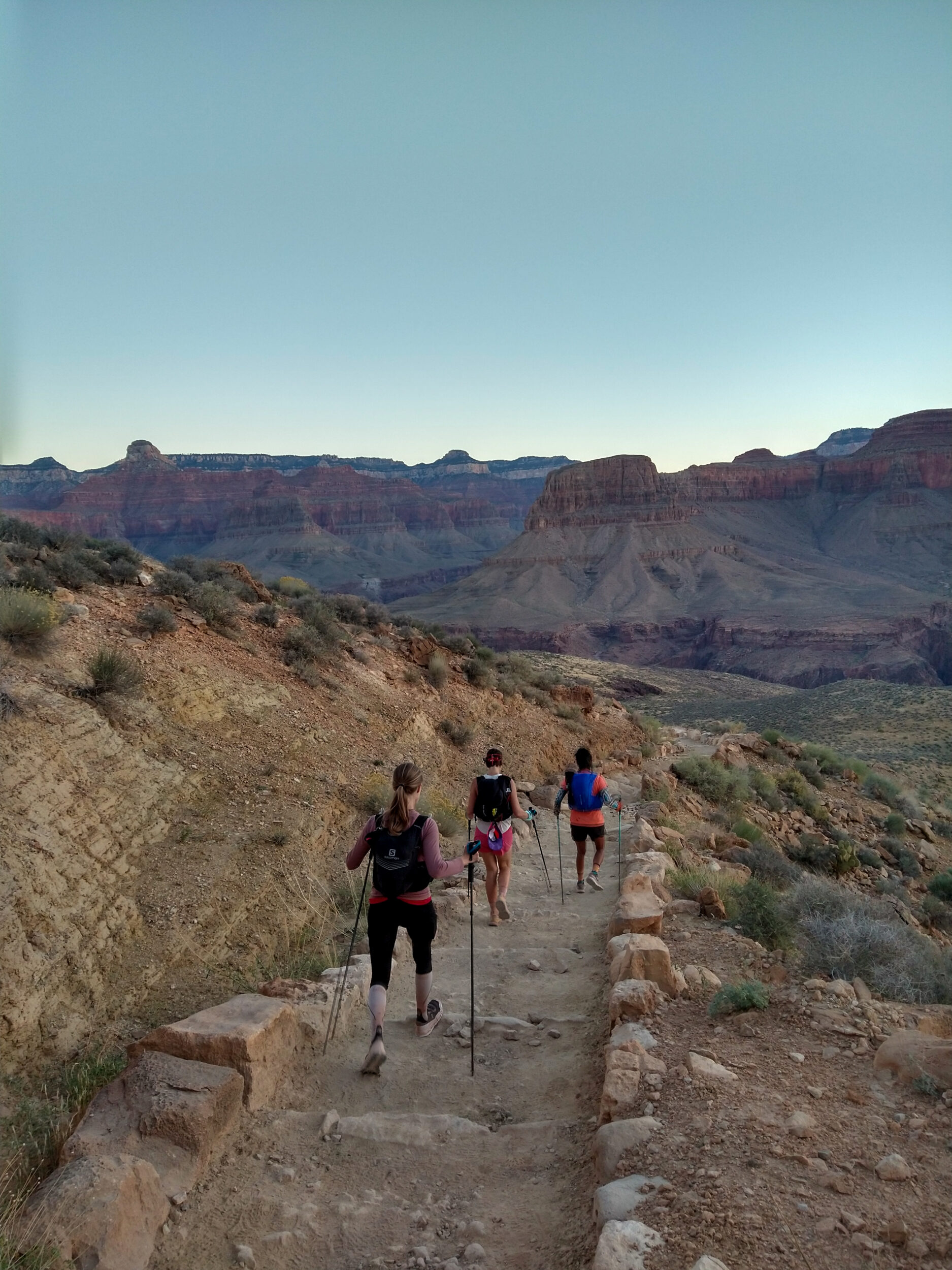
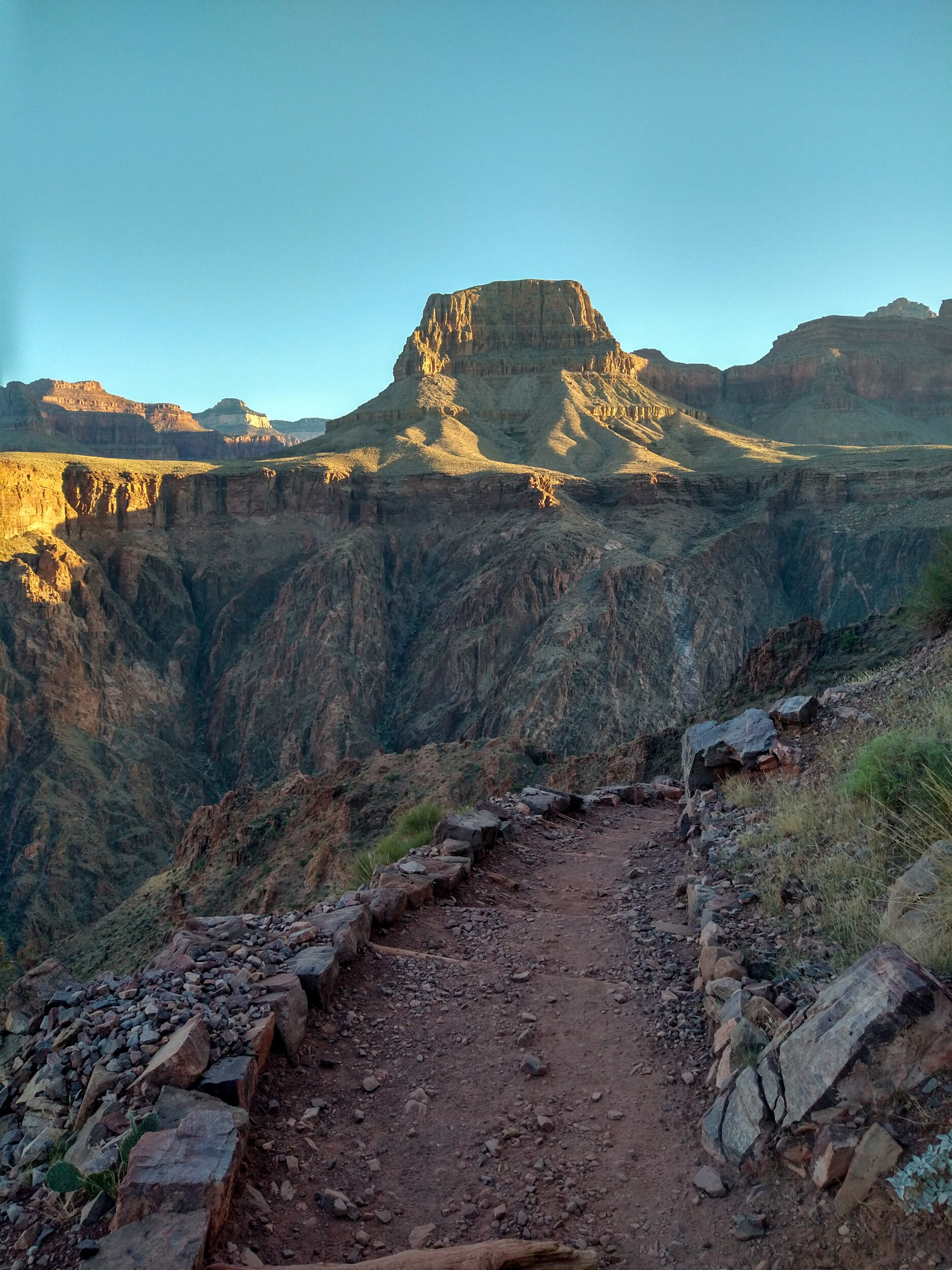
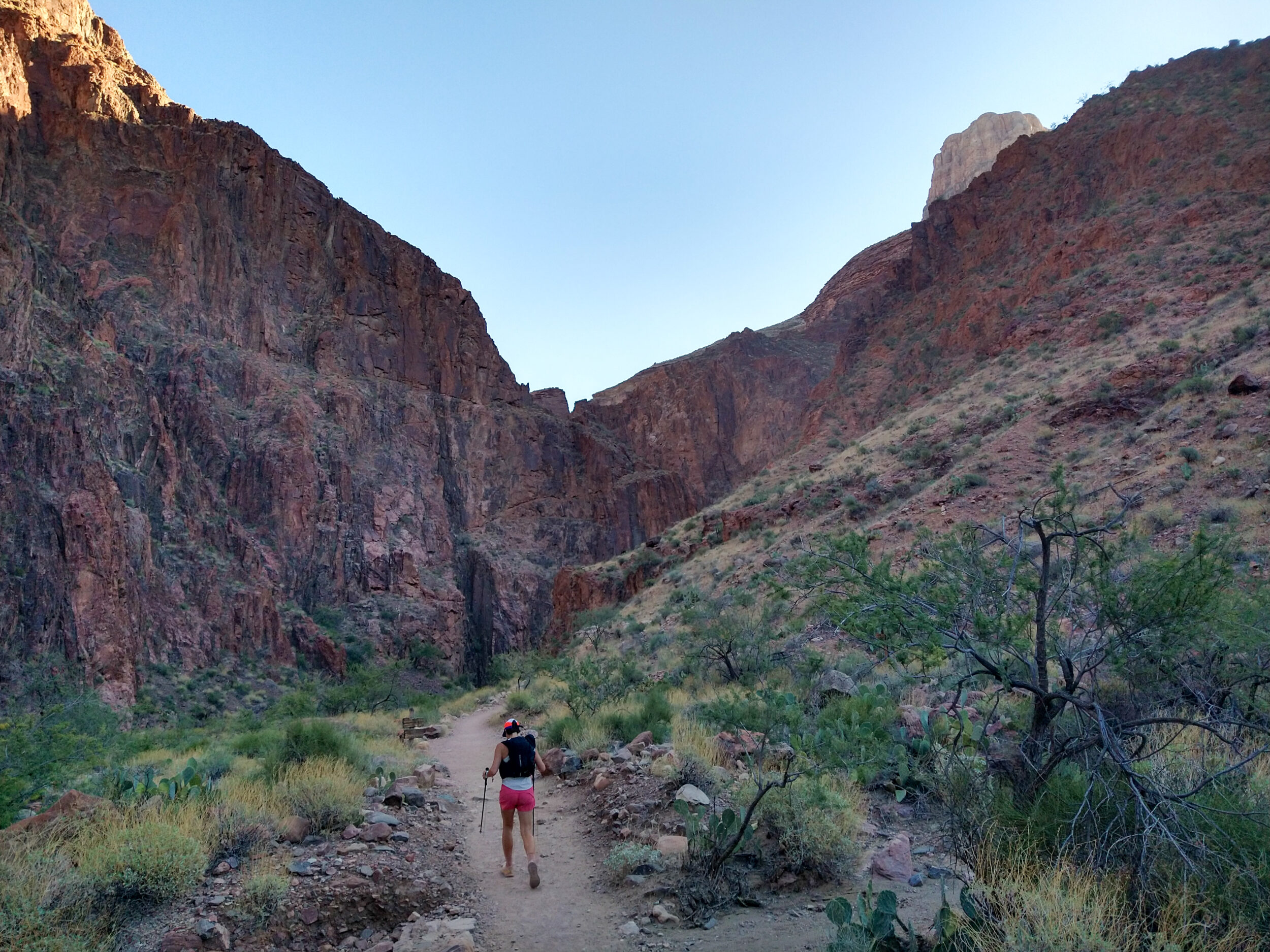
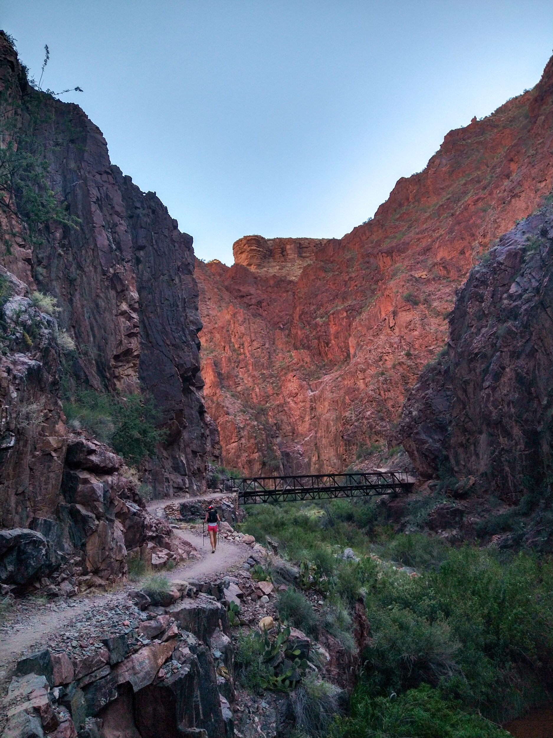
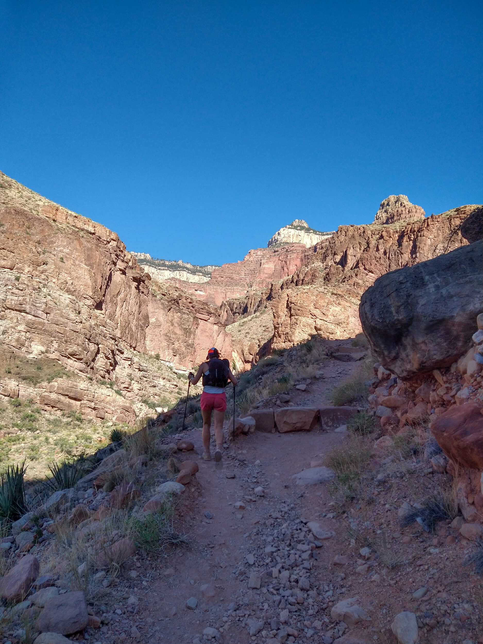
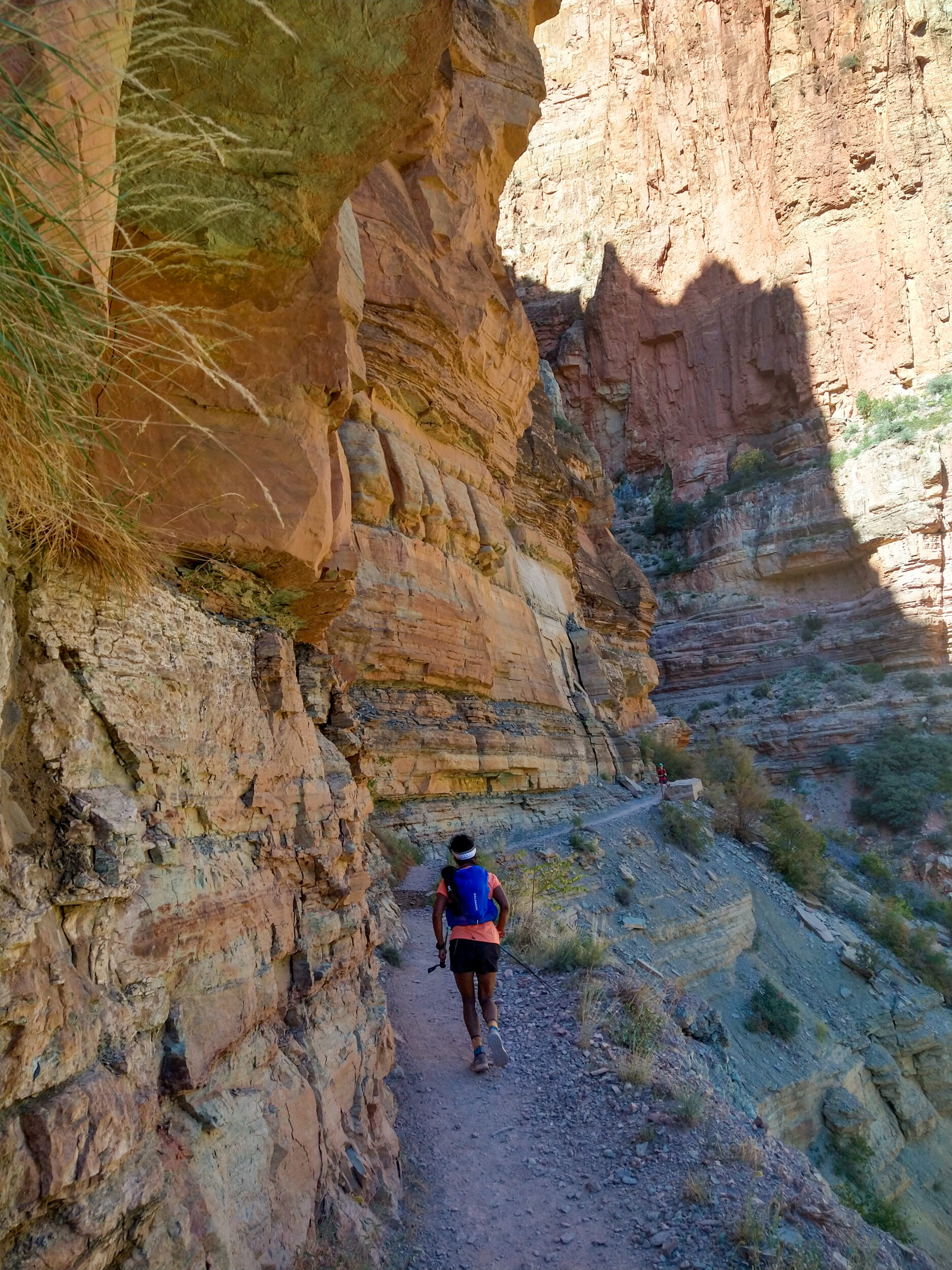
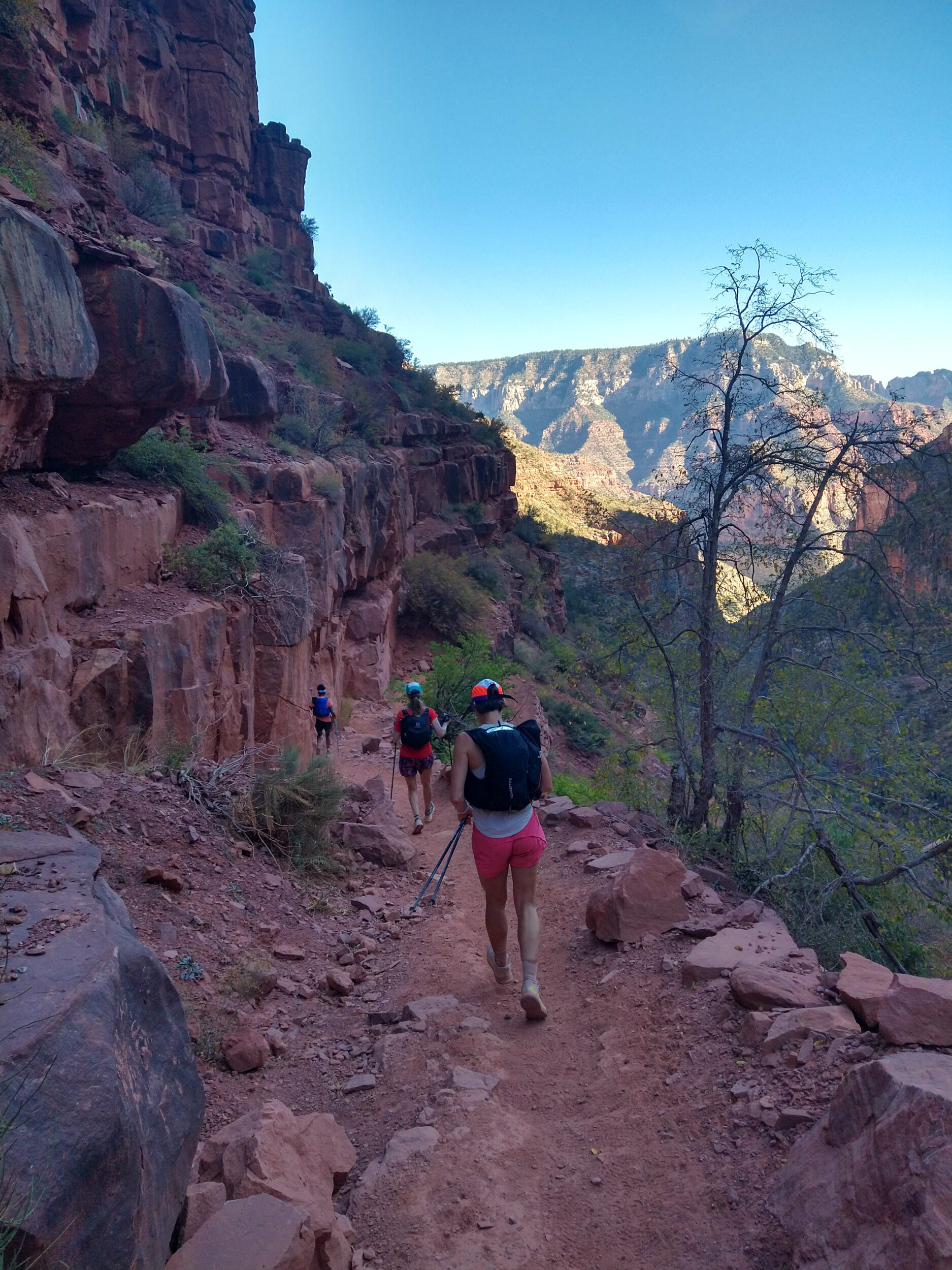
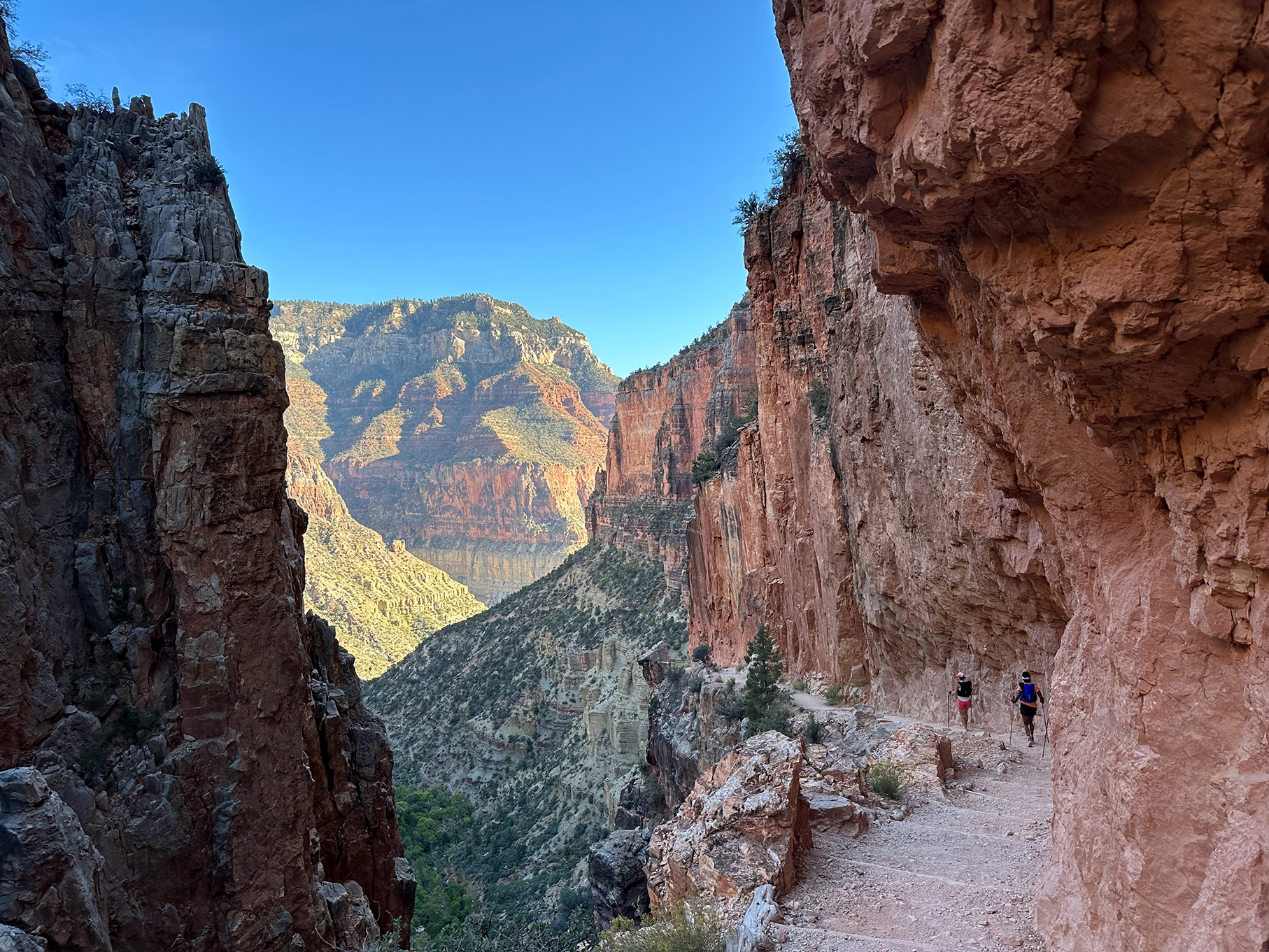
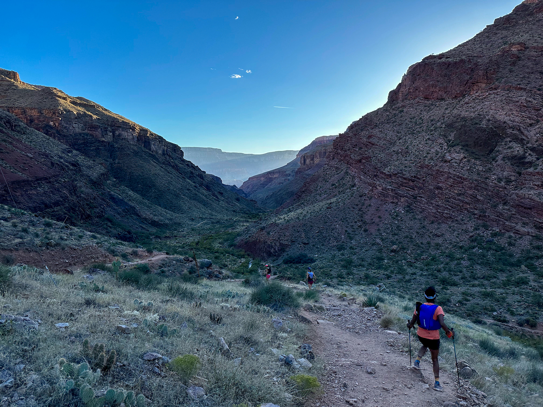
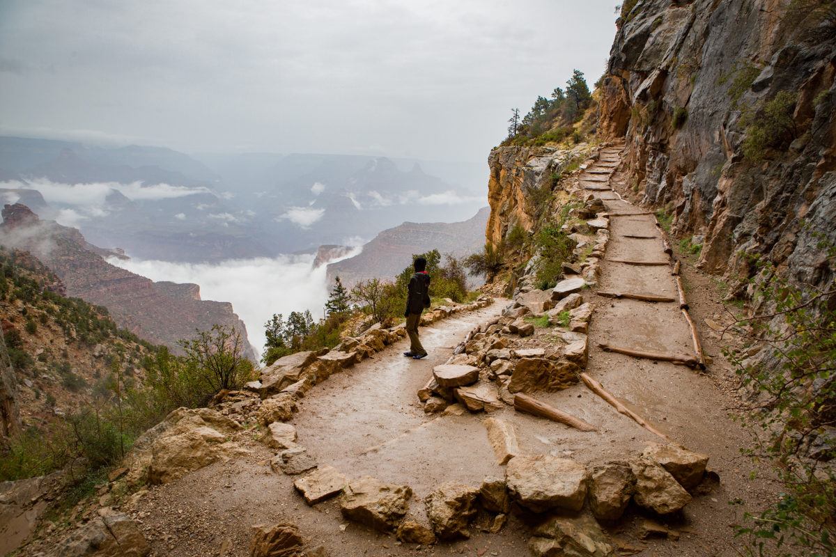
5:00am – We’re shuffling down South Kaibab trail. It’s still complete darkness, except for our headlamps lighting the way. The trail is narrow and rocky and we can’t quite see the drop on our right side, but we know it’s a big one. “Hug the wall” and “Stay on the mountain side” become our first couple of mantras for the day. The excitement is palpable, we can’t wait for the sun to start coming up.
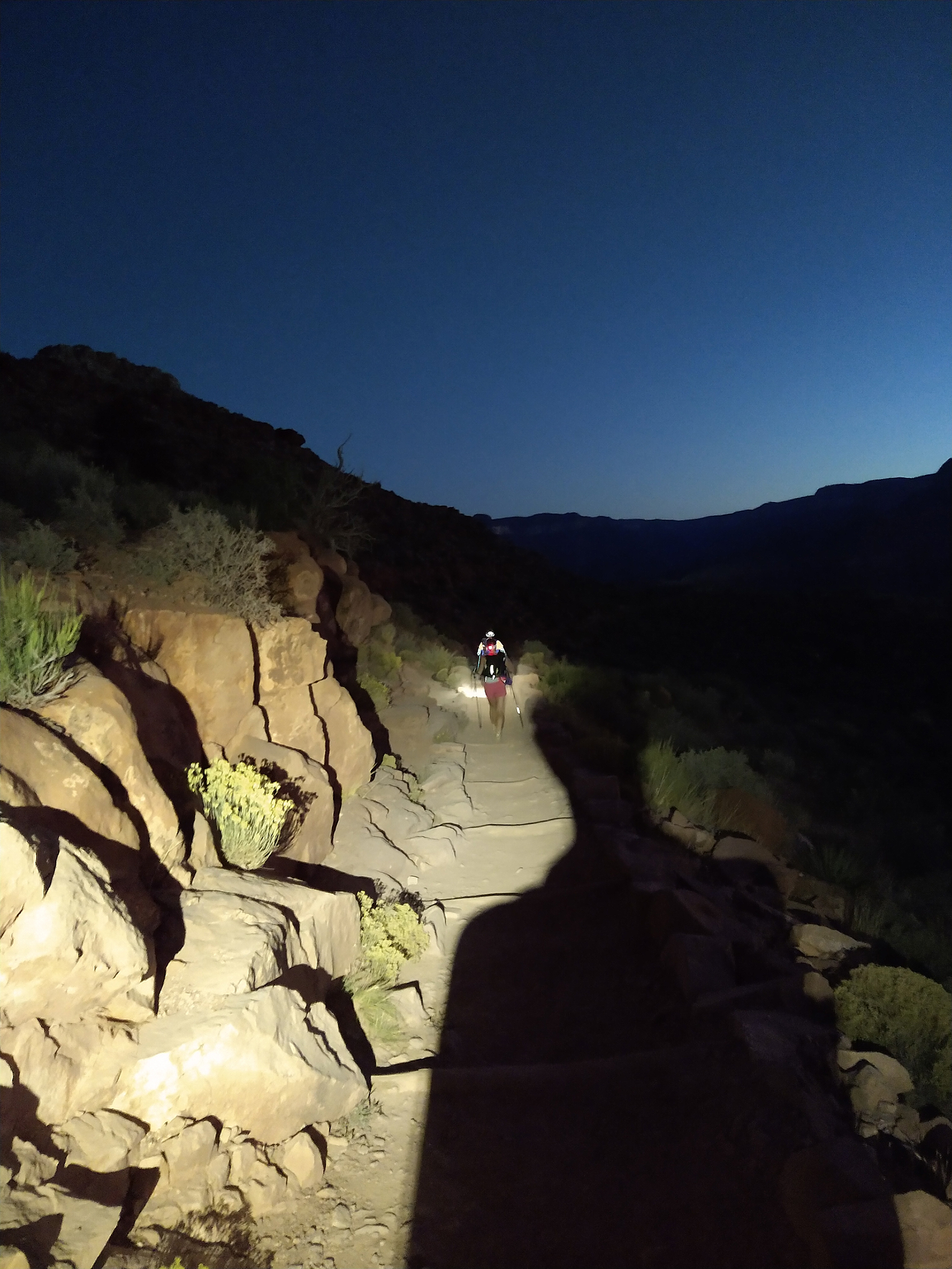
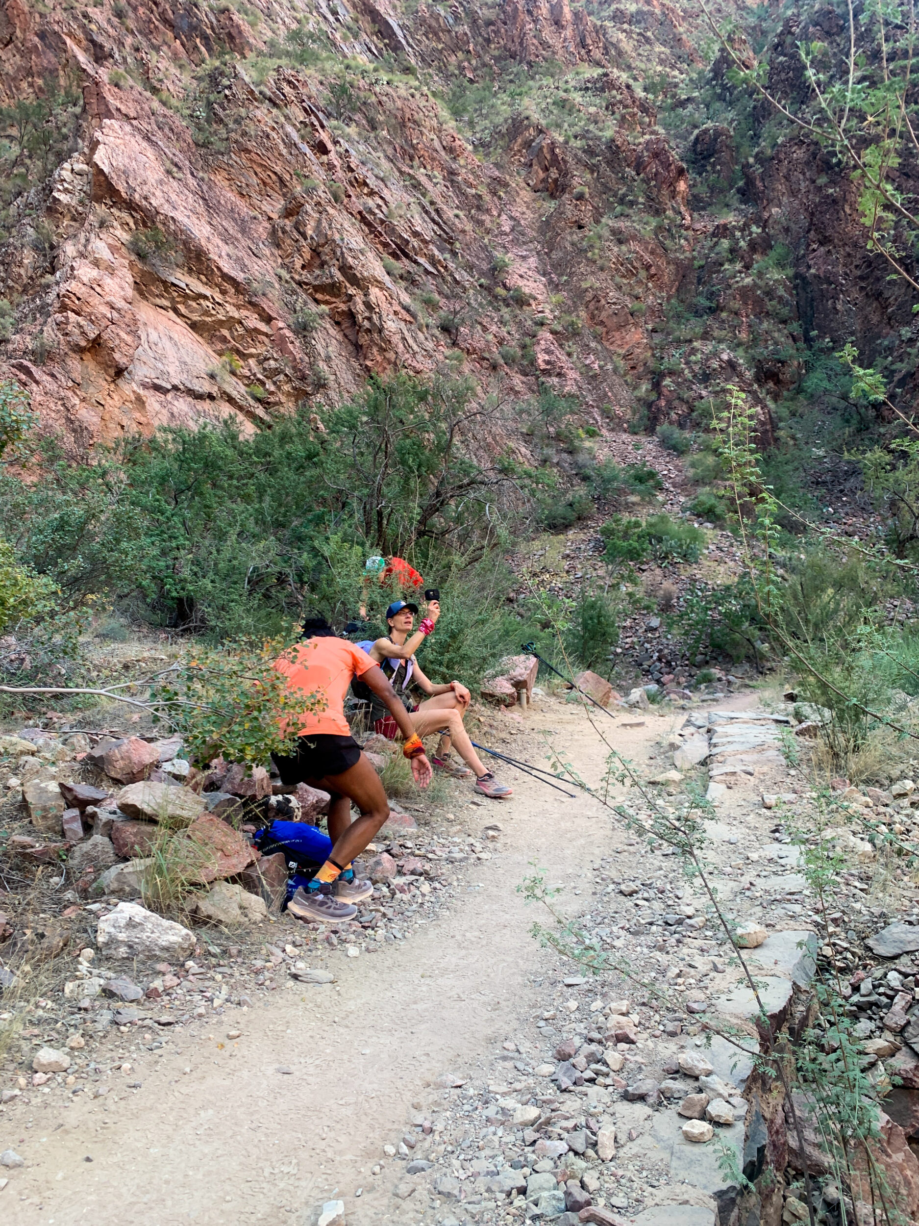
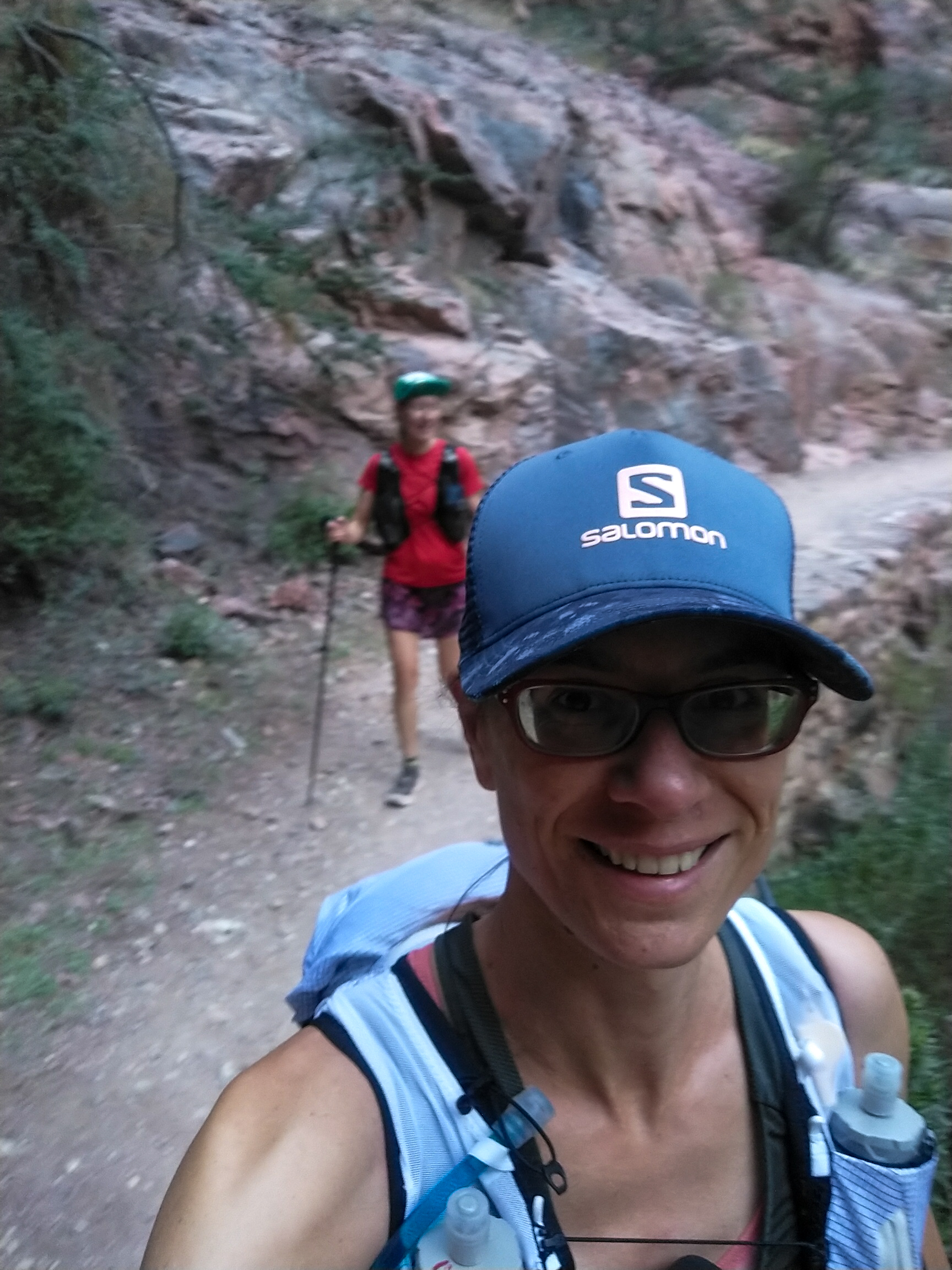
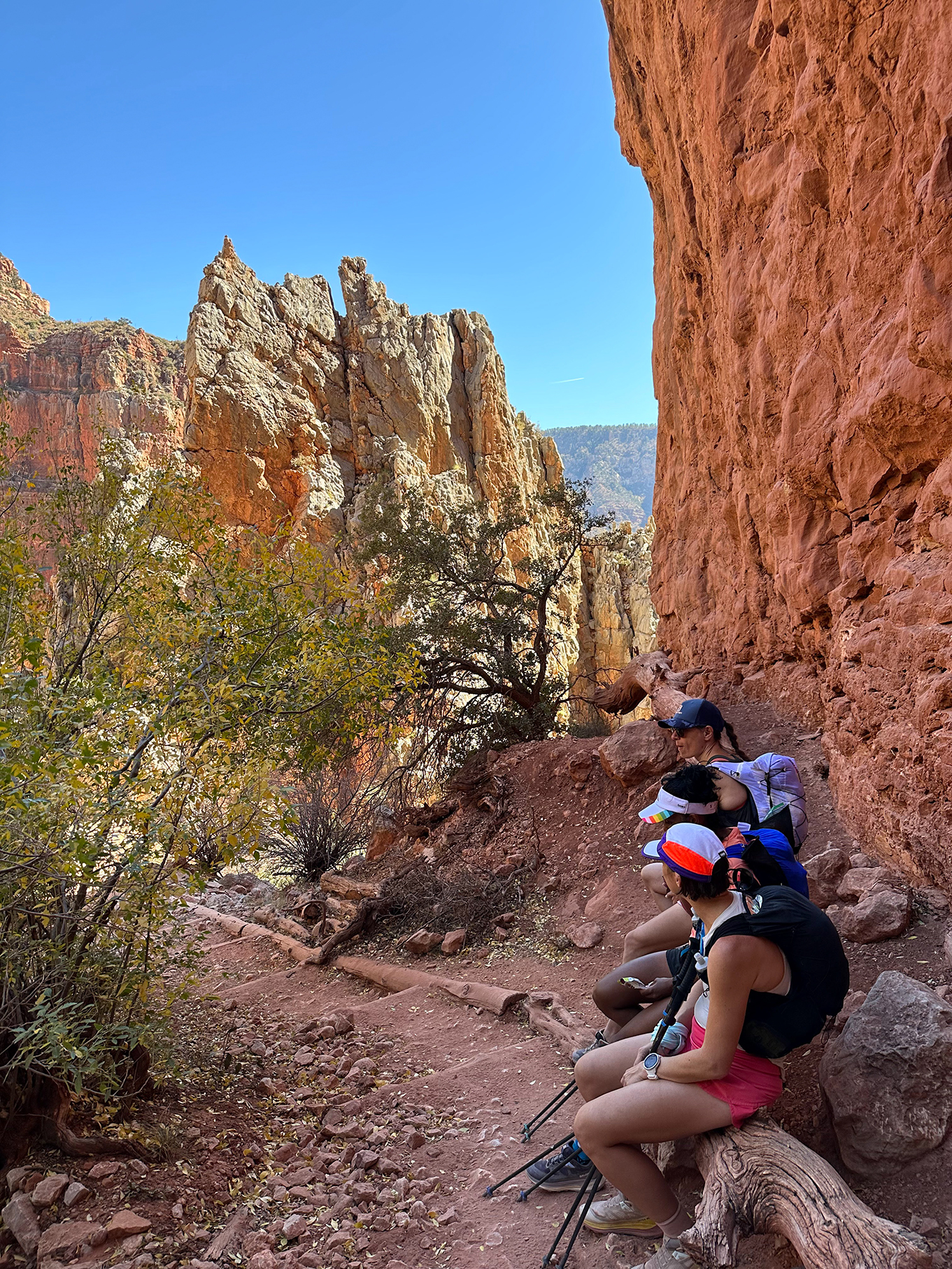
6:17am – We’ve already been on the trail for 1 hour, but we’re pretty slow-moving in the dark. The sky has been slowly getting brighter on the open side of the trail. We’ve jogged passed the Ooh Aah point without seeing much of the view, but now the trail is becoming clearer, and the vistas start to reveal themselves. We stop at every bend, every switch back to take in the views and snap the first or many photos of the day.
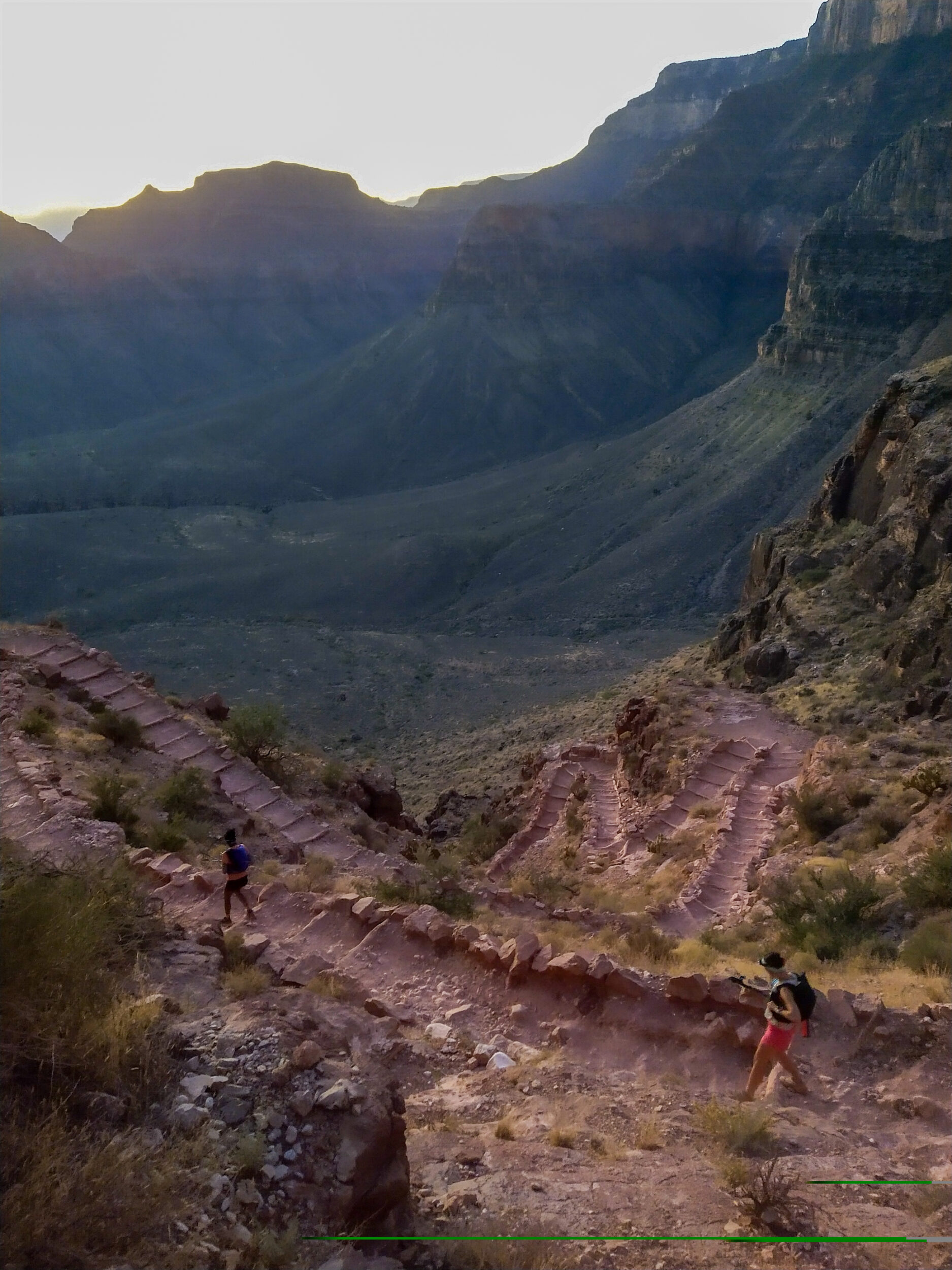
We get to the short switch backs at Skeleton Point, just short of 5km. The Grand Canyon National Park official trail information says that you “Should not go past this point as a day hike”. There’s also an illustration of a guy puking. I think they’re trying to make a point. But it’s an important one. The Grand Canyon gets incredibly hot in the summer, and it’s easy to venture downhill without realizing how hard it might be to come back uphill. There’s also no water source on this trail until you get to the Colorado river at the bottom. This is definitely not a hike you can just improvise. We’re far from improvising. We’ve been training for this for months.
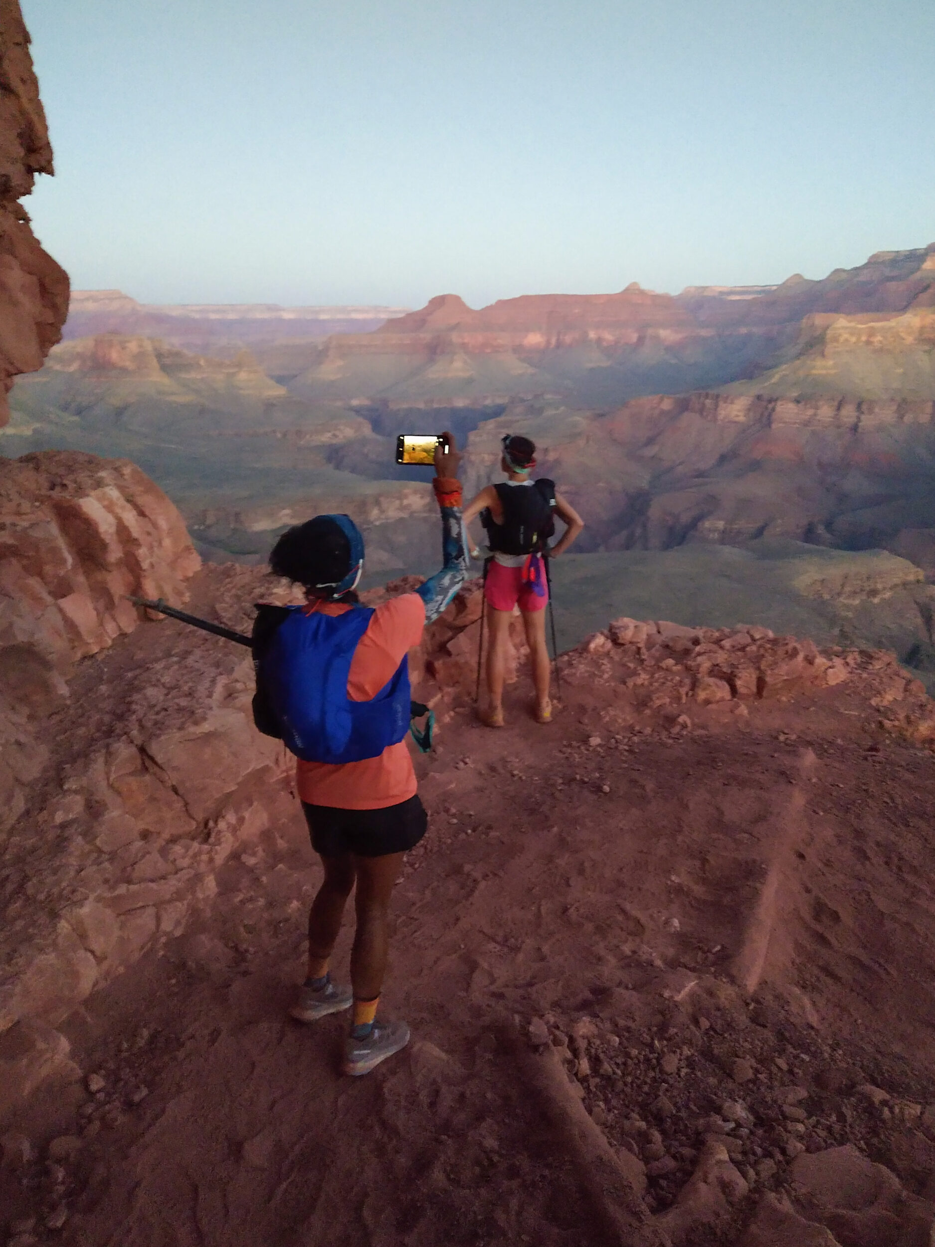
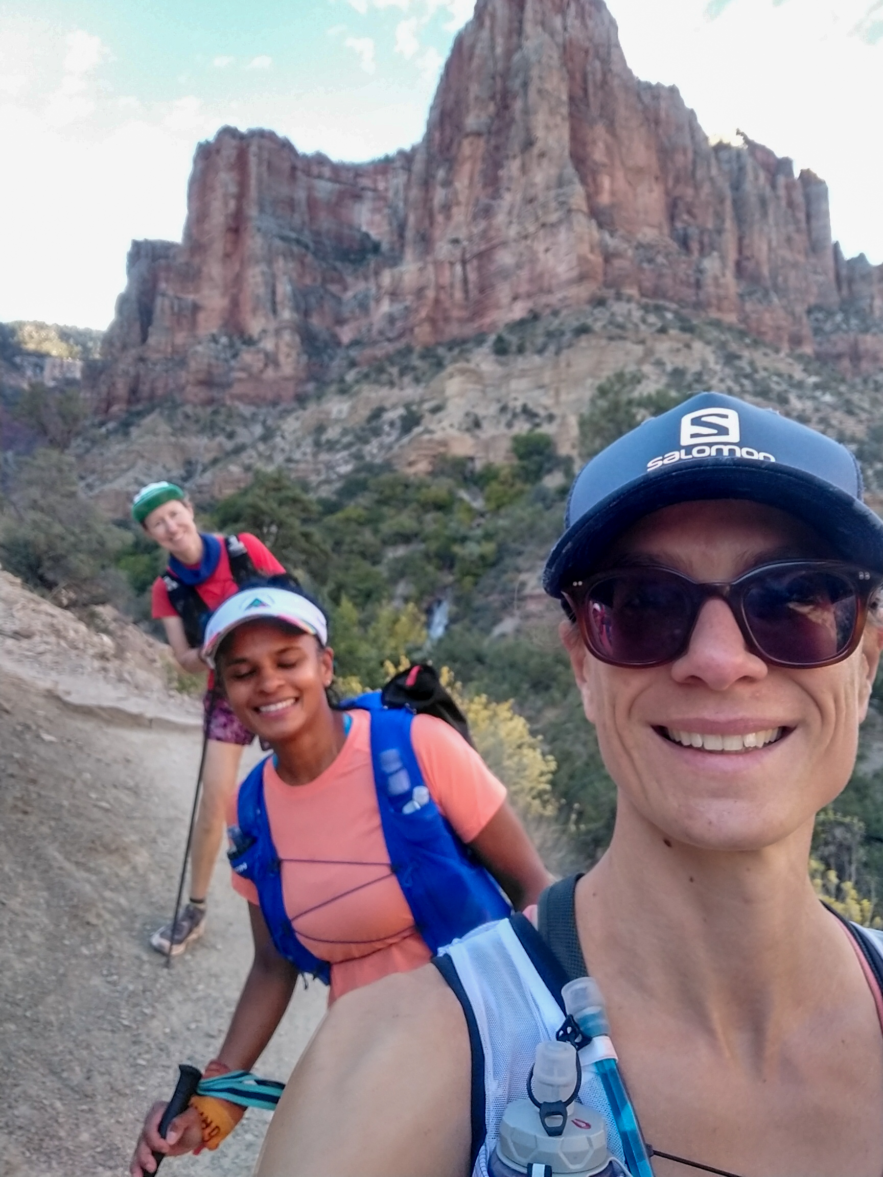
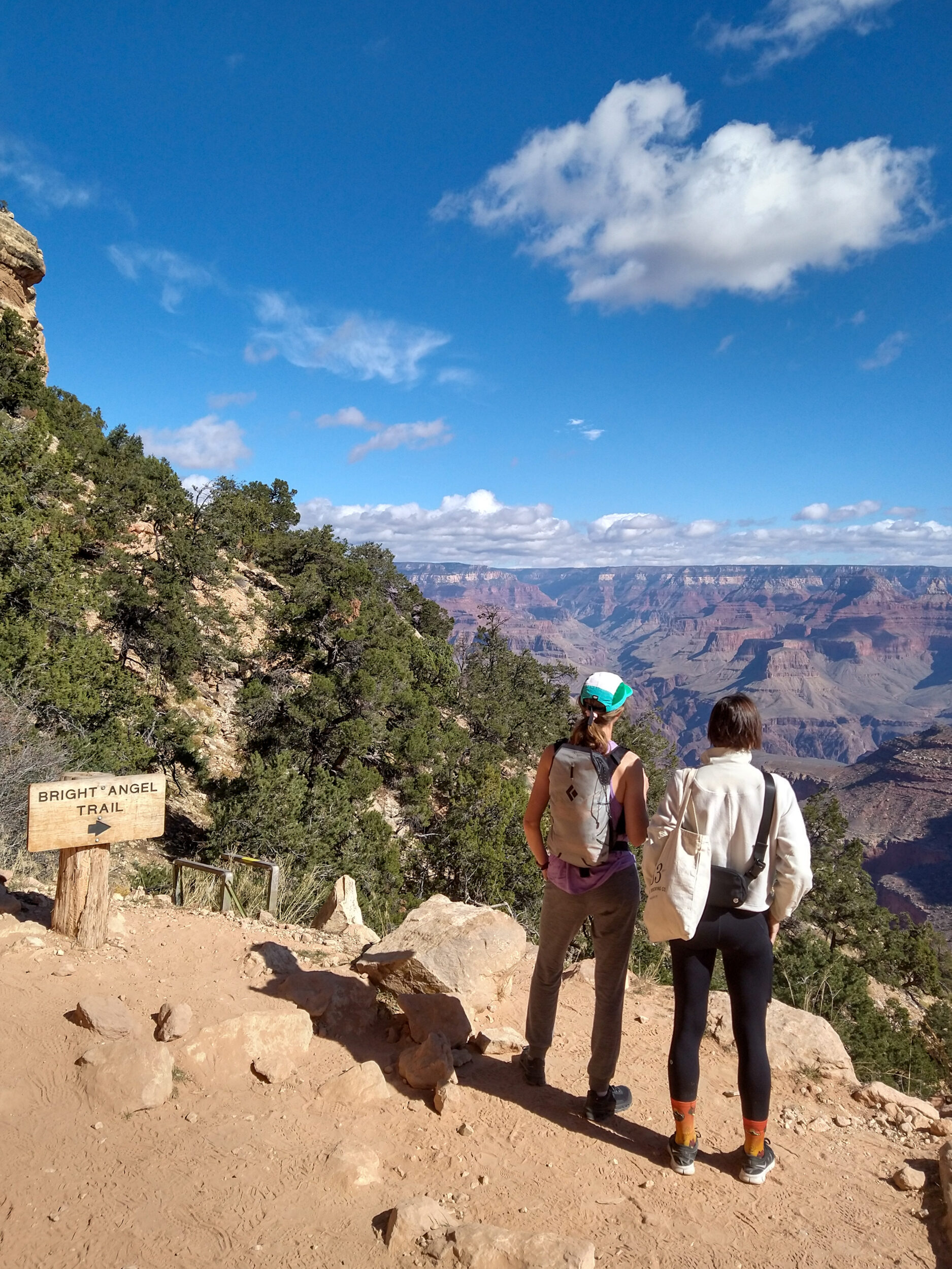
We come across a couple going down the trail. Their plan is to go to Phantom Ranch and come back on Bright Angel, another popular route – and a much shorter one. We ask them to snap a group photos of us, right on the bend of the trail, looking out to the west.
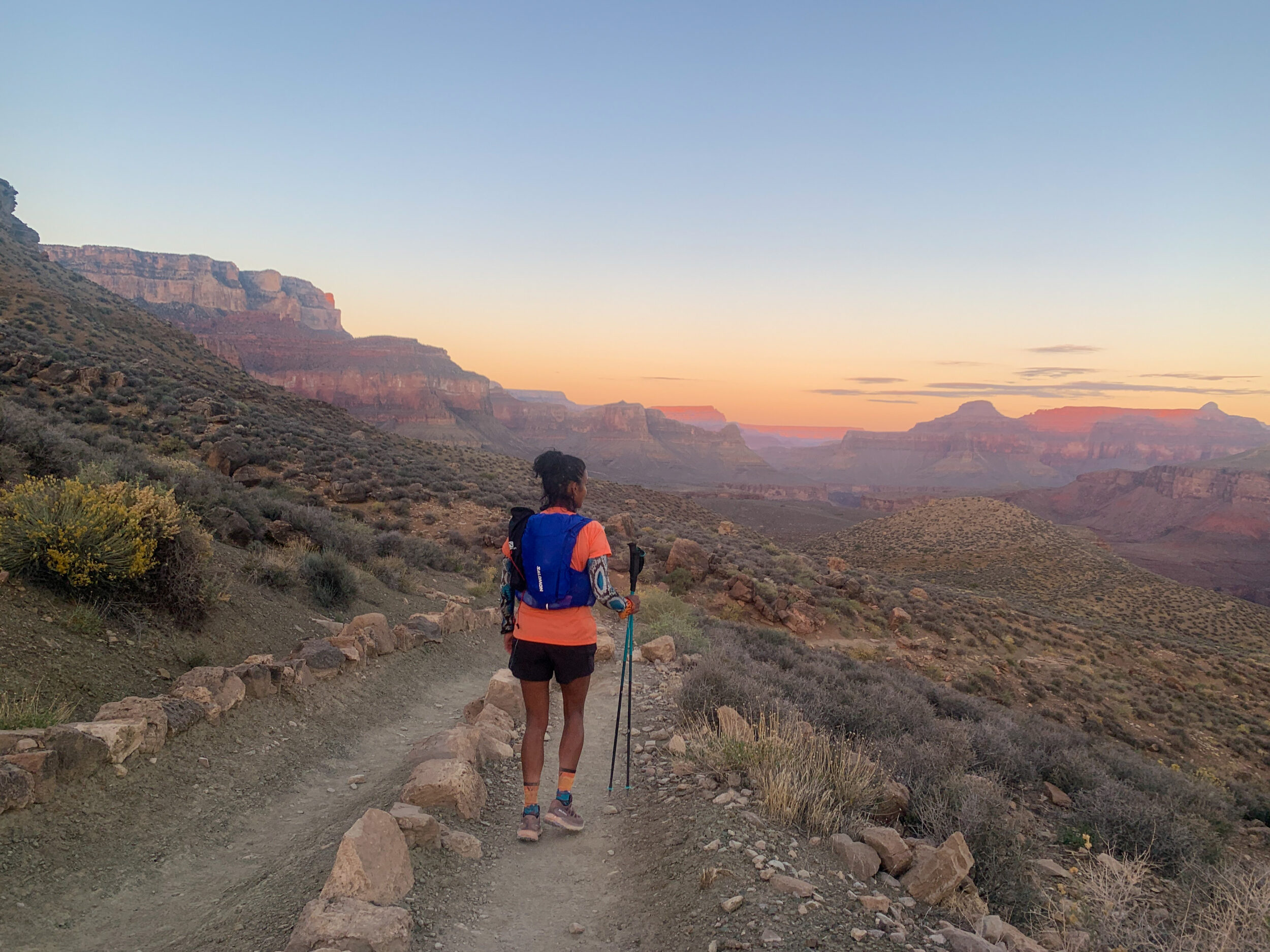
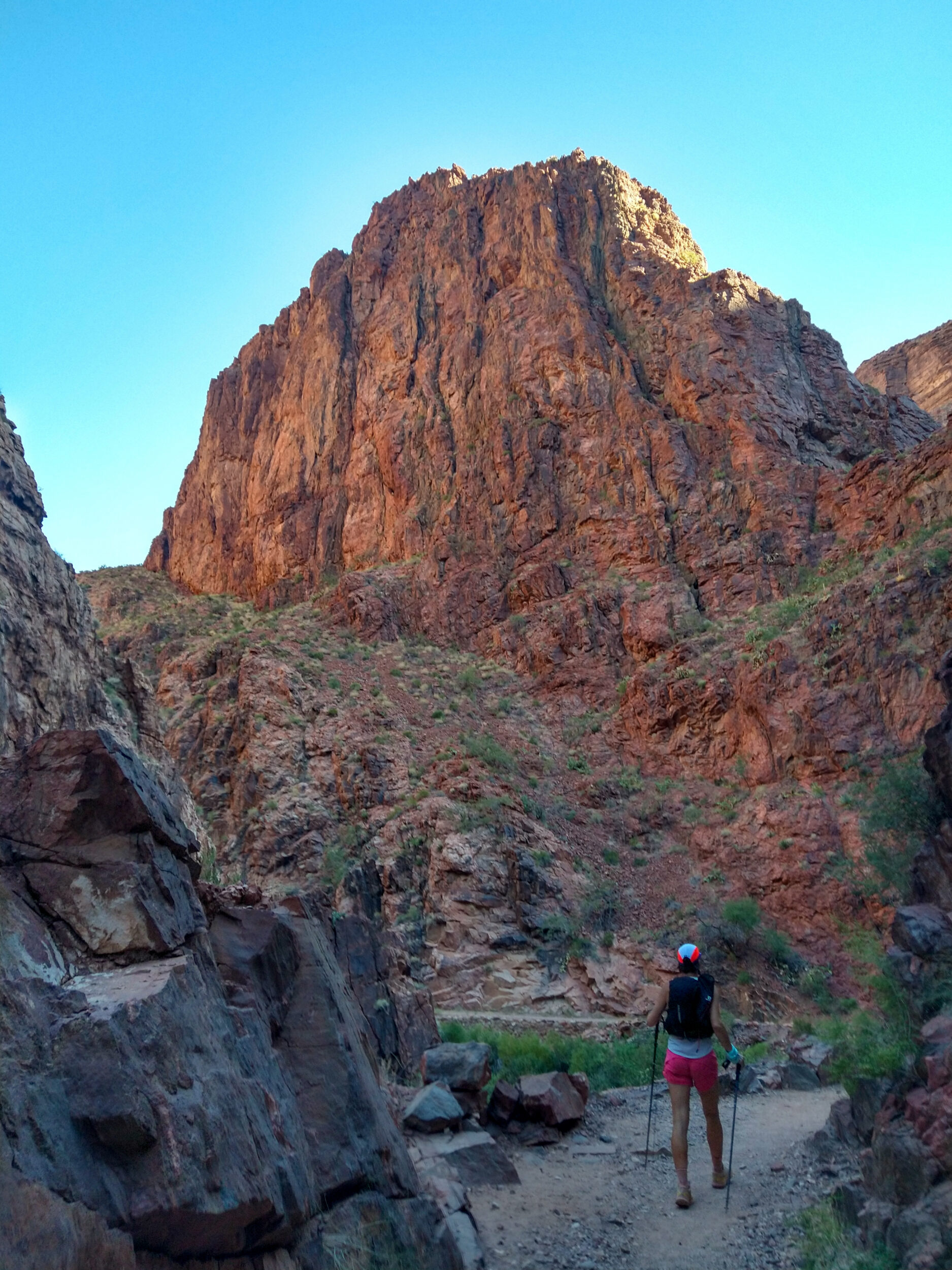
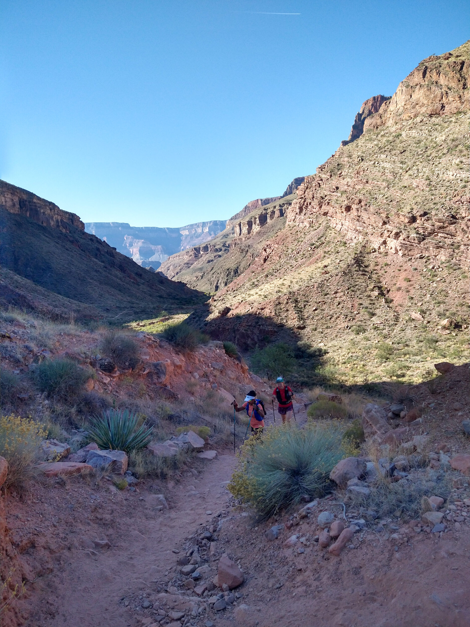
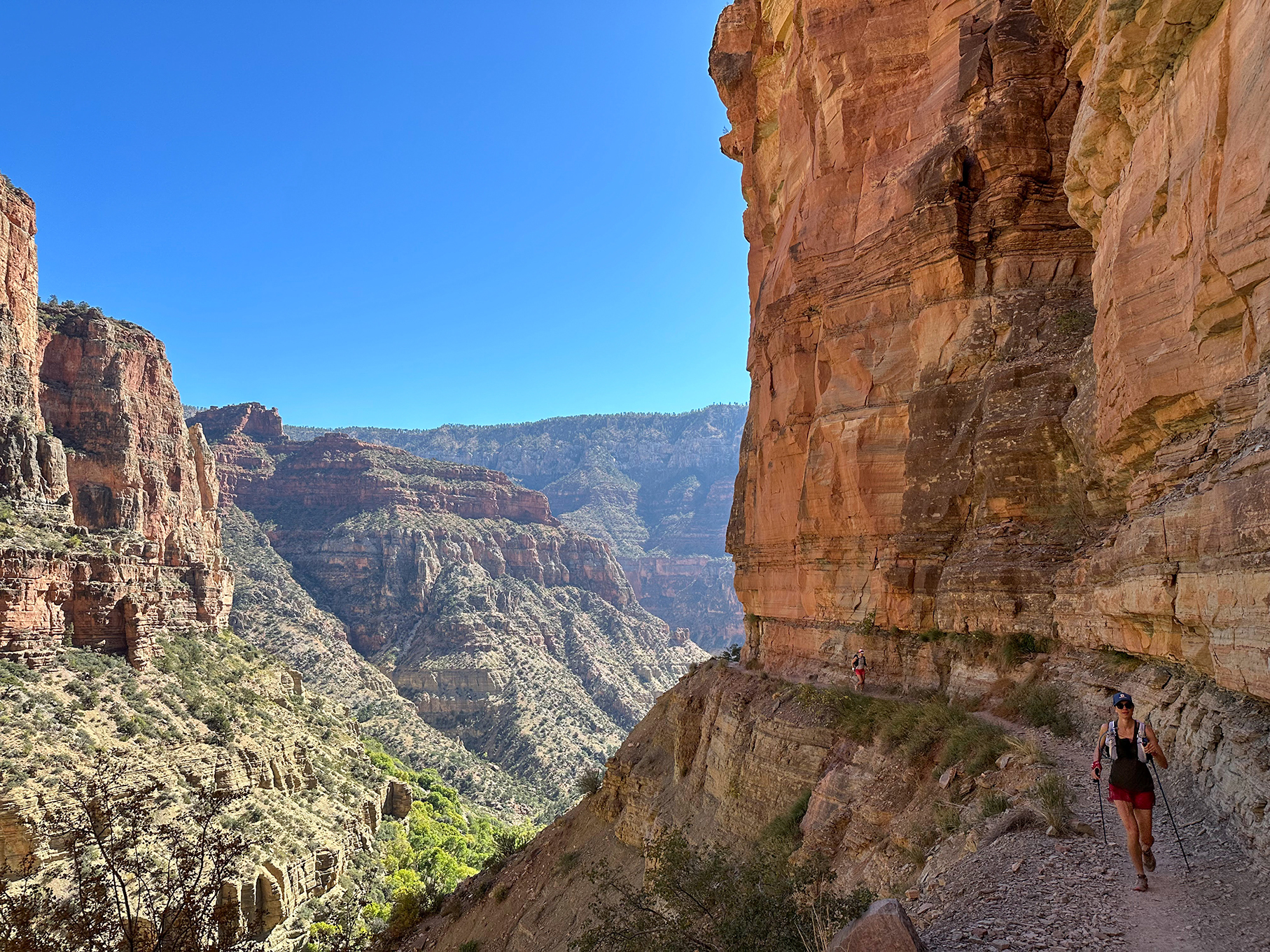
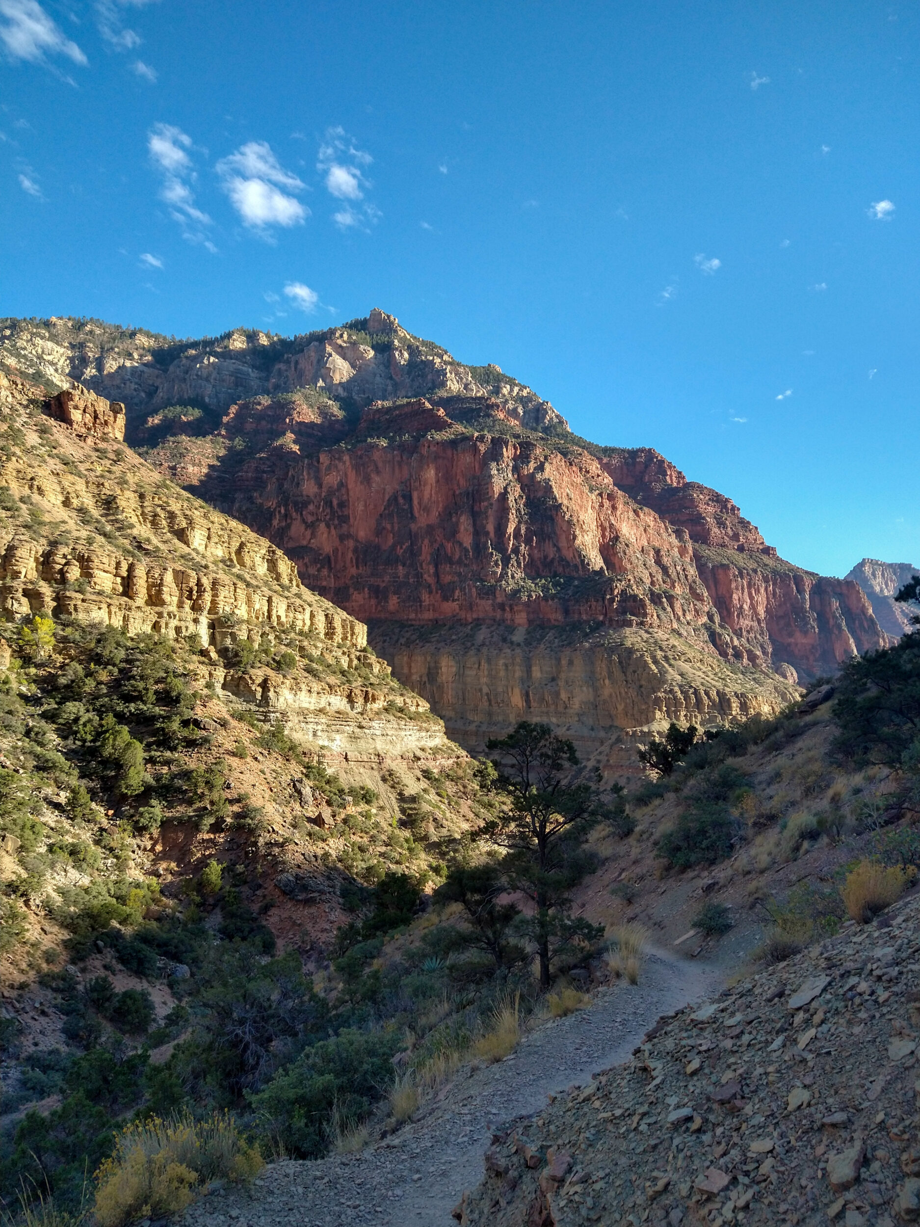
The trail is now clearly visible and the views all around are incredible. This place is so vast, it loses all sense of scale. The Grand Canyon isn’t just a massive cliff over a big flat desert. It’s the largest expanse of sprawling mounts and rocky summits, criss-crossed by other, narrower canyons. The Colorado River runs at the bottom, carving the main divide between the South and North Rims, but other tributary streams connect with it, having created their own path through layers of rock, separating the earth into a dusty jigsaw puzzle. The sun is just starting to graze the very top of the highest summits.
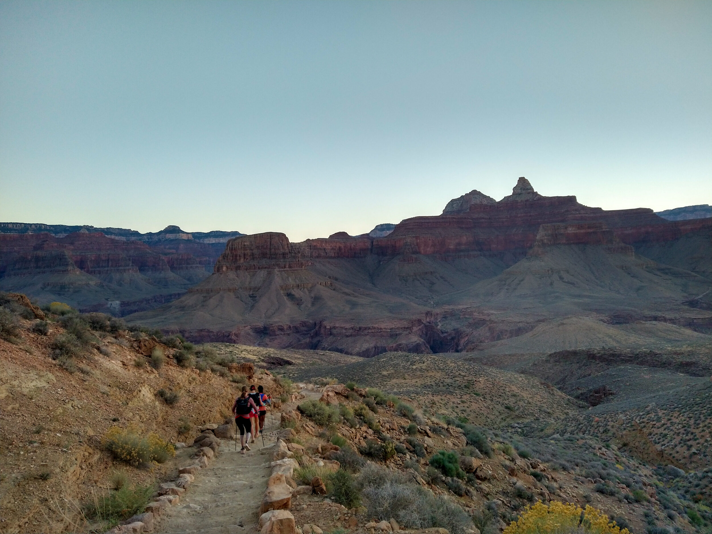
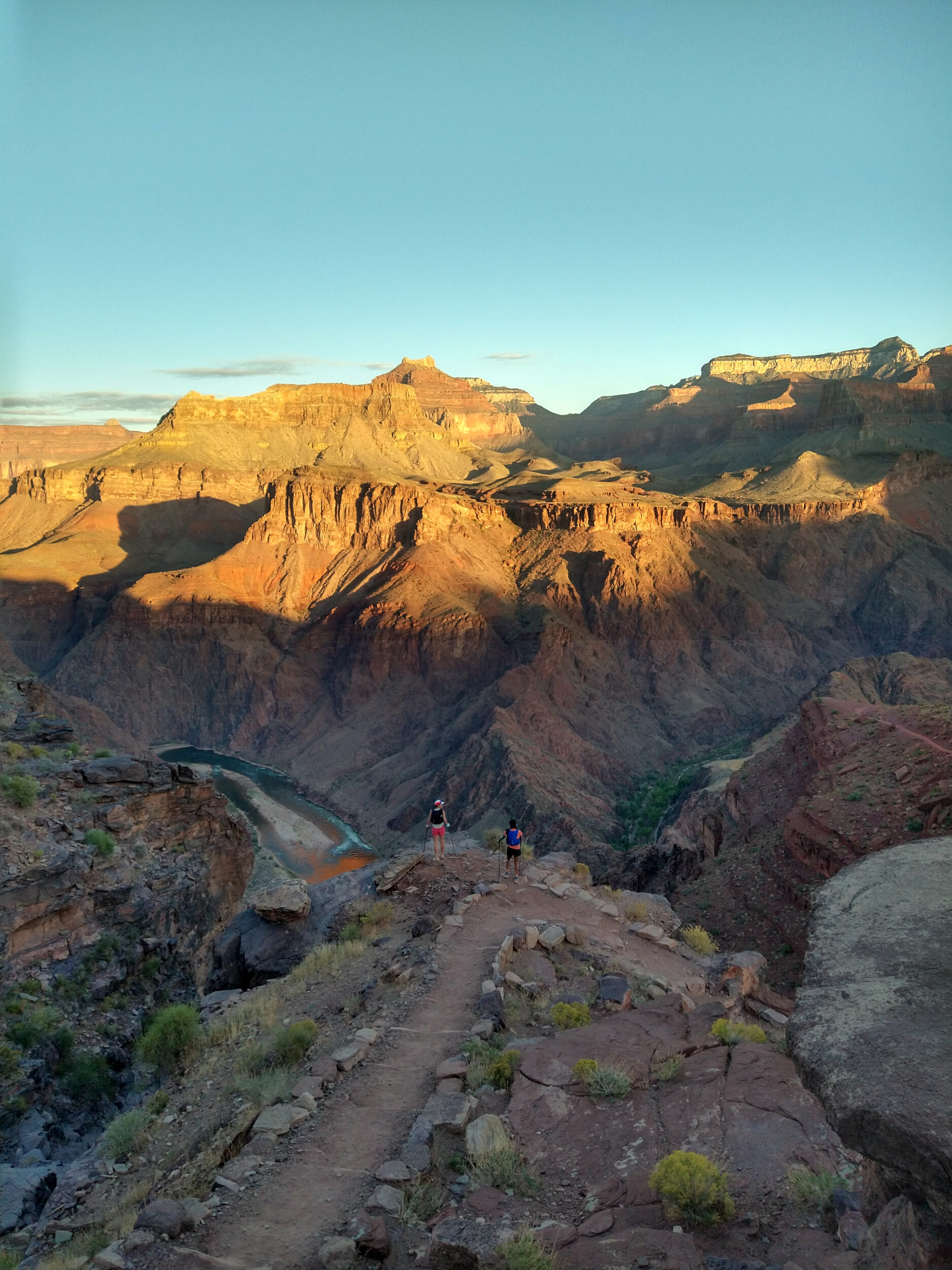
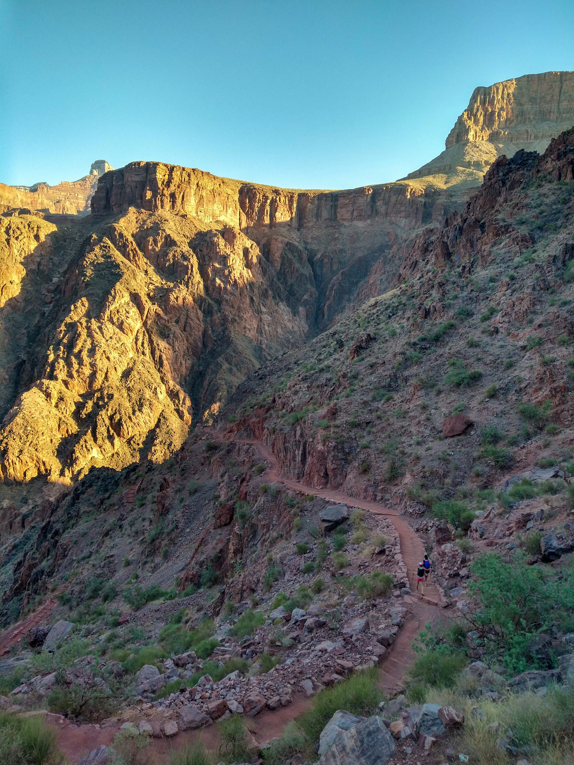
7:13am – We’ve made it to Tipoff, a plateau about 7km from the start, 1000 meters down from the South Rim. This is where the East Tonto trail crosses South Kaibab and continues west to connect with Bright Angel, the trail that we will take later in the day to go back up.
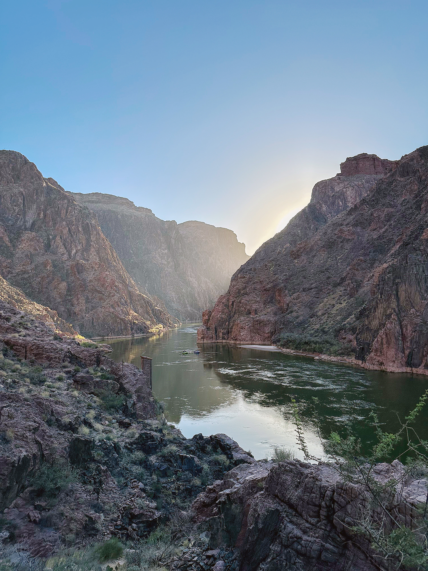
From the plateau we get a first peek at the Colorado river, glowing orange from the early rays of light reaching it. The sun is finally peeking over the top of the South Rim behind us, but it will disappear again as we continue to descend.
We stop quickly for a bathroom break and a “costume change” for Dasha.
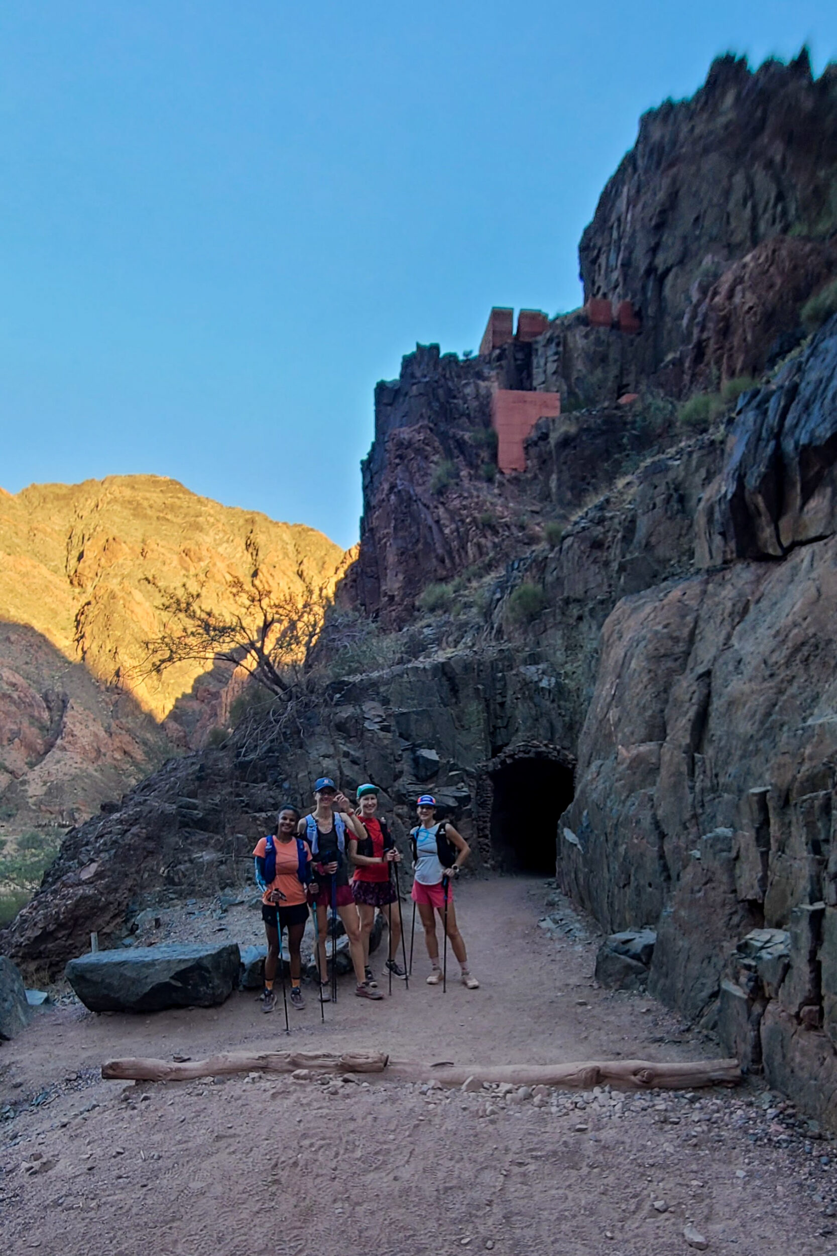
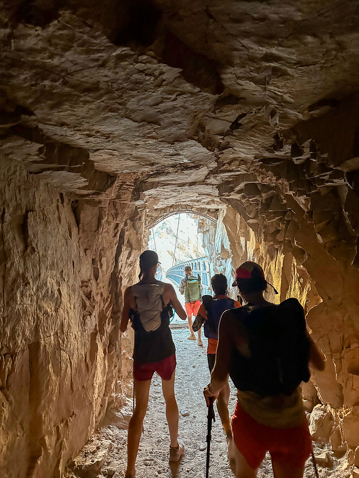
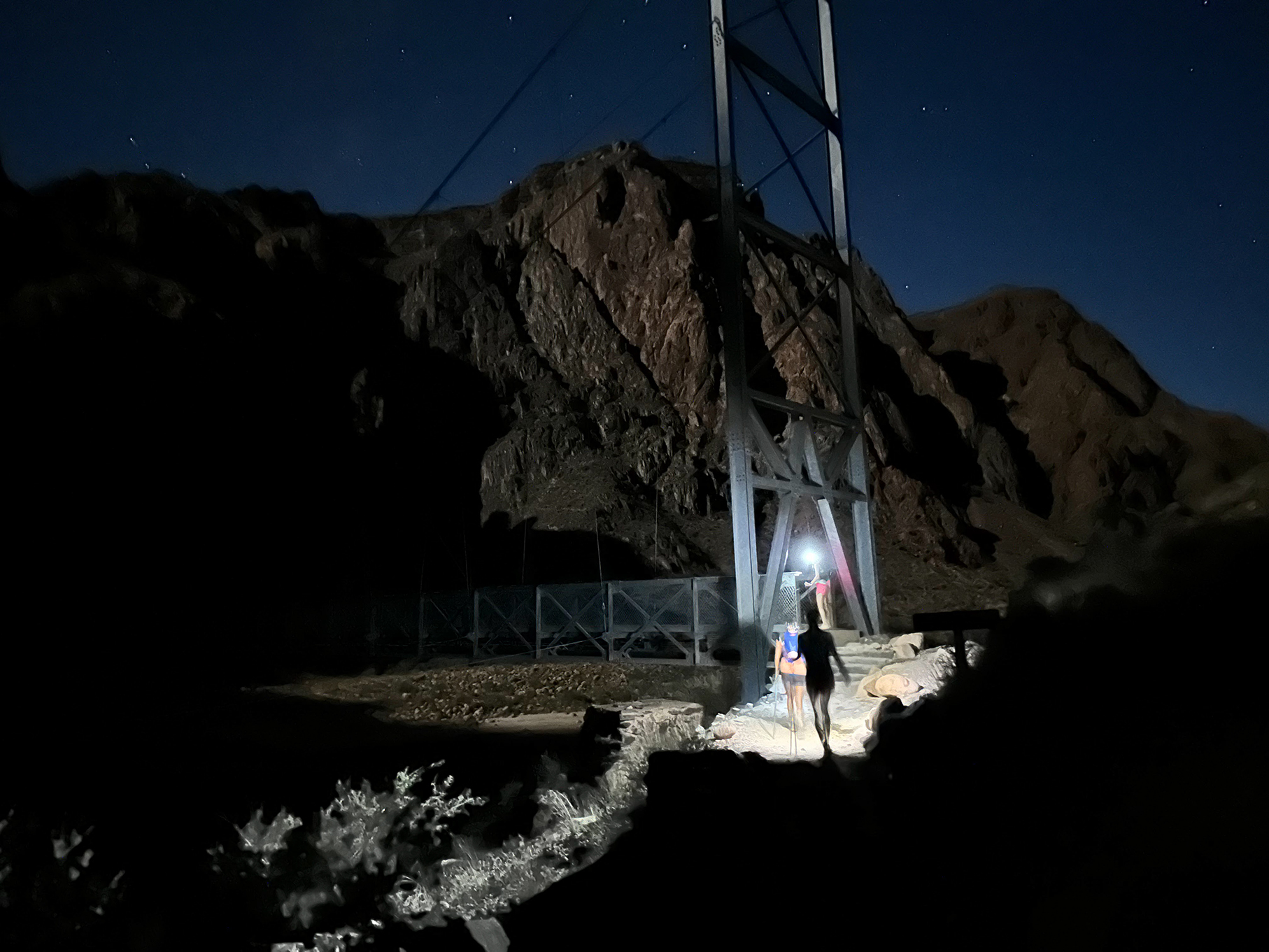
7:41am – We’re almost at the river. As we come to a short tunnel, we meet Ty, who is also on a Rim to Rim journey – although he plans to come back up the same way he came down, on South Kaibab, because “Bright Angel is so much longer and you’re staring at a rock wall for the longest time” (he’s not wrong as we will find out 14 hours later)
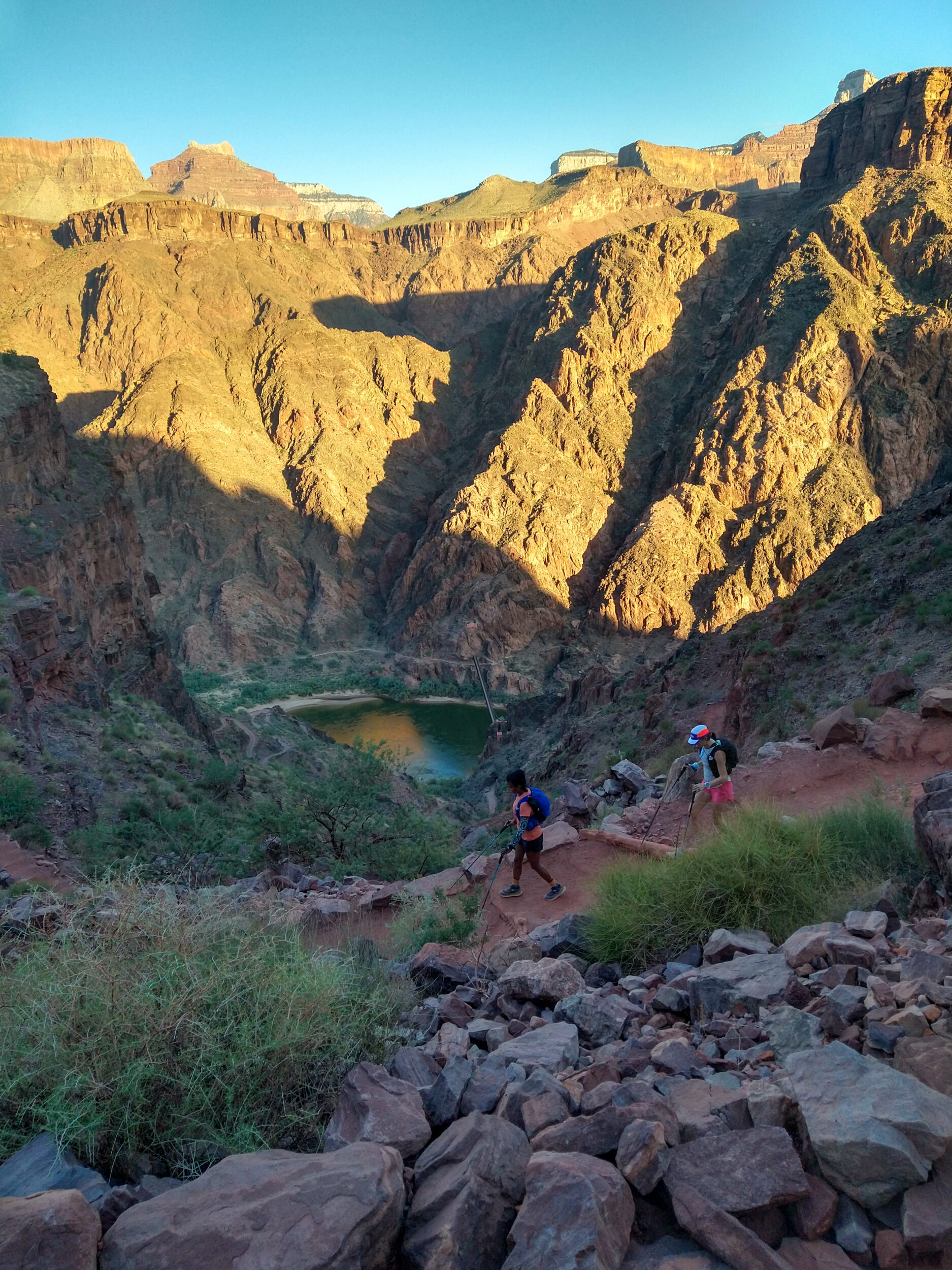
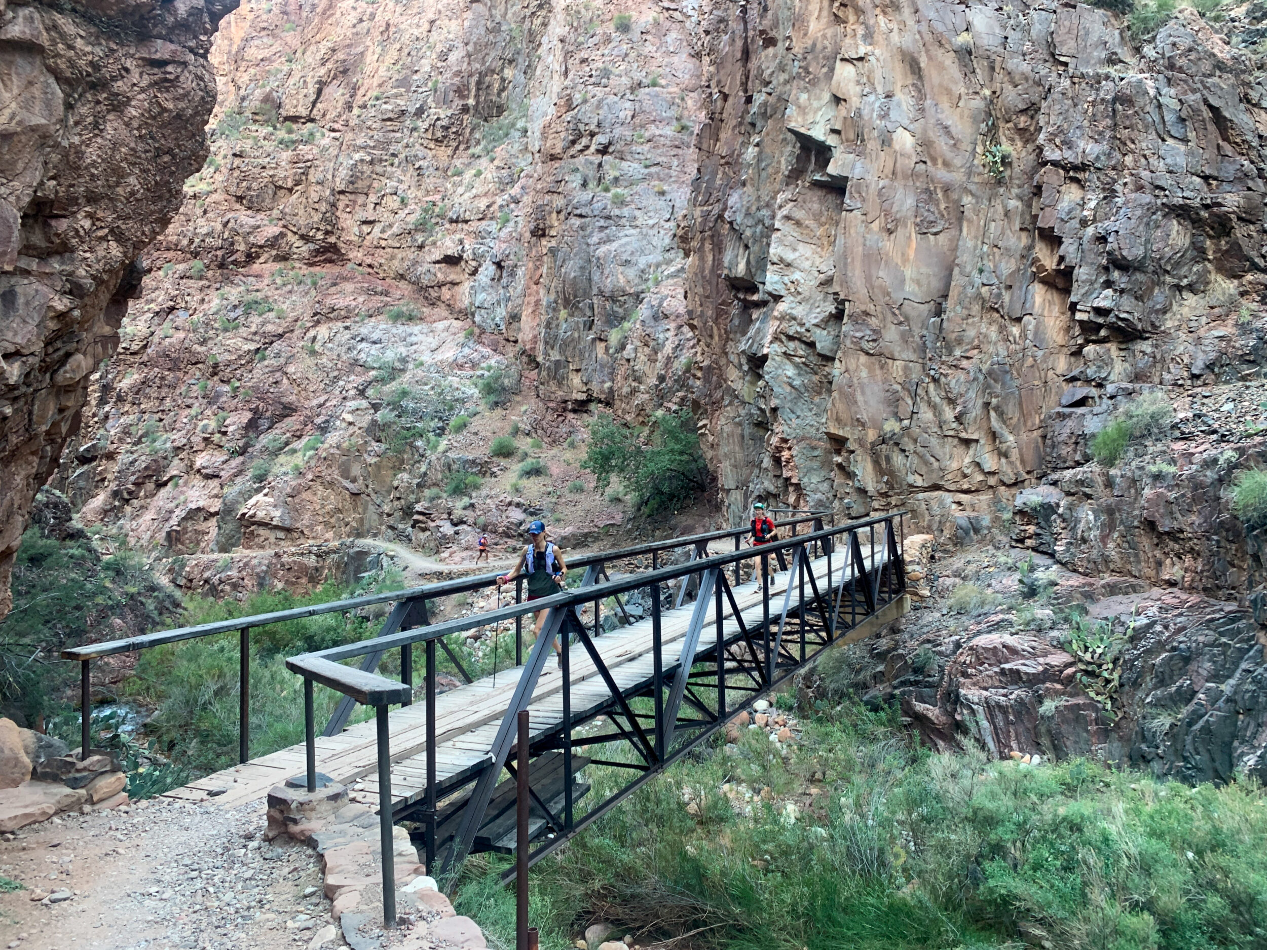
He offers to take another photo of our group in front of the tunnel. As we do, we spot a group of mule-riders on the other side of the river. They’re coming down towards the bridge and we want to make it across before they get there, or we’ll have to wait for them all to cross. So we start running through the tunnel and over the bridge, and we make it across just on time but have to tuck into a trail pocket right off the bridge, so we can be out of their way.
Mule riding looks pretty smooth and relaxed, but I honestly don’t know how comfortable I would feel perched on top of a swaying/bobbing quadruped, as it goes up a narrow rocky trail, with a 1000m drop on one side. I think I’ll take my chances at a long day on foot instead. (At some point we debated which would be faster, going up the trail on foot or on mule. But we didn’t get a chance to race them, so jury’s still out…)
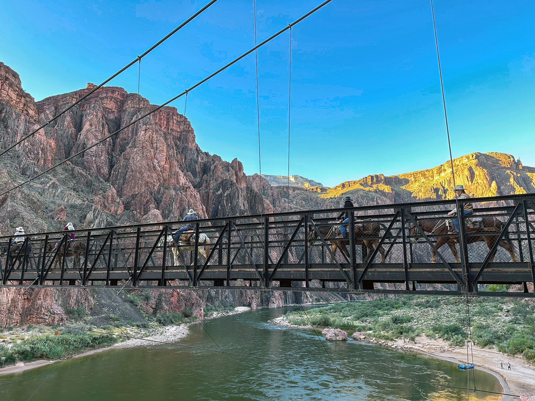
As we cross the Colorado, we see the light glowing around the river bend. A raft floats down under the bridge. Could this get any more picturesque. I think not.
On the other side of the river, we join with North Kaibab trail, which we will follow for roughly 21km up to the top of the North Rim, and 21km back
8:13am – We are at Phantom Ranch. This is a pretty awesome spot. It’s the only commercial building in the canyon. You can buy snacks and even small lunch boxes, but it’s also famous for it’s lemonade. By all accounts, you HAVE to have the lemonade. The shop is still closed when we get to it in the morning, and although it will be open when we come back later that night, coffee will seem more appealing to us at that point. I guess we will have a reason to come back.
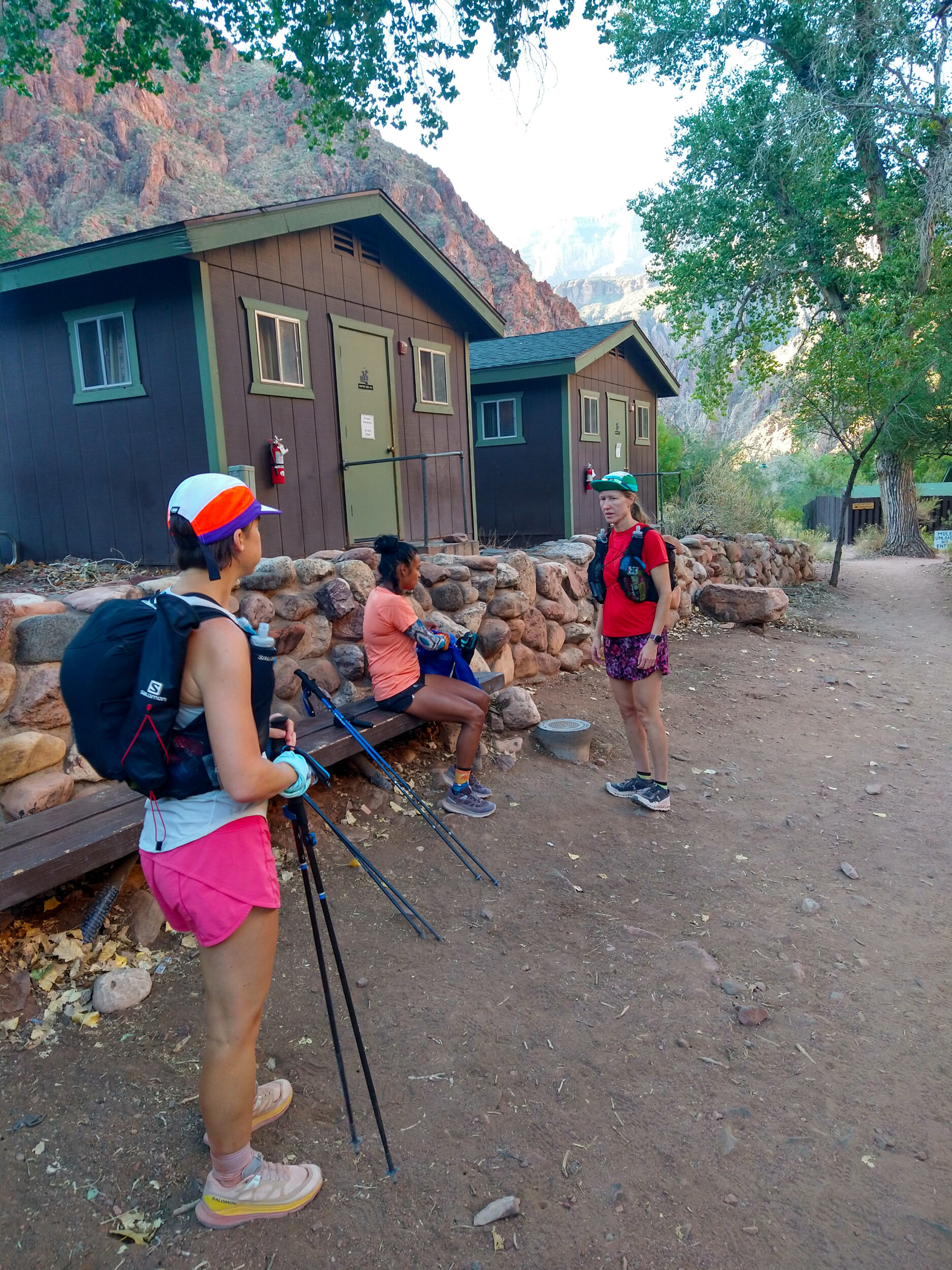
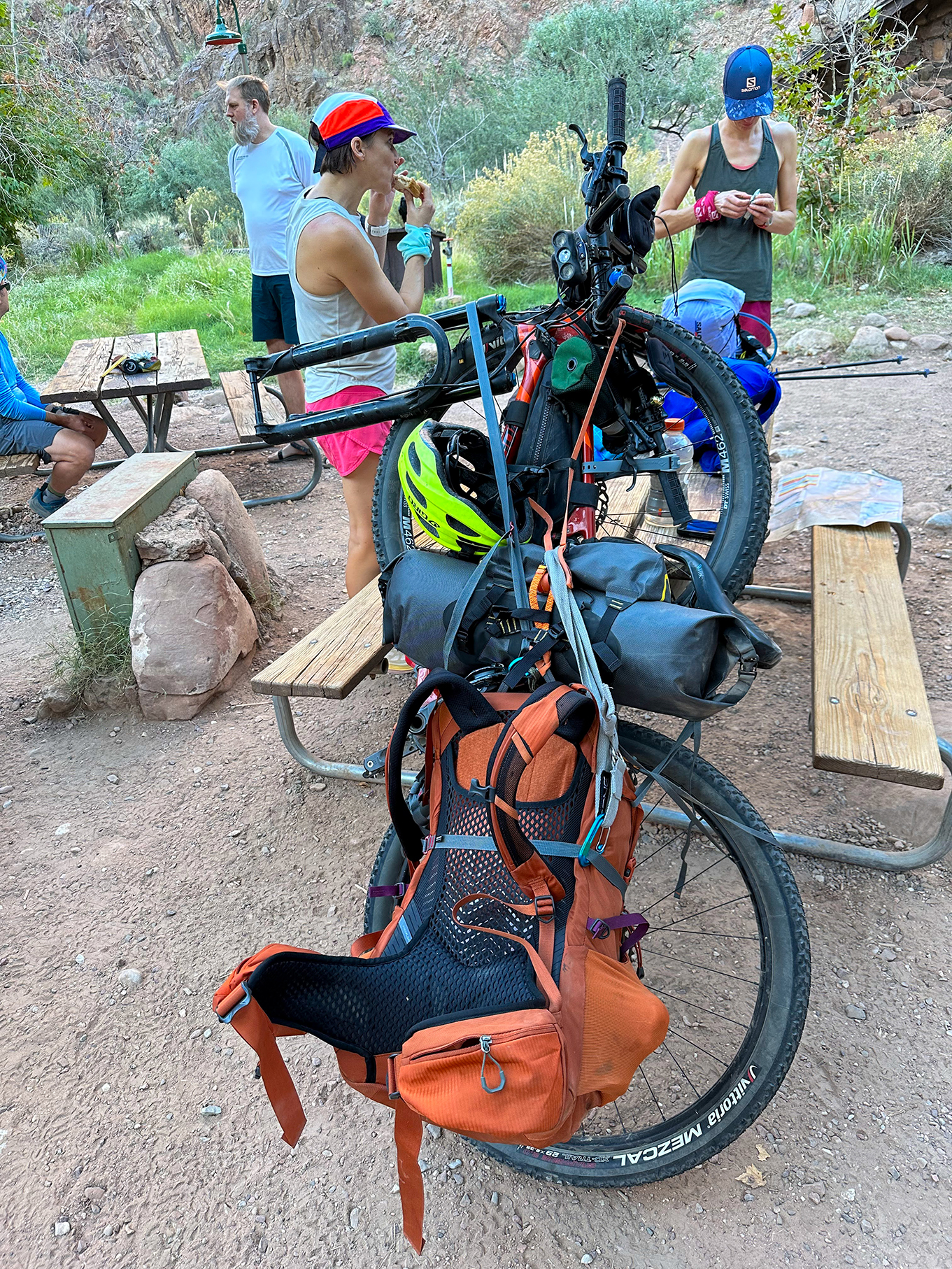
The ranch is surrounded by a campground, as well as a few cabins. It’s a popular destination as a turn around point, or as an overnight. You can actually book a full steak dinner at the Ranch for your night out in the canyon… There are a few people around. We chat in particular with one guy. We’re curious about the bicycle-looking contraption that is attached to his backpack. It is indeed a bike. He says he’s biking the Arizona trail. It goes across AZ from Utah to Texas, and crosses the Grand Canyon. Only one small caveat. You’re not allowed to bike in the Grand Canyon. Hence why he’s carrying his 70-pound bike on his back. For 36km. Way to make our day’s effort seem like a jog in the park. No matter how hard you go, there’s always someone going harder.
We take a bit of time to reset at the Ranch, filling up our flasks at the tap. We’re lucky that the water points along the trail have not been closed yet. The Grand Canyon National Park website mentions that they can be closed at any point between mid and late October, but it’s been warm enough that there haven’t been any freeze concerns. There are several campground along North Kaibab, as well as Bright Angel, so we’re able to plan on re-filling frequently along the way. Since we didn’t have any guarantee before-hand, we’re still all traveling with filters, so we could get water from the creek if needed.
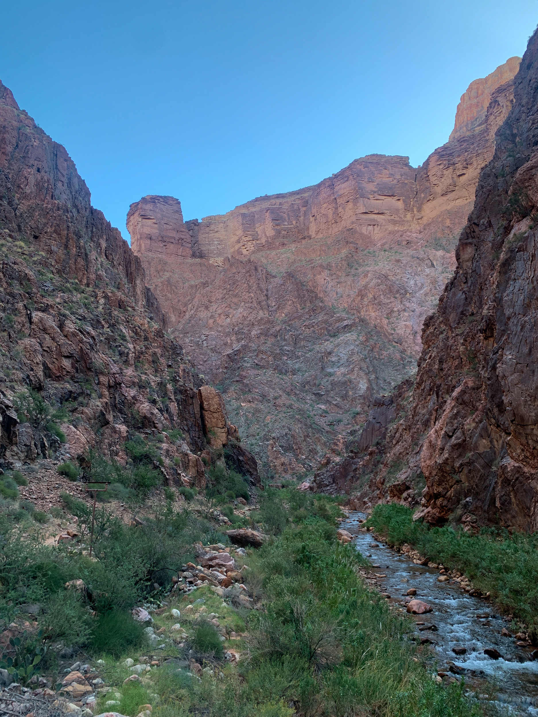
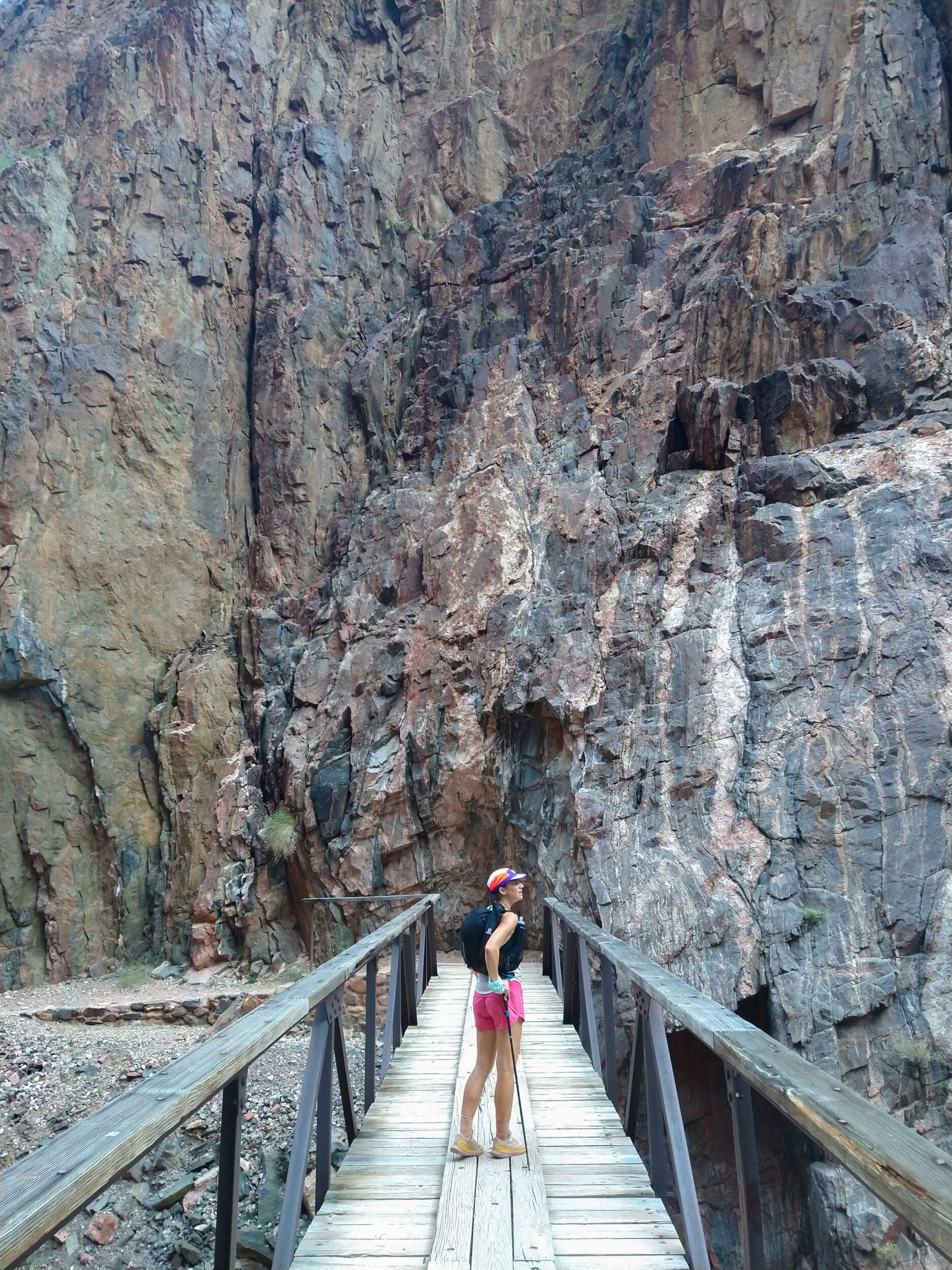
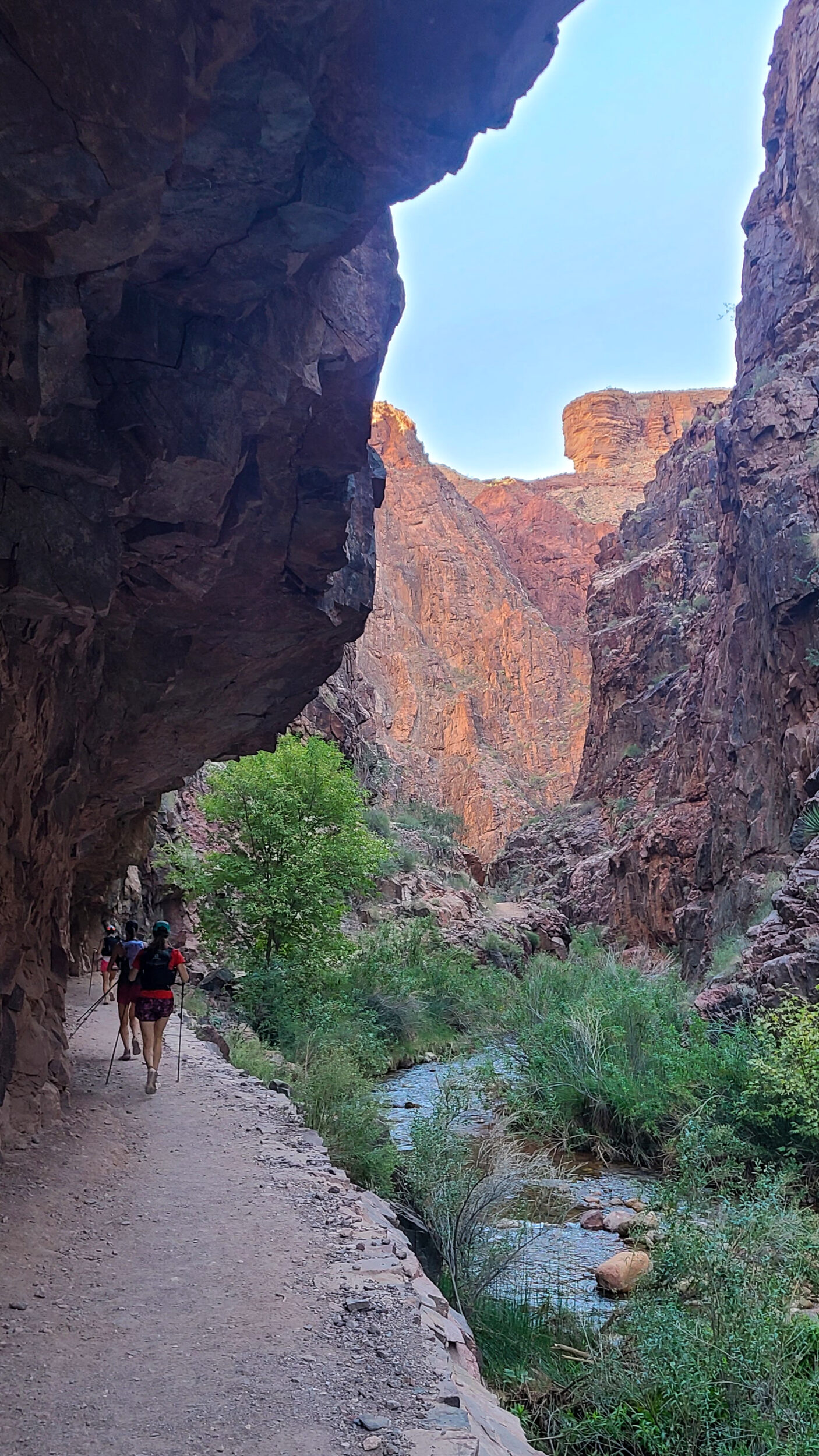
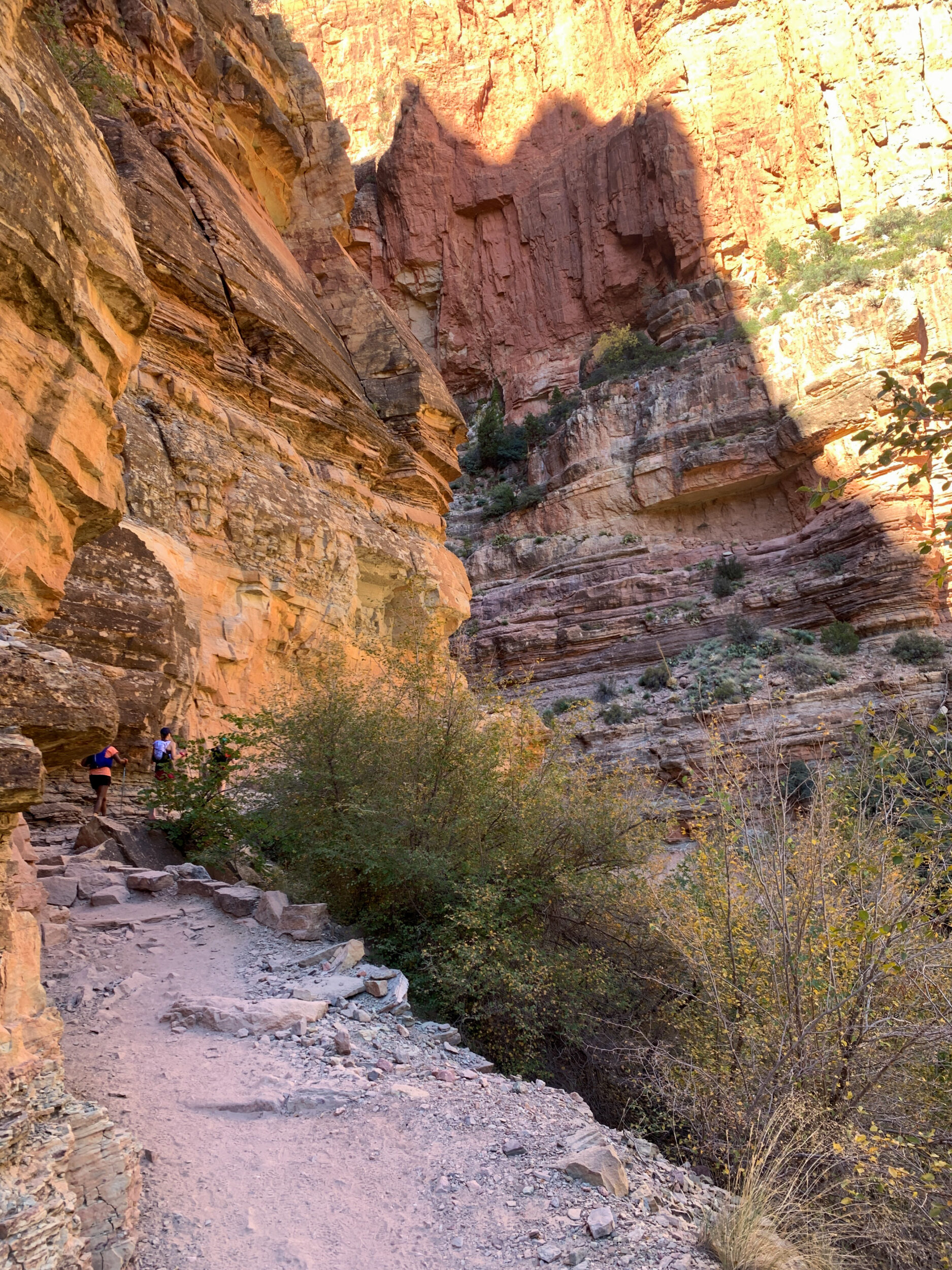
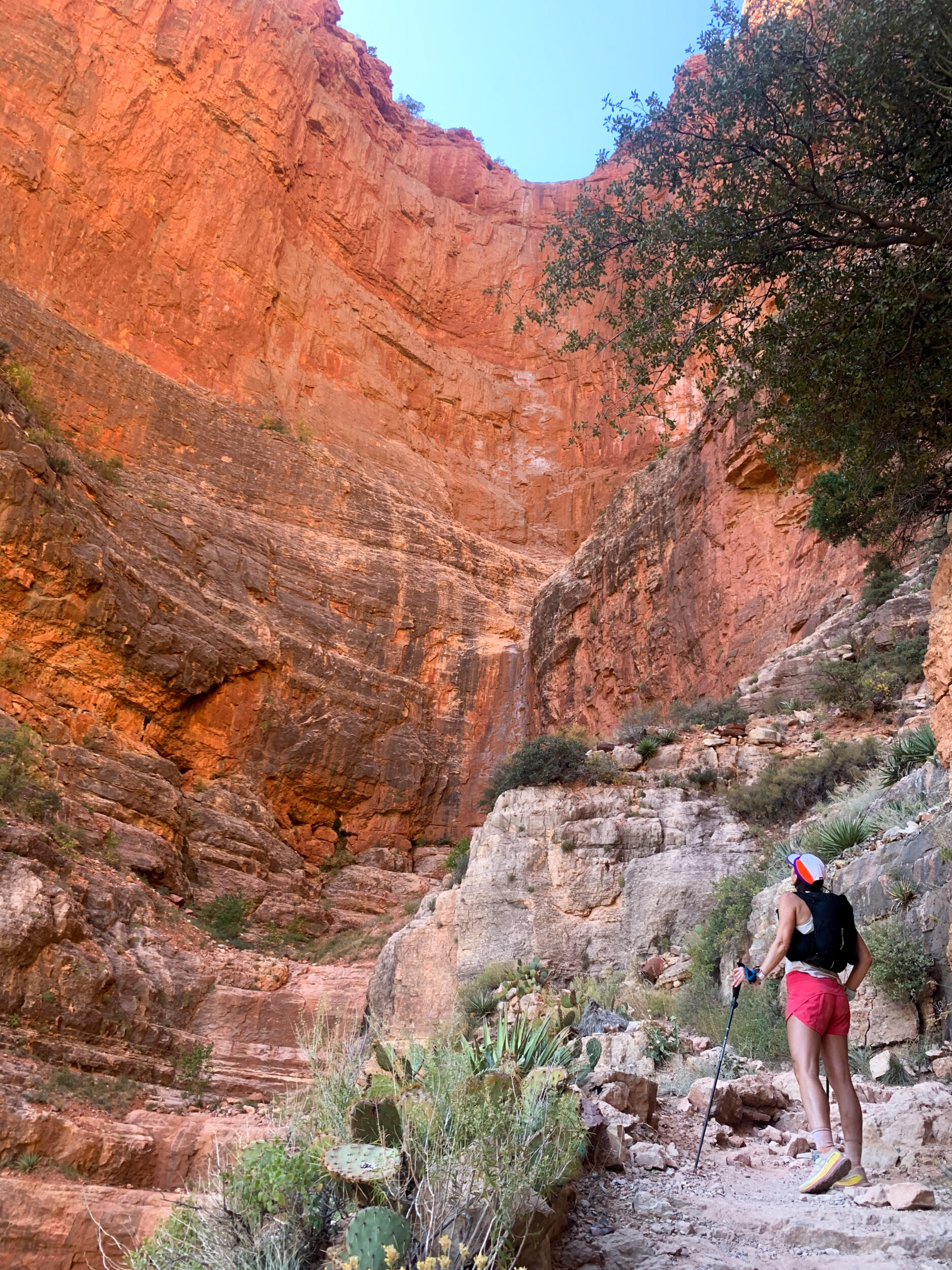
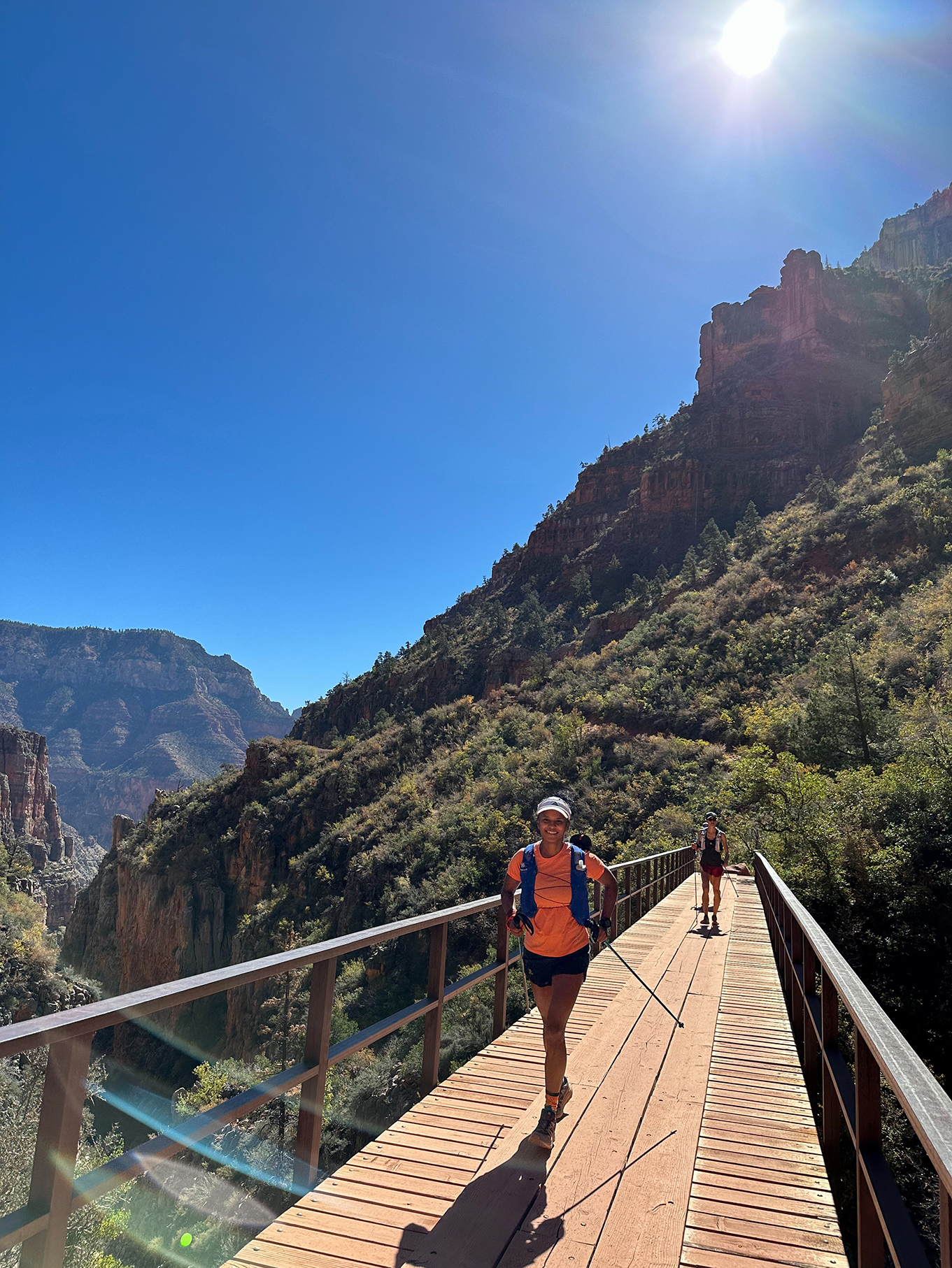
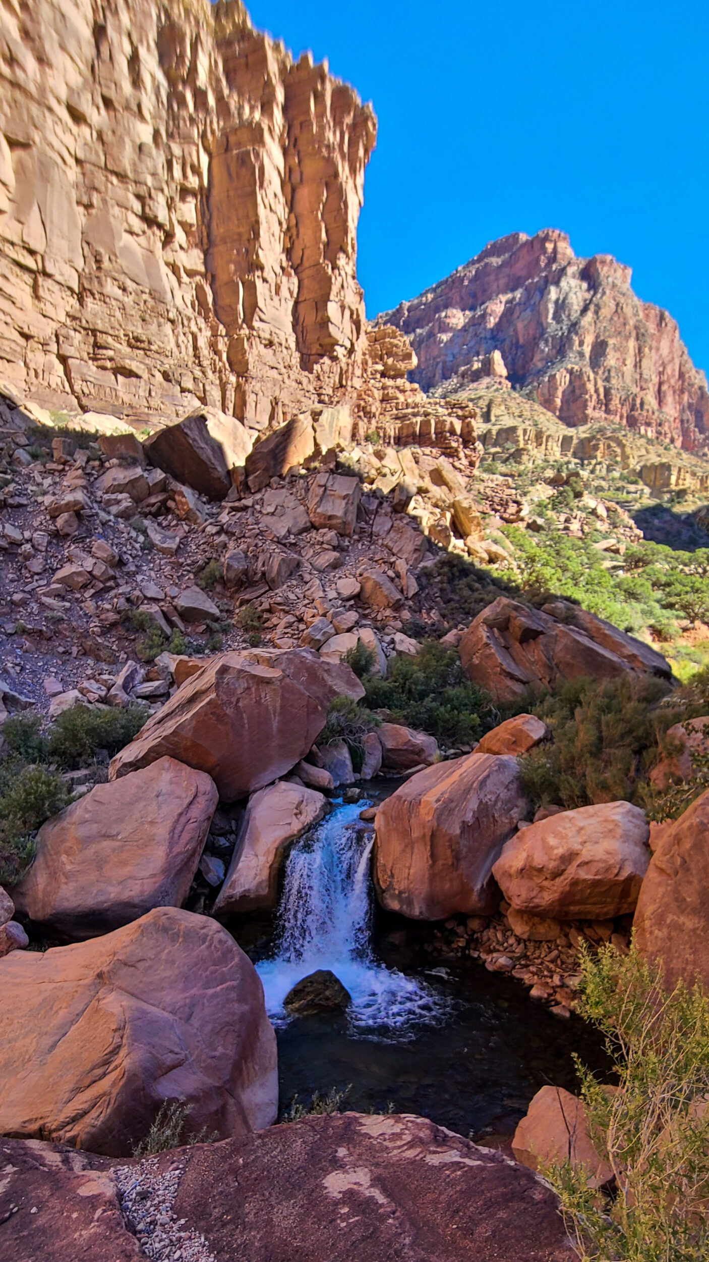
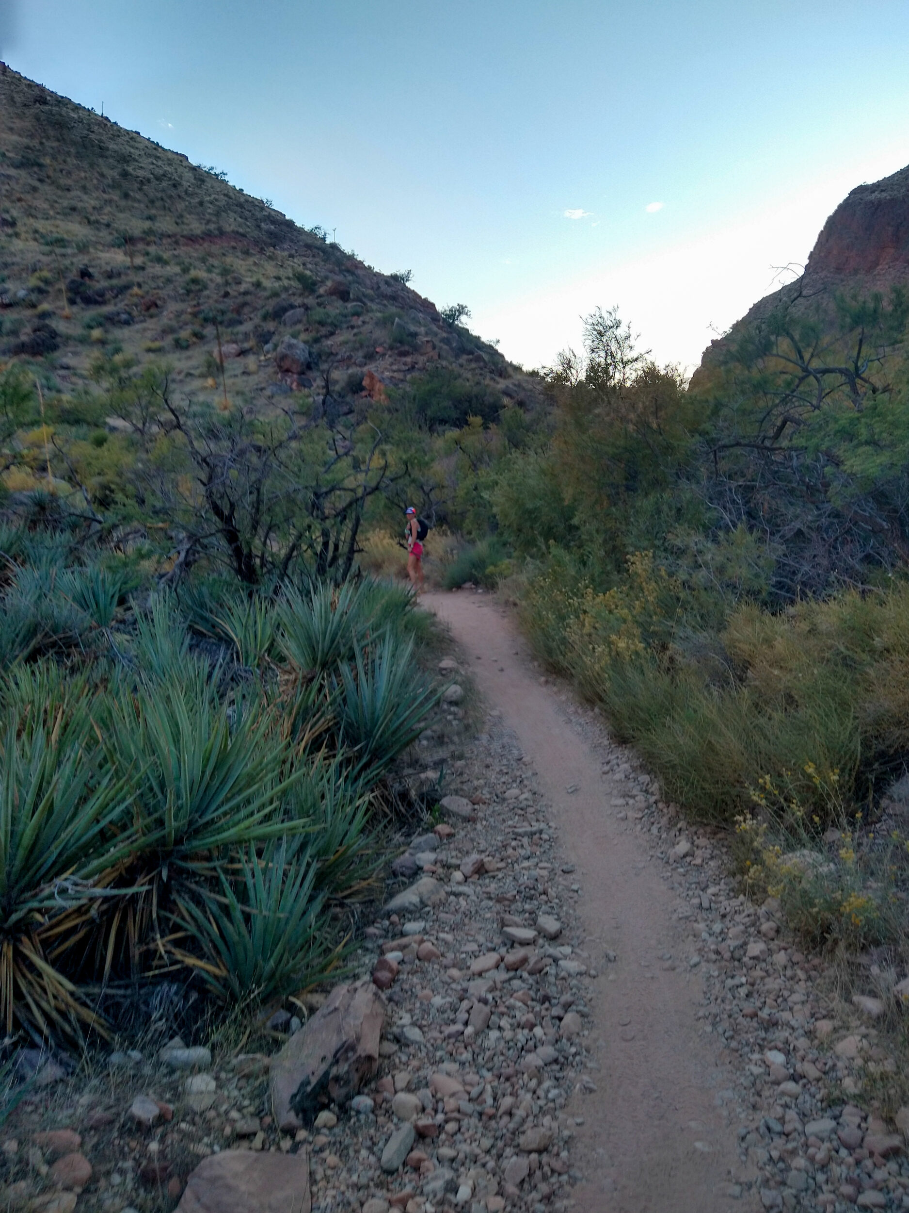
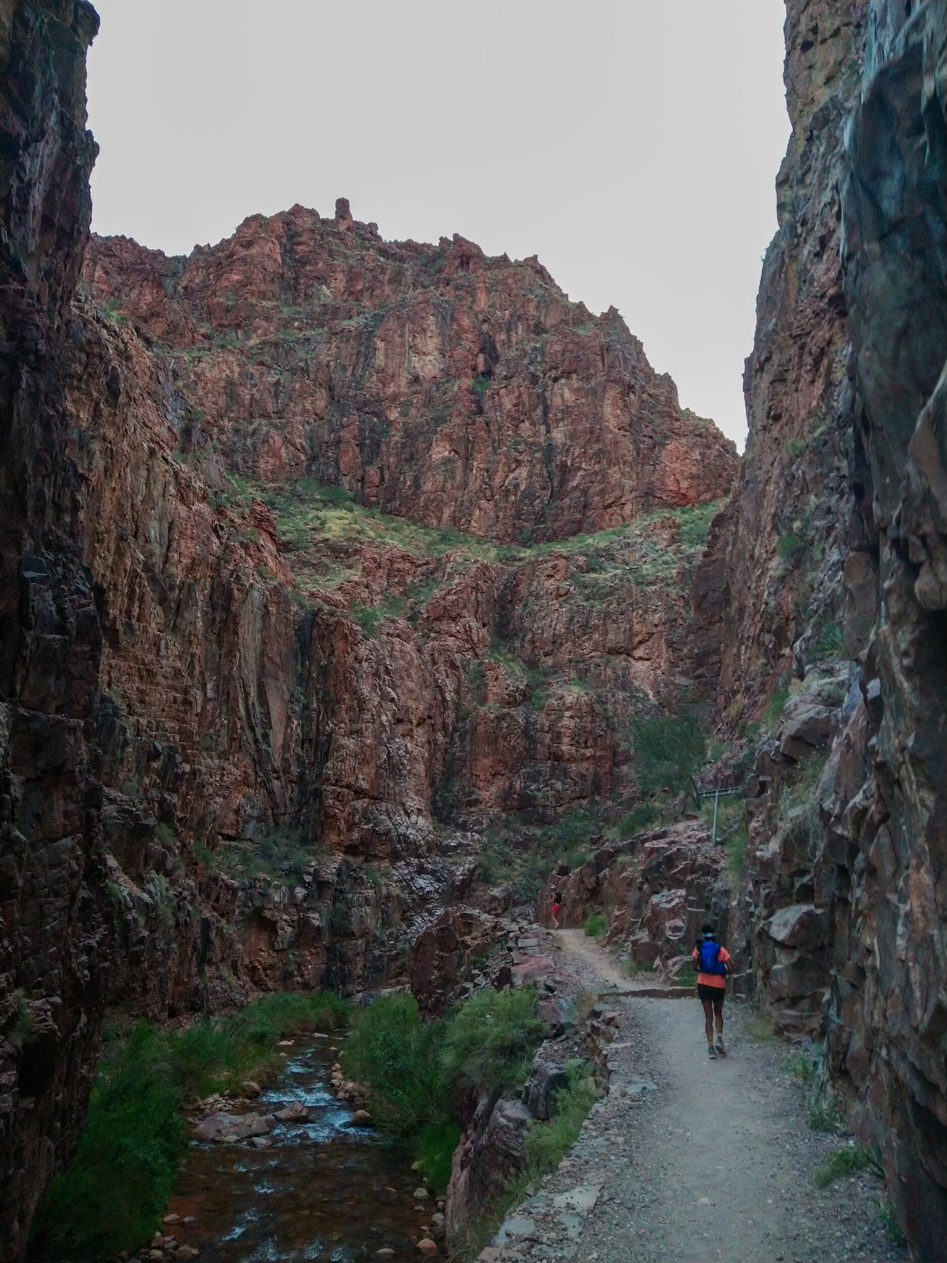
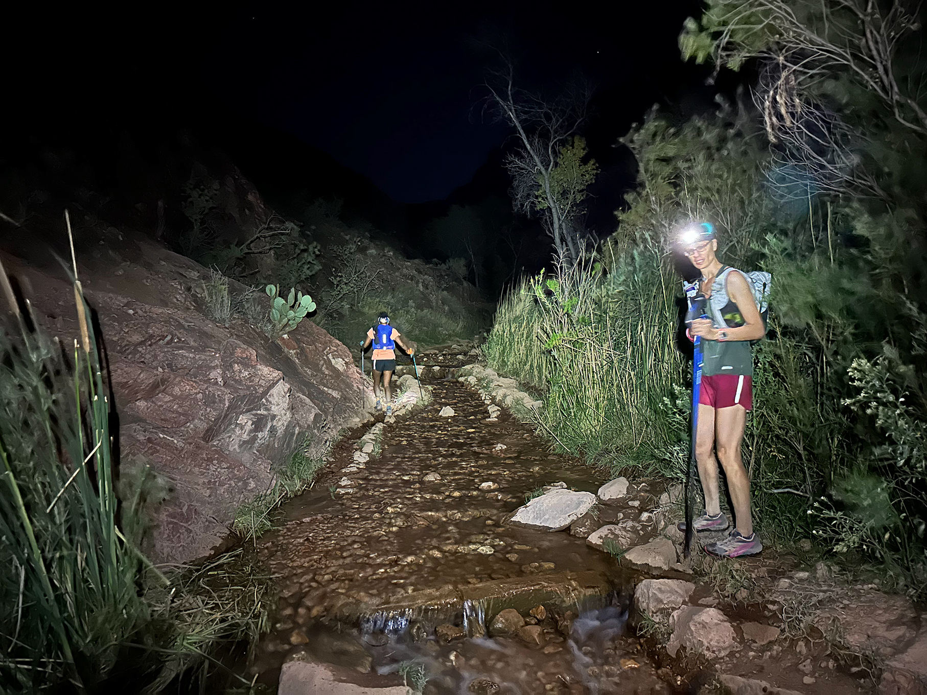
8:29am – We’re now in “the box”, as the bottom portion of the trail is called. It’s quite a contrast from coming down South Kaibab, which has wide open views to the horizon. North Kaibab trail snakes through one of those cracks that we saw from above. We’re now flanked by high rock walls. A creek runs through it, and the abundance of water creates a true oasis of green, after all the rocks and dust of the descent trail.
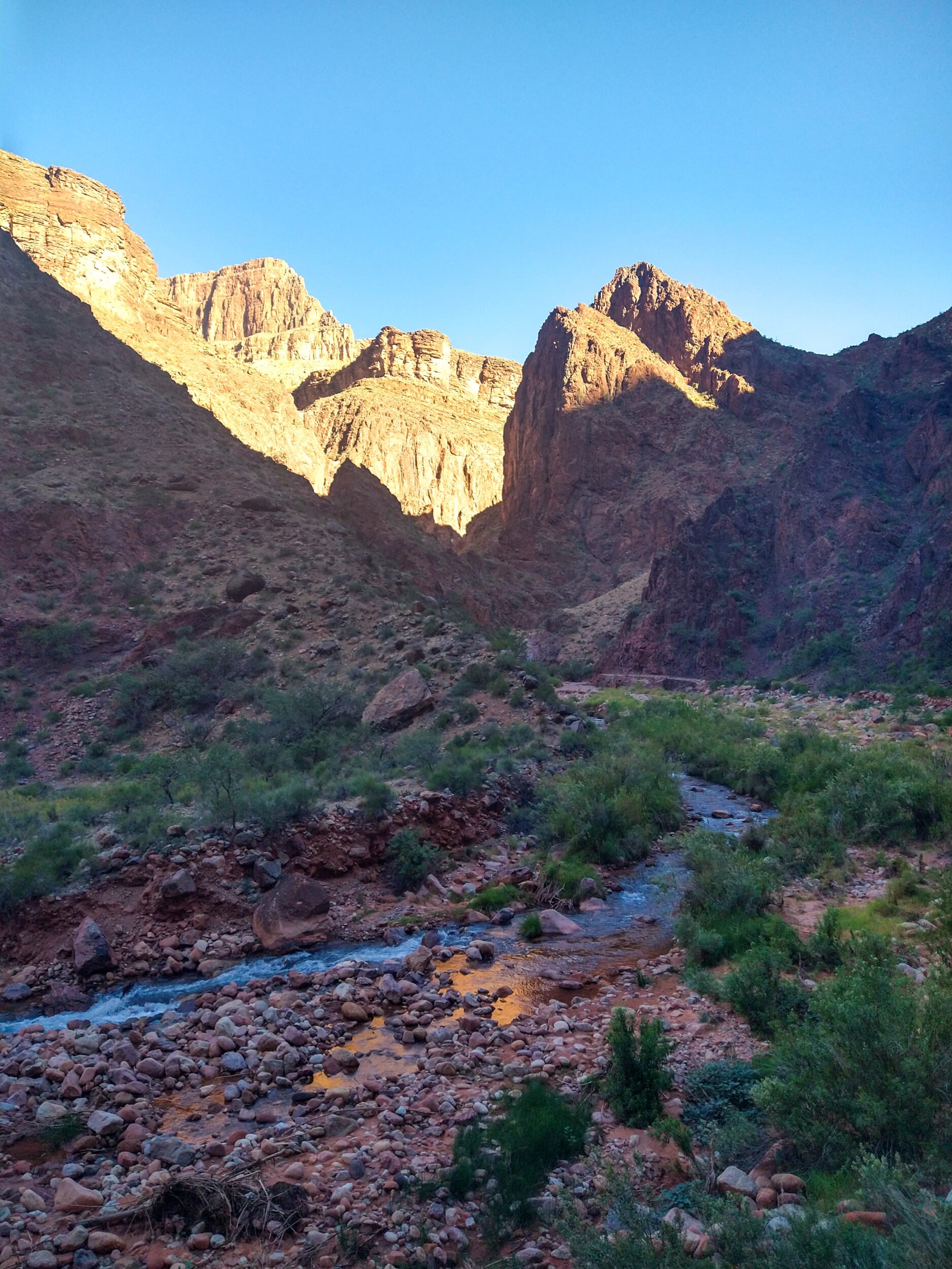
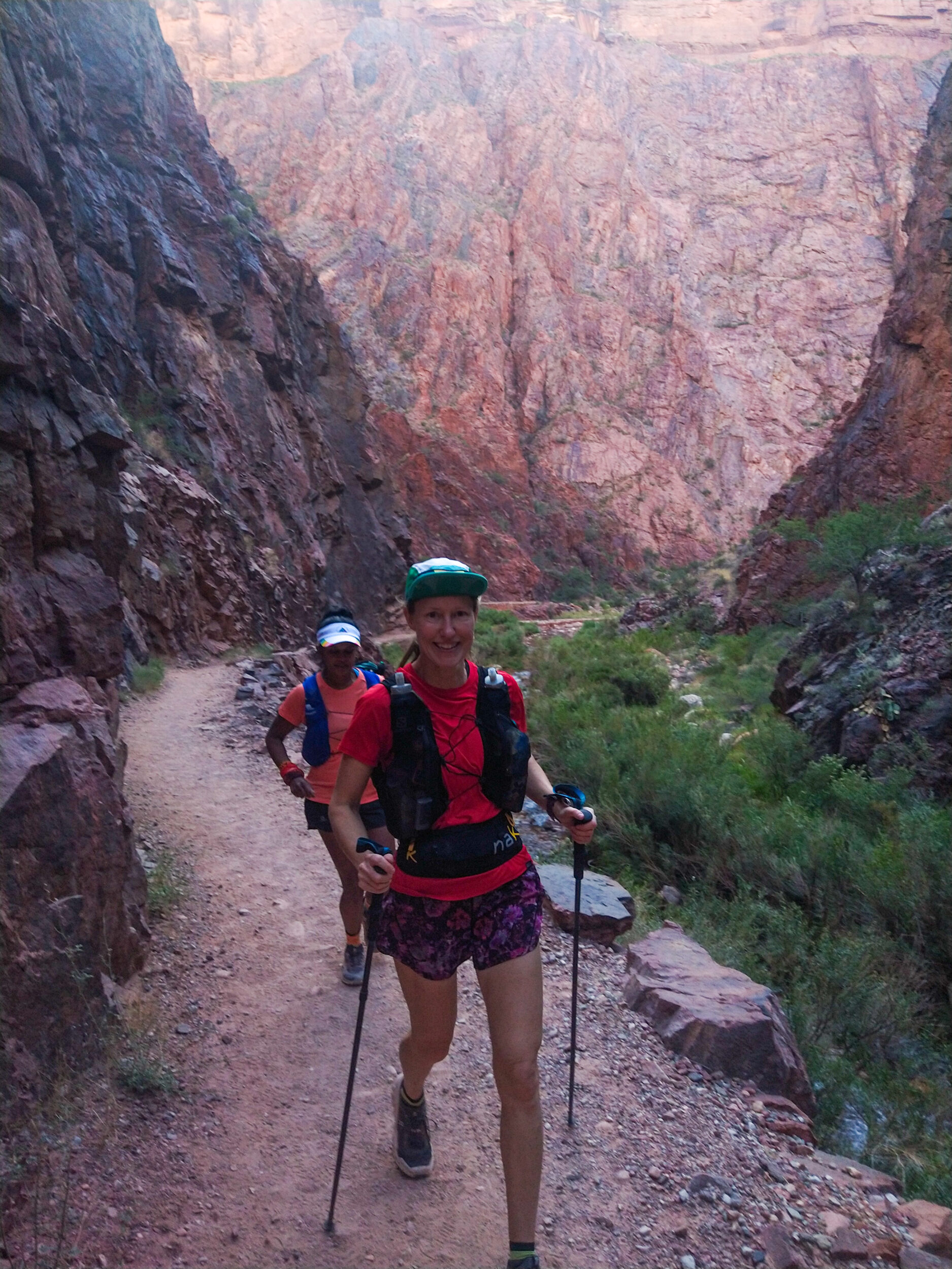
We continue to “hug the wall”, not so much to avoid a drop, there’s just the creek off to the side, but more so because the trail is still pretty narrow, sometimes it even seems carved into the rock wall, as we shuffle below some impressive overhangs.
This whole section is fairly flat and run-able, and we make good progress on our distance. We go back and forth between either side of the creek, via wood and metal bridges.
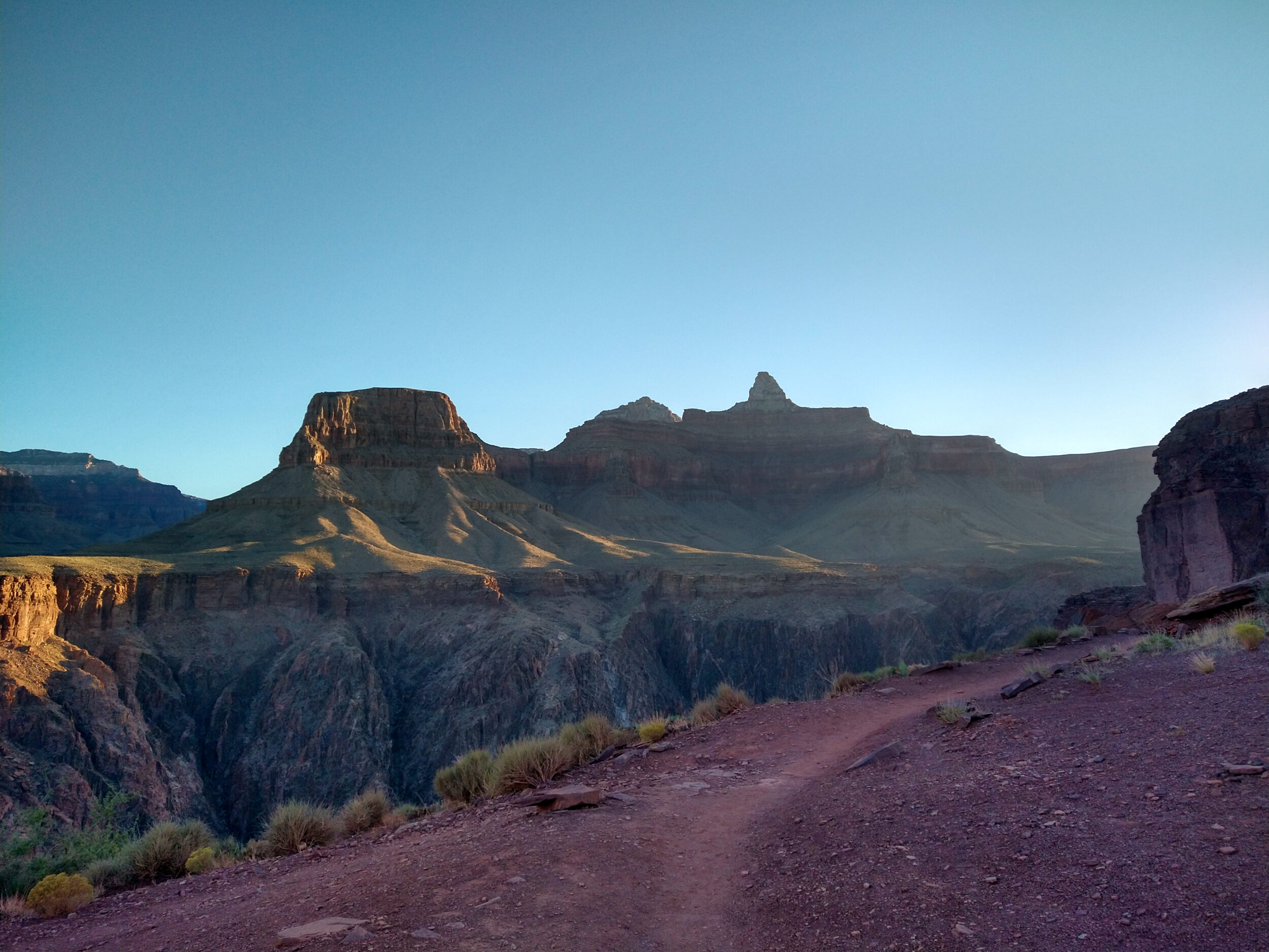
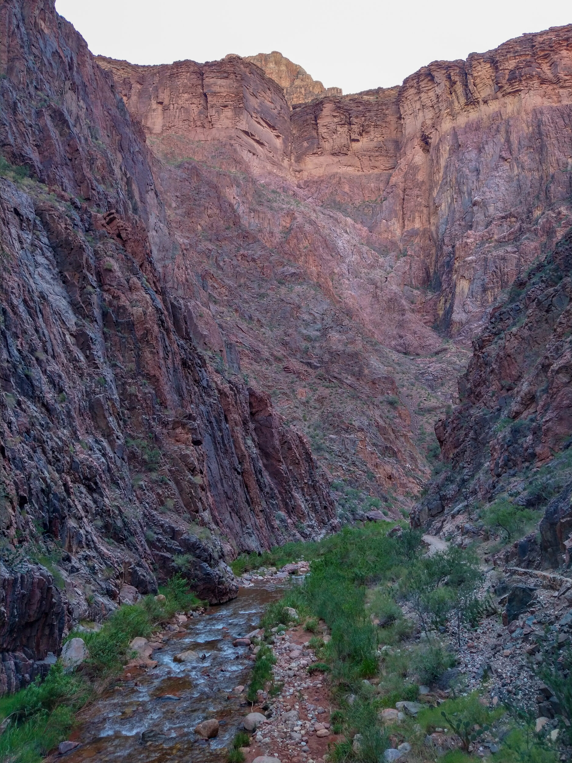
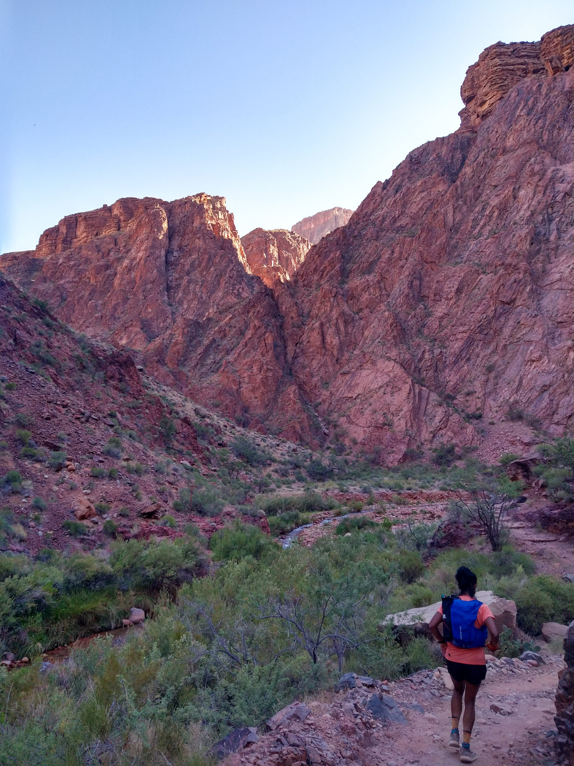
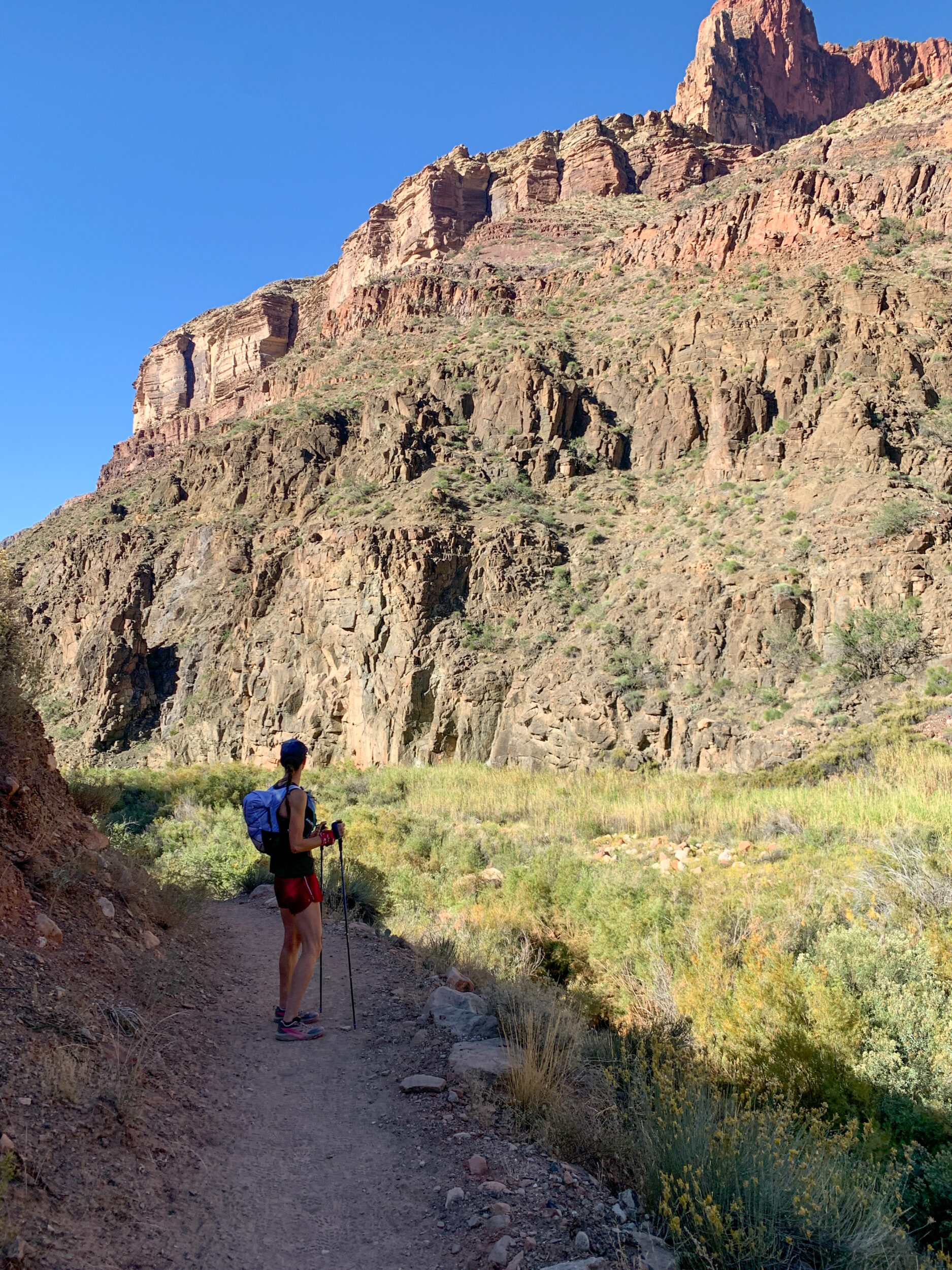
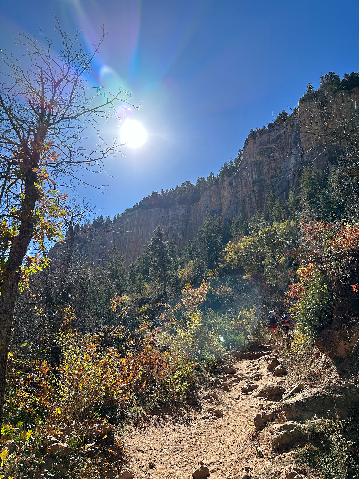
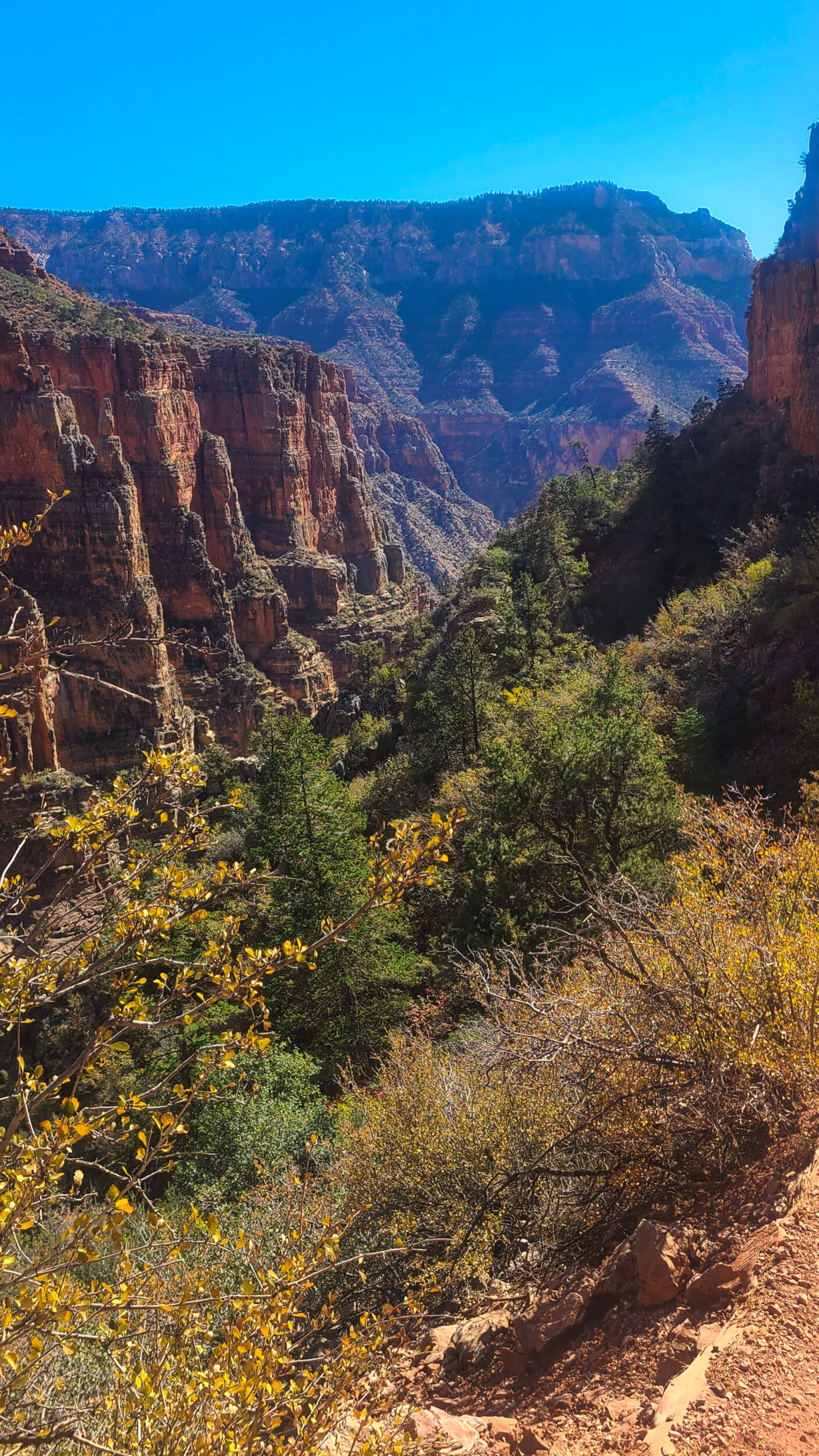
9:46am – the scenery opens up and the canyon walls start spreading out. The sun is starting to hit the walls on the opposite side. We’re preparing ourselves for the heat, the bottom of the canyon is where it gets the hottest. But we continue to be in the shade for a good while, as the trail starts to very gradually go up – not a climb per say, more a gentle incline, elevating us slowly from the creek bed.
A man and a woman come up from behind and pass us. I do a double-take and as they get away from us in a swift shuffle, I turn to Dea and say “I think I know this guy”. Well I don’t know him-know him, but I think I recognize him. No more than a week ago I came across a short documentary called “The seven summits of of my neighbourhood”. In it, Brendan Leonard recounts how he set out to summit seven of the mountains around his house – none of them extremely challenging, but all of them closer and more affordable than going on the classic “7 summit” objective of climbing the highest mountain of each continent. A somewhat arbitrary goal, with an embraced Beau Miles-esque approach to backyard adventures, for no other purpose than …creating his own fun.

I very much enjoyed his film, and may or may not have gone down a rabbit hole of reading his articles and illustrations for Outside Magazine. I might even be following him on Strava, because he mentioned he started writing short poems as descriptions for his runs, which I think is cool – It’s a nice break up in my feed amongst all the local runs titled “another wet one! 🏃🏻♀️🌧️ ”.
So this couple who just casually past us on the North Kaibab trail, I’m pretty sure that was Brendan Leonard and his wife Hilary. What a random coincidence. I’ll have to check his Strava.
10:40am – We’ve traveled about 11k since Phantom Ranch and arrive at Cottonwood campground. Time for another round of water re-fill, fuel intake, bathroom break. All the campgrounds have outhouses, and I have to say, they’re all very clean and perfectly pleasant to use, if not for the fact that they’re all up a set of stairs (but we don’t mind the extra elevation, do we?)
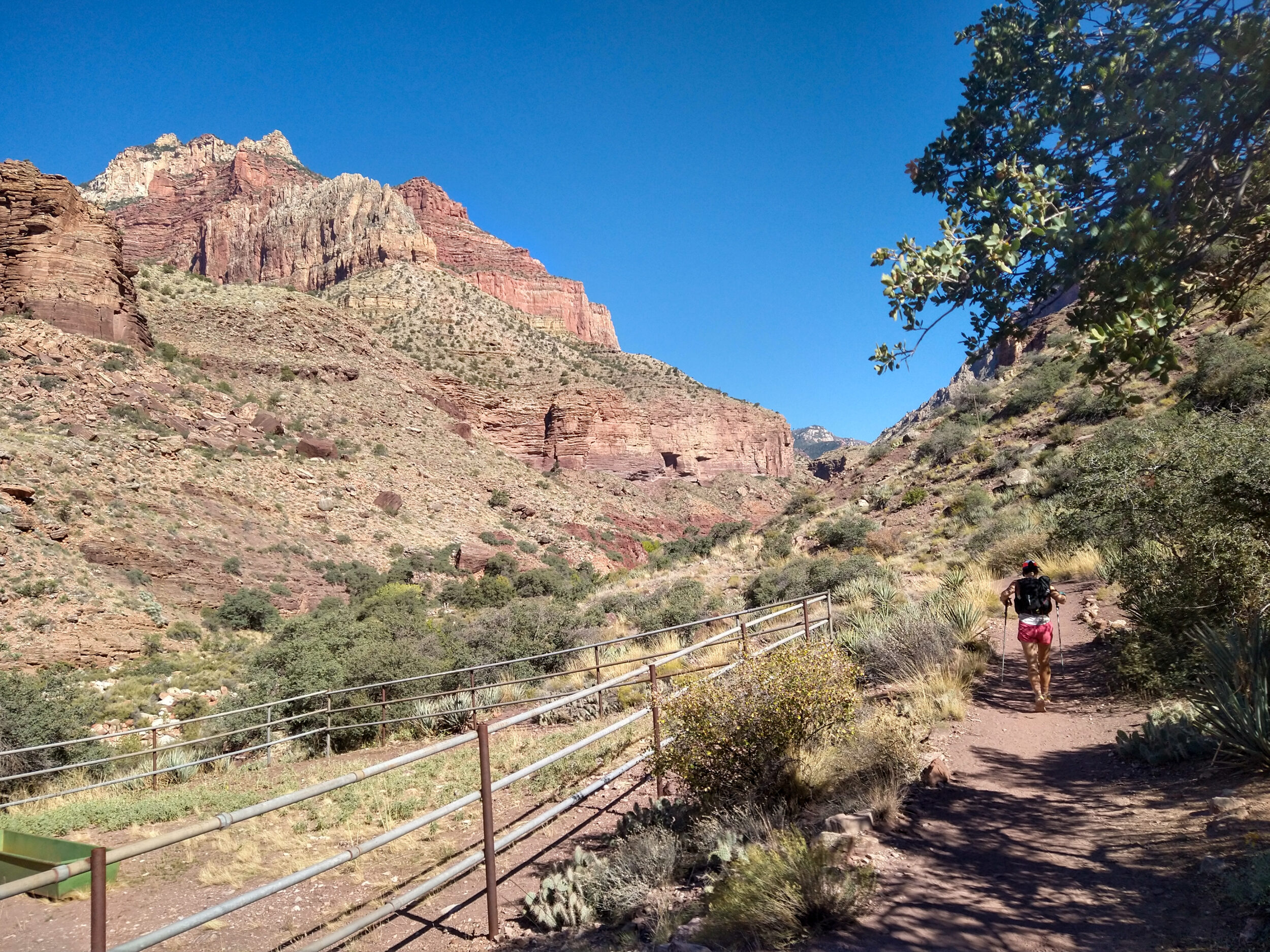
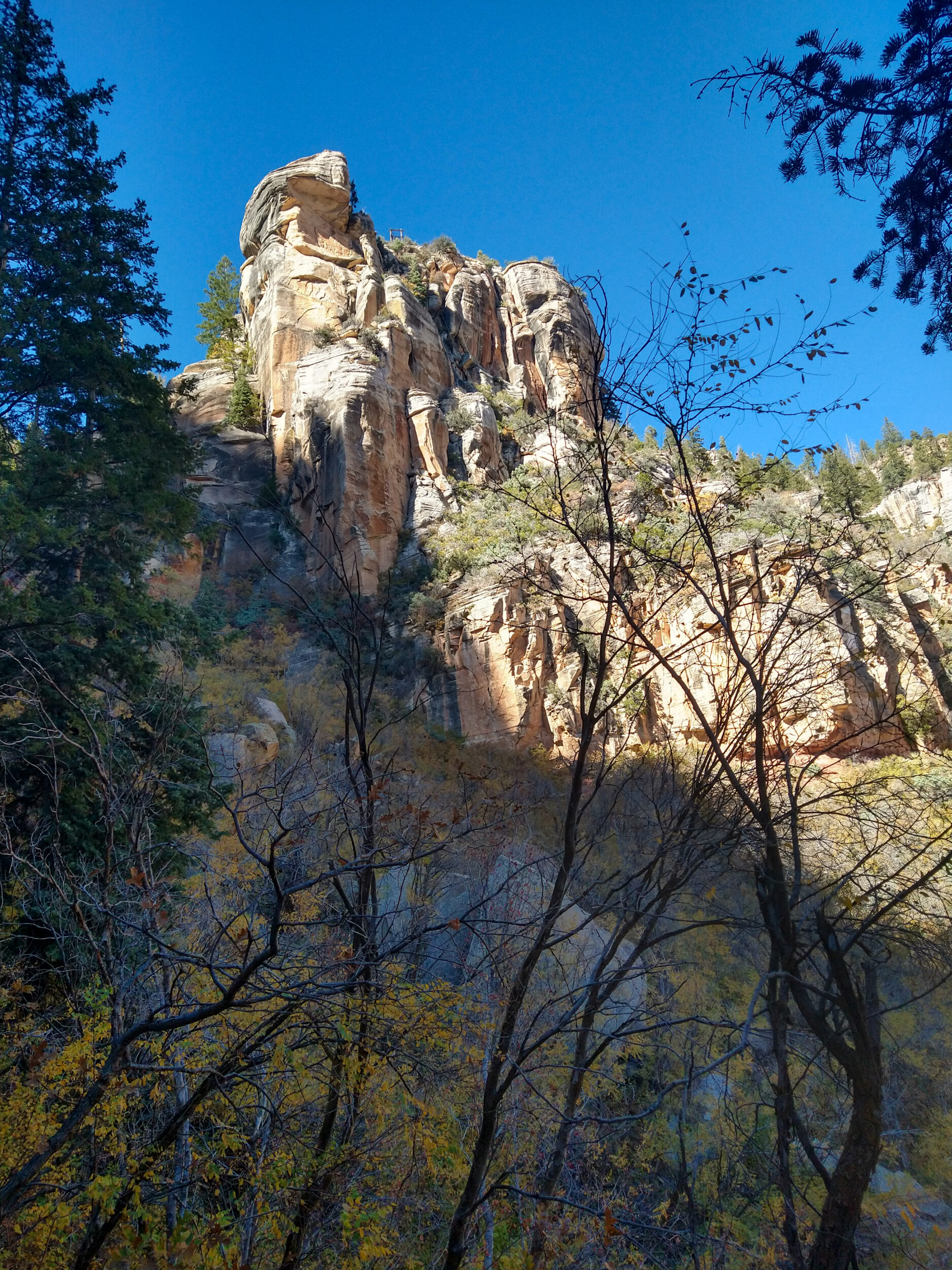
After Cottonwood, Manzanita Campsite is only a couple of kilometres away, so we reach it pretty quickly, and then we start the climb towards the top of the North Rim.
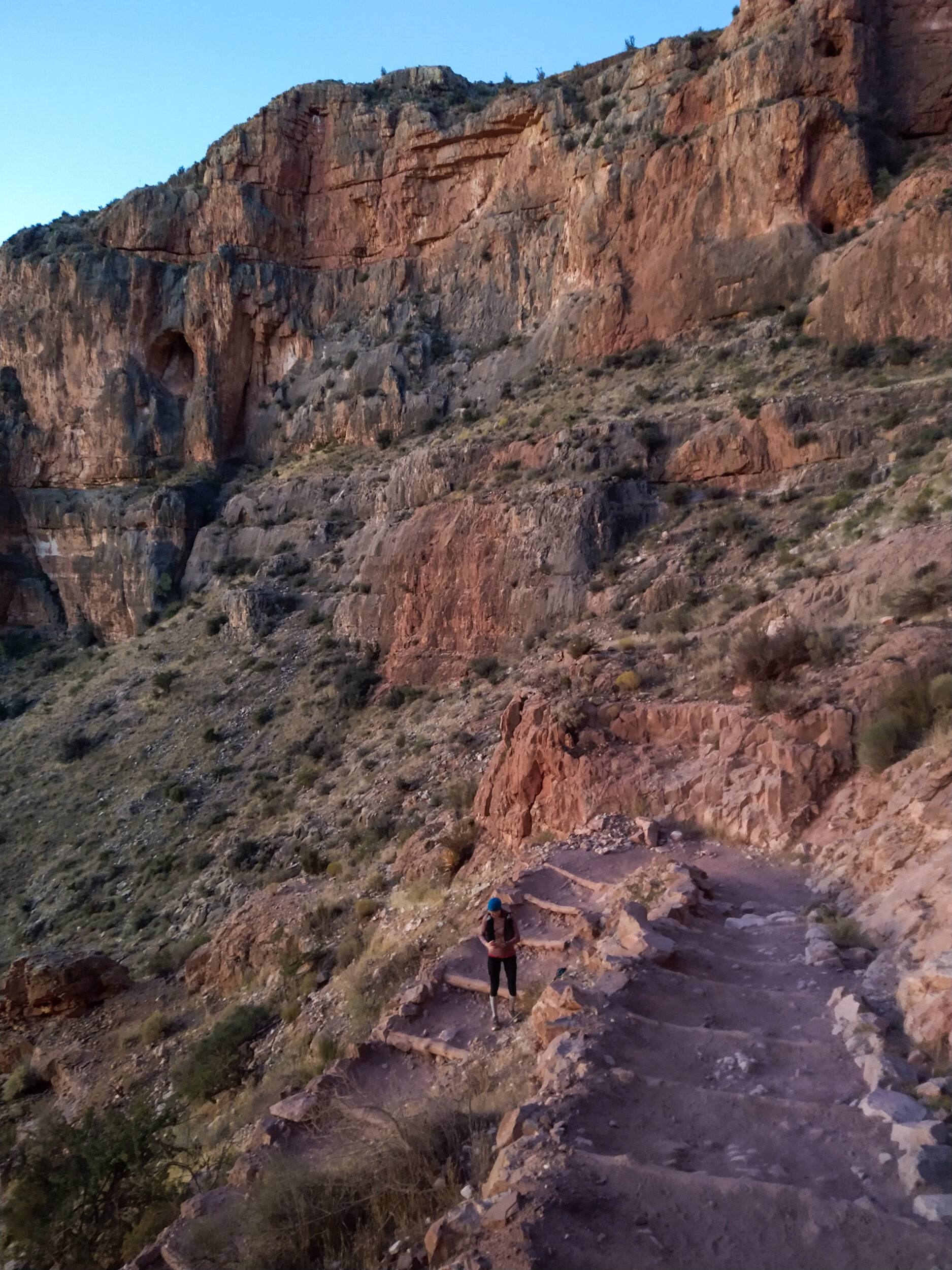
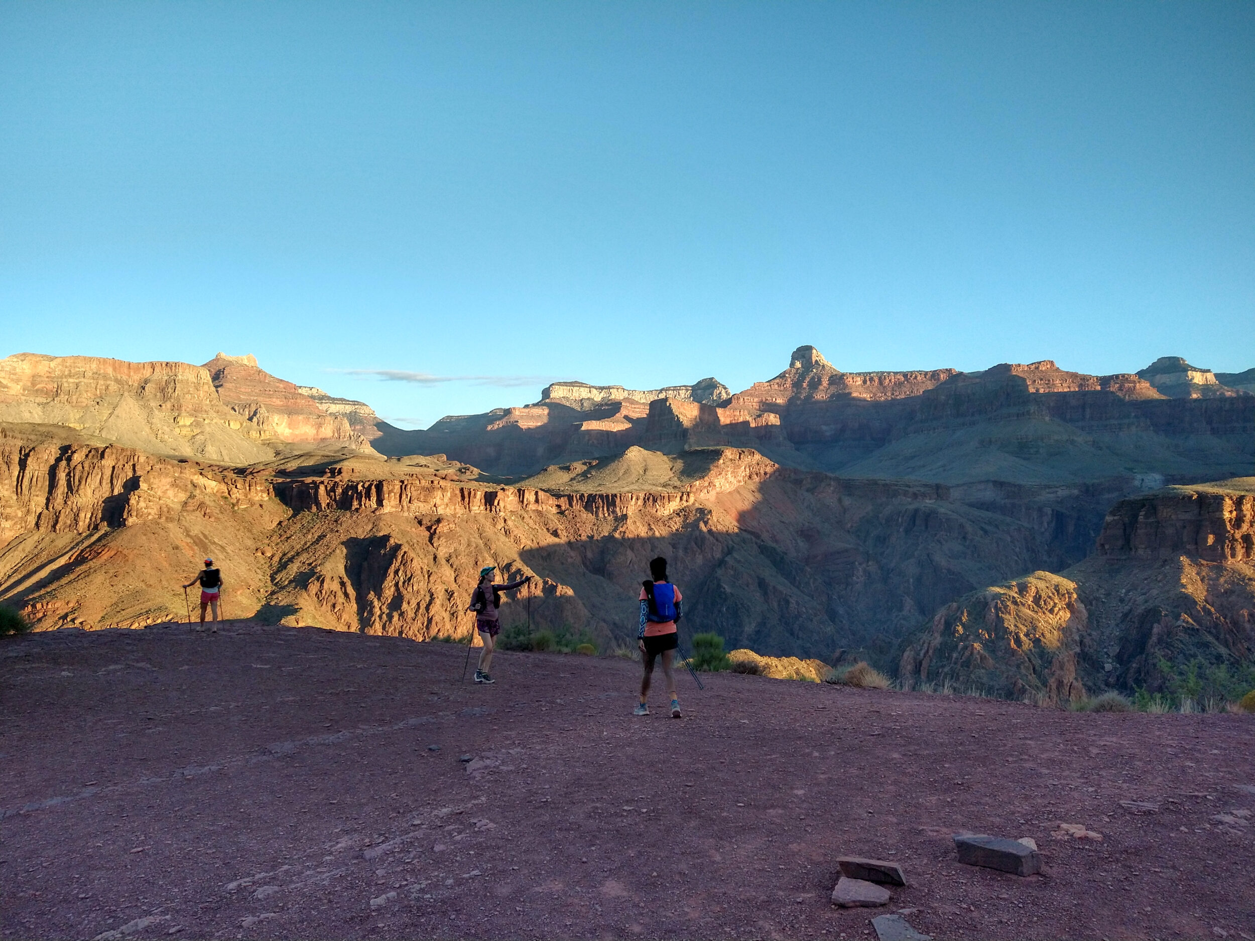
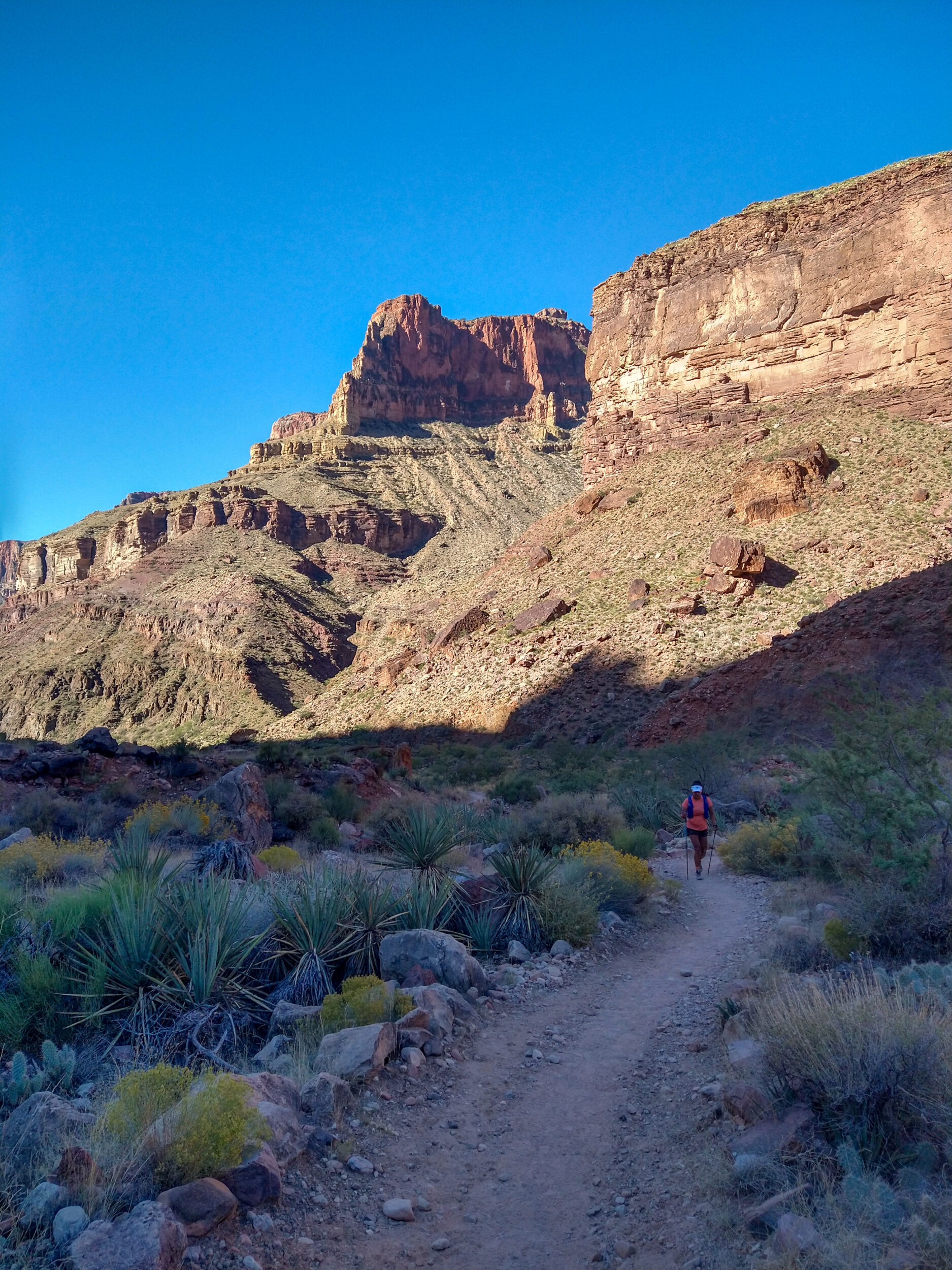
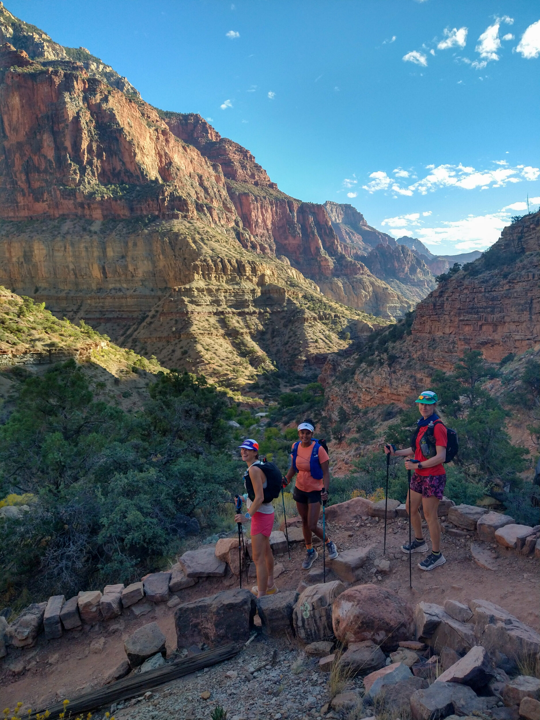
11:53am – The beginning of the climb is very enjoyable. We’re all excited to be on the way up to our turn-around point. We take photos as we come to various scenic spots along the way. This side of the canyon is relatively closed-off compared to the south rim, but looking back the views are still quite spectacular.
12:52pm – Still climbing. We get to another small tunnel carved in the rock, Supai Tunnel. On the other side is another water station. I forget exactly when it hit, but I start to bonk big time. I feel that jet lag sensation returning and my legs becoming heavy and all my energy seems to drain into the ground. I start to worry about whether this is the lack of sleep catching up with me, or maybe the heat starting to have an impact, as the sun has finally caught up with us on this latest section of the climb. Or maybe it’s the elevation (the North Rim is higher than the South, at 2500m above sea level – South Rim is at 2000).
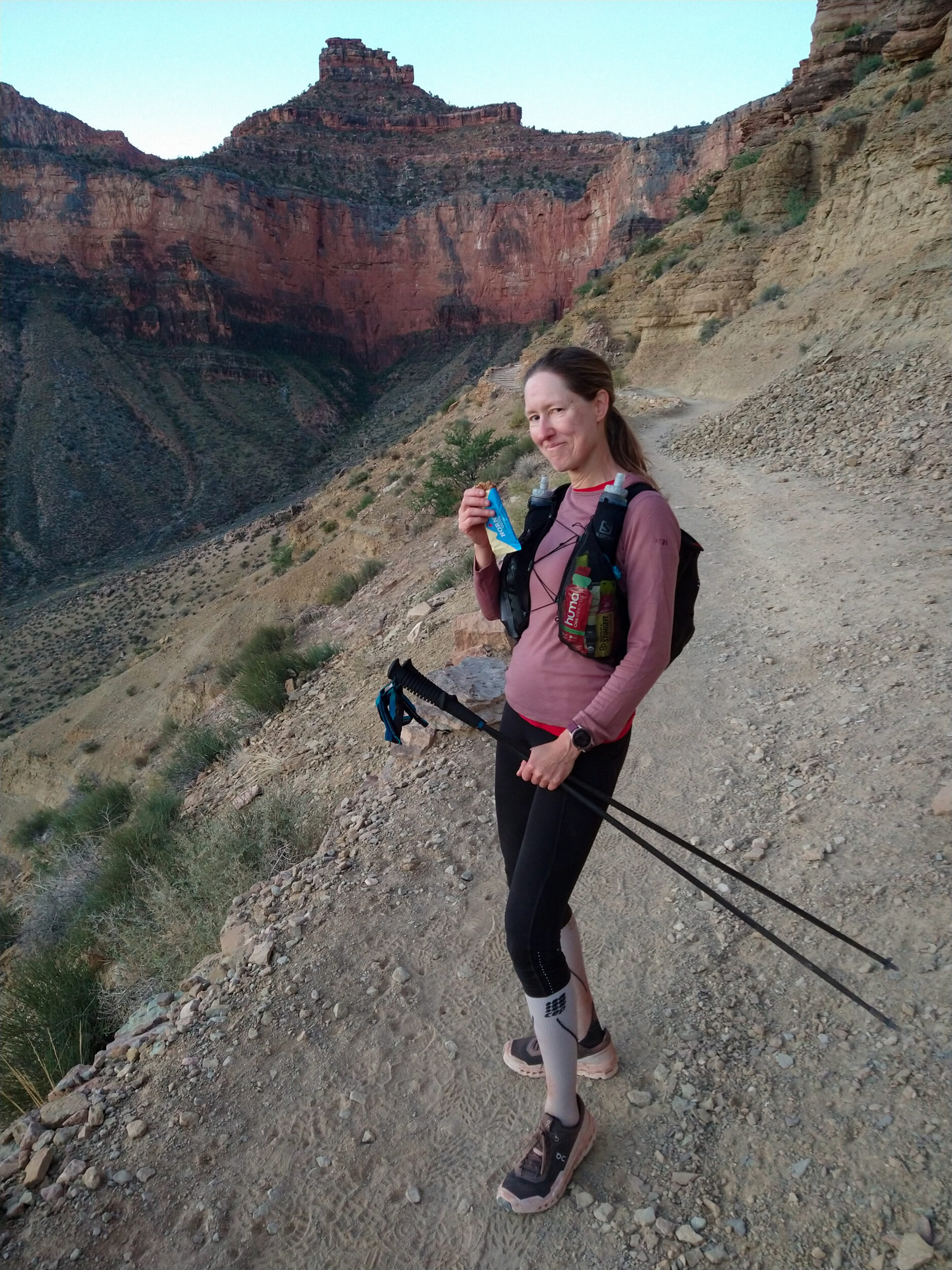
Either way, I’m struggling to keep up. We get to a bend in the trail and there’s some shade underneath a small tree, so I sit down and start assessing what to do. Dasha offers me some Tailwind powder with caffeine in it, which I gratefully take. In doing so I also chug the last quarter of Naak powder in my flask. In retrospect, it likely wasn’t the lack of sleep, but rather that I probably got behind on my nutrition while we were lower down, being distracted by the views, the photos and the conversation and less consistent with my calorie intake.
1:37pm – The Naak and the Tailwind combined, plus some additional fruit bar or waffle finally kick in, and I feel much better by the time we get to Coconino overlook, a popular viewpoint and turn around destination for shorter hikes from the top of the North Rim. We’re only about 1km away and 150m of elevation from the top.
At one point I look up, and the couple from earlier is coming back towards us. They’ve made it to the Rim and are on their way back already. I get a boost of confidence and blurt out at him, as they come near us “hey you’re the guy who made that movie about 7 summits?” (sadly my boost of confidence doesn’t prevent me from blanking out on his name in that moment). For a second I brace for a “what? ah sorry no, not me”, but instead I get a “what? oh yeah thanks” as he glides downhill past us behind is wife. I was right. It’s him. I guess I can keep going uphill now.
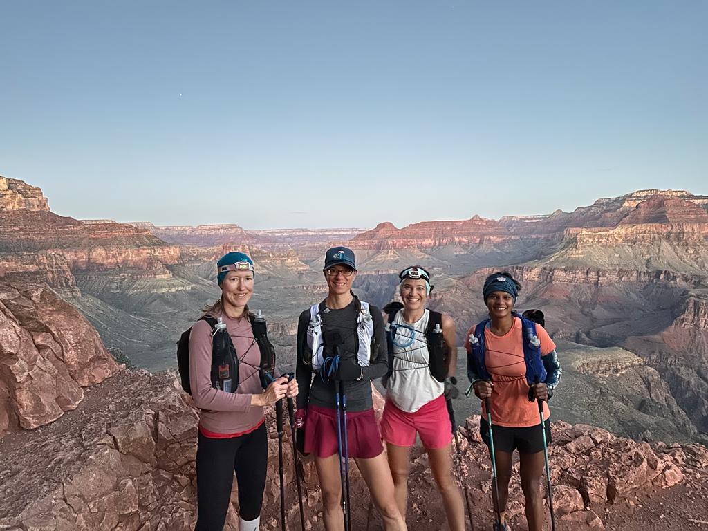
1:53pm – We’re here! the North Rim! How different it is from the other side!
We’ve crossed the Canyon and somehow found ourselves back in our Pacific Northwest forest! Douglas Fir, Alpens, Spruce densely line this side. Lichen on the rocks and pinecones on the ground. We’ve also left summer heat at the bottom and traveled up into autumn, as suggested by one short section of trail covered in fallen red and orange leaves.
This unexpected scenery adds to our excitement to finally be here, the halfway point, the middle R in our R2R2R journey.
It’s been a challenging climb for all four of us, at some point or another, in different ways, but we’re finally here. Ready to refill our water at the trailhead tap, take a moment, and then head back the other way. Except. Turns out they ARE closing the water today. At least on the North Rim. They in fact did, just minutes ago, as a park staff casually informs us. “Oh but there’s water at the Backcountry office, it’s only 1/2 mile away”.
Now. What’s half a mile, 0.8 km, when you’ve already traveled 36km and have another 40 to go (we still have another 40 to go!!). Well, if you haven’t mentally prepared for it, that half a mile might as well be a punch in the gut. That half a mile just kicked you in the groin and is now pointing at you and laughing as you lie on the ground, the last drop of water falling off that trailhead tap onto your face, one slow tear down your cheek.
A bit dramatic you say? Anyone who’s ran an ultra, and has come across a course marshal cheerily yelling “only 2 miles to go!” when your watch has already gone past the projected distance will know what I’m talking about. For the rest of you out there, how about you run 36k, with 1700m of elevation across the Grand Canyon and get back to me after.
With that said. In an ultra, mental is basically everything. On one of the last few week-ends before the trip, I spent a couple of hours studying the trail, writing down distances between each campgrounds and other key milestones. I also looked at where there would be water, in case the main system was closed. I knew we could filter from the creek, I had noted that the backcountry office had water year-round. I had made a mental note that we might have to travel an extra 1/2 mile for water. I was mentally prepared for the additional 0.8km. I’m not saying this to say ”look at how well prepared I was ”. With the exact same information, I very well could have been hoping the whole time that the water would be on, and crossing my fingers we wouldn’t have to go any further. I could have been hit even harder by the realization that unfortunately, we did. I’m mainly mentioning this to illustrate how a rather small change in plans can have a pretty big effect on the mental. And preparedness can, sometimes, help get past it.
“That’s ok” I say” it’s not that far to the backcountry office”. And so we figuratively picked ourselves up our from the ground and continued walking. It wasn’t actually as simple as “just go straight this way”. We had to go up a road and a trail and take a turn and look for it a bit. But eventually we find it and get our water. We even get to use a flushable toilet and wash our hands with clean water. Another small thing that can make a big difference.
As was part of my plan, now is the time i have my ham and cheese sandwich. Not sure if it is the cooler temperature, or the clean hands, but it tastes amazing. Summit-views levels of reward. We didn’t just make it to the North Rim and turned around. We worked for it, worked for our water, and worked for our appreciation of making it to this point. And it was worth it (yes, yes it was).
As I am mid-bite into the best ham and cheese sandwich there ever was, Wiebke does a quick time check and suggests that we probably don’t want to linger on too long, if we want to get back to Phantom Ranch before night fall. We do still have 40km to go…And with that it is time to head back…
3:08pm – Running down the steeper portion of North Kaibab is very fun, and we enjoy moving fast again and riding that high of being halfway through our day – well, technically not quite halfway since the way back via Bright Angel is longer. But again, it’s all about those mental checkpoints and as far as we’re concerned, we’ve completed the first half of the journey and then some. 2Rs down, one R to go.
4:17pm- After the big descent we reach the open canyon vista, funneling us back towards the “box”. For the first time since my bonk on North Kaibab, I start to feel a bit tired. That stretch of trail seems longer and more monotonous than on the way in. I start to notice that my feet hurt, and I am not so excited about running. I don’t remember exactly what I do about it. I want to think that i just stuck to my strategy of eating and drinking, and eventually somehow, my feet don’t hurt as much and I am running again.
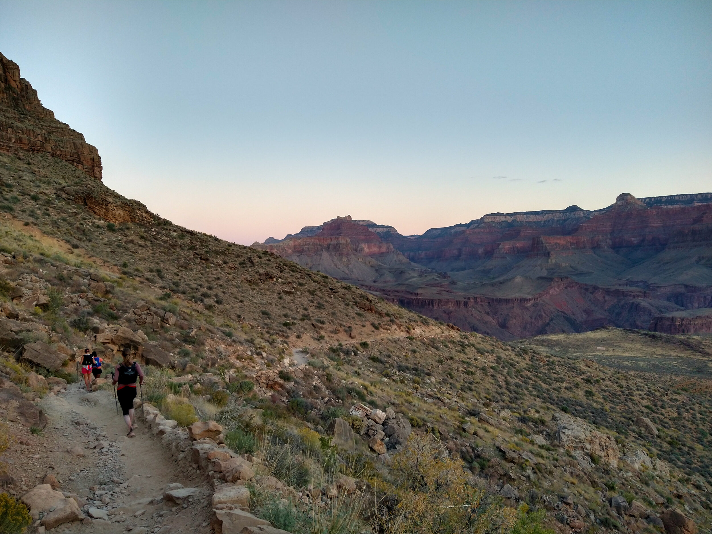
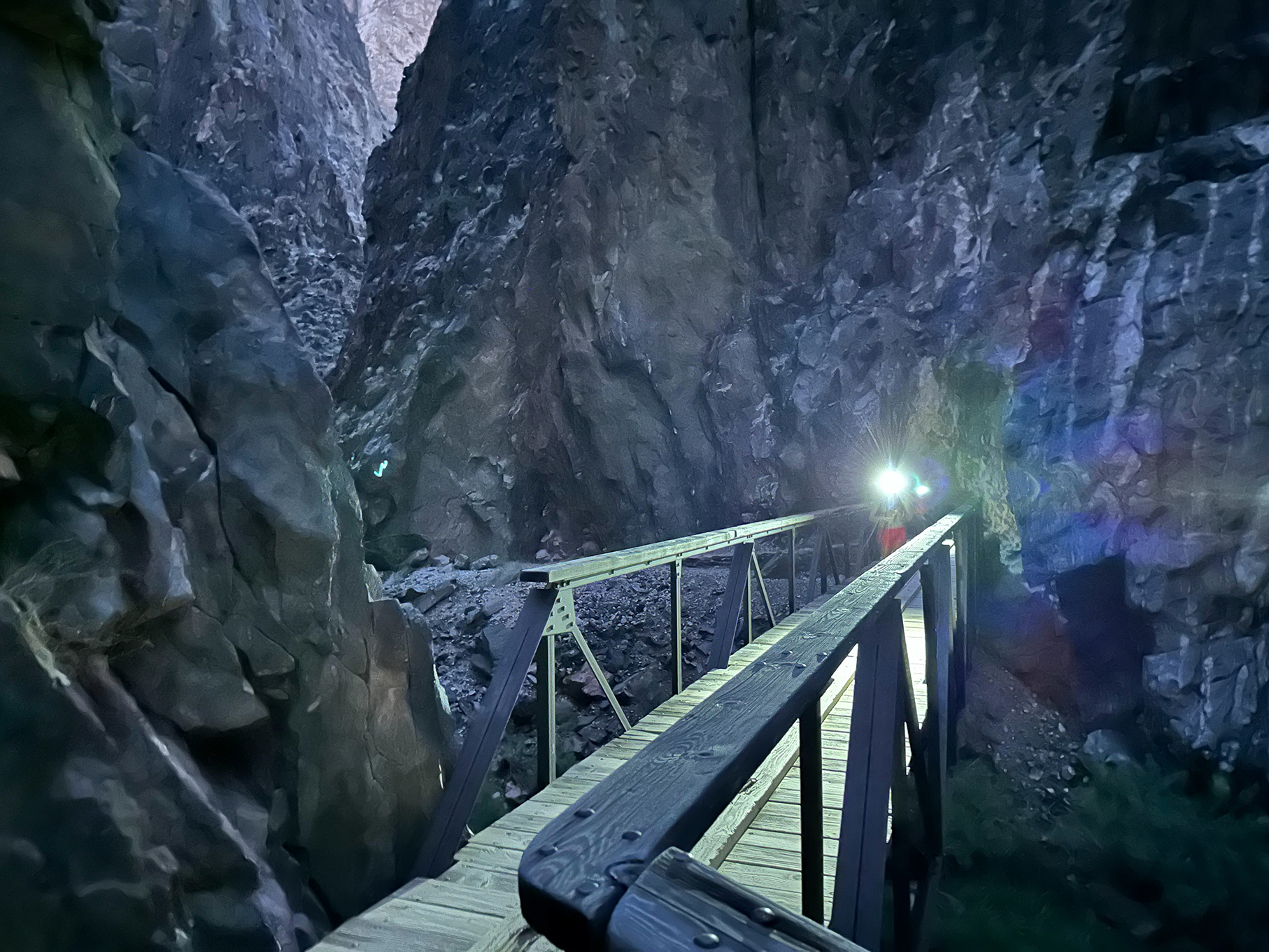
5:37pm – We’ve made it back to the narrow part. The light is starting to fade. We likely won’t be at Phantom Ranch before dark, but we’re moving fairly quickly, the trail now on a gentle downhill from here to the Colorado river. I set my pace behind Dasha’s and follow her on the narrow passage along the creek, rock walls towering around us. There won’t be a sunset for us tonight, only our ability to see the trail until we don’t.
We cross the last bridge over the creek and put our headlamps on. The rest of the way goes by fairly smoothly. I do remember being interrupted mid Gopro monologue, by jumping over a big spider on the trail. For dramatic effect we’ll say it was a tarantula (evidently all spiders in the Grand Canyon get to be called Tarentulas…according to Dasha).
6:00pm? I’m a bit fuzzy on the actual time. It’s now pitch black and there’s not much point in taking any photos (except, now that I think about it, to be able to go back and look at time stamps).
We’re back at Phantom Ranch. We weren’t sure if the small cafeteria shop would be open, but it is. As I mentioned earlier, we’re not so much into lemonade now. We’ve been ingesting sugary snacks for the last 12 hours. Also it’s starting to be a bit colder. Chicken broth would be amazing right now. Or miso soup. Dasha gets us all coffee and we cheers at a picnic table. Cheers to having made it this far. Being so close to the finish. What an adventure this has been already. We’ve got one more climb to go? Bring on the climb! We’ve got warm coffee in our belly and the spirit of friendship in our souls, we’re good to go!
We leave Phantom Ranch and make one last stop at the restrooms before crossing the Colorado (What do you know, another toilet with running water. Can’t believe we had to go all the way to the backcountry office to wash our hands…)
We cross the bridge and start following Bright Angel Trail, ready for the climb. Ready for the uphill. Ready for the steep finish. Ready for…what’s this? soft sand under our shoes? are we on a beach? is this trail going down? Are we about to dip into the river?
You know what’s harder for the mental than an extra half a mile? A trail that goes down when you know, you KNOW you’re ultimately going up.
The first few kilometers though, are pretty fun. The caffeine, the darkness, the accumulated hours on feet, all contribute to some group silliness. I can’t remember specifics, but since we can no longer be distracted by the view, we distract ourselves and each other.
There are a couple of campgrounds along the trail, and we see people coming down even in these late hours of the day. One older gentleman warns us that there is a section of the trail higher up that is flooded by a nearby creek. “ You WILL get you feet wet” he says. Oh we will, will we? Clearly this gentleman didn’t account for where we come from and the extensive amount of practice we’ve had with jumping over trails-turned-torrential-waterfall, post atmospheric river. It is pretty clear to us that we are going to do everything in our power to NOT get our feet wet. Not after 16 hours on dry desert trail. Even if it means hopping from wet rock to wet log after 16 hours on dry desert trail.
And hop we do, balancing precariously from one foot to the next and climbing off to the sides to avoid the water. Or at least three of us do. Wiebs takes one look at Dea, Dasha and I, exerting all our remaining caffeine-fuelled energy into avoiding puddles. She shakes her head and without hesitation, wades ankle-deep right through the stream. And we all respect her for it. (but between you and I…hopping rocks in that moment was actually quite fun and took our mind off of the fact that we still had a bit of a ways to go).
Bright Angel is 12km long. Roughly 1400m of elevation. When you look at the elevation profile, it looks like it climbs fairly evenly all the way through. But I swear it felt like we barely climbed at all, except near the end. It was mostly a long, gradual grind to the top. What did Ty say? “you’re staring at a rock wall for the longest time”. Fact.
9:44pm – We pass Three-mile Resthouse and stop for one last water refill. I get splashed all over my upper body by water aggressively shooting out of the tap. But at least my feet are still dry.
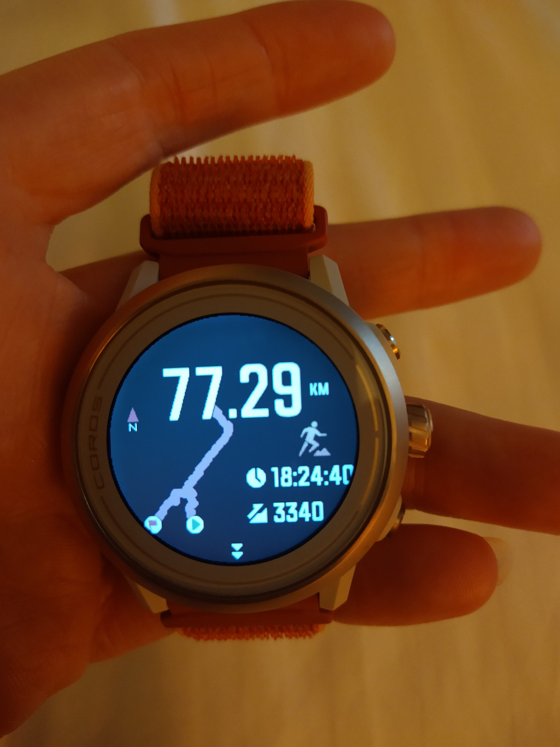
According to Wiebke, we only have about 1 to 1.5 hour to go. According to Deanne, we’ve only got about 600meters of elevation. According to my watch, we’re at 71k. When about half an hour later, Wiebke announces that we probably only have about 1 to 1.5 hour to go, and Dea concurs that indeed, we only have about 600 meters of elevation to go, I let them both know that from now on I would rather not be aware of how much time or climbing is left – thank you very much. Instead I’ll just be staring at my watch until it reaches the distance that I think is to the finish.
One interesting thing about the R2R2R is that in all our research we couldn’t seem to find any consistent result for distance or elevation between all the people that had done it. I guess GPS signals down in the bottom can get a bit wonky, and different watches have different levels of accuracy. While we have apparently been stagnating for 30min at the 600m elevation mark, Wiebs’ watch already has her at near 75k, while Dea, Dasha and I are much farther behind. (Granted, Wiebs is the fastest of the group, but not so much that she would have done an extra 5k by the time we were done – and I don’t believe all those Naak-induced pee breaks off the side of the trail account for that difference either).
Dea’s watch in the meantime must have indeed gone for a dip in the Colorado river because, as we find out the next morning, it indicates that she had done 17,000 meters of descent.
All that to say, that it is virtually impossible for either one of us to know for a fact when we will be done. But I have my heart and mind set on 76,5km and so that’s what I hang on to in those last gruelling kilometers.
To be fair, the trail isn’t even that technical or steep. We’re mainly just, well…tired. The one annoying thing is that large pieces of wood punctuate the trail every few feet, but not really evenly spaced or evenly high. So it makes it very awkward to keep a consistent stride, and know whether to step ON the wood or OVER the wood and doesn’t the wood know that we’ve been at this for 17 hours – 17 hours! Damn wood…
Every once in a while I do look up at the silhouetted black wall against the dark sky and say to myself “that can’t be right”. But it is. We have to get all the way up there.
I don’t feel like eating anything else at that point, but anytime I feel fatigue creep up more or my moral go down, I take one big gulp of my Naak water and that seems to actually help, one push at a time.
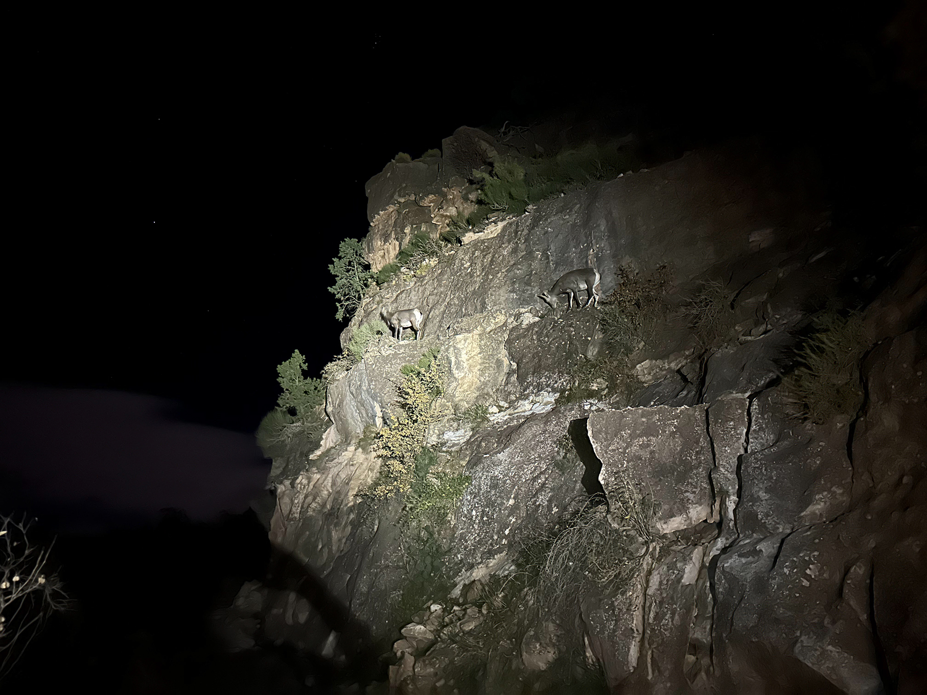
10:30ish pm – By that point we all have our heads down and even though it feels like it will go on forever, all we can do is keep going, keep putting one foot in front of the other, keep stepping over that damn wood as gracefully as a baby deer. Speaking of deer, we’ve been noticing pairs of glowing eyes around us, shining in the cone of our headlamps, up on the canyon walls.Someone mentions mountain lions and we’re all in agreement that, for sure, we’re surrounded by big cats. And then two long-horn sheep bounce up the side of the wall right above us. It’s a cool moment, captured in my mind pretty much as if I had tried to take a photo of it in the dark. Out of focus, fuzzy, under-exposed, with glowing eyeballs
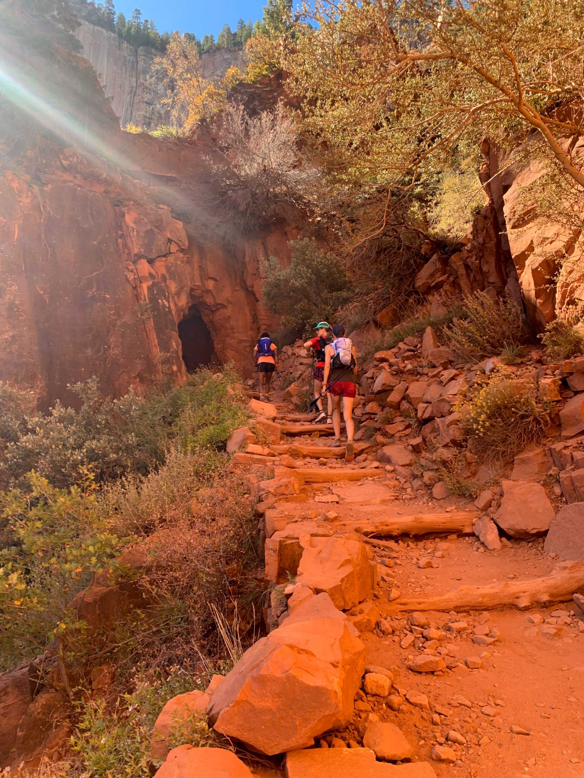
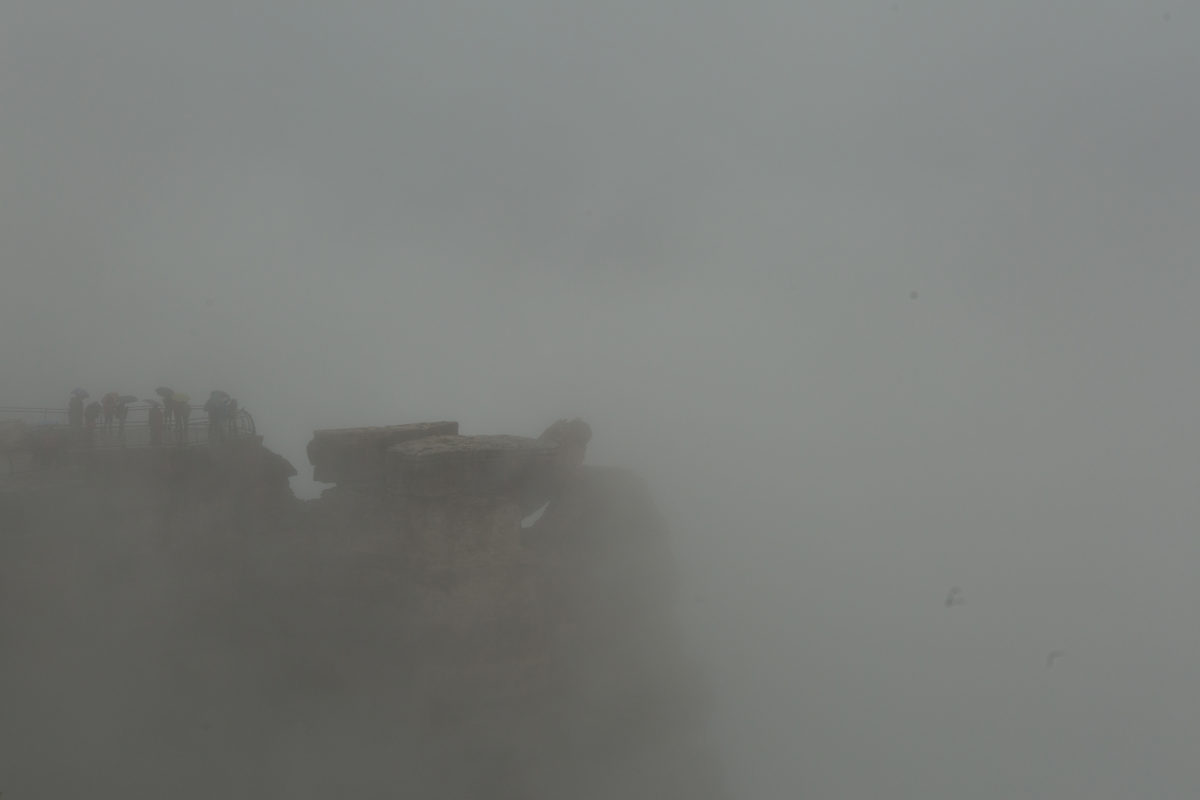
And then I see the tunnel. I recognize that tunnel, remembering it suddenly from the trip we took with Brice back in 2016. On a whim, we had decided to travel 4 hours from the Mohave Desert to the Grand Canyon. After driving 272 miles in the rain, we parked the car and walked up to the South Rim and marveled at ….a complete white-out. Thick fog obscuring any view beyond the edge. Our first time at the Grand Canyon, we almost didn’t see the Grand canyon. We hadn’t planned for a big day hike, just a short one, but with the rain and fog we debated even hiking at all. Then the clouds started to dissipate, so we decided to venture down the nearest trail, Bright Angel, and we made it down a few switchbacks to a short tunnel in the rock, a good point to stop and take in the vastness, slowly revealing itself from behind the white veil. And that tunnel, THAT tunnel, is what i see now, just a few meters away, which means the top is near. We are almost done.
Dea is slightly ahead and as she gets to a bend in a switchback she stops and turns around and points up to a building and a sign. I mistakenly think that we’re at the trailhead but turns out there is one more stretch, just a few extra meters and then finally the four of us are up there, off the trail, feet on the South Rim. The last of the Rs.
11:00pm. 18hours after we started. We are done.
The rest is a bit fuzzy. We might have high-fived or fist-pumped or something, or we might have done none of the above because the truth is the wind is howling and it is incredibly cold, so we hastily retreat to the nearby restrooms and then there is some confusion about what exactly we are doing there, are we just taking a moment to put jackets on, are we all going into one stall to keep warm and celebrate or?
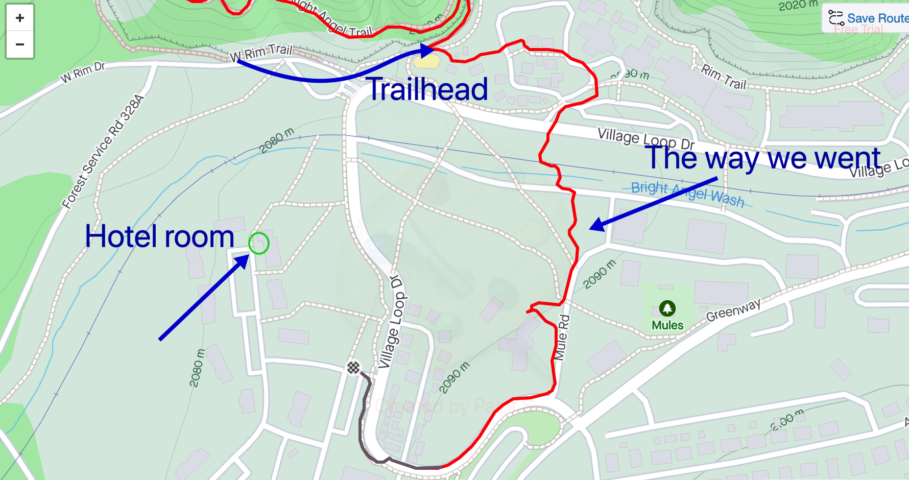
Luckily our hotel is only a short walk away (I know, more walking, but contrary to the “North Rim water debacle”, we already knew about that part, so it’s ok). Except we haven’t really planned that part, and between arriving in the dark last night and starting in the dark this morning, we haven’t quite gotten our bearings in terms of where exactly our hotel is located in relation to the Rim.
Dea is pretty certain that if we just go straight ahead we should get there, but after going down into a ditch and across the train tracks we decide to maybe take shelter from the freezing wind and consult google maps on our actual location and destination.
We didn’t make it 77km across the Grand Canyon only to get lost in the last 500 meters to our hotel.
After looking at the map we establish that following the road might be more efficient than going down ditches, although we still end up crossing train tracks twice more somehow, and I also decide that I would rather jump over a small rock wall rather than go around it because that makes total sense after an 18-hour run/hike, and then eventually we are in the parking lot of the hotel and shortly after, we are inside. For real this time, we are done.
The next day I will laugh to tears after we realize that we likely added another 0.75 kilometers to our day, based on the fact that I forgot to turn off my watch and it kept running through the “South Rim Expedition of 2023” to get back to our hotel – and that we can actually see the trailhead from our window.
But in the meantime, we each enjoy a well-deserved warm shower before passing out on our beds.
I wonder what my watch will say about my sleep pattern tomorrow.
Epilogue
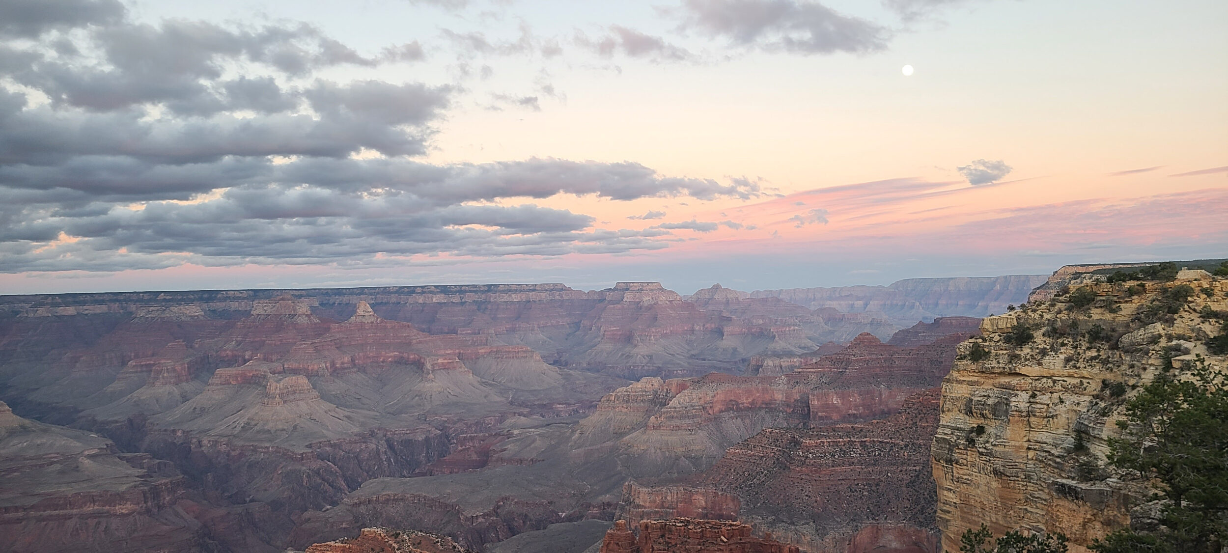
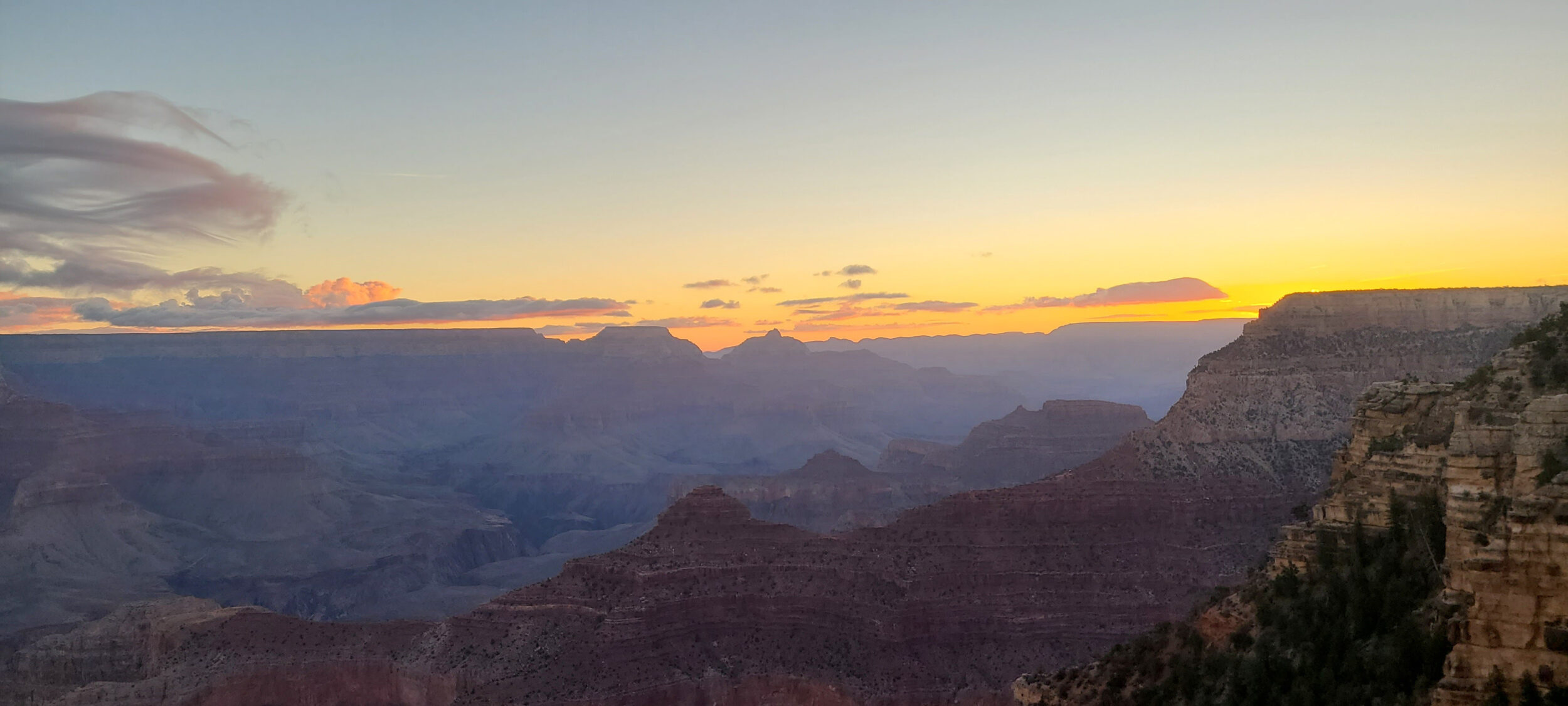
We had given ourselves a two-day window, in case weather was an issue, but since we did the run on the first day, we enjoy day two as a rest day at the Grand Canyon. Dea has made plans to see a friend who works in the village, so Dasha, Wiebs and I go out for a stroll around the South Rim.
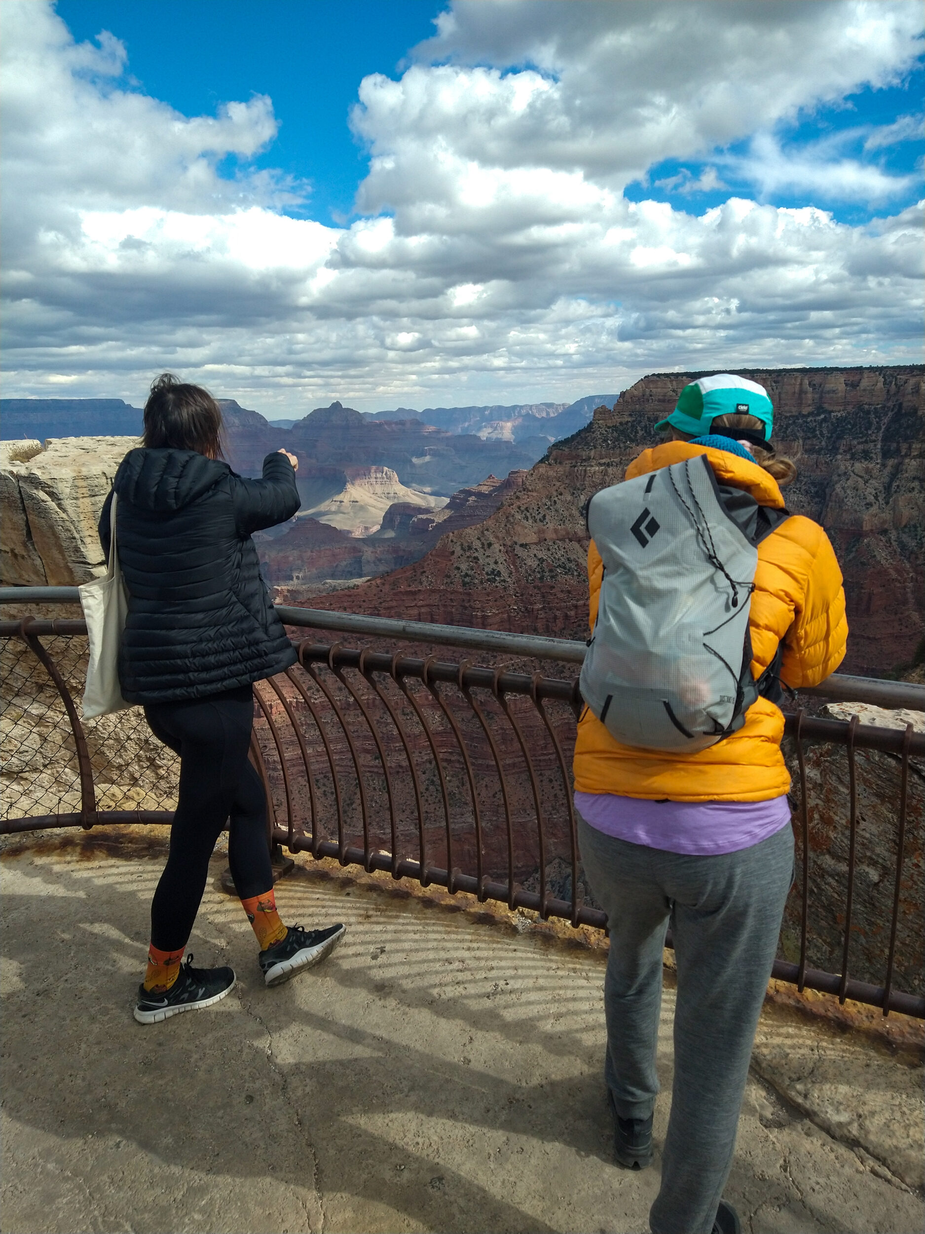
Finally we get to see it in the daylight, and really appreciate the scenery from the top. It’s also pretty neat to be able to trace our itinerary from above, from different viewpoints.
From Bright Angel trailhead, we can clearly see the Colorado River, as well as the narrower canyon through which runs North Kaibab trail.
From Mather Point, a bit more to the East, we think we can actually see the bend in South Kaibab trail where we took our first group photo.
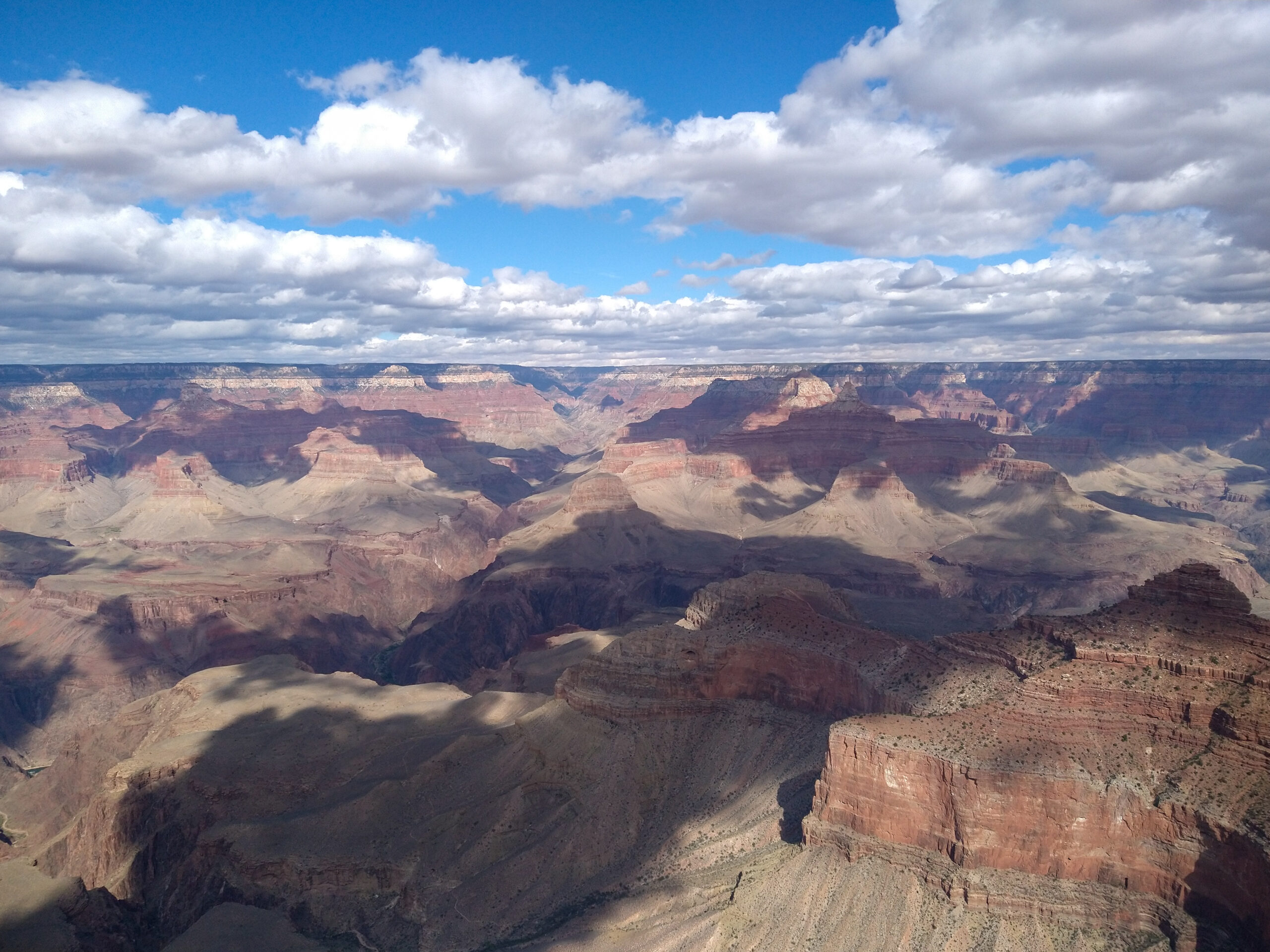
From both places we can see the North Rim, far in the distance. It quite literally puts into perspective what we did the day before.
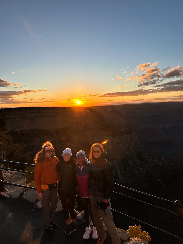
Later, Dea joins us again and we go to another viewpoint, this time in the West, to finally watch a beautiful sunset over the Grand Canyon.